Worldwide Ski Resort Forecasts

More
Colour guide Temperature · Wind · Rain · Snow
Each colour starts at the value shown. Wind colours match across all three units. Dry cells stay neutral. Colours describe the displayed values, not official weather warnings.
Sunday River - Low lift station
ECMWF · Model run: Next update expected:
Day Time (UTC) Temp. (°C) Humidity (%) Wind (km/h) Wind (knots) Wind (Bft) Direction Precip. (mm) Snow (cm) Pressure (hPa) Freezing (m) Conditions | Thursday, 05/11 06:00 12.4 74 0 0 0B SW — — 1013 3103 Clear 13% cloud  09:00 11.6 78 2 1 1B SE 0 0 1011 3092 Cloudy 62% cloud  12:00 10.2 85 2 1 1B W 0 0 1012 3085 Overcast 82% cloud  15:00 18 62 4 2 1B S 0 0 1010 3077 Overcast 94% cloud 18:00 16 94 9 5 2B S 2.1 0 1009 3059 Overcast 100% cloud 21:00 16.4 95 8 4 2B S 1.6 0 1009 3057 Overcast 97% cloud Friday, 06/11 00:00 15.7 96 7 4 2B S 0.16 0 1009 3058 Overcast 87% cloud 03:00 14.8 96 7 4 2B S 0.09 0 1009 3057 Overcast 83% cloud 06:00 13.9 97 3 1 1B NW 0.48 0 1010 3049 Overcast 82% cloud 09:00 13.4 95 4 2 1B NW 0.75 0 1010 3047 Cloudy 75% cloud 12:00 11.1 95 5 3 1B NW 0.01 0 1012 3052 Cloudy 80% cloud 15:00 16.5 70 3 2 1B NW 0 0 1012 3051 Overcast 92% cloud 18:00 18.2 55 4 2 1B NW 0 0 1011 3044 Overcast 96% cloud 21:00 15.2 69 4 2 1B N 0.01 0 1011 3040 Overcast 83% cloud Saturday, 07/11 00:00 13.2 72 7 4 2B N 0.01 0 1013 3042 Overcast 100% cloud 03:00 10.2 86 4 2 1B N 0 0 1013 2970 Overcast 100% cloud 06:00 9.7 86 3 2 1B NE 0 0 1013 2779 Overcast 100% cloud 09:00 9.1 87 9 5 2B NE 0 0 1013 2775 Partly cloudy 34% cloud  12:00 7.7 86 8 4 2B NE 0 0 1014 2704 Partly cloudy 25% cloud 15:00 9.8 69 12 6 2B NE 0 0 1013 2875 Overcast 100% cloud 18:00 8.9 73 12 7 3B NE 0.11 0 1011 2894 Overcast 100% cloud 21:00 8.1 75 11 6 2B NE 0.07 0 1010 2935 Overcast 100% cloud Sunday, 08/11 00:00 6.6 87 9 5 2B NE 0.37 0 1010 2735 Overcast 100% cloud 03:00 6.1 92 8 4 2B N 0.64 0 1007 2611 Overcast 100% cloud 06:00 5.8 94 6 3 2B NW 1.6 0 1006 2266 Overcast 100% cloud 09:00 5 93 10 5 2B NW 1.1 0 1005 1661 Overcast 100% cloud 12:00 4 94 14 8 3B NW 2.8 0 1004 1407 Overcast 99% cloud 15:00 4.7 87 18 10 3B NW 0.85 0 1005 1085 Overcast 99% cloud 18:00 6.6 68 22 12 4B NW 0.07 0 1004 1130 Overcast 94% cloud 21:00 6.9 64 15 8 3B W 0 0 1003 1125 Overcast 89% cloud Monday, 09/11 00:00 5.6 77 6 3 2B W 0 0 1003 1173 Partly cloudy 46% cloud 03:00 3.9 90 4 2 1B W 0.35 0 1003 1164 Overcast 99% cloud 06:00 4.8 92 7 4 2B W 0.33 0 1002 1062 Overcast 92% cloud 09:00 4.8 93 3 2 1B W 0.20 0 1002 1078 Overcast 100% cloud 12:00 4.8 94 3 2 1B W 0.68 0 1002 1146 Overcast 97% cloud 15:00 6.8 83 15 8 3B NW 0.18 0 1003 1124 Overcast 86% cloud 18:00 8.3 62 21 11 4B NW 0.15 0 1002 1163 Cloudy 77% cloud 21:00 7 71 19 10 3B NW 0.05 0 1005 1134 Overcast 97% cloud Tuesday, 10/11 00:00 5.6 74 21 12 4B NW 0.01 0 1006 1022 Overcast 89% cloud 03:00 5.5 72 20 11 4B NW 0 0 1007 975 Overcast 87% cloud 06:00 4.4 74 16 9 3B NW 0 0 1008 895 Overcast 86% cloud 09:00 3.7 78 14 8 3B W 0 0 1009 861 Cloudy 61% cloud 12:00 3.9 77 13 7 3B W 0 0 1010 1538 Cloudy 80% cloud 15:00 6.4 63 17 9 3B W 0.08 0 1010 1483 Overcast 93% cloud 18:00 7.2 62 11 6 2B W 0 0 1008 1441 Overcast 98% cloud 21:00 6.8 67 4 2 1B SW 0.01 0 1007 1199 Overcast 93% cloud Wednesday, 11/11 00:00 5.3 85 4 2 1B SW 0.24 0 1006 1296 Overcast 95% cloud 03:00 5.4 88 12 7 3B W 0.08 0 1005 1460 Cloudy 66% cloud 06:00 6.5 86 19 10 3B W 0.01 0 1006 1357 Overcast 91% cloud |
|---|
Forecast notes
Forecast table times: UTC.
Coordinates: 44.4691855°N, -70.8469498°E · Requested elevation: 248 m. Model terrain: 418 m. Terrain and 1000/925/850/700 hPa profiles are used for height estimates.
Outside the available profile, temperature uses an estimated 5.5°C/km height correction; wind retains the nearest available model-level value. Humidity is estimated with adjusted pressure and temperature.
These are altitude estimates, not a simulation of local mountain terrain. Precipitation, cloud and sea-level pressure use horizontal interpolation only.
Precipitation includes rain and snow water equivalent: preceding 3 hours through day 6, then 6 hours (see cell tooltip). Snow (cm) estimates fresh snowfall from precipitation and temperature using the GFS conversion; it is not snow depth on the ground. Freezing (m) uses additional 600/500 hPa temperatures when available and estimates the lowest resolved 0°C crossing above sea level. When all sampled levels are warm, the upper profile limit is shown (see tooltip). < marks an entirely cold sampled profile and its lower height limit. No extrapolation is used.
Source: ECMWF · CC BY 4.0 · Processed by Snow Report.
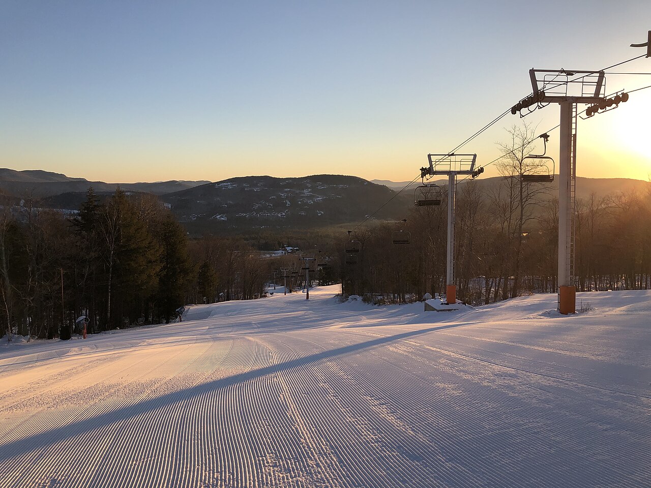
Sunday River is a downhill ski area in Maine, United States. Mapped terrain includes easy, intermediate, advanced, expert, freeride routes. Its mapped lift network extends from approximately 248 to 955 metres above sea level.
Data: OpenSkiData / OpenSkiMap, OpenStreetMap contributors (ODbL), Skimap.org, Who's On First, Mapterhorn.
Sunday River - Base lift station
ECMWF · Model run: Next update expected:
Day Time (UTC) Temp. (°C) Humidity (%) Wind (km/h) Wind (knots) Wind (Bft) Direction Precip. (mm) Snow (cm) Pressure (hPa) Freezing (m) Conditions | Thursday, 05/11 06:00 12 75 0 0 0B SW — — 1013 3103 Clear 15% cloud 09:00 11.4 79 2 1 1B SE 0 0 1011 3092 Cloudy 63% cloud 12:00 9.9 86 2 1 1B W 0 0 1012 3085 Overcast 81% cloud 15:00 17.7 62 4 2 1B S 0 0 1010 3077 Overcast 95% cloud 18:00 15.7 95 8 4 2B S 2.1 0 1009 3059 Overcast 100% cloud 21:00 16 96 8 4 2B S 1.6 0 1009 3057 Overcast 97% cloud Friday, 06/11 00:00 15.3 98 7 4 2B S 0.17 0 1009 3058 Overcast 88% cloud 03:00 14.4 98 7 4 2B S 0.10 0 1009 3056 Overcast 85% cloud 06:00 13.5 98 3 1 1B NW 0.54 0 1010 3048 Overcast 84% cloud 09:00 13.1 96 4 2 1B NW 0.77 0 1010 3046 Cloudy 76% cloud 12:00 10.7 97 5 2 1B NW 0.01 0 1012 3051 Cloudy 80% cloud 15:00 16 71 3 2 1B NW 0 0 1012 3051 Overcast 91% cloud 18:00 17.8 56 4 2 1B NW 0 0 1011 3043 Overcast 95% cloud 21:00 14.7 70 3 2 1B N 0.01 0 1011 3040 Overcast 83% cloud Saturday, 07/11 00:00 12.7 73 7 4 2B N 0.01 0 1013 3042 Overcast 100% cloud 03:00 9.7 88 4 2 1B N 0 0 1013 2964 Overcast 100% cloud 06:00 9.3 87 3 2 1B NE 0 0 1013 2775 Overcast 100% cloud 09:00 8.7 89 8 4 2B NE 0 0 1013 2771 Partly cloudy 33% cloud 12:00 7.3 87 8 4 2B NE 0 0 1014 2699 Partly cloudy 24% cloud 15:00 9.6 70 12 6 2B NE 0 0 1013 2871 Overcast 100% cloud 18:00 8.6 75 12 7 2B NE 0.11 0 1011 2887 Overcast 100% cloud 21:00 7.7 77 11 6 2B NE 0.06 0 1010 2928 Overcast 100% cloud Sunday, 08/11 00:00 6.2 88 9 5 2B NE 0.36 0 1010 2725 Overcast 100% cloud 03:00 5.7 93 7 4 2B N 0.62 0 1007 2605 Overcast 100% cloud 06:00 5.4 96 6 3 2B NW 1.6 0 1006 2260 Overcast 100% cloud 09:00 4.6 95 10 5 2B NW 1.2 0 1005 1656 Overcast 100% cloud 12:00 3.6 95 14 8 3B NW 2.9 0 1004 1399 Overcast 99% cloud 15:00 4.3 89 18 10 3B NW 0.83 0 1005 1077 Overcast 99% cloud 18:00 6.1 69 23 12 4B NW 0.06 0 1004 1123 Overcast 95% cloud 21:00 6.5 66 15 8 3B NW 0 0 1003 1124 Overcast 90% cloud Monday, 09/11 00:00 5.2 79 7 4 2B W 0 0 1003 1172 Partly cloudy 49% cloud 03:00 3.5 91 4 2 1B W 0.36 0 1003 1162 Overcast 99% cloud 06:00 4.4 93 7 4 2B W 0.33 0 1002 1059 Overcast 93% cloud 09:00 4.4 95 3 2 1B W 0.21 0 1002 1075 Overcast 100% cloud 12:00 4.4 96 3 2 1B W 0.71 0 1002 1143 Overcast 98% cloud 15:00 6.3 85 15 8 3B NW 0.18 0 1003 1123 Overcast 88% cloud 18:00 7.9 63 21 12 4B NW 0.16 0 1003 1161 Cloudy 75% cloud 21:00 6.5 73 19 10 3B NW 0.05 0 1005 1132 Overcast 98% cloud Tuesday, 10/11 00:00 5.1 76 22 12 4B NW 0.01 0 1006 1020 Overcast 90% cloud 03:00 5.1 74 20 11 4B NW 0 0 1008 974 Overcast 88% cloud 06:00 4 76 16 9 3B NW 0 0 1008 892 Overcast 87% cloud 09:00 3.2 79 14 8 3B W 0 0 1009 855 Cloudy 62% cloud 12:00 3.5 79 14 7 3B W 0 0 1010 1447 Overcast 81% cloud 15:00 5.9 65 17 9 3B W 0.10 0 1010 1412 Overcast 94% cloud 18:00 6.8 63 11 6 2B W 0 0 1008 1413 Overcast 98% cloud 21:00 6.4 68 4 2 1B SW 0.01 0 1007 1198 Overcast 94% cloud Wednesday, 11/11 00:00 5 86 4 2 1B SW 0.24 0 1006 1295 Overcast 96% cloud 03:00 5.1 90 13 7 3B W 0.10 0 1005 1455 Cloudy 68% cloud 06:00 6.1 88 19 10 3B W 0.01 0 1006 1347 Overcast 92% cloud |
|---|
Forecast notes
Forecast table times: UTC.
Coordinates: 44.4738705°N, -70.8604404°E · Requested elevation: 318 m. Model terrain: 429 m. Terrain and 1000/925/850/700 hPa profiles are used for height estimates.
Outside the available profile, temperature uses an estimated 5.5°C/km height correction; wind retains the nearest available model-level value. Humidity is estimated with adjusted pressure and temperature.
These are altitude estimates, not a simulation of local mountain terrain. Precipitation, cloud and sea-level pressure use horizontal interpolation only.
Precipitation includes rain and snow water equivalent: preceding 3 hours through day 6, then 6 hours (see cell tooltip). Snow (cm) estimates fresh snowfall from precipitation and temperature using the GFS conversion; it is not snow depth on the ground. Freezing (m) uses additional 600/500 hPa temperatures when available and estimates the lowest resolved 0°C crossing above sea level. When all sampled levels are warm, the upper profile limit is shown (see tooltip). < marks an entirely cold sampled profile and its lower height limit. No extrapolation is used.
Source: ECMWF · CC BY 4.0 · Processed by Snow Report.
Sunday River - Top lift station
ECMWF · Model run: Next update expected:
Day Time (UTC) Temp. (°C) Humidity (%) Wind (km/h) Wind (knots) Wind (Bft) Direction Precip. (mm) Snow (cm) Pressure (hPa) Freezing (m) Conditions | Thursday, 05/11 06:00 17.3 49 12 6 2B SW — — 1013 3103 Clear 18% cloud 09:00 17.1 50 18 10 3B SW 0 0 1011 3092 Cloudy 61% cloud 12:00 16.5 47 27 15 4B SW 0 0 1011 3085 Cloudy 77% cloud 15:00 15.5 58 31 17 5B SW 0 0 1010 3077 Overcast 95% cloud 18:00 13.8 89 36 19 5B SW 2.1 0 1009 3059 Overcast 100% cloud 21:00 13.8 96 37 20 5B SW 1.5 0 1009 3056 Overcast 96% cloud Friday, 06/11 00:00 14 96 36 20 5B SW 0.19 0 1009 3058 Overcast 91% cloud 03:00 14.3 92 40 22 6B SW 0.14 0 1009 3056 Overcast 88% cloud 06:00 13 95 22 12 4B W 0.68 0 1010 3048 Overcast 88% cloud 09:00 11.8 92 17 9 3B NW 0.78 0 1011 3046 Overcast 81% cloud 12:00 11 78 16 9 3B W 0.01 0 1012 3051 Cloudy 79% cloud 15:00 10.7 77 14 8 3B W 0 0 1012 3051 Overcast 88% cloud 18:00 11.7 74 9 5 2B W 0 0 1011 3043 Overcast 95% cloud 21:00 11.7 71 6 3 2B NW 0.02 0 1011 3040 Overcast 83% cloud Saturday, 07/11 00:00 10.1 76 16 8 3B NE 0.01 0 1013 3042 Overcast 100% cloud 03:00 9.3 80 15 8 3B NE 0 0 1013 2960 Overcast 100% cloud 06:00 8.5 84 18 10 3B E 0 0 1013 2765 Overcast 100% cloud 09:00 6.7 92 26 14 4B NE 0 0 1013 2767 Partly cloudy 31% cloud 12:00 5.8 89 29 16 5B NE 0 0 1014 2691 Partly cloudy 24% cloud 15:00 5.6 90 29 16 5B NE 0 0 1013 2854 Overcast 100% cloud 18:00 5.3 93 25 14 4B NE 0.11 0 1011 2882 Overcast 100% cloud 21:00 4.6 95 26 14 4B NE 0.04 0 1010 2919 Overcast 100% cloud Sunday, 08/11 00:00 3.9 96 22 12 4B NE 0.38 0 1010 2706 Overcast 100% cloud 03:00 3.5 98 16 9 3B NE 0.54 0 1007 2588 Overcast 100% cloud 06:00 2.8 98 12 6 2B N 1.5 0 1006 2242 Overcast 100% cloud 09:00 1.7 95 22 12 4B NW 1.3 0 1005 1645 Overcast 100% cloud 12:00 0.9 96 45 25 6B NW 3.0 1.2 1005 1381 Overcast 99% cloud 15:00 0.5 94 49 27 6B NW 0.72 0.2 1005 1088 Overcast 99% cloud 18:00 0.9 88 53 29 7B NW 0.04 0 1004 1119 Overcast 95% cloud 21:00 1.5 84 45 24 6B NW 0 0 1003 1130 Overcast 91% cloud Monday, 09/11 00:00 1.6 85 36 20 5B W 0 0 1004 1181 Cloudy 57% cloud 03:00 1.5 90 26 14 4B W 0.42 0 1003 1165 Overcast 99% cloud 06:00 0.7 92 28 15 4B W 0.32 0.1 1002 1058 Overcast 94% cloud 09:00 0.7 96 23 13 4B W 0.24 0 1002 1079 Overcast 100% cloud 12:00 1.1 95 31 17 5B W 0.75 0.2 1002 1147 Overcast 98% cloud 15:00 1.2 95 40 22 6B NW 0.21 0 1003 1128 Overcast 90% cloud 18:00 1.9 83 46 25 6B NW 0.18 0 1003 1163 Cloudy 72% cloud 21:00 1.4 89 51 28 7B NW 0.08 0 1005 1128 Overcast 98% cloud Tuesday, 10/11 00:00 0.4 87 62 34 8B NW 0.01 0 1007 1017 Overcast 90% cloud 03:00 0.1 87 58 31 7B NW 0 0 1008 974 Overcast 88% cloud 06:00 -0.5 88 52 28 7B NW 0 0 1009 890 Overcast 87% cloud 09:00 -0.6 83 47 25 6B NW 0 0 1010 853 Cloudy 64% cloud 12:00 0.5 74 43 23 6B NW 0 0 1010 1264 Overcast 81% cloud 15:00 1 76 33 18 5B W 0.13 0 1010 1293 Overcast 95% cloud 18:00 2 75 25 13 4B W 0 0 1008 1365 Overcast 98% cloud 21:00 2 75 22 12 4B W 0.02 0 1007 1200 Overcast 95% cloud Wednesday, 11/11 00:00 2.2 84 35 19 5B W 0.24 0 1006 1302 Overcast 96% cloud 03:00 2.6 87 50 27 7B NW 0.13 0 1006 1457 Cloudy 75% cloud 06:00 2.3 87 55 30 7B W 0.02 0 1006 1336 Overcast 92% cloud |
|---|
Forecast notes
Forecast table times: UTC.
Coordinates: 44.4604015°N, -70.9054971°E · Requested elevation: 955 m. Model terrain: 454 m. Terrain and 1000/925/850/700 hPa profiles are used for height estimates.
These are altitude estimates, not a simulation of local mountain terrain. Precipitation, cloud and sea-level pressure use horizontal interpolation only.
Precipitation includes rain and snow water equivalent: preceding 3 hours through day 6, then 6 hours (see cell tooltip). Snow (cm) estimates fresh snowfall from precipitation and temperature using the GFS conversion; it is not snow depth on the ground. Freezing (m) uses additional 600/500 hPa temperatures when available and estimates the lowest resolved 0°C crossing above sea level. When all sampled levels are warm, the upper profile limit is shown (see tooltip). < marks an entirely cold sampled profile and its lower height limit. No extrapolation is used.