Worldwide Ski Resort Forecasts

More
Colour guide Temperature · Wind · Rain · Snow
Each colour starts at the value shown. Wind colours match across all three units. Dry cells stay neutral. Colours describe the displayed values, not official weather warnings.
Killington Resort - Low lift station
ECMWF · Model run: Next update expected:
Day Time (UTC) Temp. (°C) Humidity (%) Wind (km/h) Wind (knots) Wind (Bft) Direction Precip. (mm) Snow (cm) Pressure (hPa) Freezing (m) Conditions | Thursday, 05/11 06:00 11.9 83 5 3 1B S — — 1013 3103 Clear 5% cloud  09:00 12.2 77 12 6 2B SW 0 0 1012 3088 Partly cloudy 44% cloud  12:00 13.6 91 12 7 3B SW 0.00 0 1012 3080 Overcast 100% cloud  15:00 17.2 90 14 7 3B S 1.4 0 1010 3071 Overcast 100% cloud 18:00 17.7 92 18 10 3B SW 3.4 0 1009 3057 Overcast 92% cloud 21:00 17.9 87 16 9 3B SW 0.53 0 1008 3054 Cloudy 68% cloud  Friday, 06/11 00:00 16.5 94 13 7 3B SW 0.44 0 1009 3056 Cloudy 68% cloud 03:00 16.2 94 10 6 2B SW 1.6 0 1010 3054 Overcast 100% cloud 06:00 15.7 94 9 5 2B W 1.3 0 1010 3048 Overcast 100% cloud 09:00 13 95 5 3 1B W 0.19 0 1011 3045 Cloudy 79% cloud 12:00 11 95 3 2 1B SW 0 0 1013 3050 Overcast 100% cloud 15:00 15.5 64 6 3 2B W 0 0 1012 3049 Cloudy 57% cloud 18:00 18 50 6 3 2B W 0 0 1011 3038 Clear 11% cloud 21:00 15.5 62 6 3 2B NW 0 0 1011 2935 Partly cloudy 35% cloud Saturday, 07/11 00:00 11 78 7 4 2B N 0 0 1012 2976 Partly cloudy 43% cloud 03:00 10 83 5 3 1B NE 0 0 1013 2785 Overcast 100% cloud 06:00 9.4 85 4 2 1B NE 0 0 1012 2659 Partly cloudy 46% cloud 09:00 8.5 88 5 3 1B NE 0 0 1011 2733 Cloudy 56% cloud 12:00 8.4 89 7 4 2B NE 0 0 1012 2586 Cloudy 61% cloud 15:00 11.8 75 7 4 2B NE 0 0 1011 2578 Overcast 100% cloud 18:00 13.3 69 7 4 2B NE 0.07 0 1008 2546 Overcast 99% cloud 21:00 12.2 79 2 1 1B SW 0.12 0 1007 2478 Overcast 100% cloud Sunday, 08/11 00:00 10.2 94 4 2 1B E 1.7 0 1008 2283 Overcast 100% cloud 03:00 8.5 95 2 1 1B N 2.5 0 1007 2110 Overcast 100% cloud 06:00 7.3 94 8 4 2B NW 6.1 0 1006 1836 Overcast 100% cloud 09:00 4.4 95 13 7 3B NW 3.4 0 1007 1783 Overcast 100% cloud 12:00 3.3 93 17 9 3B NW 0.25 0 1009 1524 Overcast 94% cloud 15:00 6.5 72 18 10 3B W 0 0 1008 1367 Overcast 95% cloud 18:00 7 77 16 9 3B W 0.00 0 1007 1322 Overcast 99% cloud 21:00 8.8 62 19 10 3B W 0.06 0 1005 1478 Partly cloudy 20% cloud Monday, 09/11 00:00 6.7 68 16 9 3B W 0.16 0 1005 1436 Overcast 98% cloud 03:00 6.7 75 20 11 3B W 0.11 0 1004 1352 Overcast 97% cloud 06:00 5.5 93 15 8 3B W 0.85 0 1003 1337 Overcast 98% cloud 09:00 5.4 94 17 9 3B W 0.72 0 1003 1294 Overcast 99% cloud 12:00 5.1 93 16 8 3B W 1.1 0 1005 1188 Overcast 100% cloud 15:00 5.3 91 15 8 3B W 1.2 0 1006 1135 Overcast 96% cloud 18:00 7.1 70 21 12 4B NW 0.32 0 1007 1173 Overcast 100% cloud 21:00 6.3 65 21 11 4B W 0.06 0 1009 1117 Overcast 99% cloud Tuesday, 10/11 00:00 4.8 69 19 10 3B W 0.06 0 1011 1016 Overcast 98% cloud 03:00 4.5 72 16 9 3B W 0 0 1011 1022 Overcast 84% cloud 06:00 4.4 75 15 8 3B W 0 0 1012 1022 Overcast 98% cloud 09:00 3.9 78 14 8 3B W 0.00 0 1012 1053 Overcast 93% cloud 12:00 3.4 77 16 8 3B W 0 0 1012 1745 Overcast 86% cloud 15:00 5.8 73 17 9 3B W 0 0 1012 1262 Overcast 99% cloud 18:00 8 65 15 8 3B SW 0 0 1008 1486 Overcast 89% cloud 21:00 8.4 65 16 8 3B SW 0.00 0 1007 1542 Overcast 100% cloud Wednesday, 11/11 00:00 7.3 86 20 11 4B W 0.50 0 1008 1578 Cloudy 79% cloud 03:00 7 88 18 10 3B W 0.24 0 1008 1484 Overcast 88% cloud 06:00 5.7 90 15 8 3B W 0.13 0 1009 1372 Cloudy 76% cloud |
|---|
Forecast notes
Forecast table times: UTC.
Coordinates: 43.614555°N, -72.7568023°E · Requested elevation: 356 m. Model terrain: 542 m. Terrain and 1000/925/850/700 hPa profiles are used for height estimates.
Outside the available profile, temperature uses an estimated 5.5°C/km height correction; wind retains the nearest available model-level value. Humidity is estimated with adjusted pressure and temperature.
These are altitude estimates, not a simulation of local mountain terrain. Precipitation, cloud and sea-level pressure use horizontal interpolation only.
Precipitation includes rain and snow water equivalent: preceding 3 hours through day 6, then 6 hours (see cell tooltip). Snow (cm) estimates fresh snowfall from precipitation and temperature using the GFS conversion; it is not snow depth on the ground. Freezing (m) uses additional 600/500 hPa temperatures when available and estimates the lowest resolved 0°C crossing above sea level. When all sampled levels are warm, the upper profile limit is shown (see tooltip). < marks an entirely cold sampled profile and its lower height limit. No extrapolation is used.
Source: ECMWF · CC BY 4.0 · Processed by Snow Report.
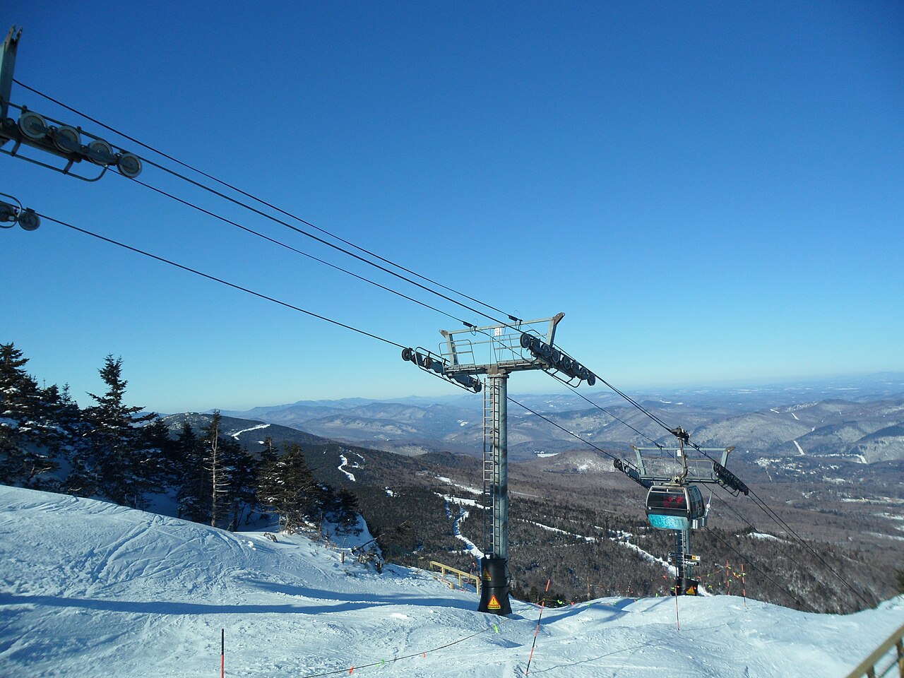
Killington Resort is a downhill ski area in Vermont, United States. Mapped terrain includes beginner, easy, intermediate, advanced, expert routes. Its mapped lift network extends from approximately 356 to 1262 metres above sea level.
Data: OpenSkiData / OpenSkiMap, OpenStreetMap contributors (ODbL), Skimap.org, Who's On First, Mapterhorn.
Killington Resort - Base lift station
ECMWF · Model run: Next update expected:
Day Time (UTC) Temp. (°C) Humidity (%) Wind (km/h) Wind (knots) Wind (Bft) Direction Precip. (mm) Snow (cm) Pressure (hPa) Freezing (m) Conditions | Thursday, 05/11 06:00 11.9 83 5 3 1B S — — 1013 3103 Clear 5% cloud 09:00 12.2 77 12 6 2B SW 0 0 1012 3088 Partly cloudy 44% cloud 12:00 13.6 91 12 7 3B SW 0.00 0 1012 3080 Overcast 100% cloud 15:00 17.2 90 14 7 3B S 1.4 0 1010 3071 Overcast 100% cloud 18:00 17.7 92 18 10 3B SW 3.4 0 1009 3057 Overcast 92% cloud 21:00 17.9 87 16 9 3B SW 0.53 0 1008 3054 Cloudy 68% cloud Friday, 06/11 00:00 16.5 94 13 7 3B SW 0.44 0 1009 3056 Cloudy 68% cloud 03:00 16.2 94 10 6 2B SW 1.6 0 1010 3054 Overcast 100% cloud 06:00 15.7 94 9 5 2B W 1.3 0 1010 3048 Overcast 100% cloud 09:00 13 95 5 3 1B W 0.19 0 1011 3045 Cloudy 79% cloud 12:00 11 95 3 2 1B SW 0 0 1013 3050 Overcast 100% cloud 15:00 15.5 64 6 3 2B W 0 0 1012 3049 Cloudy 57% cloud 18:00 18 50 6 3 2B W 0 0 1011 3038 Clear 11% cloud 21:00 15.5 62 6 3 2B NW 0 0 1011 2935 Partly cloudy 35% cloud Saturday, 07/11 00:00 11 78 7 4 2B N 0 0 1012 2976 Partly cloudy 43% cloud 03:00 10 83 5 3 1B NE 0 0 1013 2785 Overcast 100% cloud 06:00 9.4 85 4 2 1B NE 0 0 1012 2659 Partly cloudy 46% cloud 09:00 8.5 88 5 3 1B NE 0 0 1011 2733 Cloudy 56% cloud 12:00 8.4 89 7 4 2B NE 0 0 1012 2586 Cloudy 61% cloud 15:00 11.8 75 7 4 2B NE 0 0 1011 2578 Overcast 100% cloud 18:00 13.3 69 7 4 2B NE 0.07 0 1008 2546 Overcast 99% cloud 21:00 12.2 79 2 1 1B SW 0.12 0 1007 2478 Overcast 100% cloud Sunday, 08/11 00:00 10.2 94 4 2 1B E 1.7 0 1008 2283 Overcast 100% cloud 03:00 8.5 95 2 1 1B N 2.5 0 1007 2110 Overcast 100% cloud 06:00 7.3 94 8 4 2B NW 6.1 0 1006 1836 Overcast 100% cloud 09:00 4.4 95 13 7 3B NW 3.4 0 1007 1783 Overcast 100% cloud 12:00 3.3 93 17 9 3B NW 0.25 0 1009 1524 Overcast 94% cloud 15:00 6.5 72 18 10 3B W 0 0 1008 1367 Overcast 95% cloud 18:00 7 77 16 9 3B W 0.00 0 1007 1322 Overcast 99% cloud 21:00 8.8 62 19 10 3B W 0.06 0 1005 1478 Partly cloudy 20% cloud Monday, 09/11 00:00 6.7 68 16 9 3B W 0.16 0 1005 1436 Overcast 98% cloud 03:00 6.7 75 20 11 3B W 0.11 0 1004 1352 Overcast 97% cloud 06:00 5.5 93 15 8 3B W 0.85 0 1003 1337 Overcast 98% cloud 09:00 5.4 94 17 9 3B W 0.72 0 1003 1294 Overcast 99% cloud 12:00 5.1 93 16 8 3B W 1.1 0 1005 1188 Overcast 100% cloud 15:00 5.3 91 15 8 3B W 1.2 0 1006 1135 Overcast 96% cloud 18:00 7.1 70 21 12 4B NW 0.32 0 1007 1173 Overcast 100% cloud 21:00 6.3 65 21 11 4B W 0.06 0 1009 1117 Overcast 99% cloud Tuesday, 10/11 00:00 4.8 69 19 10 3B W 0.06 0 1011 1016 Overcast 98% cloud 03:00 4.5 72 16 9 3B W 0 0 1011 1022 Overcast 84% cloud 06:00 4.4 75 15 8 3B W 0 0 1012 1022 Overcast 98% cloud 09:00 3.9 78 14 8 3B W 0.00 0 1012 1053 Overcast 93% cloud 12:00 3.4 77 16 8 3B W 0 0 1012 1745 Overcast 86% cloud 15:00 5.8 73 17 9 3B W 0 0 1012 1262 Overcast 99% cloud 18:00 8 65 15 8 3B SW 0 0 1008 1486 Overcast 89% cloud 21:00 8.4 65 16 8 3B SW 0.00 0 1007 1542 Overcast 100% cloud Wednesday, 11/11 00:00 7.3 86 20 11 4B W 0.50 0 1008 1578 Cloudy 79% cloud 03:00 7 88 18 10 3B W 0.24 0 1008 1484 Overcast 88% cloud 06:00 5.7 90 15 8 3B W 0.13 0 1009 1372 Cloudy 76% cloud |
|---|
Forecast notes
Forecast table times: UTC.
Coordinates: 43.614555°N, -72.7568023°E · Requested elevation: 356 m. Model terrain: 542 m. Terrain and 1000/925/850/700 hPa profiles are used for height estimates.
Outside the available profile, temperature uses an estimated 5.5°C/km height correction; wind retains the nearest available model-level value. Humidity is estimated with adjusted pressure and temperature.
These are altitude estimates, not a simulation of local mountain terrain. Precipitation, cloud and sea-level pressure use horizontal interpolation only.
Precipitation includes rain and snow water equivalent: preceding 3 hours through day 6, then 6 hours (see cell tooltip). Snow (cm) estimates fresh snowfall from precipitation and temperature using the GFS conversion; it is not snow depth on the ground. Freezing (m) uses additional 600/500 hPa temperatures when available and estimates the lowest resolved 0°C crossing above sea level. When all sampled levels are warm, the upper profile limit is shown (see tooltip). < marks an entirely cold sampled profile and its lower height limit. No extrapolation is used.
Source: ECMWF · CC BY 4.0 · Processed by Snow Report.
Killington Resort - Top lift station
ECMWF · Model run: Next update expected:
Day Time (UTC) Temp. (°C) Humidity (%) Wind (km/h) Wind (knots) Wind (Bft) Direction Precip. (mm) Snow (cm) Pressure (hPa) Freezing (m) Conditions | Thursday, 05/11 06:00 16 42 38 21 5B SW — — 1013 3103 Clear 6% cloud 09:00 13.8 56 53 29 7B SW 0 0 1012 3088 Partly cloudy 39% cloud 12:00 12.9 80 55 30 7B SW 0.01 0 1012 3079 Overcast 100% cloud 15:00 12.6 95 62 34 8B SW 1.4 0 1010 3070 Overcast 100% cloud 18:00 12.8 97 58 31 7B SW 3.4 0 1009 3057 Overcast 90% cloud 21:00 12.8 96 52 28 7B SW 0.55 0 1008 3053 Cloudy 73% cloud Friday, 06/11 00:00 12.8 97 58 31 7B SW 0.71 0 1009 3056 Cloudy 71% cloud 03:00 11.9 96 52 28 7B SW 2.2 0 1010 3054 Overcast 100% cloud 06:00 10.6 94 37 20 5B W 1.3 0 1010 3047 Overcast 99% cloud 09:00 9 79 35 19 5B W 0.24 0 1012 3044 Cloudy 76% cloud 12:00 8.4 71 32 17 5B W 0 0 1013 3050 Overcast 99% cloud 15:00 8.7 64 23 13 4B SW 0 0 1013 3048 Cloudy 57% cloud 18:00 9.1 71 13 7 3B SW 0 0 1011 3037 Clear 12% cloud 21:00 9.6 70 7 4 2B SW 0 0 1011 2930 Partly cloudy 37% cloud Saturday, 07/11 00:00 8.7 74 5 3 1B NE 0 0 1012 2944 Partly cloudy 37% cloud 03:00 8.3 77 9 5 2B NE 0 0 1012 2771 Overcast 100% cloud 06:00 8.2 83 15 8 3B E 0 0 1012 2651 Partly cloudy 39% cloud 09:00 7.7 88 21 11 4B E 0 0 1011 2722 Cloudy 51% cloud 12:00 7.4 90 25 14 4B E 0 0 1012 2592 Cloudy 54% cloud 15:00 6.9 88 26 14 4B E 0 0 1011 2580 Overcast 100% cloud 18:00 6.1 94 17 9 3B E 0.11 0 1008 2553 Overcast 99% cloud 21:00 6 96 14 7 3B NE 0.21 0 1008 2473 Overcast 100% cloud Sunday, 08/11 00:00 4.7 100 10 5 2B E 1.9 0 1008 2284 Overcast 100% cloud 03:00 3.7 98 6 3 2B N 3.4 0 1007 2109 Overcast 100% cloud 06:00 2.3 99 20 11 4B NW 5.9 0 1007 1844 Overcast 100% cloud 09:00 1.7 97 63 34 8B N 3.3 0 1007 1765 Overcast 100% cloud 12:00 0.5 93 66 36 8B NW 0.19 0 1009 1451 Overcast 96% cloud 15:00 0.3 95 56 30 7B NW 0 0 1009 1336 Overcast 97% cloud 18:00 0.4 98 51 28 7B W 0.02 0 1007 1325 Overcast 99% cloud 21:00 1.3 87 50 27 6B W 0.05 0 1005 1485 Clear 17% cloud Monday, 09/11 00:00 1.1 75 56 30 7B W 0.11 0 1005 1432 Overcast 98% cloud 03:00 0.6 96 56 30 7B W 0.12 0 1004 1351 Overcast 90% cloud 06:00 0.5 98 57 31 7B W 0.94 0.3 1003 1342 Overcast 97% cloud 09:00 0.1 98 51 27 7B W 0.64 0.2 1004 1285 Overcast 97% cloud 12:00 -0.6 99 44 24 6B NW 1.2 0.3 1005 1177 Overcast 100% cloud 15:00 -0.9 98 45 25 6B NW 1.3 0.4 1006 1120 Overcast 97% cloud 18:00 -0.8 96 42 23 6B NW 0.35 0.1 1007 1167 Overcast 100% cloud 21:00 -1.4 94 44 24 6B NW 0.05 0 1009 1107 Overcast 100% cloud Tuesday, 10/11 00:00 -2.2 94 58 31 7B NW 0.05 0 1011 1017 Overcast 96% cloud 03:00 -1.8 92 55 30 7B NW 0 0 1012 1023 Overcast 86% cloud 06:00 -1.7 89 44 24 6B NW 0 0 1012 1014 Overcast 98% cloud 09:00 -1 79 39 21 6B NW 0.03 0 1012 1030 Overcast 92% cloud 12:00 0.5 67 46 25 6B W 0 0 1012 1590 Overcast 86% cloud 15:00 0 77 44 24 6B W 0 0 1012 1267 Overcast 99% cloud 18:00 1.1 68 33 18 5B W 0 0 1008 1474 Overcast 89% cloud 21:00 1.6 87 54 29 7B W 0.03 0 1007 1538 Overcast 100% cloud Wednesday, 11/11 00:00 1.8 93 65 35 8B W 0.57 0 1008 1557 Cloudy 77% cloud 03:00 1.2 92 59 32 7B W 0.24 0 1008 1449 Overcast 83% cloud 06:00 0.6 91 46 25 6B NW 0.13 0 1010 1356 Cloudy 69% cloud |
|---|
Forecast notes
Forecast table times: UTC.
Coordinates: 43.6047395°N, -72.8186865°E · Requested elevation: 1262 m. Model terrain: 508 m. Terrain and 1000/925/850/700 hPa profiles are used for height estimates.
These are altitude estimates, not a simulation of local mountain terrain. Precipitation, cloud and sea-level pressure use horizontal interpolation only.
Precipitation includes rain and snow water equivalent: preceding 3 hours through day 6, then 6 hours (see cell tooltip). Snow (cm) estimates fresh snowfall from precipitation and temperature using the GFS conversion; it is not snow depth on the ground. Freezing (m) uses additional 600/500 hPa temperatures when available and estimates the lowest resolved 0°C crossing above sea level. When all sampled levels are warm, the upper profile limit is shown (see tooltip). < marks an entirely cold sampled profile and its lower height limit. No extrapolation is used.