Worldwide Ski Resort Forecasts

More
Colour guide Temperature · Wind · Rain · Snow
Each colour starts at the value shown. Wind colours match across all three units. Dry cells stay neutral. Colours describe the displayed values, not official weather warnings.
Waterville Valley Resort - Low lift station
ECMWF · Model run: Next update expected:
Day Time (UTC) Temp. (°C) Humidity (%) Wind (km/h) Wind (knots) Wind (Bft) Direction Precip. (mm) Snow (cm) Pressure (hPa) Freezing (m) Conditions | Thursday, 05/11 06:00 11.6 77 1 1 1B NW — — 1013 3106 Clear 0% cloud  09:00 10.3 85 4 2 1B SW 0 0 1013 3093 Clear 18% cloud 12:00 9.8 89 5 3 1B SW 0 0 1013 3086 Partly cloudy 26% cloud  15:00 14.4 87 9 5 2B SW 0.44 0 1012 3076 Overcast 100% cloud  18:00 14.3 99 7 4 2B S 3.6 0 1010 3062 Overcast 100% cloud 21:00 15.3 97 11 6 2B S 3.1 0 1009 3059 Overcast 95% cloud Friday, 06/11 00:00 14.9 98 11 6 2B SW 1.5 0 1010 3061 Overcast 91% cloud 03:00 14.4 99 11 6 2B SW 0.43 0 1010 3059 Overcast 89% cloud 06:00 14.3 98 7 4 2B SW 0.34 0 1010 3053 Overcast 98% cloud 09:00 13.6 97 4 2 1B NW 1.2 0 1010 3052 Cloudy 73% cloud  12:00 9.6 98 3 1 1B N 0 0 1012 3057 Overcast 100% cloud 15:00 15.1 73 5 3 1B SW 0 0 1012 3055 Overcast 95% cloud 18:00 16.7 52 7 4 2B W 0 0 1011 3047 Overcast 97% cloud 21:00 13.7 68 4 2 1B NW 0 0 1011 3042 Cloudy 57% cloud Saturday, 07/11 00:00 9.5 87 7 4 2B N 0 0 1012 3043 Overcast 99% cloud 03:00 9.6 84 7 4 2B NE 0 0 1012 2994 Overcast 100% cloud 06:00 8.8 86 8 5 2B NE 0 0 1013 2808 Overcast 100% cloud 09:00 7.8 91 9 5 2B NE 0 0 1012 2844 Partly cloudy 41% cloud 12:00 7.4 90 11 6 2B NE 0 0 1012 2843 Partly cloudy 32% cloud 15:00 10.8 73 16 9 3B NE 0 0 1011 2840 Overcast 93% cloud 18:00 10.4 76 12 6 2B NE 0 0 1009 2912 Overcast 98% cloud 21:00 9 81 7 4 2B E 0 0 1008 2870 Overcast 100% cloud Sunday, 08/11 00:00 7.3 87 6 3 2B E 0.20 0 1008 2612 Overcast 100% cloud 03:00 6.5 95 3 1 1B E 0.47 0 1007 2408 Overcast 100% cloud 06:00 5.6 97 5 2 1B S 2.9 0 1005 1967 Overcast 100% cloud 09:00 4.9 96 7 4 2B NW 3.6 0 1004 1741 Overcast 100% cloud 12:00 2.9 96 15 8 3B NW 3.1 0 1005 1577 Overcast 100% cloud 15:00 3.2 90 18 9 3B NW 0.11 0 1006 1429 Overcast 96% cloud 18:00 6.3 65 22 12 4B NW 0 0 1005 1191 Overcast 94% cloud 21:00 5.6 75 15 8 3B W 0 0 1005 1229 Overcast 90% cloud Monday, 09/11 00:00 2.3 91 7 4 2B W 0 0 1004 1328 Cloudy 63% cloud 03:00 3.7 87 6 3 2B W 0.46 0 1003 1229 Overcast 99% cloud 06:00 3.3 92 7 4 2B W 0.01 0 1003 1156 Overcast 100% cloud 09:00 4 94 8 4 2B SW 0.11 0 1002 1217 Overcast 96% cloud 12:00 3.9 96 9 5 2B W 0.16 0 1003 1190 Overcast 96% cloud 15:00 5 90 14 8 3B W 0.73 0 1004 1199 Overcast 94% cloud 18:00 5.9 77 22 12 4B NW 0.57 0 1004 1205 Overcast 96% cloud 21:00 4.1 86 21 11 4B NW 0.56 0 1006 1113 Overcast 92% cloud Tuesday, 10/11 00:00 3.1 89 23 12 4B NW 0.23 0 1008 1003 Overcast 96% cloud 03:00 2.8 87 22 12 4B NW 0.21 0 1009 965 Overcast 93% cloud 06:00 2.8 86 18 10 3B NW 0.19 0 1010 936 Overcast 88% cloud 09:00 2.3 84 15 8 3B NW 0.02 0 1011 859 Overcast 91% cloud 12:00 2.2 83 12 7 3B W 0 0 1011 1033 Overcast 94% cloud 15:00 4.8 67 15 8 3B W 0 0 1011 1311 Overcast 95% cloud 18:00 6.9 60 11 6 2B W 0 0 1008 1275 Overcast 91% cloud 21:00 5.5 70 8 4 2B SW 0 0 1007 1294 Overcast 88% cloud Wednesday, 11/11 00:00 4.8 88 10 6 2B W 0.51 0 1007 1443 Overcast 99% cloud 03:00 4.8 93 14 8 3B W 0.30 0 1007 1422 Overcast 93% cloud 06:00 4.8 90 19 10 3B NW 0.21 0 1008 1241 Cloudy 69% cloud |
|---|
Forecast notes
Forecast table times: UTC.
Coordinates: 43.9643432°N, -71.5259384°E · Requested elevation: 556 m. Model terrain: 620 m. Terrain and 1000/925/850/700 hPa profiles are used for height estimates.
Outside the available profile, temperature uses an estimated 5.5°C/km height correction; wind retains the nearest available model-level value. Humidity is estimated with adjusted pressure and temperature.
These are altitude estimates, not a simulation of local mountain terrain. Precipitation, cloud and sea-level pressure use horizontal interpolation only.
Precipitation includes rain and snow water equivalent: preceding 3 hours through day 6, then 6 hours (see cell tooltip). Snow (cm) estimates fresh snowfall from precipitation and temperature using the GFS conversion; it is not snow depth on the ground. Freezing (m) uses additional 600/500 hPa temperatures when available and estimates the lowest resolved 0°C crossing above sea level. When all sampled levels are warm, the upper profile limit is shown (see tooltip). < marks an entirely cold sampled profile and its lower height limit. No extrapolation is used.
Source: ECMWF · CC BY 4.0 · Processed by Snow Report.
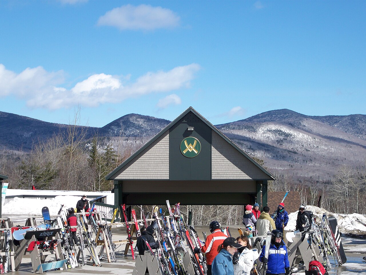
Waterville Valley Resort is a downhill ski area in New Hampshire, United States. Mapped terrain includes easy, intermediate, advanced, expert routes. Its mapped lift network extends from approximately 556 to 1164 metres above sea level.
Data: OpenSkiData / OpenSkiMap, OpenStreetMap contributors (ODbL), Skimap.org, Who's On First, Mapterhorn.
Waterville Valley Resort - Base lift station
ECMWF · Model run: Next update expected:
Day Time (UTC) Temp. (°C) Humidity (%) Wind (km/h) Wind (knots) Wind (Bft) Direction Precip. (mm) Snow (cm) Pressure (hPa) Freezing (m) Conditions | Thursday, 05/11 06:00 11.5 77 1 1 1B NW — — 1013 3106 Clear 0% cloud 09:00 10.3 86 4 2 1B SW 0 0 1013 3093 Clear 18% cloud 12:00 9.7 89 5 3 1B SW 0 0 1013 3086 Partly cloudy 26% cloud 15:00 14.4 88 9 5 2B SW 0.44 0 1012 3076 Overcast 100% cloud 18:00 14.2 99 7 4 2B S 3.6 0 1010 3062 Overcast 100% cloud 21:00 15.2 98 11 6 2B S 3.1 0 1009 3059 Overcast 96% cloud Friday, 06/11 00:00 14.8 99 11 6 2B SW 1.5 0 1010 3061 Overcast 91% cloud 03:00 14.4 99 11 6 2B SW 0.44 0 1010 3059 Overcast 90% cloud 06:00 14.3 98 7 4 2B SW 0.34 0 1010 3053 Overcast 98% cloud 09:00 13.5 98 4 2 1B NW 1.2 0 1010 3051 Cloudy 73% cloud 12:00 9.5 98 3 2 1B N 0 0 1012 3057 Overcast 100% cloud 15:00 15 73 5 3 1B SW 0 0 1012 3055 Overcast 95% cloud 18:00 16.6 52 7 4 2B W 0 0 1011 3047 Overcast 97% cloud 21:00 13.6 68 4 2 1B NW 0 0 1011 3042 Cloudy 57% cloud Saturday, 07/11 00:00 9.4 87 7 4 2B N 0 0 1012 3043 Overcast 99% cloud 03:00 9.5 84 7 4 2B NE 0 0 1012 2994 Overcast 100% cloud 06:00 8.7 87 8 4 2B NE 0 0 1013 2808 Overcast 100% cloud 09:00 7.7 91 9 5 2B NE 0 0 1012 2844 Partly cloudy 41% cloud 12:00 7.3 91 11 6 2B NE 0 0 1012 2842 Partly cloudy 32% cloud 15:00 10.8 74 16 9 3B NE 0 0 1011 2839 Overcast 93% cloud 18:00 10.3 76 12 6 2B NE 0 0 1009 2910 Overcast 97% cloud 21:00 8.9 81 7 4 2B E 0 0 1008 2868 Overcast 100% cloud Sunday, 08/11 00:00 7.2 88 6 3 2B E 0.20 0 1008 2611 Overcast 100% cloud 03:00 6.4 95 3 1 1B E 0.47 0 1007 2407 Overcast 100% cloud 06:00 5.5 98 5 2 1B S 2.9 0 1005 1967 Overcast 100% cloud 09:00 4.8 96 8 4 2B NW 3.7 0 1004 1739 Overcast 100% cloud 12:00 2.9 97 15 8 3B NW 3.1 0 1005 1573 Overcast 100% cloud 15:00 3.1 90 18 9 3B NW 0.11 0 1006 1423 Overcast 96% cloud 18:00 6.3 65 22 12 4B NW 0 0 1005 1191 Overcast 94% cloud 21:00 5.5 75 15 8 3B W 0 0 1005 1229 Overcast 89% cloud Monday, 09/11 00:00 2.2 91 7 4 2B W 0 0 1004 1327 Cloudy 63% cloud 03:00 3.6 88 6 3 2B W 0.46 0 1003 1229 Overcast 99% cloud 06:00 3.2 92 7 4 2B W 0.01 0 1003 1156 Overcast 100% cloud 09:00 3.9 95 8 4 2B SW 0.11 0 1002 1216 Overcast 96% cloud 12:00 3.8 97 9 5 2B W 0.16 0 1003 1189 Overcast 96% cloud 15:00 4.9 90 14 8 3B W 0.73 0 1004 1198 Overcast 94% cloud 18:00 5.8 77 22 12 4B NW 0.58 0 1004 1205 Overcast 96% cloud 21:00 4 87 21 11 4B NW 0.56 0 1006 1112 Overcast 92% cloud Tuesday, 10/11 00:00 3 89 23 12 4B NW 0.23 0 1008 1002 Overcast 96% cloud 03:00 2.7 87 22 12 4B NW 0.21 0 1009 964 Overcast 94% cloud 06:00 2.7 86 18 10 3B NW 0.19 0 1010 936 Overcast 88% cloud 09:00 2.2 84 15 8 3B NW 0.02 0 1011 858 Overcast 91% cloud 12:00 2.1 83 12 7 2B W 0 0 1011 1027 Overcast 94% cloud 15:00 4.7 67 15 8 3B W 0 0 1011 1305 Overcast 95% cloud 18:00 6.8 60 11 6 2B W 0 0 1008 1275 Overcast 91% cloud 21:00 5.4 71 8 4 2B SW 0 0 1007 1295 Overcast 88% cloud Wednesday, 11/11 00:00 4.7 88 10 6 2B W 0.51 0 1007 1443 Overcast 99% cloud 03:00 4.8 94 14 8 3B W 0.31 0 1007 1421 Overcast 93% cloud 06:00 4.7 91 19 10 3B NW 0.21 0 1008 1239 Cloudy 69% cloud |
|---|
Forecast notes
Forecast table times: UTC.
Coordinates: 43.9653656°N, -71.5287866°E · Requested elevation: 572 m. Model terrain: 620 m. Terrain and 1000/925/850/700 hPa profiles are used for height estimates.
Outside the available profile, temperature uses an estimated 5.5°C/km height correction; wind retains the nearest available model-level value. Humidity is estimated with adjusted pressure and temperature.
These are altitude estimates, not a simulation of local mountain terrain. Precipitation, cloud and sea-level pressure use horizontal interpolation only.
Precipitation includes rain and snow water equivalent: preceding 3 hours through day 6, then 6 hours (see cell tooltip). Snow (cm) estimates fresh snowfall from precipitation and temperature using the GFS conversion; it is not snow depth on the ground. Freezing (m) uses additional 600/500 hPa temperatures when available and estimates the lowest resolved 0°C crossing above sea level. When all sampled levels are warm, the upper profile limit is shown (see tooltip). < marks an entirely cold sampled profile and its lower height limit. No extrapolation is used.
Source: ECMWF · CC BY 4.0 · Processed by Snow Report.
Waterville Valley Resort - Top lift station
ECMWF · Model run: Next update expected:
Day Time (UTC) Temp. (°C) Humidity (%) Wind (km/h) Wind (knots) Wind (Bft) Direction Precip. (mm) Snow (cm) Pressure (hPa) Freezing (m) Conditions | Thursday, 05/11 06:00 15.7 55 21 11 4B SW — — 1013 3106 Clear 0% cloud 09:00 14.7 52 29 16 5B SW 0 0 1013 3093 Partly cloudy 21% cloud 12:00 13.4 63 39 21 6B SW 0 0 1013 3086 Partly cloudy 29% cloud 15:00 12.4 92 43 23 6B SW 0.48 0 1012 3076 Overcast 100% cloud 18:00 12.4 98 47 25 6B SW 3.6 0 1010 3062 Overcast 100% cloud 21:00 13 98 42 23 6B SW 3.0 0 1009 3059 Overcast 95% cloud Friday, 06/11 00:00 13.1 98 46 25 6B SW 1.4 0 1010 3061 Overcast 90% cloud 03:00 12.9 97 48 26 6B SW 0.42 0 1010 3060 Overcast 88% cloud 06:00 12.2 91 32 18 5B W 0.35 0 1010 3053 Overcast 96% cloud 09:00 11.1 93 25 14 4B W 1.3 0 1011 3051 Cloudy 76% cloud 12:00 10.5 67 25 14 4B W 0 0 1012 3057 Overcast 100% cloud 15:00 10.4 60 24 13 4B W 0 0 1012 3055 Overcast 93% cloud 18:00 10.6 63 15 8 3B W 0 0 1011 3046 Overcast 96% cloud 21:00 10.4 67 9 5 2B W 0 0 1011 3042 Cloudy 56% cloud Saturday, 07/11 00:00 9.9 71 7 4 2B NE 0 0 1012 3043 Overcast 99% cloud 03:00 9.4 78 13 7 3B E 0 0 1012 2995 Overcast 100% cloud 06:00 8.4 83 17 9 3B E 0 0 1013 2809 Overcast 100% cloud 09:00 8.1 81 17 9 3B E 0 0 1012 2845 Partly cloudy 40% cloud 12:00 7.6 80 24 13 4B E 0 0 1012 2837 Partly cloudy 29% cloud 15:00 7.6 86 28 15 4B NE 0 0 1011 2834 Overcast 87% cloud 18:00 7.4 88 19 10 3B NE 0 0 1009 2901 Overcast 95% cloud 21:00 6.1 94 16 8 3B NE 0 0 1008 2850 Overcast 100% cloud Sunday, 08/11 00:00 5.5 97 12 7 3B NE 0.20 0 1008 2599 Overcast 100% cloud 03:00 4.8 99 6 3 2B N 0.45 0 1007 2398 Overcast 100% cloud 06:00 3 98 10 6 2B W 3.0 0 1005 1969 Overcast 100% cloud 09:00 2.1 96 31 17 5B NW 4.1 0 1004 1726 Overcast 100% cloud 12:00 1.2 94 57 31 7B NW 2.8 0 1005 1560 Overcast 100% cloud 15:00 0.8 93 59 32 7B NW 0.09 0 1006 1387 Overcast 96% cloud 18:00 0.3 89 41 22 6B NW 0 0 1005 1195 Overcast 95% cloud 21:00 0.6 92 43 23 6B W 0 0 1005 1233 Overcast 84% cloud Monday, 09/11 00:00 0.5 87 42 23 6B W 0 0 1004 1331 Cloudy 62% cloud 03:00 0.4 92 45 24 6B W 0.44 0.1 1003 1232 Overcast 98% cloud 06:00 0 98 38 20 5B W 0.02 0 1003 1166 Overcast 100% cloud 09:00 0.3 99 38 21 5B W 0.11 0 1002 1218 Overcast 96% cloud 12:00 0.1 99 41 22 6B NW 0.19 0 1003 1187 Overcast 96% cloud 15:00 0.3 97 39 21 6B NW 0.77 0.2 1004 1197 Overcast 94% cloud 18:00 0.3 92 45 24 6B NW 0.58 0.2 1004 1203 Overcast 95% cloud 21:00 -0.4 93 57 31 7B NW 0.57 0.2 1006 1111 Overcast 92% cloud Tuesday, 10/11 00:00 -1.2 93 63 34 8B NW 0.25 0.1 1008 1001 Overcast 96% cloud 03:00 -1.4 90 64 35 8B NW 0.20 0 1009 964 Overcast 94% cloud 06:00 -1.6 91 55 29 7B NW 0.16 0 1010 935 Overcast 88% cloud 09:00 -1.8 86 48 26 6B NW 0.05 0 1011 858 Overcast 91% cloud 12:00 -0.4 72 42 22 6B NW 0 0 1011 1011 Overcast 94% cloud 15:00 0.5 72 34 19 5B W 0 0 1011 1296 Overcast 95% cloud 18:00 0.9 75 26 14 4B W 0 0 1008 1280 Overcast 91% cloud 21:00 1.1 79 28 15 4B W 0 0 1007 1305 Overcast 88% cloud Wednesday, 11/11 00:00 1.5 96 49 27 6B W 0.53 0 1007 1448 Overcast 98% cloud 03:00 1.4 96 51 28 7B NW 0.39 0 1007 1420 Overcast 93% cloud 06:00 0.5 90 54 29 7B NW 0.20 0 1008 1236 Cloudy 70% cloud |
|---|
Forecast notes
Forecast table times: UTC.
Coordinates: 43.9593689°N, -71.5557748°E · Requested elevation: 1164 m. Model terrain: 601 m. Terrain and 1000/925/850/700 hPa profiles are used for height estimates.
These are altitude estimates, not a simulation of local mountain terrain. Precipitation, cloud and sea-level pressure use horizontal interpolation only.
Precipitation includes rain and snow water equivalent: preceding 3 hours through day 6, then 6 hours (see cell tooltip). Snow (cm) estimates fresh snowfall from precipitation and temperature using the GFS conversion; it is not snow depth on the ground. Freezing (m) uses additional 600/500 hPa temperatures when available and estimates the lowest resolved 0°C crossing above sea level. When all sampled levels are warm, the upper profile limit is shown (see tooltip). < marks an entirely cold sampled profile and its lower height limit. No extrapolation is used.