Worldwide Ski Resort Forecasts

More
Colour guide Temperature · Wind · Rain · Snow
Each colour starts at the value shown. Wind colours match across all three units. Dry cells stay neutral. Colours describe the displayed values, not official weather warnings.
Schweitzer Mountain Resort - Low lift station
ECMWF · Model run: Next update expected:
Day Local time Temp. (°C) Humidity (%) Wind (km/h) Wind (knots) Wind (Bft) Direction Precip. (mm) Snow (cm) Pressure (hPa) Freezing (m) Conditions | Thursday, 05/11 01:00 1 89 9 5 2B SW 0 0 1021 1835 Overcast 99% cloud  04:00 0.5 94 10 6 2B SW 0 0 1022 1584 Overcast 100% cloud 07:00 0.8 97 12 6 2B SW 0.52 0.2 1023 1420 Overcast 100% cloud 10:00 1.3 96 12 6 2B SW 1.4 0 1024 1438 Overcast 100% cloud 13:00 1.9 95 11 6 2B SW 0.21 0 1024 1493 Overcast 99% cloud 16:00 1.9 96 10 5 2B SW 0.09 0 1025 1480 Overcast 94% cloud 19:00 1.4 97 9 5 2B SW 0.03 0 1026 1502 Cloudy 79% cloud  22:00 1.3 98 10 5 2B SW 0.04 0 1026 1627 Overcast 96% cloud Friday, 06/11 01:00 1.5 95 8 4 2B SW 0.07 0 1026 1748 Overcast 88% cloud 04:00 1.6 94 7 4 2B S 0.04 0 1025 1851 Overcast 90% cloud 07:00 2.2 89 8 4 2B S 0 0 1025 2046 Overcast 99% cloud 10:00 3.7 83 13 7 3B S 0 0 1024 2096 Overcast 99% cloud 13:00 4.7 75 17 9 3B SW 0.04 0 1022 2412 Overcast 100% cloud 16:00 4.7 74 15 8 3B SW 0.04 0 1021 2556 Partly cloudy 35% cloud  19:00 5.2 70 17 9 3B SW 0 0 1021 2782 Overcast 97% cloud 22:00 5.1 69 20 11 4B SW 0 0 1020 3082 Overcast 98% cloud Saturday, 07/11 01:00 4.8 80 13 7 3B SW 0 0 1022 2888 Overcast 89% cloud 04:00 4.3 88 10 5 2B SW 0 0 1022 2961 Overcast 82% cloud 07:00 4.5 90 6 3 1B S 0 0 1023 3091 Overcast 88% cloud 10:00 7.1 83 7 4 2B S 0 0 1022 3097 Overcast 89% cloud 13:00 8.8 75 8 4 2B SE 0 0 1020 3092 Overcast 100% cloud 16:00 8.4 72 8 4 2B SE 0 0 1017 3083 Overcast 93% cloud 19:00 8.2 62 11 6 2B S 0 0 1014 3071 Overcast 96% cloud 22:00 8.6 59 18 10 3B S 0 0 1012 3054 Overcast 97% cloud Sunday, 08/11 01:00 8.3 59 25 14 4B SW 0 0 1010 2948 Cloudy 75% cloud 04:00 6.1 78 31 17 5B SW 0.65 0 1013 2445 Overcast 100% cloud 07:00 4.7 89 26 14 4B SW 2.0 0 1017 2031 Overcast 93% cloud 10:00 4.8 84 27 15 4B SW 0.19 0 1020 1847 Cloudy 71% cloud 13:00 6.4 56 25 14 4B SW 0.40 0 1020 1954 Cloudy 77% cloud 16:00 4.8 60 21 11 4B SW 0.04 0 1021 1901 Overcast 87% cloud 19:00 2.6 72 15 8 3B SW 0 0 1023 1802 Overcast 88% cloud 22:00 1.8 77 8 4 2B SW 0 0 1024 1789 Clear 13% cloud  Monday, 09/11 01:00 1.3 79 8 4 2B SW 0 0 1024 1904 Clear 4% cloud 04:00 0.7 82 4 2 1B SW 0 0 1024 1869 Partly cloudy 23% cloud 07:00 0.9 78 3 2 1B S 0 0 1024 1956 Partly cloudy 45% cloud 10:00 4.1 64 6 3 2B E 0 0 1023 2320 Partly cloudy 50% cloud 13:00 6.3 47 4 2 1B SE 0 0 1020 2341 Overcast 81% cloud 16:00 5.4 56 4 2 1B S 0 0 1018 2351 Overcast 98% cloud 19:00 5.1 64 10 5 2B SW 0 0 1018 2297 Overcast 100% cloud 22:00 4.3 84 15 8 3B SW 0.82 0 1019 2207 Overcast 99% cloud Tuesday, 10/11 01:00 4.2 90 15 8 3B SW 0.30 0 1019 2259 Overcast 100% cloud 04:00 4.7 91 12 7 2B SW 0.20 0 1018 2294 Overcast 100% cloud 07:00 5 94 12 7 2B S 2.5 0 1017 2407 Overcast 100% cloud 10:00 5.7 96 23 12 4B S 6.6 0 1016 2510 Overcast 100% cloud 13:00 6.3 97 26 14 4B SW 6.1 0 1016 2503 Overcast 100% cloud 16:00 6.9 95 23 12 4B SW 1.5 0 1016 2511 Overcast 96% cloud 19:00 6.7 95 18 10 3B SW 0.63 0 1016 2539 Overcast 99% cloud 22:00 6.5 94 16 9 3B S 2.3 0 1017 2520 Overcast 100% cloud |
|---|
Forecast notes
Forecast table times: America/Los_Angeles.
Coordinates: 48.3976029°N, -116.6074491°E · Requested elevation: 1221 m. Model terrain: 971 m. Terrain and 1000/925/850/700 hPa profiles are used for height estimates.
These are altitude estimates, not a simulation of local mountain terrain. Precipitation, cloud and sea-level pressure use horizontal interpolation only.
Precipitation includes rain and snow water equivalent: preceding 3 hours through day 6, then 6 hours (see cell tooltip). Snow (cm) estimates fresh snowfall from precipitation and temperature using the GFS conversion; it is not snow depth on the ground. Freezing (m) uses additional 600/500 hPa temperatures when available and estimates the lowest resolved 0°C crossing above sea level. When all sampled levels are warm, the upper profile limit is shown (see tooltip). < marks an entirely cold sampled profile and its lower height limit. No extrapolation is used.
Source: ECMWF · CC BY 4.0 · Processed by Snow Report.
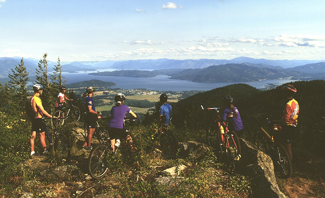
Schweitzer Mountain Resort is a downhill ski area in Idaho, United States. Mapped terrain includes easy, intermediate, advanced routes. Its mapped lift network extends from approximately 1221 to 1949 metres above sea level. Cross-country skiing is also mapped within the area.
Data: OpenSkiData / OpenSkiMap, OpenStreetMap contributors (ODbL), Skimap.org, Who's On First, Mapterhorn.
Schweitzer Mountain Resort - Base lift station
ECMWF · Model run: Next update expected:
Day Local time Temp. (°C) Humidity (%) Wind (km/h) Wind (knots) Wind (Bft) Direction Precip. (mm) Snow (cm) Pressure (hPa) Freezing (m) Conditions | Thursday, 05/11 01:00 1 89 9 5 2B SW 0 0 1021 1835 Overcast 99% cloud 04:00 0.5 94 10 6 2B SW 0 0 1022 1584 Overcast 100% cloud 07:00 0.8 97 12 6 2B SW 0.52 0.2 1023 1420 Overcast 100% cloud 10:00 1.3 96 12 6 2B SW 1.4 0 1024 1438 Overcast 100% cloud 13:00 1.9 95 11 6 2B SW 0.21 0 1024 1493 Overcast 99% cloud 16:00 1.9 96 10 5 2B SW 0.09 0 1025 1480 Overcast 94% cloud 19:00 1.4 97 9 5 2B SW 0.03 0 1026 1502 Cloudy 79% cloud 22:00 1.3 98 10 5 2B SW 0.04 0 1026 1627 Overcast 96% cloud Friday, 06/11 01:00 1.5 95 8 4 2B SW 0.07 0 1026 1748 Overcast 88% cloud 04:00 1.6 94 7 4 2B S 0.04 0 1025 1851 Overcast 90% cloud 07:00 2.2 89 8 4 2B S 0 0 1025 2046 Overcast 99% cloud 10:00 3.7 83 13 7 3B S 0 0 1024 2096 Overcast 99% cloud 13:00 4.7 75 17 9 3B SW 0.04 0 1022 2412 Overcast 100% cloud 16:00 4.7 74 15 8 3B SW 0.04 0 1021 2556 Partly cloudy 35% cloud 19:00 5.2 70 17 9 3B SW 0 0 1021 2782 Overcast 97% cloud 22:00 5.1 69 20 11 4B SW 0 0 1020 3082 Overcast 98% cloud Saturday, 07/11 01:00 4.8 80 13 7 3B SW 0 0 1022 2888 Overcast 89% cloud 04:00 4.3 88 10 5 2B SW 0 0 1022 2961 Overcast 82% cloud 07:00 4.5 90 6 3 1B S 0 0 1023 3091 Overcast 88% cloud 10:00 7.1 83 7 4 2B S 0 0 1022 3097 Overcast 89% cloud 13:00 8.8 75 8 4 2B SE 0 0 1020 3092 Overcast 100% cloud 16:00 8.4 72 8 4 2B SE 0 0 1017 3083 Overcast 93% cloud 19:00 8.2 62 11 6 2B S 0 0 1014 3071 Overcast 96% cloud 22:00 8.6 59 18 10 3B S 0 0 1012 3054 Overcast 97% cloud Sunday, 08/11 01:00 8.3 59 25 14 4B SW 0 0 1010 2948 Cloudy 75% cloud 04:00 6.1 78 31 17 5B SW 0.65 0 1013 2445 Overcast 100% cloud 07:00 4.7 89 26 14 4B SW 2.0 0 1017 2031 Overcast 93% cloud 10:00 4.8 84 27 15 4B SW 0.19 0 1020 1847 Cloudy 71% cloud 13:00 6.4 56 25 14 4B SW 0.40 0 1020 1954 Cloudy 77% cloud 16:00 4.8 60 21 11 4B SW 0.04 0 1021 1901 Overcast 87% cloud 19:00 2.6 72 15 8 3B SW 0 0 1023 1802 Overcast 88% cloud 22:00 1.8 77 8 4 2B SW 0 0 1024 1789 Clear 13% cloud Monday, 09/11 01:00 1.3 79 8 4 2B SW 0 0 1024 1904 Clear 4% cloud 04:00 0.7 82 4 2 1B SW 0 0 1024 1869 Partly cloudy 23% cloud 07:00 0.9 78 3 2 1B S 0 0 1024 1956 Partly cloudy 45% cloud 10:00 4.1 64 6 3 2B E 0 0 1023 2320 Partly cloudy 50% cloud 13:00 6.3 47 4 2 1B SE 0 0 1020 2341 Overcast 81% cloud 16:00 5.4 56 4 2 1B S 0 0 1018 2351 Overcast 98% cloud 19:00 5.1 64 10 5 2B SW 0 0 1018 2297 Overcast 100% cloud 22:00 4.3 84 15 8 3B SW 0.82 0 1019 2207 Overcast 99% cloud Tuesday, 10/11 01:00 4.2 90 15 8 3B SW 0.30 0 1019 2259 Overcast 100% cloud 04:00 4.7 91 12 7 2B SW 0.20 0 1018 2294 Overcast 100% cloud 07:00 5 94 12 7 2B S 2.5 0 1017 2407 Overcast 100% cloud 10:00 5.7 96 23 12 4B S 6.6 0 1016 2510 Overcast 100% cloud 13:00 6.3 97 26 14 4B SW 6.1 0 1016 2503 Overcast 100% cloud 16:00 6.9 95 23 12 4B SW 1.5 0 1016 2511 Overcast 96% cloud 19:00 6.7 95 18 10 3B SW 0.63 0 1016 2539 Overcast 99% cloud 22:00 6.5 94 16 9 3B S 2.3 0 1017 2520 Overcast 100% cloud |
|---|
Forecast notes
Forecast table times: America/Los_Angeles.
Coordinates: 48.3976029°N, -116.6074491°E · Requested elevation: 1221 m. Model terrain: 971 m. Terrain and 1000/925/850/700 hPa profiles are used for height estimates.
These are altitude estimates, not a simulation of local mountain terrain. Precipitation, cloud and sea-level pressure use horizontal interpolation only.
Precipitation includes rain and snow water equivalent: preceding 3 hours through day 6, then 6 hours (see cell tooltip). Snow (cm) estimates fresh snowfall from precipitation and temperature using the GFS conversion; it is not snow depth on the ground. Freezing (m) uses additional 600/500 hPa temperatures when available and estimates the lowest resolved 0°C crossing above sea level. When all sampled levels are warm, the upper profile limit is shown (see tooltip). < marks an entirely cold sampled profile and its lower height limit. No extrapolation is used.
Source: ECMWF · CC BY 4.0 · Processed by Snow Report.
Schweitzer Mountain Resort - Top lift station
ECMWF · Model run: Next update expected:
Day Local time Temp. (°C) Humidity (%) Wind (km/h) Wind (knots) Wind (Bft) Direction Precip. (mm) Snow (cm) Pressure (hPa) Freezing (m) Conditions | Thursday, 05/11 01:00 -0.4 83 20 11 3B SW 0 0 1022 1834 Overcast 99% cloud 04:00 -1.4 89 23 12 4B SW 0 0 1022 1583 Overcast 100% cloud 07:00 -2.1 99 24 13 4B SW 0.50 0.2 1023 1415 Overcast 100% cloud 10:00 -2.3 98 23 13 4B SW 1.3 0.4 1024 1434 Overcast 100% cloud 13:00 -2.3 93 23 12 4B SW 0.18 0 1024 1482 Overcast 99% cloud 16:00 -2.3 87 22 12 4B SW 0.09 0 1025 1475 Overcast 95% cloud 19:00 -1.7 79 21 11 4B SW 0.03 0 1026 1499 Cloudy 79% cloud 22:00 -1.1 85 25 13 4B SW 0.02 0 1026 1634 Overcast 96% cloud Friday, 06/11 01:00 -0.7 83 22 12 4B SW 0.05 0 1026 1757 Overcast 88% cloud 04:00 -0.3 84 21 12 4B SW 0.02 0 1025 1860 Overcast 90% cloud 07:00 0.4 74 26 14 4B SW 0 0 1025 2070 Overcast 99% cloud 10:00 0.8 73 36 19 5B SW 0 0 1024 2124 Overcast 100% cloud 13:00 1.7 73 40 22 6B SW 0.02 0 1022 2441 Overcast 100% cloud 16:00 2.1 70 39 21 6B SW 0.02 0 1021 2562 Partly cloudy 36% cloud 19:00 3 68 40 22 6B SW 0 0 1021 2787 Overcast 96% cloud 22:00 3.5 51 50 27 6B SW 0 0 1021 3083 Overcast 98% cloud Saturday, 07/11 01:00 2.8 66 36 19 5B SW 0 0 1022 2877 Overcast 89% cloud 04:00 2.8 73 23 13 4B SW 0 0 1022 2946 Overcast 85% cloud 07:00 3 75 19 10 3B SW 0 0 1023 3097 Overcast 84% cloud 10:00 3.8 78 22 12 4B SW 0 0 1022 3098 Overcast 89% cloud 13:00 5.1 78 19 10 3B S 0 0 1020 3093 Overcast 100% cloud 16:00 6.7 58 28 15 4B S 0 0 1016 3083 Overcast 93% cloud 19:00 7.8 44 39 21 5B S 0 0 1014 3071 Overcast 97% cloud 22:00 7.7 45 48 26 6B SW 0 0 1012 3054 Overcast 97% cloud Sunday, 08/11 01:00 6.7 53 60 32 7B SW 0 0 1010 2950 Cloudy 73% cloud 04:00 2.9 82 63 34 8B SW 0.68 0 1013 2448 Overcast 100% cloud 07:00 0.6 84 54 29 7B SW 1.8 0.5 1017 2041 Overcast 93% cloud 10:00 -0.7 72 49 27 6B SW 0.14 0 1020 1854 Cloudy 66% cloud 13:00 0.1 59 40 21 6B SW 0.33 0.1 1020 1958 Cloudy 75% cloud 16:00 -0.4 59 37 20 5B SW 0.02 0 1021 1903 Overcast 86% cloud 19:00 -1 64 31 17 5B W 0 0 1023 1808 Overcast 89% cloud 22:00 -1 63 18 10 3B W 0 0 1024 1793 Clear 14% cloud Monday, 09/11 01:00 -0.2 57 18 10 3B SW 0 0 1024 1911 Clear 6% cloud 04:00 -0.2 57 15 8 3B SW 0 0 1024 1886 Partly cloudy 24% cloud 07:00 0.1 53 12 6 2B SW 0 0 1024 1972 Cloudy 56% cloud 10:00 1.1 45 10 6 2B S 0 0 1023 2343 Partly cloudy 44% cloud 13:00 1.9 45 16 9 3B S 0 0 1020 2350 Overcast 84% cloud 16:00 2.4 53 23 12 4B SW 0 0 1018 2359 Overcast 98% cloud 19:00 2.3 72 31 17 5B SW 0 0 1018 2299 Overcast 100% cloud 22:00 1.4 87 37 20 5B SW 0.79 0 1019 2218 Overcast 100% cloud Tuesday, 10/11 01:00 1.5 89 35 19 5B SW 0.30 0 1019 2276 Overcast 100% cloud 04:00 1.8 92 31 17 5B SW 0.16 0 1018 2311 Overcast 100% cloud 07:00 2.2 97 35 19 5B SW 2.5 0 1017 2417 Overcast 100% cloud 10:00 2.7 98 54 29 7B SW 6.3 0 1016 2521 Overcast 100% cloud 13:00 2.8 100 51 28 7B SW 5.8 0 1016 2511 Overcast 100% cloud 16:00 3.3 91 41 22 6B SW 1.3 0 1016 2521 Overcast 94% cloud 19:00 3.4 87 38 21 5B SW 0.60 0 1016 2550 Overcast 99% cloud 22:00 3.3 95 37 20 5B SW 2.4 0 1017 2526 Overcast 100% cloud |
|---|
Forecast notes
Forecast table times: America/Los_Angeles.
Coordinates: 48.3672654°N, -116.6448083°E · Requested elevation: 1949 m. Model terrain: 965 m. Terrain and 1000/925/850/700 hPa profiles are used for height estimates.
These are altitude estimates, not a simulation of local mountain terrain. Precipitation, cloud and sea-level pressure use horizontal interpolation only.
Precipitation includes rain and snow water equivalent: preceding 3 hours through day 6, then 6 hours (see cell tooltip). Snow (cm) estimates fresh snowfall from precipitation and temperature using the GFS conversion; it is not snow depth on the ground. Freezing (m) uses additional 600/500 hPa temperatures when available and estimates the lowest resolved 0°C crossing above sea level. When all sampled levels are warm, the upper profile limit is shown (see tooltip). < marks an entirely cold sampled profile and its lower height limit. No extrapolation is used.