Worldwide Ski Resort Forecasts

More
Colour guide Temperature · Wind · Rain · Snow
Each colour starts at the value shown. Wind colours match across all three units. Dry cells stay neutral. Colours describe the displayed values, not official weather warnings.
Lutsen Mountains - Low lift station
ECMWF · Model run: Next update expected:
Day Time (UTC) Temp. (°C) Humidity (%) Wind (km/h) Wind (knots) Wind (Bft) Direction Precip. (mm) Snow (cm) Pressure (hPa) Freezing (m) Conditions | Thursday, 05/11 06:00 8.5 91 28 15 4B N — — 1001 2657 Overcast 100% cloud  09:00 6.5 85 30 16 5B N 1.9 0 1005 2370 Overcast 100% cloud 12:00 5.3 78 30 16 5B N 0.04 0 1009 2057 Overcast 91% cloud 15:00 3.7 75 26 14 4B N 0.03 0 1014 643 Overcast 96% cloud 18:00 4.1 64 24 13 4B N 0 0 1016 653 Cloudy 77% cloud  21:00 4.2 58 24 13 4B N 0.00 0 1018 689 Cloudy 52% cloud Friday, 06/11 00:00 3.6 60 18 10 3B N 0 0 1021 674 Cloudy 56% cloud 03:00 2.2 70 14 7 3B N 0 0 1023 582 Clear 11% cloud  06:00 1.2 75 14 8 3B N 0 0 1024 451 Clear 3% cloud 09:00 0.3 79 10 5 2B N 0 0 1025 < 356 Clear 8% cloud 12:00 0.2 82 8 5 2B N 0 0 1026 < 356 Cloudy 76% cloud 15:00 1.8 71 6 3 2B N 0 0 1027 485 Cloudy 51% cloud 18:00 4.1 58 4 2 1B S 0 0 1025 717 Clear 18% cloud 21:00 4.1 66 8 4 2B S 0 0 1024 2404 Clear 0% cloud Saturday, 07/11 00:00 1.9 80 7 4 2B SW 0 0 1024 2800 Clear 0% cloud 03:00 1.9 81 9 5 2B SW 0 0 1023 2831 Partly cloudy 22% cloud  06:00 2.4 81 9 5 2B SW 0 0 1022 2728 Overcast 83% cloud 09:00 2.5 82 8 4 2B SW 0 0 1021 2364 Clear 0% cloud 12:00 2.6 83 9 5 2B SW 0 0 1020 2443 Clear 0% cloud 15:00 4.7 81 10 5 2B SW 0 0 1020 2611 Clear 4% cloud 18:00 7.4 75 16 9 3B SW 0 0 1017 3010 Cloudy 60% cloud 21:00 7.7 79 17 9 3B SW 0 0 1014 2892 Cloudy 61% cloud Sunday, 08/11 00:00 6.4 81 20 11 4B SW 0 0 1011 3009 Clear 0% cloud 03:00 7.8 74 21 12 4B W 0 0 1009 2400 Clear 0% cloud 06:00 8.2 74 19 10 3B W 0 0 1008 2332 Clear 0% cloud 09:00 7.8 68 28 15 4B NW 0 0 1009 1874 Clear 4% cloud 12:00 7.9 71 30 16 5B NW 0 0 1011 1656 Cloudy 70% cloud 15:00 7.6 68 28 15 4B NW 0 0 1013 1839 Partly cloudy 43% cloud 18:00 8.8 63 26 14 4B NW 0 0 1014 1401 Partly cloudy 41% cloud 21:00 9.2 57 21 11 4B NW 0 0 1014 1396 Clear 5% cloud Monday, 09/11 00:00 7 70 16 8 3B NW 0 0 1016 2171 Clear 2% cloud 03:00 5.5 82 12 6 2B NW 0 0 1017 2651 Overcast 97% cloud 06:00 4.5 88 9 5 2B NW 0 0 1017 2988 Overcast 100% cloud 09:00 4.5 87 7 4 2B SW 0 0 1017 2987 Overcast 99% cloud 12:00 4.8 91 10 6 2B S 0 0 1016 3037 Overcast 98% cloud 15:00 6.2 88 13 7 3B S 0 0 1015 3028 Overcast 99% cloud 18:00 8.2 77 14 7 3B SW 0 0 1012 3005 Overcast 99% cloud 21:00 9.5 70 12 7 3B W 0 0 1011 2509 Overcast 98% cloud Tuesday, 10/11 00:00 8.6 75 16 9 3B W 0.04 0 1011 2301 Cloudy 56% cloud 03:00 7.5 79 20 11 4B NW 0 0 1011 2167 Clear 0% cloud 06:00 6.5 76 25 14 4B NW 0 0 1011 2064 Clear 0% cloud 09:00 5.8 74 25 14 4B NW 0 0 1012 1913 Clear 0% cloud 12:00 5 77 18 10 3B NW 0 0 1013 1631 Clear 0% cloud 15:00 5.6 71 14 8 3B W 0 0 1014 1364 Clear 0% cloud 18:00 8.2 63 16 9 3B W 0 0 1013 1395 Partly cloudy 46% cloud 21:00 8.4 61 17 9 3B W 0 0 1012 1350 Overcast 84% cloud Wednesday, 11/11 00:00 6.3 69 13 7 3B W 0 0 1012 1384 Cloudy 63% cloud 03:00 5.2 73 11 6 2B W 0 0 1012 1524 Overcast 97% cloud 06:00 5.2 73 7 4 2B W 0 0 1011 1386 Overcast 97% cloud |
|---|
Forecast notes
Forecast table times: UTC.
Coordinates: 47.6495095°N, -90.7194973°E · Requested elevation: 276 m. Model terrain: 354 m. Terrain and 1000/925/850/700 hPa profiles are used for height estimates.
Outside the available profile, temperature uses an estimated 5.5°C/km height correction; wind retains the nearest available model-level value. Humidity is estimated with adjusted pressure and temperature.
These are altitude estimates, not a simulation of local mountain terrain. Precipitation, cloud and sea-level pressure use horizontal interpolation only.
Precipitation includes rain and snow water equivalent: preceding 3 hours through day 6, then 6 hours (see cell tooltip). Snow (cm) estimates fresh snowfall from precipitation and temperature using the GFS conversion; it is not snow depth on the ground. Freezing (m) uses additional 600/500 hPa temperatures when available and estimates the lowest resolved 0°C crossing above sea level. When all sampled levels are warm, the upper profile limit is shown (see tooltip). < marks an entirely cold sampled profile and its lower height limit. No extrapolation is used.
Source: ECMWF · CC BY 4.0 · Processed by Snow Report.
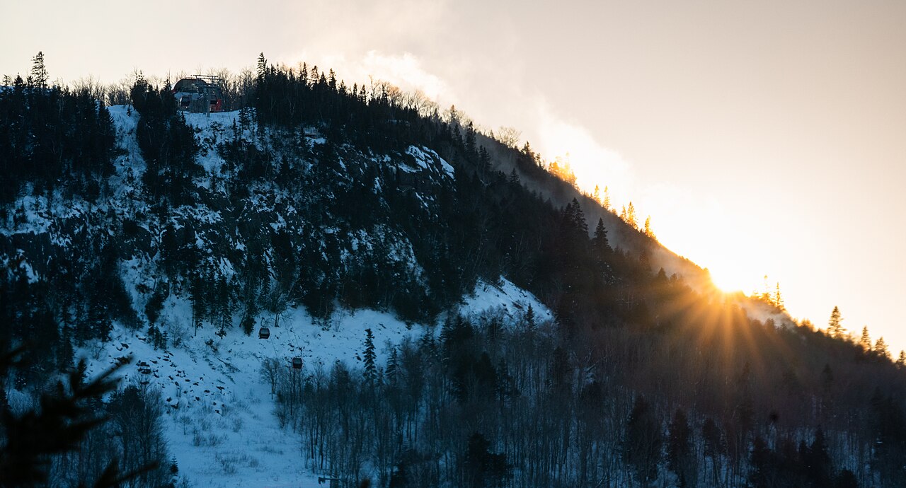
Lutsen Mountains is a downhill ski area in Minnesota, United States. Mapped terrain includes beginner, easy, intermediate, advanced, expert routes. Its mapped lift network extends from approximately 276 to 512 metres above sea level.
Data: OpenSkiData / OpenSkiMap, OpenStreetMap contributors (ODbL), Skimap.org, Who's On First, Mapterhorn.
Lutsen Mountains - Base lift station
ECMWF · Model run: Next update expected:
Day Time (UTC) Temp. (°C) Humidity (%) Wind (km/h) Wind (knots) Wind (Bft) Direction Precip. (mm) Snow (cm) Pressure (hPa) Freezing (m) Conditions | Thursday, 05/11 06:00 8.2 92 28 15 4B N — — 1001 2658 Overcast 100% cloud 09:00 6.2 86 30 16 5B N 1.8 0 1005 2370 Overcast 100% cloud 12:00 5 78 30 16 5B N 0.04 0 1009 2058 Overcast 92% cloud 15:00 3.4 75 26 14 4B N 0.03 0 1014 641 Overcast 97% cloud 18:00 3.8 65 24 13 4B N 0 0 1016 653 Cloudy 78% cloud 21:00 3.9 58 23 13 4B N 0.00 0 1018 688 Cloudy 51% cloud Friday, 06/11 00:00 3.3 61 17 9 3B N 0 0 1021 674 Cloudy 55% cloud 03:00 1.8 71 13 7 3B N 0 0 1023 571 Clear 10% cloud 06:00 0.8 77 14 8 3B N 0 0 1024 436 Clear 3% cloud 09:00 -0.1 81 10 5 2B N 0 0 1025 < 371 Clear 8% cloud 12:00 -0.2 83 8 4 2B N 0 0 1026 < 371 Cloudy 76% cloud 15:00 1.5 72 6 3 2B N 0 0 1027 487 Cloudy 51% cloud 18:00 4.1 58 4 2 1B S 0 0 1025 727 Clear 19% cloud 21:00 4 66 8 4 2B S 0 0 1024 2410 Clear 0% cloud Saturday, 07/11 00:00 1.5 81 7 4 2B SW 0 0 1024 2801 Clear 0% cloud 03:00 1.5 83 8 5 2B SW 0 0 1023 2832 Partly cloudy 22% cloud 06:00 1.9 83 8 4 2B SW 0 0 1022 2724 Overcast 83% cloud 09:00 2.1 83 8 4 2B SW 0 0 1021 2361 Clear 0% cloud 12:00 2.2 84 8 4 2B SW 0 0 1020 2443 Clear 0% cloud 15:00 4.4 81 9 5 2B SW 0 0 1020 2608 Clear 4% cloud 18:00 7.4 74 15 8 3B SW 0 0 1017 3006 Cloudy 60% cloud 21:00 7.6 80 15 8 3B SW 0 0 1014 2892 Cloudy 61% cloud Sunday, 08/11 00:00 6 82 19 10 3B SW 0 0 1011 3009 Clear 0% cloud 03:00 7.6 74 21 11 4B W 0 0 1009 2392 Clear 0% cloud 06:00 7.9 75 19 10 3B W 0 0 1008 2329 Clear 0% cloud 09:00 7.5 69 28 15 4B NW 0 0 1009 1868 Clear 4% cloud 12:00 7.7 72 30 16 5B NW 0 0 1011 1628 Cloudy 72% cloud 15:00 7.4 68 28 15 4B NW 0 0 1013 1825 Partly cloudy 46% cloud 18:00 8.5 63 26 14 4B NW 0 0 1014 1394 Partly cloudy 43% cloud 21:00 9 57 21 11 4B NW 0 0 1014 1391 Clear 5% cloud Monday, 09/11 00:00 6.7 71 16 8 3B NW 0 0 1016 2164 Clear 2% cloud 03:00 5.2 83 12 6 2B NW 0 0 1017 2653 Overcast 97% cloud 06:00 4.2 89 9 5 2B NW 0 0 1017 2989 Overcast 100% cloud 09:00 4.2 88 7 4 2B SW 0 0 1017 2980 Overcast 99% cloud 12:00 4.4 91 10 6 2B S 0 0 1016 3037 Overcast 98% cloud 15:00 5.9 88 13 7 3B S 0 0 1015 3027 Overcast 99% cloud 18:00 8.1 77 13 7 3B SW 0 0 1012 3002 Overcast 99% cloud 21:00 9.5 70 12 6 2B W 0 0 1011 2506 Overcast 98% cloud Tuesday, 10/11 00:00 8.3 75 17 9 3B NW 0.04 0 1011 2299 Cloudy 56% cloud 03:00 7.2 80 20 11 4B NW 0 0 1011 2165 Clear 0% cloud 06:00 6.2 77 25 13 4B NW 0 0 1011 2062 Clear 0% cloud 09:00 5.4 75 25 14 4B NW 0 0 1012 1907 Clear 0% cloud 12:00 4.6 78 19 10 3B NW 0 0 1013 1623 Clear 0% cloud 15:00 5.4 71 14 8 3B W 0 0 1014 1356 Clear 0% cloud 18:00 8.1 62 15 8 3B W 0 0 1013 1387 Partly cloudy 44% cloud 21:00 8.2 60 16 9 3B W 0 0 1012 1344 Overcast 85% cloud Wednesday, 11/11 00:00 5.9 70 13 7 3B W 0 0 1012 1379 Cloudy 63% cloud 03:00 4.9 74 11 6 2B W 0 0 1012 1515 Overcast 97% cloud 06:00 4.9 73 7 4 2B W 0 0 1011 1380 Overcast 98% cloud |
|---|
Forecast notes
Forecast table times: UTC.
Coordinates: 47.6621827°N, -90.7182049°E · Requested elevation: 313 m. Model terrain: 369 m. Terrain and 1000/925/850/700 hPa profiles are used for height estimates.
Outside the available profile, temperature uses an estimated 5.5°C/km height correction; wind retains the nearest available model-level value. Humidity is estimated with adjusted pressure and temperature.
These are altitude estimates, not a simulation of local mountain terrain. Precipitation, cloud and sea-level pressure use horizontal interpolation only.
Precipitation includes rain and snow water equivalent: preceding 3 hours through day 6, then 6 hours (see cell tooltip). Snow (cm) estimates fresh snowfall from precipitation and temperature using the GFS conversion; it is not snow depth on the ground. Freezing (m) uses additional 600/500 hPa temperatures when available and estimates the lowest resolved 0°C crossing above sea level. When all sampled levels are warm, the upper profile limit is shown (see tooltip). < marks an entirely cold sampled profile and its lower height limit. No extrapolation is used.
Source: ECMWF · CC BY 4.0 · Processed by Snow Report.
Lutsen Mountains - Top lift station
ECMWF · Model run: Next update expected:
Day Time (UTC) Temp. (°C) Humidity (%) Wind (km/h) Wind (knots) Wind (Bft) Direction Precip. (mm) Snow (cm) Pressure (hPa) Freezing (m) Conditions | Thursday, 05/11 06:00 7.4 91 45 24 6B N — — 1001 2657 Overcast 100% cloud 09:00 4.7 89 47 25 6B N 1.9 0 1005 2372 Overcast 100% cloud 12:00 3.3 84 41 22 6B N 0.02 0 1009 2056 Overcast 91% cloud 15:00 1.5 82 33 18 5B N 0.03 0 1014 643 Overcast 96% cloud 18:00 1.7 71 29 16 5B N 0 0 1016 654 Cloudy 78% cloud 21:00 2 63 29 15 4B N 0.00 0 1018 689 Cloudy 52% cloud Friday, 06/11 00:00 1.6 64 23 12 4B N 0 0 1021 675 Cloudy 55% cloud 03:00 0.5 72 19 10 3B N 0 0 1023 579 Clear 10% cloud 06:00 -0.5 77 20 11 3B N 0 0 1024 445 Clear 2% cloud 09:00 -1.2 80 13 7 3B N 0 0 1025 < 363 Clear 7% cloud 12:00 -1.4 83 9 5 2B N 0 0 1026 < 363 Cloudy 77% cloud 15:00 -0.3 74 7 4 2B N 0 0 1027 486 Partly cloudy 50% cloud 18:00 2.2 61 3 2 1B SW 0 0 1025 724 Clear 18% cloud 21:00 2.7 68 6 3 1B SW 0 0 1024 2414 Clear 0% cloud Saturday, 07/11 00:00 1.3 75 9 5 2B SW 0 0 1024 2803 Clear 0% cloud 03:00 1.5 74 13 7 3B SW 0 0 1023 2833 Partly cloudy 23% cloud 06:00 1.6 77 15 8 3B SW 0 0 1022 2723 Overcast 83% cloud 09:00 1.9 77 15 8 3B SW 0 0 1021 2362 Clear 0% cloud 12:00 2.3 77 13 7 3B SW 0 0 1020 2446 Clear 0% cloud 15:00 4.1 76 16 8 3B SW 0 0 1020 2614 Clear 4% cloud 18:00 6.4 72 20 11 3B SW 0 0 1017 3014 Cloudy 60% cloud 21:00 7.2 75 20 11 4B SW 0 0 1014 2892 Cloudy 61% cloud Sunday, 08/11 00:00 6.2 74 33 18 5B SW 0 0 1011 3009 Clear 0% cloud 03:00 7.2 72 35 19 5B W 0 0 1009 2400 Clear 0% cloud 06:00 7.4 73 35 19 5B W 0 0 1008 2332 Clear 0% cloud 09:00 6.7 69 45 24 6B NW 0 0 1009 1871 Clear 4% cloud 12:00 6.4 74 46 25 6B NW 0 0 1011 1642 Cloudy 71% cloud 15:00 5.7 73 39 21 6B NW 0 0 1013 1835 Partly cloudy 43% cloud 18:00 6.6 69 34 18 5B NW 0 0 1014 1400 Partly cloudy 43% cloud 21:00 7.4 60 29 16 5B NW 0 0 1014 1395 Clear 5% cloud Monday, 09/11 00:00 5.7 72 27 14 4B NW 0 0 1016 2188 Clear 2% cloud 03:00 4.4 84 22 12 4B NW 0 0 1017 2660 Overcast 97% cloud 06:00 4.1 80 13 7 3B NW 0 0 1017 2998 Overcast 100% cloud 09:00 4.4 76 11 6 2B SW 0 0 1017 2985 Overcast 99% cloud 12:00 4.4 80 18 10 3B S 0 0 1016 3037 Overcast 98% cloud 15:00 5.2 82 23 12 4B SW 0 0 1015 3028 Overcast 99% cloud 18:00 7.1 77 17 9 3B SW 0 0 1012 3004 Overcast 99% cloud 21:00 8.4 70 19 10 3B W 0 0 1011 2507 Overcast 98% cloud Tuesday, 10/11 00:00 8 72 30 16 5B NW 0.04 0 1012 2300 Cloudy 56% cloud 03:00 7.5 72 32 17 5B NW 0 0 1011 2166 Clear 0% cloud 06:00 6.3 66 38 21 5B NW 0 0 1011 2062 Clear 0% cloud 09:00 5 71 41 22 6B NW 0 0 1012 1912 Clear 0% cloud 12:00 3.9 76 34 18 5B NW 0 0 1013 1629 Clear 0% cloud 15:00 4 73 27 15 4B NW 0 0 1014 1367 Clear 0% cloud 18:00 6.3 65 21 11 4B W 0 0 1013 1394 Partly cloudy 46% cloud 21:00 6.8 61 23 12 4B W 0 0 1012 1349 Overcast 84% cloud Wednesday, 11/11 00:00 5.3 67 23 12 4B W 0 0 1012 1383 Cloudy 63% cloud 03:00 4.5 67 22 12 4B W 0 0 1012 1525 Overcast 97% cloud 06:00 4.4 67 16 8 3B NW 0 0 1011 1387 Overcast 97% cloud |
|---|
Forecast notes
Forecast table times: UTC.
Coordinates: 47.6516599°N, -90.7341609°E · Requested elevation: 512 m. Model terrain: 360 m. Terrain and 1000/925/850/700 hPa profiles are used for height estimates.
These are altitude estimates, not a simulation of local mountain terrain. Precipitation, cloud and sea-level pressure use horizontal interpolation only.
Precipitation includes rain and snow water equivalent: preceding 3 hours through day 6, then 6 hours (see cell tooltip). Snow (cm) estimates fresh snowfall from precipitation and temperature using the GFS conversion; it is not snow depth on the ground. Freezing (m) uses additional 600/500 hPa temperatures when available and estimates the lowest resolved 0°C crossing above sea level. When all sampled levels are warm, the upper profile limit is shown (see tooltip). < marks an entirely cold sampled profile and its lower height limit. No extrapolation is used.