Worldwide Ski Resort Forecasts

More
Colour guide Temperature · Wind · Rain · Snow
Each colour starts at the value shown. Wind colours match across all three units. Dry cells stay neutral. Colours describe the displayed values, not official weather warnings.
Hunter Mountain - Low lift station
ECMWF · Model run: Next update expected:
Day Time (UTC) Temp. (°C) Humidity (%) Wind (km/h) Wind (knots) Wind (Bft) Direction Precip. (mm) Snow (cm) Pressure (hPa) Freezing (m) Conditions | Thursday, 05/11 06:00 12.7 83 16 9 3B S — — 1014 3108 Clear 0% cloud  09:00 13.8 94 16 9 3B SW 0 0 1013 3094 Overcast 98% cloud  12:00 14.7 95 15 8 3B S 0.74 0 1012 3089 Overcast 99% cloud 15:00 16.1 95 17 9 3B S 1.4 0 1011 3084 Overcast 99% cloud 18:00 17.7 90 16 9 3B S 1.1 0 1010 3070 Overcast 97% cloud 21:00 17.6 91 16 8 3B S 0.63 0 1009 3068 Overcast 84% cloud Friday, 06/11 00:00 16.3 94 14 8 3B SW 0.23 0 1010 3073 Overcast 95% cloud 03:00 15.9 95 11 6 2B SW 0.13 0 1011 3072 Overcast 91% cloud 06:00 15.4 97 8 4 2B W 0.10 0 1011 3064 Overcast 94% cloud 09:00 13 97 3 1 1B NW 0.12 0 1012 3058 Overcast 88% cloud 12:00 11.9 97 2 1 1B S 0 0 1013 3059 Cloudy 76% cloud  15:00 16.1 66 5 3 1B S 0 0 1012 3057 Partly cloudy 49% cloud  18:00 19 48 4 2 1B SW 0 0 1010 3043 Partly cloudy 35% cloud 21:00 16.7 64 0 0 0B — 0.07 0 1010 3036 Clear 6% cloud Saturday, 07/11 00:00 11.6 84 4 2 1B N 0 0 1011 3036 Clear 20% cloud 03:00 10.4 90 5 3 1B NW 0 0 1012 2951 Partly cloudy 41% cloud 06:00 9.3 92 6 3 2B NW 0 0 1011 2839 Clear 11% cloud 09:00 8.4 94 5 3 1B NW 0 0 1010 2694 Cloudy 78% cloud 12:00 8.3 94 5 3 1B NW 0.21 0 1011 2591 Cloudy 74% cloud 15:00 10.9 87 4 2 1B N 0.38 0 1011 2474 Overcast 100% cloud 18:00 10.8 89 6 3 1B N 0.85 0 1009 2274 Overcast 100% cloud 21:00 5.9 96 20 11 3B W 4.5 0 1010 1725 Overcast 100% cloud Sunday, 08/11 00:00 4 94 14 7 3B W 3.5 0 1011 1670 Overcast 97% cloud 03:00 4.3 93 13 7 3B W 0.80 0 1009 1588 Overcast 99% cloud 06:00 5.3 96 17 9 3B NW 2.6 0 1008 1785 Overcast 100% cloud 09:00 5.2 95 21 12 4B NW 1.1 0 1009 1932 Overcast 96% cloud 12:00 5.8 92 18 10 3B NW 0.02 0 1011 1700 Overcast 99% cloud 15:00 7.9 83 19 10 3B W 0.16 0 1011 1866 Overcast 99% cloud 18:00 10 56 17 9 3B W 0.16 0 1009 1958 Partly cloudy 29% cloud 21:00 9.5 56 11 6 2B W 0 0 1007 2056 Clear 0% cloud Monday, 09/11 00:00 6.7 61 15 8 3B W 0 0 1007 1916 Partly cloudy 21% cloud 03:00 7.1 62 19 10 3B W 0 0 1007 1545 Partly cloudy 20% cloud 06:00 6.6 80 19 10 3B W 0 0 1006 1415 Overcast 98% cloud 09:00 5.8 84 18 10 3B W 0.08 0 1007 1322 Overcast 87% cloud 12:00 4.7 86 17 9 3B W 0.10 0 1008 1185 Overcast 89% cloud 15:00 5.7 75 20 11 4B NW 0.07 0 1010 1126 Overcast 98% cloud 18:00 6 67 26 14 4B NW 0.38 0 1010 1123 Overcast 97% cloud 21:00 5.3 65 22 12 4B NW 0.02 0 1012 1106 Overcast 85% cloud Tuesday, 10/11 00:00 4 76 19 10 3B NW 0.08 0 1014 1051 Overcast 93% cloud 03:00 4.6 81 13 7 3B NW 0 0 1014 1116 Overcast 97% cloud 06:00 4.6 85 12 7 2B NW 0 0 1015 1166 Overcast 98% cloud 09:00 4.8 87 11 6 2B W 0 0 1014 2275 Overcast 98% cloud 12:00 4.3 86 12 6 2B W 0 0 1014 2807 Overcast 100% cloud 15:00 7.6 70 10 6 2B W 0 0 1013 2696 Overcast 95% cloud 18:00 11.4 47 14 7 3B SW 0 0 1009 2282 Clear 3% cloud 21:00 11.1 57 14 8 3B W 0 0 1008 2165 Overcast 96% cloud Wednesday, 11/11 00:00 8.2 87 18 10 3B W 0.16 0 1010 1990 Cloudy 79% cloud 03:00 7.7 86 19 10 3B W 0 0 1011 1987 Cloudy 80% cloud 06:00 6.7 88 12 7 3B W 0 0 1012 1726 Overcast 92% cloud |
|---|
Forecast notes
Forecast table times: UTC.
Coordinates: 42.2042264°N, -74.2062122°E · Requested elevation: 502 m. Model terrain: 571 m. Terrain and 1000/925/850/700 hPa profiles are used for height estimates.
Outside the available profile, temperature uses an estimated 5.5°C/km height correction; wind retains the nearest available model-level value. Humidity is estimated with adjusted pressure and temperature.
These are altitude estimates, not a simulation of local mountain terrain. Precipitation, cloud and sea-level pressure use horizontal interpolation only.
Precipitation includes rain and snow water equivalent: preceding 3 hours through day 6, then 6 hours (see cell tooltip). Snow (cm) estimates fresh snowfall from precipitation and temperature using the GFS conversion; it is not snow depth on the ground. Freezing (m) uses additional 600/500 hPa temperatures when available and estimates the lowest resolved 0°C crossing above sea level. When all sampled levels are warm, the upper profile limit is shown (see tooltip). < marks an entirely cold sampled profile and its lower height limit. No extrapolation is used.
Source: ECMWF · CC BY 4.0 · Processed by Snow Report.
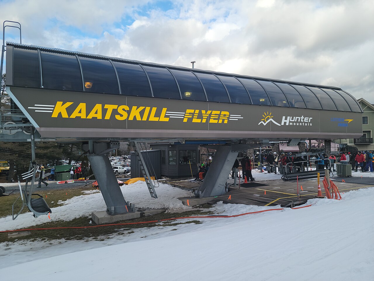
Hunter Mountain is the New York ski resort, not Hunter Mountain Shiobara in Japan. Its official trail guide divides the mountain into four faces and includes terrain for different abilities. Use the winter trail map to choose a sector and return route; the summer hiking map serves a different purpose.
For a first visit, distinguish the learning facilities and their meeting points from the main mountain trails. For a returning visit, consult the current map rather than relying on an old photograph or remembered lift arrangement. The resort publishes operating hours separately from its weather and webcam information.
The forecast opens at a lower point of 502 m. Around freezing, that height matters: a small temperature change can alter what falls at the base compared with higher terrain. Look at the sequence of precipitation and temperature through the day, including the journey home. Fresh-snow forecasts do not describe snowmaking, grooming or the existing piste base, so compare the weather outlook with the operator’s current terrain report.
Official sources: Hunter Mountain trail maps · Hunter Mountain operating hours. Reviewed 18 October 2026.
Hunter Mountain - Base lift station
ECMWF · Model run: Next update expected:
Day Time (UTC) Temp. (°C) Humidity (%) Wind (km/h) Wind (knots) Wind (Bft) Direction Precip. (mm) Snow (cm) Pressure (hPa) Freezing (m) Conditions | Thursday, 05/11 06:00 12.7 83 16 9 3B S — — 1014 3108 Clear 0% cloud 09:00 13.7 94 17 9 3B SW 0 0 1013 3094 Overcast 98% cloud 12:00 14.7 95 15 8 3B S 0.71 0 1012 3089 Overcast 99% cloud 15:00 16.1 95 17 9 3B S 1.4 0 1011 3083 Overcast 99% cloud 18:00 17.6 91 16 9 3B S 1.1 0 1010 3070 Overcast 97% cloud 21:00 17.5 92 16 8 3B S 0.63 0 1009 3068 Overcast 84% cloud Friday, 06/11 00:00 16.2 94 14 8 3B SW 0.23 0 1010 3073 Overcast 95% cloud 03:00 15.8 95 11 6 2B SW 0.13 0 1011 3072 Overcast 91% cloud 06:00 15.3 98 8 4 2B W 0.10 0 1011 3064 Overcast 94% cloud 09:00 13 97 3 1 1B NW 0.12 0 1012 3058 Overcast 88% cloud 12:00 11.9 97 2 1 1B S 0 0 1013 3059 Cloudy 75% cloud 15:00 16 66 5 3 1B S 0 0 1012 3056 Partly cloudy 49% cloud 18:00 18.9 47 5 2 1B SW 0 0 1010 3043 Partly cloudy 35% cloud 21:00 16.7 64 0 0 0B — 0.06 0 1010 3035 Clear 6% cloud Saturday, 07/11 00:00 11.6 85 4 2 1B N 0 0 1011 3035 Clear 19% cloud 03:00 10.3 90 5 3 1B NW 0 0 1012 2950 Partly cloudy 40% cloud 06:00 9.2 92 6 3 2B NW 0 0 1011 2839 Clear 11% cloud 09:00 8.3 94 5 3 1B NW 0 0 1010 2693 Cloudy 79% cloud 12:00 8.2 95 5 3 1B NW 0.21 0 1011 2590 Cloudy 74% cloud 15:00 10.9 87 4 2 1B N 0.37 0 1011 2472 Overcast 100% cloud 18:00 10.7 89 6 3 1B N 0.87 0 1009 2273 Overcast 100% cloud 21:00 5.8 96 20 11 3B W 4.5 0 1010 1720 Overcast 100% cloud Sunday, 08/11 00:00 3.9 94 14 7 3B W 3.5 0 1011 1669 Overcast 97% cloud 03:00 4.2 94 13 7 3B W 0.80 0 1009 1589 Overcast 99% cloud 06:00 5.2 96 17 9 3B NW 2.6 0 1008 1788 Overcast 100% cloud 09:00 5.1 95 22 12 4B NW 1.1 0 1009 1933 Overcast 97% cloud 12:00 5.7 93 18 10 3B NW 0.02 0 1011 1701 Overcast 99% cloud 15:00 7.8 84 19 11 3B W 0.17 0 1011 1869 Overcast 99% cloud 18:00 9.9 56 17 9 3B W 0.17 0 1009 1958 Partly cloudy 29% cloud 21:00 9.4 56 11 6 2B W 0 0 1007 2057 Clear 0% cloud Monday, 09/11 00:00 6.6 61 15 8 3B W 0 0 1007 1917 Partly cloudy 21% cloud 03:00 7 62 19 10 3B W 0 0 1007 1544 Partly cloudy 21% cloud 06:00 6.6 80 19 11 3B W 0 0 1006 1415 Overcast 98% cloud 09:00 5.7 85 18 10 3B W 0.08 0 1007 1322 Overcast 87% cloud 12:00 4.6 86 17 9 3B W 0.10 0 1008 1184 Overcast 90% cloud 15:00 5.6 76 20 11 4B NW 0.08 0 1010 1124 Overcast 98% cloud 18:00 5.9 68 26 14 4B NW 0.39 0 1010 1123 Overcast 98% cloud 21:00 5.2 65 22 12 4B NW 0.02 0 1012 1106 Overcast 86% cloud Tuesday, 10/11 00:00 3.9 76 19 10 3B NW 0.08 0 1014 1050 Overcast 94% cloud 03:00 4.5 81 13 7 3B NW 0 0 1014 1116 Overcast 98% cloud 06:00 4.5 85 12 7 3B NW 0 0 1015 1166 Overcast 98% cloud 09:00 4.7 87 11 6 2B W 0 0 1014 2278 Overcast 98% cloud 12:00 4.2 86 12 6 2B W 0 0 1014 2809 Overcast 100% cloud 15:00 7.5 70 10 6 2B W 0 0 1013 2697 Overcast 95% cloud 18:00 11.3 47 14 7 3B SW 0 0 1009 2282 Clear 3% cloud 21:00 11 57 14 8 3B W 0 0 1008 2164 Overcast 96% cloud Wednesday, 11/11 00:00 8.1 87 18 10 3B W 0.17 0 1010 1989 Overcast 81% cloud 03:00 7.6 87 19 10 3B W 0 0 1011 1985 Overcast 81% cloud 06:00 6.6 88 13 7 3B W 0 0 1012 1726 Overcast 92% cloud |
|---|
Forecast notes
Forecast table times: UTC.
Coordinates: 42.2038346°N, -74.2108188°E · Requested elevation: 517 m. Model terrain: 578 m. Terrain and 1000/925/850/700 hPa profiles are used for height estimates.
Outside the available profile, temperature uses an estimated 5.5°C/km height correction; wind retains the nearest available model-level value. Humidity is estimated with adjusted pressure and temperature.
These are altitude estimates, not a simulation of local mountain terrain. Precipitation, cloud and sea-level pressure use horizontal interpolation only.
Precipitation includes rain and snow water equivalent: preceding 3 hours through day 6, then 6 hours (see cell tooltip). Snow (cm) estimates fresh snowfall from precipitation and temperature using the GFS conversion; it is not snow depth on the ground. Freezing (m) uses additional 600/500 hPa temperatures when available and estimates the lowest resolved 0°C crossing above sea level. When all sampled levels are warm, the upper profile limit is shown (see tooltip). < marks an entirely cold sampled profile and its lower height limit. No extrapolation is used.
Source: ECMWF · CC BY 4.0 · Processed by Snow Report.
Hunter Mountain - Top lift station
ECMWF · Model run: Next update expected:
Day Time (UTC) Temp. (°C) Humidity (%) Wind (km/h) Wind (knots) Wind (Bft) Direction Precip. (mm) Snow (cm) Pressure (hPa) Freezing (m) Conditions | Thursday, 05/11 06:00 14.3 68 46 25 6B SW — — 1014 3108 Clear 1% cloud 09:00 13.3 88 50 27 6B SW 0 0 1013 3093 Overcast 98% cloud 12:00 13.7 95 48 26 6B SW 0.59 0 1012 3089 Overcast 99% cloud 15:00 14.2 95 49 27 6B SW 1.4 0 1011 3083 Overcast 99% cloud 18:00 14.7 96 42 23 6B SW 1.1 0 1010 3070 Overcast 97% cloud 21:00 15.2 93 40 22 6B SW 0.64 0 1009 3068 Overcast 85% cloud Friday, 06/11 00:00 14.8 94 43 23 6B SW 0.24 0 1010 3073 Overcast 97% cloud 03:00 14.3 93 38 21 5B SW 0.12 0 1011 3071 Overcast 93% cloud 06:00 13 96 25 14 4B W 0.11 0 1011 3064 Overcast 95% cloud 09:00 11.7 88 15 8 3B W 0.11 0 1012 3058 Overcast 90% cloud 12:00 11 82 14 8 3B SW 0 0 1013 3059 Cloudy 75% cloud 15:00 11.6 68 13 7 3B SW 0 0 1012 3056 Partly cloudy 48% cloud 18:00 13.6 58 9 5 2B SW 0 0 1010 3043 Partly cloudy 33% cloud 21:00 13.6 56 7 4 2B SW 0.03 0 1010 3035 Clear 5% cloud Saturday, 07/11 00:00 11.6 77 7 4 2B N 0 0 1011 3035 Clear 16% cloud 03:00 10.4 82 11 6 2B N 0 0 1012 2946 Partly cloudy 36% cloud 06:00 9.8 80 11 6 2B NE 0 0 1011 2838 Clear 12% cloud 09:00 9.3 83 10 6 2B NE 0 0 1010 2689 Overcast 83% cloud 12:00 8.3 89 3 2 1B NE 0.22 0 1011 2587 Cloudy 72% cloud 15:00 7.8 96 0 0 0B W 0.34 0 1011 2468 Overcast 100% cloud 18:00 7.4 95 4 2 1B NW 0.94 0 1009 2266 Overcast 100% cloud 21:00 3.2 93 31 17 5B NW 4.6 0 1011 1697 Overcast 100% cloud Sunday, 08/11 00:00 2.3 92 32 17 5B NW 3.5 0 1011 1664 Overcast 97% cloud 03:00 2.4 94 32 17 5B NW 0.80 0 1009 1594 Overcast 99% cloud 06:00 3.5 97 40 21 6B NW 2.5 0 1008 1797 Overcast 100% cloud 09:00 3.7 91 53 29 7B NW 1.1 0 1010 1937 Overcast 98% cloud 12:00 3.2 97 50 27 6B NW 0.02 0 1012 1703 Overcast 99% cloud 15:00 4 94 44 24 6B NW 0.18 0 1011 1883 Overcast 99% cloud 18:00 4.9 71 31 17 5B W 0.18 0 1009 1963 Partly cloudy 30% cloud 21:00 6.2 57 32 18 5B W 0 0 1007 2060 Clear 0% cloud Monday, 09/11 00:00 5.5 54 48 26 6B W 0 0 1007 1920 Partly cloudy 21% cloud 03:00 3.9 74 47 25 6B W 0 0 1007 1543 Partly cloudy 22% cloud 06:00 3.3 89 47 25 6B W 0 0 1006 1417 Overcast 98% cloud 09:00 2.6 89 45 25 6B W 0.09 0 1007 1322 Overcast 90% cloud 12:00 1.4 90 44 24 6B NW 0.10 0 1009 1179 Overcast 92% cloud 15:00 1.1 89 41 22 6B NW 0.09 0 1010 1117 Overcast 98% cloud 18:00 1.4 83 48 26 6B NW 0.41 0 1010 1123 Overcast 98% cloud 21:00 1.2 78 45 24 6B NW 0.02 0 1012 1102 Overcast 90% cloud Tuesday, 10/11 00:00 0.6 86 53 29 7B NW 0.09 0 1014 1049 Overcast 96% cloud 03:00 1.1 90 44 24 6B NW 0 0 1014 1116 Overcast 99% cloud 06:00 1.3 92 40 21 6B NW 0 0 1015 1167 Overcast 98% cloud 09:00 2.4 85 35 19 5B NW 0 0 1014 2295 Overcast 99% cloud 12:00 3.9 61 36 20 5B W 0 0 1014 2817 Overcast 100% cloud 15:00 4.7 56 31 17 5B W 0 0 1013 2700 Overcast 95% cloud 18:00 6.5 52 29 16 4B W 0 0 1009 2281 Clear 3% cloud 21:00 7.5 70 40 22 6B W 0 0 1008 2164 Overcast 97% cloud Wednesday, 11/11 00:00 5.9 88 53 29 7B W 0.18 0 1010 1984 Overcast 87% cloud 03:00 4.9 83 51 27 7B NW 0 0 1011 1979 Overcast 86% cloud 06:00 4 87 38 21 5B NW 0 0 1012 1725 Overcast 94% cloud |
|---|
Forecast notes
Forecast table times: UTC.
Coordinates: 42.2005354°N, -74.2302992°E · Requested elevation: 969 m. Model terrain: 605 m. Terrain and 1000/925/850/700 hPa profiles are used for height estimates.
These are altitude estimates, not a simulation of local mountain terrain. Precipitation, cloud and sea-level pressure use horizontal interpolation only.
Precipitation includes rain and snow water equivalent: preceding 3 hours through day 6, then 6 hours (see cell tooltip). Snow (cm) estimates fresh snowfall from precipitation and temperature using the GFS conversion; it is not snow depth on the ground. Freezing (m) uses additional 600/500 hPa temperatures when available and estimates the lowest resolved 0°C crossing above sea level. When all sampled levels are warm, the upper profile limit is shown (see tooltip). < marks an entirely cold sampled profile and its lower height limit. No extrapolation is used.