Worldwide Ski Resort Forecasts

More
Colour guide Temperature · Wind · Rain · Snow
Each colour starts at the value shown. Wind colours match across all three units. Dry cells stay neutral. Colours describe the displayed values, not official weather warnings.
Smugglers' Notch Resort - Low lift station
ECMWF · Model run: Next update expected:
Day Time (UTC) Temp. (°C) Humidity (%) Wind (km/h) Wind (knots) Wind (Bft) Direction Precip. (mm) Snow (cm) Pressure (hPa) Freezing (m) Conditions | Thursday, 05/11 06:00 12.4 82 11 6 2B S — — 1011 3096 Partly cloudy 24% cloud  09:00 12.5 81 13 7 3B S 0 0 1010 3079 Cloudy 54% cloud  12:00 13.5 81 14 7 3B S 0 0 1010 3066 Overcast 96% cloud  15:00 15.2 92 14 8 3B S 0.72 0 1009 3053 Overcast 100% cloud 18:00 17.4 91 16 9 3B S 1.9 0 1007 3039 Overcast 96% cloud 21:00 17.6 88 16 9 3B S 0.36 0 1007 3036 Cloudy 62% cloud Friday, 06/11 00:00 15 97 14 7 3B SW 1.9 0 1008 3038 Overcast 96% cloud 03:00 14.3 97 6 3 2B W 3.8 0 1009 3033 Overcast 98% cloud 06:00 12.9 94 6 3 2B W 0.65 0 1011 3025 Overcast 100% cloud 09:00 11.5 91 4 2 1B SW 0 0 1011 3024 Partly cloudy 34% cloud 12:00 9.7 92 4 2 1B W 0.01 0 1012 3029 Overcast 85% cloud 15:00 13.5 77 5 3 1B W 0.09 0 1013 3032 Overcast 95% cloud 18:00 15.3 60 5 3 1B NW 0 0 1012 2995 Cloudy 77% cloud 21:00 13.2 70 5 3 1B N 0 0 1012 2778 Partly cloudy 28% cloud Saturday, 07/11 00:00 9.2 84 5 3 1B NE 0 0 1013 2583 Clear 4% cloud  03:00 7.8 92 5 2 1B E 0 0 1013 2448 Overcast 97% cloud 06:00 7 96 5 3 1B NE 0 0 1013 2416 Partly cloudy 38% cloud 09:00 7.1 96 4 2 1B NE 0 0 1012 2453 Overcast 81% cloud 12:00 7.3 96 3 2 1B NE 0 0 1013 2395 Overcast 96% cloud 15:00 11.1 79 6 3 2B NE 0 0 1012 2502 Partly cloudy 39% cloud 18:00 14.4 64 8 5 2B NE 0 0 1009 2537 Cloudy 71% cloud 21:00 12 69 9 5 2B N 0.07 0 1008 2463 Overcast 86% cloud Sunday, 08/11 00:00 8.6 77 8 4 2B N 0.09 0 1009 2325 Overcast 96% cloud 03:00 6.7 87 7 4 2B N 0.23 0 1008 2260 Overcast 100% cloud 06:00 4.8 91 9 5 2B NW 0.35 0 1008 1965 Overcast 100% cloud 09:00 3 91 11 6 2B NW 0.45 0 1008 1773 Overcast 96% cloud 12:00 2.8 90 12 7 2B NW 0.01 0 1009 686 Overcast 100% cloud 15:00 5.6 73 10 5 2B NW 0 0 1008 1011 Cloudy 67% cloud 18:00 6.2 74 10 5 2B W 0.01 0 1006 1119 Overcast 100% cloud 21:00 6 84 5 2 1B SW 0.11 0 1004 1254 Partly cloudy 40% cloud Monday, 09/11 00:00 5.2 84 10 6 2B W 0.28 0 1004 1246 Overcast 100% cloud 03:00 4.7 95 8 4 2B W 1.4 0 1003 1094 Overcast 100% cloud 06:00 5 97 6 3 2B SW 2.0 0 1002 1203 Overcast 100% cloud 09:00 5 97 11 6 2B W 1.3 0 1003 1185 Overcast 100% cloud 12:00 4.7 98 11 6 2B NW 2.1 0 1004 1123 Overcast 99% cloud 15:00 5.2 96 14 8 3B NW 1.7 0 1005 1092 Overcast 100% cloud 18:00 5.3 94 17 9 3B W 1.6 0 1006 1060 Overcast 100% cloud 21:00 4.9 91 18 10 3B W 0.67 0 1008 1016 Overcast 100% cloud Tuesday, 10/11 00:00 4.2 89 19 10 3B W 0.50 0 1010 964 Overcast 100% cloud 03:00 4.4 87 18 10 3B W 0.23 0 1011 956 Overcast 100% cloud 06:00 3.8 81 17 9 3B W 0.32 0 1011 843 Overcast 100% cloud 09:00 3.8 82 12 7 2B W 0.16 0 1011 842 Overcast 100% cloud 12:00 4 81 10 5 2B W 0.07 0 1011 894 Overcast 100% cloud 15:00 6 69 13 7 3B W 0 0 1011 1037 Overcast 100% cloud 18:00 6.1 74 9 5 2B S 0.07 0 1007 1333 Overcast 100% cloud 21:00 5.6 92 8 4 2B S 1.4 0 1006 1297 Overcast 100% cloud Wednesday, 11/11 00:00 5.6 97 14 8 3B W 3.7 0 1006 1412 Overcast 99% cloud 03:00 5.9 96 16 9 3B W 2.1 0 1008 1276 Overcast 100% cloud 06:00 4.1 96 14 8 3B W 0.38 0 1009 1071 Partly cloudy 22% cloud |
|---|
Forecast notes
Forecast table times: UTC.
Coordinates: 44.5885185°N, -72.7857534°E · Requested elevation: 339 m. Model terrain: 412 m. Terrain and 1000/925/850/700 hPa profiles are used for height estimates.
Outside the available profile, temperature uses an estimated 5.5°C/km height correction; wind retains the nearest available model-level value. Humidity is estimated with adjusted pressure and temperature.
These are altitude estimates, not a simulation of local mountain terrain. Precipitation, cloud and sea-level pressure use horizontal interpolation only.
Precipitation includes rain and snow water equivalent: preceding 3 hours through day 6, then 6 hours (see cell tooltip). Snow (cm) estimates fresh snowfall from precipitation and temperature using the GFS conversion; it is not snow depth on the ground. Freezing (m) uses additional 600/500 hPa temperatures when available and estimates the lowest resolved 0°C crossing above sea level. When all sampled levels are warm, the upper profile limit is shown (see tooltip). < marks an entirely cold sampled profile and its lower height limit. No extrapolation is used.
Source: ECMWF · CC BY 4.0 · Processed by Snow Report.
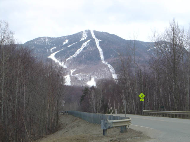
Smugglers' Notch Resort is a downhill ski area in Vermont, United States. Mapped terrain includes easy, intermediate, advanced, expert, freeride routes. Its mapped lift network extends from approximately 339 to 1112 metres above sea level.
Data: OpenSkiData / OpenSkiMap, OpenStreetMap contributors (ODbL), Skimap.org, Who's On First, Mapterhorn.
Smugglers' Notch Resort - Base lift station
ECMWF · Model run: Next update expected:
Day Time (UTC) Temp. (°C) Humidity (%) Wind (km/h) Wind (knots) Wind (Bft) Direction Precip. (mm) Snow (cm) Pressure (hPa) Freezing (m) Conditions | Thursday, 05/11 06:00 12.8 78 16 9 3B S — — 1011 3096 Partly cloudy 24% cloud 09:00 12.5 79 20 11 4B S 0 0 1010 3079 Cloudy 54% cloud 12:00 13 82 20 11 4B S 0 0 1010 3066 Overcast 96% cloud 15:00 14.5 94 20 11 3B S 0.67 0 1009 3054 Overcast 100% cloud 18:00 16.4 94 22 12 4B S 1.9 0 1007 3040 Overcast 97% cloud 21:00 16.7 91 21 12 4B SW 0.41 0 1007 3036 Cloudy 66% cloud Friday, 06/11 00:00 14.3 99 19 10 3B SW 2.0 0 1008 3038 Overcast 97% cloud 03:00 13.7 98 10 5 2B W 4.2 0 1009 3034 Overcast 98% cloud 06:00 12.2 94 10 5 2B W 0.72 0 1011 3026 Overcast 100% cloud 09:00 11 90 6 4 2B SW 0 0 1011 3024 Partly cloudy 31% cloud 12:00 9.4 91 6 3 2B W 0.01 0 1012 3029 Overcast 86% cloud 15:00 12.4 80 7 4 2B W 0.10 0 1013 3032 Overcast 95% cloud 18:00 14.2 64 5 3 1B NW 0 0 1012 2998 Cloudy 74% cloud 21:00 12.3 72 6 3 2B N 0 0 1012 2785 Partly cloudy 28% cloud Saturday, 07/11 00:00 9 83 8 4 2B NE 0 0 1013 2590 Clear 4% cloud 03:00 7.8 90 7 4 2B E 0 0 1013 2457 Overcast 98% cloud 06:00 7.1 94 7 4 2B NE 0 0 1013 2420 Partly cloudy 34% cloud 09:00 7.3 94 7 4 2B E 0 0 1012 2461 Overcast 84% cloud 12:00 7.1 96 5 3 1B E 0 0 1013 2399 Overcast 97% cloud 15:00 10.1 82 8 4 2B NE 0 0 1012 2508 Partly cloudy 39% cloud 18:00 13.2 67 10 5 2B NE 0 0 1009 2540 Cloudy 75% cloud 21:00 11.2 72 12 6 2B NE 0.08 0 1008 2465 Overcast 87% cloud Sunday, 08/11 00:00 7.9 79 11 6 2B NE 0.09 0 1009 2326 Overcast 97% cloud 03:00 6 89 8 5 2B N 0.23 0 1008 2257 Overcast 100% cloud 06:00 4 94 11 6 2B NW 0.35 0 1008 1965 Overcast 100% cloud 09:00 2.1 94 14 8 3B NW 0.51 0 1008 1779 Overcast 96% cloud 12:00 1.7 94 16 9 3B NW 0.01 0 1009 685 Overcast 100% cloud 15:00 4.3 78 12 7 2B NW 0 0 1008 1019 Cloudy 67% cloud 18:00 5 78 12 7 3B W 0.01 0 1006 1121 Overcast 100% cloud 21:00 5.2 86 7 4 2B SW 0.11 0 1004 1256 Partly cloudy 38% cloud Monday, 09/11 00:00 4.7 83 15 8 3B W 0.29 0 1004 1251 Overcast 100% cloud 03:00 4 96 12 7 2B W 1.4 0 1003 1098 Overcast 100% cloud 06:00 4.1 99 10 5 2B SW 2.0 0 1002 1204 Overcast 100% cloud 09:00 4.2 99 16 9 3B W 1.3 0 1003 1188 Overcast 100% cloud 12:00 3.9 99 16 9 3B NW 2.3 0 1004 1127 Overcast 100% cloud 15:00 4.2 99 19 10 3B NW 1.8 0 1005 1094 Overcast 100% cloud 18:00 4.2 97 22 12 4B NW 1.7 0 1006 1063 Overcast 100% cloud 21:00 3.9 94 24 13 4B W 0.69 0 1008 1018 Overcast 100% cloud Tuesday, 10/11 00:00 3.3 91 25 13 4B W 0.50 0 1010 965 Overcast 100% cloud 03:00 3.5 90 23 13 4B NW 0.24 0 1011 959 Overcast 100% cloud 06:00 2.8 85 21 12 4B W 0.31 0 1011 845 Overcast 100% cloud 09:00 2.7 86 16 9 3B W 0.17 0 1011 844 Overcast 100% cloud 12:00 3 84 14 8 3B W 0.06 0 1011 897 Overcast 100% cloud 15:00 4.8 74 16 8 3B W 0 0 1011 1038 Overcast 100% cloud 18:00 5.1 77 12 6 2B SW 0.06 0 1007 1338 Overcast 100% cloud 21:00 5 90 12 7 2B SW 1.3 0 1006 1298 Overcast 100% cloud Wednesday, 11/11 00:00 4.9 98 20 11 4B W 3.5 0 1006 1414 Overcast 99% cloud 03:00 5.1 98 23 12 4B W 2.1 0 1008 1281 Overcast 100% cloud 06:00 3.4 97 20 11 4B NW 0.37 0 1009 1074 Partly cloudy 22% cloud |
|---|
Forecast notes
Forecast table times: UTC.
Coordinates: 44.572954°N, -72.7747654°E · Requested elevation: 485 m. Model terrain: 429 m. Terrain and 1000/925/850/700 hPa profiles are used for height estimates.
These are altitude estimates, not a simulation of local mountain terrain. Precipitation, cloud and sea-level pressure use horizontal interpolation only.
Precipitation includes rain and snow water equivalent: preceding 3 hours through day 6, then 6 hours (see cell tooltip). Snow (cm) estimates fresh snowfall from precipitation and temperature using the GFS conversion; it is not snow depth on the ground. Freezing (m) uses additional 600/500 hPa temperatures when available and estimates the lowest resolved 0°C crossing above sea level. When all sampled levels are warm, the upper profile limit is shown (see tooltip). < marks an entirely cold sampled profile and its lower height limit. No extrapolation is used.
Source: ECMWF · CC BY 4.0 · Processed by Snow Report.
Smugglers' Notch Resort - Top lift station
ECMWF · Model run: Next update expected:
Day Time (UTC) Temp. (°C) Humidity (%) Wind (km/h) Wind (knots) Wind (Bft) Direction Precip. (mm) Snow (cm) Pressure (hPa) Freezing (m) Conditions | Thursday, 05/11 06:00 17.2 47 44 24 6B SW — — 1011 3096 Partly cloudy 24% cloud 09:00 15.3 49 57 31 7B SW 0 0 1010 3080 Cloudy 55% cloud 12:00 13.5 74 54 29 7B SW 0 0 1010 3067 Overcast 97% cloud 15:00 12.7 94 54 29 7B SW 0.60 0 1009 3054 Overcast 100% cloud 18:00 12.8 96 52 28 7B SW 1.9 0 1007 3040 Overcast 98% cloud 21:00 13.3 93 49 27 6B SW 0.46 0 1007 3036 Cloudy 71% cloud Friday, 06/11 00:00 12 96 45 24 6B SW 2.1 0 1008 3039 Overcast 98% cloud 03:00 11.2 99 31 17 5B W 4.6 0 1009 3034 Overcast 99% cloud 06:00 9.1 90 30 16 5B W 0.78 0 1011 3026 Overcast 100% cloud 09:00 8.3 84 27 14 4B W 0 0 1011 3024 Partly cloudy 28% cloud 12:00 7.7 85 22 12 4B SW 0.00 0 1012 3029 Overcast 85% cloud 15:00 7.2 86 18 10 3B W 0.10 0 1013 3033 Overcast 95% cloud 18:00 8 79 9 5 2B W 0 0 1012 3003 Cloudy 71% cloud 21:00 8.2 75 8 4 2B NW 0 0 1012 2793 Partly cloudy 29% cloud Saturday, 07/11 00:00 8.3 72 11 6 2B NE 0 0 1013 2597 Clear 4% cloud 03:00 8 74 15 8 3B NE 0 0 1013 2466 Overcast 98% cloud 06:00 7.8 75 14 7 3B E 0 0 1013 2424 Partly cloudy 31% cloud 09:00 7.9 79 13 7 3B E 0 0 1012 2468 Overcast 87% cloud 12:00 7 85 14 7 3B E 0 0 1013 2404 Overcast 98% cloud 15:00 6.5 88 17 9 3B E 0 0 1012 2513 Partly cloudy 37% cloud 18:00 7.3 86 18 10 3B E 0 0 1009 2544 Cloudy 78% cloud 21:00 6.5 89 21 12 4B NE 0.09 0 1008 2468 Overcast 87% cloud Sunday, 08/11 00:00 5.5 90 21 12 4B NE 0.09 0 1009 2329 Overcast 98% cloud 03:00 4.2 96 21 11 4B N 0.20 0 1008 2256 Overcast 100% cloud 06:00 2.5 98 33 18 5B N 0.36 0 1008 1967 Overcast 100% cloud 09:00 1.3 96 49 27 6B NW 0.56 0 1008 1785 Overcast 96% cloud 12:00 -0.3 100 50 27 6B NW 0.00 0 1009 683 Overcast 100% cloud 15:00 -0.4 91 37 20 5B NW 0 0 1008 1027 Cloudy 67% cloud 18:00 0.1 95 38 20 5B W 0.00 0 1006 1123 Overcast 100% cloud 21:00 1 88 37 20 5B W 0.12 0 1005 1256 Partly cloudy 35% cloud Monday, 09/11 00:00 1.1 87 45 24 6B W 0.31 0.1 1004 1257 Overcast 100% cloud 03:00 -0.1 96 36 20 5B W 1.5 0.4 1003 1100 Overcast 100% cloud 06:00 0.5 99 36 19 5B W 1.9 0.6 1002 1204 Overcast 100% cloud 09:00 0.5 100 41 22 6B W 1.3 0.4 1003 1191 Overcast 100% cloud 12:00 0.1 99 39 21 6B NW 2.4 0.7 1004 1131 Overcast 100% cloud 15:00 -0.1 100 46 25 6B NW 1.8 0.5 1005 1095 Overcast 100% cloud 18:00 -0.3 99 52 28 7B NW 1.8 0.5 1006 1066 Overcast 100% cloud 21:00 -0.7 97 55 29 7B NW 0.70 0.2 1008 1020 Overcast 100% cloud Tuesday, 10/11 00:00 -1.2 95 61 33 7B NW 0.51 0.2 1010 965 Overcast 100% cloud 03:00 -1.2 96 55 29 7B NW 0.24 0 1011 961 Overcast 100% cloud 06:00 -2.1 95 48 26 6B NW 0.30 0.1 1011 846 Overcast 100% cloud 09:00 -2 95 39 21 6B W 0.18 0 1011 845 Overcast 100% cloud 12:00 -1.4 93 37 20 5B W 0.06 0 1011 899 Overcast 100% cloud 15:00 -0.5 86 33 18 5B W 0 0 1011 1036 Overcast 100% cloud 18:00 1.2 72 29 16 5B W 0.06 0 1007 1343 Overcast 100% cloud 21:00 1.5 88 40 22 6B SW 1.3 0 1006 1299 Overcast 100% cloud Wednesday, 11/11 00:00 1.7 97 57 31 7B W 3.2 0 1006 1416 Overcast 100% cloud 03:00 1.2 98 57 31 7B NW 2.1 0 1008 1285 Overcast 100% cloud 06:00 -0.3 91 50 27 6B NW 0.36 0.1 1009 1077 Partly cloudy 21% cloud |
|---|
Forecast notes
Forecast table times: UTC.
Coordinates: 44.5614733°N, -72.7588526°E · Requested elevation: 1112 m. Model terrain: 449 m. Terrain and 1000/925/850/700 hPa profiles are used for height estimates.
These are altitude estimates, not a simulation of local mountain terrain. Precipitation, cloud and sea-level pressure use horizontal interpolation only.
Precipitation includes rain and snow water equivalent: preceding 3 hours through day 6, then 6 hours (see cell tooltip). Snow (cm) estimates fresh snowfall from precipitation and temperature using the GFS conversion; it is not snow depth on the ground. Freezing (m) uses additional 600/500 hPa temperatures when available and estimates the lowest resolved 0°C crossing above sea level. When all sampled levels are warm, the upper profile limit is shown (see tooltip). < marks an entirely cold sampled profile and its lower height limit. No extrapolation is used.