Worldwide Ski Resort Forecasts

More
Colour guide Temperature · Wind · Rain · Snow
Each colour starts at the value shown. Wind colours match across all three units. Dry cells stay neutral. Colours describe the displayed values, not official weather warnings.
Preparing forecast graphs…
Times and values match the detailed forecast. Tap or point at a value for details. Scroll each chart sideways for later days. Rain / precipitation is the total water equivalent per forecast interval, including snow; snowfall is fresh snow per interval, not snow depth.
GFS and ECMWF model comparison. Each model retains its own forecast times and horizon. Precipitation and snowfall amounts cover their own forecast intervals; these can differ between models.
Forecast values and model notes
San Martino di Castrozza - Low lift station
ECMWF · Model run: Next update expected:
Day Time (UTC) Temp. (°C) Humidity (%) Wind (km/h) Wind (knots) Wind (Bft) Direction Precip. (mm) Snow (cm) Pressure (hPa) Freezing (m) Conditions | Thursday, 05/11 06:00 -1.8 86 3 1 1B N — — 1028 < 1740 Cloudy 62% cloud  09:00 6 60 2 1 1B SE 0 0 1028 2798 Clear 0% cloud  12:00 8.6 54 5 2 1B S 0 0 1026 2882 Clear 0% cloud 15:00 6.1 69 3 2 1B S 0 0 1026 2843 Clear 0% cloud 18:00 1.9 80 2 1 1B NW 0 0 1026 1809 Clear 0% cloud 21:00 1.5 77 1 0 0B NW 0 0 1026 < 1740 Clear 0% cloud Friday, 06/11 00:00 0.9 77 1 0 0B NW 0 0 1024 < 1740 Clear 0% cloud 03:00 1 75 1 1 1B NW 0 0 1023 < 1740 Clear 2% cloud 06:00 1 71 1 0 0B N 0 0 1022 < 1740 Clear 5% cloud 09:00 7.6 55 3 2 1B SE 0 0 1022 2971 Partly cloudy 32% cloud  12:00 8.8 51 5 3 1B SE 0 0 1021 2871 Overcast 92% cloud  15:00 5.6 70 2 1 1B S 0 0 1021 2562 Overcast 99% cloud 18:00 3.6 80 1 1 1B SE 0 0 1022 2201 Overcast 100% cloud 21:00 2.7 88 2 1 1B N 0.83 0 1023 1935 Overcast 100% cloud Saturday, 07/11 00:00 2.7 86 1 1 1B NE 0.22 0 1023 1918 Overcast 98% cloud 03:00 2.4 89 1 1 1B NE 1.0 0 1023 1841 Overcast 100% cloud 06:00 2 89 2 1 1B NE 1.2 0 1024 1774 Overcast 100% cloud 09:00 3.6 78 3 1 1B NE 0.15 0 1025 2034 Overcast 100% cloud 12:00 4.9 70 3 2 1B E 0.14 0 1024 2190 Overcast 98% cloud 15:00 4.2 71 2 1 1B E 0.03 0 1024 2101 Overcast 96% cloud 18:00 2.8 84 0 0 0B E 0 0 1026 1911 Overcast 98% cloud 21:00 0.7 83 1 1 0B N 0 0 1026 < 1740 Partly cloudy 22% cloud Sunday, 08/11 00:00 -0.9 78 2 1 1B N 0 0 1026 < 1740 Clear 11% cloud 03:00 -0.6 71 1 1 0B N 0 0 1025 < 1740 Clear 8% cloud 06:00 -1.1 69 1 1 1B N 0 0 1026 < 1740 Clear 16% cloud 09:00 5 48 3 2 1B S 0 0 1026 2175 Clear 10% cloud 12:00 6.4 49 6 3 2B S 0 0 1024 2251 Partly cloudy 45% cloud 15:00 3.6 67 3 2 1B S 0 0 1025 2014 Partly cloudy 34% cloud 18:00 -0.5 81 2 1 1B NW 0 0 1026 < 1740 Clear 10% cloud 21:00 -1.4 84 2 1 1B NW 0 0 1026 < 1740 Partly cloudy 42% cloud Monday, 09/11 00:00 -1.3 87 4 2 1B NW 0 0 1026 < 1740 Overcast 82% cloud 03:00 -2.4 87 3 2 1B NW 0 0 1025 < 1740 Overcast 81% cloud 06:00 -2.2 85 1 1 1B NW 0 0 1025 < 1740 Overcast 87% cloud 09:00 4.2 67 3 2 1B S 0 0 1025 2235 Cloudy 80% cloud 12:00 6.1 59 6 3 2B S 0 0 1022 2526 Cloudy 80% cloud 15:00 3.4 74 4 2 1B S 0 0 1022 2282 Cloudy 77% cloud 18:00 0.1 87 2 1 1B W 0 0 1022 < 1740 Cloudy 66% cloud 21:00 -0.3 85 2 1 1B W 0 0 1022 < 1740 Cloudy 65% cloud Tuesday, 10/11 00:00 0.9 86 3 2 1B NW 0.00 0 1020 < 1740 Overcast 95% cloud 03:00 2 87 3 2 1B NW 0 0 1018 1863 Overcast 100% cloud 06:00 2.4 86 3 2 1B NW 0.19 0 1017 2186 Overcast 98% cloud 09:00 6 78 3 2 1B SW 0 0 1016 2892 Overcast 90% cloud 12:00 7.7 71 5 3 1B SW 0 0 1014 2991 Overcast 100% cloud 15:00 5.3 86 2 1 1B W 0.38 0 1014 2939 Overcast 100% cloud 18:00 2.7 86 3 1 1B NW 0.00 0 1014 2934 Cloudy 67% cloud 21:00 1.2 88 2 1 1B N 0 0 1014 < 1740 Cloudy 63% cloud Wednesday, 11/11 00:00 1.8 83 2 1 1B N 0 0 1014 < 1740 Cloudy 73% cloud 03:00 2.7 78 1 1 1B N 0 0 1014 2402 Partly cloudy 40% cloud 06:00 2.1 81 1 1 0B N 0 0 1015 2108 Clear 4% cloud |
|---|
Forecast notes
Forecast table times: UTC.
Coordinates: 46.2549718°N, 11.7988176°E · Requested elevation: 1406 m. Model terrain: 1737 m. Terrain and 1000/925/850/700 hPa profiles are used for height estimates.
Outside the available profile, temperature uses an estimated 5.5°C/km height correction; wind retains the nearest available model-level value. Humidity is estimated with adjusted pressure and temperature.
These are altitude estimates, not a simulation of local mountain terrain. Precipitation, cloud and sea-level pressure use horizontal interpolation only.
Precipitation includes rain and snow water equivalent: preceding 3 hours through day 6, then 6 hours (see cell tooltip). Snow (cm) estimates fresh snowfall from precipitation and temperature using the GFS conversion; it is not snow depth on the ground. Freezing (m) uses additional 600/500 hPa temperatures when available and estimates the lowest resolved 0°C crossing above sea level. When all sampled levels are warm, the upper profile limit is shown (see tooltip). < marks an entirely cold sampled profile and its lower height limit. No extrapolation is used.
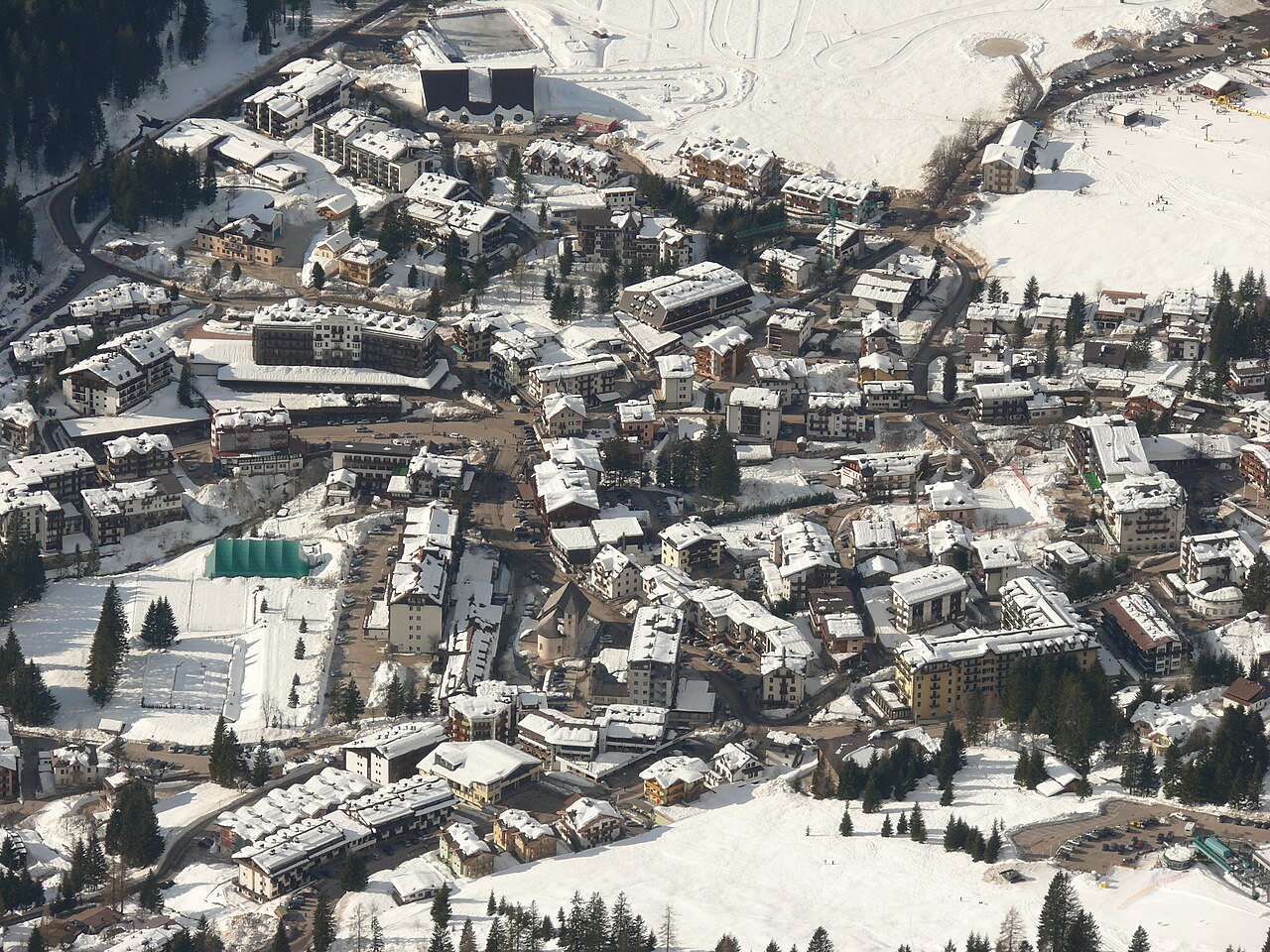
San Martino di Castrozza is a downhill ski area in Trento, Italy. Mapped terrain includes easy, intermediate, advanced routes. Its mapped lift network extends from approximately 1406 to 2618 metres above sea level.
Data: OpenSkiData / OpenSkiMap, OpenStreetMap contributors (ODbL), Skimap.org, Who's On First, Mapterhorn.
Preparing forecast graphs…
Times and values match the detailed forecast. Tap or point at a value for details. Scroll each chart sideways for later days. Rain / precipitation is the total water equivalent per forecast interval, including snow; snowfall is fresh snow per interval, not snow depth.
GFS and ECMWF model comparison. Each model retains its own forecast times and horizon. Precipitation and snowfall amounts cover their own forecast intervals; these can differ between models.
Forecast values and model notes
San Martino di Castrozza - Base lift station
ECMWF · Model run: Next update expected:
Day Time (UTC) Temp. (°C) Humidity (%) Wind (km/h) Wind (knots) Wind (Bft) Direction Precip. (mm) Snow (cm) Pressure (hPa) Freezing (m) Conditions | Thursday, 05/11 06:00 -2.6 89 3 1 1B N — — 1028 < 1782 Cloudy 63% cloud 09:00 5 62 2 1 1B SE 0 0 1028 2799 Clear 0% cloud 12:00 7.6 56 4 2 1B S 0 0 1026 2883 Clear 0% cloud 15:00 5.1 72 3 2 1B S 0 0 1026 2842 Clear 0% cloud 18:00 0.9 83 2 1 1B NW 0 0 1026 < 1782 Clear 0% cloud 21:00 0.7 80 1 0 0B NW 0 0 1025 < 1782 Clear 0% cloud Friday, 06/11 00:00 0.1 80 1 0 0B NW 0 0 1024 < 1782 Clear 0% cloud 03:00 0.2 77 1 1 0B N 0 0 1023 < 1782 Clear 3% cloud 06:00 0.3 73 1 0 0B N 0 0 1022 < 1782 Clear 5% cloud 09:00 6.7 56 3 2 1B SE 0 0 1022 2974 Partly cloudy 36% cloud 12:00 7.9 52 5 3 1B SE 0 0 1020 2875 Overcast 92% cloud 15:00 4.6 71 2 1 1B S 0 0 1021 2559 Overcast 99% cloud 18:00 2.6 83 1 1 1B SE 0 0 1022 2199 Overcast 100% cloud 21:00 1.6 92 2 1 1B N 0.86 0 1023 1934 Overcast 100% cloud Saturday, 07/11 00:00 1.7 90 1 1 1B NE 0.24 0 1023 1921 Overcast 99% cloud 03:00 1.3 93 1 1 1B NE 1.1 0 1023 1846 Overcast 100% cloud 06:00 0.9 93 2 1 1B NE 1.2 0.4 1024 < 1782 Overcast 100% cloud 09:00 2.6 81 3 1 1B E 0.15 0 1025 2043 Overcast 100% cloud 12:00 3.9 72 3 2 1B E 0.13 0 1024 2198 Overcast 99% cloud 15:00 3.2 74 2 1 1B E 0.02 0 1024 2108 Overcast 96% cloud 18:00 1.7 86 0 0 0B E 0 0 1026 1912 Overcast 96% cloud 21:00 -0.4 86 1 1 0B N 0 0 1026 < 1782 Partly cloudy 21% cloud Sunday, 08/11 00:00 -1.9 82 1 1 1B N 0 0 1025 < 1782 Clear 10% cloud 03:00 -1.6 74 1 0 0B N 0 0 1025 < 1782 Clear 8% cloud 06:00 -2.1 71 1 1 1B N 0 0 1026 < 1782 Clear 15% cloud 09:00 3.9 51 3 2 1B S 0 0 1026 2178 Clear 9% cloud 12:00 5.2 51 6 3 2B S 0 0 1024 2257 Partly cloudy 45% cloud 15:00 2.5 69 3 2 1B S 0 0 1025 2019 Partly cloudy 37% cloud 18:00 -1.5 84 1 1 1B NW 0 0 1026 < 1782 Clear 11% cloud 21:00 -2.4 88 2 1 1B NW 0 0 1026 < 1782 Partly cloudy 46% cloud Monday, 09/11 00:00 -2.3 91 3 2 1B NW 0 0 1026 < 1782 Overcast 84% cloud 03:00 -3.4 91 3 1 1B NW 0 0 1025 < 1782 Cloudy 79% cloud 06:00 -3.2 88 1 1 1B NW 0 0 1025 < 1782 Overcast 87% cloud 09:00 3.1 70 3 2 1B S 0 0 1025 2236 Cloudy 79% cloud 12:00 5.1 61 6 3 2B S 0 0 1022 2527 Cloudy 79% cloud 15:00 2.4 78 4 2 1B S 0 0 1022 2257 Cloudy 78% cloud 18:00 -0.9 91 2 1 1B W 0 0 1022 < 1782 Cloudy 65% cloud 21:00 -1.3 89 2 1 1B W 0 0 1022 < 1782 Cloudy 71% cloud Tuesday, 10/11 00:00 0 89 3 2 1B NW 0.01 0 1020 < 1782 Overcast 97% cloud 03:00 1.1 90 3 2 1B NW 0 0 1018 1854 Overcast 100% cloud 06:00 1.4 90 3 1 1B NW 0.20 0 1017 2142 Overcast 99% cloud 09:00 5 82 3 2 1B SW 0 0 1016 2880 Overcast 91% cloud 12:00 6.6 74 5 3 1B SW 0 0 1014 2978 Overcast 100% cloud 15:00 4.3 89 2 1 1B W 0.31 0 1014 2928 Overcast 100% cloud 18:00 1.6 89 3 2 1B NW 0.02 0 1014 2842 Cloudy 66% cloud 21:00 0.3 91 2 1 1B N 0 0 1014 < 1782 Cloudy 66% cloud Wednesday, 11/11 00:00 0.9 86 1 1 1B N 0 0 1014 < 1782 Cloudy 72% cloud 03:00 1.8 82 1 1 0B N 0 0 1013 2391 Partly cloudy 37% cloud 06:00 1.2 84 1 1 0B N 0 0 1014 2082 Clear 4% cloud |
|---|
Forecast notes
Forecast table times: UTC.
Coordinates: 46.2682149°N, 11.7786401°E · Requested elevation: 1602 m. Model terrain: 1780 m. Terrain and 1000/925/850/700 hPa profiles are used for height estimates.
Outside the available profile, temperature uses an estimated 5.5°C/km height correction; wind retains the nearest available model-level value. Humidity is estimated with adjusted pressure and temperature.
These are altitude estimates, not a simulation of local mountain terrain. Precipitation, cloud and sea-level pressure use horizontal interpolation only.
Precipitation includes rain and snow water equivalent: preceding 3 hours through day 6, then 6 hours (see cell tooltip). Snow (cm) estimates fresh snowfall from precipitation and temperature using the GFS conversion; it is not snow depth on the ground. Freezing (m) uses additional 600/500 hPa temperatures when available and estimates the lowest resolved 0°C crossing above sea level. When all sampled levels are warm, the upper profile limit is shown (see tooltip). < marks an entirely cold sampled profile and its lower height limit. No extrapolation is used.
Preparing forecast graphs…
Times and values match the detailed forecast. Tap or point at a value for details. Scroll each chart sideways for later days. Rain / precipitation is the total water equivalent per forecast interval, including snow; snowfall is fresh snow per interval, not snow depth.
GFS and ECMWF model comparison. Each model retains its own forecast times and horizon. Precipitation and snowfall amounts cover their own forecast intervals; these can differ between models.
Forecast values and model notes
San Martino di Castrozza - Top lift station
ECMWF · Model run: Next update expected:
Day Time (UTC) Temp. (°C) Humidity (%) Wind (km/h) Wind (knots) Wind (Bft) Direction Precip. (mm) Snow (cm) Pressure (hPa) Freezing (m) Conditions | Thursday, 05/11 06:00 -2.5 46 10 6 2B S — — 1028 < 1704 Cloudy 52% cloud 09:00 0.7 41 11 6 2B S 0 0 1028 2795 Clear 0% cloud 12:00 1.5 43 8 4 2B SW 0 0 1026 2883 Clear 0% cloud 15:00 0.8 49 7 4 2B S 0 0 1026 2841 Clear 0% cloud 18:00 -0.3 50 6 3 1B SW 0 0 1026 1917 Clear 0% cloud 21:00 -0.2 48 4 2 1B S 0 0 1026 < 1704 Clear 0% cloud Friday, 06/11 00:00 -0.5 47 7 4 2B S 0 0 1024 < 1704 Clear 0% cloud 03:00 -0.4 46 8 4 2B S 0 0 1023 < 1704 Clear 2% cloud 06:00 -0.5 45 7 4 2B S 0 0 1022 < 1704 Clear 4% cloud 09:00 1.7 43 13 7 3B SE 0 0 1022 2976 Partly cloudy 33% cloud 12:00 1.6 44 18 10 3B SE 0 0 1021 2874 Overcast 91% cloud 15:00 -0.2 52 18 10 3B SE 0 0 1021 2570 Overcast 99% cloud 18:00 -1.6 63 22 12 4B SE 0 0 1022 2202 Overcast 100% cloud 21:00 -2.9 74 25 14 4B SE 0.71 0.7 1023 1952 Overcast 100% cloud Saturday, 07/11 00:00 -3.6 85 27 15 4B SE 0.22 0.2 1023 1924 Overcast 97% cloud 03:00 -4.1 97 22 12 4B SE 0.90 0.9 1023 1847 Overcast 100% cloud 06:00 -4.2 98 11 6 2B SE 1.1 1.1 1024 1789 Overcast 100% cloud 09:00 -3.5 93 10 5 2B SE 0.17 0.2 1025 2036 Overcast 100% cloud 12:00 -3 89 15 8 3B SE 0.16 0.2 1024 2189 Overcast 97% cloud 15:00 -3.4 89 13 7 3B SE 0.05 0 1024 2103 Overcast 97% cloud 18:00 -4 95 13 7 3B SE 0 0 1026 1909 Overcast 97% cloud 21:00 -4.5 82 11 6 2B SE 0 0 1026 < 1704 Partly cloudy 23% cloud Sunday, 08/11 00:00 -5.1 82 8 4 2B SE 0 0 1026 < 1704 Clear 12% cloud 03:00 -5 78 6 3 2B SE 0 0 1025 < 1704 Clear 9% cloud 06:00 -5.4 78 3 1 1B S 0 0 1025 < 1704 Clear 16% cloud 09:00 -3.2 66 4 2 1B S 0 0 1026 2176 Clear 11% cloud 12:00 -3.3 72 6 3 2B SW 0 0 1024 2250 Partly cloudy 46% cloud 15:00 -4 79 5 3 1B W 0 0 1025 2015 Partly cloudy 34% cloud 18:00 -5.3 82 9 5 2B W 0 0 1026 < 1704 Clear 10% cloud 21:00 -5.2 72 9 5 2B NW 0 0 1026 < 1704 Partly cloudy 36% cloud Monday, 09/11 00:00 -4.9 65 9 5 2B NW 0 0 1026 < 1704 Cloudy 78% cloud 03:00 -4.9 63 10 5 2B W 0 0 1025 < 1704 Cloudy 75% cloud 06:00 -4.5 61 10 5 2B W 0 0 1025 < 1704 Overcast 86% cloud 09:00 -1.8 55 11 6 2B SW 0 0 1025 2238 Cloudy 79% cloud 12:00 -0.6 56 18 10 3B W 0 0 1022 2517 Cloudy 77% cloud 15:00 -1 65 24 13 4B W 0 0 1022 2294 Cloudy 77% cloud 18:00 -1.9 71 25 14 4B W 0 0 1022 < 1704 Cloudy 68% cloud 21:00 -1.6 72 27 15 4B W 0 0 1022 < 1704 Cloudy 58% cloud Tuesday, 10/11 00:00 -1.4 79 28 15 4B W 0.01 0 1020 < 1704 Overcast 92% cloud 03:00 -0.9 81 27 15 4B W 0 0 1018 < 1704 Overcast 99% cloud 06:00 -0.5 82 23 13 4B W 0.15 0 1017 2156 Overcast 99% cloud 09:00 0.9 79 21 11 4B W 0 0 1017 2891 Overcast 89% cloud 12:00 1.8 76 21 11 4B W 0 0 1014 2997 Overcast 100% cloud 15:00 0.9 85 20 11 4B W 0.46 0.1 1014 2939 Overcast 100% cloud 18:00 0.3 82 18 10 3B NW 0.01 0 1014 2968 Cloudy 65% cloud 21:00 -0.2 78 13 7 3B NW 0 0 1014 < 1704 Cloudy 59% cloud Wednesday, 11/11 00:00 -0.4 80 8 5 2B NW 0 0 1014 2061 Cloudy 73% cloud 03:00 -0.2 78 6 3 2B W 0 0 1014 2460 Partly cloudy 41% cloud 06:00 -0.3 75 8 4 2B W 0 0 1015 2290 Clear 3% cloud |
|---|
Forecast notes
Forecast table times: UTC.
Coordinates: 46.2648189°N, 11.8329385°E · Requested elevation: 2618 m. Model terrain: 1702 m. Terrain and 1000/925/850/700 hPa profiles are used for height estimates.
These are altitude estimates, not a simulation of local mountain terrain. Precipitation, cloud and sea-level pressure use horizontal interpolation only.
Precipitation includes rain and snow water equivalent: preceding 3 hours through day 6, then 6 hours (see cell tooltip). Snow (cm) estimates fresh snowfall from precipitation and temperature using the GFS conversion; it is not snow depth on the ground. Freezing (m) uses additional 600/500 hPa temperatures when available and estimates the lowest resolved 0°C crossing above sea level. When all sampled levels are warm, the upper profile limit is shown (see tooltip). < marks an entirely cold sampled profile and its lower height limit. No extrapolation is used.