Spinale · Madonna di Campiglio · Panorama
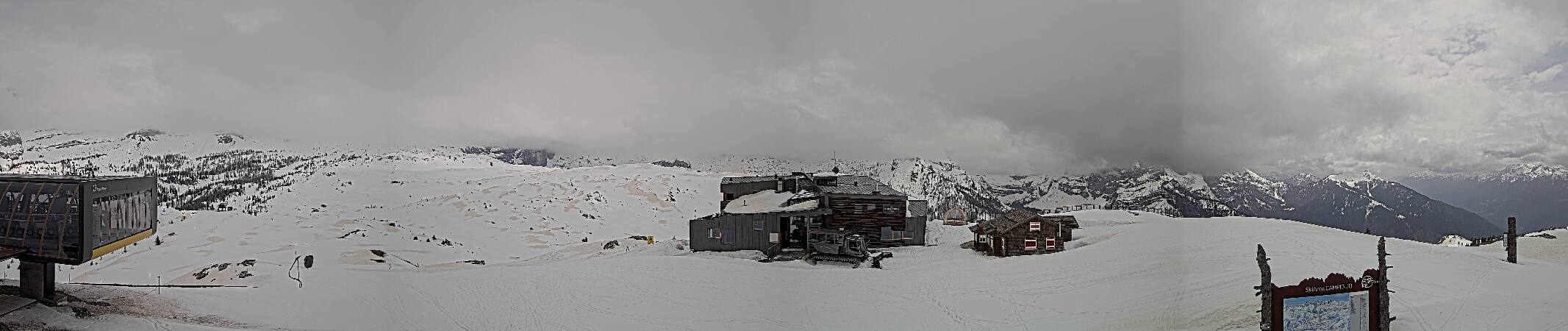
Provider panorama/video player. Capture time is shown by the camera.
Open camera page ↗
Each colour starts at the value shown. Wind colours match across all three units. Dry cells stay neutral. Colours describe the displayed values, not official weather warnings.
Preparing forecast graphs…
Times and values match the detailed forecast. Tap or point at a value for details. Scroll each chart sideways for later days. Rain / precipitation is the total water equivalent per forecast interval, including snow; snowfall is fresh snow per interval, not snow depth.
GFS and ECMWF model comparison. Each model retains its own forecast times and horizon. Precipitation and snowfall amounts cover their own forecast intervals; these can differ between models.
ECMWF · Model run: Next update expected:
Day Time (UTC) Temp. (°C) Humidity (%) Wind (km/h) Wind (knots) Wind (Bft) Direction Precip. (mm) Snow (cm) Pressure (hPa) Freezing (m) Conditions | Thursday, 05/11 06:00 -4 87 2 1 1B W — — 1028 < 1635 Partly cloudy 35% cloud  09:00 4.2 63 1 1 0B E 0 0 1028 2567 Clear 9% cloud  12:00 6.8 60 2 1 1B SE 0 0 1026 2791 Clear 3% cloud 15:00 5.5 72 1 1 1B E 0 0 1025 2850 Clear 8% cloud 18:00 1 81 1 0 0B W 0 0 1026 2145 Clear 5% cloud 21:00 -0.7 79 2 1 1B W 0 0 1026 < 1635 Clear 14% cloud Friday, 06/11 00:00 -1.2 74 2 1 1B W 0 0 1025 < 1635 Partly cloudy 34% cloud 03:00 -1 70 1 1 1B W 0 0 1024 < 1635 Cloudy 57% cloud  06:00 -0.9 68 2 1 1B W 0 0 1022 < 1635 Cloudy 74% cloud 09:00 5.6 49 1 1 1B SE 0 0 1022 2739 Cloudy 61% cloud 12:00 6.1 56 2 1 1B E 0 0 1021 2592 Overcast 100% cloud  15:00 3.5 84 1 0 0B S 1.3 0 1022 2239 Overcast 100% cloud 18:00 2.4 88 0 0 0B W 2.6 0 1023 2028 Overcast 100% cloud 21:00 1.8 90 1 1 1B NE 1.9 0 1024 1875 Overcast 100% cloud Saturday, 07/11 00:00 1.4 92 1 0 0B NW 2.4 0 1024 1779 Overcast 100% cloud 03:00 1.3 91 0 0 0B N 1.6 0 1023 1752 Overcast 100% cloud 06:00 1.3 90 0 0 0B NW 0.39 0 1024 1752 Overcast 100% cloud 09:00 2.7 85 1 0 0B E 0.16 0 1025 1963 Overcast 100% cloud 12:00 4.3 76 2 1 1B E 0.01 0 1024 2135 Cloudy 79% cloud 15:00 3.9 77 2 1 1B E 0.08 0 1024 2103 Overcast 82% cloud 18:00 2.5 86 1 0 0B S 0.01 0 1025 1942 Overcast 93% cloud 21:00 1.9 87 1 0 0B W 0 0 1026 1852 Overcast 81% cloud Sunday, 08/11 00:00 0.7 88 1 0 0B NW 0 0 1026 1642 Cloudy 76% cloud 03:00 -0.6 87 1 1 0B W 0 0 1025 < 1635 Cloudy 60% cloud 06:00 -2.8 90 2 1 1B W 0.01 0 1026 < 1635 Cloudy 57% cloud 09:00 3.4 71 1 0 0B E 0 0 1026 2040 Partly cloudy 30% cloud 12:00 5.2 66 2 1 1B SE 0.08 0 1024 2188 Overcast 83% cloud 15:00 3.9 78 2 1 1B SE 0.18 0 1024 2092 Partly cloudy 41% cloud 18:00 0.2 87 1 0 0B W 0.01 0 1025 < 1635 Partly cloudy 39% cloud 21:00 -2.6 86 3 2 1B W 0.02 0 1026 < 1635 Cloudy 74% cloud Monday, 09/11 00:00 -2.7 86 3 2 1B W 0.01 0 1025 < 1635 Cloudy 63% cloud 03:00 -3.3 86 3 2 1B W 0 0 1025 < 1635 Overcast 86% cloud 06:00 -2.8 85 3 2 1B W 0 0 1025 < 1635 Cloudy 75% cloud 09:00 3.2 66 1 1 0B S 0 0 1025 2228 Cloudy 65% cloud 12:00 5.3 63 2 1 1B SE 0 0 1022 2508 Overcast 88% cloud 15:00 4 74 1 1 1B SE 0 0 1020 2429 Cloudy 65% cloud 18:00 2.3 85 1 1 1B SW 0.00 0 1021 2224 Cloudy 64% cloud 21:00 1.7 88 2 1 1B SW 0.04 0 1021 2046 Overcast 85% cloud Tuesday, 10/11 00:00 1.9 87 2 1 1B W 0.01 0 1020 2108 Overcast 95% cloud 03:00 2 88 2 1 1B W 0 0 1019 2181 Overcast 99% cloud 06:00 1.3 90 2 1 1B W 0.24 0 1018 2067 Overcast 93% cloud 09:00 4.7 81 0 0 0B SW 0 0 1017 2789 Overcast 88% cloud 12:00 6.1 75 1 0 0B SE 0.15 0 1015 2855 Overcast 99% cloud 15:00 5.1 83 0 0 0B E 0.07 0 1014 2918 Overcast 97% cloud 18:00 2.1 89 2 1 1B W 0 0 1014 2798 Partly cloudy 49% cloud 21:00 -1 92 2 1 1B W 0 0 1015 3039 Overcast 86% cloud Wednesday, 11/11 00:00 -0.7 83 2 1 1B W 0 0 1015 < 1635 Cloudy 67% cloud 03:00 -0.6 83 2 1 1B W 0 0 1014 < 1635 Clear 12% cloud 06:00 -1 85 2 1 1B W 0 0 1015 < 1635 Clear 5% cloud |
|---|
Forecast table times: UTC.
Coordinates: 46.22830303°N, 10.82874298°E · Requested elevation: 1508 m. Model terrain: 1632 m. Terrain and 1000/925/850/700 hPa profiles are used for height estimates.
Outside the available profile, temperature uses an estimated 5.5°C/km height correction; wind retains the nearest available model-level value. Humidity is estimated with adjusted pressure and temperature.
These are altitude estimates, not a simulation of local mountain terrain. Precipitation, cloud and sea-level pressure use horizontal interpolation only.
Precipitation includes rain and snow water equivalent: preceding 3 hours through day 6, then 6 hours (see cell tooltip). Snow (cm) estimates fresh snowfall from precipitation and temperature using the GFS conversion; it is not snow depth on the ground. Freezing (m) uses additional 600/500 hPa temperatures when available and estimates the lowest resolved 0°C crossing above sea level. When all sampled levels are warm, the upper profile limit is shown (see tooltip). < marks an entirely cold sampled profile and its lower height limit. No extrapolation is used.
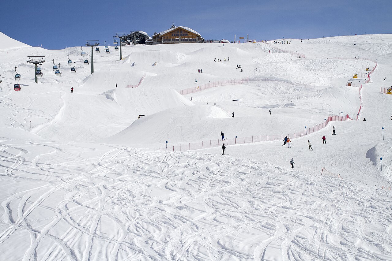
Provider panorama/video player. Capture time is shown by the camera.
Open camera page ↗Preparing forecast graphs…
Times and values match the detailed forecast. Tap or point at a value for details. Scroll each chart sideways for later days. Rain / precipitation is the total water equivalent per forecast interval, including snow; snowfall is fresh snow per interval, not snow depth.
GFS and ECMWF model comparison. Each model retains its own forecast times and horizon. Precipitation and snowfall amounts cover their own forecast intervals; these can differ between models.
ECMWF · Model run: Next update expected:
Day Time (UTC) Temp. (°C) Humidity (%) Wind (km/h) Wind (knots) Wind (Bft) Direction Precip. (mm) Snow (cm) Pressure (hPa) Freezing (m) Conditions | Thursday, 05/11 06:00 -3.9 74 5 3 1B SW — — 1028 < 1582 Partly cloudy 37% cloud 09:00 2.1 60 5 3 1B S 0 0 1028 2568 Clear 10% cloud 12:00 4.1 59 4 2 1B S 0 0 1026 2794 Clear 4% cloud 15:00 3.4 67 4 2 1B S 0 0 1025 2857 Clear 7% cloud 18:00 0.3 72 4 2 1B SW 0 0 1026 2408 Clear 5% cloud 21:00 -0.9 68 3 2 1B SW 0 0 1026 < 1582 Clear 14% cloud Friday, 06/11 00:00 -1.3 64 4 2 1B S 0 0 1025 < 1582 Partly cloudy 34% cloud 03:00 -1.2 61 4 2 1B S 0 0 1024 < 1582 Cloudy 56% cloud 06:00 -1.2 59 5 2 1B S 0 0 1023 < 1582 Cloudy 74% cloud 09:00 3.2 48 6 3 2B SE 0 0 1023 2736 Cloudy 62% cloud 12:00 3.3 58 8 4 2B SE 0 0 1021 2595 Overcast 100% cloud 15:00 1.2 87 8 5 2B SE 1.2 0 1022 2258 Overcast 100% cloud 18:00 0.2 92 5 2 1B SE 2.6 0.8 1023 2051 Overcast 100% cloud 21:00 -0.5 94 5 3 1B SE 2.0 0.6 1024 1893 Overcast 100% cloud Saturday, 07/11 00:00 -1.1 96 6 3 2B SE 2.4 0.7 1024 1791 Overcast 100% cloud 03:00 -1.2 95 3 2 1B SE 1.6 0.5 1023 1764 Overcast 100% cloud 06:00 -1.3 94 2 1 1B E 0.37 0.1 1024 1760 Overcast 100% cloud 09:00 -0.3 91 2 1 1B E 0.15 0 1025 1959 Overcast 100% cloud 12:00 1 82 4 2 1B E 0.01 0 1024 2136 Cloudy 76% cloud 15:00 0.7 83 4 2 1B E 0.07 0 1024 2103 Overcast 82% cloud 18:00 -0.3 91 3 1 1B SE 0.01 0 1025 1946 Overcast 93% cloud 21:00 -0.8 90 1 0 0B SE 0 0 1026 1860 Cloudy 79% cloud Sunday, 08/11 00:00 -1.6 89 1 1 0B SE 0 0 1026 1658 Cloudy 74% cloud 03:00 -2.5 86 1 1 1B S 0 0 1025 < 1582 Cloudy 58% cloud 06:00 -4.1 88 2 1 1B SW 0.01 0 1026 < 1582 Cloudy 55% cloud 09:00 0.2 76 2 1 1B SW 0 0 1026 2034 Partly cloudy 29% cloud 12:00 1.4 73 3 2 1B SW 0.07 0 1024 2183 Cloudy 79% cloud 15:00 0.6 84 2 1 1B W 0.19 0 1024 2090 Partly cloudy 43% cloud 18:00 -1.8 86 2 1 1B NW 0.02 0 1025 < 1582 Partly cloudy 39% cloud 21:00 -3.6 85 4 2 1B W 0.02 0 1026 < 1582 Cloudy 75% cloud Monday, 09/11 00:00 -3.6 81 4 2 1B W 0.02 0 1025 < 1582 Cloudy 65% cloud 03:00 -3.9 77 4 2 1B W 0 0 1025 < 1582 Overcast 87% cloud 06:00 -3.5 76 6 3 1B W 0 0 1025 < 1582 Cloudy 76% cloud 09:00 0.9 65 5 3 1B SW 0 0 1025 2224 Cloudy 67% cloud 12:00 2.6 64 7 4 2B SW 0 0 1022 2510 Overcast 89% cloud 15:00 1.8 73 7 4 2B W 0 0 1021 2440 Cloudy 67% cloud 18:00 0.7 82 9 5 2B W 0.00 0 1021 2254 Cloudy 66% cloud 21:00 0.2 88 11 6 2B W 0.04 0 1021 2087 Overcast 86% cloud Tuesday, 10/11 00:00 0.3 90 11 6 2B W 0.01 0 1020 2132 Overcast 95% cloud 03:00 0.5 90 10 5 2B W 0 0 1019 2200 Overcast 99% cloud 06:00 0.2 91 8 5 2B W 0.24 0 1018 2123 Overcast 93% cloud 09:00 2.7 83 7 4 2B W 0 0 1017 2797 Overcast 89% cloud 12:00 3.8 79 6 3 2B W 0.14 0 1015 2862 Overcast 99% cloud 15:00 3.2 86 6 3 1B W 0.08 0 1015 2926 Overcast 98% cloud 18:00 1.1 89 5 3 1B NW 0 0 1014 2832 Partly cloudy 49% cloud 21:00 -1 88 5 3 1B NW 0 0 1015 3028 Overcast 84% cloud Wednesday, 11/11 00:00 -0.9 82 3 2 1B W 0 0 1015 < 1582 Cloudy 68% cloud 03:00 -0.8 82 3 1 1B W 0 0 1014 < 1582 Clear 12% cloud 06:00 -1.2 82 4 2 1B W 0 0 1015 < 1582 Clear 5% cloud |
|---|
Forecast table times: UTC.
Coordinates: 46.2245028°N, 10.84299088°E · Requested elevation: 2001 m. Model terrain: 1580 m. Terrain and 1000/925/850/700 hPa profiles are used for height estimates.
These are altitude estimates, not a simulation of local mountain terrain. Precipitation, cloud and sea-level pressure use horizontal interpolation only.
Precipitation includes rain and snow water equivalent: preceding 3 hours through day 6, then 6 hours (see cell tooltip). Snow (cm) estimates fresh snowfall from precipitation and temperature using the GFS conversion; it is not snow depth on the ground. Freezing (m) uses additional 600/500 hPa temperatures when available and estimates the lowest resolved 0°C crossing above sea level. When all sampled levels are warm, the upper profile limit is shown (see tooltip). < marks an entirely cold sampled profile and its lower height limit. No extrapolation is used.
Preparing forecast graphs…
Times and values match the detailed forecast. Tap or point at a value for details. Scroll each chart sideways for later days. Rain / precipitation is the total water equivalent per forecast interval, including snow; snowfall is fresh snow per interval, not snow depth.
GFS and ECMWF model comparison. Each model retains its own forecast times and horizon. Precipitation and snowfall amounts cover their own forecast intervals; these can differ between models.
ECMWF · Model run: Next update expected:
Day Time (UTC) Temp. (°C) Humidity (%) Wind (km/h) Wind (knots) Wind (Bft) Direction Precip. (mm) Snow (cm) Pressure (hPa) Freezing (m) Conditions | Thursday, 05/11 06:00 -2.8 53 12 6 2B S — — 1029 < 1382 Partly cloudy 45% cloud 09:00 0.2 51 12 6 2B S 0 0 1029 2571 Clear 15% cloud 12:00 1.6 52 9 5 2B S 0 0 1027 2806 Clear 4% cloud 15:00 1.6 55 9 5 2B SW 0 0 1025 2880 Clear 7% cloud 18:00 0.4 55 9 5 2B SW 0 0 1026 2743 Clear 5% cloud 21:00 -0.2 53 7 4 2B S 0 0 1026 2051 Clear 12% cloud Friday, 06/11 00:00 -0.6 49 10 5 2B S 0 0 1025 < 1382 Partly cloudy 32% cloud 03:00 -0.6 47 11 6 2B S 0 0 1024 < 1382 Cloudy 51% cloud 06:00 -0.7 46 12 6 2B S 0 0 1023 < 1382 Cloudy 75% cloud 09:00 0.9 45 14 8 3B SE 0 0 1023 2729 Cloudy 64% cloud 12:00 0.6 58 18 9 3B SE 0 0 1022 2610 Overcast 100% cloud 15:00 -0.9 87 21 11 4B SE 0.93 0.3 1022 2322 Overcast 100% cloud 18:00 -1.7 94 12 7 2B S 2.5 0.7 1023 2126 Overcast 100% cloud 21:00 -2.6 95 14 7 3B SE 2.4 0.7 1024 1951 Overcast 100% cloud Saturday, 07/11 00:00 -3.6 94 16 9 3B SE 2.3 2.3 1024 1831 Overcast 100% cloud 03:00 -3.7 96 9 5 2B SE 1.5 1.5 1023 1800 Overcast 100% cloud 06:00 -3.9 95 4 2 1B E 0.31 0.3 1024 1786 Overcast 100% cloud 09:00 -3.4 94 4 2 1B E 0.10 0.1 1025 1946 Overcast 100% cloud 12:00 -2.6 84 7 4 2B E 0.01 0 1024 2142 Cloudy 66% cloud 15:00 -2.8 88 7 4 2B E 0.04 0 1024 2104 Overcast 82% cloud 18:00 -3.4 93 6 3 2B E 0.01 0 1025 1956 Overcast 96% cloud 21:00 -3.5 89 3 2 1B SE 0 0 1026 1881 Cloudy 70% cloud Sunday, 08/11 00:00 -3.9 87 3 2 1B SE 0 0 1026 1697 Cloudy 66% cloud 03:00 -4.2 81 3 2 1B S 0 0 1025 1458 Partly cloudy 50% cloud 06:00 -4.8 80 3 1 1B SW 0.01 0 1026 < 1382 Partly cloudy 46% cloud 09:00 -3.1 79 5 3 1B SW 0 0 1027 2015 Partly cloudy 25% cloud 12:00 -2.6 80 7 4 2B SW 0.04 0 1025 2167 Cloudy 66% cloud 15:00 -2.9 84 7 4 2B W 0.23 0.2 1024 2085 Partly cloudy 48% cloud 18:00 -3.6 78 5 3 1B NW 0.01 0 1025 1738 Partly cloudy 40% cloud 21:00 -4.1 78 6 3 2B W 0.02 0 1026 < 1382 Cloudy 77% cloud Monday, 09/11 00:00 -4 72 6 3 2B W 0.01 0 1026 < 1382 Cloudy 74% cloud 03:00 -3.9 63 7 4 2B W 0 0 1025 < 1382 Overcast 89% cloud 06:00 -3.4 61 9 5 2B W 0 0 1025 < 1382 Cloudy 79% cloud 09:00 -1.2 60 11 6 2B W 0 0 1025 2211 Cloudy 75% cloud 12:00 0.1 62 17 9 3B W 0 0 1023 2519 Overcast 92% cloud 15:00 -0.1 68 19 10 3B W 0 0 1021 2483 Cloudy 75% cloud 18:00 -0.4 72 21 11 4B W 0.01 0 1021 2363 Cloudy 77% cloud 21:00 -0.7 82 23 12 4B W 0.06 0 1021 2229 Overcast 90% cloud Tuesday, 10/11 00:00 -0.7 87 24 13 4B W 0.01 0 1021 2219 Overcast 97% cloud 03:00 -0.5 87 21 11 4B W 0 0 1019 2276 Overcast 99% cloud 06:00 -0.3 87 17 9 3B W 0.24 0 1018 2301 Overcast 95% cloud 09:00 1.1 82 16 8 3B W 0 0 1018 2831 Overcast 92% cloud 12:00 1.7 81 16 9 3B W 0.08 0 1015 2893 Overcast 99% cloud 15:00 1.6 84 14 8 3B W 0.12 0 1015 2959 Overcast 98% cloud 18:00 0.7 85 11 6 2B NW 0 0 1015 2908 Cloudy 52% cloud 21:00 0 79 9 5 2B NW 0 0 1015 2252 Cloudy 78% cloud Wednesday, 11/11 00:00 -0.3 78 6 3 2B NW 0 0 1015 < 1382 Cloudy 70% cloud 03:00 -0.4 78 4 2 1B W 0 0 1014 < 1382 Clear 14% cloud 06:00 -0.5 76 6 3 2B W 0 0 1015 < 1382 Clear 7% cloud |
|---|
Forecast table times: UTC.
Coordinates: 46.21143751°N, 10.9006691°E · Requested elevation: 2502 m. Model terrain: 1379 m. Terrain and 1000/925/850/700 hPa profiles are used for height estimates.
These are altitude estimates, not a simulation of local mountain terrain. Precipitation, cloud and sea-level pressure use horizontal interpolation only.
Precipitation includes rain and snow water equivalent: preceding 3 hours through day 6, then 6 hours (see cell tooltip). Snow (cm) estimates fresh snowfall from precipitation and temperature using the GFS conversion; it is not snow depth on the ground. Freezing (m) uses additional 600/500 hPa temperatures when available and estimates the lowest resolved 0°C crossing above sea level. When all sampled levels are warm, the upper profile limit is shown (see tooltip). < marks an entirely cold sampled profile and its lower height limit. No extrapolation is used.