Worldwide Ski Resort Forecasts

More
Colour guide Temperature · Wind · Rain · Snow
Each colour starts at the value shown. Wind colours match across all three units. Dry cells stay neutral. Colours describe the displayed values, not official weather warnings.
Preparing forecast graphs…
Times and values match the detailed forecast. Tap or point at a value for details. Scroll each chart sideways for later days. Rain / precipitation is the total water equivalent per forecast interval, including snow; snowfall is fresh snow per interval, not snow depth.
GFS and ECMWF model comparison. Each model retains its own forecast times and horizon. Precipitation and snowfall amounts cover their own forecast intervals; these can differ between models.
Forecast values and model notes
Livigno - base 1820 m
ECMWF · Model run: Next update expected:
Day Time (UTC) Temp. (°C) Humidity (%) Wind (km/h) Wind (knots) Wind (Bft) Direction Precip. (mm) Snow (cm) Pressure (hPa) Freezing (m) Conditions | Thursday, 05/11 06:00 -4.5 81 2 1 1B S — — 1027 < 2364 Overcast 83% cloud  09:00 2.3 68 4 2 1B S 0 0 1027 < 2364 Clear 17% cloud  12:00 5.2 57 4 2 1B S 0 0 1025 2757 Clear 4% cloud 15:00 3.3 62 2 1 1B S 0 0 1024 2497 Clear 4% cloud 18:00 -1.4 76 1 1 1B S 0 0 1025 < 2364 Clear 10% cloud 21:00 -2.5 77 2 1 1B S 0 0 1024 < 2364 Clear 10% cloud Friday, 06/11 00:00 -2 73 2 1 1B S 0 0 1023 < 2364 Partly cloudy 46% cloud  03:00 -1.4 70 1 1 1B S 0 0 1021 < 2364 Cloudy 76% cloud  06:00 -1.1 68 1 1 1B S 0 0 1020 < 2364 Cloudy 58% cloud 09:00 4.4 51 2 1 1B SE 0 0 1020 2688 Overcast 86% cloud 12:00 4.7 51 3 2 1B SE 0.09 0 1020 2628 Overcast 100% cloud 15:00 2.2 72 2 1 1B SE 1.5 0 1021 < 2364 Overcast 100% cloud 18:00 1.2 81 1 1 1B NE 1.1 0 1021 < 2364 Overcast 99% cloud 21:00 1.3 82 1 1 1B E 0.24 0 1022 < 2364 Overcast 100% cloud Saturday, 07/11 00:00 1 84 2 1 1B E 0.96 0.3 1022 < 2364 Overcast 100% cloud 03:00 0.6 84 2 1 1B NE 2.5 0.7 1022 < 2364 Overcast 100% cloud 06:00 0.3 83 2 1 1B NE 1.4 0.4 1023 < 2364 Overcast 100% cloud 09:00 1.5 78 3 1 1B E 0.51 0 1024 < 2364 Overcast 100% cloud 12:00 2.7 70 3 2 1B SE 0.15 0 1023 < 2364 Overcast 97% cloud 15:00 1.9 73 1 1 1B SE 0.11 0 1023 < 2364 Overcast 83% cloud 18:00 -2.1 83 2 1 1B SW 0.01 0 1025 < 2364 Cloudy 76% cloud 21:00 -6.9 80 2 1 1B SW 0 0 1026 < 2364 Overcast 94% cloud Sunday, 08/11 00:00 -6.9 78 2 1 1B SW 0 0 1026 < 2364 Cloudy 79% cloud 03:00 -7.6 77 2 1 1B SW 0 0 1026 < 2364 Cloudy 77% cloud 06:00 -7.4 77 2 1 1B SW 0 0 1027 < 2364 Cloudy 76% cloud 09:00 -2.4 78 2 1 1B S 0 0 1027 < 2364 Cloudy 56% cloud 12:00 1.9 61 6 3 1B S 0 0 1025 < 2364 Partly cloudy 23% cloud 15:00 0.1 68 3 1 1B S 0 0 1025 < 2364 Partly cloudy 43% cloud 18:00 -7.6 81 2 1 1B SW 0 0 1026 < 2364 Overcast 85% cloud 21:00 -9.7 75 2 1 1B SW 0 0 1026 < 2364 Cloudy 70% cloud Monday, 09/11 00:00 -7.7 72 2 1 1B SW 0 0 1025 < 2364 Cloudy 76% cloud 03:00 -6.2 69 2 1 1B S 0 0 1024 < 2364 Overcast 94% cloud 06:00 -5.3 68 2 1 1B S 0 0 1024 < 2364 Overcast 89% cloud 09:00 1 62 5 3 1B S 0 0 1024 < 2364 Cloudy 79% cloud 12:00 2.9 63 8 4 2B S 0.10 0 1021 < 2364 Cloudy 75% cloud 15:00 1.7 70 6 3 1B S 0 0 1020 < 2364 Overcast 88% cloud 18:00 -0.5 77 6 3 1B S 0.01 0 1021 < 2364 Overcast 88% cloud 21:00 -0.4 82 6 3 2B S 0.10 0 1022 < 2364 Overcast 96% cloud Tuesday, 10/11 00:00 0 82 6 3 1B S 0.06 0 1020 < 2364 Overcast 97% cloud 03:00 0.7 82 5 3 1B S 0.23 0 1018 < 2364 Overcast 99% cloud 06:00 0.8 83 4 2 1B S 0.26 0.1 1017 < 2364 Overcast 95% cloud 09:00 2.9 79 5 3 1B S 0.24 0 1017 < 2364 Overcast 99% cloud 12:00 3.6 80 4 2 1B S 0.43 0 1015 2576 Overcast 100% cloud 15:00 3.4 80 1 1 0B SW 0.28 0 1015 2595 Overcast 90% cloud 18:00 1 85 1 1 1B SW 0 0 1014 < 2364 Overcast 89% cloud 21:00 -2.5 83 2 1 1B W 0 0 1014 < 2364 Overcast 96% cloud Wednesday, 11/11 00:00 -3.3 83 2 1 1B W 0 0 1014 < 2364 Overcast 96% cloud 03:00 -3.1 83 2 1 1B W 0 0 1013 < 2364 Overcast 96% cloud 06:00 -3.5 83 2 1 1B SW 0 0 1013 < 2364 Overcast 97% cloud |
|---|
Forecast notes
Forecast table times: UTC.
Coordinates: 46.5378006°N, 10.1363165°E · Requested elevation: 1820 m. Model terrain: 2361 m. Terrain and 1000/925/850/700 hPa profiles are used for height estimates.
Outside the available profile, temperature uses an estimated 5.5°C/km height correction; wind retains the nearest available model-level value. Humidity is estimated with adjusted pressure and temperature.
These are altitude estimates, not a simulation of local mountain terrain. Precipitation, cloud and sea-level pressure use horizontal interpolation only.
Precipitation includes rain and snow water equivalent: preceding 3 hours through day 6, then 6 hours (see cell tooltip). Snow (cm) estimates fresh snowfall from precipitation and temperature using the GFS conversion; it is not snow depth on the ground. Freezing (m) uses additional 600/500 hPa temperatures when available and estimates the lowest resolved 0°C crossing above sea level. When all sampled levels are warm, the upper profile limit is shown (see tooltip). < marks an entirely cold sampled profile and its lower height limit. No extrapolation is used.
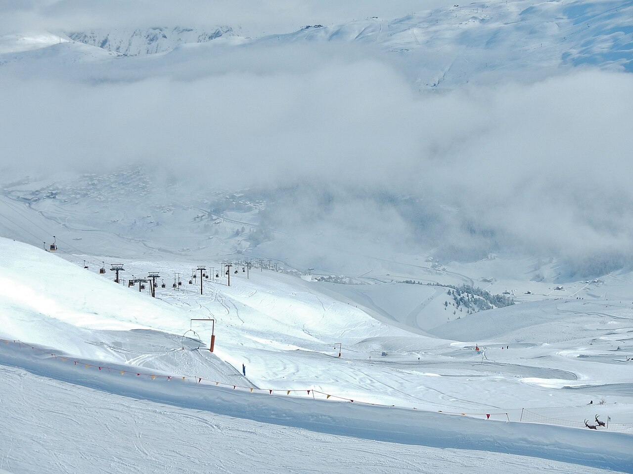
There are approximately 30 km of well-frequented and accessible cross-country ski trails for Nordic skiing fans, including leisurely and technical sections, throughout this valley where the sun never ceases to shine.
With its wide slopes, over 100 km3 of skiable surfaces, its Snowparks and its difference in height, Livigno has been affirmed as a popular tourist destination and snowboarders’ paradise.
Its capacity to modernize itself capturing the latest trends makes Livigno at the forefront of this market. In its comprehensive facilities backed up by high quality systems and efficient management, snowboarders are able to execute their spectacular half pipe flips on jumps and on boardercross slopes. There are specific zones equipped with kickers of different sizes, fun boxes, rails and other structures that may be used in complete freedom and safety.
Preparing forecast graphs…
Times and values match the detailed forecast. Tap or point at a value for details. Scroll each chart sideways for later days. Rain / precipitation is the total water equivalent per forecast interval, including snow; snowfall is fresh snow per interval, not snow depth.
GFS and ECMWF model comparison. Each model retains its own forecast times and horizon. Precipitation and snowfall amounts cover their own forecast intervals; these can differ between models.
Forecast values and model notes
Livigno - middle 2300 m
ECMWF · Model run: Next update expected:
Day Time (UTC) Temp. (°C) Humidity (%) Wind (km/h) Wind (knots) Wind (Bft) Direction Precip. (mm) Snow (cm) Pressure (hPa) Freezing (m) Conditions | Thursday, 05/11 06:00 -7.2 94 2 1 1B S — — 1027 < 2350 Overcast 86% cloud 09:00 -0.4 77 5 2 1B S 0 0 1027 < 2350 Clear 15% cloud 12:00 2.5 65 4 2 1B S 0 0 1025 2750 Clear 4% cloud 15:00 0.6 71 2 1 1B S 0 0 1024 2487 Clear 5% cloud 18:00 -4 88 1 1 0B S 0 0 1025 < 2350 Clear 9% cloud 21:00 -5.2 89 2 1 1B S 0 0 1025 < 2350 Clear 10% cloud Friday, 06/11 00:00 -4.6 85 2 1 1B S 0 0 1023 < 2350 Partly cloudy 44% cloud 03:00 -4 81 1 1 1B S 0 0 1021 < 2350 Cloudy 76% cloud 06:00 -3.8 80 1 1 1B S 0 0 1020 < 2350 Cloudy 53% cloud 09:00 1.7 59 2 1 1B SE 0 0 1020 2686 Overcast 84% cloud 12:00 2 58 3 2 1B S 0.08 0 1020 2624 Overcast 100% cloud 15:00 -0.5 83 1 1 1B SE 1.5 0.5 1021 < 2350 Overcast 100% cloud 18:00 -1.5 93 1 1 0B NE 1.2 0.4 1021 < 2350 Overcast 99% cloud 21:00 -1.3 94 1 1 1B E 0.24 0 1022 < 2350 Overcast 100% cloud Saturday, 07/11 00:00 -1.6 96 2 1 1B E 1.0 0.3 1022 < 2350 Overcast 100% cloud 03:00 -2.1 96 2 1 1B NE 2.5 0.7 1022 < 2350 Overcast 100% cloud 06:00 -2.4 96 2 1 1B NE 1.3 0.4 1023 < 2350 Overcast 100% cloud 09:00 -1.1 88 2 1 1B E 0.48 0.1 1024 < 2350 Overcast 100% cloud 12:00 0.1 80 3 2 1B SE 0.15 0 1023 < 2350 Overcast 98% cloud 15:00 -0.7 84 1 1 1B SE 0.11 0 1023 < 2350 Overcast 86% cloud 18:00 -4.6 96 2 1 1B SW 0.01 0 1025 < 2350 Overcast 80% cloud 21:00 -9.4 93 2 1 1B SW 0 0 1026 < 2350 Overcast 95% cloud Sunday, 08/11 00:00 -9.5 91 2 1 1B SW 0 0 1026 < 2350 Overcast 82% cloud 03:00 -10.3 90 2 1 1B SW 0 0 1026 < 2350 Overcast 81% cloud 06:00 -10.1 90 2 1 1B SW 0 0 1027 < 2350 Cloudy 79% cloud 09:00 -5.1 90 1 1 1B S 0 0 1027 < 2350 Cloudy 58% cloud 12:00 -0.7 70 6 3 1B S 0 0 1025 < 2350 Partly cloudy 21% cloud 15:00 -2.6 78 3 1 1B SW 0 0 1025 < 2350 Partly cloudy 49% cloud 18:00 -10.3 95 2 1 1B SW 0 0 1026 < 2350 Overcast 88% cloud 21:00 -12.6 88 2 1 1B SW 0 0 1026 < 2350 Cloudy 74% cloud Monday, 09/11 00:00 -10.4 85 2 1 1B SW 0 0 1025 < 2350 Overcast 80% cloud 03:00 -8.8 83 2 1 1B SW 0 0 1024 < 2350 Overcast 96% cloud 06:00 -7.8 80 2 1 1B S 0 0 1024 < 2350 Overcast 90% cloud 09:00 -1.7 71 5 3 1B S 0 0 1024 < 2350 Cloudy 78% cloud 12:00 0.2 72 8 4 2B S 0.11 0 1022 < 2350 Cloudy 75% cloud 15:00 -0.9 80 6 3 2B S 0 0 1020 < 2350 Overcast 88% cloud 18:00 -3.1 89 6 3 2B S 0.01 0 1021 < 2350 Overcast 90% cloud 21:00 -3 95 6 3 2B S 0.10 0.1 1022 < 2350 Overcast 96% cloud Tuesday, 10/11 00:00 -2.6 95 6 3 1B S 0.07 0 1021 < 2350 Overcast 98% cloud 03:00 -2 95 5 3 1B S 0.23 0 1018 < 2350 Overcast 99% cloud 06:00 -1.9 96 4 2 1B S 0.25 0.1 1017 < 2350 Overcast 95% cloud 09:00 0.1 91 5 3 1B S 0.24 0 1017 < 2350 Overcast 99% cloud 12:00 0.9 92 5 3 1B S 0.44 0.1 1015 2554 Overcast 100% cloud 15:00 0.7 92 1 1 1B SW 0.27 0.1 1015 2586 Overcast 91% cloud 18:00 -1.7 98 1 1 1B W 0 0 1014 < 2350 Overcast 88% cloud 21:00 -5.4 95 2 1 1B W 0 0 1014 < 2350 Overcast 96% cloud Wednesday, 11/11 00:00 -6.1 96 2 1 1B W 0 0 1014 < 2350 Overcast 97% cloud 03:00 -6 96 2 1 1B W 0 0 1013 < 2350 Overcast 97% cloud 06:00 -6.4 95 2 1 1B SW 0 0 1013 < 2350 Overcast 97% cloud |
|---|
Forecast notes
Forecast table times: UTC.
Coordinates: 46.5296976°N, 10.15909195°E · Requested elevation: 2300 m. Model terrain: 2347 m. Terrain and 1000/925/850/700 hPa profiles are used for height estimates.
Outside the available profile, temperature uses an estimated 5.5°C/km height correction; wind retains the nearest available model-level value. Humidity is estimated with adjusted pressure and temperature.
These are altitude estimates, not a simulation of local mountain terrain. Precipitation, cloud and sea-level pressure use horizontal interpolation only.
Precipitation includes rain and snow water equivalent: preceding 3 hours through day 6, then 6 hours (see cell tooltip). Snow (cm) estimates fresh snowfall from precipitation and temperature using the GFS conversion; it is not snow depth on the ground. Freezing (m) uses additional 600/500 hPa temperatures when available and estimates the lowest resolved 0°C crossing above sea level. When all sampled levels are warm, the upper profile limit is shown (see tooltip). < marks an entirely cold sampled profile and its lower height limit. No extrapolation is used.
Preparing forecast graphs…
Times and values match the detailed forecast. Tap or point at a value for details. Scroll each chart sideways for later days. Rain / precipitation is the total water equivalent per forecast interval, including snow; snowfall is fresh snow per interval, not snow depth.
GFS and ECMWF model comparison. Each model retains its own forecast times and horizon. Precipitation and snowfall amounts cover their own forecast intervals; these can differ between models.
Forecast values and model notes
Livigno - top 2773 m
ECMWF · Model run: Next update expected:
Day Time (UTC) Temp. (°C) Humidity (%) Wind (km/h) Wind (knots) Wind (Bft) Direction Precip. (mm) Snow (cm) Pressure (hPa) Freezing (m) Conditions | Thursday, 05/11 06:00 -5.1 72 12 6 2B S — — 1027 < 2362 Overcast 83% cloud 09:00 -1.5 63 14 7 3B S 0 0 1027 < 2362 Clear 10% cloud 12:00 -0.2 60 13 7 3B S 0 0 1025 2735 Clear 4% cloud 15:00 -0.8 62 10 6 2B S 0 0 1025 2431 Clear 5% cloud 18:00 -2.4 65 8 4 2B S 0 0 1025 < 2362 Clear 10% cloud 21:00 -3 67 10 5 2B S 0 0 1024 < 2362 Clear 10% cloud Friday, 06/11 00:00 -2.6 58 11 6 2B S 0 0 1023 < 2362 Partly cloudy 47% cloud 03:00 -2.3 54 11 6 2B S 0 0 1021 < 2362 Cloudy 74% cloud 06:00 -2.4 53 11 6 2B SE 0 0 1020 < 2362 Cloudy 50% cloud 09:00 -0.4 50 13 7 3B SE 0 0 1020 2674 Overcast 84% cloud 12:00 -1.1 59 15 8 3B SE 0.09 0 1020 2603 Overcast 100% cloud 15:00 -2.7 89 13 7 3B SE 1.6 0.5 1022 < 2362 Overcast 100% cloud 18:00 -3.3 96 9 5 2B SE 1.1 1.1 1021 < 2362 Overcast 99% cloud 21:00 -3.5 97 7 4 2B SE 0.24 0.2 1022 < 2362 Overcast 100% cloud Saturday, 07/11 00:00 -4 97 6 3 1B SE 1.0 1 1022 < 2362 Overcast 100% cloud 03:00 -4.6 98 4 2 1B SE 2.6 2.6 1022 < 2362 Overcast 100% cloud 06:00 -4.9 97 3 1 1B E 1.3 1.3 1023 < 2362 Overcast 100% cloud 09:00 -4.4 94 4 2 1B E 0.51 0.5 1024 < 2362 Overcast 100% cloud 12:00 -3.9 91 5 3 1B SE 0.17 0.2 1023 < 2362 Overcast 99% cloud 15:00 -4.2 90 4 2 1B SE 0.12 0.1 1023 < 2362 Overcast 88% cloud 18:00 -6 89 5 3 1B SE 0.00 0 1025 < 2362 Overcast 80% cloud 21:00 -8.1 84 6 3 2B S 0 0 1026 < 2362 Overcast 94% cloud Sunday, 08/11 00:00 -8 78 3 2 1B S 0 0 1027 < 2362 Cloudy 79% cloud 03:00 -8.4 77 3 1 1B SW 0 0 1026 < 2362 Cloudy 77% cloud 06:00 -8.1 74 1 1 1B NW 0 0 1027 < 2362 Cloudy 76% cloud 09:00 -6 74 4 2 1B S 0 0 1027 < 2362 Cloudy 53% cloud 12:00 -4.4 70 8 4 2B SW 0 0 1025 < 2362 Partly cloudy 25% cloud 15:00 -5.3 77 4 2 1B SW 0 0 1025 < 2362 Cloudy 51% cloud 18:00 -8.2 64 3 2 1B W 0 0 1026 < 2362 Overcast 96% cloud 21:00 -9 58 4 2 1B W 0 0 1026 < 2362 Cloudy 70% cloud Monday, 09/11 00:00 -7.6 55 3 2 1B W 0 0 1025 < 2362 Cloudy 77% cloud 03:00 -6.7 63 5 3 1B SW 0 0 1024 < 2362 Overcast 95% cloud 06:00 -5.9 65 9 5 2B SW 0 0 1024 < 2362 Overcast 89% cloud 09:00 -2.9 66 11 6 2B SW 0 0 1024 < 2362 Cloudy 78% cloud 12:00 -2 67 16 8 3B SW 0.12 0 1022 < 2362 Cloudy 77% cloud 15:00 -2.3 74 16 8 3B SW 0 0 1020 < 2362 Overcast 87% cloud 18:00 -3.1 83 18 10 3B SW 0.00 0 1021 < 2362 Overcast 89% cloud 21:00 -3.2 92 19 10 3B SW 0.08 0.1 1022 < 2362 Overcast 97% cloud Tuesday, 10/11 00:00 -3.1 94 19 10 3B SW 0.07 0.1 1021 < 2362 Overcast 98% cloud 03:00 -2.3 92 16 9 3B SW 0.24 0 1018 < 2362 Overcast 99% cloud 06:00 -2.1 93 13 7 3B SW 0.25 0 1017 < 2362 Overcast 95% cloud 09:00 -1 91 12 6 2B SW 0.24 0 1017 < 2362 Overcast 99% cloud 12:00 -0.7 93 13 7 3B SW 0.40 0.1 1015 2553 Overcast 100% cloud 15:00 -0.3 90 11 6 2B W 0.25 0.1 1015 2588 Overcast 89% cloud 18:00 -1.5 93 10 5 2B NW 0 0 1014 < 2362 Overcast 89% cloud 21:00 -3 88 9 5 2B NW 0 0 1014 < 2362 Overcast 97% cloud Wednesday, 11/11 00:00 -3 83 7 4 2B NW 0 0 1014 < 2362 Overcast 97% cloud 03:00 -2.8 79 4 2 1B W 0 0 1013 < 2362 Overcast 97% cloud 06:00 -2.7 74 5 3 1B SW 0 0 1013 < 2362 Overcast 97% cloud |
|---|
Forecast notes
Forecast table times: UTC.
Coordinates: 46.5085537°N, 10.14947891°E · Requested elevation: 2773 m. Model terrain: 2360 m. Terrain and 1000/925/850/700 hPa profiles are used for height estimates.
These are altitude estimates, not a simulation of local mountain terrain. Precipitation, cloud and sea-level pressure use horizontal interpolation only.
Precipitation includes rain and snow water equivalent: preceding 3 hours through day 6, then 6 hours (see cell tooltip). Snow (cm) estimates fresh snowfall from precipitation and temperature using the GFS conversion; it is not snow depth on the ground. Freezing (m) uses additional 600/500 hPa temperatures when available and estimates the lowest resolved 0°C crossing above sea level. When all sampled levels are warm, the upper profile limit is shown (see tooltip). < marks an entirely cold sampled profile and its lower height limit. No extrapolation is used.