Worldwide Ski Resort Forecasts

More
Colour guide Temperature · Wind · Rain · Snow
Each colour starts at the value shown. Wind colours match across all three units. Dry cells stay neutral. Colours describe the displayed values, not official weather warnings.
Preparing forecast graphs…
Times and values match the detailed forecast. Tap or point at a value for details. Scroll each chart sideways for later days. Rain / precipitation is the total water equivalent per forecast interval, including snow; snowfall is fresh snow per interval, not snow depth.
GFS and ECMWF model comparison. Each model retains its own forecast times and horizon. Precipitation and snowfall amounts cover their own forecast intervals; these can differ between models.
Forecast values and model notes
Monte Bondone - Base lift station
ECMWF · Model run: Next update expected:
Day Time (UTC) Temp. (°C) Humidity (%) Wind (km/h) Wind (knots) Wind (Bft) Direction Precip. (mm) Snow (cm) Pressure (hPa) Freezing (m) Conditions | Thursday, 05/11 06:00 0.6 89 2 1 1B N — — 1029 1003 Cloudy 60% cloud  09:00 4 79 3 1 1B NE 0 0 1030 2339 Partly cloudy 38% cloud  12:00 6.8 65 2 1 1B SE 0 0 1028 2671 Clear 6% cloud  15:00 7 68 1 1 1B S 0 0 1026 2869 Clear 7% cloud 18:00 4.8 74 2 1 1B NE 0 0 1026 2931 Clear 4% cloud 21:00 3.8 81 0 0 0B SE 0 0 1027 2915 Partly cloudy 25% cloud Friday, 06/11 00:00 2.3 85 1 1 1B N 0 0 1026 2892 Overcast 83% cloud  03:00 2.3 77 3 1 1B NE 0 0 1026 2864 Overcast 86% cloud 06:00 2.4 71 3 2 1B NE 0 0 1025 2859 Overcast 93% cloud 09:00 5.3 66 1 1 1B SE 0 0 1025 2680 Overcast 81% cloud 12:00 7 62 2 1 1B S 0 0 1022 2591 Overcast 100% cloud 15:00 5.7 76 1 1 0B SW 0.59 0 1022 2363 Overcast 100% cloud 18:00 4.6 85 4 2 1B NE 2.3 0 1022 2180 Overcast 100% cloud 21:00 3.8 90 5 3 1B NE 4.7 0 1024 1905 Overcast 100% cloud Saturday, 07/11 00:00 3.8 87 5 3 1B NE 1.7 0 1024 1875 Overcast 100% cloud 03:00 3.6 88 5 3 1B NE 1.8 0 1023 1853 Overcast 100% cloud 06:00 3.7 87 4 2 1B NE 0.19 0 1024 1879 Overcast 100% cloud 09:00 4.3 91 2 1 1B E 0.09 0 1025 1902 Overcast 98% cloud 12:00 6 76 1 1 0B NE 0.02 0 1024 1996 Cloudy 67% cloud 15:00 6 77 1 1 1B S 0.00 0 1024 2039 Overcast 96% cloud 18:00 4.8 85 2 1 1B S 0.00 0 1025 1989 Overcast 93% cloud 21:00 3.7 92 1 0 0B SW 0 0 1026 1985 Cloudy 69% cloud Sunday, 08/11 00:00 2.7 95 1 1 1B NW 0 0 1026 1941 Overcast 90% cloud 03:00 2.5 93 2 1 1B NW 0 0 1026 1910 Overcast 86% cloud 06:00 2.9 89 1 1 1B N 0 0 1026 1893 Cloudy 77% cloud 09:00 4.5 83 2 1 1B NE 0 0 1027 1891 Partly cloudy 34% cloud 12:00 6.4 68 4 2 1B S 0 0 1025 2009 Partly cloudy 26% cloud 15:00 6.1 76 5 3 1B SW 0.05 0 1024 2052 Partly cloudy 47% cloud 18:00 4.6 83 4 2 1B S 0 0 1025 2030 Partly cloudy 37% cloud 21:00 3.7 88 3 2 1B S 0 0 1026 1991 Cloudy 74% cloud Monday, 09/11 00:00 2.3 92 1 1 1B SW 0 0 1026 1960 Overcast 97% cloud 03:00 2.2 93 1 0 0B SW 0 0 1025 1963 Overcast 98% cloud 06:00 2 96 1 0 0B SW 0 0 1026 1941 Overcast 96% cloud 09:00 3.5 87 3 2 1B S 0 0 1026 2006 Overcast 91% cloud 12:00 5.3 77 6 3 1B S 0 0 1024 2339 Overcast 92% cloud 15:00 5.5 78 8 4 2B S 0 0 1021 2425 Overcast 88% cloud 18:00 3.9 88 9 5 2B SW 0.09 0 1022 2498 Overcast 82% cloud 21:00 3.4 94 7 4 2B SW 0.02 0 1022 2373 Overcast 83% cloud Tuesday, 10/11 00:00 3.5 96 6 3 2B SW 0 0 1021 2368 Overcast 96% cloud 03:00 3.5 97 5 2 1B SW 0 0 1020 2491 Overcast 100% cloud 06:00 3.5 98 4 2 1B SW 0.21 0 1019 2624 Overcast 100% cloud 09:00 4.8 93 4 2 1B SW 0.03 0 1019 2890 Overcast 96% cloud 12:00 6.4 85 3 2 1B SW 0 0 1016 2943 Overcast 100% cloud 15:00 6.3 88 1 1 1B N 0.03 0 1015 2982 Overcast 98% cloud 18:00 5.6 87 3 1 1B N 0 0 1015 3045 Partly cloudy 29% cloud 21:00 5 88 2 1 1B NW 0 0 1016 3049 Partly cloudy 41% cloud Wednesday, 11/11 00:00 4.3 86 3 2 1B N 0 0 1016 3036 Overcast 80% cloud 03:00 4.1 81 2 1 1B N 0 0 1016 2951 Cloudy 68% cloud 06:00 4 81 1 0 0B NE 0 0 1017 2947 Partly cloudy 42% cloud |
|---|
Forecast notes
Forecast table times: UTC.
Coordinates: 46.0410244°N, 11.0368374°E · Requested elevation: 1184 m. Model terrain: 820 m. Terrain and 1000/925/850/700 hPa profiles are used for height estimates.
These are altitude estimates, not a simulation of local mountain terrain. Precipitation, cloud and sea-level pressure use horizontal interpolation only.
Precipitation includes rain and snow water equivalent: preceding 3 hours through day 6, then 6 hours (see cell tooltip). Snow (cm) estimates fresh snowfall from precipitation and temperature using the GFS conversion; it is not snow depth on the ground. Freezing (m) uses additional 600/500 hPa temperatures when available and estimates the lowest resolved 0°C crossing above sea level. When all sampled levels are warm, the upper profile limit is shown (see tooltip). < marks an entirely cold sampled profile and its lower height limit. No extrapolation is used.
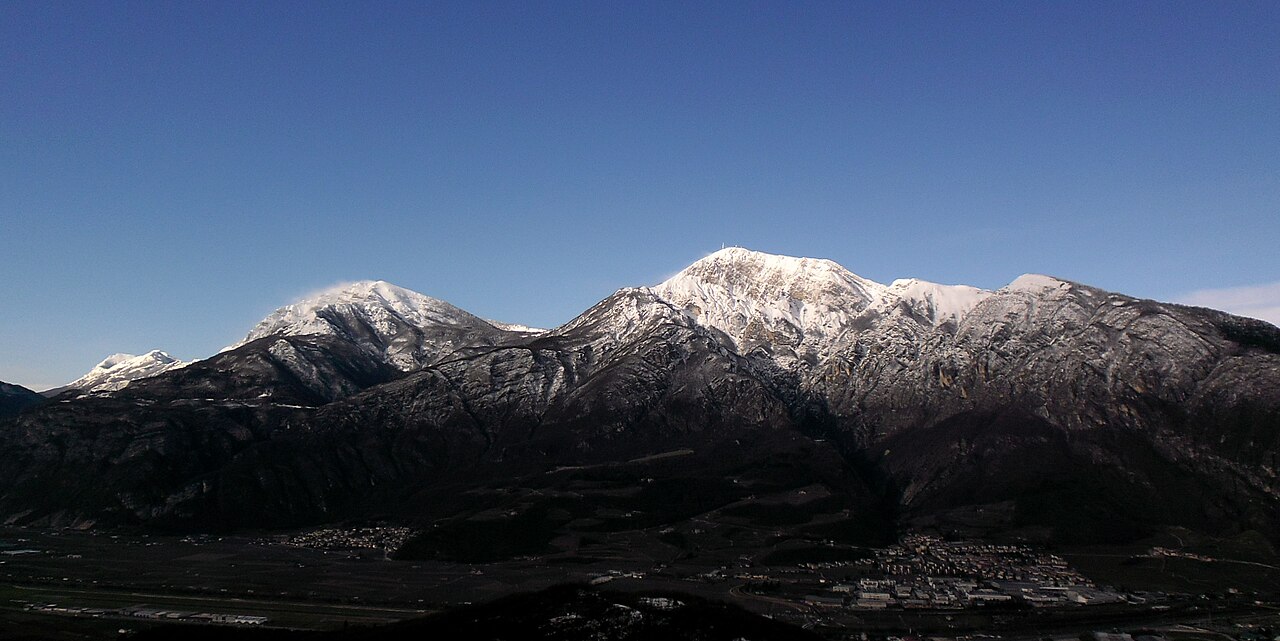
Monte Bondone is a mapped downhill ski area in IT. Forecasts cover three real lift-station locations from approximately 1184 to 2087 metres. Elevations are terrain-model estimates.
Data: OpenSkiData / OpenSkiMap, OpenStreetMap contributors (ODbL), Skimap.org, Who's On First, Mapterhorn.
Preparing forecast graphs…
Times and values match the detailed forecast. Tap or point at a value for details. Scroll each chart sideways for later days. Rain / precipitation is the total water equivalent per forecast interval, including snow; snowfall is fresh snow per interval, not snow depth.
GFS and ECMWF model comparison. Each model retains its own forecast times and horizon. Precipitation and snowfall amounts cover their own forecast intervals; these can differ between models.
Forecast values and model notes
Monte Bondone - Middle lift station
ECMWF · Model run: Next update expected:
Day Time (UTC) Temp. (°C) Humidity (%) Wind (km/h) Wind (knots) Wind (Bft) Direction Precip. (mm) Snow (cm) Pressure (hPa) Freezing (m) Conditions | Thursday, 05/11 06:00 1.5 79 3 2 1B NE — — 1029 1013 Cloudy 63% cloud 09:00 1.8 77 3 2 1B NE 0 0 1030 2350 Partly cloudy 35% cloud 12:00 3.4 67 2 1 1B SE 0 0 1028 2682 Clear 6% cloud 15:00 4.3 65 3 1 1B S 0 0 1026 2869 Clear 7% cloud 18:00 3.9 68 3 2 1B NE 0 0 1026 2929 Clear 4% cloud 21:00 3.5 78 1 1 1B S 0 0 1027 2921 Partly cloudy 31% cloud Friday, 06/11 00:00 3.4 73 1 1 1B NE 0 0 1026 2893 Overcast 83% cloud 03:00 3.4 62 2 1 1B NE 0 0 1026 2869 Overcast 86% cloud 06:00 3.6 53 3 2 1B NE 0 0 1025 2862 Overcast 92% cloud 09:00 3.7 55 3 2 1B SE 0 0 1025 2688 Overcast 80% cloud 12:00 4.5 57 5 3 1B SE 0 0 1022 2603 Overcast 100% cloud 15:00 3.3 71 4 2 1B S 0.53 0 1022 2376 Overcast 100% cloud 18:00 2.2 83 6 3 2B E 2.3 0 1022 2185 Overcast 100% cloud 21:00 1.1 93 8 4 2B NE 4.7 1.9 1024 1916 Overcast 100% cloud Saturday, 07/11 00:00 1.2 88 7 4 2B NE 1.6 0 1024 1882 Overcast 100% cloud 03:00 1.1 90 8 4 2B NE 1.8 0.5 1023 1849 Overcast 100% cloud 06:00 1.4 87 7 4 2B NE 0.24 0 1024 1883 Overcast 100% cloud 09:00 1.5 87 4 2 1B NE 0.08 0 1025 1903 Overcast 98% cloud 12:00 2.1 83 2 1 1B NE 0.03 0 1024 2001 Cloudy 69% cloud 15:00 2.5 80 3 1 1B SE 0.01 0 1024 2041 Overcast 95% cloud 18:00 2.3 87 3 1 1B SE 0.01 0 1025 1990 Overcast 89% cloud 21:00 2.1 89 1 0 0B SW 0 0 1026 1986 Cloudy 71% cloud Sunday, 08/11 00:00 1.8 91 2 1 1B NW 0 0 1026 1943 Overcast 90% cloud 03:00 1.5 91 3 1 1B NW 0 0 1026 1912 Overcast 87% cloud 06:00 1.4 87 2 1 1B N 0 0 1027 1894 Cloudy 79% cloud 09:00 1.5 89 2 1 1B NE 0 0 1027 1893 Partly cloudy 34% cloud 12:00 2.4 73 6 3 2B S 0 0 1025 2015 Partly cloudy 32% cloud 15:00 2.7 81 8 4 2B SW 0.04 0 1024 2056 Partly cloudy 45% cloud 18:00 2.3 85 6 3 2B SW 0 0 1025 2026 Partly cloudy 37% cloud 21:00 1.8 86 6 3 1B SW 0 0 1026 1988 Cloudy 75% cloud Monday, 09/11 00:00 1.6 83 3 2 1B SW 0 0 1026 1959 Overcast 96% cloud 03:00 1.4 86 3 2 1B SW 0 0 1025 1960 Overcast 97% cloud 06:00 1.1 90 4 2 1B SW 0 0 1026 1941 Overcast 95% cloud 09:00 1.1 89 7 4 2B SW 0 0 1026 1999 Overcast 89% cloud 12:00 2.2 83 11 6 2B SW 0 0 1024 2334 Overcast 90% cloud 15:00 2.6 82 14 7 3B SW 0 0 1021 2422 Overcast 86% cloud 18:00 2.1 86 16 9 3B SW 0.07 0 1022 2489 Overcast 83% cloud 21:00 1.9 92 14 8 3B SW 0.01 0 1022 2367 Overcast 85% cloud Tuesday, 10/11 00:00 2.1 96 13 7 3B SW 0 0 1021 2362 Overcast 96% cloud 03:00 2.4 96 11 6 2B SW 0 0 1020 2485 Overcast 100% cloud 06:00 2.5 97 9 5 2B SW 0.19 0 1019 2620 Overcast 100% cloud 09:00 2.9 96 9 5 2B SW 0.06 0 1019 2888 Overcast 97% cloud 12:00 4 91 8 4 2B SW 0 0 1016 2941 Overcast 100% cloud 15:00 4.3 89 5 2 1B NW 0.03 0 1015 2977 Overcast 98% cloud 18:00 4.8 83 6 3 2B N 0 0 1015 3044 Partly cloudy 30% cloud 21:00 4.8 82 5 3 1B NW 0 0 1016 3049 Partly cloudy 40% cloud Wednesday, 11/11 00:00 5.1 77 5 3 1B N 0 0 1016 3036 Overcast 83% cloud 03:00 5.3 72 3 1 1B N 0 0 1016 2950 Cloudy 72% cloud 06:00 5.2 72 0 0 0B W 0 0 1017 2949 Partly cloudy 41% cloud |
|---|
Forecast notes
Forecast table times: UTC.
Coordinates: 46.0412412°N, 11.0696366°E · Requested elevation: 1636 m. Model terrain: 843 m. Terrain and 1000/925/850/700 hPa profiles are used for height estimates.
These are altitude estimates, not a simulation of local mountain terrain. Precipitation, cloud and sea-level pressure use horizontal interpolation only.
Precipitation includes rain and snow water equivalent: preceding 3 hours through day 6, then 6 hours (see cell tooltip). Snow (cm) estimates fresh snowfall from precipitation and temperature using the GFS conversion; it is not snow depth on the ground. Freezing (m) uses additional 600/500 hPa temperatures when available and estimates the lowest resolved 0°C crossing above sea level. When all sampled levels are warm, the upper profile limit is shown (see tooltip). < marks an entirely cold sampled profile and its lower height limit. No extrapolation is used.
Preparing forecast graphs…
Times and values match the detailed forecast. Tap or point at a value for details. Scroll each chart sideways for later days. Rain / precipitation is the total water equivalent per forecast interval, including snow; snowfall is fresh snow per interval, not snow depth.
GFS and ECMWF model comparison. Each model retains its own forecast times and horizon. Precipitation and snowfall amounts cover their own forecast intervals; these can differ between models.
Forecast values and model notes
Monte Bondone - Top lift station
ECMWF · Model run: Next update expected:
Day Time (UTC) Temp. (°C) Humidity (%) Wind (km/h) Wind (knots) Wind (Bft) Direction Precip. (mm) Snow (cm) Pressure (hPa) Freezing (m) Conditions | Thursday, 05/11 06:00 0.4 66 3 2 1B S — — 1029 976 Cloudy 62% cloud 09:00 0.6 66 4 2 1B S 0 0 1030 2345 Partly cloudy 38% cloud 12:00 1.9 59 5 3 1B S 0 0 1028 2676 Clear 6% cloud 15:00 2.7 58 6 3 2B SW 0 0 1026 2870 Clear 7% cloud 18:00 2.6 60 2 1 1B S 0 0 1026 2930 Clear 4% cloud 21:00 2.3 67 4 2 1B S 0 0 1027 2915 Partly cloudy 30% cloud Friday, 06/11 00:00 2.2 63 4 2 1B S 0 0 1026 2892 Overcast 88% cloud 03:00 2.2 55 5 3 1B SE 0 0 1026 2865 Overcast 90% cloud 06:00 2.3 47 5 3 1B SE 0 0 1025 2860 Overcast 94% cloud 09:00 2.1 49 9 5 2B SE 0 0 1025 2681 Overcast 82% cloud 12:00 2.3 58 12 7 3B SE 0 0 1022 2596 Overcast 100% cloud 15:00 1.2 78 14 8 3B SE 0.57 0 1022 2368 Overcast 100% cloud 18:00 0.4 88 6 3 2B SE 2.3 0.7 1023 2183 Overcast 100% cloud 21:00 -0.7 95 9 5 2B SE 4.8 1.9 1024 1910 Overcast 100% cloud Saturday, 07/11 00:00 -1.1 91 10 5 2B E 1.6 0.5 1024 1879 Overcast 100% cloud 03:00 -1.2 92 5 3 1B E 1.9 0.6 1023 1851 Overcast 100% cloud 06:00 -1.1 91 6 3 2B NE 0.21 0 1024 1883 Overcast 100% cloud 09:00 -1.1 90 5 3 1B E 0.09 0 1025 1901 Overcast 98% cloud 12:00 -0.5 85 5 3 1B E 0.03 0 1024 1996 Cloudy 70% cloud 15:00 -0.3 85 5 3 1B E 0.00 0 1024 2037 Overcast 96% cloud 18:00 -0.7 91 4 2 1B E 0.00 0 1025 1987 Overcast 90% cloud 21:00 -0.6 90 2 1 1B E 0 0 1026 1984 Cloudy 71% cloud Sunday, 08/11 00:00 -0.9 92 1 1 0B SE 0 0 1026 1940 Overcast 94% cloud 03:00 -1 91 1 0 0B W 0 0 1026 1910 Overcast 91% cloud 06:00 -1.1 87 1 0 0B NW 0 0 1027 1895 Overcast 81% cloud 09:00 -1.1 89 1 0 0B SW 0 0 1027 1892 Partly cloudy 35% cloud 12:00 -0.5 75 7 4 2B SW 0 0 1025 2012 Partly cloudy 29% cloud 15:00 -0.2 81 8 4 2B SW 0.03 0 1024 2054 Partly cloudy 46% cloud 18:00 -0.4 83 5 3 1B SW 0 0 1025 2028 Partly cloudy 37% cloud 21:00 -0.5 79 5 3 1B W 0 0 1026 1992 Cloudy 75% cloud Monday, 09/11 00:00 -0.6 76 5 3 1B W 0 0 1026 1960 Overcast 98% cloud 03:00 -0.5 78 6 3 2B W 0 0 1025 1964 Overcast 98% cloud 06:00 -0.5 80 8 4 2B W 0 0 1026 1944 Overcast 96% cloud 09:00 -0.3 79 10 6 2B SW 0 0 1026 2002 Overcast 90% cloud 12:00 0.8 76 16 9 3B SW 0 0 1024 2340 Overcast 91% cloud 15:00 1.1 76 19 10 3B SW 0 0 1021 2423 Overcast 87% cloud 18:00 1 78 22 12 4B SW 0.08 0 1022 2496 Overcast 81% cloud 21:00 0.7 87 23 12 4B W 0.01 0 1022 2369 Overcast 83% cloud Tuesday, 10/11 00:00 0.8 93 23 12 4B W 0 0 1021 2363 Overcast 96% cloud 03:00 1.1 92 20 11 4B W 0 0 1020 2489 Overcast 100% cloud 06:00 1.4 93 17 9 3B W 0.19 0 1019 2621 Overcast 100% cloud 09:00 1.9 90 17 9 3B W 0.05 0 1019 2893 Overcast 96% cloud 12:00 2.6 87 17 9 3B W 0 0 1016 2945 Overcast 100% cloud 15:00 2.9 88 13 7 3B W 0.02 0 1015 2977 Overcast 98% cloud 18:00 3.3 82 9 5 2B NW 0 0 1015 3045 Partly cloudy 28% cloud 21:00 3.4 79 7 4 2B NW 0 0 1016 3049 Partly cloudy 39% cloud Wednesday, 11/11 00:00 3.4 76 5 3 1B NW 0 0 1016 3044 Overcast 82% cloud 03:00 3.5 73 3 2 1B NW 0 0 1016 2954 Cloudy 74% cloud 06:00 3.4 73 3 2 1B W 0 0 1017 2951 Partly cloudy 43% cloud |
|---|
Forecast notes
Forecast table times: UTC.
Coordinates: 46.0269684°N, 11.0587172°E · Requested elevation: 2087 m. Model terrain: 817 m. Terrain and 1000/925/850/700 hPa profiles are used for height estimates.
These are altitude estimates, not a simulation of local mountain terrain. Precipitation, cloud and sea-level pressure use horizontal interpolation only.
Precipitation includes rain and snow water equivalent: preceding 3 hours through day 6, then 6 hours (see cell tooltip). Snow (cm) estimates fresh snowfall from precipitation and temperature using the GFS conversion; it is not snow depth on the ground. Freezing (m) uses additional 600/500 hPa temperatures when available and estimates the lowest resolved 0°C crossing above sea level. When all sampled levels are warm, the upper profile limit is shown (see tooltip). < marks an entirely cold sampled profile and its lower height limit. No extrapolation is used.