Canazei · Val di Fassa · Panorama

Provider panorama/video player. Capture time is shown by the camera.
Open camera page ↗
Each colour starts at the value shown. Wind colours match across all three units. Dry cells stay neutral. Colours describe the displayed values, not official weather warnings.
Preparing forecast graphs…
Times and values match the detailed forecast. Tap or point at a value for details. Scroll each chart sideways for later days. Rain / precipitation is the total water equivalent per forecast interval, including snow; snowfall is fresh snow per interval, not snow depth.
GFS and ECMWF model comparison. Each model retains its own forecast times and horizon. Precipitation and snowfall amounts cover their own forecast intervals; these can differ between models.
ECMWF · Model run: Next update expected:
Day Time (UTC) Temp. (°C) Humidity (%) Wind (km/h) Wind (knots) Wind (Bft) Direction Precip. (mm) Snow (cm) Pressure (hPa) Freezing (m) Conditions | Thursday, 05/11 06:00 0.4 73 1 0 0B NE — — 1027 < 2000 Clear 10% cloud  09:00 6.5 51 2 1 1B S 0 0 1027 2802 Clear 0% cloud 12:00 8.9 46 2 1 1B SW 0 0 1025 2901 Clear 0% cloud 15:00 6.3 64 2 1 1B SW 0 0 1025 2818 Clear 0% cloud 18:00 2.7 70 1 0 0B NW 0 0 1025 < 2000 Clear 0% cloud 21:00 2.7 67 0 0 0B — 0 0 1024 < 2000 Clear 0% cloud Friday, 06/11 00:00 2.6 63 0 0 0B NE 0 0 1023 < 2000 Clear 0% cloud 03:00 3 56 0 0 0B NE 0 0 1022 < 2000 Clear 0% cloud 06:00 3.6 52 0 0 0B E 0 0 1020 2689 Clear 1% cloud 09:00 8.8 35 3 1 1B S 0 0 1021 3028 Cloudy 79% cloud  12:00 9.9 37 3 2 1B S 0 0 1019 2934 Overcast 86% cloud  15:00 5.8 59 2 1 1B S 0 0 1020 2591 Overcast 97% cloud 18:00 3.7 69 2 1 1B SE 0 0 1021 2175 Overcast 100% cloud 21:00 3.3 80 1 1 0B E 0.50 0 1023 2051 Overcast 100% cloud Saturday, 07/11 00:00 3.1 79 2 1 1B E 0.36 0 1023 2016 Overcast 99% cloud 03:00 2.8 77 1 1 1B NE 0.41 0 1023 < 2000 Overcast 100% cloud 06:00 2.6 76 2 1 1B E 0.54 0 1024 < 2000 Overcast 97% cloud 09:00 4.2 65 3 2 1B E 0.25 0 1025 2163 Overcast 100% cloud 12:00 5.3 60 2 1 1B E 0.02 0 1023 2293 Overcast 100% cloud 15:00 4.5 60 3 2 1B SE 0.11 0 1024 2202 Overcast 97% cloud 18:00 2.5 69 2 1 1B SE 0 0 1025 < 2000 Cloudy 73% cloud 21:00 1.2 70 0 0 0B NE 0 0 1026 < 2000 Partly cloudy 21% cloud  Sunday, 08/11 00:00 0.8 65 0 0 0B NE 0 0 1025 < 2000 Clear 6% cloud 03:00 0.8 61 0 0 0B — 0 0 1025 < 2000 Clear 6% cloud 06:00 0.6 61 0 0 0B — 0 0 1025 < 2000 Clear 7% cloud 09:00 4.7 51 3 2 1B SW 0 0 1025 2216 Clear 11% cloud 12:00 6.2 45 6 3 2B SW 0 0 1024 2323 Partly cloudy 47% cloud 15:00 3.8 65 3 2 1B SW 0 0 1024 2097 Cloudy 62% cloud 18:00 0.5 79 0 0 0B E 0 0 1026 < 2000 Clear 16% cloud 21:00 -0.9 82 0 0 0B E 0 0 1026 < 2000 Cloudy 56% cloud Monday, 09/11 00:00 -2.2 83 1 0 0B N 0 0 1026 < 2000 Overcast 88% cloud 03:00 -2.2 82 1 0 0B NE 0 0 1025 < 2000 Partly cloudy 30% cloud 06:00 -1.8 81 1 0 0B NE 0 0 1024 < 2000 Cloudy 75% cloud 09:00 4.5 53 4 2 1B SW 0 0 1024 2278 Cloudy 74% cloud 12:00 5.8 55 6 3 1B SW 0 0 1022 2482 Cloudy 59% cloud 15:00 3.2 73 4 2 1B SW 0 0 1021 2072 Overcast 87% cloud 18:00 0.5 82 2 1 1B S 0 0 1022 < 2000 Cloudy 61% cloud 21:00 0.4 83 2 1 1B S 0 0 1022 < 2000 Overcast 82% cloud Tuesday, 10/11 00:00 0 84 2 1 1B SW 0.11 0 1020 < 2000 Overcast 100% cloud 03:00 1.3 85 2 1 1B SW 0 0 1018 < 2000 Overcast 100% cloud 06:00 2 86 1 1 1B S 0.02 0 1017 < 2000 Overcast 100% cloud 09:00 5.2 76 4 2 1B SW 0 0 1017 2708 Overcast 86% cloud 12:00 7.2 67 5 3 1B W 0 0 1014 2868 Overcast 99% cloud 15:00 4.9 80 2 1 1B NW 0.05 0 1015 2772 Overcast 97% cloud 18:00 2.9 82 2 1 1B N 0.20 0 1015 < 2000 Partly cloudy 40% cloud 21:00 3.3 78 1 1 1B NE 0 0 1014 2271 Cloudy 61% cloud Wednesday, 11/11 00:00 3.9 74 1 0 0B E 0 0 1014 2441 Cloudy 52% cloud 03:00 4.6 69 1 0 0B SE 0 0 1013 2616 Clear 18% cloud 06:00 4.4 71 1 0 0B SE 0 0 1014 2635 Clear 0% cloud |
|---|
Forecast table times: UTC.
Coordinates: 46.4768809°N, 11.7710748°E · Requested elevation: 1448 m. Model terrain: 1997 m. Terrain and 1000/925/850/700 hPa profiles are used for height estimates.
Outside the available profile, temperature uses an estimated 5.5°C/km height correction; wind retains the nearest available model-level value. Humidity is estimated with adjusted pressure and temperature.
These are altitude estimates, not a simulation of local mountain terrain. Precipitation, cloud and sea-level pressure use horizontal interpolation only.
Precipitation includes rain and snow water equivalent: preceding 3 hours through day 6, then 6 hours (see cell tooltip). Snow (cm) estimates fresh snowfall from precipitation and temperature using the GFS conversion; it is not snow depth on the ground. Freezing (m) uses additional 600/500 hPa temperatures when available and estimates the lowest resolved 0°C crossing above sea level. When all sampled levels are warm, the upper profile limit is shown (see tooltip). < marks an entirely cold sampled profile and its lower height limit. No extrapolation is used.
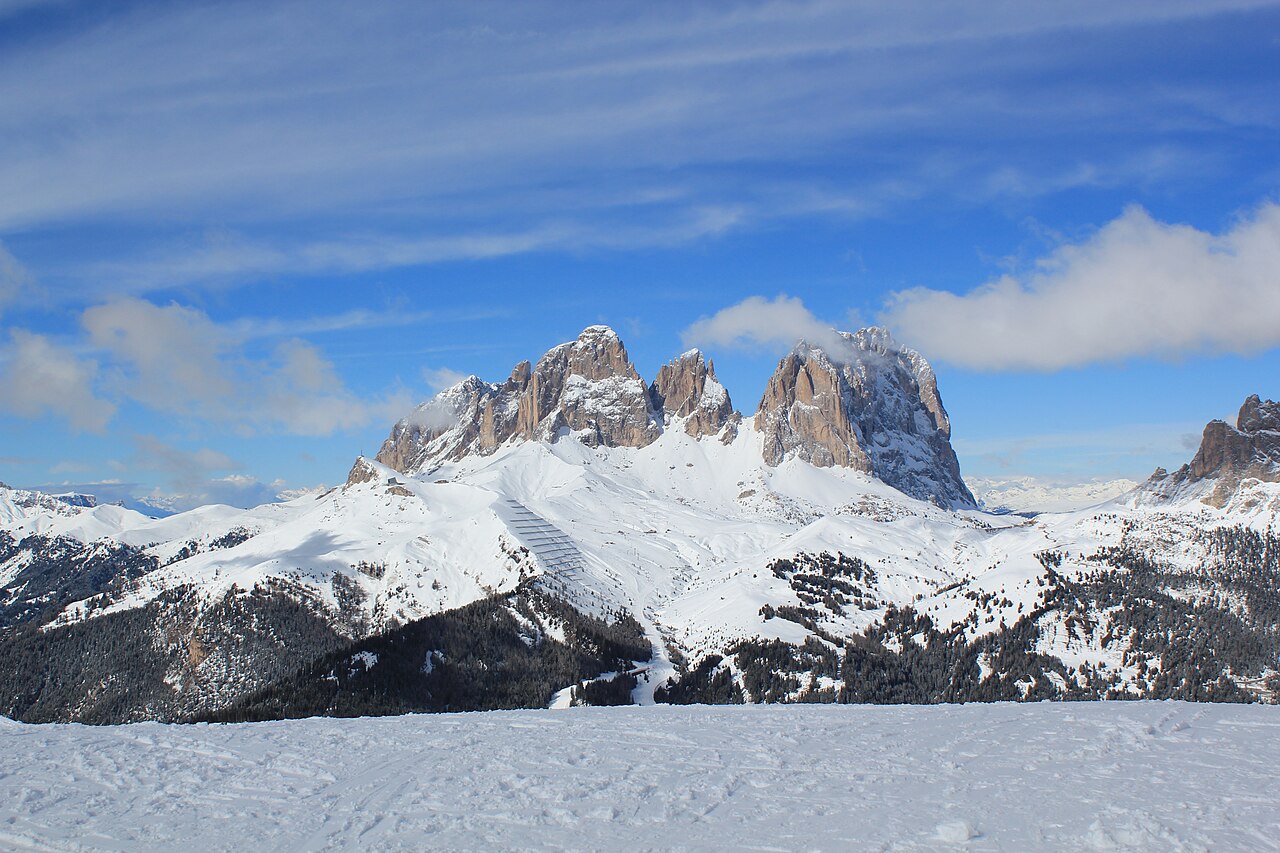
Provider panorama/video player. Capture time is shown by the camera.
Open camera page ↗Preparing forecast graphs…
Times and values match the detailed forecast. Tap or point at a value for details. Scroll each chart sideways for later days. Rain / precipitation is the total water equivalent per forecast interval, including snow; snowfall is fresh snow per interval, not snow depth.
GFS and ECMWF model comparison. Each model retains its own forecast times and horizon. Precipitation and snowfall amounts cover their own forecast intervals; these can differ between models.
ECMWF · Model run: Next update expected:
Day Time (UTC) Temp. (°C) Humidity (%) Wind (km/h) Wind (knots) Wind (Bft) Direction Precip. (mm) Snow (cm) Pressure (hPa) Freezing (m) Conditions | Thursday, 05/11 06:00 -2.6 81 0 0 0B SE — — 1027 < 1994 Clear 10% cloud 09:00 3.2 58 3 2 1B S 0 0 1027 2799 Clear 0% cloud 12:00 5.6 52 3 1 1B S 0 0 1025 2902 Clear 0% cloud 15:00 3 72 2 1 1B SW 0 0 1025 2819 Clear 0% cloud 18:00 -0.4 78 1 0 0B W 0 0 1025 < 1994 Clear 0% cloud 21:00 -0.3 75 0 0 0B SW 0 0 1024 < 1994 Clear 0% cloud Friday, 06/11 00:00 -0.3 71 0 0 0B S 0 0 1023 < 1994 Clear 0% cloud 03:00 -0 63 0 0 0B S 0 0 1022 2025 Clear 0% cloud 06:00 0.6 58 1 0 0B SE 0 0 1020 2719 Clear 0% cloud 09:00 5.5 41 4 2 1B SE 0 0 1021 3028 Cloudy 74% cloud 12:00 6.5 42 5 3 1B S 0 0 1020 2933 Overcast 83% cloud 15:00 2.6 67 3 2 1B S 0 0 1020 2592 Overcast 97% cloud 18:00 0.4 79 3 2 1B SE 0 0 1022 2169 Overcast 100% cloud 21:00 -0 91 3 1 1B SE 0.46 0.1 1023 2048 Overcast 100% cloud Saturday, 07/11 00:00 -0.2 92 4 2 1B SE 0.37 0.1 1023 2009 Overcast 99% cloud 03:00 -0.6 90 2 1 1B E 0.37 0.1 1023 < 1994 Overcast 100% cloud 06:00 -0.8 89 3 2 1B E 0.52 0.2 1024 < 1994 Overcast 98% cloud 09:00 0.8 76 4 2 1B E 0.27 0.1 1025 2158 Overcast 100% cloud 12:00 1.9 70 4 2 1B SE 0.03 0 1023 2291 Overcast 99% cloud 15:00 1.1 70 4 2 1B SE 0.11 0 1024 2196 Overcast 97% cloud 18:00 -0.9 81 2 1 1B SE 0 0 1025 < 1994 Cloudy 71% cloud 21:00 -2.1 81 1 0 0B E 0 0 1026 < 1994 Partly cloudy 21% cloud Sunday, 08/11 00:00 -2.4 75 1 0 0B SE 0 0 1025 < 1994 Clear 7% cloud 03:00 -2.4 69 1 0 0B SE 0 0 1025 < 1994 Clear 7% cloud 06:00 -2.6 68 0 0 0B SE 0 0 1025 < 1994 Clear 8% cloud 09:00 1.3 57 3 2 1B S 0 0 1025 2219 Clear 11% cloud 12:00 2.7 53 6 3 2B SW 0 0 1024 2322 Partly cloudy 45% cloud 15:00 0.3 75 3 2 1B SW 0 0 1024 2096 Cloudy 62% cloud 18:00 -2.8 90 0 0 0B NW 0 0 1026 < 1994 Clear 16% cloud 21:00 -4.1 94 1 0 0B NW 0 0 1026 < 1994 Cloudy 53% cloud Monday, 09/11 00:00 -5.3 94 2 1 1B NW 0 0 1026 < 1994 Overcast 86% cloud 03:00 -5.3 93 1 1 0B NW 0 0 1024 < 1994 Partly cloudy 29% cloud 06:00 -4.9 91 1 0 0B NW 0 0 1024 < 1994 Cloudy 74% cloud 09:00 1.2 60 4 2 1B SW 0 0 1024 2287 Cloudy 73% cloud 12:00 2.5 63 6 3 2B SW 0 0 1022 2486 Cloudy 58% cloud 15:00 0.1 83 5 3 1B SW 0 0 1021 2090 Overcast 87% cloud 18:00 -2.5 93 3 2 1B SW 0 0 1022 < 1994 Cloudy 62% cloud 21:00 -2.6 95 3 2 1B SW 0 0 1022 < 1994 Cloudy 79% cloud Tuesday, 10/11 00:00 -3 97 3 2 1B SW 0.11 0.1 1020 < 1994 Overcast 99% cloud 03:00 -1.8 98 3 2 1B W 0 0 1018 < 1994 Overcast 99% cloud 06:00 -1 98 2 1 1B W 0.02 0 1017 < 1994 Overcast 100% cloud 09:00 2.1 87 5 3 1B W 0 0 1017 2724 Overcast 84% cloud 12:00 4.1 77 6 3 2B W 0 0 1014 2879 Overcast 99% cloud 15:00 1.8 91 3 2 1B NW 0.07 0 1015 2783 Overcast 97% cloud 18:00 -0.1 94 3 1 1B NW 0.18 0 1014 < 1994 Partly cloudy 42% cloud 21:00 0.3 89 2 1 1B N 0 0 1014 2327 Cloudy 62% cloud Wednesday, 11/11 00:00 0.8 85 1 0 0B N 0 0 1014 2467 Cloudy 53% cloud 03:00 1.5 80 0 0 0B SW 0 0 1013 2626 Clear 18% cloud 06:00 1.3 81 1 0 0B SW 0 0 1014 2638 Clear 0% cloud |
|---|
Forecast table times: UTC.
Coordinates: 46.47806367°N, 11.79416656°E · Requested elevation: 2050 m. Model terrain: 1991 m. Terrain and 1000/925/850/700 hPa profiles are used for height estimates.
These are altitude estimates, not a simulation of local mountain terrain. Precipitation, cloud and sea-level pressure use horizontal interpolation only.
Precipitation includes rain and snow water equivalent: preceding 3 hours through day 6, then 6 hours (see cell tooltip). Snow (cm) estimates fresh snowfall from precipitation and temperature using the GFS conversion; it is not snow depth on the ground. Freezing (m) uses additional 600/500 hPa temperatures when available and estimates the lowest resolved 0°C crossing above sea level. When all sampled levels are warm, the upper profile limit is shown (see tooltip). < marks an entirely cold sampled profile and its lower height limit. No extrapolation is used.
Preparing forecast graphs…
Times and values match the detailed forecast. Tap or point at a value for details. Scroll each chart sideways for later days. Rain / precipitation is the total water equivalent per forecast interval, including snow; snowfall is fresh snow per interval, not snow depth.
GFS and ECMWF model comparison. Each model retains its own forecast times and horizon. Precipitation and snowfall amounts cover their own forecast intervals; these can differ between models.
ECMWF · Model run: Next update expected:
Day Time (UTC) Temp. (°C) Humidity (%) Wind (km/h) Wind (knots) Wind (Bft) Direction Precip. (mm) Snow (cm) Pressure (hPa) Freezing (m) Conditions | Thursday, 05/11 06:00 -2.4 51 10 5 2B S — — 1027 < 1924 Partly cloudy 24% cloud 09:00 0.8 42 10 6 2B S 0 0 1027 2797 Clear 0% cloud 12:00 1.8 43 8 4 2B SW 0 0 1025 2897 Clear 0% cloud 15:00 0.9 52 6 3 2B SW 0 0 1025 2825 Clear 0% cloud 18:00 -0.5 52 5 3 1B SW 0 0 1025 < 1924 Clear 0% cloud 21:00 -0.2 51 5 3 1B S 0 0 1025 < 1924 Clear 0% cloud Friday, 06/11 00:00 -0.3 48 7 4 2B S 0 0 1023 < 1924 Clear 0% cloud 03:00 -0.2 45 7 4 2B S 0 0 1022 < 1924 Clear 1% cloud 06:00 -0.1 44 6 3 2B S 0 0 1021 2402 Clear 2% cloud 09:00 2.2 38 12 6 2B SE 0 0 1021 3014 Cloudy 62% cloud 12:00 2.2 40 16 9 3B S 0 0 1020 2917 Overcast 85% cloud 15:00 -0.1 52 16 8 3B SE 0 0 1020 2583 Overcast 98% cloud 18:00 -1.7 61 19 10 3B SE 0 0 1022 2178 Overcast 100% cloud 21:00 -2.7 74 21 11 4B SE 0.55 0.2 1023 2015 Overcast 100% cloud Saturday, 07/11 00:00 -3.3 85 24 13 4B SE 0.33 0.3 1023 1982 Overcast 98% cloud 03:00 -4 94 20 11 3B SE 0.54 0.5 1023 < 1924 Overcast 100% cloud 06:00 -4.1 95 12 7 3B SE 0.71 0.7 1024 < 1924 Overcast 98% cloud 09:00 -3.3 88 9 5 2B SE 0.24 0.2 1025 2121 Overcast 100% cloud 12:00 -2.6 84 14 8 3B SE 0.06 0 1024 2261 Overcast 99% cloud 15:00 -3.2 79 13 7 3B SE 0.09 0.1 1024 2168 Overcast 97% cloud 18:00 -3.8 89 12 6 2B SE 0 0 1025 < 1924 Cloudy 78% cloud 21:00 -4.4 77 10 5 2B SE 0 0 1026 < 1924 Partly cloudy 22% cloud Sunday, 08/11 00:00 -4.7 77 8 4 2B SE 0 0 1025 < 1924 Clear 8% cloud 03:00 -4.7 73 6 3 2B SE 0 0 1025 < 1924 Clear 7% cloud 06:00 -5 73 3 2 1B S 0 0 1025 < 1924 Clear 10% cloud 09:00 -3 64 5 3 1B S 0 0 1026 2206 Clear 11% cloud 12:00 -2.9 69 6 3 2B SW 0 0 1024 2300 Partly cloudy 44% cloud 15:00 -3.9 81 5 3 1B W 0 0 1024 2070 Cloudy 55% cloud 18:00 -5.2 83 7 4 2B W 0 0 1026 < 1924 Clear 15% cloud 21:00 -5.3 78 7 4 2B NW 0 0 1026 < 1924 Partly cloudy 49% cloud Monday, 09/11 00:00 -5.4 69 7 4 2B NW 0 0 1026 < 1924 Overcast 85% cloud 03:00 -5.3 67 8 4 2B W 0 0 1025 < 1924 Partly cloudy 43% cloud 06:00 -4.8 65 9 5 2B W 0 0 1024 < 1924 Cloudy 77% cloud 09:00 -1.7 54 10 6 2B SW 0 0 1024 2272 Cloudy 75% cloud 12:00 -0.6 56 17 9 3B SW 0 0 1022 2495 Cloudy 64% cloud 15:00 -1.4 68 20 11 4B SW 0 0 1021 2143 Overcast 85% cloud 18:00 -2.4 75 21 11 4B W 0 0 1022 < 1924 Cloudy 64% cloud 21:00 -2.1 78 23 13 4B W 0 0 1022 < 1924 Cloudy 75% cloud Tuesday, 10/11 00:00 -2 83 24 13 4B W 0.08 0 1020 < 1924 Overcast 98% cloud 03:00 -1.4 85 23 12 4B W 0 0 1018 < 1924 Overcast 99% cloud 06:00 -0.9 85 20 11 4B W 0.06 0 1017 < 1924 Overcast 99% cloud 09:00 0.6 82 19 10 3B W 0 0 1017 2778 Overcast 85% cloud 12:00 1.5 78 19 10 3B W 0 0 1014 2909 Overcast 99% cloud 15:00 0.6 87 18 10 3B W 0.16 0 1014 2835 Overcast 98% cloud 18:00 -0.2 87 15 8 3B NW 0.13 0 1014 2279 Partly cloudy 49% cloud 21:00 -0.3 83 12 7 2B NW 0 0 1014 2089 Cloudy 62% cloud Wednesday, 11/11 00:00 -0.4 82 8 4 2B NW 0 0 1014 2377 Cloudy 58% cloud 03:00 -0.1 79 5 3 1B W 0 0 1013 2580 Partly cloudy 24% cloud 06:00 -0.1 77 7 4 2B W 0 0 1014 2566 Clear 1% cloud |
|---|
Forecast table times: UTC.
Coordinates: 46.41786072°N, 11.7984581°E · Requested elevation: 2605 m. Model terrain: 1922 m. Terrain and 1000/925/850/700 hPa profiles are used for height estimates.
These are altitude estimates, not a simulation of local mountain terrain. Precipitation, cloud and sea-level pressure use horizontal interpolation only.
Precipitation includes rain and snow water equivalent: preceding 3 hours through day 6, then 6 hours (see cell tooltip). Snow (cm) estimates fresh snowfall from precipitation and temperature using the GFS conversion; it is not snow depth on the ground. Freezing (m) uses additional 600/500 hPa temperatures when available and estimates the lowest resolved 0°C crossing above sea level. When all sampled levels are warm, the upper profile limit is shown (see tooltip). < marks an entirely cold sampled profile and its lower height limit. No extrapolation is used.
Preparing forecast graphs…
Times and values match the detailed forecast. Tap or point at a value for details. Scroll each chart sideways for later days. Rain / precipitation is the total water equivalent per forecast interval, including snow; snowfall is fresh snow per interval, not snow depth.
GFS and ECMWF model comparison. Each model retains its own forecast times and horizon. Precipitation and snowfall amounts cover their own forecast intervals; these can differ between models.
ECMWF · Model run: Next update expected:
Day Time (UTC) Temp. (°C) Humidity (%) Wind (km/h) Wind (knots) Wind (Bft) Direction Precip. (mm) Snow (cm) Pressure (hPa) Freezing (m) Conditions | Thursday, 05/11 06:00 0.3 73 1 0 0B NE — — 1027 < 1996 Clear 11% cloud 09:00 6.4 52 2 1 1B S 0 0 1027 2801 Clear 0% cloud 12:00 8.8 46 2 1 1B SW 0 0 1025 2901 Clear 0% cloud 15:00 6.2 65 2 1 1B SW 0 0 1025 2818 Clear 0% cloud 18:00 2.5 70 1 0 0B NW 0 0 1025 < 1996 Clear 0% cloud 21:00 2.6 68 0 0 0B — 0 0 1024 < 1996 Clear 0% cloud Friday, 06/11 00:00 2.5 64 0 0 0B N 0 0 1023 < 1996 Clear 0% cloud 03:00 2.9 57 0 0 0B NE 0 0 1022 < 1996 Clear 0% cloud 06:00 3.5 52 0 0 0B E 0 0 1020 2688 Clear 1% cloud 09:00 8.7 36 3 1 1B S 0 0 1021 3028 Cloudy 77% cloud 12:00 9.8 37 3 2 1B S 0 0 1019 2933 Overcast 86% cloud 15:00 5.8 60 2 1 1B S 0 0 1020 2591 Overcast 97% cloud 18:00 3.6 69 2 1 1B SE 0 0 1021 2174 Overcast 100% cloud 21:00 3.2 81 1 1 0B E 0.49 0 1023 2049 Overcast 100% cloud Saturday, 07/11 00:00 3 80 2 1 1B E 0.36 0 1023 2013 Overcast 99% cloud 03:00 2.7 77 1 1 1B NE 0.41 0 1023 < 1996 Overcast 100% cloud 06:00 2.5 77 2 1 1B E 0.55 0 1024 < 1996 Overcast 97% cloud 09:00 4.1 65 3 2 1B E 0.26 0 1025 2161 Overcast 100% cloud 12:00 5.2 61 2 1 1B E 0.03 0 1023 2291 Overcast 99% cloud 15:00 4.4 60 3 2 1B SE 0.11 0 1024 2199 Overcast 97% cloud 18:00 2.4 69 2 1 1B E 0 0 1025 < 1996 Cloudy 73% cloud 21:00 1.1 70 0 0 0B N 0 0 1026 < 1996 Partly cloudy 21% cloud Sunday, 08/11 00:00 0.7 65 0 0 0B NE 0 0 1025 < 1996 Clear 6% cloud 03:00 0.7 61 0 0 0B — 0 0 1025 < 1996 Clear 6% cloud 06:00 0.5 60 0 0 0B NE 0 0 1025 < 1996 Clear 7% cloud 09:00 4.6 51 3 2 1B SW 0 0 1025 2217 Clear 11% cloud 12:00 6.1 45 6 3 2B SW 0 0 1024 2322 Partly cloudy 46% cloud 15:00 3.7 65 3 2 1B SW 0 0 1024 2095 Cloudy 62% cloud 18:00 0.4 79 0 0 0B E 0 0 1026 < 1996 Clear 16% cloud 21:00 -1 82 0 0 0B NE 0 0 1026 < 1996 Cloudy 55% cloud Monday, 09/11 00:00 -2.3 83 1 1 0B N 0 0 1026 < 1996 Overcast 87% cloud 03:00 -2.4 82 1 0 0B NE 0 0 1025 < 1996 Partly cloudy 30% cloud 06:00 -1.9 81 0 0 0B NE 0 0 1024 < 1996 Cloudy 75% cloud 09:00 4.4 53 4 2 1B SW 0 0 1024 2279 Cloudy 73% cloud 12:00 5.8 56 6 3 1B SW 0 0 1022 2483 Cloudy 59% cloud 15:00 3.2 73 4 2 1B SW 0 0 1021 2078 Overcast 87% cloud 18:00 0.4 82 2 1 1B S 0 0 1022 < 1996 Cloudy 61% cloud 21:00 0.3 84 2 1 1B S 0 0 1022 < 1996 Overcast 81% cloud Tuesday, 10/11 00:00 -0.1 85 2 1 1B SW 0.11 0 1020 < 1996 Overcast 99% cloud 03:00 1.2 86 2 1 1B SW 0 0 1018 < 1996 Overcast 100% cloud 06:00 1.9 86 1 1 1B S 0.02 0 1017 < 1996 Overcast 100% cloud 09:00 5.1 77 4 2 1B SW 0 0 1017 2714 Overcast 86% cloud 12:00 7.2 67 5 3 1B W 0 0 1014 2872 Overcast 99% cloud 15:00 4.8 80 2 1 1B NW 0.06 0 1015 2777 Overcast 97% cloud 18:00 2.8 82 2 1 1B N 0.20 0 1015 < 1996 Partly cloudy 41% cloud 21:00 3.2 78 1 1 1B NE 0 0 1014 2277 Cloudy 61% cloud Wednesday, 11/11 00:00 3.8 74 0 0 0B NE 0 0 1014 2444 Cloudy 53% cloud 03:00 4.5 70 1 0 0B SE 0 0 1013 2617 Clear 18% cloud 06:00 4.3 71 1 0 0B SE 0 0 1014 2633 Clear 0% cloud |
|---|
Forecast table times: UTC.
Coordinates: 46.47499008°N, 11.77631378°E · Requested elevation: 1464 m. Model terrain: 1993 m. Terrain and 1000/925/850/700 hPa profiles are used for height estimates.
Outside the available profile, temperature uses an estimated 5.5°C/km height correction; wind retains the nearest available model-level value. Humidity is estimated with adjusted pressure and temperature.
These are altitude estimates, not a simulation of local mountain terrain. Precipitation, cloud and sea-level pressure use horizontal interpolation only.
Precipitation includes rain and snow water equivalent: preceding 3 hours through day 6, then 6 hours (see cell tooltip). Snow (cm) estimates fresh snowfall from precipitation and temperature using the GFS conversion; it is not snow depth on the ground. Freezing (m) uses additional 600/500 hPa temperatures when available and estimates the lowest resolved 0°C crossing above sea level. When all sampled levels are warm, the upper profile limit is shown (see tooltip). < marks an entirely cold sampled profile and its lower height limit. No extrapolation is used.
Preparing forecast graphs…
Times and values match the detailed forecast. Tap or point at a value for details. Scroll each chart sideways for later days. Rain / precipitation is the total water equivalent per forecast interval, including snow; snowfall is fresh snow per interval, not snow depth.
GFS and ECMWF model comparison. Each model retains its own forecast times and horizon. Precipitation and snowfall amounts cover their own forecast intervals; these can differ between models.
ECMWF · Model run: Next update expected:
Day Time (UTC) Temp. (°C) Humidity (%) Wind (km/h) Wind (knots) Wind (Bft) Direction Precip. (mm) Snow (cm) Pressure (hPa) Freezing (m) Conditions | Thursday, 05/11 06:00 -2.3 83 1 0 0B NE — — 1027 < 1998 Clear 9% cloud 09:00 3.8 58 2 1 1B S 0 0 1027 2800 Clear 0% cloud 12:00 6.3 52 2 1 1B S 0 0 1025 2902 Clear 0% cloud 15:00 3.6 73 2 1 1B SW 0 0 1025 2818 Clear 0% cloud 18:00 -0 79 1 0 0B NW 0 0 1025 < 1998 Clear 0% cloud 21:00 0 76 0 0 0B — 0 0 1024 < 1998 Clear 0% cloud Friday, 06/11 00:00 0 72 0 0 0B N 0 0 1023 < 1998 Clear 0% cloud 03:00 0.4 64 0 0 0B NE 0 0 1022 2006 Clear 0% cloud 06:00 1 59 0 0 0B E 0 0 1020 2722 Clear 0% cloud 09:00 6.1 40 3 1 1B S 0 0 1021 3029 Cloudy 75% cloud 12:00 7.2 41 4 2 1B S 0 0 1019 2934 Overcast 83% cloud 15:00 3.2 67 2 1 1B S 0 0 1020 2592 Overcast 97% cloud 18:00 1 79 2 1 1B SE 0 0 1021 2170 Overcast 100% cloud 21:00 0.6 91 1 1 0B E 0.46 0.1 1023 2050 Overcast 100% cloud Saturday, 07/11 00:00 0.4 91 2 1 1B E 0.37 0.1 1023 2011 Overcast 99% cloud 03:00 0.1 88 1 1 1B NE 0.37 0.1 1023 < 1998 Overcast 100% cloud 06:00 -0.1 87 2 1 1B E 0.51 0.2 1024 < 1998 Overcast 98% cloud 09:00 1.5 74 3 2 1B E 0.27 0 1025 2161 Overcast 100% cloud 12:00 2.7 68 2 1 1B SE 0.03 0 1023 2292 Overcast 99% cloud 15:00 1.9 68 3 2 1B SE 0.11 0 1024 2199 Overcast 97% cloud 18:00 -0.2 79 2 1 1B E 0 0 1025 < 1998 Cloudy 71% cloud 21:00 -1.5 79 0 0 0B N 0 0 1026 < 1998 Partly cloudy 21% cloud Sunday, 08/11 00:00 -1.9 74 0 0 0B NE 0 0 1025 < 1998 Clear 7% cloud 03:00 -1.8 68 0 0 0B — 0 0 1025 < 1998 Clear 6% cloud 06:00 -2 67 0 0 0B — 0 0 1025 < 1998 Clear 7% cloud 09:00 2 56 3 2 1B SW 0 0 1025 2219 Clear 11% cloud 12:00 3.6 51 6 3 1B SW 0 0 1024 2323 Partly cloudy 45% cloud 15:00 1.1 73 3 2 1B SW 0 0 1024 2097 Cloudy 63% cloud 18:00 -2.2 89 0 0 0B NE 0 0 1026 < 1998 Clear 16% cloud 21:00 -3.6 94 0 0 0B NE 0 0 1026 < 1998 Cloudy 53% cloud Monday, 09/11 00:00 -4.9 95 1 1 1B N 0 0 1026 < 1998 Overcast 87% cloud 03:00 -4.9 94 1 0 0B N 0 0 1025 < 1998 Partly cloudy 29% cloud 06:00 -4.5 92 0 0 0B NE 0 0 1024 < 1998 Cloudy 74% cloud 09:00 1.9 59 4 2 1B SW 0 0 1024 2286 Cloudy 73% cloud 12:00 3.2 63 5 3 1B SW 0 0 1022 2485 Cloudy 58% cloud 15:00 0.6 83 4 2 1B SW 0 0 1021 2084 Overcast 87% cloud 18:00 -2.1 93 2 1 1B S 0 0 1022 < 1998 Cloudy 62% cloud 21:00 -2.3 95 2 1 1B SW 0 0 1022 < 1998 Cloudy 79% cloud Tuesday, 10/11 00:00 -2.7 96 2 1 1B SW 0.11 0 1020 < 1998 Overcast 99% cloud 03:00 -1.4 97 2 1 1B SW 0 0 1018 < 1998 Overcast 100% cloud 06:00 -0.7 97 1 1 1B S 0.02 0 1017 < 1998 Overcast 100% cloud 09:00 2.6 86 4 2 1B SW 0 0 1017 2718 Overcast 84% cloud 12:00 4.7 75 5 3 1B W 0 0 1014 2876 Overcast 99% cloud 15:00 2.2 90 2 1 1B NW 0.06 0 1015 2779 Overcast 97% cloud 18:00 0.3 93 2 1 1B N 0.19 0 1015 < 1998 Partly cloudy 41% cloud 21:00 0.7 88 1 1 1B N 0 0 1014 2324 Cloudy 62% cloud Wednesday, 11/11 00:00 1.3 84 0 0 0B NE 0 0 1014 2466 Cloudy 52% cloud 03:00 2 79 1 0 0B SE 0 0 1013 2626 Clear 18% cloud 06:00 1.8 80 1 0 0B SE 0 0 1014 2640 Clear 0% cloud |
|---|
Forecast table times: UTC.
Coordinates: 46.4803636°N, 11.789586°E · Requested elevation: 1930 m. Model terrain: 1995 m. Terrain and 1000/925/850/700 hPa profiles are used for height estimates.
Outside the available profile, temperature uses an estimated 5.5°C/km height correction; wind retains the nearest available model-level value. Humidity is estimated with adjusted pressure and temperature.
These are altitude estimates, not a simulation of local mountain terrain. Precipitation, cloud and sea-level pressure use horizontal interpolation only.
Precipitation includes rain and snow water equivalent: preceding 3 hours through day 6, then 6 hours (see cell tooltip). Snow (cm) estimates fresh snowfall from precipitation and temperature using the GFS conversion; it is not snow depth on the ground. Freezing (m) uses additional 600/500 hPa temperatures when available and estimates the lowest resolved 0°C crossing above sea level. When all sampled levels are warm, the upper profile limit is shown (see tooltip). < marks an entirely cold sampled profile and its lower height limit. No extrapolation is used.
Preparing forecast graphs…
Times and values match the detailed forecast. Tap or point at a value for details. Scroll each chart sideways for later days. Rain / precipitation is the total water equivalent per forecast interval, including snow; snowfall is fresh snow per interval, not snow depth.
GFS and ECMWF model comparison. Each model retains its own forecast times and horizon. Precipitation and snowfall amounts cover their own forecast intervals; these can differ between models.
ECMWF · Model run: Next update expected:
Day Time (UTC) Temp. (°C) Humidity (%) Wind (km/h) Wind (knots) Wind (Bft) Direction Precip. (mm) Snow (cm) Pressure (hPa) Freezing (m) Conditions | Thursday, 05/11 06:00 -2.4 61 7 4 2B S — — 1027 < 1989 Clear 9% cloud 09:00 1.6 48 8 4 2B S 0 0 1027 2797 Clear 0% cloud 12:00 3.1 46 6 3 2B SW 0 0 1025 2903 Clear 0% cloud 15:00 1.5 60 5 3 1B SW 0 0 1025 2819 Clear 0% cloud 18:00 -0.5 60 4 2 1B SW 0 0 1025 < 1989 Clear 0% cloud 21:00 -0.2 58 3 2 1B SW 0 0 1024 < 1989 Clear 0% cloud Friday, 06/11 00:00 -0.3 55 5 3 1B S 0 0 1023 < 1989 Clear 0% cloud 03:00 -0 50 4 2 1B S 0 0 1022 2221 Clear 0% cloud 06:00 0.3 47 4 2 1B S 0 0 1020 2739 Clear 0% cloud 09:00 3.4 38 9 5 2B S 0 0 1021 3028 Cloudy 70% cloud 12:00 3.7 39 12 6 2B S 0 0 1020 2932 Overcast 80% cloud 15:00 0.8 57 11 6 2B SE 0 0 1020 2593 Overcast 97% cloud 18:00 -1 66 13 7 3B SE 0 0 1022 2164 Overcast 100% cloud 21:00 -1.8 80 14 8 3B SE 0.43 0.1 1023 2046 Overcast 100% cloud Saturday, 07/11 00:00 -2.3 88 16 9 3B SE 0.38 0.1 1023 2003 Overcast 99% cloud 03:00 -2.8 92 13 7 3B SE 0.34 0.1 1023 < 1989 Overcast 100% cloud 06:00 -2.9 93 10 5 2B SE 0.50 0.5 1024 < 1989 Overcast 98% cloud 09:00 -1.9 83 7 4 2B SE 0.29 0.1 1025 2154 Overcast 100% cloud 12:00 -1.1 78 11 6 2B SE 0.04 0 1023 2289 Overcast 99% cloud 15:00 -1.7 74 11 6 2B SE 0.11 0 1024 2192 Overcast 98% cloud 18:00 -2.9 84 9 5 2B SE 0 0 1025 < 1989 Cloudy 70% cloud 21:00 -3.6 77 7 4 2B SE 0 0 1026 < 1989 Partly cloudy 22% cloud Sunday, 08/11 00:00 -3.9 75 6 3 2B SE 0 0 1025 < 1989 Clear 8% cloud 03:00 -3.8 69 5 3 1B SE 0 0 1025 < 1989 Clear 7% cloud 06:00 -4 69 3 1 1B S 0 0 1025 < 1989 Clear 9% cloud 09:00 -1.5 61 4 2 1B S 0 0 1025 2220 Clear 11% cloud 12:00 -1 62 6 3 2B SW 0 0 1024 2321 Partly cloudy 43% cloud 15:00 -2.5 79 4 2 1B W 0 0 1024 2094 Cloudy 63% cloud 18:00 -4.3 85 5 2 1B W 0 0 1026 < 1989 Clear 17% cloud 21:00 -5 85 5 3 1B NW 0 0 1026 < 1989 Partly cloudy 49% cloud Monday, 09/11 00:00 -5.5 78 5 3 1B NW 0 0 1026 < 1989 Overcast 85% cloud 03:00 -5.4 76 6 3 1B W 0 0 1024 < 1989 Partly cloudy 28% cloud 06:00 -4.9 74 6 3 2B W 0 0 1024 < 1989 Cloudy 73% cloud 09:00 -0.7 55 8 4 2B SW 0 0 1024 2294 Cloudy 73% cloud 12:00 0.4 59 13 7 3B SW 0 0 1022 2490 Cloudy 58% cloud 15:00 -1 73 15 8 3B SW 0 0 1021 2103 Overcast 88% cloud 18:00 -2.5 81 14 8 3B SW 0 0 1022 < 1989 Cloudy 64% cloud 21:00 -2.3 85 16 9 3B W 0 0 1022 < 1989 Cloudy 76% cloud Tuesday, 10/11 00:00 -2.6 88 16 9 3B W 0.11 0 1020 < 1989 Overcast 99% cloud 03:00 -1.7 89 16 8 3B W 0 0 1018 < 1989 Overcast 99% cloud 06:00 -1.1 90 14 8 3B W 0.02 0 1017 < 1989 Overcast 100% cloud 09:00 1 84 14 8 3B W 0 0 1017 2736 Overcast 82% cloud 12:00 2.4 78 14 8 3B W 0 0 1014 2888 Overcast 99% cloud 15:00 0.9 89 12 7 3B W 0.09 0 1015 2793 Overcast 98% cloud 18:00 -0.2 90 10 6 2B NW 0.17 0 1014 < 1989 Partly cloudy 43% cloud 21:00 -0.1 86 9 5 2B NW 0 0 1014 2363 Cloudy 62% cloud Wednesday, 11/11 00:00 0.1 83 5 3 1B NW 0 0 1014 2485 Cloudy 53% cloud 03:00 0.5 80 4 2 1B W 0 0 1013 2633 Clear 17% cloud 06:00 0.5 79 5 3 1B W 0 0 1014 2639 Clear 0% cloud |
|---|
Forecast table times: UTC.
Coordinates: 46.4782726°N, 11.8122496°E · Requested elevation: 2423 m. Model terrain: 1986 m. Terrain and 1000/925/850/700 hPa profiles are used for height estimates.
These are altitude estimates, not a simulation of local mountain terrain. Precipitation, cloud and sea-level pressure use horizontal interpolation only.
Precipitation includes rain and snow water equivalent: preceding 3 hours through day 6, then 6 hours (see cell tooltip). Snow (cm) estimates fresh snowfall from precipitation and temperature using the GFS conversion; it is not snow depth on the ground. Freezing (m) uses additional 600/500 hPa temperatures when available and estimates the lowest resolved 0°C crossing above sea level. When all sampled levels are warm, the upper profile limit is shown (see tooltip). < marks an entirely cold sampled profile and its lower height limit. No extrapolation is used.