Worldwide Ski Resort Forecasts

More
Colour guide Temperature · Wind · Rain · Snow
Each colour starts at the value shown. Wind colours match across all three units. Dry cells stay neutral. Colours describe the displayed values, not official weather warnings.
Ragged Mountain Resort - Low lift station
ECMWF · Model run: Next update expected:
Day Time (UTC) Temp. (°C) Humidity (%) Wind (km/h) Wind (knots) Wind (Bft) Direction Precip. (mm) Snow (cm) Pressure (hPa) Freezing (m) Conditions | Thursday, 05/11 06:00 11.1 89 6 3 2B SW — — 1014 3108 Clear 1% cloud  09:00 10.8 87 9 5 2B SW 0 0 1013 3096 Partly cloudy 33% cloud  12:00 11 91 9 5 2B SW 0 0 1013 3092 Cloudy 53% cloud  15:00 15.5 95 14 8 3B S 0.69 0 1012 3083 Overcast 100% cloud  18:00 17.2 98 16 9 3B SW 1.6 0 1010 3070 Overcast 93% cloud 21:00 18.3 87 16 9 3B S 0.16 0 1009 3067 Partly cloudy 42% cloud Friday, 06/11 00:00 16.8 92 17 9 3B SW 0.11 0 1010 3070 Cloudy 73% cloud 03:00 16.4 95 16 8 3B SW 0 0 1010 3069 Cloudy 59% cloud 06:00 15.4 98 11 6 2B SW 0 0 1010 3063 Overcast 89% cloud 09:00 14.7 99 11 6 2B W 0.09 0 1011 3059 Cloudy 60% cloud 12:00 12.9 99 5 3 1B W 0 0 1012 3063 Overcast 96% cloud 15:00 16.4 78 5 3 1B W 0.11 0 1012 3061 Overcast 90% cloud 18:00 19.1 53 6 3 2B SW 0 0 1011 3051 Overcast 97% cloud 21:00 16.4 66 5 3 1B N 0 0 1010 3044 Partly cloudy 43% cloud Saturday, 07/11 00:00 12.1 79 6 3 1B N 0.01 0 1011 3045 Overcast 100% cloud 03:00 11.6 81 9 5 2B N 0 0 1011 3038 Overcast 100% cloud 06:00 12 76 13 7 3B NE 0.00 0 1012 2915 Overcast 100% cloud 09:00 11.2 78 14 7 3B NE 0.00 0 1011 2932 Overcast 95% cloud 12:00 9.4 85 15 8 3B NE 0 0 1011 2852 Partly cloudy 26% cloud 15:00 11.7 70 17 9 3B NE 0 0 1011 2894 Overcast 98% cloud 18:00 11.8 70 14 8 3B NE 0 0 1008 2925 Overcast 100% cloud 21:00 10 76 12 6 2B NE 0 0 1008 2815 Overcast 100% cloud Sunday, 08/11 00:00 7.7 85 11 6 2B E 0.09 0 1008 2499 Overcast 100% cloud 03:00 6.8 88 6 3 2B E 0.09 0 1007 2242 Overcast 100% cloud 06:00 6.4 97 2 1 1B NE 1.5 0 1006 1875 Overcast 100% cloud 09:00 6.3 99 15 8 3B NW 1.0 0 1005 1709 Overcast 100% cloud 12:00 4.7 95 23 13 4B NW 0.71 0 1006 1816 Overcast 96% cloud 15:00 7.8 67 23 12 4B NW 0 0 1006 1428 Partly cloudy 41% cloud 18:00 9 61 21 11 4B W 0 0 1005 1281 Overcast 93% cloud 21:00 9 68 13 7 3B W 0.07 0 1005 1361 Partly cloudy 33% cloud Monday, 09/11 00:00 6.7 70 17 9 3B W 0 0 1004 1489 Partly cloudy 35% cloud 03:00 7.8 62 18 10 3B W 0 0 1003 1423 Cloudy 60% cloud 06:00 6 80 11 6 2B W 0 0 1003 1324 Cloudy 69% cloud 09:00 5.8 90 15 8 3B W 0.05 0 1003 1348 Cloudy 79% cloud 12:00 5.5 92 16 9 3B W 0.20 0 1004 1268 Partly cloudy 40% cloud 15:00 7.7 74 19 10 3B W 0.20 0 1005 1237 Cloudy 73% cloud 18:00 8.7 65 22 12 4B NW 0.38 0 1005 1250 Cloudy 50% cloud 21:00 7.7 61 21 11 4B NW 0.12 0 1007 1158 Overcast 96% cloud Tuesday, 10/11 00:00 6 67 21 11 4B NW 0 0 1009 1032 Overcast 80% cloud 03:00 5.4 68 21 11 4B NW 0 0 1010 1035 Partly cloudy 46% cloud 06:00 4.9 72 16 9 3B NW 0 0 1011 1024 Cloudy 55% cloud 09:00 4.7 74 13 7 3B NW 0 0 1011 1193 Overcast 87% cloud 12:00 3.4 82 12 6 2B W 0 0 1012 2025 Cloudy 63% cloud 15:00 7.3 61 17 9 3B W 0 0 1011 2113 Overcast 97% cloud 18:00 9.1 56 12 7 2B W 0 0 1008 1815 Overcast 86% cloud 21:00 8.6 63 9 5 2B SW 0.09 0 1007 1528 Cloudy 66% cloud Wednesday, 11/11 00:00 8.7 69 18 10 3B W 0 0 1007 1626 Partly cloudy 33% cloud 03:00 7.3 81 18 10 3B W 0 0 1007 1593 Partly cloudy 23% cloud 06:00 6.6 82 18 10 3B W 0 0 1008 1522 Partly cloudy 29% cloud |
|---|
Forecast notes
Forecast table times: UTC.
Coordinates: 43.4851116°N, -71.8433485°E · Requested elevation: 337 m. Model terrain: 317 m. Terrain and 1000/925/850/700 hPa profiles are used for height estimates.
These are altitude estimates, not a simulation of local mountain terrain. Precipitation, cloud and sea-level pressure use horizontal interpolation only.
Precipitation includes rain and snow water equivalent: preceding 3 hours through day 6, then 6 hours (see cell tooltip). Snow (cm) estimates fresh snowfall from precipitation and temperature using the GFS conversion; it is not snow depth on the ground. Freezing (m) uses additional 600/500 hPa temperatures when available and estimates the lowest resolved 0°C crossing above sea level. When all sampled levels are warm, the upper profile limit is shown (see tooltip). < marks an entirely cold sampled profile and its lower height limit. No extrapolation is used.
Source: ECMWF · CC BY 4.0 · Processed by Snow Report.
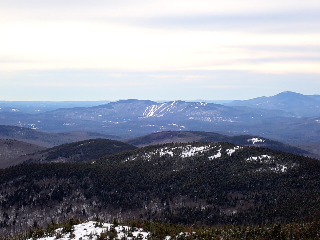
Ragged Mountain Resort is a downhill ski area in New Hampshire, United States. Mapped terrain includes beginner, easy, intermediate, advanced routes. Its mapped lift network extends from approximately 337 to 673 metres above sea level.
Data: OpenSkiData / OpenSkiMap, OpenStreetMap contributors (ODbL), Skimap.org, Who's On First, Mapterhorn.
Ragged Mountain Resort - Base lift station
ECMWF · Model run: Next update expected:
Day Time (UTC) Temp. (°C) Humidity (%) Wind (km/h) Wind (knots) Wind (Bft) Direction Precip. (mm) Snow (cm) Pressure (hPa) Freezing (m) Conditions | Thursday, 05/11 06:00 11.2 88 6 3 2B SW — — 1014 3108 Clear 1% cloud 09:00 10.9 87 10 5 2B SW 0 0 1013 3096 Partly cloudy 33% cloud 12:00 11 91 10 5 2B SW 0 0 1013 3092 Cloudy 53% cloud 15:00 15.5 95 15 8 3B S 0.68 0 1012 3083 Overcast 100% cloud 18:00 17.2 98 17 9 3B SW 1.6 0 1010 3070 Overcast 93% cloud 21:00 18.2 87 16 9 3B S 0.16 0 1009 3067 Partly cloudy 42% cloud Friday, 06/11 00:00 16.8 93 17 9 3B SW 0.11 0 1010 3070 Cloudy 73% cloud 03:00 16.4 95 16 9 3B SW 0 0 1010 3069 Cloudy 59% cloud 06:00 15.4 98 12 6 2B SW 0 0 1010 3063 Overcast 89% cloud 09:00 14.7 99 11 6 2B W 0.09 0 1011 3059 Cloudy 60% cloud 12:00 12.9 98 5 3 1B W 0 0 1012 3063 Overcast 96% cloud 15:00 16.3 78 5 3 1B W 0.11 0 1012 3061 Overcast 90% cloud 18:00 19 54 6 3 2B SW 0 0 1011 3051 Overcast 97% cloud 21:00 16.4 66 5 3 1B N 0 0 1010 3044 Partly cloudy 43% cloud Saturday, 07/11 00:00 12.2 78 6 3 1B N 0.01 0 1011 3045 Overcast 100% cloud 03:00 11.6 81 10 5 2B N 0 0 1011 3038 Overcast 100% cloud 06:00 12 76 13 7 3B NE 0.00 0 1012 2915 Overcast 100% cloud 09:00 11.2 78 14 8 3B NE 0.00 0 1011 2932 Overcast 95% cloud 12:00 9.4 85 15 8 3B NE 0 0 1011 2853 Partly cloudy 26% cloud 15:00 11.6 71 17 9 3B NE 0 0 1011 2894 Overcast 98% cloud 18:00 11.7 71 14 8 3B NE 0 0 1008 2926 Overcast 100% cloud 21:00 9.9 76 12 6 2B NE 0 0 1008 2816 Overcast 100% cloud Sunday, 08/11 00:00 7.7 85 11 6 2B E 0.09 0 1008 2500 Overcast 100% cloud 03:00 6.8 88 6 3 2B E 0.09 0 1007 2242 Overcast 100% cloud 06:00 6.4 97 2 1 1B NE 1.5 0 1006 1875 Overcast 100% cloud 09:00 6.3 99 16 8 3B NW 1.0 0 1005 1709 Overcast 100% cloud 12:00 4.6 96 24 13 4B NW 0.71 0 1006 1817 Overcast 96% cloud 15:00 7.7 67 23 12 4B NW 0 0 1006 1429 Partly cloudy 41% cloud 18:00 8.9 62 21 11 4B W 0 0 1005 1281 Overcast 93% cloud 21:00 8.9 68 13 7 3B W 0.07 0 1005 1361 Partly cloudy 33% cloud Monday, 09/11 00:00 6.6 70 18 10 3B W 0 0 1004 1490 Partly cloudy 34% cloud 03:00 7.7 62 19 10 3B W 0 0 1003 1423 Cloudy 60% cloud 06:00 6 80 12 6 2B W 0 0 1003 1324 Cloudy 69% cloud 09:00 5.8 90 15 8 3B W 0.05 0 1003 1348 Cloudy 79% cloud 12:00 5.5 92 17 9 3B W 0.20 0 1004 1268 Partly cloudy 40% cloud 15:00 7.7 74 19 11 3B W 0.20 0 1005 1238 Cloudy 73% cloud 18:00 8.6 65 23 12 4B NW 0.37 0 1005 1250 Cloudy 50% cloud 21:00 7.6 61 21 11 4B NW 0.12 0 1007 1158 Overcast 95% cloud Tuesday, 10/11 00:00 6 68 22 12 4B NW 0 0 1009 1033 Overcast 80% cloud 03:00 5.4 68 22 12 4B NW 0 0 1010 1036 Partly cloudy 46% cloud 06:00 4.8 72 17 9 3B NW 0 0 1011 1025 Cloudy 55% cloud 09:00 4.6 74 14 7 3B NW 0 0 1011 1196 Overcast 87% cloud 12:00 3.4 82 12 7 3B W 0 0 1012 2027 Cloudy 63% cloud 15:00 7.2 61 17 9 3B W 0 0 1011 2115 Overcast 97% cloud 18:00 9 56 12 7 3B W 0 0 1008 1816 Overcast 86% cloud 21:00 8.5 63 10 5 2B SW 0.08 0 1007 1529 Cloudy 66% cloud Wednesday, 11/11 00:00 8.6 69 19 10 3B W 0 0 1007 1626 Partly cloudy 33% cloud 03:00 7.3 81 19 10 3B W 0 0 1007 1594 Partly cloudy 23% cloud 06:00 6.6 82 19 10 3B W 0 0 1008 1523 Partly cloudy 29% cloud |
|---|
Forecast notes
Forecast table times: UTC.
Coordinates: 43.484495°N, -71.8425275°E · Requested elevation: 343 m. Model terrain: 316 m. Terrain and 1000/925/850/700 hPa profiles are used for height estimates.
These are altitude estimates, not a simulation of local mountain terrain. Precipitation, cloud and sea-level pressure use horizontal interpolation only.
Precipitation includes rain and snow water equivalent: preceding 3 hours through day 6, then 6 hours (see cell tooltip). Snow (cm) estimates fresh snowfall from precipitation and temperature using the GFS conversion; it is not snow depth on the ground. Freezing (m) uses additional 600/500 hPa temperatures when available and estimates the lowest resolved 0°C crossing above sea level. When all sampled levels are warm, the upper profile limit is shown (see tooltip). < marks an entirely cold sampled profile and its lower height limit. No extrapolation is used.
Source: ECMWF · CC BY 4.0 · Processed by Snow Report.
Ragged Mountain Resort - Top lift station
ECMWF · Model run: Next update expected:
Day Time (UTC) Temp. (°C) Humidity (%) Wind (km/h) Wind (knots) Wind (Bft) Direction Precip. (mm) Snow (cm) Pressure (hPa) Freezing (m) Conditions | Thursday, 05/11 06:00 16.3 60 25 13 4B SW — — 1014 3108 Clear 1% cloud 09:00 14.9 58 45 24 6B SW 0 0 1013 3096 Partly cloudy 33% cloud 12:00 13.2 87 44 24 6B SW 0 0 1013 3092 Cloudy 54% cloud 15:00 14.1 99 43 23 6B SW 0.66 0 1012 3083 Overcast 100% cloud 18:00 15.3 98 47 25 6B SW 1.7 0 1010 3070 Overcast 93% cloud 21:00 16.3 90 43 23 6B SW 0.16 0 1009 3067 Partly cloudy 42% cloud Friday, 06/11 00:00 15.8 95 48 26 6B SW 0.11 0 1010 3070 Cloudy 72% cloud 03:00 15.5 96 48 26 6B SW 0 0 1010 3069 Cloudy 60% cloud 06:00 14.9 98 35 19 5B SW 0 0 1010 3063 Overcast 89% cloud 09:00 14.1 92 27 15 4B W 0.09 0 1011 3059 Cloudy 59% cloud 12:00 12.9 87 17 9 3B W 0 0 1012 3063 Overcast 94% cloud 15:00 13.1 78 13 7 3B W 0.11 0 1012 3061 Overcast 90% cloud 18:00 15.2 64 10 5 2B SW 0 0 1011 3051 Overcast 97% cloud 21:00 15 63 8 4 2B NW 0 0 1010 3044 Partly cloudy 43% cloud Saturday, 07/11 00:00 13.2 66 15 8 3B NE 0.02 0 1011 3045 Overcast 100% cloud 03:00 12.6 74 29 16 5B NE 0 0 1011 3038 Overcast 100% cloud 06:00 11.3 79 40 22 6B E 0.01 0 1012 2916 Overcast 100% cloud 09:00 9.6 84 41 22 6B NE 0.01 0 1011 2933 Overcast 93% cloud 12:00 7.8 90 43 23 6B NE 0 0 1011 2853 Partly cloudy 30% cloud 15:00 7.9 87 39 21 5B NE 0 0 1011 2895 Overcast 98% cloud 18:00 7.7 88 26 14 4B NE 0 0 1008 2927 Overcast 100% cloud 21:00 6.7 91 26 14 4B NE 0 0 1008 2816 Overcast 100% cloud Sunday, 08/11 00:00 5.4 90 33 18 5B NE 0.10 0 1008 2498 Overcast 100% cloud 03:00 4.3 93 22 12 4B NE 0.13 0 1007 2242 Overcast 100% cloud 06:00 4.7 92 10 5 2B N 1.5 0 1006 1875 Overcast 100% cloud 09:00 4 98 40 21 6B NW 1.00 0 1005 1703 Overcast 100% cloud 12:00 2.1 98 57 31 7B NW 0.70 0 1006 1818 Overcast 95% cloud 15:00 3.5 84 46 25 6B NW 0 0 1006 1435 Partly cloudy 40% cloud 18:00 5.1 75 39 21 6B W 0 0 1005 1283 Overcast 93% cloud 21:00 6 77 34 18 5B W 0.07 0 1005 1364 Partly cloudy 35% cloud Monday, 09/11 00:00 5.7 64 50 27 6B W 0 0 1004 1497 Partly cloudy 34% cloud 03:00 5.9 67 50 27 6B W 0 0 1003 1426 Cloudy 60% cloud 06:00 4.6 85 37 20 5B W 0 0 1003 1329 Cloudy 68% cloud 09:00 4.4 92 43 23 6B W 0.05 0 1003 1350 Cloudy 79% cloud 12:00 3.8 92 44 24 6B W 0.19 0 1004 1269 Partly cloudy 41% cloud 15:00 4.1 86 38 20 5B W 0.20 0 1005 1240 Cloudy 73% cloud 18:00 4.5 79 41 22 6B NW 0.37 0 1005 1252 Partly cloudy 49% cloud 21:00 4.5 72 43 23 6B NW 0.13 0 1007 1159 Overcast 95% cloud Tuesday, 10/11 00:00 3.2 76 49 26 6B NW 0 0 1009 1033 Cloudy 80% cloud 03:00 2.8 75 52 28 7B NW 0 0 1010 1037 Partly cloudy 47% cloud 06:00 2.4 80 42 23 6B NW 0 0 1011 1028 Cloudy 57% cloud 09:00 1.9 85 36 19 5B NW 0 0 1011 1222 Overcast 85% cloud 12:00 1.6 85 35 19 5B W 0 0 1012 2043 Cloudy 64% cloud 15:00 3.2 76 30 16 5B W 0 0 1011 2129 Overcast 97% cloud 18:00 5.2 69 22 12 4B W 0 0 1008 1826 Overcast 85% cloud 21:00 6 69 26 14 4B SW 0.08 0 1007 1533 Cloudy 65% cloud Wednesday, 11/11 00:00 6.5 77 49 26 6B W 0 0 1007 1629 Partly cloudy 35% cloud 03:00 5.9 83 50 27 7B W 0 0 1007 1596 Partly cloudy 23% cloud 06:00 5.1 84 46 25 6B NW 0 0 1008 1531 Partly cloudy 28% cloud |
|---|
Forecast notes
Forecast table times: UTC.
Coordinates: 43.4724877°N, -71.8449689°E · Requested elevation: 673 m. Model terrain: 314 m. Terrain and 1000/925/850/700 hPa profiles are used for height estimates.
These are altitude estimates, not a simulation of local mountain terrain. Precipitation, cloud and sea-level pressure use horizontal interpolation only.
Precipitation includes rain and snow water equivalent: preceding 3 hours through day 6, then 6 hours (see cell tooltip). Snow (cm) estimates fresh snowfall from precipitation and temperature using the GFS conversion; it is not snow depth on the ground. Freezing (m) uses additional 600/500 hPa temperatures when available and estimates the lowest resolved 0°C crossing above sea level. When all sampled levels are warm, the upper profile limit is shown (see tooltip). < marks an entirely cold sampled profile and its lower height limit. No extrapolation is used.