Worldwide Ski Resort Forecasts

More
Colour guide Temperature · Wind · Rain · Snow
Each colour starts at the value shown. Wind colours match across all three units. Dry cells stay neutral. Colours describe the displayed values, not official weather warnings.
Powder Ridge Ski Area - Low lift station
ECMWF · Model run: Next update expected:
Day Time (UTC) Temp. (°C) Humidity (%) Wind (km/h) Wind (knots) Wind (Bft) Direction Precip. (mm) Snow (cm) Pressure (hPa) Freezing (m) Conditions | Thursday, 05/11 06:00 15.6 96 18 9 3B SW — — 1016 3122 Cloudy 64% cloud  09:00 16.6 99 17 9 3B SW 0 0 1015 3110 Overcast 100% cloud  12:00 16.5 100 15 8 3B S 0 0 1015 3112 Overcast 100% cloud 15:00 19.5 88 22 12 4B S 0.00 0 1014 3109 Overcast 100% cloud 18:00 19.7 83 20 11 3B S 0.13 0 1012 3094 Cloudy 69% cloud 21:00 19.7 79 22 12 4B S 0 0 1011 3093 Overcast 85% cloud Friday, 06/11 00:00 18.3 89 20 11 3B S 0.00 0 1012 3099 Partly cloudy 48% cloud  03:00 17.9 91 20 11 4B S 0.12 0 1012 3097 Cloudy 65% cloud 06:00 17.1 98 21 11 4B SW 2.6 0 1012 3094 Overcast 100% cloud 09:00 16.7 99 10 6 2B SW 0.36 0 1012 3089 Overcast 100% cloud 12:00 16.4 99 7 4 2B S 3.8 0 1012 3088 Overcast 100% cloud 15:00 17.4 98 4 2 1B S 3.7 0 1012 3080 Overcast 100% cloud 18:00 17.9 98 4 2 1B S 9.2 0 1011 3068 Overcast 100% cloud 21:00 17.6 99 5 3 1B S 1.8 0 1010 3061 Overcast 100% cloud Saturday, 07/11 00:00 16.5 99 2 1 1B S 0.20 0 1010 3057 Overcast 100% cloud 03:00 16.1 100 2 1 1B N 0.74 0 1010 3048 Overcast 100% cloud 06:00 15.6 99 11 6 2B N 1.4 0 1009 3035 Overcast 100% cloud 09:00 12.6 98 13 7 3B N 0.77 0 1008 3021 Overcast 96% cloud 12:00 12.8 97 12 6 2B N 0.00 0 1009 3018 Overcast 100% cloud 15:00 14.6 87 12 6 2B N 0.01 0 1009 2973 Overcast 100% cloud 18:00 15.2 80 7 4 2B N 0 0 1008 2967 Overcast 100% cloud 21:00 14 91 4 2 1B W 0.34 0 1007 2485 Overcast 98% cloud Sunday, 08/11 00:00 9.5 92 18 10 3B W 1.9 0 1008 2156 Clear 19% cloud  03:00 6.9 82 14 8 3B W 0.00 0 1008 1516 Clear 20% cloud 06:00 6.5 92 14 8 3B W 0.47 0 1007 1385 Overcast 90% cloud 09:00 8.1 86 18 10 3B NW 0.24 0 1007 1788 Cloudy 72% cloud 12:00 8.6 82 21 12 4B NW 0.25 0 1009 1964 Cloudy 50% cloud 15:00 12.3 63 19 10 3B NW 0 0 1010 1979 Clear 17% cloud 18:00 13.4 58 20 11 4B W 0 0 1009 2057 Overcast 95% cloud 21:00 12.3 62 13 7 3B W 0 0 1008 2607 Clear 0% cloud Monday, 09/11 00:00 9.8 72 17 9 3B SW 0 0 1007 2189 Clear 10% cloud 03:00 8.9 64 16 9 3B SW 0 0 1007 1912 Clear 5% cloud 06:00 7.8 64 15 8 3B SW 0 0 1007 1642 Clear 10% cloud 09:00 8.4 71 18 10 3B W 0 0 1007 1751 Clear 6% cloud 12:00 7.4 80 12 6 2B W 0 0 1008 1363 Clear 8% cloud 15:00 10.7 62 21 11 4B W 0 0 1008 1310 Overcast 91% cloud 18:00 11.6 56 23 12 4B NW 0.12 0 1008 1303 Partly cloudy 33% cloud 21:00 9.8 56 18 10 3B NW 0.01 0 1010 1173 Clear 16% cloud Tuesday, 10/11 00:00 7.6 62 17 9 3B NW 0.00 0 1013 1140 Clear 6% cloud 03:00 5.9 69 13 7 3B NW 0 0 1014 1591 Clear 3% cloud 06:00 4.7 79 9 5 2B W 0 0 1014 1921 Clear 11% cloud 09:00 4.1 86 8 4 2B W 0 0 1014 2650 Partly cloudy 26% cloud 12:00 4.5 89 9 5 2B SW 0 0 1015 2767 Overcast 93% cloud 15:00 9.9 67 12 6 2B SW 0 0 1014 2922 Overcast 82% cloud 18:00 12.9 56 13 7 3B SW 0 0 1011 2804 Overcast 93% cloud 21:00 11.4 68 14 7 3B SW 0 0 1009 2706 Clear 0% cloud Wednesday, 11/11 00:00 10.8 65 17 9 3B SW 0 0 1010 2366 Partly cloudy 32% cloud 03:00 10.2 75 15 8 3B W 0 0 1011 2215 Clear 2% cloud 06:00 8.1 85 11 6 2B W 0 0 1011 2258 Clear 17% cloud |
|---|
Forecast notes
Forecast table times: UTC.
Coordinates: 41.5028611°N, -72.7372756°E · Requested elevation: 116 m. Model terrain: 89 m. Terrain and 1000/925/850/700 hPa profiles are used for height estimates.
These are altitude estimates, not a simulation of local mountain terrain. Precipitation, cloud and sea-level pressure use horizontal interpolation only.
Precipitation includes rain and snow water equivalent: preceding 3 hours through day 6, then 6 hours (see cell tooltip). Snow (cm) estimates fresh snowfall from precipitation and temperature using the GFS conversion; it is not snow depth on the ground. Freezing (m) uses additional 600/500 hPa temperatures when available and estimates the lowest resolved 0°C crossing above sea level. When all sampled levels are warm, the upper profile limit is shown (see tooltip). < marks an entirely cold sampled profile and its lower height limit. No extrapolation is used.
Source: ECMWF · CC BY 4.0 · Processed by Snow Report.
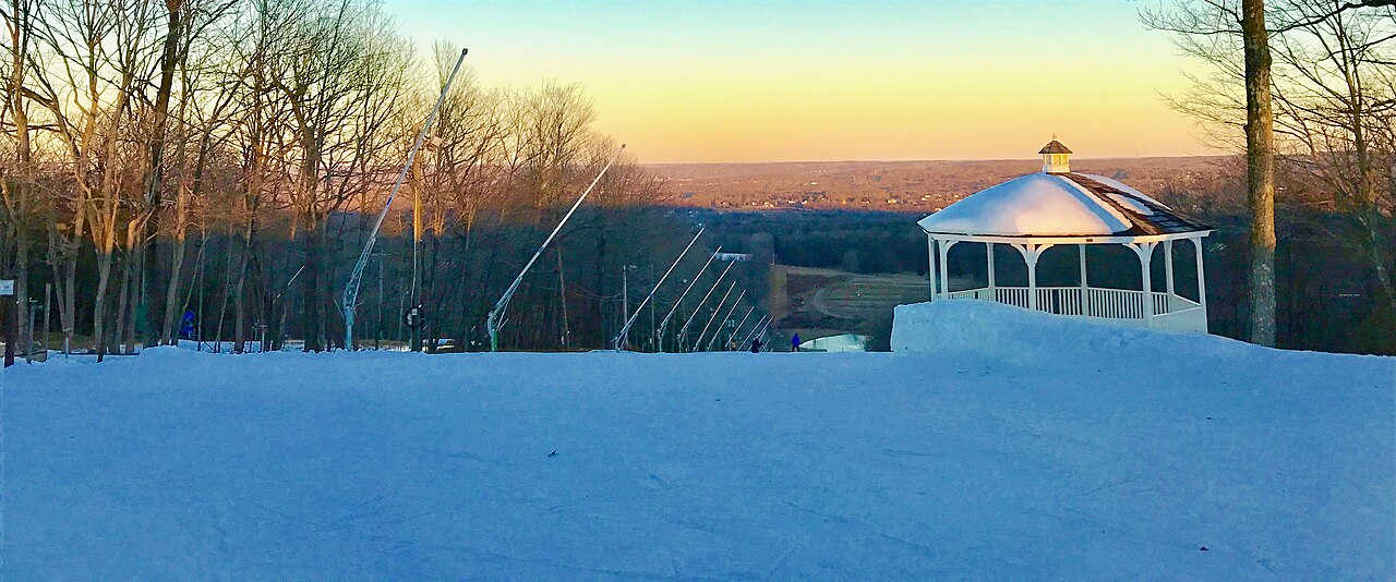
Powder Ridge Ski Area is a downhill ski area in Connecticut, United States. Mapped terrain includes easy, intermediate, advanced routes. Its mapped lift network extends from approximately 116 to 246 metres above sea level.
Data: OpenSkiData / OpenSkiMap, OpenStreetMap contributors (ODbL), Skimap.org, Who's On First, Mapterhorn.
Powder Ridge Ski Area - Base lift station
ECMWF · Model run: Next update expected:
Day Time (UTC) Temp. (°C) Humidity (%) Wind (km/h) Wind (knots) Wind (Bft) Direction Precip. (mm) Snow (cm) Pressure (hPa) Freezing (m) Conditions | Thursday, 05/11 06:00 15.6 96 18 10 3B SW — — 1016 3122 Cloudy 64% cloud 09:00 16.6 99 17 9 3B SW 0 0 1015 3110 Overcast 100% cloud 12:00 16.5 100 15 8 3B S 0 0 1015 3112 Overcast 100% cloud 15:00 19.5 88 22 12 4B S 0.00 0 1014 3109 Overcast 100% cloud 18:00 19.7 83 20 11 4B S 0.13 0 1012 3094 Cloudy 69% cloud 21:00 19.7 79 22 12 4B S 0 0 1012 3093 Overcast 86% cloud Friday, 06/11 00:00 18.3 89 20 11 4B S 0.00 0 1012 3099 Partly cloudy 48% cloud 03:00 17.9 91 20 11 4B S 0.12 0 1012 3097 Cloudy 65% cloud 06:00 17.1 98 21 11 4B SW 2.5 0 1012 3094 Overcast 100% cloud 09:00 16.7 99 10 6 2B SW 0.36 0 1012 3089 Overcast 100% cloud 12:00 16.3 99 7 4 2B S 3.8 0 1012 3088 Overcast 100% cloud 15:00 17.4 98 4 2 1B S 3.8 0 1012 3080 Overcast 100% cloud 18:00 17.9 98 4 2 1B S 9.2 0 1011 3068 Overcast 100% cloud 21:00 17.5 99 5 3 1B S 1.8 0 1010 3061 Overcast 100% cloud Saturday, 07/11 00:00 16.5 99 2 1 1B S 0.20 0 1010 3057 Overcast 100% cloud 03:00 16.1 100 2 1 1B N 0.75 0 1010 3048 Overcast 100% cloud 06:00 15.6 99 11 6 2B N 1.4 0 1009 3035 Overcast 100% cloud 09:00 12.6 98 13 7 3B N 0.78 0 1008 3021 Overcast 97% cloud 12:00 12.8 97 12 6 2B N 0.00 0 1009 3018 Overcast 100% cloud 15:00 14.6 87 12 6 2B N 0.01 0 1009 2973 Overcast 100% cloud 18:00 15.2 80 7 4 2B N 0 0 1008 2967 Overcast 100% cloud 21:00 14 91 4 2 1B W 0.35 0 1007 2486 Overcast 98% cloud Sunday, 08/11 00:00 9.5 92 18 10 3B W 2.0 0 1008 2156 Clear 19% cloud 03:00 6.9 82 15 8 3B W 0.00 0 1008 1516 Clear 20% cloud 06:00 6.5 92 14 8 3B W 0.47 0 1007 1384 Overcast 90% cloud 09:00 8.1 87 18 10 3B NW 0.24 0 1007 1788 Cloudy 72% cloud 12:00 8.6 82 21 12 4B NW 0.25 0 1009 1965 Partly cloudy 50% cloud 15:00 12.3 63 19 10 3B NW 0 0 1010 1979 Clear 17% cloud 18:00 13.4 58 20 11 4B W 0 0 1009 2057 Overcast 95% cloud 21:00 12.3 62 13 7 3B W 0 0 1008 2608 Clear 0% cloud Monday, 09/11 00:00 9.8 72 17 9 3B SW 0 0 1007 2190 Clear 10% cloud 03:00 8.8 64 16 9 3B SW 0 0 1007 1912 Clear 5% cloud 06:00 7.8 64 15 8 3B SW 0 0 1007 1641 Clear 10% cloud 09:00 8.4 71 19 10 3B W 0 0 1007 1751 Clear 6% cloud 12:00 7.4 80 12 6 2B W 0 0 1008 1363 Clear 8% cloud 15:00 10.7 62 21 11 4B W 0 0 1008 1311 Overcast 91% cloud 18:00 11.6 56 23 12 4B NW 0.12 0 1008 1304 Partly cloudy 33% cloud 21:00 9.8 56 18 10 3B NW 0.01 0 1010 1173 Clear 16% cloud Tuesday, 10/11 00:00 7.6 62 17 9 3B NW 0.00 0 1013 1140 Clear 6% cloud 03:00 5.9 69 13 7 3B NW 0 0 1014 1590 Clear 3% cloud 06:00 4.7 79 9 5 2B W 0 0 1014 1921 Clear 11% cloud 09:00 4.1 86 8 4 2B W 0 0 1014 2651 Partly cloudy 26% cloud 12:00 4.5 89 9 5 2B SW 0 0 1015 2768 Overcast 93% cloud 15:00 9.8 67 12 6 2B SW 0 0 1014 2923 Overcast 82% cloud 18:00 12.9 56 13 7 3B SW 0 0 1011 2805 Overcast 93% cloud 21:00 11.4 68 14 7 3B SW 0 0 1009 2707 Clear 0% cloud Wednesday, 11/11 00:00 10.8 65 17 9 3B SW 0 0 1010 2367 Partly cloudy 32% cloud 03:00 10.2 75 15 8 3B W 0 0 1011 2216 Clear 2% cloud 06:00 8.1 85 11 6 2B W 0 0 1011 2258 Clear 17% cloud |
|---|
Forecast notes
Forecast table times: UTC.
Coordinates: 41.5010464°N, -72.7370051°E · Requested elevation: 118 m. Model terrain: 90 m. Terrain and 1000/925/850/700 hPa profiles are used for height estimates.
These are altitude estimates, not a simulation of local mountain terrain. Precipitation, cloud and sea-level pressure use horizontal interpolation only.
Precipitation includes rain and snow water equivalent: preceding 3 hours through day 6, then 6 hours (see cell tooltip). Snow (cm) estimates fresh snowfall from precipitation and temperature using the GFS conversion; it is not snow depth on the ground. Freezing (m) uses additional 600/500 hPa temperatures when available and estimates the lowest resolved 0°C crossing above sea level. When all sampled levels are warm, the upper profile limit is shown (see tooltip). < marks an entirely cold sampled profile and its lower height limit. No extrapolation is used.
Source: ECMWF · CC BY 4.0 · Processed by Snow Report.
Powder Ridge Ski Area - Top lift station
ECMWF · Model run: Next update expected:
Day Time (UTC) Temp. (°C) Humidity (%) Wind (km/h) Wind (knots) Wind (Bft) Direction Precip. (mm) Snow (cm) Pressure (hPa) Freezing (m) Conditions | Thursday, 05/11 06:00 15.9 88 24 13 4B SW — — 1016 3122 Cloudy 63% cloud 09:00 16.3 94 24 13 4B SW 0 0 1015 3110 Overcast 100% cloud 12:00 16.3 98 24 13 4B SW 0 0 1015 3112 Overcast 100% cloud 15:00 18.8 88 30 16 5B SW 0.00 0 1014 3109 Overcast 100% cloud 18:00 19 83 29 16 5B SW 0.12 0 1012 3094 Cloudy 68% cloud 21:00 19.1 80 30 16 5B SW 0 0 1011 3093 Overcast 88% cloud Friday, 06/11 00:00 17.9 89 29 16 5B SW 0.00 0 1012 3099 Partly cloudy 48% cloud 03:00 17.6 92 30 16 5B SW 0.12 0 1012 3097 Cloudy 64% cloud 06:00 16.8 97 31 16 5B SW 2.5 0 1012 3094 Overcast 100% cloud 09:00 16.4 99 14 8 3B SW 0.36 0 1012 3089 Overcast 100% cloud 12:00 16.1 98 7 4 2B SW 3.9 0 1012 3088 Overcast 100% cloud 15:00 16.8 98 5 2 1B S 3.3 0 1012 3080 Overcast 100% cloud 18:00 17.3 98 5 3 1B S 9.2 0 1011 3068 Overcast 100% cloud 21:00 17 95 4 2 1B S 1.8 0 1010 3061 Overcast 100% cloud Saturday, 07/11 00:00 16.2 95 1 1 1B SW 0.15 0 1010 3057 Overcast 100% cloud 03:00 15.7 96 4 2 1B N 0.74 0 1010 3048 Overcast 100% cloud 06:00 15.2 98 12 6 2B N 1.3 0 1009 3035 Overcast 100% cloud 09:00 12.7 96 14 7 3B N 0.75 0 1008 3021 Overcast 97% cloud 12:00 12.6 97 13 7 3B N 0.00 0 1009 3018 Overcast 100% cloud 15:00 13.7 90 11 6 2B N 0.00 0 1009 2971 Overcast 100% cloud 18:00 14.1 84 6 3 2B N 0 0 1008 2968 Overcast 100% cloud 21:00 13.1 93 6 3 2B W 0.36 0 1007 2481 Overcast 100% cloud Sunday, 08/11 00:00 9 91 22 12 4B W 2.0 0 1008 2154 Clear 18% cloud 03:00 6.2 84 20 11 3B W 0.00 0 1008 1510 Clear 19% cloud 06:00 5.9 92 21 11 4B W 0.48 0 1007 1385 Overcast 89% cloud 09:00 7.3 87 27 14 4B NW 0.24 0 1007 1794 Cloudy 72% cloud 12:00 8 82 32 17 5B NW 0.25 0 1009 1966 Partly cloudy 50% cloud 15:00 10.9 66 26 14 4B NW 0 0 1010 1981 Clear 17% cloud 18:00 12.1 62 24 13 4B W 0 0 1009 2055 Overcast 95% cloud 21:00 11.2 64 18 10 3B W 0 0 1008 2608 Clear 0% cloud Monday, 09/11 00:00 9.5 69 24 13 4B SW 0 0 1007 2188 Clear 9% cloud 03:00 8.6 60 25 13 4B W 0 0 1007 1911 Clear 5% cloud 06:00 7.6 64 22 12 4B W 0 0 1007 1643 Clear 10% cloud 09:00 7.9 72 28 15 4B W 0 0 1007 1752 Clear 6% cloud 12:00 6.8 80 20 11 3B W 0 0 1008 1362 Clear 8% cloud 15:00 9.3 66 25 14 4B W 0 0 1008 1309 Overcast 91% cloud 18:00 10.1 59 28 15 4B NW 0.12 0 1008 1304 Partly cloudy 33% cloud 21:00 8.6 58 24 13 4B NW 0.00 0 1010 1172 Clear 16% cloud Tuesday, 10/11 00:00 6.6 64 24 13 4B NW 0.00 0 1013 1138 Clear 6% cloud 03:00 5.1 71 20 11 4B NW 0 0 1014 1588 Clear 3% cloud 06:00 4.2 80 16 9 3B NW 0 0 1014 1914 Clear 11% cloud 09:00 3.7 86 13 7 3B W 0 0 1014 2652 Partly cloudy 26% cloud 12:00 4.2 89 12 6 2B W 0 0 1015 2769 Overcast 95% cloud 15:00 8.6 69 15 8 3B W 0 0 1014 2922 Overcast 82% cloud 18:00 11.4 59 16 8 3B SW 0 0 1011 2804 Overcast 94% cloud 21:00 10.6 68 19 10 3B SW 0 0 1009 2708 Clear 0% cloud Wednesday, 11/11 00:00 10.6 64 26 14 4B W 0 0 1010 2370 Partly cloudy 33% cloud 03:00 9.7 75 24 13 4B NW 0 0 1011 2216 Clear 2% cloud 06:00 8 80 19 10 3B NW 0 0 1011 2259 Clear 17% cloud |
|---|
Forecast notes
Forecast table times: UTC.
Coordinates: 41.5002305°N, -72.7461177°E · Requested elevation: 246 m. Model terrain: 88 m. Terrain and 1000/925/850/700 hPa profiles are used for height estimates.
These are altitude estimates, not a simulation of local mountain terrain. Precipitation, cloud and sea-level pressure use horizontal interpolation only.
Precipitation includes rain and snow water equivalent: preceding 3 hours through day 6, then 6 hours (see cell tooltip). Snow (cm) estimates fresh snowfall from precipitation and temperature using the GFS conversion; it is not snow depth on the ground. Freezing (m) uses additional 600/500 hPa temperatures when available and estimates the lowest resolved 0°C crossing above sea level. When all sampled levels are warm, the upper profile limit is shown (see tooltip). < marks an entirely cold sampled profile and its lower height limit. No extrapolation is used.