Worldwide Ski Resort Forecasts

More
Colour guide Temperature · Wind · Rain · Snow
Each colour starts at the value shown. Wind colours match across all three units. Dry cells stay neutral. Colours describe the displayed values, not official weather warnings.
Pertouli Ski Area - Base 1175
ECMWF · Model run: Next update expected:
Day Time (UTC) Temp. (°C) Humidity (%) Wind (km/h) Wind (knots) Wind (Bft) Direction Precip. (mm) Snow (cm) Pressure (hPa) Freezing (m) Conditions | Thursday, 05/11 06:00 6 98 7 4 2B E — — 1026 2310 Overcast 100% cloud  09:00 5.8 98 10 6 2B E 1.5 0 1028 2223 Overcast 100% cloud 12:00 5.9 98 9 5 2B E 1.3 0 1027 2230 Overcast 97% cloud 15:00 5.4 97 7 4 2B E 0.98 0 1026 2207 Overcast 97% cloud 18:00 4.9 98 6 3 2B E 0.78 0 1027 2186 Overcast 100% cloud 21:00 4.7 99 5 3 1B E 0.24 0 1027 2209 Overcast 99% cloud Friday, 06/11 00:00 4.4 98 6 3 1B NE 0.09 0 1026 2190 Overcast 99% cloud 03:00 4.1 97 5 3 1B NE 0.00 0 1025 2210 Overcast 92% cloud 06:00 4.2 95 4 2 1B N 0 0 1024 2334 Cloudy 55% cloud  09:00 6.8 77 6 3 2B NE 0.12 0 1024 2538 Cloudy 78% cloud 12:00 8.5 71 6 3 1B NE 0 0 1021 2675 Partly cloudy 40% cloud  15:00 7 83 1 1 1B N 0 0 1021 2733 Clear 9% cloud  18:00 5.3 83 4 2 1B NW 0 0 1021 2836 Clear 2% cloud 21:00 5 80 4 2 1B N 0 0 1021 2817 Clear 0% cloud Saturday, 07/11 00:00 4.8 75 4 2 1B N 0 0 1022 2719 Clear 0% cloud 03:00 4.2 79 5 2 1B N 0 0 1022 2670 Clear 7% cloud 06:00 4.3 81 4 2 1B NE 0 0 1024 2536 Overcast 100% cloud 09:00 6 79 6 3 2B E 0.00 0 1025 2478 Cloudy 79% cloud 12:00 7 75 7 4 2B E 0.00 0 1024 2476 Cloudy 51% cloud 15:00 5.5 80 5 3 1B E 0 0 1024 2470 Partly cloudy 43% cloud 18:00 3.9 87 3 2 1B SE 0 0 1026 2339 Partly cloudy 40% cloud 21:00 3.1 91 3 2 1B E 0.00 0 1028 2157 Cloudy 57% cloud Sunday, 08/11 00:00 2.5 97 4 2 1B E 0.00 0 1029 1921 Overcast 97% cloud 03:00 2.6 98 7 4 2B E 0.10 0 1029 1809 Overcast 99% cloud 06:00 2.9 97 8 4 2B E 0.22 0 1030 1716 Overcast 95% cloud 09:00 4.6 85 9 5 2B E 0.13 0 1031 1851 Overcast 84% cloud 12:00 5.2 84 7 4 2B E 0.22 0 1030 2050 Cloudy 75% cloud 15:00 4.3 87 4 2 1B E 0.09 0 1030 2184 Overcast 83% cloud 18:00 3.4 86 1 1 1B E 0 0 1031 2249 Cloudy 69% cloud 21:00 2.5 85 1 1 1B E 0 0 1031 2351 Cloudy 71% cloud Monday, 09/11 00:00 2.5 84 1 1 1B SE 0 0 1030 2376 Overcast 92% cloud 03:00 3.6 81 3 1 1B S 0 0 1030 2399 Overcast 86% cloud 06:00 3.9 88 3 2 1B S 0.56 0 1030 2425 Overcast 100% cloud 09:00 4.9 92 4 2 1B S 3.5 0 1030 2525 Overcast 100% cloud 12:00 5.1 95 4 2 1B S 1.3 0 1029 2542 Overcast 100% cloud 15:00 5.1 99 4 2 1B SW 0.96 0 1027 2538 Overcast 100% cloud 18:00 5.5 99 6 3 2B SW 1.2 0 1027 2601 Overcast 100% cloud 21:00 5.9 99 7 4 2B SW 0.31 0 1027 2642 Overcast 92% cloud Tuesday, 10/11 00:00 5.8 98 7 4 2B SW 0.10 0 1026 2757 Overcast 86% cloud 03:00 5.8 96 7 4 2B W 0 0 1025 2820 Overcast 82% cloud 06:00 5.8 92 7 4 2B SW 0 0 1025 2899 Cloudy 59% cloud 09:00 9.4 80 7 4 2B SW 0 0 1024 3044 Partly cloudy 47% cloud 12:00 11.2 67 10 5 2B SW 0 0 1021 3117 Overcast 84% cloud 15:00 9.2 80 8 4 2B SW 0 0 1021 3111 Overcast 96% cloud 18:00 7.7 89 10 5 2B SW 0 0 1021 3111 Overcast 97% cloud 21:00 7.7 91 12 6 2B W 0 0 1021 3111 Overcast 99% cloud Wednesday, 11/11 00:00 8.1 92 12 6 2B W 0 0 1020 3100 Overcast 96% cloud 03:00 8.3 92 12 6 2B SW 0.19 0 1019 2990 Overcast 99% cloud 06:00 8.6 93 11 6 2B SW 0 0 1019 3095 Overcast 100% cloud |
|---|
Forecast notes
Forecast table times: UTC.
Coordinates: 39.55326°N, 21.50522°E · Requested elevation: 1175 m. Model terrain: 959 m. Terrain and 1000/925/850/700 hPa profiles are used for height estimates.
These are altitude estimates, not a simulation of local mountain terrain. Precipitation, cloud and sea-level pressure use horizontal interpolation only.
Precipitation includes rain and snow water equivalent: preceding 3 hours through day 6, then 6 hours (see cell tooltip). Snow (cm) estimates fresh snowfall from precipitation and temperature using the GFS conversion; it is not snow depth on the ground. Freezing (m) uses additional 600/500 hPa temperatures when available and estimates the lowest resolved 0°C crossing above sea level. When all sampled levels are warm, the upper profile limit is shown (see tooltip). < marks an entirely cold sampled profile and its lower height limit. No extrapolation is used.
Source: ECMWF · CC BY 4.0 · Processed by Snow Report.
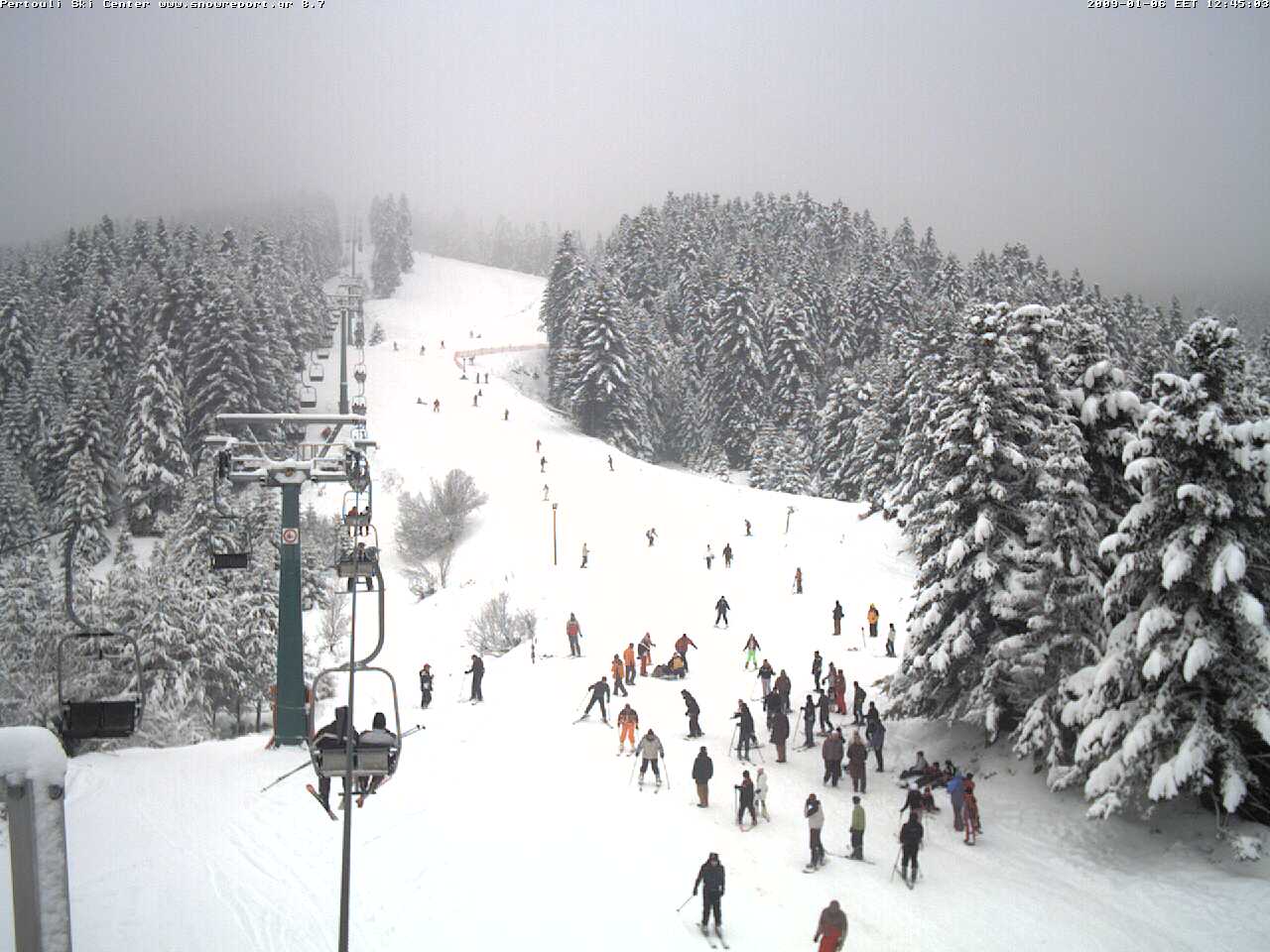
It is one of the most easily accessible in the country, just 45min from the city of Trikala (40 km), right between Elati and Pertouli (Thessaly Region).
Check current ski conditions at Snow Report Pertouli
Places to stay — Pertouli
Swipe to see all 5 places to stay →
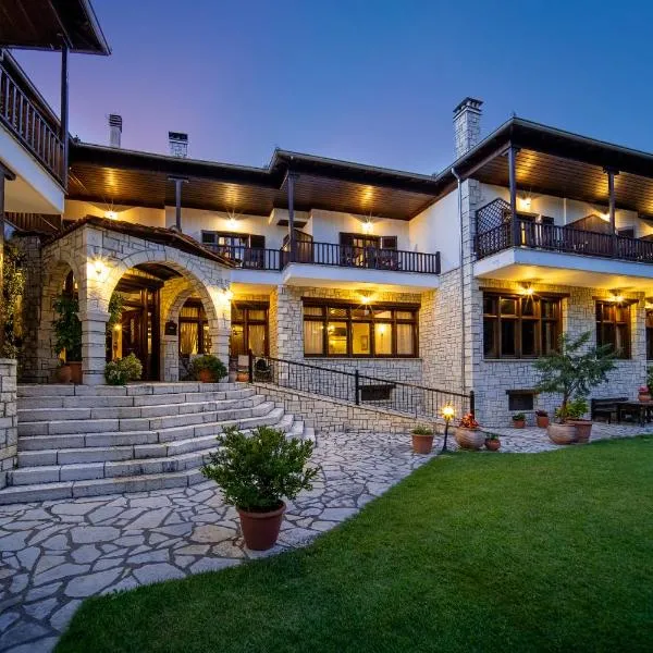 Hotel Giamandes
Elati Trikalon
Drive to ski centre: ≈ 8.6 km · 10 min
View on Booking.com ↗
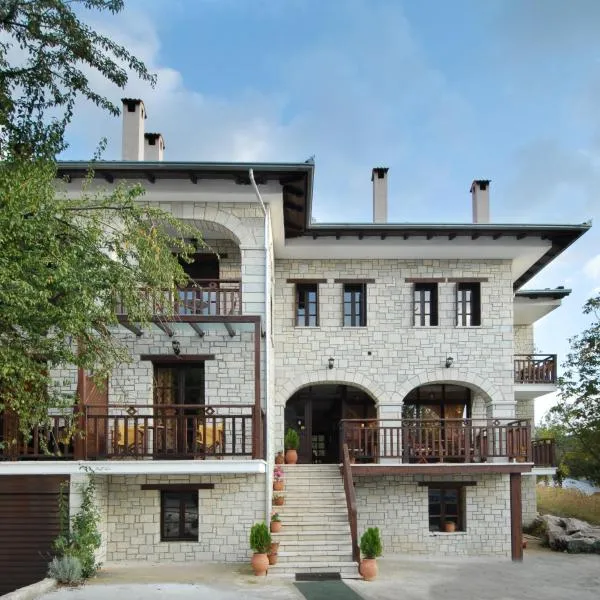 Mikri Arktos
Elati Trikalon
Drive to ski centre: ≈ 8.6 km · 10 min
View on Booking.com ↗
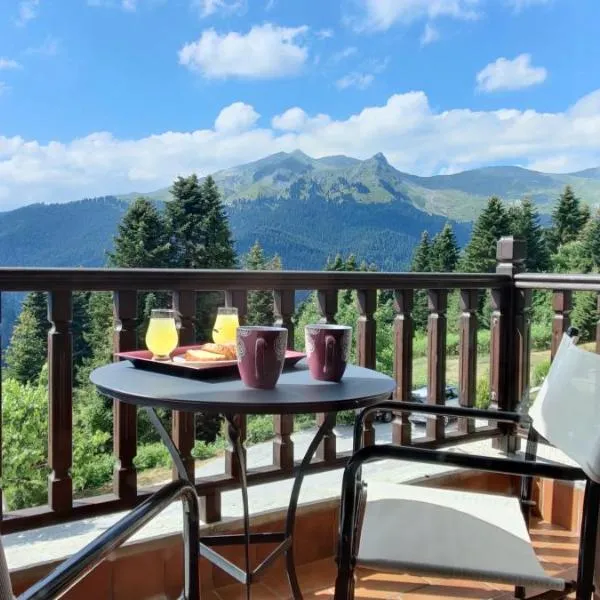 Magiossi Hotel
Neraïdochóri
Drive to ski centre: ≈ 8.6 km · 10 min
View on Booking.com ↗
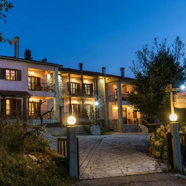 Hotel Kroupi
Elati Trikalon
Drive to ski centre: ≈ 8.6 km · 10 min
View on Booking.com ↗
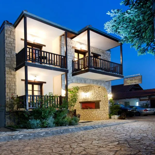 Fretzato
Elati Trikalon
Drive to ski centre: ≈ 8.2 km · 10 min
View on Booking.com ↗
Pertouli Ski Area - Top 1330
ECMWF · Model run: Next update expected:
Day Time (UTC) Temp. (°C) Humidity (%) Wind (km/h) Wind (knots) Wind (Bft) Direction Precip. (mm) Snow (cm) Pressure (hPa) Freezing (m) Conditions | Thursday, 05/11 06:00 4.9 99 10 5 2B E — — 1026 2312 Overcast 100% cloud 09:00 4.7 98 13 7 3B E 1.6 0 1028 2227 Overcast 100% cloud 12:00 4.8 98 12 6 2B E 1.3 0 1027 2234 Overcast 97% cloud 15:00 4.4 98 9 5 2B E 1.0 0 1026 2210 Overcast 97% cloud 18:00 4 99 8 4 2B E 0.80 0 1027 2187 Overcast 100% cloud 21:00 3.8 99 7 4 2B E 0.25 0 1027 2213 Overcast 99% cloud Friday, 06/11 00:00 3.5 98 8 4 2B NE 0.10 0 1026 2194 Overcast 99% cloud 03:00 3.1 98 8 4 2B NE 0 0 1025 2213 Overcast 92% cloud 06:00 3.2 95 7 4 2B NE 0 0 1024 2338 Cloudy 56% cloud 09:00 5.2 82 7 4 2B NE 0.12 0 1024 2544 Cloudy 78% cloud 12:00 6.9 76 6 3 1B NE 0 0 1021 2683 Partly cloudy 40% cloud 15:00 6.3 83 2 1 1B N 0 0 1021 2737 Clear 9% cloud 18:00 5.4 81 5 3 1B NW 0 0 1021 2836 Clear 3% cloud 21:00 5.2 78 7 4 2B N 0 0 1021 2818 Clear 0% cloud Saturday, 07/11 00:00 4.9 71 7 4 2B N 0 0 1022 2722 Clear 0% cloud 03:00 4.1 78 8 4 2B N 0 0 1022 2672 Clear 7% cloud 06:00 3.8 79 7 4 2B NE 0 0 1024 2539 Overcast 100% cloud 09:00 4.6 82 7 4 2B E 0 0 1025 2484 Cloudy 77% cloud 12:00 5.5 79 7 4 2B E 0 0 1024 2484 Partly cloudy 48% cloud 15:00 4.6 78 6 3 1B SE 0 0 1024 2476 Partly cloudy 44% cloud 18:00 3.3 85 5 3 1B E 0 0 1026 2343 Partly cloudy 40% cloud 21:00 2.6 88 6 3 2B E 0 0 1028 2163 Cloudy 58% cloud Sunday, 08/11 00:00 1.9 97 8 4 2B E 0 0 1029 1926 Overcast 98% cloud 03:00 1.9 98 11 6 2B E 0.10 0 1029 1814 Overcast 99% cloud 06:00 2 97 12 6 2B E 0.22 0 1030 1719 Overcast 96% cloud 09:00 3.2 88 11 6 2B E 0.12 0 1031 1859 Overcast 84% cloud 12:00 3.8 87 7 4 2B E 0.22 0 1030 2061 Cloudy 75% cloud 15:00 3.5 86 5 3 1B E 0.10 0 1030 2192 Overcast 85% cloud 18:00 3.1 81 3 1 1B E 0 0 1031 2252 Cloudy 71% cloud 21:00 2.7 79 3 1 1B E 0 0 1031 2354 Cloudy 72% cloud Monday, 09/11 00:00 2.9 78 3 1 1B SE 0 0 1030 2377 Overcast 92% cloud 03:00 3.6 77 4 2 1B S 0 0 1029 2399 Overcast 86% cloud 06:00 3.9 83 4 2 1B S 0.56 0 1030 2426 Overcast 100% cloud 09:00 4.9 88 6 3 1B S 3.5 0 1030 2526 Overcast 100% cloud 12:00 4.8 93 6 3 2B S 1.3 0 1029 2542 Overcast 100% cloud 15:00 4.9 99 7 4 2B SW 0.98 0 1027 2538 Overcast 100% cloud 18:00 5.4 99 9 5 2B SW 1.2 0 1027 2602 Overcast 100% cloud 21:00 5.8 99 10 6 2B SW 0.32 0 1026 2640 Overcast 93% cloud Tuesday, 10/11 00:00 5.7 99 10 6 2B SW 0.10 0 1026 2758 Overcast 89% cloud 03:00 5.6 96 10 5 2B W 0 0 1025 2824 Overcast 85% cloud 06:00 5.8 88 9 5 2B W 0 0 1025 2902 Cloudy 60% cloud 09:00 8.2 82 10 6 2B SW 0 0 1024 3046 Partly cloudy 48% cloud 12:00 9.7 72 14 7 3B SW 0 0 1021 3117 Overcast 84% cloud 15:00 8.3 81 12 7 2B SW 0.00 0 1021 3111 Overcast 96% cloud 18:00 7.3 88 13 7 3B W 0 0 1021 3111 Overcast 98% cloud 21:00 7.4 91 16 9 3B W 0 0 1021 3111 Overcast 99% cloud Wednesday, 11/11 00:00 7.8 92 17 9 3B W 0 0 1020 3102 Overcast 97% cloud 03:00 8.1 92 17 9 3B W 0.20 0 1019 2990 Overcast 99% cloud 06:00 8.1 93 16 9 3B SW 0.00 0 1019 3095 Overcast 100% cloud |
|---|
Forecast notes
Forecast table times: UTC.
Coordinates: 39.54598°N, 21.49869°E · Requested elevation: 1330 m. Model terrain: 992 m. Terrain and 1000/925/850/700 hPa profiles are used for height estimates.
These are altitude estimates, not a simulation of local mountain terrain. Precipitation, cloud and sea-level pressure use horizontal interpolation only.
Precipitation includes rain and snow water equivalent: preceding 3 hours through day 6, then 6 hours (see cell tooltip). Snow (cm) estimates fresh snowfall from precipitation and temperature using the GFS conversion; it is not snow depth on the ground. Freezing (m) uses additional 600/500 hPa temperatures when available and estimates the lowest resolved 0°C crossing above sea level. When all sampled levels are warm, the upper profile limit is shown (see tooltip). < marks an entirely cold sampled profile and its lower height limit. No extrapolation is used.