Falakro · Chionotrypa 2100 m · Meteolive
Press play to connect.
Open camera page ↗
Each colour starts at the value shown. Wind colours match across all three units. Dry cells stay neutral. Colours describe the displayed values, not official weather warnings.
ECMWF · Model run: Next update expected:
Day Time (UTC) Temp. (°C) Humidity (%) Wind (km/h) Wind (knots) Wind (Bft) Direction Precip. (mm) Snow (cm) Pressure (hPa) Freezing (m) Conditions | Thursday, 05/11 06:00 1.8 96 10 5 2B N — — 1027 2060 Overcast 100% cloud  09:00 1.2 95 9 5 2B N 0.38 0 1028 1969 Overcast 100% cloud 12:00 1.2 96 11 6 2B NW 0.55 0 1028 1958 Overcast 100% cloud 15:00 1.3 93 12 7 3B N 0.32 0 1027 1988 Overcast 100% cloud 18:00 0.9 87 12 7 3B N 0.09 0 1027 1949 Overcast 100% cloud 21:00 0.5 81 11 6 2B N 0.09 0 1027 1855 Overcast 98% cloud Friday, 06/11 00:00 0.3 82 14 7 3B NW 0.03 0 1026 1825 Overcast 87% cloud 03:00 0.1 79 15 8 3B NW 0.07 0 1025 1778 Overcast 81% cloud 06:00 0.1 65 14 7 3B N 0 0 1025 1776 Cloudy 73% cloud  09:00 1 50 10 6 2B N 0 0 1024 2050 Partly cloudy 24% cloud  12:00 2.5 61 8 4 2B NW 0 0 1021 2356 Partly cloudy 30% cloud 15:00 3.3 59 11 6 2B NW 0 0 1020 2528 Clear 13% cloud  18:00 3.1 61 12 7 3B N 0 0 1021 2478 Partly cloudy 40% cloud 21:00 2.8 54 14 7 3B N 0 0 1022 2358 Partly cloudy 37% cloud Saturday, 07/11 00:00 2.1 53 14 8 3B N 0 0 1023 2241 Partly cloudy 41% cloud 03:00 1 56 11 6 2B N 0 0 1023 2047 Partly cloudy 45% cloud 06:00 0.3 59 7 4 2B NW 0 0 1025 1841 Clear 19% cloud 09:00 0.2 74 10 5 2B NW 0 0 1025 1791 Partly cloudy 49% cloud 12:00 1.2 75 7 4 2B NW 0 0 1024 2011 Partly cloudy 37% cloud 15:00 1.2 78 6 3 2B NW 0 0 1025 2012 Clear 15% cloud 18:00 0.2 84 7 4 2B N 0 0 1027 1784 Partly cloudy 47% cloud 21:00 -0.6 87 6 3 2B N 0 0 1029 1573 Cloudy 74% cloud Sunday, 08/11 00:00 -1.1 88 9 5 2B NW 0 0 1030 1456 Overcast 81% cloud 03:00 -1.2 90 13 7 3B NW 0 0 1030 1410 Overcast 97% cloud 06:00 -1.3 91 12 6 2B NW 0 0 1031 1416 Overcast 95% cloud 09:00 -0.9 80 8 4 2B NW 0 0 1031 1531 Cloudy 66% cloud 12:00 0.3 76 8 4 2B NW 0 0 1030 1826 Clear 17% cloud 15:00 0.8 76 6 3 2B NW 0 0 1030 1944 Clear 2% cloud 18:00 0.7 74 5 3 1B NW 0 0 1031 1912 Clear 8% cloud 21:00 1 68 5 3 1B W 0 0 1031 1992 Clear 6% cloud Monday, 09/11 00:00 1.5 61 5 2 1B W 0 0 1031 2121 Partly cloudy 30% cloud 03:00 1.9 56 3 2 1B W 0 0 1030 2183 Overcast 83% cloud 06:00 1.7 57 6 3 1B SW 0 0 1031 2143 Overcast 94% cloud 09:00 1.7 53 9 5 2B SW 0 0 1031 2136 Partly cloudy 31% cloud 12:00 1.9 60 10 5 2B W 0 0 1028 2188 Clear 10% cloud 15:00 2.5 65 10 6 2B W 0 0 1027 2260 Overcast 82% cloud 18:00 2.6 69 10 6 2B W 0.34 0 1027 2261 Clear 10% cloud 21:00 2.4 78 13 7 3B W 0 0 1027 2268 Clear 18% cloud Tuesday, 10/11 00:00 2.7 83 16 9 3B W 0.07 0 1026 2302 Clear 9% cloud 03:00 2.9 83 16 9 3B W 0 0 1026 2299 Clear 10% cloud 06:00 3.3 78 13 7 3B W 0 0 1026 2362 Cloudy 56% cloud 09:00 3.3 78 13 7 3B W 0 0 1025 2439 Clear 10% cloud 12:00 3.8 82 13 7 3B W 0 0 1022 2645 Cloudy 53% cloud 15:00 4.4 76 15 8 3B W 0 0 1022 2827 Cloudy 75% cloud 18:00 4.4 72 16 9 3B W 0 0 1022 2863 Cloudy 72% cloud 21:00 4.2 78 18 10 3B W 0 0 1022 2849 Overcast 91% cloud Wednesday, 11/11 00:00 4.3 81 22 12 4B W 0 0 1021 2918 Overcast 95% cloud 03:00 4.7 84 24 13 4B W 0 0 1019 2917 Overcast 92% cloud 06:00 5.6 79 21 11 4B W 0 0 1020 2972 Overcast 91% cloud |
|---|
Forecast table times: UTC.
Coordinates: 41.30587°N, 24.069306°E · Requested elevation: 1730 m. Model terrain: 740 m. Terrain and 1000/925/850/700 hPa profiles are used for height estimates.
These are altitude estimates, not a simulation of local mountain terrain. Precipitation, cloud and sea-level pressure use horizontal interpolation only.
Precipitation includes rain and snow water equivalent: preceding 3 hours through day 6, then 6 hours (see cell tooltip). Snow (cm) estimates fresh snowfall from precipitation and temperature using the GFS conversion; it is not snow depth on the ground. Freezing (m) uses additional 600/500 hPa temperatures when available and estimates the lowest resolved 0°C crossing above sea level. When all sampled levels are warm, the upper profile limit is shown (see tooltip). < marks an entirely cold sampled profile and its lower height limit. No extrapolation is used.
Source: ECMWF · CC BY 4.0 · Processed by Snow Report.
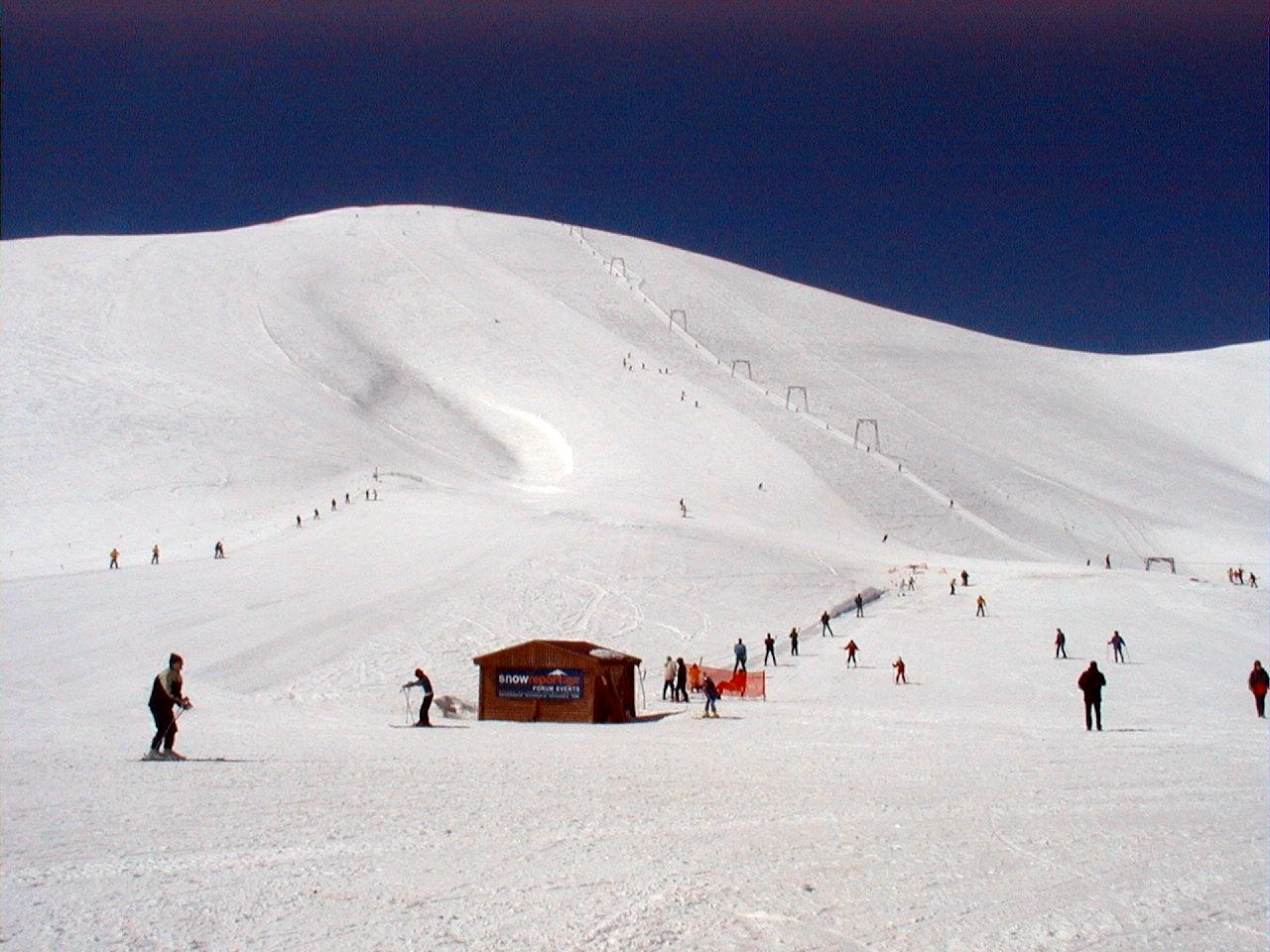
Falakro is a mountain ski destination in the Drama region of northern Greece. Its four-seat chairlift and the named sectors Pappous, Mesta, Kartalka and Chionotrypa provide useful reference points when consulting a lift report. The high mountain setting makes it worth looking beyond the forecast symbol: visibility and wind can shape a day on the slopes even when the weather appears dry.
The three forecast reference points here are the base at 1,730 m, a middle point at 2,080 m and Profitis Ilias at 2,200 m. Select the elevation closest to your plans, rather than treating the base forecast as a description of the entire mountain. During a change in the weather, compare precipitation timing, temperature and fresh snowfall at these elevations to see where conditions may differ.
The linked SnowReport.gr page brings together published operating information and cameras for Falakro. Check the report’s date and the image timestamp before relying on either for a journey. Snow predicted by a model is separate from the snow already on the ground; it also does not establish that the access road or a particular lift is open.
Sources: SnowReport.gr — Falakro. Reviewed 18 October 2026.
Swipe to see all 5 places to stay →
 Hotel Epavlis
Drama
Drive to ski centre: ≈ 38.8 km · 49 min
View on Booking.com ↗
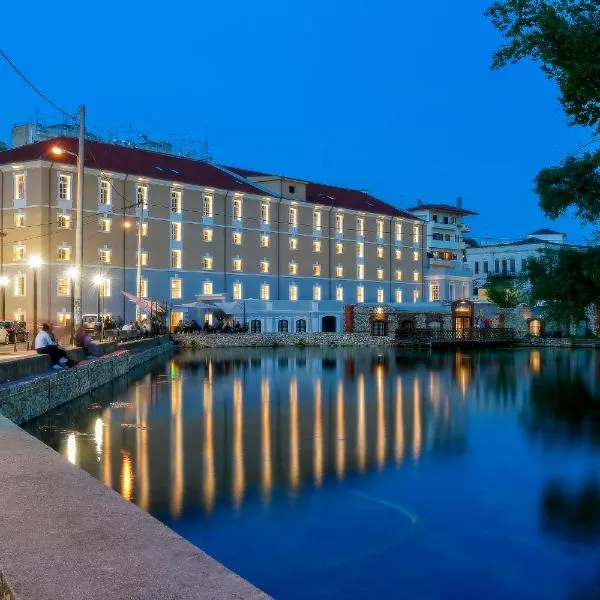 Hydrama Grand Hotel
Drama
Drive to ski centre: ≈ 44.7 km · 56 min
View on Booking.com ↗
 Aya Hotel
Drama
Drive to ski centre: ≈ 45.2 km · 56 min
View on Booking.com ↗
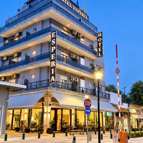 ESPERIA Drama HOTEL
Drama
Drive to ski centre: ≈ 45.2 km · 56 min
View on Booking.com ↗
 Diamond City Living
Drama
Drive to ski centre: ≈ 45.8 km · 57 min
View on Booking.com ↗
Press play to connect.
Open camera page ↗ECMWF · Model run: Next update expected:
Day Time (UTC) Temp. (°C) Humidity (%) Wind (km/h) Wind (knots) Wind (Bft) Direction Precip. (mm) Snow (cm) Pressure (hPa) Freezing (m) Conditions | Thursday, 05/11 06:00 -0.1 96 11 6 2B N — — 1027 2058 Overcast 100% cloud 09:00 -0.6 96 12 6 2B N 0.38 0.1 1028 1967 Overcast 100% cloud 12:00 -0.7 97 15 8 3B NW 0.56 0.2 1028 1952 Overcast 100% cloud 15:00 -0.5 91 17 9 3B N 0.32 0.1 1027 1985 Overcast 100% cloud 18:00 -0.6 77 17 9 3B N 0.09 0 1027 1945 Overcast 100% cloud 21:00 -0.9 70 15 8 3B N 0.09 0 1027 1854 Overcast 97% cloud Friday, 06/11 00:00 -0.8 66 16 9 3B N 0.03 0 1026 1821 Overcast 89% cloud 03:00 -0.8 63 17 9 3B N 0.07 0 1025 1779 Overcast 84% cloud 06:00 -0.8 52 16 9 3B N 0 0 1025 1782 Cloudy 76% cloud 09:00 -0.1 44 15 8 3B N 0 0 1024 2051 Partly cloudy 25% cloud 12:00 1.1 54 14 7 3B N 0 0 1021 2350 Partly cloudy 32% cloud 15:00 1.8 52 17 9 3B NW 0 0 1020 2527 Clear 13% cloud 18:00 1.6 53 19 10 3B N 0 0 1021 2476 Partly cloudy 40% cloud 21:00 1.2 48 19 10 3B N 0 0 1022 2357 Partly cloudy 36% cloud Saturday, 07/11 00:00 0.7 46 19 10 3B N 0 0 1023 2239 Partly cloudy 41% cloud 03:00 -0.1 46 18 10 3B N 0 0 1023 2044 Partly cloudy 45% cloud 06:00 -0.7 47 15 8 3B N 0 0 1025 1835 Clear 19% cloud 09:00 -1 59 14 8 3B NW 0 0 1025 1785 Partly cloudy 49% cloud 12:00 -0.4 63 13 7 3B NW 0 0 1024 1998 Partly cloudy 38% cloud 15:00 -0.4 65 14 8 3B N 0 0 1025 2001 Clear 16% cloud 18:00 -1.2 70 15 8 3B N 0 0 1027 1776 Partly cloudy 45% cloud 21:00 -1.9 73 12 6 2B N 0 0 1029 1567 Cloudy 73% cloud Sunday, 08/11 00:00 -2.3 73 13 7 3B N 0 0 1030 1456 Cloudy 79% cloud 03:00 -2.3 75 16 8 3B N 0 0 1030 1409 Overcast 97% cloud 06:00 -2.4 77 14 7 3B N 0 0 1031 1416 Overcast 94% cloud 09:00 -2 68 10 6 2B N 0 0 1031 1531 Cloudy 66% cloud 12:00 -0.9 66 10 5 2B NW 0 0 1030 1818 Clear 17% cloud 15:00 -0.5 66 8 4 2B NW 0 0 1030 1940 Clear 2% cloud 18:00 -0.6 65 6 3 2B NW 0 0 1031 1910 Clear 7% cloud 21:00 -0.3 60 6 3 2B NW 0 0 1031 1996 Clear 6% cloud Monday, 09/11 00:00 0.2 55 5 3 1B W 0 0 1031 2123 Partly cloudy 31% cloud 03:00 0.4 50 5 3 1B W 0 0 1030 2184 Overcast 83% cloud 06:00 0.3 50 6 4 2B W 0 0 1031 2143 Overcast 94% cloud 09:00 0.2 47 10 5 2B W 0 0 1031 2136 Partly cloudy 34% cloud 12:00 0.4 55 11 6 2B W 0 0 1028 2190 Clear 10% cloud 15:00 0.9 63 12 7 2B W 0 0 1027 2261 Overcast 82% cloud 18:00 0.9 72 14 8 3B W 0.36 0.1 1027 2263 Clear 10% cloud 21:00 0.9 79 16 9 3B W 0 0 1027 2272 Clear 18% cloud Tuesday, 10/11 00:00 1 82 18 10 3B W 0.07 0 1026 2302 Clear 9% cloud 03:00 1.1 81 19 10 3B W 0 0 1026 2301 Clear 11% cloud 06:00 1.5 76 16 9 3B W 0 0 1026 2364 Cloudy 54% cloud 09:00 1.7 73 16 9 3B W 0 0 1025 2438 Clear 10% cloud 12:00 2.3 75 17 9 3B W 0 0 1022 2644 Cloudy 52% cloud 15:00 3 69 19 10 3B W 0 0 1022 2825 Cloudy 75% cloud 18:00 3 65 21 11 4B W 0 0 1022 2864 Cloudy 72% cloud 21:00 2.9 70 22 12 4B W 0 0 1022 2849 Overcast 91% cloud Wednesday, 11/11 00:00 3.1 75 26 14 4B W 0 0 1021 2917 Overcast 95% cloud 03:00 3.3 82 28 15 4B W 0 0 1019 2917 Overcast 92% cloud 06:00 4 79 25 14 4B W 0 0 1019 2971 Overcast 92% cloud |
|---|
Forecast table times: UTC.
Coordinates: 41.29765°N, 24.083715°E · Requested elevation: 2080 m. Model terrain: 737 m. Terrain and 1000/925/850/700 hPa profiles are used for height estimates.
These are altitude estimates, not a simulation of local mountain terrain. Precipitation, cloud and sea-level pressure use horizontal interpolation only.
Precipitation includes rain and snow water equivalent: preceding 3 hours through day 6, then 6 hours (see cell tooltip). Snow (cm) estimates fresh snowfall from precipitation and temperature using the GFS conversion; it is not snow depth on the ground. Freezing (m) uses additional 600/500 hPa temperatures when available and estimates the lowest resolved 0°C crossing above sea level. When all sampled levels are warm, the upper profile limit is shown (see tooltip). < marks an entirely cold sampled profile and its lower height limit. No extrapolation is used.
Source: ECMWF · CC BY 4.0 · Processed by Snow Report.
ECMWF · Model run: Next update expected:
Day Time (UTC) Temp. (°C) Humidity (%) Wind (km/h) Wind (knots) Wind (Bft) Direction Precip. (mm) Snow (cm) Pressure (hPa) Freezing (m) Conditions | Thursday, 05/11 06:00 -0.8 95 12 6 2B NW — — 1027 2056 Overcast 100% cloud 09:00 -1.2 96 13 7 3B NW 0.39 0.1 1028 1966 Overcast 100% cloud 12:00 -1.3 98 17 9 3B NW 0.56 0.2 1028 1949 Overcast 100% cloud 15:00 -1.1 90 19 10 3B N 0.31 0.1 1027 1984 Overcast 100% cloud 18:00 -1.1 74 18 10 3B N 0.09 0 1027 1942 Overcast 99% cloud 21:00 -1.3 66 16 9 3B N 0.09 0 1027 1852 Overcast 97% cloud Friday, 06/11 00:00 -1.2 61 17 9 3B N 0.04 0 1026 1818 Overcast 90% cloud 03:00 -1.2 57 18 10 3B N 0.06 0 1025 1780 Overcast 85% cloud 06:00 -1.1 48 17 9 3B N 0 0 1025 1786 Cloudy 77% cloud 09:00 -0.5 41 16 9 3B N 0 0 1024 2052 Partly cloudy 25% cloud 12:00 0.6 51 16 8 3B N 0 0 1021 2347 Partly cloudy 32% cloud 15:00 1.3 49 19 10 3B N 0 0 1020 2527 Clear 14% cloud 18:00 1.1 50 21 11 4B N 0 0 1021 2475 Partly cloudy 40% cloud 21:00 0.7 46 21 11 4B N 0 0 1022 2356 Partly cloudy 36% cloud Saturday, 07/11 00:00 0.2 43 20 11 4B N 0 0 1023 2238 Partly cloudy 41% cloud 03:00 -0.5 42 20 11 4B N 0 0 1023 2042 Partly cloudy 45% cloud 06:00 -1.1 43 17 9 3B N 0 0 1025 1830 Clear 20% cloud 09:00 -1.4 53 16 9 3B NW 0 0 1025 1784 Partly cloudy 48% cloud 12:00 -0.9 58 15 8 3B N 0 0 1024 1991 Partly cloudy 39% cloud 15:00 -0.9 61 17 9 3B N 0 0 1025 1994 Clear 16% cloud 18:00 -1.7 65 17 9 3B N 0 0 1027 1771 Partly cloudy 44% cloud 21:00 -2.4 67 14 8 3B N 0 0 1029 1563 Cloudy 72% cloud Sunday, 08/11 00:00 -2.8 68 15 8 3B N 0 0 1030 1456 Cloudy 78% cloud 03:00 -2.7 69 17 9 3B N 0 0 1030 1407 Overcast 97% cloud 06:00 -2.7 71 15 8 3B N 0 0 1032 1415 Overcast 94% cloud 09:00 -2.4 63 11 6 2B N 0 0 1031 1531 Cloudy 66% cloud 12:00 -1.3 62 11 6 2B NW 0 0 1030 1815 Clear 16% cloud 15:00 -1 62 8 4 2B NW 0 0 1030 1937 Clear 2% cloud 18:00 -1.1 61 7 4 2B NW 0 0 1031 1909 Clear 7% cloud 21:00 -0.8 57 6 3 2B NW 0 0 1031 1999 Clear 6% cloud Monday, 09/11 00:00 -0.3 53 5 3 1B W 0 0 1031 2125 Partly cloudy 31% cloud 03:00 -0.1 48 5 3 1B W 0 0 1030 2185 Overcast 82% cloud 06:00 -0.3 47 7 4 2B W 0 0 1031 2142 Overcast 94% cloud 09:00 -0.3 45 10 6 2B W 0 0 1031 2137 Partly cloudy 37% cloud 12:00 -0 53 12 7 2B W 0 0 1028 2192 Clear 10% cloud 15:00 0.3 62 13 7 3B W 0 0 1027 2262 Overcast 83% cloud 18:00 0.3 73 15 8 3B W 0.38 0.1 1027 2264 Clear 11% cloud 21:00 0.3 80 17 9 3B W 0 0 1027 2274 Clear 18% cloud Tuesday, 10/11 00:00 0.5 82 19 10 3B W 0.06 0 1026 2302 Clear 9% cloud 03:00 0.5 81 20 11 4B W 0 0 1026 2302 Clear 11% cloud 06:00 0.8 74 17 9 3B NW 0 0 1026 2364 Cloudy 52% cloud 09:00 1.1 71 17 9 3B W 0 0 1025 2438 Clear 10% cloud 12:00 1.8 72 19 10 3B W 0 0 1022 2643 Cloudy 51% cloud 15:00 2.5 66 20 11 4B W 0 0 1022 2824 Cloudy 74% cloud 18:00 2.6 62 22 12 4B W 0 0 1022 2864 Cloudy 73% cloud 21:00 2.4 67 24 13 4B W 0 0 1022 2848 Overcast 92% cloud Wednesday, 11/11 00:00 2.6 74 27 15 4B W 0 0 1021 2916 Overcast 96% cloud 03:00 2.8 81 30 16 5B W 0 0 1019 2917 Overcast 92% cloud 06:00 3.5 78 27 14 4B W 0 0 1019 2970 Overcast 92% cloud |
|---|
Forecast table times: UTC.
Coordinates: 41.294228°N, 24.093693°E · Requested elevation: 2200 m. Model terrain: 736 m. Terrain and 1000/925/850/700 hPa profiles are used for height estimates.
These are altitude estimates, not a simulation of local mountain terrain. Precipitation, cloud and sea-level pressure use horizontal interpolation only.
Precipitation includes rain and snow water equivalent: preceding 3 hours through day 6, then 6 hours (see cell tooltip). Snow (cm) estimates fresh snowfall from precipitation and temperature using the GFS conversion; it is not snow depth on the ground. Freezing (m) uses additional 600/500 hPa temperatures when available and estimates the lowest resolved 0°C crossing above sea level. When all sampled levels are warm, the upper profile limit is shown (see tooltip). < marks an entirely cold sampled profile and its lower height limit. No extrapolation is used.