Camera 1
Press play to connect.

Each colour starts at the value shown. Wind colours match across all three units. Dry cells stay neutral. Colours describe the displayed values, not official weather warnings.
ECMWF · Model run: Next update expected:
Day Time (UTC) Temp. (°C) Humidity (%) Wind (km/h) Wind (knots) Wind (Bft) Direction Precip. (mm) Snow (cm) Pressure (hPa) Freezing (m) Conditions | Thursday, 05/11 06:00 3 96 9 5 2B E — — 1026 2336 Overcast 99% cloud  09:00 3.1 97 10 5 2B E 0.09 0 1027 2278 Overcast 99% cloud 12:00 3.9 88 9 5 2B E 0.27 0 1026 2390 Overcast 100% cloud 15:00 3.5 92 8 4 2B E 0.16 0 1026 2343 Overcast 90% cloud 18:00 2.7 96 9 5 2B E 0.01 0 1027 2275 Overcast 92% cloud 21:00 2.4 94 9 5 2B NE 0.02 0 1027 2295 Overcast 95% cloud Friday, 06/11 00:00 2.2 92 8 4 2B NE 0.01 0 1026 2315 Overcast 99% cloud 03:00 1.9 92 8 4 2B NE 0.04 0 1025 2333 Overcast 93% cloud 06:00 1.9 89 6 3 2B NE 0 0 1025 2420 Overcast 95% cloud 09:00 3.9 75 5 3 1B NE 0.04 0 1023 2671 Partly cloudy 30% cloud  12:00 6.5 59 7 4 2B N 0 0 1020 2772 Clear 15% cloud  15:00 5.9 65 7 4 2B N 0 0 1020 2793 Clear 18% cloud 18:00 5.4 68 7 4 2B N 0 0 1021 2848 Clear 1% cloud 21:00 5 68 8 4 2B N 0 0 1021 2820 Clear 8% cloud Saturday, 07/11 00:00 4.6 70 7 4 2B N 0 0 1022 2723 Clear 0% cloud 03:00 4.1 68 7 4 2B NE 0 0 1022 2670 Cloudy 52% cloud  06:00 3.3 63 8 4 2B NE 0 0 1023 2595 Overcast 99% cloud 09:00 3.5 58 6 3 1B E 0 0 1024 2582 Overcast 99% cloud 12:00 4 68 6 3 1B E 0 0 1023 2549 Overcast 95% cloud 15:00 3.5 78 5 3 1B E 0 0 1024 2488 Partly cloudy 27% cloud 18:00 2.7 80 8 4 2B E 0 0 1025 2377 Clear 4% cloud 21:00 2 77 8 5 2B E 0 0 1027 2214 Partly cloudy 43% cloud Sunday, 08/11 00:00 1.3 83 12 7 2B E 0 0 1028 1344 Cloudy 68% cloud 03:00 0.6 90 14 7 3B E 0 0 1029 1819 Overcast 99% cloud 06:00 0.3 93 15 8 3B SE 0 0 1030 1752 Overcast 99% cloud 09:00 1.2 89 11 6 2B SE 0.06 0 1030 1953 Cloudy 63% cloud 12:00 3.3 75 7 4 2B SE 0 0 1028 2314 Partly cloudy 29% cloud 15:00 2.8 84 5 3 1B SE 0 0 1029 2269 Partly cloudy 27% cloud 18:00 2.9 82 4 2 1B SE 0 0 1030 2286 Cloudy 67% cloud 21:00 3.1 79 5 3 1B SE 0 0 1030 2346 Overcast 98% cloud Monday, 09/11 00:00 3.8 75 5 3 1B SE 0 0 1029 2407 Overcast 100% cloud 03:00 3.8 76 5 3 1B S 0.08 0 1028 2411 Overcast 100% cloud 06:00 3.9 79 8 4 2B S 0.33 0 1029 2428 Overcast 82% cloud 09:00 4.5 87 10 6 2B SW 2.8 0 1029 2527 Overcast 100% cloud 12:00 4.4 93 8 4 2B SW 3.4 0 1027 2536 Overcast 100% cloud 15:00 4.2 98 9 5 2B SW 1.7 0 1026 2518 Overcast 100% cloud 18:00 4.5 98 12 6 2B SW 1.1 0 1026 2550 Overcast 100% cloud 21:00 4.8 98 14 7 3B SW 0.04 0 1026 2610 Overcast 98% cloud Tuesday, 10/11 00:00 4.9 97 15 8 3B SW 0.06 0 1025 2702 Overcast 100% cloud 03:00 4.6 95 14 8 3B W 0.03 0 1024 2793 Overcast 99% cloud 06:00 4.6 91 12 7 2B W 0 0 1025 3016 Overcast 81% cloud 09:00 5.7 84 15 8 3B W 0 0 1024 3097 Cloudy 79% cloud 12:00 7.2 72 16 9 3B W 0 0 1021 3112 Overcast 98% cloud 15:00 6.4 84 17 9 3B W 0 0 1021 3076 Overcast 94% cloud 18:00 5.8 92 17 9 3B W 0.12 0 1021 3014 Overcast 94% cloud 21:00 6 91 19 10 3B W 0 0 1022 3029 Overcast 99% cloud Wednesday, 11/11 00:00 6.4 92 20 11 4B W 0.22 0 1020 2946 Overcast 99% cloud 03:00 6.5 93 21 11 4B SW 0.38 0 1019 2956 Overcast 98% cloud 06:00 6.5 93 20 11 3B W 0 0 1019 3091 Overcast 97% cloud |
|---|
Forecast table times: UTC.
Coordinates: 40.05271°N, 21.100058°E · Requested elevation: 1640 m. Model terrain: 1278 m. Terrain and 1000/925/850/700 hPa profiles are used for height estimates.
These are altitude estimates, not a simulation of local mountain terrain. Precipitation, cloud and sea-level pressure use horizontal interpolation only.
Precipitation includes rain and snow water equivalent: preceding 3 hours through day 6, then 6 hours (see cell tooltip). Snow (cm) estimates fresh snowfall from precipitation and temperature using the GFS conversion; it is not snow depth on the ground. Freezing (m) uses additional 600/500 hPa temperatures when available and estimates the lowest resolved 0°C crossing above sea level. When all sampled levels are warm, the upper profile limit is shown (see tooltip). < marks an entirely cold sampled profile and its lower height limit. No extrapolation is used.
Source: ECMWF · CC BY 4.0 · Processed by Snow Report.
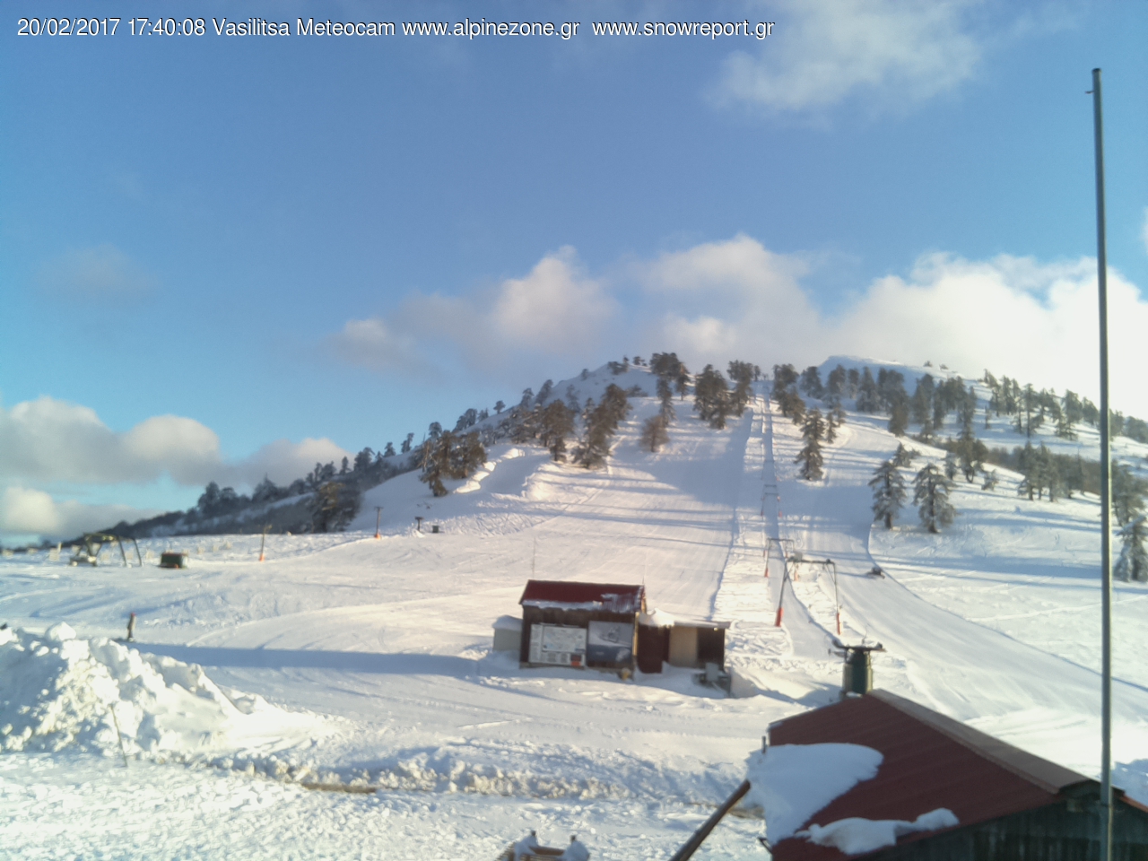
Vasilitsa brings skiing into the mountain landscape of the northern Pindus, with terrain on Vasilitsa and neighbouring Gomara. Its named lift areas, including Filippos, Elimeia and Tymfaia, are useful landmarks when reading an operating report or arranging where to meet. Conditions can differ between these parts of the mountain, so an overview for the resort is only the starting point for planning a ski day.
The forecast locations on this page represent the base at 1,640 m, a middle point at 1,805 m and an upper point at 2,105 m. Choose the point closest to the terrain you intend to use: a forecast for the base cannot describe every slope above it. When temperatures are close to freezing, compare temperature, the freezing level and fresh snowfall at the different elevations, together with the timing of precipitation.
Use the SnowReport.gr report below to check the latest published lift information and camera views, paying attention to its update date. Predicted snowfall does not confirm that a lift or road is open, and a camera image may cover only one part of the resort. For a trip into the Pindus, check access conditions as well as the mountain forecast before setting out.
Sources: SnowReport.gr — Vasilitsa. Reviewed 18 October 2026.
Swipe to see all 5 places to stay →
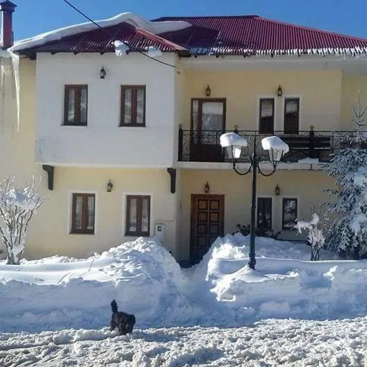 Natasa Rooms
Filippaioi
Drive to ski centre: ≈ 14.5 km · 19 min
View on Booking.com ↗
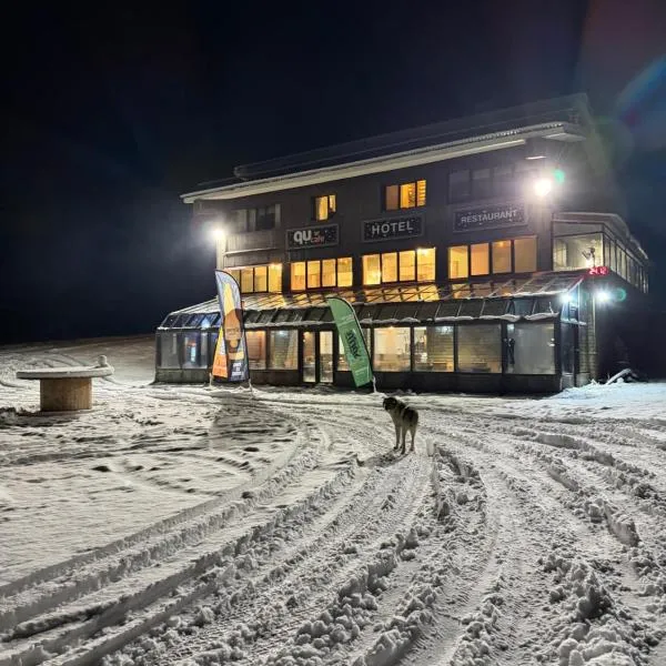 Chalet Vasilitsa
Grevena
Drive to ski centre: ≈ 2.4 km · 4 min
View on Booking.com ↗
 Guesthouse Chotos
Samarína
Drive to ski centre: ≈ 13.6 km · 19 min
View on Booking.com ↗
 Cozy cottage for 4
Lávdhas
Drive to ski centre: ≈ 16.6 km · 21 min
View on Booking.com ↗
 La Noi Guesthouse
Samarína
Drive to ski centre: ≈ 13.9 km · 20 min
View on Booking.com ↗
Press play to connect.
ECMWF · Model run: Next update expected:
Day Time (UTC) Temp. (°C) Humidity (%) Wind (km/h) Wind (knots) Wind (Bft) Direction Precip. (mm) Snow (cm) Pressure (hPa) Freezing (m) Conditions | Thursday, 05/11 06:00 2.3 93 7 4 2B E — — 1026 2342 Overcast 99% cloud 09:00 2.3 94 8 4 2B E 0.09 0 1027 2283 Overcast 99% cloud 12:00 3.1 86 6 4 2B E 0.27 0 1026 2398 Overcast 100% cloud 15:00 2.7 90 6 3 2B NE 0.16 0 1026 2349 Overcast 91% cloud 18:00 2 93 8 4 2B NE 0.01 0 1027 2277 Overcast 93% cloud 21:00 1.9 89 9 5 2B NE 0.02 0 1027 2300 Overcast 95% cloud Friday, 06/11 00:00 1.7 86 9 5 2B NE 0.01 0 1026 2322 Overcast 99% cloud 03:00 1.5 84 9 5 2B NE 0.04 0 1025 2336 Overcast 94% cloud 06:00 1.5 81 8 4 2B NE 0 0 1025 2423 Overcast 95% cloud 09:00 3.3 69 7 4 2B N 0.04 0 1023 2678 Partly cloudy 28% cloud 12:00 5.6 56 9 5 2B N 0 0 1020 2777 Clear 15% cloud 15:00 5.1 61 9 5 2B N 0 0 1020 2797 Clear 18% cloud 18:00 4.6 64 9 5 2B N 0 0 1021 2848 Clear 1% cloud 21:00 4.3 64 9 5 2B N 0 0 1021 2820 Clear 9% cloud Saturday, 07/11 00:00 3.9 65 7 4 2B N 0 0 1022 2724 Clear 0% cloud 03:00 3.4 64 7 4 2B NE 0 0 1022 2669 Cloudy 52% cloud 06:00 2.8 60 8 4 2B NE 0 0 1023 2599 Overcast 99% cloud 09:00 2.9 54 5 3 1B NE 0 0 1024 2588 Overcast 98% cloud 12:00 3.4 64 4 2 1B E 0 0 1023 2556 Overcast 95% cloud 15:00 2.8 74 4 2 1B E 0 0 1024 2495 Partly cloudy 28% cloud 18:00 2.2 76 6 3 2B E 0 0 1025 2383 Clear 4% cloud 21:00 1.5 74 6 3 2B E 0 0 1027 2221 Partly cloudy 44% cloud Sunday, 08/11 00:00 0.8 80 9 5 2B E 0 0 1028 1373 Cloudy 70% cloud 03:00 0.1 87 11 6 2B E 0 0 1029 1830 Overcast 99% cloud 06:00 -0.1 88 12 6 2B SE 0 0 1030 1766 Overcast 99% cloud 09:00 0.6 84 9 5 2B SE 0.06 0 1030 1966 Cloudy 61% cloud 12:00 2.6 72 4 2 1B E 0 0 1028 2327 Partly cloudy 27% cloud 15:00 2.2 82 2 1 1B E 0 0 1029 2280 Partly cloudy 26% cloud 18:00 2.2 81 1 0 0B S 0 0 1030 2292 Cloudy 69% cloud 21:00 2.4 79 2 1 1B SE 0 0 1030 2352 Overcast 99% cloud Monday, 09/11 00:00 3 77 4 2 1B S 0 0 1029 2411 Overcast 100% cloud 03:00 3.1 77 5 3 1B SW 0.09 0 1028 2415 Overcast 100% cloud 06:00 3.1 80 7 4 2B SW 0.32 0 1029 2432 Overcast 82% cloud 09:00 3.7 89 12 7 2B SW 2.8 0 1029 2530 Overcast 100% cloud 12:00 3.6 94 12 7 3B SW 3.5 0 1027 2537 Overcast 100% cloud 15:00 3.5 99 12 7 3B SW 1.7 0 1026 2520 Overcast 100% cloud 18:00 3.7 98 14 8 3B SW 1.1 0 1026 2551 Overcast 100% cloud 21:00 4 96 15 8 3B SW 0.04 0 1026 2610 Overcast 99% cloud Tuesday, 10/11 00:00 4.2 93 16 9 3B W 0.06 0 1025 2702 Overcast 100% cloud 03:00 4 90 15 8 3B W 0.03 0 1024 2796 Overcast 99% cloud 06:00 4 86 13 7 3B W 0 0 1025 3021 Overcast 82% cloud 09:00 5 80 15 8 3B W 0 0 1024 3100 Overcast 80% cloud 12:00 6.4 69 18 9 3B W 0 0 1021 3112 Overcast 98% cloud 15:00 5.6 81 19 10 3B W 0 0 1021 3076 Overcast 94% cloud 18:00 5 88 19 10 3B W 0.13 0 1021 3015 Overcast 95% cloud 21:00 5.2 88 20 11 3B W 0 0 1022 3030 Overcast 99% cloud Wednesday, 11/11 00:00 5.5 90 22 12 4B W 0.23 0 1020 2942 Overcast 99% cloud 03:00 5.7 91 22 12 4B W 0.41 0 1019 2953 Overcast 98% cloud 06:00 5.7 93 22 12 4B W 0 0 1019 3091 Overcast 97% cloud |
|---|
Forecast table times: UTC.
Coordinates: 40.047246°N, 21.09136°E · Requested elevation: 1805 m. Model terrain: 1298 m. Terrain and 1000/925/850/700 hPa profiles are used for height estimates.
These are altitude estimates, not a simulation of local mountain terrain. Precipitation, cloud and sea-level pressure use horizontal interpolation only.
Precipitation includes rain and snow water equivalent: preceding 3 hours through day 6, then 6 hours (see cell tooltip). Snow (cm) estimates fresh snowfall from precipitation and temperature using the GFS conversion; it is not snow depth on the ground. Freezing (m) uses additional 600/500 hPa temperatures when available and estimates the lowest resolved 0°C crossing above sea level. When all sampled levels are warm, the upper profile limit is shown (see tooltip). < marks an entirely cold sampled profile and its lower height limit. No extrapolation is used.
Source: ECMWF · CC BY 4.0 · Processed by Snow Report.
ECMWF · Model run: Next update expected:
Day Time (UTC) Temp. (°C) Humidity (%) Wind (km/h) Wind (knots) Wind (Bft) Direction Precip. (mm) Snow (cm) Pressure (hPa) Freezing (m) Conditions | Thursday, 05/11 06:00 1 86 4 2 1B NE — — 1026 2347 Overcast 99% cloud 09:00 0.9 90 4 2 1B NE 0.09 0 1027 2288 Overcast 99% cloud 12:00 1.6 82 2 1 1B NE 0.26 0 1026 2406 Overcast 100% cloud 15:00 1.2 86 6 3 2B N 0.16 0 1026 2355 Overcast 92% cloud 18:00 0.7 88 10 5 2B NE 0.01 0 1027 2280 Overcast 94% cloud 21:00 0.7 80 12 7 2B NE 0.02 0 1027 2304 Overcast 95% cloud Friday, 06/11 00:00 0.7 73 11 6 2B NE 0.01 0 1026 2328 Overcast 99% cloud 03:00 0.7 70 12 7 2B N 0.03 0 1025 2340 Overcast 94% cloud 06:00 0.8 67 12 7 2B N 0 0 1025 2427 Overcast 96% cloud 09:00 2.2 58 11 6 2B N 0.03 0 1023 2684 Partly cloudy 25% cloud 12:00 3.9 50 13 7 3B N 0 0 1020 2781 Clear 16% cloud 15:00 3.6 54 13 7 3B N 0 0 1020 2802 Clear 19% cloud 18:00 3.3 56 12 6 2B N 0 0 1021 2848 Clear 1% cloud 21:00 3 56 11 6 2B N 0 0 1021 2819 Clear 9% cloud Saturday, 07/11 00:00 2.6 57 8 4 2B N 0 0 1022 2725 Clear 0% cloud 03:00 2.2 56 8 4 2B N 0 0 1021 2668 Cloudy 52% cloud 06:00 1.8 53 8 4 2B N 0 0 1023 2603 Overcast 99% cloud 09:00 1.8 47 5 3 1B NE 0 0 1024 2594 Overcast 98% cloud 12:00 2.1 57 3 2 1B NE 0 0 1023 2563 Overcast 94% cloud 15:00 1.6 66 2 1 1B NE 0 0 1023 2501 Partly cloudy 29% cloud 18:00 1.1 69 3 2 1B NE 0 0 1025 2387 Clear 4% cloud 21:00 0.4 68 3 2 1B E 0 0 1027 2227 Partly cloudy 46% cloud Sunday, 08/11 00:00 -0.2 74 4 2 1B E 0 0 1028 1396 Cloudy 72% cloud 03:00 -0.9 81 5 3 1B E 0 0 1029 1346 Overcast 99% cloud 06:00 -1.1 80 6 3 2B SE 0 0 1030 1778 Overcast 99% cloud 09:00 -0.5 77 4 2 1B SE 0.05 0 1030 1977 Cloudy 60% cloud 12:00 1.2 68 2 1 1B NW 0 0 1028 2339 Partly cloudy 26% cloud 15:00 0.8 78 5 3 1B NW 0 0 1028 2291 Partly cloudy 24% cloud 18:00 0.9 79 5 3 1B NW 0 0 1030 2299 Cloudy 71% cloud 21:00 1.1 79 4 2 1B W 0 0 1030 2358 Overcast 99% cloud Monday, 09/11 00:00 1.5 80 5 3 1B SW 0 0 1029 2416 Overcast 100% cloud 03:00 1.6 78 6 3 2B W 0.09 0 1028 2418 Overcast 100% cloud 06:00 1.7 83 9 5 2B W 0.32 0 1029 2436 Overcast 82% cloud 09:00 2.2 91 16 9 3B SW 2.9 0 1029 2533 Overcast 100% cloud 12:00 2.2 96 20 11 4B SW 3.5 0 1027 2538 Overcast 100% cloud 15:00 2 99 18 10 3B W 1.8 0 1026 2522 Overcast 100% cloud 18:00 2.2 97 19 10 3B SW 1.2 0 1026 2551 Overcast 100% cloud 21:00 2.5 92 19 10 3B W 0.03 0 1026 2610 Overcast 99% cloud Tuesday, 10/11 00:00 2.8 85 19 10 3B W 0.07 0 1025 2702 Overcast 100% cloud 03:00 2.8 80 18 10 3B W 0.03 0 1024 2798 Overcast 99% cloud 06:00 3 77 15 8 3B W 0 0 1025 3026 Overcast 83% cloud 09:00 3.9 71 17 9 3B W 0 0 1024 3103 Overcast 81% cloud 12:00 4.9 63 20 11 4B W 0 0 1021 3112 Overcast 98% cloud 15:00 4.3 73 23 12 4B W 0 0 1021 3074 Overcast 94% cloud 18:00 3.8 81 22 12 4B W 0.13 0 1022 3015 Overcast 96% cloud 21:00 3.9 80 22 12 4B W 0 0 1022 3030 Overcast 99% cloud Wednesday, 11/11 00:00 4 85 24 13 4B W 0.23 0 1020 2939 Overcast 99% cloud 03:00 4.2 87 25 14 4B W 0.43 0 1019 2950 Overcast 98% cloud 06:00 4.4 93 27 15 4B W 0 0 1019 3091 Overcast 98% cloud |
|---|
Forecast table times: UTC.
Coordinates: 40.044289°N, 21.082248°E · Requested elevation: 2105 m. Model terrain: 1317 m. Terrain and 1000/925/850/700 hPa profiles are used for height estimates.
These are altitude estimates, not a simulation of local mountain terrain. Precipitation, cloud and sea-level pressure use horizontal interpolation only.
Precipitation includes rain and snow water equivalent: preceding 3 hours through day 6, then 6 hours (see cell tooltip). Snow (cm) estimates fresh snowfall from precipitation and temperature using the GFS conversion; it is not snow depth on the ground. Freezing (m) uses additional 600/500 hPa temperatures when available and estimates the lowest resolved 0°C crossing above sea level. When all sampled levels are warm, the upper profile limit is shown (see tooltip). < marks an entirely cold sampled profile and its lower height limit. No extrapolation is used.