Camera 1
Press play to connect.

Each colour starts at the value shown. Wind colours match across all three units. Dry cells stay neutral. Colours describe the displayed values, not official weather warnings.
ECMWF · Model run: Next update expected:
Day Time (UTC) Temp. (°C) Humidity (%) Wind (km/h) Wind (knots) Wind (Bft) Direction Precip. (mm) Snow (cm) Pressure (hPa) Freezing (m) Conditions | Thursday, 05/11 06:00 3.3 95 10 5 2B E — — 1026 2390 Overcast 97% cloud  09:00 3.3 96 10 6 2B E 0.39 0 1027 2315 Overcast 96% cloud 12:00 3.6 91 10 6 2B E 0.50 0 1026 2378 Overcast 95% cloud 15:00 3.1 93 7 4 2B E 0.22 0 1026 2307 Overcast 97% cloud 18:00 2.6 94 8 5 2B E 0.11 0 1027 2238 Overcast 98% cloud 21:00 2.5 92 9 5 2B NE 0 0 1027 2303 Overcast 96% cloud Friday, 06/11 00:00 2.1 91 8 4 2B NE 0 0 1026 2275 Overcast 96% cloud 03:00 1.9 89 9 5 2B NE 0 0 1025 2296 Overcast 96% cloud 06:00 2.1 81 7 4 2B NE 0 0 1024 2393 Overcast 91% cloud 09:00 3.8 76 5 3 1B NE 0 0 1023 2658 Clear 12% cloud  12:00 6.4 57 7 4 2B N 0 0 1020 2792 Partly cloudy 47% cloud  15:00 5.6 72 5 3 1B N 0 0 1020 2805 Clear 12% cloud 18:00 4.8 76 6 3 1B NW 0 0 1021 2829 Clear 3% cloud 21:00 5.1 74 7 4 2B N 0 0 1021 2820 Clear 2% cloud Saturday, 07/11 00:00 4.7 68 6 3 2B N 0 0 1021 2739 Clear 3% cloud 03:00 4.1 71 7 4 2B NE 0 0 1021 2700 Partly cloudy 49% cloud 06:00 3.1 69 7 4 2B NE 0 0 1023 2564 Overcast 99% cloud 09:00 3.5 71 5 3 1B NE 0 0 1024 2595 Cloudy 66% cloud  12:00 4.4 75 4 2 1B NE 0 0 1023 2596 Overcast 80% cloud 15:00 3.7 81 3 2 1B E 0 0 1024 2552 Cloudy 63% cloud 18:00 2.8 88 6 3 1B E 0 0 1026 2391 Overcast 95% cloud 21:00 2.1 87 6 3 2B E 0 0 1027 2239 Overcast 97% cloud Sunday, 08/11 00:00 1.2 84 10 6 2B E 0 0 1029 2010 Overcast 98% cloud 03:00 0.8 86 12 6 2B E 0 0 1029 1898 Overcast 96% cloud 06:00 0.6 85 13 7 3B E 0 0 1030 1844 Overcast 95% cloud 09:00 1.8 80 10 6 2B E 0 0 1030 2100 Partly cloudy 20% cloud 12:00 3.4 80 5 3 1B E 0 0 1028 2354 Clear 14% cloud 15:00 2.7 88 2 1 1B E 0 0 1029 2277 Cloudy 71% cloud 18:00 2.9 84 2 1 1B SE 0 0 1030 2317 Overcast 97% cloud 21:00 3.3 79 4 2 1B SE 0 0 1030 2380 Overcast 99% cloud Monday, 09/11 00:00 3.9 75 4 2 1B SE 0 0 1029 2436 Overcast 95% cloud 03:00 3.9 74 5 3 1B S 0 0 1028 2452 Overcast 100% cloud 06:00 3.9 77 7 4 2B S 1.2 0 1029 2434 Overcast 100% cloud 09:00 4.8 81 9 5 2B SW 4.9 0 1028 2551 Overcast 100% cloud 12:00 4.4 97 10 5 2B SW 2.7 0 1027 2563 Overcast 100% cloud 15:00 4.5 98 10 6 2B SW 1.8 0 1026 2560 Overcast 100% cloud 18:00 4.6 100 13 7 3B SW 1.3 0 1026 2559 Overcast 100% cloud 21:00 5.1 98 15 8 3B SW 0.87 0 1026 2627 Overcast 100% cloud Tuesday, 10/11 00:00 4.9 100 15 8 3B SW 0.01 0 1025 2739 Overcast 100% cloud 03:00 4.5 96 14 8 3B W 0 0 1025 2817 Overcast 100% cloud 06:00 4.7 84 11 6 2B W 0 0 1024 2926 Cloudy 73% cloud 09:00 5.9 82 14 7 3B W 0 0 1024 3104 Partly cloudy 23% cloud 12:00 7 71 16 9 3B W 0 0 1022 3115 Overcast 97% cloud 15:00 6.3 84 16 9 3B W 0.24 0 1021 3108 Overcast 99% cloud 18:00 5.7 93 17 9 3B W 0 0 1022 3070 Overcast 100% cloud 21:00 6 93 18 10 3B W 0 0 1022 3093 Overcast 100% cloud Wednesday, 11/11 00:00 6.4 96 20 11 3B W 0.02 0 1020 2994 Overcast 100% cloud 03:00 6.6 95 21 11 4B W 0.26 0 1019 3005 Overcast 98% cloud 06:00 6.5 97 19 10 3B W 0.02 0 1019 3093 Overcast 96% cloud |
|---|
Forecast table times: UTC.
Coordinates: 39.747685°N, 21.23153°E · Requested elevation: 1650 m. Model terrain: 1343 m. Terrain and 1000/925/850/700 hPa profiles are used for height estimates.
These are altitude estimates, not a simulation of local mountain terrain. Precipitation, cloud and sea-level pressure use horizontal interpolation only.
Precipitation includes rain and snow water equivalent: preceding 3 hours through day 6, then 6 hours (see cell tooltip). Snow (cm) estimates fresh snowfall from precipitation and temperature using the GFS conversion; it is not snow depth on the ground. Freezing (m) uses additional 600/500 hPa temperatures when available and estimates the lowest resolved 0°C crossing above sea level. When all sampled levels are warm, the upper profile limit is shown (see tooltip). < marks an entirely cold sampled profile and its lower height limit. No extrapolation is used.
Source: ECMWF · CC BY 4.0 · Processed by Snow Report.
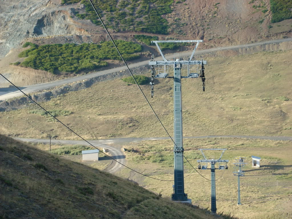
Anilio’s forecast is split between the base at 1,650 m and an upper point at 1,810 m. These are the two reference elevations used on this page, not a forecast for every slope or for the road from Metsovo. Select the point closest to your planned activity.
With only 160 metres between the two forecast points, small temperature differences still matter when precipitation falls near freezing. Compare temperature, precipitation timing and expected fresh snow at both elevations. Open the date for detailed intervals: a wet morning and a dry afternoon can be hidden by a single daily total. Model disagreement is a reason to revisit the forecast closer to departure.
Use the Anilio SnowReport bulletin and webcams to check published operating information and visible snow conditions, checking their timestamps. A road cannot be assumed clear because the forecast is dry, and predicted snowfall does not confirm that pistes or lifts are open. Check the latest access information before leaving; this forecast does not measure road ice or existing snow depth.
Forecast points and guidance reviewed 4 November 2026. Current bulletin and webcams: SnowReport.gr.
Swipe to see all 5 places to stay →
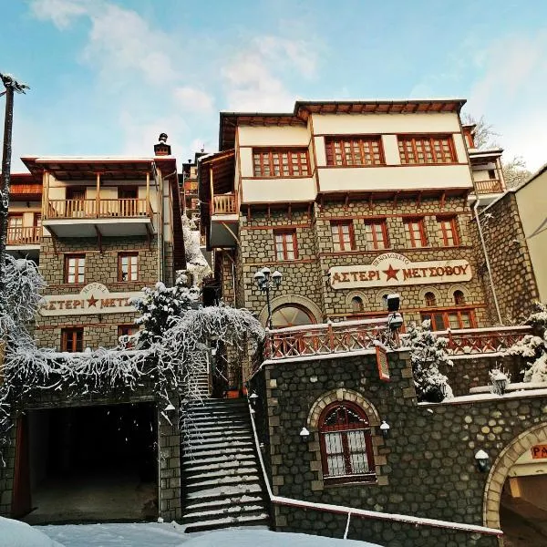 Asteri Metsovou
Metsovo
Drive to ski centre: ≈ 12.3 km · 20 min
View on Booking.com ↗
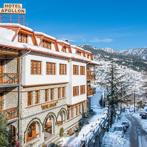 Hotel Apollon
Metsovo
Drive to ski centre: ≈ 11.9 km · 19 min
View on Booking.com ↗
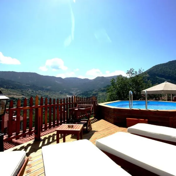 Archontiko Metsovou Luxury Boutique Spa Hotel
Metsovo
Drive to ski centre: ≈ 11.9 km · 19 min
View on Booking.com ↗
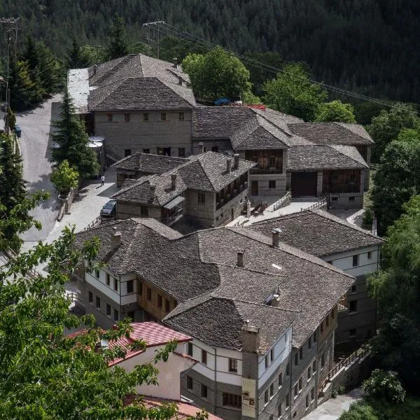 Katogi Averoff Hotel & Winery
Metsovo
Drive to ski centre: ≈ 12.0 km · 20 min
View on Booking.com ↗
 Hotel Kassaros
Metsovo
Drive to ski centre: ≈ 12.3 km · 19 min
View on Booking.com ↗
Press play to connect.
Press play to connect.
ECMWF · Model run: Next update expected:
Day Time (UTC) Temp. (°C) Humidity (%) Wind (km/h) Wind (knots) Wind (Bft) Direction Precip. (mm) Snow (cm) Pressure (hPa) Freezing (m) Conditions | Thursday, 05/11 06:00 2.6 92 7 4 2B E — — 1026 2397 Overcast 96% cloud 09:00 2.5 94 8 4 2B E 0.38 0 1027 2321 Overcast 95% cloud 12:00 2.8 88 7 4 2B E 0.48 0 1026 2384 Overcast 93% cloud 15:00 2.4 90 5 3 1B NE 0.22 0 1026 2313 Overcast 96% cloud 18:00 1.9 91 8 4 2B NE 0.11 0 1027 2246 Overcast 97% cloud 21:00 2 88 9 5 2B NE 0 0 1027 2311 Overcast 95% cloud Friday, 06/11 00:00 1.6 85 9 5 2B NE 0 0 1026 2285 Overcast 94% cloud 03:00 1.5 82 10 5 2B NE 0 0 1025 2304 Overcast 95% cloud 06:00 1.7 74 9 5 2B NE 0 0 1024 2402 Overcast 90% cloud 09:00 3.2 70 8 4 2B N 0 0 1023 2662 Clear 11% cloud 12:00 5.5 54 9 5 2B N 0 0 1020 2793 Partly cloudy 47% cloud 15:00 4.8 68 8 4 2B N 0 0 1020 2807 Clear 13% cloud 18:00 4.2 71 7 4 2B NW 0 0 1021 2829 Clear 3% cloud 21:00 4.4 69 9 5 2B N 0 0 1021 2820 Clear 3% cloud Saturday, 07/11 00:00 4 65 7 4 2B N 0 0 1021 2741 Clear 4% cloud 03:00 3.5 66 7 4 2B N 0 0 1021 2702 Partly cloudy 49% cloud 06:00 2.6 64 7 4 2B NE 0 0 1023 2570 Overcast 99% cloud 09:00 2.9 66 5 3 1B NE 0 0 1024 2598 Cloudy 64% cloud 12:00 3.7 71 4 2 1B NE 0 0 1023 2600 Cloudy 79% cloud 15:00 3.1 76 3 1 1B NE 0 0 1024 2557 Cloudy 62% cloud 18:00 2.2 83 4 2 1B E 0 0 1026 2396 Overcast 93% cloud 21:00 1.6 83 5 3 1B E 0 0 1027 2246 Overcast 96% cloud Sunday, 08/11 00:00 0.7 80 8 4 2B E 0 0 1029 2022 Overcast 97% cloud 03:00 0.3 82 9 5 2B E 0 0 1029 1915 Overcast 95% cloud 06:00 0.2 81 10 5 2B E 0 0 1030 1865 Overcast 94% cloud 09:00 1.2 77 7 4 2B E 0 0 1030 2113 Clear 20% cloud 12:00 2.7 77 3 2 1B NE 0 0 1028 2361 Clear 14% cloud 15:00 2.1 86 2 1 1B N 0 0 1029 2287 Cloudy 68% cloud 18:00 2.3 82 1 1 1B NW 0 0 1030 2322 Overcast 96% cloud 21:00 2.6 79 1 1 1B SE 0 0 1030 2384 Overcast 99% cloud Monday, 09/11 00:00 3.1 76 3 1 1B S 0 0 1029 2439 Overcast 96% cloud 03:00 3.2 76 5 3 1B SW 0 0 1028 2454 Overcast 100% cloud 06:00 3.1 79 7 4 2B SW 1.2 0 1029 2437 Overcast 100% cloud 09:00 4 83 11 6 2B SW 4.8 0 1028 2552 Overcast 100% cloud 12:00 3.7 97 14 7 3B SW 2.6 0 1027 2564 Overcast 100% cloud 15:00 3.7 97 14 7 3B SW 1.8 0 1026 2561 Overcast 100% cloud 18:00 3.8 100 16 9 3B SW 1.3 0 1026 2559 Overcast 100% cloud 21:00 4.3 96 17 9 3B SW 0.87 0 1026 2626 Overcast 100% cloud Tuesday, 10/11 00:00 4.2 96 17 9 3B W 0.01 0 1025 2738 Overcast 100% cloud 03:00 3.9 90 15 8 3B W 0 0 1025 2817 Overcast 100% cloud 06:00 4.1 80 12 7 2B W 0 0 1024 2928 Cloudy 74% cloud 09:00 5.2 78 14 8 3B W 0 0 1024 3105 Partly cloudy 25% cloud 12:00 6.3 68 17 9 3B W 0 0 1022 3115 Overcast 97% cloud 15:00 5.7 80 18 10 3B W 0.24 0 1021 3108 Overcast 99% cloud 18:00 5 89 19 10 3B W 0 0 1022 3066 Overcast 100% cloud 21:00 5.3 89 20 11 3B W 0 0 1022 3091 Overcast 100% cloud Wednesday, 11/11 00:00 5.7 93 21 11 4B W 0.02 0 1020 2990 Overcast 100% cloud 03:00 5.8 93 22 12 4B W 0.28 0 1019 2999 Overcast 98% cloud 06:00 5.8 96 21 11 4B W 0.03 0 1019 3093 Overcast 96% cloud |
|---|
Forecast table times: UTC.
Coordinates: 39.7420217°N, 21.2274527°E · Requested elevation: 1810 m. Model terrain: 1337 m. Terrain and 1000/925/850/700 hPa profiles are used for height estimates.
These are altitude estimates, not a simulation of local mountain terrain. Precipitation, cloud and sea-level pressure use horizontal interpolation only.
Precipitation includes rain and snow water equivalent: preceding 3 hours through day 6, then 6 hours (see cell tooltip). Snow (cm) estimates fresh snowfall from precipitation and temperature using the GFS conversion; it is not snow depth on the ground. Freezing (m) uses additional 600/500 hPa temperatures when available and estimates the lowest resolved 0°C crossing above sea level. When all sampled levels are warm, the upper profile limit is shown (see tooltip). < marks an entirely cold sampled profile and its lower height limit. No extrapolation is used.