Worldwide Ski Resort Forecasts

More
Colour guide Temperature · Wind · Rain · Snow
Each colour starts at the value shown. Wind colours match across all three units. Dry cells stay neutral. Colours describe the displayed values, not official weather warnings.
Lailias Ski Area - Chalet 1595
ECMWF · Model run: Next update expected:
Day Time (UTC) Temp. (°C) Humidity (%) Wind (km/h) Wind (knots) Wind (Bft) Direction Precip. (mm) Snow (cm) Pressure (hPa) Freezing (m) Conditions | Thursday, 05/11 06:00 2.7 100 6 4 2B N — — 1027 2078 Overcast 100% cloud  09:00 2.3 99 6 3 1B NW 0.76 0 1028 2022 Overcast 100% cloud 12:00 2.1 100 11 6 2B W 2.0 0 1028 1981 Overcast 100% cloud 15:00 2 99 14 8 3B NW 1.3 0 1027 2004 Overcast 99% cloud 18:00 1.7 94 13 7 3B N 0.22 0 1027 1979 Overcast 99% cloud 21:00 1.1 95 10 5 2B NW 0.34 0.1 1027 1906 Overcast 100% cloud Friday, 06/11 00:00 0.9 91 14 7 3B NW 0.43 0.1 1026 1870 Overcast 100% cloud 03:00 0.7 83 16 9 3B NW 0.13 0 1025 1836 Cloudy 51% cloud  06:00 0.6 73 14 7 3B NW 0 0 1025 1846 Cloudy 67% cloud 09:00 1.2 69 10 5 2B NW 0 0 1024 2042 Clear 10% cloud  12:00 2.7 60 13 7 3B NW 0 0 1021 2368 Clear 7% cloud 15:00 3.7 48 18 10 3B NW 0 0 1020 2559 Clear 5% cloud 18:00 4 50 16 8 3B N 0 0 1021 2552 Partly cloudy 31% cloud  21:00 3.5 55 11 6 2B N 0 0 1022 2443 Cloudy 59% cloud Saturday, 07/11 00:00 2.9 63 6 3 2B NE 0 0 1022 2335 Cloudy 62% cloud 03:00 1.7 69 3 2 1B E 0 0 1023 2146 Cloudy 71% cloud 06:00 0.8 84 5 3 1B SW 0 0 1025 1897 Cloudy 67% cloud 09:00 0.5 82 8 4 2B W 0.05 0 1025 1796 Cloudy 59% cloud 12:00 1.2 75 10 5 2B NW 0 0 1024 1935 Partly cloudy 33% cloud 15:00 1.8 66 12 7 3B NW 0 0 1025 2025 Clear 3% cloud 18:00 1.3 79 8 4 2B NW 0 0 1027 1900 Clear 10% cloud 21:00 0.2 97 2 1 1B N 0 0 1029 1651 Overcast 98% cloud Sunday, 08/11 00:00 -0.4 100 6 3 2B W 0.06 0 1029 1522 Overcast 100% cloud 03:00 -0.6 99 9 5 2B W 0.24 0 1030 1479 Overcast 100% cloud 06:00 -0.6 93 8 4 2B NW 0.10 0 1031 1474 Overcast 89% cloud 09:00 -0.3 91 11 6 2B W 0.00 0 1032 1555 Cloudy 70% cloud 12:00 0.4 81 10 5 2B NW 0.07 0 1030 1724 Partly cloudy 46% cloud 15:00 1.1 78 5 3 1B NW 0 0 1030 1904 Clear 17% cloud 18:00 1.2 79 4 2 1B NW 0 0 1031 1937 Clear 10% cloud 21:00 1.4 71 4 2 1B W 0 0 1031 1984 Partly cloudy 23% cloud Monday, 09/11 00:00 1.8 57 6 3 2B W 0 0 1031 2082 Partly cloudy 35% cloud 03:00 2.2 46 5 3 1B W 0 0 1030 2152 Cloudy 69% cloud 06:00 2.2 43 7 4 2B W 0 0 1031 2145 Overcast 97% cloud 09:00 1.9 61 9 5 2B SW 0 0 1030 2088 Clear 17% cloud 12:00 2.3 69 11 6 2B W 0 0 1028 2156 Cloudy 62% cloud 15:00 3.1 73 11 6 2B W 0.47 0 1027 2240 Cloudy 78% cloud 18:00 2.9 81 10 5 2B W 0.77 0 1027 2228 Partly cloudy 40% cloud 21:00 3.1 86 13 7 3B W 0 0 1027 2259 Partly cloudy 25% cloud Tuesday, 10/11 00:00 3.3 89 15 8 3B W 0 0 1026 2289 Partly cloudy 29% cloud 03:00 3.5 88 14 8 3B W 0 0 1025 2305 Clear 19% cloud 06:00 3.9 82 13 7 3B W 0 0 1025 2399 Partly cloudy 34% cloud 09:00 3.7 88 12 6 2B W 0 0 1025 2487 Cloudy 68% cloud 12:00 4.2 85 11 6 2B W 0.10 0 1022 2718 Cloudy 61% cloud 15:00 4.8 77 15 8 3B W 0 0 1022 2813 Overcast 88% cloud 18:00 4.9 77 16 9 3B W 0 0 1022 2786 Cloudy 63% cloud 21:00 5 80 17 9 3B W 0 0 1021 2850 Cloudy 72% cloud Wednesday, 11/11 00:00 5.1 84 20 11 3B W 0 0 1020 2836 Overcast 83% cloud 03:00 5.6 85 22 12 4B W 0 0 1019 2874 Cloudy 72% cloud 06:00 6.3 82 21 11 4B W 0 0 1019 2937 Cloudy 66% cloud |
|---|
Forecast notes
Forecast table times: UTC.
Coordinates: 41.265928°N, 23.605569°E · Requested elevation: 1595 m. Model terrain: 840 m. Terrain and 1000/925/850/700 hPa profiles are used for height estimates.
These are altitude estimates, not a simulation of local mountain terrain. Precipitation, cloud and sea-level pressure use horizontal interpolation only.
Precipitation includes rain and snow water equivalent: preceding 3 hours through day 6, then 6 hours (see cell tooltip). Snow (cm) estimates fresh snowfall from precipitation and temperature using the GFS conversion; it is not snow depth on the ground. Freezing (m) uses additional 600/500 hPa temperatures when available and estimates the lowest resolved 0°C crossing above sea level. When all sampled levels are warm, the upper profile limit is shown (see tooltip). < marks an entirely cold sampled profile and its lower height limit. No extrapolation is used.
Source: ECMWF · CC BY 4.0 · Processed by Snow Report.
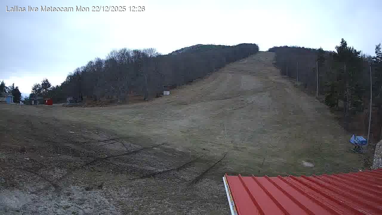
The ski center of Lailias has a basic track with a length of 1000 meters (3280 feet) and a width of 60 meters (197 feet), which is served by a sliding lift which can carry a total of 700 people. The length of the lift is 850 meters (2788 feet) and in recent years was expanded by 200 meters (656 feet). For beginners there is also a smaller lift length of 200 meters (656 feet). At the bottom of the tracks there are ski rental shops and ski equipment stores, coffee and snack canteens, an information desk and First Aid Station.
In the region there is a developed tourist infrastructure with hotels, restaurants, taverns, clubs, and businesses relating to sports and leisure. The ski center is open Friday to Sunday and during holidays (tel: 23210-58784, 23210-62400). For more information please contact the ski site.
Check current ski conditions at Snow Report Lailias
Places to stay — Serres — Lailias area
Swipe to see all 5 places to stay →
 Elpida Resort & Spa
Serres
Drive to ski centre: ≈ 26.8 km · 34 min
View on Booking.com ↗
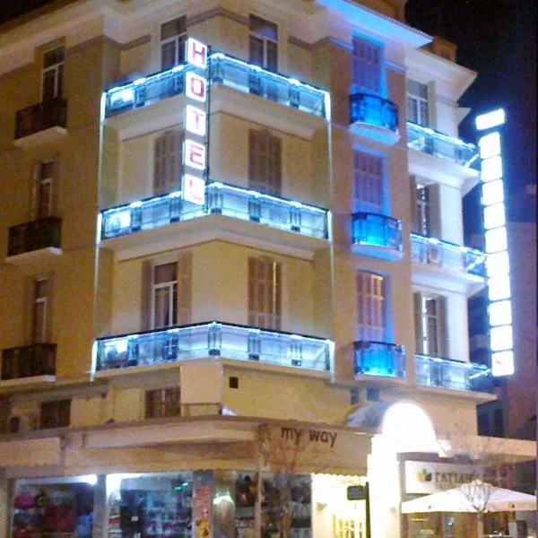 Metropolis Hotel
Serres
Drive to ski centre: ≈ 27.6 km · 34 min
View on Booking.com ↗
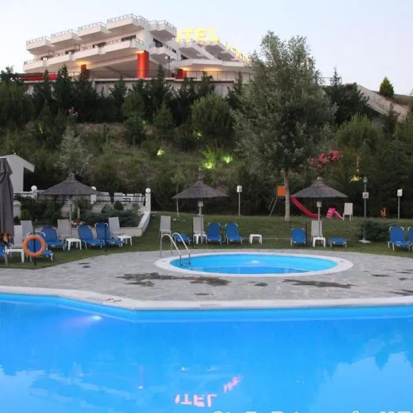 Acropol Hotel
Serres
Drive to ski centre: ≈ 34.4 km · 45 min
View on Booking.com ↗
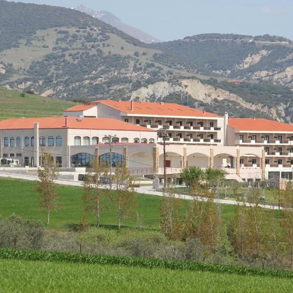 Siris Hotel
Serres
Drive to ski centre: ≈ 34.3 km · 45 min
View on Booking.com ↗
 Philippos Xenia Hotel
Serres
Drive to ski centre: ≈ 28.2 km · 35 min
View on Booking.com ↗
Lailias Ski Area - Top 1820
ECMWF · Model run: Next update expected:
Day Time (UTC) Temp. (°C) Humidity (%) Wind (km/h) Wind (knots) Wind (Bft) Direction Precip. (mm) Snow (cm) Pressure (hPa) Freezing (m) Conditions | Thursday, 05/11 06:00 1.4 100 7 4 2B NW — — 1027 2077 Overcast 100% cloud 09:00 1.1 99 7 4 2B NW 0.72 0.2 1028 2022 Overcast 100% cloud 12:00 0.8 100 13 7 3B NW 2.0 0.6 1028 1980 Overcast 100% cloud 15:00 0.9 98 16 8 3B NW 1.3 0.4 1027 2003 Overcast 99% cloud 18:00 0.7 90 15 8 3B N 0.21 0 1027 1978 Overcast 99% cloud 21:00 0.3 87 12 6 2B N 0.32 0.1 1027 1905 Overcast 100% cloud Friday, 06/11 00:00 0.1 82 15 8 3B NW 0.42 0.1 1026 1870 Overcast 100% cloud 03:00 0 74 16 9 3B NW 0.13 0 1025 1836 Partly cloudy 49% cloud 06:00 0.1 64 14 8 3B N 0 0 1025 1842 Cloudy 66% cloud 09:00 0.6 62 11 6 2B N 0 0 1024 2040 Clear 8% cloud 12:00 1.9 55 14 8 3B NW 0 0 1021 2366 Clear 7% cloud 15:00 2.9 45 19 10 3B NW 0 0 1020 2559 Clear 5% cloud 18:00 3.1 46 18 10 3B N 0 0 1021 2553 Partly cloudy 31% cloud 21:00 2.6 51 14 7 3B N 0 0 1022 2445 Cloudy 60% cloud Saturday, 07/11 00:00 2 58 8 4 2B N 0 0 1022 2335 Cloudy 62% cloud 03:00 1 63 5 3 1B N 0 0 1023 2145 Cloudy 71% cloud 06:00 0.2 75 3 2 1B W 0 0 1025 1893 Cloudy 68% cloud 09:00 -0.1 74 8 4 2B W 0.05 0 1025 1793 Cloudy 61% cloud 12:00 0.4 68 11 6 2B NW 0 0 1024 1927 Partly cloudy 33% cloud 15:00 0.8 61 15 8 3B NW 0 0 1025 2021 Clear 3% cloud 18:00 0.3 74 11 6 2B N 0 0 1027 1898 Clear 10% cloud 21:00 -0.6 89 5 3 1B N 0 0 1029 1650 Overcast 99% cloud Sunday, 08/11 00:00 -1.1 91 5 3 1B W 0.05 0 1029 1522 Overcast 100% cloud 03:00 -1.3 90 8 4 2B NW 0.24 0 1030 1478 Overcast 100% cloud 06:00 -1.4 84 8 4 2B NW 0.10 0 1031 1474 Overcast 89% cloud 09:00 -1 82 10 6 2B NW 0.00 0 1032 1555 Cloudy 68% cloud 12:00 -0.3 73 10 5 2B NW 0.07 0 1030 1718 Partly cloudy 46% cloud 15:00 0.3 71 6 3 2B NW 0 0 1030 1902 Clear 18% cloud 18:00 0.4 72 5 2 1B NW 0 0 1031 1939 Clear 10% cloud 21:00 0.6 65 4 2 1B NW 0 0 1031 1986 Partly cloudy 23% cloud Monday, 09/11 00:00 1 52 6 4 2B W 0 0 1031 2082 Partly cloudy 36% cloud 03:00 1.3 42 6 3 2B W 0 0 1030 2153 Cloudy 69% cloud 06:00 1.3 41 7 4 2B W 0 0 1031 2145 Overcast 98% cloud 09:00 1 59 10 5 2B W 0 0 1030 2089 Clear 18% cloud 12:00 1.4 67 11 6 2B W 0 0 1028 2156 Cloudy 63% cloud 15:00 2 75 13 7 3B W 0.49 0 1027 2241 Cloudy 78% cloud 18:00 1.9 83 12 7 2B W 0.80 0 1027 2228 Partly cloudy 41% cloud 21:00 2 86 15 8 3B W 0 0 1027 2260 Partly cloudy 26% cloud Tuesday, 10/11 00:00 2.2 88 17 9 3B W 0 0 1026 2290 Partly cloudy 30% cloud 03:00 2.4 86 17 9 3B W 0 0 1025 2306 Clear 19% cloud 06:00 2.8 80 15 8 3B W 0 0 1025 2401 Partly cloudy 34% cloud 09:00 2.8 84 14 8 3B W 0 0 1025 2489 Cloudy 68% cloud 12:00 3.4 80 14 8 3B W 0.10 0 1022 2719 Cloudy 61% cloud 15:00 3.9 72 19 10 3B W 0 0 1022 2815 Overcast 88% cloud 18:00 4 72 19 10 3B W 0 0 1022 2787 Cloudy 63% cloud 21:00 4.1 75 20 11 4B W 0 0 1021 2852 Cloudy 72% cloud Wednesday, 11/11 00:00 4.2 82 22 12 4B W 0 0 1020 2836 Overcast 83% cloud 03:00 4.6 84 25 14 4B W 0 0 1019 2874 Cloudy 72% cloud 06:00 5.2 83 24 13 4B W 0 0 1019 2938 Cloudy 66% cloud |
|---|
Forecast notes
Forecast table times: UTC.
Coordinates: 41.25832°N, 23.60186°E · Requested elevation: 1820 m. Model terrain: 834 m. Terrain and 1000/925/850/700 hPa profiles are used for height estimates.
These are altitude estimates, not a simulation of local mountain terrain. Precipitation, cloud and sea-level pressure use horizontal interpolation only.
Precipitation includes rain and snow water equivalent: preceding 3 hours through day 6, then 6 hours (see cell tooltip). Snow (cm) estimates fresh snowfall from precipitation and temperature using the GFS conversion; it is not snow depth on the ground. Freezing (m) uses additional 600/500 hPa temperatures when available and estimates the lowest resolved 0°C crossing above sea level. When all sampled levels are warm, the upper profile limit is shown (see tooltip). < marks an entirely cold sampled profile and its lower height limit. No extrapolation is used.
Source: ECMWF · CC BY 4.0 · Processed by Snow Report.
Lailias Ski Area - Refuge 1505
ECMWF · Model run: Next update expected:
Day Time (UTC) Temp. (°C) Humidity (%) Wind (km/h) Wind (knots) Wind (Bft) Direction Precip. (mm) Snow (cm) Pressure (hPa) Freezing (m) Conditions | Thursday, 05/11 06:00 3.2 100 6 3 2B N — — 1027 2077 Overcast 100% cloud 09:00 2.9 98 5 3 1B NW 0.64 0 1028 2023 Overcast 100% cloud 12:00 2.6 100 11 6 2B W 1.8 0 1028 1978 Overcast 100% cloud 15:00 2.5 99 14 7 3B NW 1.2 0 1027 2002 Overcast 100% cloud 18:00 2.2 95 12 7 3B NW 0.19 0 1027 1977 Overcast 99% cloud 21:00 1.6 96 10 5 2B NW 0.29 0 1027 1905 Overcast 100% cloud Friday, 06/11 00:00 1.2 92 14 7 3B NW 0.38 0 1026 1870 Overcast 100% cloud 03:00 1 85 16 9 3B NW 0.12 0 1025 1837 Partly cloudy 48% cloud 06:00 0.9 74 14 8 3B NW 0 0 1025 1841 Cloudy 62% cloud 09:00 1.6 68 10 6 2B NW 0 0 1024 2044 Clear 8% cloud 12:00 3 59 13 7 3B NW 0 0 1021 2364 Clear 7% cloud 15:00 4.1 48 18 10 3B NW 0 0 1020 2561 Clear 5% cloud 18:00 4.4 50 16 9 3B NW 0 0 1021 2556 Partly cloudy 30% cloud 21:00 3.9 55 11 6 2B N 0 0 1022 2449 Cloudy 61% cloud Saturday, 07/11 00:00 3.2 65 6 3 1B NE 0 0 1022 2337 Cloudy 61% cloud 03:00 2 72 4 2 1B E 0 0 1023 2149 Cloudy 71% cloud 06:00 1 87 6 3 2B SW 0 0 1025 1893 Cloudy 70% cloud 09:00 1 83 8 5 2B W 0.04 0 1025 1796 Cloudy 60% cloud 12:00 1.6 77 9 5 2B W 0 0 1024 1920 Partly cloudy 31% cloud 15:00 2.1 68 12 6 2B NW 0 0 1025 2018 Clear 3% cloud 18:00 1.6 81 7 4 2B NW 0 0 1027 1901 Clear 9% cloud 21:00 0.6 98 1 1 1B NW 0 0 1029 1650 Overcast 100% cloud Sunday, 08/11 00:00 0.1 100 6 3 2B W 0.04 0 1029 1521 Overcast 100% cloud 03:00 -0.2 100 9 5 2B W 0.24 0 1030 1475 Overcast 100% cloud 06:00 -0.2 93 8 4 2B NW 0.09 0 1031 1476 Overcast 88% cloud 09:00 0.4 89 11 6 2B W 0.00 0 1032 1556 Cloudy 66% cloud 12:00 1.1 79 10 5 2B NW 0.08 0 1030 1713 Partly cloudy 46% cloud 15:00 1.5 78 5 3 1B NW 0 0 1030 1902 Clear 18% cloud 18:00 1.5 80 3 2 1B NW 0 0 1031 1943 Clear 10% cloud 21:00 1.5 72 3 2 1B W 0 0 1031 1990 Partly cloudy 25% cloud Monday, 09/11 00:00 1.9 59 5 3 1B W 0 0 1031 2085 Partly cloudy 38% cloud 03:00 2.2 48 5 3 1B W 0 0 1030 2155 Cloudy 70% cloud 06:00 2.4 47 6 3 2B W 0 0 1031 2145 Overcast 98% cloud 09:00 2.5 62 9 5 2B SW 0 0 1030 2093 Clear 18% cloud 12:00 3 68 10 6 2B W 0 0 1028 2156 Cloudy 64% cloud 15:00 3.5 75 10 6 2B W 0.51 0 1027 2240 Cloudy 78% cloud 18:00 3.2 82 9 5 2B W 0.83 0 1027 2227 Partly cloudy 42% cloud 21:00 3.4 86 12 6 2B W 0 0 1027 2260 Partly cloudy 28% cloud Tuesday, 10/11 00:00 3.5 90 14 8 3B W 0 0 1026 2290 Partly cloudy 31% cloud 03:00 3.8 88 14 7 3B W 0 0 1025 2308 Clear 19% cloud 06:00 4.2 84 12 6 2B W 0 0 1025 2403 Partly cloudy 31% cloud 09:00 4.2 88 11 6 2B W 0 0 1025 2493 Cloudy 65% cloud 12:00 4.7 85 10 6 2B W 0.08 0 1022 2721 Cloudy 59% cloud 15:00 5.1 78 15 8 3B W 0 0 1022 2813 Overcast 89% cloud 18:00 5.3 78 15 8 3B W 0 0 1022 2785 Cloudy 63% cloud 21:00 5.3 81 16 9 3B W 0 0 1021 2851 Cloudy 72% cloud Wednesday, 11/11 00:00 5.5 85 19 10 3B W 0 0 1020 2832 Overcast 82% cloud 03:00 6 85 21 11 4B W 0 0 1019 2870 Cloudy 70% cloud 06:00 6.7 82 20 11 4B W 0 0 1019 2934 Cloudy 64% cloud |
|---|
Forecast notes
Forecast table times: UTC.
Coordinates: 41.25535°N, 23.58848°E · Requested elevation: 1505 m. Model terrain: 816 m. Terrain and 1000/925/850/700 hPa profiles are used for height estimates.
These are altitude estimates, not a simulation of local mountain terrain. Precipitation, cloud and sea-level pressure use horizontal interpolation only.
Precipitation includes rain and snow water equivalent: preceding 3 hours through day 6, then 6 hours (see cell tooltip). Snow (cm) estimates fresh snowfall from precipitation and temperature using the GFS conversion; it is not snow depth on the ground. Freezing (m) uses additional 600/500 hPa temperatures when available and estimates the lowest resolved 0°C crossing above sea level. When all sampled levels are warm, the upper profile limit is shown (see tooltip). < marks an entirely cold sampled profile and its lower height limit. No extrapolation is used.