Worldwide Ski Resort Forecasts

More
Colour guide Temperature · Wind · Rain · Snow
Each colour starts at the value shown. Wind colours match across all three units. Dry cells stay neutral. Colours describe the displayed values, not official weather warnings.
Mountain Creek - Low lift station
ECMWF · Model run: Next update expected:
Day Time (UTC) Temp. (°C) Humidity (%) Wind (km/h) Wind (knots) Wind (Bft) Direction Precip. (mm) Snow (cm) Pressure (hPa) Freezing (m) Conditions | Thursday, 05/11 06:00 14.5 95 15 8 3B S — — 1015 3115 Partly cloudy 34% cloud  09:00 15.9 96 15 8 3B S 0 0 1014 3105 Overcast 97% cloud  12:00 16.9 96 18 10 3B S 0.73 0 1013 3103 Overcast 100% cloud 15:00 18.9 90 21 11 4B S 1.3 0 1013 3100 Overcast 99% cloud 18:00 22.2 69 22 12 4B SW 0.75 0 1011 3087 Overcast 98% cloud 21:00 21.2 77 16 9 3B SW 0.35 0 1010 3084 Partly cloudy 43% cloud Friday, 06/11 00:00 18.2 95 13 7 3B SW 1.1 0 1011 3090 Overcast 98% cloud 03:00 17.1 96 15 8 3B SW 2.9 0 1012 3089 Cloudy 78% cloud  06:00 17.1 97 8 4 2B SW 3.1 0 1011 3081 Overcast 100% cloud 09:00 16.6 97 3 2 1B SW 0 0 1011 3074 Cloudy 76% cloud 12:00 15.3 99 3 2 1B N 0 0 1012 3074 Overcast 100% cloud 15:00 17.4 85 3 1 1B N 0.43 0 1012 3068 Cloudy 74% cloud 18:00 21.4 59 4 2 1B SW 0.04 0 1010 3053 Clear 14% cloud  21:00 20 61 3 2 1B W 0 0 1009 3043 Cloudy 62% cloud Saturday, 07/11 00:00 15 78 2 1 1B SW 0 0 1011 3044 Overcast 96% cloud 03:00 12.7 76 7 4 2B W 0 0 1011 3036 Clear 3% cloud 06:00 10.7 85 6 3 1B N 0 0 1010 3023 Clear 1% cloud 09:00 9.3 93 5 3 1B NW 0 0 1010 2878 Clear 0% cloud 12:00 8.6 95 5 3 1B NW 0 0 1010 2747 Clear 8% cloud 15:00 14.3 73 10 5 2B NW 0 0 1011 2728 Overcast 85% cloud 18:00 11.6 72 17 9 3B W 0.10 0 1010 2229 Overcast 100% cloud 21:00 9.7 67 20 11 4B W 0 0 1011 1513 Partly cloudy 39% cloud Sunday, 08/11 00:00 7.7 70 14 8 3B W 0 0 1012 1312 Partly cloudy 39% cloud 03:00 7.8 73 17 9 3B W 0.16 0 1011 1339 Overcast 95% cloud 06:00 8.3 82 19 10 3B W 1.2 0 1010 1782 Overcast 97% cloud 09:00 8.8 78 23 13 4B NW 0.08 0 1010 2138 Overcast 86% cloud 12:00 9.5 79 18 10 3B NW 0 0 1013 1869 Overcast 84% cloud 15:00 12.3 62 21 11 4B W 0 0 1013 1922 Overcast 100% cloud 18:00 13.6 51 18 10 3B W 0 0 1011 2626 Clear 17% cloud 21:00 12.9 53 15 8 3B SW 0 0 1009 2607 Clear 6% cloud Monday, 09/11 00:00 10 55 17 9 3B SW 0 0 1008 2325 Partly cloudy 25% cloud 03:00 10 52 19 10 3B W 0 0 1009 1820 Clear 5% cloud 06:00 9.1 62 18 10 3B W 0 0 1009 1669 Partly cloudy 34% cloud 09:00 8.5 73 17 9 3B W 0 0 1009 1564 Clear 11% cloud 12:00 7.6 79 15 8 3B W 0 0 1010 1355 Partly cloudy 24% cloud 15:00 10.7 56 21 11 4B W 0 0 1011 1205 Cloudy 71% cloud 18:00 11.2 52 24 13 4B NW 0.24 0 1011 1304 Partly cloudy 33% cloud 21:00 10.1 51 22 12 4B NW 0 0 1013 1219 Cloudy 51% cloud Tuesday, 10/11 00:00 7.8 61 15 8 3B NW 0.00 0 1015 1147 Clear 19% cloud 03:00 6.9 67 13 7 3B NW 0 0 1016 1214 Clear 13% cloud 06:00 5.7 75 8 4 2B W 0 0 1016 3014 Clear 14% cloud 09:00 5.3 80 9 5 2B W 0 0 1016 2985 Partly cloudy 43% cloud 12:00 5.4 84 10 5 2B SW 0 0 1016 3035 Overcast 92% cloud 15:00 10.3 62 14 7 3B SW 0 0 1015 3029 Cloudy 66% cloud 18:00 13.9 51 18 10 3B SW 0 0 1011 2778 Cloudy 77% cloud 21:00 13.6 52 18 10 3B SW 0 0 1010 2781 Clear 18% cloud Wednesday, 11/11 00:00 12 59 15 8 3B W 0 0 1011 2562 Clear 11% cloud 03:00 9.8 79 12 6 2B W 0 0 1012 2343 Clear 0% cloud 06:00 7.9 84 10 6 2B NW 0 0 1013 2429 Clear 19% cloud |
|---|
Forecast notes
Forecast table times: UTC.
Coordinates: 41.1781416°N, -74.5311411°E · Requested elevation: 139 m. Model terrain: 236 m. Terrain and 1000/925/850/700 hPa profiles are used for height estimates.
Outside the available profile, temperature uses an estimated 5.5°C/km height correction; wind retains the nearest available model-level value. Humidity is estimated with adjusted pressure and temperature.
These are altitude estimates, not a simulation of local mountain terrain. Precipitation, cloud and sea-level pressure use horizontal interpolation only.
Precipitation includes rain and snow water equivalent: preceding 3 hours through day 6, then 6 hours (see cell tooltip). Snow (cm) estimates fresh snowfall from precipitation and temperature using the GFS conversion; it is not snow depth on the ground. Freezing (m) uses additional 600/500 hPa temperatures when available and estimates the lowest resolved 0°C crossing above sea level. When all sampled levels are warm, the upper profile limit is shown (see tooltip). < marks an entirely cold sampled profile and its lower height limit. No extrapolation is used.
Source: ECMWF · CC BY 4.0 · Processed by Snow Report.
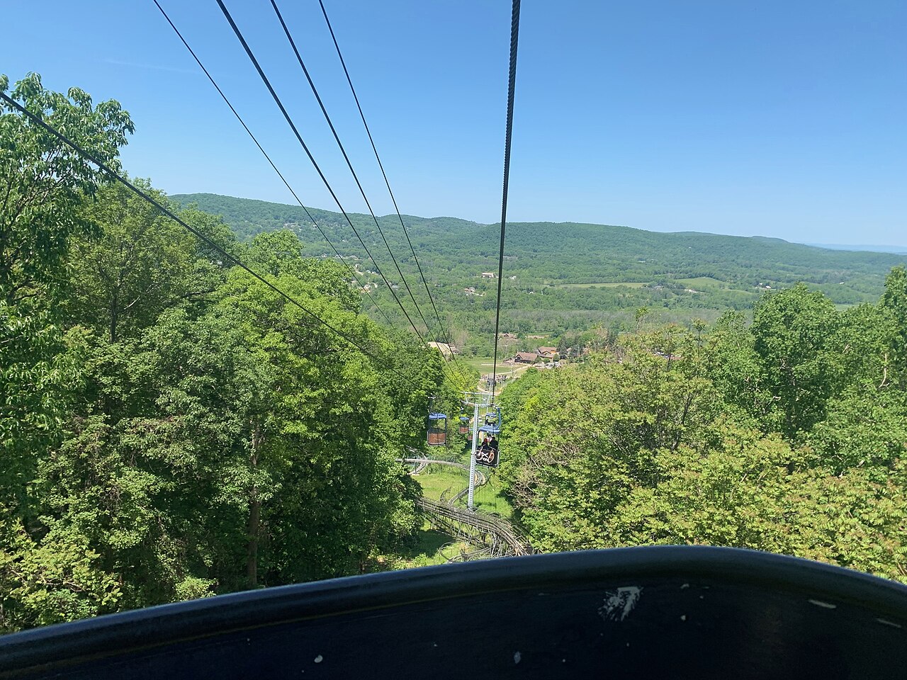
Mountain Creek is a downhill ski area in New Jersey, United States. Mapped terrain includes beginner, easy, intermediate, advanced routes. Its mapped lift network extends from approximately 139 to 448 metres above sea level.
Data: OpenSkiData / OpenSkiMap, OpenStreetMap contributors (ODbL), Skimap.org, Who's On First, Mapterhorn.
Mountain Creek - Base lift station
ECMWF · Model run: Next update expected:
Day Time (UTC) Temp. (°C) Humidity (%) Wind (km/h) Wind (knots) Wind (Bft) Direction Precip. (mm) Snow (cm) Pressure (hPa) Freezing (m) Conditions | Thursday, 05/11 06:00 14.4 95 15 8 3B S — — 1015 3115 Partly cloudy 32% cloud 09:00 15.8 97 16 8 3B S 0 0 1014 3105 Overcast 96% cloud 12:00 16.7 96 18 10 3B S 0.69 0 1013 3103 Overcast 100% cloud 15:00 18.8 90 22 12 4B S 1.4 0 1013 3100 Overcast 99% cloud 18:00 22.1 69 22 12 4B SW 0.81 0 1011 3087 Overcast 98% cloud 21:00 21.1 77 16 9 3B SW 0.30 0 1010 3084 Partly cloudy 38% cloud Friday, 06/11 00:00 18 95 13 7 3B SW 1.0 0 1011 3090 Overcast 99% cloud 03:00 17 96 15 8 3B SW 2.6 0 1011 3090 Cloudy 74% cloud 06:00 16.9 98 9 5 2B SW 3.0 0 1011 3081 Overcast 100% cloud 09:00 16.5 98 3 2 1B SW 0 0 1011 3074 Cloudy 73% cloud 12:00 15.2 100 3 2 1B NW 0 0 1012 3074 Overcast 100% cloud 15:00 17.2 86 3 1 1B N 0.40 0 1012 3068 Cloudy 77% cloud 18:00 21.2 60 4 2 1B SW 0.03 0 1010 3054 Clear 15% cloud 21:00 19.8 62 3 2 1B W 0 0 1009 3043 Cloudy 65% cloud Saturday, 07/11 00:00 14.9 78 2 1 1B S 0 0 1011 3044 Overcast 98% cloud 03:00 12.6 76 7 4 2B W 0 0 1011 3036 Clear 1% cloud 06:00 10.4 86 5 3 1B N 0 0 1010 3023 Clear 1% cloud 09:00 9.1 94 5 2 1B NW 0 0 1010 2883 Clear 0% cloud 12:00 8.4 96 5 2 1B NW 0 0 1010 2733 Clear 5% cloud 15:00 14.2 73 9 5 2B NW 0 0 1011 2756 Overcast 85% cloud 18:00 11.4 73 17 9 3B W 0.10 0 1010 2242 Overcast 100% cloud 21:00 9.5 68 20 11 4B W 0 0 1011 1537 Partly cloudy 39% cloud Sunday, 08/11 00:00 7.6 71 15 8 3B W 0 0 1012 1320 Partly cloudy 43% cloud 03:00 7.6 75 17 9 3B W 0.18 0 1011 1341 Overcast 95% cloud 06:00 8 84 19 10 3B W 1.5 0 1010 1786 Overcast 98% cloud 09:00 8.6 79 24 13 4B NW 0.09 0 1010 2150 Overcast 86% cloud 12:00 9.3 79 19 10 3B NW 0 0 1012 1872 Overcast 82% cloud 15:00 12.2 63 21 12 4B W 0 0 1013 1930 Overcast 100% cloud 18:00 13.3 52 19 10 3B W 0 0 1011 2644 Clear 17% cloud 21:00 12.7 53 15 8 3B SW 0 0 1009 2602 Clear 5% cloud Monday, 09/11 00:00 9.8 56 17 9 3B SW 0 0 1008 2320 Partly cloudy 25% cloud 03:00 9.9 53 19 10 3B W 0 0 1008 1831 Clear 5% cloud 06:00 9 62 18 10 3B W 0 0 1009 1671 Partly cloudy 33% cloud 09:00 8.3 73 17 9 3B W 0 0 1009 1566 Clear 10% cloud 12:00 7.4 80 15 8 3B W 0 0 1010 1351 Partly cloudy 23% cloud 15:00 10.6 56 21 11 4B W 0 0 1011 1201 Cloudy 72% cloud 18:00 11 53 24 13 4B NW 0.24 0 1011 1307 Partly cloudy 29% cloud 21:00 9.9 51 22 12 4B NW 0 0 1013 1214 Partly cloudy 48% cloud Tuesday, 10/11 00:00 7.6 62 15 8 3B NW 0.00 0 1015 1142 Partly cloudy 21% cloud 03:00 6.8 68 13 7 3B NW 0 0 1016 1207 Clear 14% cloud 06:00 5.5 75 8 4 2B W 0 0 1016 3013 Clear 15% cloud 09:00 5.1 81 9 5 2B W 0 0 1016 2976 Partly cloudy 44% cloud 12:00 5.2 85 10 5 2B SW 0 0 1016 3034 Overcast 92% cloud 15:00 10.1 62 14 8 3B SW 0 0 1015 3029 Cloudy 67% cloud 18:00 13.7 52 18 10 3B SW 0 0 1011 2773 Cloudy 79% cloud 21:00 13.3 53 18 10 3B SW 0 0 1010 2778 Clear 17% cloud Wednesday, 11/11 00:00 11.8 60 15 8 3B W 0 0 1011 2559 Clear 10% cloud 03:00 9.5 80 12 6 2B W 0 0 1012 2336 Clear 0% cloud 06:00 7.6 84 10 5 2B NW 0 0 1013 2415 Clear 18% cloud |
|---|
Forecast notes
Forecast table times: UTC.
Coordinates: 41.1905777°N, -74.5061948°E · Requested elevation: 170 m. Model terrain: 232 m. Terrain and 1000/925/850/700 hPa profiles are used for height estimates.
Outside the available profile, temperature uses an estimated 5.5°C/km height correction; wind retains the nearest available model-level value. Humidity is estimated with adjusted pressure and temperature.
These are altitude estimates, not a simulation of local mountain terrain. Precipitation, cloud and sea-level pressure use horizontal interpolation only.
Precipitation includes rain and snow water equivalent: preceding 3 hours through day 6, then 6 hours (see cell tooltip). Snow (cm) estimates fresh snowfall from precipitation and temperature using the GFS conversion; it is not snow depth on the ground. Freezing (m) uses additional 600/500 hPa temperatures when available and estimates the lowest resolved 0°C crossing above sea level. When all sampled levels are warm, the upper profile limit is shown (see tooltip). < marks an entirely cold sampled profile and its lower height limit. No extrapolation is used.
Source: ECMWF · CC BY 4.0 · Processed by Snow Report.
Mountain Creek - Top lift station
ECMWF · Model run: Next update expected:
Day Time (UTC) Temp. (°C) Humidity (%) Wind (km/h) Wind (knots) Wind (Bft) Direction Precip. (mm) Snow (cm) Pressure (hPa) Freezing (m) Conditions | Thursday, 05/11 06:00 14.3 92 32 17 5B SW — — 1015 3115 Partly cloudy 36% cloud 09:00 15.3 97 34 18 5B SW 0 0 1014 3105 Overcast 97% cloud 12:00 15.9 98 36 19 5B SW 0.71 0 1013 3103 Overcast 100% cloud 15:00 17.3 91 40 22 6B SW 1.4 0 1013 3100 Overcast 99% cloud 18:00 19.5 78 34 18 5B SW 0.76 0 1011 3087 Overcast 98% cloud 21:00 19.2 82 30 16 5B SW 0.31 0 1010 3084 Partly cloudy 39% cloud Friday, 06/11 00:00 17.1 97 28 15 4B SW 1.0 0 1011 3091 Overcast 99% cloud 03:00 16.4 95 29 15 4B SW 2.8 0 1012 3090 Cloudy 77% cloud 06:00 16 99 20 11 4B SW 3.3 0 1011 3081 Overcast 100% cloud 09:00 15.5 95 8 5 2B W 0 0 1011 3074 Cloudy 75% cloud 12:00 14.5 93 3 2 1B N 0 0 1012 3074 Overcast 100% cloud 15:00 15.6 86 0 0 0B W 0.48 0 1012 3068 Cloudy 75% cloud 18:00 18.4 68 5 3 1B SW 0.04 0 1010 3054 Clear 15% cloud 21:00 17.9 62 5 3 1B W 0 0 1009 3043 Cloudy 65% cloud Saturday, 07/11 00:00 14.6 73 5 3 1B W 0 0 1011 3044 Overcast 98% cloud 03:00 13.1 67 11 6 2B NW 0 0 1011 3036 Clear 1% cloud 06:00 11.4 81 12 7 3B N 0 0 1010 3023 Clear 1% cloud 09:00 10.3 84 9 5 2B N 0 0 1010 2888 Clear 0% cloud 12:00 9.6 89 5 3 1B N 0 0 1010 2741 Clear 6% cloud 15:00 11.8 81 10 5 2B W 0 0 1011 2751 Overcast 83% cloud 18:00 9 81 24 13 4B NW 0.09 0 1010 2243 Overcast 100% cloud 21:00 7 76 31 17 5B NW 0 0 1011 1523 Partly cloudy 38% cloud Sunday, 08/11 00:00 5.8 74 30 16 5B NW 0 0 1012 1316 Partly cloudy 40% cloud 03:00 5.6 81 32 17 5B W 0.17 0 1011 1341 Overcast 95% cloud 06:00 6.3 88 37 20 5B NW 1.3 0 1010 1783 Overcast 98% cloud 09:00 6.8 85 43 23 6B NW 0.08 0 1010 2152 Overcast 85% cloud 12:00 7.4 86 36 19 5B NW 0 0 1013 1873 Overcast 83% cloud 15:00 9.5 71 30 16 5B NW 0 0 1013 1932 Overcast 100% cloud 18:00 10.5 59 25 13 4B W 0 0 1011 2644 Clear 19% cloud 21:00 10.6 56 26 14 4B W 0 0 1009 2613 Clear 5% cloud Monday, 09/11 00:00 9 50 35 19 5B W 0 0 1008 2332 Partly cloudy 27% cloud 03:00 8.5 55 36 20 5B W 0 0 1008 1832 Clear 5% cloud 06:00 7.6 67 35 19 5B W 0 0 1009 1680 Partly cloudy 32% cloud 09:00 6.9 78 32 17 5B W 0 0 1009 1571 Clear 10% cloud 12:00 5.8 84 31 17 5B W 0 0 1010 1356 Partly cloudy 22% cloud 15:00 7.7 64 30 16 5B NW 0 0 1011 1205 Cloudy 70% cloud 18:00 8.2 59 34 18 5B NW 0.24 0 1011 1308 Partly cloudy 30% cloud 21:00 7.5 57 32 17 5B NW 0 0 1012 1217 Partly cloudy 48% cloud Tuesday, 10/11 00:00 5.7 67 30 16 5B NW 0.00 0 1015 1145 Clear 19% cloud 03:00 5.2 71 28 15 4B NW 0 0 1016 1209 Clear 14% cloud 06:00 4.4 77 22 12 4B NW 0 0 1016 3014 Clear 15% cloud 09:00 4.2 83 22 12 4B NW 0 0 1016 2980 Partly cloudy 43% cloud 12:00 4.4 86 19 11 3B W 0 0 1016 3035 Overcast 92% cloud 15:00 7.9 64 23 12 4B W 0 0 1015 3029 Cloudy 66% cloud 18:00 10.9 58 25 14 4B SW 0 0 1011 2779 Cloudy 79% cloud 21:00 11.5 56 32 17 5B SW 0 0 1010 2787 Clear 17% cloud Wednesday, 11/11 00:00 11.1 62 32 17 5B W 0 0 1011 2573 Clear 10% cloud 03:00 8.8 79 29 15 4B NW 0 0 1012 2345 Clear 0% cloud 06:00 7 82 25 13 4B NW 0 0 1013 2427 Clear 19% cloud |
|---|
Forecast notes
Forecast table times: UTC.
Coordinates: 41.1759174°N, -74.5106446°E · Requested elevation: 448 m. Model terrain: 236 m. Terrain and 1000/925/850/700 hPa profiles are used for height estimates.
These are altitude estimates, not a simulation of local mountain terrain. Precipitation, cloud and sea-level pressure use horizontal interpolation only.
Precipitation includes rain and snow water equivalent: preceding 3 hours through day 6, then 6 hours (see cell tooltip). Snow (cm) estimates fresh snowfall from precipitation and temperature using the GFS conversion; it is not snow depth on the ground. Freezing (m) uses additional 600/500 hPa temperatures when available and estimates the lowest resolved 0°C crossing above sea level. When all sampled levels are warm, the upper profile limit is shown (see tooltip). < marks an entirely cold sampled profile and its lower height limit. No extrapolation is used.