Worldwide Ski Resort Forecasts

More
Colour guide Temperature · Wind · Rain · Snow
Each colour starts at the value shown. Wind colours match across all three units. Dry cells stay neutral. Colours describe the displayed values, not official weather warnings.
Metsovo Ski Area - Karakoli 1310
ECMWF · Model run: Next update expected:
Day Time (UTC) Temp. (°C) Humidity (%) Wind (km/h) Wind (knots) Wind (Bft) Direction Precip. (mm) Snow (cm) Pressure (hPa) Freezing (m) Conditions | Thursday, 05/11 06:00 4.9 96 8 5 2B E — — 1026 2427 Overcast 88% cloud  09:00 5.8 91 10 5 2B E 0.28 0 1027 2345 Overcast 88% cloud 12:00 6.4 84 10 5 2B E 0.39 0 1026 2416 Overcast 81% cloud 15:00 5.2 89 8 4 2B E 0.18 0 1026 2348 Overcast 90% cloud 18:00 4.1 94 7 4 2B E 0.08 0 1026 2279 Overcast 93% cloud 21:00 3.8 94 6 3 2B E 0.00 0 1026 2343 Overcast 88% cloud Friday, 06/11 00:00 3.2 95 6 3 2B NE 0 0 1026 2328 Overcast 86% cloud 03:00 3 95 6 3 2B NE 0.01 0 1025 2344 Overcast 86% cloud 06:00 3.1 90 4 2 1B NE 0 0 1024 2440 Overcast 84% cloud 09:00 6.6 71 4 2 1B NE 0.01 0 1023 2678 Clear 14% cloud  12:00 9.2 57 3 2 1B N 0 0 1020 2793 Partly cloudy 40% cloud  15:00 6.9 77 1 1 1B NW 0 0 1020 2811 Clear 15% cloud 18:00 4.8 83 2 1 1B NW 0 0 1021 2833 Clear 2% cloud 21:00 4.4 83 3 1 1B N 0 0 1021 2818 Clear 9% cloud Saturday, 07/11 00:00 4.2 79 3 2 1B NE 0 0 1021 2751 Clear 9% cloud 03:00 3.7 78 5 2 1B NE 0 0 1021 2710 Cloudy 53% cloud  06:00 3.7 76 5 3 1B NE 0 0 1023 2596 Overcast 97% cloud 09:00 6.2 65 6 3 1B E 0 0 1024 2609 Cloudy 58% cloud 12:00 7.2 68 5 3 1B E 0 0 1022 2608 Cloudy 68% cloud 15:00 5.5 80 4 2 1B E 0 0 1023 2571 Cloudy 50% cloud 18:00 3.3 92 5 3 1B E 0 0 1025 2410 Cloudy 74% cloud 21:00 2.1 92 5 3 1B E 0 0 1027 2277 Overcast 82% cloud Sunday, 08/11 00:00 1.4 89 7 4 2B E 0 0 1028 2076 Overcast 88% cloud 03:00 1.3 90 8 4 2B E 0 0 1028 1976 Overcast 90% cloud 06:00 1.6 89 9 5 2B E 0 0 1030 1943 Overcast 87% cloud 09:00 4.9 71 9 5 2B E 0.01 0 1029 2150 Partly cloudy 21% cloud 12:00 6.8 68 6 3 2B E 0 0 1028 2388 Clear 15% cloud 15:00 4.5 85 5 3 1B E 0 0 1029 2320 Cloudy 54% cloud 18:00 2.6 90 2 1 1B E 0 0 1030 2344 Overcast 89% cloud 21:00 2.3 89 3 2 1B E 0 0 1030 2399 Overcast 98% cloud Monday, 09/11 00:00 2.9 85 3 2 1B SE 0 0 1029 2450 Overcast 96% cloud 03:00 3.6 82 3 1 1B SE 0.00 0 1028 2456 Overcast 100% cloud 06:00 4 89 4 2 1B S 1.4 0 1029 2449 Overcast 97% cloud 09:00 5.7 92 2 1 1B S 4.7 0 1028 2555 Overcast 100% cloud 12:00 6 97 4 2 1B SW 2.7 0 1027 2564 Overcast 100% cloud 15:00 5.9 99 5 3 1B SW 1.7 0 1026 2564 Overcast 100% cloud 18:00 5.6 100 6 3 2B SW 1.3 0 1026 2562 Overcast 100% cloud 21:00 5.9 99 7 4 2B SW 0.84 0 1026 2620 Overcast 100% cloud Tuesday, 10/11 00:00 5.8 100 8 4 2B SW 0.04 0 1025 2725 Overcast 100% cloud 03:00 5.4 98 7 4 2B W 0 0 1025 2809 Overcast 99% cloud 06:00 5.5 93 6 3 2B SW 0 0 1024 2944 Cloudy 71% cloud 09:00 8.5 78 10 5 2B W 0 0 1024 3106 Partly cloudy 38% cloud 12:00 9.5 69 12 6 2B W 0 0 1022 3114 Overcast 98% cloud 15:00 8.1 84 10 5 2B SW 0.22 0 1021 3107 Overcast 98% cloud 18:00 7.1 94 11 6 2B SW 0.01 0 1022 3042 Overcast 100% cloud 21:00 7 96 11 6 2B SW 0 0 1022 3065 Overcast 100% cloud Wednesday, 11/11 00:00 7.3 97 12 6 2B SW 0.09 0 1020 2964 Overcast 100% cloud 03:00 7.6 97 12 7 3B SW 0.31 0 1019 2967 Overcast 98% cloud 06:00 7.6 97 11 6 2B SW 0.06 0 1019 3093 Overcast 95% cloud |
|---|
Forecast notes
Forecast table times: UTC.
Coordinates: 39.77483°N, 21.17666°E · Requested elevation: 1375 m. Model terrain: 1249 m. Terrain and 1000/925/850/700 hPa profiles are used for height estimates.
These are altitude estimates, not a simulation of local mountain terrain. Precipitation, cloud and sea-level pressure use horizontal interpolation only.
Precipitation includes rain and snow water equivalent: preceding 3 hours through day 6, then 6 hours (see cell tooltip). Snow (cm) estimates fresh snowfall from precipitation and temperature using the GFS conversion; it is not snow depth on the ground. Freezing (m) uses additional 600/500 hPa temperatures when available and estimates the lowest resolved 0°C crossing above sea level. When all sampled levels are warm, the upper profile limit is shown (see tooltip). < marks an entirely cold sampled profile and its lower height limit. No extrapolation is used.
Source: ECMWF · CC BY 4.0 · Processed by Snow Report.
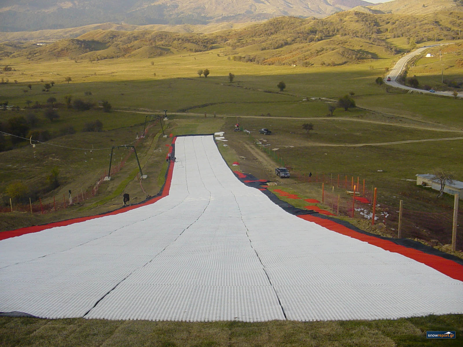
There are three ski centres around Metsovo: Politsies (at an altitude of 1360-1620m), 4km away from Mestovo, Karakoli (alt 1340-1520m) 1,5km away from Metsovo and Zygos (alt 1680-1850m).
Check current ski conditions at Snow Report Metsovo
Places to stay — Metsovo
Swipe to see all 5 places to stay →
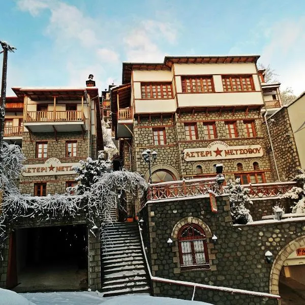 Asteri Metsovou
Metsovo
Drive to ski centre: ≈ 4.2 km · 5 min
View on Booking.com ↗
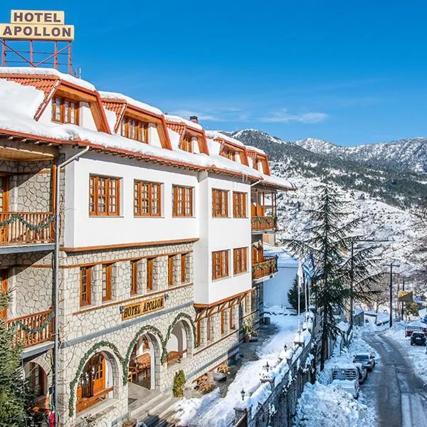 Hotel Apollon
Metsovo
Drive to ski centre: ≈ 4.6 km · 6 min
View on Booking.com ↗
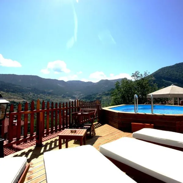 Archontiko Metsovou Luxury Boutique Spa Hotel
Metsovo
Drive to ski centre: ≈ 4.7 km · 6 min
View on Booking.com ↗
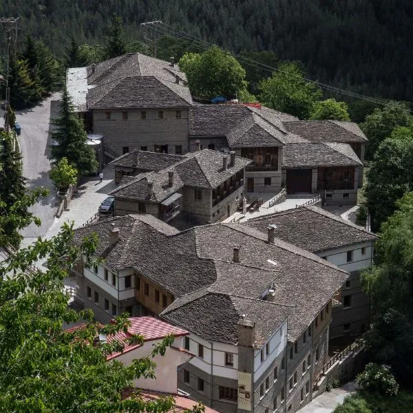 Katogi Averoff Hotel & Winery
Metsovo
Drive to ski centre: ≈ 5.0 km · 6 min
View on Booking.com ↗
 Hotel Kassaros
Metsovo
Drive to ski centre: ≈ 4.8 km · 6 min
View on Booking.com ↗
Metsovo Ski Area - Politsies 1375
ECMWF · Model run: Next update expected:
Day Time (UTC) Temp. (°C) Humidity (%) Wind (km/h) Wind (knots) Wind (Bft) Direction Precip. (mm) Snow (cm) Pressure (hPa) Freezing (m) Conditions | Thursday, 05/11 06:00 4.9 95 9 5 2B E — — 1025 2438 Overcast 86% cloud 09:00 5.9 90 10 5 2B E 0.25 0 1027 2355 Overcast 86% cloud 12:00 6.5 83 10 5 2B E 0.35 0 1026 2428 Cloudy 77% cloud 15:00 5.4 87 8 4 2B E 0.16 0 1025 2362 Overcast 87% cloud 18:00 4.2 93 7 4 2B E 0.07 0 1026 2291 Overcast 91% cloud 21:00 3.8 93 7 4 2B E 0.01 0 1026 2356 Overcast 85% cloud Friday, 06/11 00:00 3.3 94 6 3 2B NE 0 0 1026 2345 Overcast 82% cloud 03:00 3.1 93 6 3 2B NE 0.01 0 1025 2359 Overcast 83% cloud 06:00 3.2 89 4 2 1B NE 0 0 1024 2455 Overcast 83% cloud 09:00 6.6 71 4 2 1B NE 0.01 0 1023 2685 Clear 15% cloud 12:00 9.1 58 3 2 1B N 0 0 1020 2794 Partly cloudy 38% cloud 15:00 6.9 77 2 1 1B NW 0 0 1020 2814 Clear 17% cloud 18:00 5 82 2 1 1B NW 0 0 1021 2834 Clear 2% cloud 21:00 4.5 83 3 2 1B N 0 0 1021 2817 Clear 11% cloud Saturday, 07/11 00:00 4.3 79 3 2 1B NE 0 0 1021 2754 Clear 11% cloud 03:00 3.8 77 5 3 1B NE 0 0 1021 2712 Cloudy 53% cloud 06:00 3.9 74 6 3 1B NE 0 0 1023 2606 Overcast 97% cloud 09:00 6.3 63 5 3 1B E 0 0 1023 2615 Cloudy 57% cloud 12:00 7.2 66 5 3 1B E 0 0 1022 2612 Cloudy 65% cloud 15:00 5.6 79 3 2 1B E 0 0 1023 2576 Partly cloudy 46% cloud 18:00 3.4 91 5 3 1B E 0 0 1025 2416 Cloudy 67% cloud 21:00 2.3 91 5 3 1B E 0 0 1027 2289 Cloudy 76% cloud Sunday, 08/11 00:00 1.5 88 8 4 2B E 0 0 1028 2096 Overcast 85% cloud 03:00 1.4 88 8 5 2B E 0 0 1028 1999 Overcast 89% cloud 06:00 1.7 87 9 5 2B E 0 0 1030 1971 Overcast 84% cloud 09:00 4.9 71 9 5 2B E 0.01 0 1029 2164 Partly cloudy 21% cloud 12:00 6.9 67 6 3 2B E 0 0 1027 2400 Clear 15% cloud 15:00 4.7 83 4 2 1B E 0 0 1028 2334 Partly cloudy 48% cloud 18:00 2.9 88 2 1 1B E 0 0 1030 2353 Overcast 86% cloud 21:00 2.5 88 3 2 1B E 0 0 1030 2406 Overcast 98% cloud Monday, 09/11 00:00 3.2 84 3 2 1B SE 0 0 1029 2455 Overcast 96% cloud 03:00 3.8 81 3 1 1B SE 0.01 0 1027 2457 Overcast 100% cloud 06:00 4.2 88 5 3 1B S 1.5 0 1029 2454 Overcast 96% cloud 09:00 5.8 91 3 1 1B S 4.6 0 1028 2557 Overcast 100% cloud 12:00 6 97 5 2 1B SW 2.7 0 1027 2564 Overcast 100% cloud 15:00 5.9 99 5 3 1B SW 1.6 0 1026 2564 Overcast 100% cloud 18:00 5.7 99 7 4 2B SW 1.3 0 1026 2563 Overcast 100% cloud 21:00 5.9 99 8 4 2B SW 0.82 0 1026 2618 Overcast 100% cloud Tuesday, 10/11 00:00 5.9 100 8 4 2B SW 0.05 0 1025 2720 Overcast 100% cloud 03:00 5.5 97 7 4 2B W 0 0 1025 2806 Overcast 98% cloud 06:00 5.5 93 6 3 2B SW 0 0 1024 2952 Cloudy 70% cloud 09:00 8.3 79 10 5 2B W 0 0 1024 3107 Partly cloudy 43% cloud 12:00 9.4 70 12 6 2B W 0 0 1022 3114 Overcast 98% cloud 15:00 8 85 10 5 2B SW 0.21 0 1021 3107 Overcast 98% cloud 18:00 7 95 11 6 2B SW 0.01 0 1022 3033 Overcast 99% cloud 21:00 7 96 11 6 2B SW 0 0 1022 3056 Overcast 100% cloud Wednesday, 11/11 00:00 7.4 97 12 6 2B SW 0.11 0 1020 2954 Overcast 100% cloud 03:00 7.6 97 13 7 3B SW 0.33 0 1019 2954 Overcast 98% cloud 06:00 7.6 97 11 6 2B SW 0.08 0 1019 3093 Overcast 94% cloud |
|---|
Forecast notes
Forecast table times: UTC.
Coordinates: 39.78626°N, 21.15681°E · Requested elevation: 1375 m. Model terrain: 1224 m. Terrain and 1000/925/850/700 hPa profiles are used for height estimates.
These are altitude estimates, not a simulation of local mountain terrain. Precipitation, cloud and sea-level pressure use horizontal interpolation only.
Precipitation includes rain and snow water equivalent: preceding 3 hours through day 6, then 6 hours (see cell tooltip). Snow (cm) estimates fresh snowfall from precipitation and temperature using the GFS conversion; it is not snow depth on the ground. Freezing (m) uses additional 600/500 hPa temperatures when available and estimates the lowest resolved 0°C crossing above sea level. When all sampled levels are warm, the upper profile limit is shown (see tooltip). < marks an entirely cold sampled profile and its lower height limit. No extrapolation is used.
Source: ECMWF · CC BY 4.0 · Processed by Snow Report.
Metsovo Ski Area - Politsies 1570
ECMWF · Model run: Next update expected:
Day Time (UTC) Temp. (°C) Humidity (%) Wind (km/h) Wind (knots) Wind (Bft) Direction Precip. (mm) Snow (cm) Pressure (hPa) Freezing (m) Conditions | Thursday, 05/11 06:00 4 93 11 6 2B E — — 1025 2445 Overcast 85% cloud 09:00 4.1 94 12 7 2B E 0.24 0 1027 2361 Overcast 85% cloud 12:00 4.5 88 11 6 2B E 0.34 0 1026 2434 Cloudy 75% cloud 15:00 4 88 9 5 2B E 0.15 0 1025 2367 Overcast 87% cloud 18:00 3.3 89 9 5 2B E 0.07 0 1026 2296 Overcast 91% cloud 21:00 3.2 88 9 5 2B E 0.00 0 1026 2362 Overcast 84% cloud Friday, 06/11 00:00 2.8 87 9 5 2B NE 0 0 1026 2352 Overcast 81% cloud 03:00 2.5 87 9 5 2B NE 0.01 0 1025 2364 Overcast 81% cloud 06:00 2.7 79 6 3 2B NE 0 0 1024 2461 Overcast 81% cloud 09:00 4.4 75 5 2 1B NE 0.01 0 1023 2689 Clear 13% cloud 12:00 6.9 62 5 3 1B NW 0 0 1020 2796 Partly cloudy 38% cloud 15:00 6.1 75 5 3 1B NW 0 0 1020 2816 Clear 17% cloud 18:00 5.3 79 5 3 1B NW 0 0 1021 2834 Clear 2% cloud 21:00 5.3 77 6 3 2B N 0 0 1021 2817 Clear 12% cloud Saturday, 07/11 00:00 5.1 71 6 3 1B NE 0 0 1021 2757 Clear 12% cloud 03:00 4.7 68 7 4 2B NE 0 0 1021 2714 Cloudy 54% cloud 06:00 3.8 61 7 4 2B NE 0 0 1023 2610 Overcast 97% cloud 09:00 4.1 66 5 3 1B E 0 0 1023 2618 Cloudy 54% cloud 12:00 5.1 71 4 2 1B E 0 0 1022 2617 Cloudy 63% cloud 15:00 4.3 79 3 1 1B E 0 0 1023 2582 Partly cloudy 46% cloud 18:00 3.3 88 6 3 2B E 0 0 1025 2420 Cloudy 68% cloud 21:00 2.8 85 7 4 2B E 0 0 1027 2296 Cloudy 78% cloud Sunday, 08/11 00:00 2 77 11 6 2B E 0 0 1028 2106 Overcast 86% cloud 03:00 1.6 78 12 7 3B E 0 0 1028 2013 Overcast 88% cloud 06:00 1.5 76 13 7 3B E 0 0 1030 1987 Overcast 83% cloud 09:00 2.6 73 10 6 2B E 0.01 0 1029 2177 Clear 19% cloud 12:00 4.4 74 6 3 2B E 0 0 1027 2408 Clear 13% cloud 15:00 3.7 82 4 2 1B E 0 0 1028 2343 Partly cloudy 47% cloud 18:00 3.6 80 3 1 1B SE 0 0 1030 2358 Overcast 86% cloud 21:00 3.9 78 5 3 1B SE 0 0 1030 2410 Overcast 98% cloud Monday, 09/11 00:00 4.5 73 5 3 1B SE 0 0 1029 2459 Overcast 96% cloud 03:00 4.5 73 5 3 1B S 0.01 0 1027 2459 Overcast 100% cloud 06:00 4.6 78 9 5 2B S 1.5 0 1029 2457 Overcast 97% cloud 09:00 5.2 82 8 4 2B S 4.7 0 1028 2558 Overcast 100% cloud 12:00 4.9 96 10 5 2B SW 2.7 0 1027 2565 Overcast 100% cloud 15:00 5 99 11 6 2B SW 1.6 0 1026 2566 Overcast 100% cloud 18:00 5.1 100 14 7 3B SW 1.3 0 1026 2563 Overcast 100% cloud 21:00 5.5 99 14 8 3B SW 0.85 0 1026 2617 Overcast 100% cloud Tuesday, 10/11 00:00 5.3 100 14 7 3B SW 0.05 0 1025 2719 Overcast 100% cloud 03:00 4.8 96 13 7 3B W 0 0 1025 2807 Overcast 98% cloud 06:00 4.9 89 11 6 2B W 0 0 1024 2954 Cloudy 71% cloud 09:00 6 86 13 7 3B W 0 0 1024 3109 Partly cloudy 43% cloud 12:00 7.1 76 15 8 3B W 0 0 1022 3114 Overcast 98% cloud 15:00 6.5 88 14 8 3B SW 0.22 0 1021 3107 Overcast 98% cloud 18:00 6 95 16 8 3B SW 0.01 0 1022 3031 Overcast 100% cloud 21:00 6.3 96 17 9 3B SW 0 0 1022 3054 Overcast 100% cloud Wednesday, 11/11 00:00 6.8 97 18 10 3B SW 0.11 0 1020 2951 Overcast 100% cloud 03:00 6.9 96 19 10 3B SW 0.33 0 1019 2950 Overcast 98% cloud 06:00 6.8 97 18 9 3B SW 0.08 0 1019 3093 Overcast 94% cloud |
|---|
Forecast notes
Forecast table times: UTC.
Coordinates: 39.77917°N, 21.152007°E · Requested elevation: 1570 m. Model terrain: 1218 m. Terrain and 1000/925/850/700 hPa profiles are used for height estimates.
These are altitude estimates, not a simulation of local mountain terrain. Precipitation, cloud and sea-level pressure use horizontal interpolation only.
Precipitation includes rain and snow water equivalent: preceding 3 hours through day 6, then 6 hours (see cell tooltip). Snow (cm) estimates fresh snowfall from precipitation and temperature using the GFS conversion; it is not snow depth on the ground. Freezing (m) uses additional 600/500 hPa temperatures when available and estimates the lowest resolved 0°C crossing above sea level. When all sampled levels are warm, the upper profile limit is shown (see tooltip). < marks an entirely cold sampled profile and its lower height limit. No extrapolation is used.