Worldwide Ski Resort Forecasts

More
Colour guide Temperature · Wind · Rain · Snow
Each colour starts at the value shown. Wind colours match across all three units. Dry cells stay neutral. Colours describe the displayed values, not official weather warnings.
Crotched Mountain Ski & Ride - Low lift station
ECMWF · Model run: Next update expected:
Day Time (UTC) Temp. (°C) Humidity (%) Wind (km/h) Wind (knots) Wind (Bft) Direction Precip. (mm) Snow (cm) Pressure (hPa) Freezing (m) Conditions | Thursday, 05/11 06:00 13.4 84 17 9 3B SW — — 1014 3113 Clear 3% cloud  09:00 13.4 87 20 11 3B SW 0 0 1013 3101 Cloudy 56% cloud  12:00 14 94 19 10 3B SW 0 0 1013 3099 Overcast 83% cloud  15:00 16.5 92 20 11 3B SW 1.3 0 1012 3091 Overcast 100% cloud 18:00 18.2 92 22 12 4B SW 1.1 0 1010 3077 Overcast 93% cloud 21:00 18.9 81 19 10 3B SW 0.18 0 1010 3075 Cloudy 65% cloud Friday, 06/11 00:00 17.2 91 20 11 4B SW 0 0 1010 3079 Partly cloudy 30% cloud  03:00 16.9 93 20 11 3B SW 0 0 1010 3077 Overcast 97% cloud 06:00 16.6 95 16 8 3B SW 0.06 0 1011 3073 Overcast 99% cloud 09:00 15.7 98 11 6 2B SW 0.06 0 1011 3068 Cloudy 77% cloud 12:00 14.1 98 5 3 1B W 0 0 1012 3071 Cloudy 75% cloud 15:00 18.1 68 3 2 1B W 0 0 1012 3069 Overcast 91% cloud 18:00 20.6 55 8 4 2B SW 0 0 1010 3056 Overcast 99% cloud 21:00 18.1 73 2 1 1B SE 0 0 1010 3050 Cloudy 61% cloud Saturday, 07/11 00:00 14.2 91 6 3 1B N 0.12 0 1011 3049 Overcast 100% cloud 03:00 13.3 92 11 6 2B N 0.29 0 1011 3041 Overcast 100% cloud 06:00 11.9 93 14 7 3B NE 0.76 0 1011 2995 Overcast 100% cloud 09:00 10.7 97 15 8 3B NE 0.82 0 1010 3019 Overcast 98% cloud 12:00 9.8 93 15 8 3B NE 0.18 0 1011 2916 Overcast 100% cloud 15:00 11.4 74 18 10 3B NE 0 0 1010 2954 Overcast 100% cloud 18:00 11.6 73 11 6 2B NE 0 0 1008 2996 Overcast 100% cloud 21:00 10.2 79 9 5 2B NE 0.12 0 1008 2775 Overcast 100% cloud Sunday, 08/11 00:00 8 91 10 6 2B NE 0.54 0 1008 2483 Overcast 100% cloud 03:00 6.9 96 8 4 2B NE 0.74 0 1007 2233 Overcast 100% cloud 06:00 6.2 99 6 3 2B N 1.7 0 1006 1839 Overcast 100% cloud 09:00 6.5 98 8 4 2B W 0.84 0 1005 1569 Overcast 100% cloud 12:00 5.5 94 22 12 4B NW 0.61 0 1006 1850 Cloudy 74% cloud 15:00 8.6 64 25 13 4B NW 0 0 1007 1660 Partly cloudy 23% cloud 18:00 9.7 62 22 12 4B W 0 0 1006 1363 Overcast 95% cloud 21:00 10.2 62 18 10 3B W 0 0 1005 1505 Cloudy 58% cloud Monday, 09/11 00:00 6.5 73 15 8 3B W 0 0 1005 1732 Clear 17% cloud 03:00 6.8 71 15 8 3B W 0 0 1004 1530 Partly cloudy 43% cloud 06:00 6.6 77 17 9 3B W 0 0 1003 1539 Partly cloudy 39% cloud 09:00 6.5 84 17 9 3B W 0.06 0 1004 1384 Overcast 92% cloud 12:00 6.3 88 18 9 3B W 0.06 0 1004 1307 Cloudy 66% cloud 15:00 9 69 22 12 4B W 0.12 0 1005 1334 Overcast 85% cloud 18:00 9.2 62 23 12 4B NW 0.36 0 1005 1279 Partly cloudy 45% cloud 21:00 8.2 59 20 11 4B NW 0.01 0 1008 1190 Overcast 85% cloud Tuesday, 10/11 00:00 5.8 67 20 11 4B W 0.06 0 1010 1108 Clear 20% cloud 03:00 5.3 66 18 10 3B NW 0 0 1011 1107 Partly cloudy 28% cloud 06:00 4.5 72 15 8 3B W 0 0 1011 1374 Partly cloudy 23% cloud 09:00 4.1 76 17 9 3B W 0 0 1012 2156 Partly cloudy 41% cloud 12:00 3.6 77 16 9 3B W 0 0 1012 2386 Cloudy 80% cloud 15:00 7.3 64 16 9 3B W 0 0 1011 2471 Overcast 98% cloud 18:00 9.4 60 13 7 3B W 0 0 1009 2174 Cloudy 76% cloud 21:00 9.7 58 11 6 2B SW 0 0 1007 1781 Partly cloudy 44% cloud Wednesday, 11/11 00:00 9.4 62 17 9 3B W 0 0 1007 1738 Partly cloudy 46% cloud 03:00 7.7 80 18 10 3B W 0 0 1008 1638 Partly cloudy 20% cloud 06:00 6.3 85 16 9 3B W 0 0 1009 1758 Clear 8% cloud |
|---|
Forecast notes
Forecast table times: UTC.
Coordinates: 43.0110235°N, -71.8760917°E · Requested elevation: 316 m. Model terrain: 295 m. Terrain and 1000/925/850/700 hPa profiles are used for height estimates.
These are altitude estimates, not a simulation of local mountain terrain. Precipitation, cloud and sea-level pressure use horizontal interpolation only.
Precipitation includes rain and snow water equivalent: preceding 3 hours through day 6, then 6 hours (see cell tooltip). Snow (cm) estimates fresh snowfall from precipitation and temperature using the GFS conversion; it is not snow depth on the ground. Freezing (m) uses additional 600/500 hPa temperatures when available and estimates the lowest resolved 0°C crossing above sea level. When all sampled levels are warm, the upper profile limit is shown (see tooltip). < marks an entirely cold sampled profile and its lower height limit. No extrapolation is used.
Source: ECMWF · CC BY 4.0 · Processed by Snow Report.
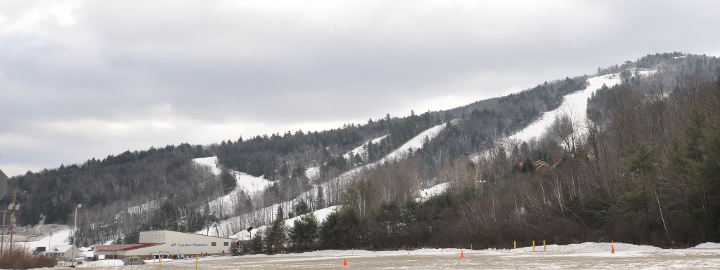
Crotched Mountain Ski & Ride is a downhill ski area in New Hampshire, United States. Mapped terrain includes beginner, easy, intermediate, advanced routes. Its mapped lift network extends from approximately 316 to 585 metres above sea level.
Data: OpenSkiData / OpenSkiMap, OpenStreetMap contributors (ODbL), Skimap.org, Who's On First, Mapterhorn.
Crotched Mountain Ski & Ride - Base lift station
ECMWF · Model run: Next update expected:
Day Time (UTC) Temp. (°C) Humidity (%) Wind (km/h) Wind (knots) Wind (Bft) Direction Precip. (mm) Snow (cm) Pressure (hPa) Freezing (m) Conditions | Thursday, 05/11 06:00 13.4 84 17 9 3B SW — — 1014 3113 Clear 3% cloud 09:00 13.4 87 20 11 3B SW 0 0 1013 3101 Cloudy 56% cloud 12:00 14 94 19 10 3B SW 0 0 1013 3099 Overcast 83% cloud 15:00 16.5 92 20 11 3B SW 1.3 0 1012 3091 Overcast 100% cloud 18:00 18.2 92 22 12 4B SW 1.1 0 1010 3077 Overcast 93% cloud 21:00 18.9 81 19 10 3B SW 0.18 0 1010 3075 Cloudy 65% cloud Friday, 06/11 00:00 17.2 91 20 11 4B SW 0 0 1010 3079 Partly cloudy 30% cloud 03:00 16.9 93 20 11 3B SW 0 0 1010 3077 Overcast 97% cloud 06:00 16.6 95 16 8 3B SW 0.06 0 1011 3073 Overcast 99% cloud 09:00 15.7 98 11 6 2B SW 0.06 0 1011 3068 Cloudy 77% cloud 12:00 14.1 98 5 3 1B W 0 0 1012 3071 Cloudy 75% cloud 15:00 18.1 68 3 2 1B W 0 0 1012 3069 Overcast 91% cloud 18:00 20.6 55 8 4 2B SW 0 0 1010 3056 Overcast 99% cloud 21:00 18.1 73 2 1 1B SE 0 0 1010 3050 Cloudy 61% cloud Saturday, 07/11 00:00 14.1 91 6 3 1B N 0.12 0 1011 3049 Overcast 100% cloud 03:00 13.3 92 11 6 2B N 0.29 0 1011 3041 Overcast 100% cloud 06:00 11.9 93 14 7 3B NE 0.75 0 1011 2995 Overcast 100% cloud 09:00 10.7 97 14 8 3B NE 0.82 0 1010 3019 Overcast 98% cloud 12:00 9.8 93 15 8 3B NE 0.18 0 1011 2916 Overcast 100% cloud 15:00 11.4 74 18 10 3B NE 0 0 1010 2954 Overcast 100% cloud 18:00 11.6 73 11 6 2B NE 0 0 1008 2996 Overcast 100% cloud 21:00 10.2 79 9 5 2B NE 0.12 0 1008 2775 Overcast 100% cloud Sunday, 08/11 00:00 8 91 10 6 2B NE 0.54 0 1008 2483 Overcast 100% cloud 03:00 6.9 96 8 4 2B NE 0.74 0 1007 2233 Overcast 100% cloud 06:00 6.2 99 6 3 2B N 1.7 0 1006 1839 Overcast 100% cloud 09:00 6.5 98 8 4 2B W 0.84 0 1005 1569 Overcast 100% cloud 12:00 5.5 94 22 12 4B NW 0.61 0 1006 1849 Cloudy 74% cloud 15:00 8.6 64 25 13 4B NW 0 0 1007 1660 Partly cloudy 23% cloud 18:00 9.7 62 22 12 4B W 0 0 1006 1363 Overcast 95% cloud 21:00 10.2 62 18 10 3B W 0 0 1005 1504 Cloudy 58% cloud Monday, 09/11 00:00 6.5 73 15 8 3B W 0 0 1005 1732 Clear 17% cloud 03:00 6.8 71 15 8 3B W 0 0 1004 1530 Partly cloudy 43% cloud 06:00 6.6 78 17 9 3B W 0 0 1003 1539 Partly cloudy 40% cloud 09:00 6.5 84 17 9 3B W 0.06 0 1004 1383 Overcast 92% cloud 12:00 6.3 88 17 9 3B W 0.06 0 1004 1306 Cloudy 66% cloud 15:00 9 69 22 12 4B W 0.12 0 1005 1334 Overcast 85% cloud 18:00 9.2 62 23 12 4B NW 0.37 0 1005 1279 Partly cloudy 45% cloud 21:00 8.2 59 20 11 4B NW 0.01 0 1008 1190 Overcast 85% cloud Tuesday, 10/11 00:00 5.8 67 20 11 4B W 0.06 0 1010 1108 Clear 20% cloud 03:00 5.3 66 18 10 3B NW 0 0 1011 1107 Partly cloudy 28% cloud 06:00 4.5 72 15 8 3B W 0 0 1011 1373 Partly cloudy 23% cloud 09:00 4.1 76 17 9 3B W 0 0 1012 2155 Partly cloudy 41% cloud 12:00 3.6 77 16 9 3B W 0 0 1012 2386 Cloudy 80% cloud 15:00 7.3 64 16 9 3B W 0 0 1011 2471 Overcast 98% cloud 18:00 9.4 60 13 7 3B W 0 0 1009 2174 Cloudy 76% cloud 21:00 9.7 58 11 6 2B SW 0 0 1007 1781 Partly cloudy 44% cloud Wednesday, 11/11 00:00 9.4 62 17 9 3B W 0 0 1007 1738 Partly cloudy 46% cloud 03:00 7.7 80 18 10 3B W 0 0 1008 1637 Partly cloudy 20% cloud 06:00 6.3 85 16 9 3B W 0 0 1009 1757 Clear 8% cloud |
|---|
Forecast notes
Forecast table times: UTC.
Coordinates: 43.0112941°N, -71.8774599°E · Requested elevation: 316 m. Model terrain: 295 m. Terrain and 1000/925/850/700 hPa profiles are used for height estimates.
These are altitude estimates, not a simulation of local mountain terrain. Precipitation, cloud and sea-level pressure use horizontal interpolation only.
Precipitation includes rain and snow water equivalent: preceding 3 hours through day 6, then 6 hours (see cell tooltip). Snow (cm) estimates fresh snowfall from precipitation and temperature using the GFS conversion; it is not snow depth on the ground. Freezing (m) uses additional 600/500 hPa temperatures when available and estimates the lowest resolved 0°C crossing above sea level. When all sampled levels are warm, the upper profile limit is shown (see tooltip). < marks an entirely cold sampled profile and its lower height limit. No extrapolation is used.
Source: ECMWF · CC BY 4.0 · Processed by Snow Report.
Crotched Mountain Ski & Ride - Top lift station
ECMWF · Model run: Next update expected:
Day Local time Temp. (°C) Humidity (%) Wind (km/h) Wind (knots) Wind (Bft) Direction Precip. (mm) Snow (cm) Pressure (hPa) Freezing (m) Conditions | Thursday, 05/11 01:00 15.8 58 38 20 5B SW — — 1014 3113 Clear 3% cloud 04:00 15 64 49 26 6B SW 0 0 1013 3101 Cloudy 57% cloud 07:00 14.5 87 48 26 6B SW 0 0 1013 3099 Overcast 84% cloud 10:00 15.1 97 47 25 6B SW 1.3 0 1012 3091 Overcast 100% cloud 13:00 16.2 95 46 25 6B SW 1.1 0 1010 3077 Overcast 93% cloud 16:00 17 87 41 22 6B SW 0.18 0 1010 3075 Cloudy 65% cloud 19:00 16.1 93 47 26 6B SW 0 0 1010 3079 Partly cloudy 29% cloud 22:00 15.9 96 47 25 6B SW 0 0 1010 3077 Overcast 98% cloud Friday, 06/11 01:00 15.4 98 36 19 5B SW 0.06 0 1011 3073 Overcast 99% cloud 04:00 15 96 25 13 4B W 0.06 0 1011 3068 Cloudy 78% cloud 07:00 13.9 83 12 6 2B W 0 0 1012 3071 Cloudy 76% cloud 10:00 15.1 75 5 3 1B W 0 0 1012 3069 Overcast 91% cloud 13:00 17.5 63 11 6 2B SW 0 0 1010 3056 Overcast 99% cloud 16:00 16.5 72 4 2 1B SW 0 0 1010 3050 Cloudy 62% cloud 19:00 14.2 86 8 4 2B NE 0.12 0 1011 3049 Overcast 100% cloud 22:00 13.3 83 22 12 4B NE 0.30 0 1011 3041 Overcast 100% cloud Saturday, 07/11 01:00 11.4 92 33 18 5B NE 0.77 0 1011 2996 Overcast 100% cloud 04:00 9.8 95 35 19 5B NE 0.85 0 1010 3019 Overcast 100% cloud 07:00 8.2 97 36 20 5B NE 0.18 0 1011 2917 Overcast 100% cloud 10:00 8.2 88 32 17 5B NE 0 0 1010 2955 Overcast 100% cloud 13:00 8.5 86 19 10 3B NE 0 0 1008 2996 Overcast 100% cloud 16:00 7.6 89 15 8 3B NE 0.12 0 1008 2773 Overcast 100% cloud 19:00 5.8 95 19 10 3B NE 0.55 0 1008 2482 Overcast 100% cloud 22:00 4.7 98 16 9 3B NE 0.74 0 1007 2232 Overcast 100% cloud Sunday, 08/11 01:00 4.4 98 13 7 3B NE 1.7 0 1006 1838 Overcast 100% cloud 04:00 5 97 22 12 4B NW 0.85 0 1005 1568 Overcast 100% cloud 07:00 3.7 93 49 26 6B NW 0.61 0 1006 1849 Cloudy 74% cloud 10:00 5.4 76 45 24 6B NW 0 0 1007 1663 Partly cloudy 23% cloud 13:00 6.7 73 37 20 5B W 0 0 1006 1364 Overcast 95% cloud 16:00 7.7 70 34 18 5B W 0 0 1005 1503 Cloudy 59% cloud 19:00 6.3 67 39 21 6B W 0 0 1005 1735 Clear 17% cloud 22:00 6.7 65 41 22 6B W 0 0 1004 1531 Partly cloudy 43% cloud Monday, 09/11 01:00 5.3 82 43 23 6B W 0 0 1003 1542 Partly cloudy 40% cloud 04:00 5.1 87 41 22 6B W 0.06 0 1004 1383 Overcast 92% cloud 07:00 4.7 91 41 22 6B W 0.06 0 1004 1307 Cloudy 66% cloud 10:00 5.6 81 36 19 5B W 0.12 0 1005 1335 Overcast 85% cloud 13:00 6 72 36 19 5B NW 0.37 0 1005 1279 Partly cloudy 46% cloud 16:00 5.7 66 36 20 5B NW 0.00 0 1008 1191 Overcast 85% cloud 19:00 3.9 72 43 23 6B NW 0.06 0 1010 1110 Clear 18% cloud 22:00 3.4 71 40 21 6B NW 0 0 1011 1108 Partly cloudy 27% cloud Tuesday, 10/11 01:00 3.1 76 34 19 5B NW 0 0 1011 1387 Partly cloudy 21% cloud 04:00 2.6 79 38 20 5B NW 0 0 1012 2163 Partly cloudy 41% cloud 07:00 2.3 78 38 20 5B W 0 0 1012 2389 Cloudy 79% cloud 10:00 4.2 75 28 15 4B W 0 0 1011 2475 Overcast 98% cloud 13:00 6.3 70 21 11 4B W 0 0 1009 2179 Cloudy 76% cloud 16:00 7.7 62 26 14 4B SW 0 0 1007 1788 Partly cloudy 44% cloud 19:00 7.9 67 40 22 6B W 0 0 1007 1740 Partly cloudy 46% cloud 22:00 6.4 82 42 22 6B W 0 0 1008 1636 Partly cloudy 20% cloud Wednesday, 11/11 01:00 5.5 85 37 20 5B W 0 0 1009 1759 Clear 8% cloud |
|---|
Forecast notes
Forecast table times: America/New_York.
Coordinates: 43.0028702°N, -71.8787353°E · Requested elevation: 585 m. Model terrain: 296 m. Terrain and 1000/925/850/700 hPa profiles are used for height estimates.
These are altitude estimates, not a simulation of local mountain terrain. Precipitation, cloud and sea-level pressure use horizontal interpolation only.
Precipitation includes rain and snow water equivalent: preceding 3 hours through day 6, then 6 hours (see cell tooltip). Snow (cm) estimates fresh snowfall from precipitation and temperature using the GFS conversion; it is not snow depth on the ground. Freezing (m) uses additional 600/500 hPa temperatures when available and estimates the lowest resolved 0°C crossing above sea level. When all sampled levels are warm, the upper profile limit is shown (see tooltip). < marks an entirely cold sampled profile and its lower height limit. No extrapolation is used.