Worldwide Ski Resort Forecasts

More
Colour guide Temperature · Wind · Rain · Snow
Each colour starts at the value shown. Wind colours match across all three units. Dry cells stay neutral. Colours describe the displayed values, not official weather warnings.
Christie Mountain Ski Area - Low lift station
ECMWF · Model run: Next update expected:
Day Time (UTC) Temp. (°C) Humidity (%) Wind (km/h) Wind (knots) Wind (Bft) Direction Precip. (mm) Snow (cm) Pressure (hPa) Freezing (m) Conditions | Thursday, 05/11 06:00 7.5 100 6 3 2B SW — — 1002 2558 Overcast 100% cloud  09:00 8.8 98 14 7 3B N 1.2 0 1003 2480 Overcast 100% cloud 12:00 8.1 94 21 11 4B N 0.26 0 1006 2097 Overcast 100% cloud 15:00 7.2 75 24 13 4B N 0.03 0 1011 1260 Overcast 100% cloud 18:00 6.8 70 20 11 4B N 0.06 0 1014 1097 Overcast 100% cloud 21:00 5.7 68 18 10 3B N 0.00 0 1016 957 Overcast 100% cloud Friday, 06/11 00:00 3.9 68 17 9 3B N 0.06 0 1020 784 Overcast 99% cloud 03:00 3.2 63 14 8 3B NE 0 0 1022 718 Overcast 99% cloud 06:00 2.4 68 8 4 2B NE 0.00 0 1023 681 Partly cloudy 46% cloud  09:00 1.1 76 5 3 1B N 0 0 1024 587 Partly cloudy 33% cloud 12:00 -0.2 85 8 4 2B N 0 0 1026 < 396 Partly cloudy 20% cloud 15:00 3.1 66 9 5 2B N 0 0 1026 667 Clear 15% cloud  18:00 6.3 51 6 3 2B N 0 0 1025 1756 Clear 5% cloud 21:00 7.2 46 7 4 2B NW 0 0 1024 2323 Clear 1% cloud Saturday, 07/11 00:00 2.2 73 6 3 2B NW 0 0 1024 3000 Clear 0% cloud 03:00 0.8 81 4 2 1B NW 0 0 1024 2992 Clear 2% cloud 06:00 -0.7 89 4 2 1B SW 0 0 1023 501 Overcast 87% cloud 09:00 -1 90 6 3 2B SW 0 0 1023 546 Cloudy 61% cloud  12:00 -1.4 92 7 4 2B SW 0 0 1023 563 Clear 11% cloud 15:00 3.2 78 9 5 2B SW 0 0 1023 2891 Clear 0% cloud 18:00 8.8 57 14 8 3B SW 0 0 1020 2958 Clear 8% cloud 21:00 9.8 58 14 7 3B SW 0 0 1018 3062 Overcast 89% cloud Sunday, 08/11 00:00 5.7 80 14 8 3B SW 0 0 1016 3057 Cloudy 61% cloud 03:00 5.7 87 16 9 3B SW 0 0 1015 3050 Partly cloudy 39% cloud 06:00 6.9 88 17 9 3B W 0 0 1014 3028 Clear 0% cloud 09:00 5.8 86 16 9 3B W 0 0 1014 3021 Partly cloudy 31% cloud 12:00 5.7 76 17 9 3B NW 0 0 1016 3028 Clear 0% cloud 15:00 7.7 67 18 10 3B NW 0 0 1018 3038 Clear 2% cloud 18:00 10.5 57 19 10 3B NW 0 0 1017 3043 Clear 5% cloud 21:00 11.2 52 17 9 3B W 0 0 1017 2907 Clear 0% cloud Monday, 09/11 00:00 6.8 70 13 7 3B W 0 0 1018 3038 Clear 0% cloud 03:00 4.8 78 11 6 2B NW 0 0 1019 3068 Partly cloudy 42% cloud 06:00 3.2 86 5 3 1B W 0 0 1019 3076 Overcast 97% cloud 09:00 1.7 92 6 3 2B SW 0 0 1019 3078 Overcast 99% cloud 12:00 2.2 95 9 5 2B S 0 0 1018 3076 Overcast 98% cloud 15:00 5.8 81 10 6 2B S 0 0 1018 3072 Overcast 90% cloud 18:00 11.3 59 15 8 3B SW 0 0 1015 3060 Overcast 95% cloud 21:00 12.8 61 12 6 2B SW 0 0 1013 3038 Overcast 95% cloud Tuesday, 10/11 00:00 8.3 86 11 6 2B W 0.00 0 1014 2889 Overcast 98% cloud 03:00 7.7 86 12 6 2B NW 0 0 1014 2626 Overcast 86% cloud 06:00 5.5 89 14 8 3B NW 0 0 1014 2553 Clear 0% cloud 09:00 4.1 86 14 8 3B NW 0 0 1016 2260 Clear 0% cloud 12:00 2.6 87 12 7 3B NW 0 0 1017 2374 Clear 0% cloud 15:00 5.7 70 11 6 2B NW 0 0 1018 2374 Cloudy 69% cloud 18:00 10.3 49 11 6 2B W 0 0 1017 2411 Overcast 98% cloud 21:00 10 49 13 7 3B W 0 0 1016 2447 Overcast 98% cloud Wednesday, 11/11 00:00 5 74 9 5 2B SW 0 0 1015 2411 Overcast 84% cloud 03:00 4 83 9 5 2B SW 0 0 1014 2168 Overcast 98% cloud 06:00 5.1 83 8 4 2B W 0.25 0 1014 1889 Overcast 98% cloud |
|---|
Forecast notes
Forecast table times: UTC.
Coordinates: 45.5090287°N, -91.380078°E · Requested elevation: 396 m. Model terrain: 393 m. Terrain and 1000/925/850/700 hPa profiles are used for height estimates.
These are altitude estimates, not a simulation of local mountain terrain. Precipitation, cloud and sea-level pressure use horizontal interpolation only.
Precipitation includes rain and snow water equivalent: preceding 3 hours through day 6, then 6 hours (see cell tooltip). Snow (cm) estimates fresh snowfall from precipitation and temperature using the GFS conversion; it is not snow depth on the ground. Freezing (m) uses additional 600/500 hPa temperatures when available and estimates the lowest resolved 0°C crossing above sea level. When all sampled levels are warm, the upper profile limit is shown (see tooltip). < marks an entirely cold sampled profile and its lower height limit. No extrapolation is used.
Source: ECMWF · CC BY 4.0 · Processed by Snow Report.
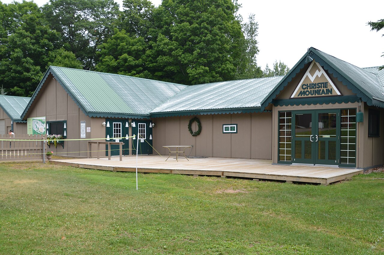
Christie Mountain Ski Area is a downhill ski area in Wisconsin, United States. Mapped terrain includes beginner, easy, intermediate, advanced routes. Its mapped lift network extends from approximately 396 to 502 metres above sea level.
Data: OpenSkiData / OpenSkiMap, OpenStreetMap contributors (ODbL), Skimap.org, Who's On First, Mapterhorn.
Christie Mountain Ski Area - Base lift station
ECMWF · Model run: Next update expected:
Day Time (UTC) Temp. (°C) Humidity (%) Wind (km/h) Wind (knots) Wind (Bft) Direction Precip. (mm) Snow (cm) Pressure (hPa) Freezing (m) Conditions | Thursday, 05/11 06:00 7.5 100 6 3 2B SW — — 1002 2558 Overcast 100% cloud 09:00 8.7 98 14 7 3B N 1.2 0 1003 2480 Overcast 100% cloud 12:00 8.1 94 21 11 4B N 0.26 0 1006 2097 Overcast 100% cloud 15:00 7.2 75 24 13 4B N 0.03 0 1011 1260 Overcast 100% cloud 18:00 6.8 70 20 11 4B N 0.06 0 1014 1097 Overcast 100% cloud 21:00 5.7 68 18 10 3B N 0.00 0 1016 957 Overcast 100% cloud Friday, 06/11 00:00 3.9 68 17 9 3B N 0.06 0 1020 784 Overcast 99% cloud 03:00 3.2 63 14 8 3B NE 0 0 1022 718 Overcast 99% cloud 06:00 2.4 68 8 4 2B NE 0.00 0 1023 681 Partly cloudy 46% cloud 09:00 1 76 5 3 1B N 0 0 1024 587 Partly cloudy 32% cloud 12:00 -0.2 85 8 4 2B N 0 0 1026 < 396 Partly cloudy 20% cloud 15:00 3.1 66 9 5 2B N 0 0 1026 667 Clear 15% cloud 18:00 6.3 51 6 3 2B N 0 0 1025 1757 Clear 5% cloud 21:00 7.1 47 7 4 2B NW 0 0 1024 2323 Clear 1% cloud Saturday, 07/11 00:00 2.2 73 6 3 2B NW 0 0 1024 3000 Clear 0% cloud 03:00 0.8 81 4 2 1B NW 0 0 1024 2992 Clear 2% cloud 06:00 -0.7 89 4 2 1B SW 0 0 1023 501 Overcast 87% cloud 09:00 -1 90 6 3 2B SW 0 0 1023 546 Cloudy 61% cloud 12:00 -1.4 92 7 4 2B SW 0 0 1023 563 Clear 11% cloud 15:00 3.2 78 9 5 2B SW 0 0 1023 2891 Clear 0% cloud 18:00 8.8 57 14 8 3B SW 0 0 1020 2958 Clear 8% cloud 21:00 9.7 58 14 7 3B SW 0 0 1018 3062 Overcast 89% cloud Sunday, 08/11 00:00 5.8 80 14 8 3B SW 0 0 1016 3057 Cloudy 61% cloud 03:00 5.7 87 16 9 3B SW 0 0 1015 3050 Partly cloudy 39% cloud 06:00 6.9 87 17 9 3B W 0 0 1014 3028 Clear 0% cloud 09:00 5.8 86 16 9 3B W 0 0 1014 3021 Partly cloudy 31% cloud 12:00 5.7 76 17 9 3B NW 0 0 1016 3028 Clear 0% cloud 15:00 7.7 67 18 10 3B NW 0 0 1018 3038 Clear 2% cloud 18:00 10.5 57 19 10 3B NW 0 0 1017 3043 Clear 5% cloud 21:00 11.2 52 17 9 3B W 0 0 1017 2907 Clear 0% cloud Monday, 09/11 00:00 6.8 70 13 7 3B W 0 0 1018 3039 Clear 0% cloud 03:00 4.8 78 11 6 2B NW 0 0 1019 3068 Partly cloudy 42% cloud 06:00 3.2 86 5 3 1B W 0 0 1019 3076 Overcast 97% cloud 09:00 1.7 92 6 3 2B SW 0 0 1019 3078 Overcast 99% cloud 12:00 2.2 95 10 5 2B S 0 0 1018 3076 Overcast 98% cloud 15:00 5.8 81 10 6 2B S 0 0 1018 3072 Overcast 90% cloud 18:00 11.3 60 15 8 3B SW 0 0 1015 3060 Overcast 95% cloud 21:00 12.8 61 12 6 2B SW 0 0 1013 3038 Overcast 95% cloud Tuesday, 10/11 00:00 8.3 86 11 6 2B W 0.00 0 1014 2889 Overcast 98% cloud 03:00 7.7 86 12 6 2B NW 0 0 1014 2626 Overcast 86% cloud 06:00 5.5 89 14 8 3B NW 0 0 1014 2554 Clear 0% cloud 09:00 4.1 86 14 8 3B NW 0 0 1016 2260 Clear 0% cloud 12:00 2.6 87 12 7 3B NW 0 0 1017 2375 Clear 0% cloud 15:00 5.7 69 11 6 2B NW 0 0 1018 2374 Cloudy 69% cloud 18:00 10.3 49 11 6 2B W 0 0 1017 2411 Overcast 98% cloud 21:00 10 50 13 7 3B W 0 0 1016 2447 Overcast 98% cloud Wednesday, 11/11 00:00 5 74 9 5 2B SW 0 0 1015 2411 Overcast 84% cloud 03:00 4 82 9 5 2B SW 0 0 1014 2168 Overcast 98% cloud 06:00 5.1 83 8 4 2B W 0.25 0 1014 1889 Overcast 98% cloud |
|---|
Forecast notes
Forecast table times: UTC.
Coordinates: 45.5086713°N, -91.380334°E · Requested elevation: 397 m. Model terrain: 393 m. Terrain and 1000/925/850/700 hPa profiles are used for height estimates.
These are altitude estimates, not a simulation of local mountain terrain. Precipitation, cloud and sea-level pressure use horizontal interpolation only.
Precipitation includes rain and snow water equivalent: preceding 3 hours through day 6, then 6 hours (see cell tooltip). Snow (cm) estimates fresh snowfall from precipitation and temperature using the GFS conversion; it is not snow depth on the ground. Freezing (m) uses additional 600/500 hPa temperatures when available and estimates the lowest resolved 0°C crossing above sea level. When all sampled levels are warm, the upper profile limit is shown (see tooltip). < marks an entirely cold sampled profile and its lower height limit. No extrapolation is used.
Source: ECMWF · CC BY 4.0 · Processed by Snow Report.
Christie Mountain Ski Area - Top lift station
ECMWF · Model run: Next update expected:
Day Time (UTC) Temp. (°C) Humidity (%) Wind (km/h) Wind (knots) Wind (Bft) Direction Precip. (mm) Snow (cm) Pressure (hPa) Freezing (m) Conditions | Thursday, 05/11 06:00 7.1 96 10 5 2B W — — 1002 2558 Overcast 100% cloud 09:00 8 99 22 12 4B N 1.2 0 1003 2479 Overcast 100% cloud 12:00 7.2 96 30 16 5B N 0.26 0 1006 2100 Overcast 100% cloud 15:00 6.1 79 30 16 5B N 0.03 0 1011 1261 Overcast 100% cloud 18:00 5.6 75 24 13 4B N 0.06 0 1014 1098 Overcast 100% cloud 21:00 4.5 72 21 12 4B N 0.00 0 1016 959 Overcast 100% cloud Friday, 06/11 00:00 2.9 71 21 11 4B N 0.05 0 1020 785 Overcast 99% cloud 03:00 2.1 66 18 10 3B NE 0 0 1022 718 Overcast 99% cloud 06:00 1.5 70 12 6 2B NE 0.00 0 1023 682 Partly cloudy 45% cloud 09:00 0.5 76 9 5 2B N 0 0 1024 587 Partly cloudy 32% cloud 12:00 -0.5 84 10 5 2B N 0 0 1026 < 397 Clear 20% cloud 15:00 1.9 70 11 6 2B N 0 0 1026 668 Clear 15% cloud 18:00 4.9 55 7 4 2B N 0 0 1025 1762 Clear 5% cloud 21:00 6 49 8 4 2B NW 0 0 1024 2327 Clear 1% cloud Saturday, 07/11 00:00 2.2 69 8 4 2B NW 0 0 1024 3004 Clear 0% cloud 03:00 1.1 76 5 3 1B NW 0 0 1024 2993 Clear 2% cloud 06:00 0 78 6 3 2B SW 0 0 1023 499 Overcast 87% cloud 09:00 -0.3 81 10 6 2B SW 0 0 1023 545 Cloudy 62% cloud 12:00 -0.5 83 10 5 2B SW 0 0 1023 563 Clear 11% cloud 15:00 3.2 75 13 7 3B SW 0 0 1023 2893 Clear 0% cloud 18:00 7.5 61 18 10 3B SW 0 0 1020 2960 Clear 8% cloud 21:00 8.7 61 17 9 3B SW 0 0 1018 3062 Overcast 89% cloud Sunday, 08/11 00:00 6.2 77 23 13 4B SW 0 0 1016 3057 Cloudy 60% cloud 03:00 6.6 81 28 15 4B SW 0 0 1015 3050 Partly cloudy 39% cloud 06:00 7.2 83 29 16 5B W 0 0 1014 3029 Clear 0% cloud 09:00 6.2 80 28 15 4B NW 0 0 1014 3021 Partly cloudy 32% cloud 12:00 5.6 74 27 15 4B NW 0 0 1016 3028 Clear 0% cloud 15:00 6.6 70 27 15 4B NW 0 0 1018 3038 Clear 2% cloud 18:00 9.2 60 23 13 4B NW 0 0 1017 3043 Clear 5% cloud 21:00 10.1 54 22 12 4B W 0 0 1017 2907 Clear 0% cloud Monday, 09/11 00:00 6.8 66 21 12 4B NW 0 0 1018 3041 Clear 0% cloud 03:00 5.2 71 18 10 3B NW 0 0 1019 3068 Partly cloudy 41% cloud 06:00 4 75 8 5 2B NW 0 0 1019 3076 Overcast 97% cloud 09:00 3.1 76 9 5 2B SW 0 0 1019 3078 Overcast 99% cloud 12:00 3.5 78 15 8 3B SW 0 0 1018 3077 Overcast 98% cloud 15:00 6.3 72 19 10 3B SW 0 0 1018 3072 Overcast 90% cloud 18:00 10.3 61 24 13 4B SW 0 0 1015 3060 Overcast 95% cloud 21:00 11.7 64 15 8 3B SW 0 0 1013 3038 Overcast 95% cloud Tuesday, 10/11 00:00 8.6 80 17 9 3B W 0.00 0 1014 2891 Overcast 98% cloud 03:00 8.2 79 21 12 4B NW 0 0 1014 2627 Overcast 87% cloud 06:00 6.4 74 24 13 4B NW 0 0 1014 2556 Clear 0% cloud 09:00 4.9 75 25 13 4B NW 0 0 1016 2262 Clear 0% cloud 12:00 3.5 75 21 12 4B NW 0 0 1017 2378 Clear 0% cloud 15:00 5.5 64 18 10 3B NW 0 0 1018 2379 Cloudy 68% cloud 18:00 8.9 52 14 8 3B W 0 0 1017 2413 Overcast 98% cloud 21:00 9 52 17 9 3B W 0 0 1016 2449 Overcast 98% cloud Wednesday, 11/11 00:00 5.5 64 14 8 3B W 0 0 1015 2411 Overcast 85% cloud 03:00 4.9 67 15 8 3B W 0 0 1014 2169 Overcast 98% cloud 06:00 5.5 72 15 8 3B W 0.25 0 1014 1890 Overcast 98% cloud |
|---|
Forecast notes
Forecast table times: UTC.
Coordinates: 45.504776°N, -91.3877672°E · Requested elevation: 502 m. Model terrain: 394 m. Terrain and 1000/925/850/700 hPa profiles are used for height estimates.
These are altitude estimates, not a simulation of local mountain terrain. Precipitation, cloud and sea-level pressure use horizontal interpolation only.
Precipitation includes rain and snow water equivalent: preceding 3 hours through day 6, then 6 hours (see cell tooltip). Snow (cm) estimates fresh snowfall from precipitation and temperature using the GFS conversion; it is not snow depth on the ground. Freezing (m) uses additional 600/500 hPa temperatures when available and estimates the lowest resolved 0°C crossing above sea level. When all sampled levels are warm, the upper profile limit is shown (see tooltip). < marks an entirely cold sampled profile and its lower height limit. No extrapolation is used.