Worldwide Ski Resort Forecasts

More
Colour guide Temperature · Wind · Rain · Snow
Each colour starts at the value shown. Wind colours match across all three units. Dry cells stay neutral. Colours describe the displayed values, not official weather warnings.
Bogus Basin Mountain Recreation Area - Low lift station
ECMWF · Model run: Next update expected:
Day Time (UTC) Temp. (°C) Humidity (%) Wind (km/h) Wind (knots) Wind (Bft) Direction Precip. (mm) Snow (cm) Pressure (hPa) Freezing (m) Conditions | Thursday, 05/11 06:00 5.7 49 3 2 1B W — — 1019 2832 Partly cloudy 36% cloud  09:00 5.1 54 1 1 1B NW 0 0 1020 2641 Overcast 100% cloud  12:00 4.9 55 2 1 1B W 0 0 1020 2559 Overcast 100% cloud 15:00 3.9 64 6 3 1B W 0 0 1022 2377 Overcast 92% cloud 18:00 4 68 6 3 2B W 0 0 1022 2356 Cloudy 78% cloud  21:00 4.7 67 9 5 2B W 0 0 1021 2394 Cloudy 58% cloud Friday, 06/11 00:00 4.3 68 12 6 2B NW 0 0 1023 2398 Clear 3% cloud  03:00 3.9 69 7 4 2B NW 0 0 1024 2346 Clear 0% cloud 06:00 4.3 63 7 4 2B N 0 0 1025 2557 Partly cloudy 41% cloud 09:00 4.3 63 4 2 1B N 0 0 1025 2720 Partly cloudy 33% cloud 12:00 4.4 60 3 2 1B NE 0 0 1026 2820 Clear 2% cloud 15:00 4.2 60 3 2 1B SW 0 0 1027 2972 Clear 7% cloud 18:00 4.8 61 4 2 1B SW 0 0 1027 2933 Partly cloudy 43% cloud 21:00 6.9 49 6 3 1B SW 0 0 1025 3101 Clear 4% cloud Saturday, 07/11 00:00 7.2 51 4 2 1B SW 0 0 1025 3142 Partly cloudy 48% cloud 03:00 7.1 52 2 1 1B SE 0 0 1025 3147 Partly cloudy 43% cloud 06:00 7.5 43 3 2 1B SE 0 0 1025 3150 Cloudy 76% cloud 09:00 7.5 41 2 1 1B S 0 0 1025 3149 Overcast 89% cloud 12:00 7.8 39 5 3 1B SE 0 0 1024 3147 Partly cloudy 28% cloud 15:00 7.7 38 8 4 2B S 0 0 1024 3150 Clear 0% cloud 18:00 8.7 40 12 7 3B SE 0 0 1024 3153 Clear 0% cloud 21:00 10.8 39 15 8 3B S 0 0 1022 3151 Clear 2% cloud Sunday, 08/11 00:00 11.4 41 21 11 4B SE 0 0 1021 3147 Cloudy 59% cloud 03:00 11.5 38 25 14 4B SE 0 0 1020 3143 Partly cloudy 49% cloud 06:00 11.2 38 25 14 4B SE 0 0 1020 3141 Partly cloudy 48% cloud 09:00 10.7 40 24 13 4B S 0 0 1019 3130 Overcast 83% cloud 12:00 9.9 41 20 11 4B S 0 0 1019 3127 Overcast 89% cloud 15:00 9.4 41 17 9 3B S 0 0 1020 3128 Overcast 88% cloud 18:00 9.3 43 14 7 3B SW 0 0 1022 3133 Overcast 87% cloud 21:00 9.6 44 9 5 2B SW 0 0 1020 3057 Overcast 100% cloud Monday, 09/11 00:00 9.3 48 5 3 1B W 0 0 1020 3052 Overcast 98% cloud 03:00 8.8 51 4 2 1B SW 0 0 1020 3089 Overcast 94% cloud 06:00 8.5 53 3 2 1B SW 0 0 1020 3050 Overcast 96% cloud 09:00 8.2 52 6 4 2B S 0 0 1020 3040 Overcast 100% cloud 12:00 7.9 52 10 5 2B S 0 0 1020 3058 Cloudy 61% cloud 15:00 7 53 11 6 2B S 0 0 1020 3043 Overcast 100% cloud 18:00 8 52 13 7 3B S 0 0 1021 3121 Overcast 99% cloud 21:00 9.7 48 14 7 3B S 0 0 1019 3113 Overcast 97% cloud Tuesday, 10/11 00:00 9.7 52 13 7 3B SW 0 0 1019 3110 Overcast 98% cloud 03:00 9.6 49 12 7 2B SW 0 0 1020 2955 Overcast 100% cloud 06:00 8.4 54 11 6 2B W 0.02 0 1022 2813 Overcast 99% cloud 09:00 7.8 59 8 4 2B W 0.24 0 1022 2860 Overcast 95% cloud 12:00 7.6 60 5 3 1B W 0 0 1022 2890 Clear 12% cloud 15:00 7.8 57 7 4 2B SW 0 0 1022 2971 Partly cloudy 26% cloud 18:00 8.3 58 12 7 2B S 0 0 1023 3133 Overcast 95% cloud 21:00 10.3 49 14 7 3B SW 0 0 1021 3133 Overcast 94% cloud Wednesday, 11/11 00:00 10.4 49 6 3 2B SW 0.18 0 1020 3129 Partly cloudy 35% cloud 03:00 10.5 48 7 4 2B S 0 0 1020 3132 Partly cloudy 40% cloud 06:00 10.7 45 13 7 3B S 0 0 1020 3135 Clear 11% cloud |
|---|
Forecast notes
Forecast table times: UTC.
Coordinates: 43.7662303°N, -116.0705847°E · Requested elevation: 1758 m. Model terrain: 1390 m. Terrain and 1000/925/850/700 hPa profiles are used for height estimates.
These are altitude estimates, not a simulation of local mountain terrain. Precipitation, cloud and sea-level pressure use horizontal interpolation only.
Precipitation includes rain and snow water equivalent: preceding 3 hours through day 6, then 6 hours (see cell tooltip). Snow (cm) estimates fresh snowfall from precipitation and temperature using the GFS conversion; it is not snow depth on the ground. Freezing (m) uses additional 600/500 hPa temperatures when available and estimates the lowest resolved 0°C crossing above sea level. When all sampled levels are warm, the upper profile limit is shown (see tooltip). < marks an entirely cold sampled profile and its lower height limit. No extrapolation is used.
Source: ECMWF · CC BY 4.0 · Processed by Snow Report.
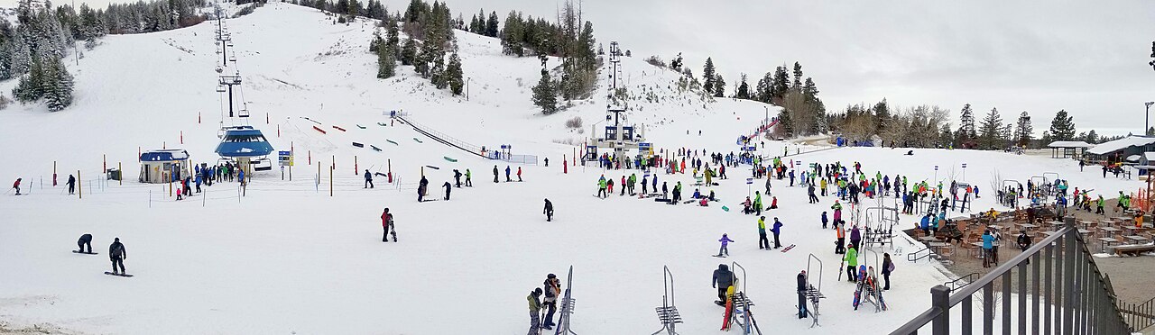
Bogus Basin Mountain Recreation Area is a downhill ski area in Idaho, United States. Mapped terrain includes beginner, easy, intermediate, advanced routes. Its mapped lift network extends from approximately 1758 to 2304 metres above sea level. Cross-country skiing is also mapped within the area.
Data: OpenSkiData / OpenSkiMap, OpenStreetMap contributors (ODbL), Skimap.org, Who's On First, Mapterhorn.
Bogus Basin Mountain Recreation Area - Base lift station
ECMWF · Model run: Next update expected:
Day Time (UTC) Temp. (°C) Humidity (%) Wind (km/h) Wind (knots) Wind (Bft) Direction Precip. (mm) Snow (cm) Pressure (hPa) Freezing (m) Conditions | Thursday, 05/11 06:00 5.1 49 5 3 1B W — — 1019 2833 Partly cloudy 41% cloud 09:00 4.4 54 3 2 1B W 0 0 1020 2645 Overcast 100% cloud 12:00 4.1 56 4 2 1B W 0 0 1020 2560 Overcast 100% cloud 15:00 3.1 66 8 4 2B W 0 0 1022 2380 Overcast 91% cloud 18:00 3.1 70 8 4 2B W 0 0 1023 2349 Cloudy 78% cloud 21:00 3.6 69 10 5 2B W 0 0 1021 2383 Cloudy 51% cloud Friday, 06/11 00:00 3.4 69 12 7 3B NW 0 0 1023 2390 Clear 3% cloud 03:00 3.1 69 7 4 2B NW 0 0 1024 2350 Clear 0% cloud 06:00 3.7 60 8 4 2B NW 0 0 1025 2571 Partly cloudy 40% cloud 09:00 3.8 59 5 2 1B N 0 0 1025 2725 Partly cloudy 36% cloud 12:00 3.9 56 2 1 1B N 0 0 1026 2839 Clear 1% cloud 15:00 3.8 57 5 3 1B SW 0 0 1027 2972 Clear 6% cloud 18:00 4.2 59 5 3 1B SW 0 0 1027 2932 Partly cloudy 39% cloud 21:00 6.1 50 6 3 2B SW 0 0 1025 3101 Clear 4% cloud Saturday, 07/11 00:00 6.6 52 4 2 1B SW 0 0 1025 3142 Partly cloudy 46% cloud 03:00 6.5 53 0 0 0B SW 0 0 1025 3147 Partly cloudy 42% cloud 06:00 7 45 2 1 1B S 0 0 1025 3150 Cloudy 76% cloud 09:00 7 43 3 1 1B SW 0 0 1025 3150 Overcast 89% cloud 12:00 7.4 41 5 3 1B S 0 0 1024 3147 Partly cloudy 27% cloud 15:00 7.2 40 8 4 2B S 0 0 1024 3150 Clear 0% cloud 18:00 8.1 41 13 7 3B S 0 0 1024 3153 Clear 0% cloud 21:00 10 41 15 8 3B S 0 0 1022 3150 Clear 2% cloud Sunday, 08/11 00:00 10.7 41 22 12 4B S 0 0 1020 3147 Cloudy 58% cloud 03:00 10.9 37 28 15 4B S 0 0 1020 3143 Partly cloudy 49% cloud 06:00 10.6 38 28 15 4B S 0 0 1020 3141 Partly cloudy 47% cloud 09:00 10.2 40 27 15 4B S 0 0 1019 3130 Overcast 85% cloud 12:00 9.4 41 22 12 4B S 0 0 1019 3127 Overcast 90% cloud 15:00 8.7 41 18 10 3B S 0 0 1020 3128 Overcast 88% cloud 18:00 8.4 43 16 8 3B SW 0 0 1022 3133 Overcast 88% cloud 21:00 8.6 46 11 6 2B SW 0 0 1020 3056 Overcast 99% cloud Monday, 09/11 00:00 8.3 49 7 4 2B W 0 0 1020 3052 Overcast 98% cloud 03:00 8 52 7 4 2B SW 0 0 1020 3086 Overcast 92% cloud 06:00 7.7 53 6 3 2B SW 0 0 1020 3051 Overcast 97% cloud 09:00 7.4 53 8 4 2B S 0 0 1020 3039 Overcast 99% cloud 12:00 7.1 53 11 6 2B S 0 0 1020 3056 Cloudy 61% cloud 15:00 6.3 53 11 6 2B S 0 0 1020 3042 Overcast 100% cloud 18:00 7.2 52 15 8 3B S 0 0 1021 3120 Overcast 99% cloud 21:00 8.7 49 16 9 3B S 0 0 1019 3113 Overcast 98% cloud Tuesday, 10/11 00:00 8.7 52 16 9 3B SW 0 0 1019 3106 Overcast 98% cloud 03:00 8.6 50 15 8 3B SW 0 0 1020 2954 Overcast 100% cloud 06:00 7.4 57 14 7 3B W 0.01 0 1022 2819 Overcast 99% cloud 09:00 7 61 11 6 2B W 0.24 0 1022 2862 Overcast 95% cloud 12:00 6.8 62 8 5 2B W 0 0 1022 2891 Clear 10% cloud 15:00 7.1 57 10 5 2B SW 0 0 1022 2977 Partly cloudy 28% cloud 18:00 7.6 57 14 7 3B S 0 0 1023 3133 Overcast 95% cloud 21:00 9.3 49 16 8 3B SW 0 0 1021 3133 Overcast 94% cloud Wednesday, 11/11 00:00 9.5 50 9 5 2B SW 0.14 0 1020 3129 Partly cloudy 34% cloud 03:00 9.7 50 8 4 2B S 0 0 1020 3132 Partly cloudy 40% cloud 06:00 10 46 14 8 3B S 0 0 1020 3135 Clear 13% cloud |
|---|
Forecast notes
Forecast table times: UTC.
Coordinates: 43.7637257°N, -116.102464°E · Requested elevation: 1885 m. Model terrain: 1348 m. Terrain and 1000/925/850/700 hPa profiles are used for height estimates.
These are altitude estimates, not a simulation of local mountain terrain. Precipitation, cloud and sea-level pressure use horizontal interpolation only.
Precipitation includes rain and snow water equivalent: preceding 3 hours through day 6, then 6 hours (see cell tooltip). Snow (cm) estimates fresh snowfall from precipitation and temperature using the GFS conversion; it is not snow depth on the ground. Freezing (m) uses additional 600/500 hPa temperatures when available and estimates the lowest resolved 0°C crossing above sea level. When all sampled levels are warm, the upper profile limit is shown (see tooltip). < marks an entirely cold sampled profile and its lower height limit. No extrapolation is used.
Source: ECMWF · CC BY 4.0 · Processed by Snow Report.
Bogus Basin Mountain Recreation Area - Top lift station
ECMWF · Model run: Next update expected:
Day Time (UTC) Temp. (°C) Humidity (%) Wind (km/h) Wind (knots) Wind (Bft) Direction Precip. (mm) Snow (cm) Pressure (hPa) Freezing (m) Conditions | Thursday, 05/11 06:00 2.8 45 10 5 2B W — — 1019 2831 Partly cloudy 39% cloud 09:00 1.9 52 9 5 2B NW 0 0 1020 2642 Overcast 100% cloud 12:00 1.5 55 7 4 2B W 0 0 1020 2557 Overcast 100% cloud 15:00 0.5 71 12 7 2B W 0 0 1022 2377 Overcast 92% cloud 18:00 0.3 76 12 6 2B W 0 0 1023 2352 Cloudy 77% cloud 21:00 0.6 76 13 7 3B W 0 0 1021 2388 Cloudy 53% cloud Friday, 06/11 00:00 0.6 73 14 7 3B NW 0 0 1023 2394 Clear 3% cloud 03:00 0.3 69 7 4 2B NW 0 0 1024 2348 Clear 0% cloud 06:00 1.4 52 10 5 2B NW 0 0 1025 2563 Partly cloudy 40% cloud 09:00 1.9 48 6 3 2B N 0 0 1025 2721 Partly cloudy 35% cloud 12:00 2.2 46 6 3 1B NW 0 0 1026 2829 Clear 2% cloud 15:00 2.3 48 11 6 2B W 0 0 1027 2970 Clear 7% cloud 18:00 2.5 53 12 6 2B W 0 0 1027 2931 Partly cloudy 40% cloud 21:00 4 49 12 6 2B W 0 0 1025 3099 Clear 4% cloud Saturday, 07/11 00:00 4.6 57 10 5 2B W 0 0 1025 3142 Partly cloudy 47% cloud 03:00 4.5 62 9 5 2B NW 0 0 1025 3147 Partly cloudy 43% cloud 06:00 5 53 7 4 2B NW 0 0 1025 3150 Cloudy 76% cloud 09:00 5.1 49 9 5 2B W 0 0 1025 3149 Overcast 89% cloud 12:00 5.7 46 10 5 2B SW 0 0 1024 3147 Partly cloudy 28% cloud 15:00 5.7 44 10 6 2B SW 0 0 1024 3150 Clear 0% cloud 18:00 6.4 44 12 6 2B SW 0 0 1024 3153 Clear 0% cloud 21:00 7.8 42 15 8 3B S 0 0 1022 3150 Clear 2% cloud Sunday, 08/11 00:00 8.5 41 21 11 4B S 0 0 1021 3147 Cloudy 59% cloud 03:00 8.8 37 29 16 5B S 0 0 1020 3143 Partly cloudy 49% cloud 06:00 8.5 39 29 16 5B S 0 0 1020 3141 Partly cloudy 48% cloud 09:00 8.1 39 29 15 4B S 0 0 1019 3129 Overcast 84% cloud 12:00 7.2 41 23 13 4B SW 0 0 1019 3127 Overcast 90% cloud 15:00 6.1 41 20 11 4B SW 0 0 1020 3128 Overcast 88% cloud 18:00 5.6 44 20 11 4B SW 0 0 1022 3133 Overcast 87% cloud 21:00 5.5 49 18 10 3B SW 0 0 1020 3054 Overcast 99% cloud Monday, 09/11 00:00 5.3 51 16 9 3B SW 0 0 1020 3050 Overcast 98% cloud 03:00 5.2 53 19 10 3B SW 0 0 1020 3083 Overcast 93% cloud 06:00 4.9 56 16 9 3B SW 0 0 1020 3048 Overcast 97% cloud 09:00 4.7 56 15 8 3B SW 0 0 1020 3036 Overcast 99% cloud 12:00 4.5 55 14 7 3B SW 0 0 1020 3054 Cloudy 61% cloud 15:00 4 52 13 7 3B SW 0 0 1020 3040 Overcast 100% cloud 18:00 4.8 51 18 10 3B S 0 0 1021 3120 Overcast 99% cloud 21:00 5.8 50 23 12 4B SW 0 0 1019 3113 Overcast 98% cloud Tuesday, 10/11 00:00 5.7 53 24 13 4B SW 0 0 1019 3107 Overcast 98% cloud 03:00 5.2 55 24 13 4B SW 0 0 1020 2953 Overcast 100% cloud 06:00 4.1 66 21 11 4B W 0.02 0 1022 2815 Overcast 99% cloud 09:00 4 72 17 9 3B W 0.24 0 1022 2860 Overcast 94% cloud 12:00 3.9 68 16 9 3B W 0 0 1022 2890 Clear 12% cloud 15:00 4.3 59 20 11 4B SW 0 0 1022 2973 Partly cloudy 28% cloud 18:00 5.1 55 20 11 4B SW 0 0 1023 3133 Overcast 95% cloud 21:00 6.3 49 24 13 4B W 0 0 1021 3133 Overcast 94% cloud Wednesday, 11/11 00:00 6.5 56 18 10 3B W 0.16 0 1020 3129 Partly cloudy 34% cloud 03:00 6.7 58 13 7 3B SW 0 0 1020 3132 Partly cloudy 40% cloud 06:00 7.1 52 17 9 3B SW 0 0 1020 3134 Clear 12% cloud |
|---|
Forecast notes
Forecast table times: UTC.
Coordinates: 43.7714775°N, -116.0876573°E · Requested elevation: 2304 m. Model terrain: 1366 m. Terrain and 1000/925/850/700 hPa profiles are used for height estimates.
These are altitude estimates, not a simulation of local mountain terrain. Precipitation, cloud and sea-level pressure use horizontal interpolation only.
Precipitation includes rain and snow water equivalent: preceding 3 hours through day 6, then 6 hours (see cell tooltip). Snow (cm) estimates fresh snowfall from precipitation and temperature using the GFS conversion; it is not snow depth on the ground. Freezing (m) uses additional 600/500 hPa temperatures when available and estimates the lowest resolved 0°C crossing above sea level. When all sampled levels are warm, the upper profile limit is shown (see tooltip). < marks an entirely cold sampled profile and its lower height limit. No extrapolation is used.