Worldwide Ski Resort Forecasts

More
Colour guide Temperature · Wind · Rain · Snow
Each colour starts at the value shown. Wind colours match across all three units. Dry cells stay neutral. Colours describe the displayed values, not official weather warnings.
Shiga Kogen Okushiga Kogen Ski Area - Low lift station
ECMWF · Model run: Next update expected:
Day Time (UTC) Temp. (°C) Humidity (%) Wind (km/h) Wind (knots) Wind (Bft) Direction Precip. (mm) Snow (cm) Pressure (hPa) Freezing (m) Conditions | Thursday, 05/11 06:00 10.9 79 13 7 3B SW — — 1011 3054 Partly cloudy 29% cloud  09:00 10.7 81 6 3 2B SW 0 0 1010 3045 Overcast 82% cloud  12:00 11.3 73 17 9 3B SW 0.50 0 1007 3031 Overcast 99% cloud 15:00 10.9 72 18 10 3B SW 0.12 0 1006 3016 Partly cloudy 42% cloud 18:00 9.5 82 13 7 3B W 0.75 0 1005 2998 Cloudy 80% cloud  21:00 8.1 91 18 10 3B NW 0.93 0 1007 2939 Overcast 97% cloud Friday, 06/11 00:00 7.8 87 17 9 3B NW 1.1 0 1010 2856 Overcast 94% cloud 03:00 9.1 66 14 7 3B W 0.06 0 1008 2840 Partly cloudy 45% cloud 06:00 8.7 65 18 10 3B W 0.08 0 1009 2768 Partly cloudy 41% cloud 09:00 5.9 77 16 9 3B W 0.06 0 1013 2576 Partly cloudy 46% cloud 12:00 3.1 86 18 10 3B NW 0.07 0 1017 2111 Overcast 96% cloud 15:00 1.2 92 20 11 3B NW 0.69 0 1018 1702 Overcast 100% cloud 18:00 -0.2 89 19 10 3B NW 0.73 0.2 1019 1456 Overcast 100% cloud 21:00 -0.1 86 16 9 3B W 0.40 0.1 1020 1462 Overcast 96% cloud Saturday, 07/11 00:00 0 93 21 11 4B NW 0.52 0.2 1022 1478 Overcast 100% cloud 03:00 0 81 27 14 4B NW 1.1 0.3 1023 1475 Cloudy 59% cloud 06:00 -0.7 81 28 15 4B NW 0.56 0.2 1025 1432 Cloudy 57% cloud 09:00 -2 89 24 13 4B NW 0.42 0.1 1028 < 1332 Cloudy 79% cloud 12:00 -2.5 86 19 10 3B NW 0.12 0 1030 < 1332 Cloudy 78% cloud 15:00 -2.7 84 19 10 3B NW 0.03 0 1032 < 1332 Overcast 83% cloud 18:00 -2.7 89 21 11 4B NW 0.03 0 1032 < 1332 Overcast 92% cloud 21:00 -2.8 89 18 10 3B NW 0.20 0 1034 < 1332 Overcast 95% cloud Sunday, 08/11 00:00 -1.7 87 14 8 3B NW 0.15 0 1035 < 1332 Overcast 98% cloud 03:00 -0.2 83 15 8 3B N 0.02 0 1034 1460 Overcast 94% cloud 06:00 -0.2 78 10 5 2B N 0.00 0 1033 1452 Overcast 92% cloud 09:00 -0.9 75 4 2 1B N 0 0 1032 < 1332 Overcast 86% cloud 12:00 0.2 74 2 1 1B S 0 0 1032 1693 Cloudy 74% cloud 15:00 1.3 68 8 5 2B S 0 0 1029 2048 Overcast 84% cloud 18:00 2.1 64 8 4 2B SW 0 0 1027 2127 Overcast 97% cloud 21:00 3.1 58 11 6 2B SW 0 0 1026 2240 Overcast 93% cloud Monday, 09/11 00:00 5.3 55 11 6 2B SW 0.10 0 1024 2357 Overcast 93% cloud 03:00 6.2 62 12 7 3B SW 0.02 0 1021 2394 Partly cloudy 50% cloud 06:00 5.6 70 3 2 1B NW 0 0 1020 2294 Partly cloudy 43% cloud 09:00 3.8 78 7 4 2B NW 0.01 0 1021 2176 Cloudy 60% cloud 12:00 1.4 97 18 10 3B NW 1.5 0 1023 1747 Overcast 100% cloud 15:00 -1.2 97 21 11 4B NW 2.1 0.6 1025 < 1332 Overcast 100% cloud 18:00 -2.5 91 20 11 4B NW 0.60 0.2 1025 < 1332 Overcast 99% cloud 21:00 -3.1 90 21 11 4B NW 0.19 0.2 1026 < 1332 Overcast 97% cloud Tuesday, 10/11 00:00 -2.7 91 21 12 4B NW 0.31 0.1 1027 < 1332 Overcast 95% cloud 03:00 -2 92 22 12 4B NW 1.3 0.4 1026 < 1332 Overcast 97% cloud 06:00 -2.9 89 14 8 3B NW 1.1 1.1 1027 < 1332 Overcast 96% cloud 09:00 -3.6 88 12 7 3B NW 0.05 0 1029 < 1332 Overcast 95% cloud 12:00 -3.2 73 9 5 2B NW 0.02 0 1028 < 1332 Cloudy 72% cloud 15:00 -3.4 72 7 4 2B NW 0 0 1028 < 1332 Partly cloudy 29% cloud 18:00 -3.6 77 8 4 2B NW 0 0 1028 < 1332 Partly cloudy 31% cloud 21:00 -3.3 83 8 4 2B NW 0 0 1030 < 1332 Cloudy 80% cloud Wednesday, 11/11 00:00 -1.3 79 8 5 2B NW 0 0 1031 1376 Partly cloudy 34% cloud 03:00 0.6 66 8 4 2B NW 0 0 1029 1517 Partly cloudy 37% cloud 06:00 1 56 9 5 2B NW 0 0 1030 1572 Clear 17% cloud  |
|---|
Forecast notes
Forecast table times: UTC.
Coordinates: 36.7663654°N, 138.5351149°E · Requested elevation: 1473 m. Model terrain: 1329 m. Terrain and 1000/925/850/700 hPa profiles are used for height estimates.
These are altitude estimates, not a simulation of local mountain terrain. Precipitation, cloud and sea-level pressure use horizontal interpolation only.
Precipitation includes rain and snow water equivalent: preceding 3 hours through day 6, then 6 hours (see cell tooltip). Snow (cm) estimates fresh snowfall from precipitation and temperature using the GFS conversion; it is not snow depth on the ground. Freezing (m) uses additional 600/500 hPa temperatures when available and estimates the lowest resolved 0°C crossing above sea level. When all sampled levels are warm, the upper profile limit is shown (see tooltip). < marks an entirely cold sampled profile and its lower height limit. No extrapolation is used.
Source: ECMWF · CC BY 4.0 · Processed by Snow Report.
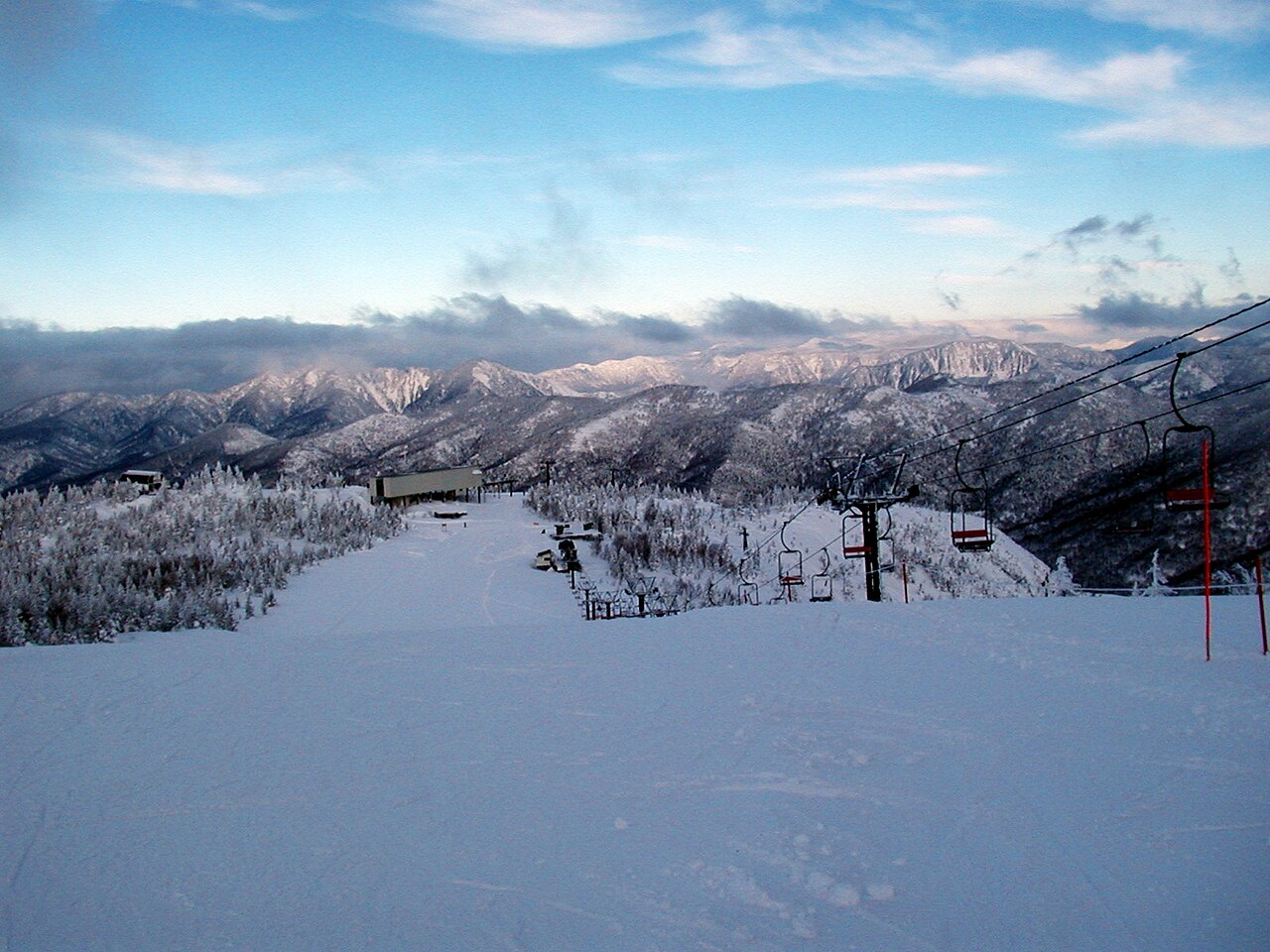
Shiga Kogen Okushiga Kogen Ski Area is a downhill ski area in Nagano Prefecture, Japan. Mapped terrain includes easy, intermediate, advanced routes. Its mapped lift network extends from approximately 1473 to 1999 metres above sea level.
Data: OpenSkiData / OpenSkiMap, OpenStreetMap contributors (ODbL), Skimap.org, Who's On First, Mapterhorn.
Shiga Kogen Okushiga Kogen Ski Area - Base lift station
ECMWF · Model run: Next update expected:
Day Time (UTC) Temp. (°C) Humidity (%) Wind (km/h) Wind (knots) Wind (Bft) Direction Precip. (mm) Snow (cm) Pressure (hPa) Freezing (m) Conditions | Thursday, 05/11 06:00 10.8 78 14 7 3B SW — — 1011 3054 Partly cloudy 29% cloud 09:00 10.5 81 7 4 2B SW 0 0 1010 3045 Overcast 83% cloud 12:00 11.2 73 18 10 3B SW 0.50 0 1007 3030 Overcast 99% cloud 15:00 10.7 72 19 10 3B SW 0.11 0 1006 3016 Partly cloudy 45% cloud 18:00 9.3 83 14 8 3B W 0.77 0 1005 2998 Overcast 81% cloud 21:00 7.9 92 19 10 3B NW 1.2 0 1007 2934 Overcast 98% cloud Friday, 06/11 00:00 7.5 87 19 10 3B NW 1.1 0 1010 2843 Overcast 94% cloud 03:00 8.8 66 16 9 3B W 0.05 0 1008 2827 Partly cloudy 43% cloud 06:00 8.5 65 20 11 4B W 0.06 0 1010 2762 Partly cloudy 40% cloud 09:00 5.7 76 18 10 3B W 0.05 0 1013 2563 Partly cloudy 43% cloud 12:00 2.9 86 20 11 3B NW 0.06 0 1017 2092 Overcast 96% cloud 15:00 1 92 20 11 4B NW 0.78 0.2 1018 1686 Overcast 100% cloud 18:00 -0.4 90 20 11 3B NW 0.86 0.3 1019 1449 Overcast 99% cloud 21:00 -0.3 85 19 10 3B W 0.42 0.1 1020 1457 Overcast 94% cloud Saturday, 07/11 00:00 -0.4 94 24 13 4B NW 0.63 0.2 1022 1468 Overcast 100% cloud 03:00 -0.6 83 30 16 5B NW 1.3 0.4 1023 1465 Cloudy 61% cloud 06:00 -1.2 83 31 17 5B NW 0.73 0.2 1025 1416 Cloudy 58% cloud 09:00 -2.4 89 27 15 4B NW 0.55 0.2 1028 < 1290 Cloudy 79% cloud 12:00 -2.8 85 22 12 4B NW 0.17 0 1030 < 1290 Cloudy 78% cloud 15:00 -3 84 21 12 4B NW 0.03 0 1032 < 1290 Overcast 82% cloud 18:00 -3 90 23 13 4B NW 0.05 0 1032 < 1290 Overcast 92% cloud 21:00 -3.1 89 20 11 4B NW 0.22 0.2 1034 < 1290 Overcast 94% cloud Sunday, 08/11 00:00 -2 88 15 8 3B NW 0.17 0 1035 1305 Overcast 98% cloud 03:00 -0.6 85 15 8 3B N 0.03 0 1034 1448 Overcast 95% cloud 06:00 -0.6 79 11 6 2B N 0.00 0 1033 1442 Overcast 92% cloud 09:00 -0.6 74 4 2 1B N 0 0 1032 < 1290 Overcast 87% cloud 12:00 0.2 73 2 1 1B SW 0 0 1032 1672 Cloudy 74% cloud 15:00 1.5 66 10 6 2B SW 0 0 1029 2044 Overcast 84% cloud 18:00 2.3 63 10 5 2B SW 0 0 1028 2122 Overcast 97% cloud 21:00 3.4 56 13 7 3B SW 0 0 1026 2235 Overcast 93% cloud Monday, 09/11 00:00 5.1 55 13 7 3B SW 0.10 0 1024 2355 Overcast 93% cloud 03:00 5.7 62 13 7 3B SW 0.01 0 1021 2387 Cloudy 50% cloud 06:00 5.2 71 4 2 1B W 0 0 1020 2287 Partly cloudy 45% cloud 09:00 4 78 10 5 2B NW 0.01 0 1021 2169 Cloudy 63% cloud 12:00 1.1 97 20 11 4B NW 1.6 0.5 1024 1729 Overcast 100% cloud 15:00 -1.5 96 22 12 4B NW 2.3 0.7 1025 1316 Overcast 100% cloud 18:00 -2.7 90 21 12 4B NW 0.63 0.2 1025 < 1290 Overcast 99% cloud 21:00 -3.3 90 23 12 4B NW 0.21 0.2 1026 < 1290 Overcast 97% cloud Tuesday, 10/11 00:00 -3 91 23 12 4B NW 0.36 0.4 1027 < 1290 Overcast 95% cloud 03:00 -2.3 93 23 13 4B NW 1.5 0.4 1026 < 1290 Overcast 97% cloud 06:00 -3.2 89 15 8 3B NW 1.1 1.1 1027 < 1290 Overcast 96% cloud 09:00 -3.8 87 13 7 3B NW 0.09 0.1 1029 < 1290 Overcast 95% cloud 12:00 -3 70 10 6 2B NW 0.03 0 1028 < 1290 Cloudy 73% cloud 15:00 -3.2 70 9 5 2B NW 0 0 1028 < 1290 Partly cloudy 30% cloud 18:00 -3.4 76 9 5 2B NW 0 0 1028 < 1290 Partly cloudy 34% cloud 21:00 -3.2 82 10 5 2B NW 0 0 1030 < 1290 Cloudy 80% cloud Wednesday, 11/11 00:00 -1.8 81 9 5 2B NW 0 0 1031 1358 Partly cloudy 37% cloud 03:00 0.1 68 9 5 2B NW 0 0 1030 1507 Partly cloudy 39% cloud 06:00 0.6 56 9 5 2B NW 0 0 1030 1560 Clear 17% cloud |
|---|
Forecast notes
Forecast table times: UTC.
Coordinates: 36.7795032°N, 138.527926°E · Requested elevation: 1500 m. Model terrain: 1288 m. Terrain and 1000/925/850/700 hPa profiles are used for height estimates.
These are altitude estimates, not a simulation of local mountain terrain. Precipitation, cloud and sea-level pressure use horizontal interpolation only.
Precipitation includes rain and snow water equivalent: preceding 3 hours through day 6, then 6 hours (see cell tooltip). Snow (cm) estimates fresh snowfall from precipitation and temperature using the GFS conversion; it is not snow depth on the ground. Freezing (m) uses additional 600/500 hPa temperatures when available and estimates the lowest resolved 0°C crossing above sea level. When all sampled levels are warm, the upper profile limit is shown (see tooltip). < marks an entirely cold sampled profile and its lower height limit. No extrapolation is used.
Source: ECMWF · CC BY 4.0 · Processed by Snow Report.
Shiga Kogen Okushiga Kogen Ski Area - Top lift station
ECMWF · Model run: Next update expected:
Day Time (UTC) Temp. (°C) Humidity (%) Wind (km/h) Wind (knots) Wind (Bft) Direction Precip. (mm) Snow (cm) Pressure (hPa) Freezing (m) Conditions | Thursday, 05/11 06:00 8.2 75 25 13 4B SW — — 1011 3054 Partly cloudy 26% cloud 09:00 8 79 20 11 3B SW 0 0 1010 3045 Overcast 84% cloud 12:00 8.6 73 29 16 5B SW 0.53 0 1007 3030 Overcast 99% cloud 15:00 7.9 77 33 18 5B SW 0.12 0 1006 3016 Partly cloudy 43% cloud 18:00 6.4 88 33 18 5B W 0.82 0 1005 2999 Cloudy 79% cloud 21:00 5.1 94 33 18 5B NW 0.88 0 1007 2932 Overcast 97% cloud Friday, 06/11 00:00 4.8 80 33 18 5B W 0.96 0 1010 2841 Overcast 95% cloud 03:00 5.5 62 33 18 5B W 0.02 0 1008 2830 Partly cloudy 43% cloud 06:00 5.2 61 33 18 5B W 0.03 0 1010 2766 Partly cloudy 40% cloud 09:00 3.1 65 30 16 5B W 0.02 0 1013 2567 Partly cloudy 41% cloud 12:00 0.5 76 29 16 4B W 0.03 0 1017 2097 Overcast 97% cloud 15:00 -1.6 88 28 15 4B W 0.62 0.2 1018 1695 Overcast 100% cloud 18:00 -3 85 33 18 5B W 0.65 0.6 1019 1455 Overcast 100% cloud 21:00 -3.3 85 40 22 6B W 0.39 0.4 1020 1464 Overcast 97% cloud Saturday, 07/11 00:00 -3.6 94 41 22 6B W 0.48 0.5 1022 1479 Overcast 100% cloud 03:00 -3.7 81 47 25 6B W 1.0 1 1023 1479 Cloudy 56% cloud 06:00 -4.1 78 49 26 6B W 0.52 0.5 1025 1440 Cloudy 53% cloud 09:00 -4.5 72 47 25 6B NW 0.37 0.4 1028 < 1349 Cloudy 77% cloud 12:00 -4.2 61 43 23 6B NW 0.07 0.1 1030 < 1349 Cloudy 76% cloud 15:00 -4 62 42 22 6B NW 0.01 0 1032 < 1349 Overcast 81% cloud 18:00 -3.8 66 43 23 6B NW 0.02 0 1032 < 1349 Overcast 91% cloud 21:00 -3.5 65 40 22 6B NW 0.16 0.2 1034 < 1349 Overcast 95% cloud Sunday, 08/11 00:00 -2.6 67 31 17 5B NW 0.14 0 1035 < 1349 Overcast 98% cloud 03:00 -1.5 69 24 13 4B NW 0.01 0 1034 1463 Overcast 94% cloud 06:00 -1.4 66 19 10 3B NW 0.00 0 1033 1452 Overcast 92% cloud 09:00 -0.9 64 18 10 3B W 0 0 1031 < 1349 Overcast 87% cloud 12:00 -0.9 71 17 9 3B W 0 0 1032 1352 Cloudy 72% cloud 15:00 0.2 66 25 14 4B SW 0 0 1029 2059 Overcast 84% cloud 18:00 0.6 61 27 14 4B SW 0 0 1027 2133 Overcast 97% cloud 21:00 1.3 58 31 17 5B SW 0 0 1026 2240 Overcast 92% cloud Monday, 09/11 00:00 2.1 58 28 15 4B SW 0.11 0 1024 2358 Overcast 94% cloud 03:00 2.5 67 28 15 4B SW 0.01 0 1021 2394 Cloudy 51% cloud 06:00 2 74 21 11 4B W 0 0 1020 2299 Partly cloudy 41% cloud 09:00 1.1 79 21 11 4B W 0.01 0 1021 2177 Cloudy 62% cloud 12:00 -1.3 97 21 12 4B NW 1.5 0.4 1024 1733 Overcast 100% cloud 15:00 -3.5 95 27 14 4B NW 2.1 1.6 1025 < 1349 Overcast 100% cloud 18:00 -4.2 69 35 19 5B NW 0.55 0.5 1025 < 1349 Overcast 99% cloud 21:00 -4.5 69 39 21 6B NW 0.16 0.2 1026 < 1349 Overcast 97% cloud Tuesday, 10/11 00:00 -4.4 70 37 20 5B NW 0.29 0.3 1027 < 1349 Overcast 94% cloud 03:00 -3.9 73 35 19 5B NW 1.3 1.3 1026 < 1349 Overcast 97% cloud 06:00 -4 63 29 16 5B NW 1.1 1.1 1027 < 1349 Overcast 96% cloud 09:00 -4.3 61 24 13 4B NW 0.04 0 1029 < 1349 Overcast 95% cloud 12:00 -3.6 54 19 10 3B W 0.01 0 1028 < 1349 Cloudy 72% cloud 15:00 -4 56 19 10 3B W 0 0 1028 < 1349 Partly cloudy 27% cloud 18:00 -4.2 61 22 12 4B W 0 0 1029 < 1349 Partly cloudy 31% cloud 21:00 -4.2 66 23 13 4B W 0 0 1030 < 1349 Overcast 81% cloud Wednesday, 11/11 00:00 -3.7 69 22 12 4B NW 0 0 1031 1381 Partly cloudy 33% cloud 03:00 -2.4 59 23 12 4B NW 0 0 1030 1521 Partly cloudy 38% cloud 06:00 -1.6 46 21 12 4B NW 0 0 1030 1578 Clear 19% cloud |
|---|
Forecast notes
Forecast table times: UTC.
Coordinates: 36.7627922°N, 138.5112999°E · Requested elevation: 1999 m. Model terrain: 1346 m. Terrain and 1000/925/850/700 hPa profiles are used for height estimates.
These are altitude estimates, not a simulation of local mountain terrain. Precipitation, cloud and sea-level pressure use horizontal interpolation only.
Precipitation includes rain and snow water equivalent: preceding 3 hours through day 6, then 6 hours (see cell tooltip). Snow (cm) estimates fresh snowfall from precipitation and temperature using the GFS conversion; it is not snow depth on the ground. Freezing (m) uses additional 600/500 hPa temperatures when available and estimates the lowest resolved 0°C crossing above sea level. When all sampled levels are warm, the upper profile limit is shown (see tooltip). < marks an entirely cold sampled profile and its lower height limit. No extrapolation is used.