Worldwide Ski Resort Forecasts

More
Colour guide Temperature · Wind · Rain · Snow
Each colour starts at the value shown. Wind colours match across all three units. Dry cells stay neutral. Colours describe the displayed values, not official weather warnings.
Myoko Suginohara Ski Resort - Low lift station
ECMWF · Model run: Next update expected:
Day Time (UTC) Temp. (°C) Humidity (%) Wind (km/h) Wind (knots) Wind (Bft) Direction Precip. (mm) Snow (cm) Pressure (hPa) Freezing (m) Conditions | Thursday, 05/11 06:00 16.5 67 2 1 1B W — — 1010 3050 Partly cloudy 25% cloud  09:00 12.7 82 2 1 1B S 0.03 0 1009 3042 Overcast 94% cloud  12:00 12 87 4 2 1B SW 0.80 0 1007 3027 Overcast 91% cloud 15:00 11.8 84 3 2 1B SW 0.15 0 1006 3013 Cloudy 79% cloud  18:00 11.4 88 2 1 1B W 1.7 0 1005 2998 Overcast 82% cloud 21:00 10.7 95 5 3 1B NW 4.1 0 1007 2877 Overcast 98% cloud Friday, 06/11 00:00 12.8 92 5 2 1B NW 2.1 0 1009 2810 Cloudy 56% cloud 03:00 15.5 59 7 4 2B W 1.6 0 1008 2803 Cloudy 58% cloud 06:00 14 63 9 5 2B W 0.68 0 1010 2728 Partly cloudy 49% cloud 09:00 9.5 83 8 4 2B NW 0.20 0 1013 2507 Partly cloudy 42% cloud 12:00 7.3 93 6 3 2B NW 0.54 0 1017 2031 Overcast 80% cloud 15:00 6 93 9 5 2B N 3.3 0 1018 1658 Overcast 99% cloud 18:00 4.8 95 6 3 1B NW 3.2 0 1018 1485 Overcast 97% cloud 21:00 4.7 90 6 3 2B W 1.3 0 1019 1556 Cloudy 77% cloud Saturday, 07/11 00:00 5.4 90 8 5 2B NW 2.2 0 1023 1429 Overcast 98% cloud 03:00 5.6 81 8 4 2B NW 3.5 0 1024 1376 Overcast 83% cloud 06:00 5 78 8 4 2B NW 2.6 0 1025 1333 Cloudy 68% cloud 09:00 3.3 86 6 3 2B NW 1.5 0 1028 1206 Cloudy 69% cloud 12:00 2.7 85 6 3 2B NW 0.66 0 1030 1143 Cloudy 62% cloud 15:00 2.4 81 7 4 2B NW 0.12 0 1031 1130 Cloudy 69% cloud 18:00 2.9 85 7 4 2B NW 0.27 0 1032 1135 Cloudy 79% cloud 21:00 3.1 86 4 2 1B NW 0.29 0 1033 1129 Overcast 86% cloud Sunday, 08/11 00:00 5.2 74 6 3 2B NW 0.13 0 1034 1304 Cloudy 78% cloud 03:00 7.5 57 10 5 2B N 0.03 0 1032 1417 Cloudy 76% cloud 06:00 6.5 61 9 5 2B N 0.02 0 1031 1428 Cloudy 73% cloud 09:00 4 75 4 2 1B N 0 0 1032 1480 Cloudy 79% cloud 12:00 4 74 1 1 1B NW 0 0 1032 1618 Overcast 84% cloud 15:00 3.8 75 3 1 1B SW 0.03 0 1030 2082 Overcast 89% cloud 18:00 3.9 77 2 1 1B W 0.02 0 1028 2131 Overcast 99% cloud 21:00 4.4 79 3 2 1B SW 0.14 0 1026 2231 Overcast 96% cloud Monday, 09/11 00:00 8.5 70 5 3 1B SW 0.09 0 1025 2325 Overcast 84% cloud 03:00 11.8 56 3 1 1B W 0 0 1021 2331 Partly cloudy 35% cloud 06:00 11.2 63 5 3 1B N 0.03 0 1020 2275 Cloudy 56% cloud 09:00 7.3 88 7 4 2B NW 0.48 0 1021 2200 Cloudy 78% cloud 12:00 5.5 98 12 6 2B N 5.2 0 1024 1614 Overcast 99% cloud 15:00 4.2 96 8 4 2B N 2.2 0 1024 1317 Overcast 97% cloud 18:00 3.1 93 8 4 2B N 1.1 0 1025 1158 Overcast 86% cloud 21:00 2.7 91 6 3 2B N 0.37 0 1025 1102 Overcast 89% cloud Tuesday, 10/11 00:00 4.1 81 8 4 2B N 0.60 0 1027 1192 Cloudy 71% cloud 03:00 4.7 77 11 6 2B N 1.5 0 1026 1251 Overcast 84% cloud 06:00 3.4 82 10 5 2B N 1.7 0 1026 1126 Overcast 88% cloud 09:00 2 90 6 3 2B N 0.23 0 1028 1027 Overcast 91% cloud 12:00 1.5 89 4 2 1B N 0.05 0 1028 1005 Overcast 81% cloud 15:00 1 87 1 1 1B NW 0.03 0 1028 930 Cloudy 76% cloud 18:00 0.4 85 2 1 1B W 0 0 1028 836 Cloudy 76% cloud 21:00 0.3 85 1 0 0B W 0 0 1029 817 Cloudy 63% cloud Wednesday, 11/11 00:00 4.9 66 3 2 1B N 0.09 0 1030 1261 Cloudy 55% cloud 03:00 7.6 54 7 4 2B N 0 0 1029 1429 Partly cloudy 26% cloud 06:00 7.5 53 9 5 2B N 0 0 1029 1523 Clear 12% cloud  |
|---|
Forecast notes
Forecast table times: UTC.
Coordinates: 36.8502477°N, 138.1606347°E · Requested elevation: 739 m. Model terrain: 668 m. Terrain and 1000/925/850/700 hPa profiles are used for height estimates.
These are altitude estimates, not a simulation of local mountain terrain. Precipitation, cloud and sea-level pressure use horizontal interpolation only.
Precipitation includes rain and snow water equivalent: preceding 3 hours through day 6, then 6 hours (see cell tooltip). Snow (cm) estimates fresh snowfall from precipitation and temperature using the GFS conversion; it is not snow depth on the ground. Freezing (m) uses additional 600/500 hPa temperatures when available and estimates the lowest resolved 0°C crossing above sea level. When all sampled levels are warm, the upper profile limit is shown (see tooltip). < marks an entirely cold sampled profile and its lower height limit. No extrapolation is used.
Source: ECMWF · CC BY 4.0 · Processed by Snow Report.
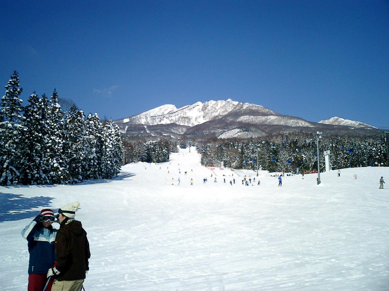
Myoko Suginohara Ski Resort is a downhill ski area in Niigata Prefecture, Japan. Mapped terrain includes easy, intermediate, advanced routes. Its mapped lift network extends from approximately 739 to 1857 metres above sea level.
Data: OpenSkiData / OpenSkiMap, OpenStreetMap contributors (ODbL), Skimap.org, Who's On First, Mapterhorn.
Myoko Suginohara Ski Resort - Base lift station
ECMWF · Model run: Next update expected:
Day Time (UTC) Temp. (°C) Humidity (%) Wind (km/h) Wind (knots) Wind (Bft) Direction Precip. (mm) Snow (cm) Pressure (hPa) Freezing (m) Conditions | Thursday, 05/11 06:00 15.9 68 3 1 1B SW — — 1010 3050 Partly cloudy 25% cloud 09:00 12.5 82 2 1 1B S 0.03 0 1009 3042 Overcast 94% cloud 12:00 11.9 86 5 3 1B SW 0.79 0 1007 3026 Overcast 91% cloud 15:00 11.7 84 5 3 1B SW 0.15 0 1006 3013 Overcast 80% cloud 18:00 11.2 88 3 2 1B SW 1.8 0 1005 2998 Overcast 82% cloud 21:00 10.5 95 7 4 2B NW 4.2 0 1007 2875 Overcast 98% cloud Friday, 06/11 00:00 12.3 92 7 4 2B NW 2.1 0 1009 2808 Cloudy 54% cloud 03:00 14.9 59 9 5 2B W 1.5 0 1008 2800 Cloudy 57% cloud 06:00 13.4 64 12 6 2B W 0.66 0 1010 2724 Partly cloudy 49% cloud 09:00 9.1 82 10 6 2B W 0.21 0 1014 2500 Partly cloudy 43% cloud 12:00 6.9 92 8 4 2B NW 0.56 0 1017 2026 Overcast 81% cloud 15:00 5.5 94 10 5 2B NW 3.4 0 1018 1653 Overcast 99% cloud 18:00 4.4 95 8 4 2B NW 3.3 0 1019 1482 Overcast 96% cloud 21:00 4.3 89 9 5 2B W 1.3 0 1019 1552 Cloudy 77% cloud Saturday, 07/11 00:00 4.8 90 10 5 2B NW 2.3 0 1023 1423 Overcast 98% cloud 03:00 5 82 10 5 2B NW 3.6 0 1024 1372 Overcast 83% cloud 06:00 4.4 79 11 6 2B NW 2.7 0 1025 1328 Cloudy 69% cloud 09:00 2.8 87 8 5 2B NW 1.6 0 1028 1202 Cloudy 70% cloud 12:00 2.2 86 8 4 2B NW 0.69 0 1030 1139 Cloudy 63% cloud 15:00 1.9 82 8 4 2B NW 0.12 0 1031 1127 Cloudy 70% cloud 18:00 2.4 86 9 5 2B NW 0.28 0 1032 1132 Cloudy 79% cloud 21:00 2.5 87 6 3 2B NW 0.31 0 1033 1127 Overcast 86% cloud Sunday, 08/11 00:00 4.6 75 7 4 2B NW 0.14 0 1034 1301 Cloudy 78% cloud 03:00 6.7 59 11 6 2B N 0.03 0 1032 1414 Cloudy 77% cloud 06:00 5.8 63 9 5 2B N 0.02 0 1031 1425 Cloudy 74% cloud 09:00 3.6 75 4 2 1B N 0 0 1032 1473 Overcast 80% cloud 12:00 3.6 75 1 1 1B W 0 0 1032 1611 Overcast 84% cloud 15:00 3.6 74 4 2 1B SW 0.03 0 1030 2079 Overcast 89% cloud 18:00 3.8 76 3 2 1B SW 0.02 0 1028 2128 Overcast 99% cloud 21:00 4.4 77 4 2 1B SW 0.15 0 1026 2228 Overcast 96% cloud Monday, 09/11 00:00 8.2 69 6 3 2B SW 0.09 0 1025 2323 Overcast 84% cloud 03:00 11.2 56 4 2 1B W 0 0 1021 2328 Partly cloudy 35% cloud 06:00 10.6 64 5 3 1B NW 0.03 0 1020 2272 Cloudy 57% cloud 09:00 7.1 88 9 5 2B NW 0.50 0 1021 2195 Cloudy 78% cloud 12:00 5.1 98 13 7 3B N 5.4 0 1024 1609 Overcast 99% cloud 15:00 3.7 96 9 5 2B N 2.3 0 1024 1315 Overcast 97% cloud 18:00 2.6 94 10 5 2B N 1.1 0 1025 1156 Overcast 86% cloud 21:00 2.2 92 8 4 2B N 0.39 0 1026 1100 Overcast 89% cloud Tuesday, 10/11 00:00 3.4 82 9 5 2B NW 0.62 0 1027 1190 Cloudy 71% cloud 03:00 4 79 12 6 2B N 1.6 0 1026 1248 Overcast 85% cloud 06:00 2.7 84 11 6 2B N 1.8 0 1026 1122 Overcast 88% cloud 09:00 1.6 91 7 4 2B N 0.24 0 1028 1025 Overcast 91% cloud 12:00 1.1 89 4 2 1B N 0.05 0 1028 1001 Overcast 81% cloud 15:00 0.6 88 2 1 1B NW 0.04 0 1028 926 Cloudy 76% cloud 18:00 0.1 85 2 1 1B NW 0 0 1028 829 Cloudy 76% cloud 21:00 -0 85 2 1 1B NW 0 0 1029 806 Cloudy 62% cloud Wednesday, 11/11 00:00 4.3 68 4 2 1B N 0.09 0 1030 1259 Cloudy 55% cloud 03:00 6.8 56 7 4 2B N 0 0 1029 1428 Partly cloudy 26% cloud 06:00 6.8 54 9 5 2B N 0 0 1029 1522 Clear 11% cloud |
|---|
Forecast notes
Forecast table times: UTC.
Coordinates: 36.8556481°N, 138.1569893°E · Requested elevation: 805 m. Model terrain: 669 m. Terrain and 1000/925/850/700 hPa profiles are used for height estimates.
These are altitude estimates, not a simulation of local mountain terrain. Precipitation, cloud and sea-level pressure use horizontal interpolation only.
Precipitation includes rain and snow water equivalent: preceding 3 hours through day 6, then 6 hours (see cell tooltip). Snow (cm) estimates fresh snowfall from precipitation and temperature using the GFS conversion; it is not snow depth on the ground. Freezing (m) uses additional 600/500 hPa temperatures when available and estimates the lowest resolved 0°C crossing above sea level. When all sampled levels are warm, the upper profile limit is shown (see tooltip). < marks an entirely cold sampled profile and its lower height limit. No extrapolation is used.
Source: ECMWF · CC BY 4.0 · Processed by Snow Report.
Myoko Suginohara Ski Resort - Top lift station
ECMWF · Model run: Next update expected:
Day Time (UTC) Temp. (°C) Humidity (%) Wind (km/h) Wind (knots) Wind (Bft) Direction Precip. (mm) Snow (cm) Pressure (hPa) Freezing (m) Conditions | Thursday, 05/11 06:00 8.6 75 23 12 4B SW — — 1010 3050 Partly cloudy 27% cloud 09:00 8.7 79 20 11 3B SW 0.03 0 1009 3042 Overcast 95% cloud 12:00 8.6 79 27 14 4B SW 0.77 0 1007 3026 Overcast 88% cloud 15:00 8.3 83 31 17 5B SW 0.16 0 1006 3013 Overcast 83% cloud 18:00 6.9 93 33 18 5B W 1.9 0 1005 2998 Overcast 85% cloud 21:00 5.8 94 37 20 5B W 4.9 0 1008 2869 Overcast 98% cloud Friday, 06/11 00:00 5.3 79 42 23 6B W 2.0 0 1009 2808 Partly cloudy 45% cloud 03:00 5.9 67 44 24 6B W 0.99 0 1008 2792 Cloudy 54% cloud 06:00 4.9 71 47 25 6B W 0.60 0 1010 2703 Cloudy 53% cloud 09:00 3.1 69 45 24 6B W 0.29 0 1014 2473 Partly cloudy 47% cloud 12:00 0.8 84 36 19 5B W 0.70 0.2 1017 2004 Overcast 85% cloud 15:00 -1.4 92 32 17 5B W 4.2 1.7 1018 1627 Overcast 99% cloud 18:00 -2.3 90 41 22 6B W 3.9 1.6 1019 1469 Overcast 96% cloud 21:00 -2.1 80 51 27 7B W 1.1 0.3 1019 1535 Overcast 80% cloud Saturday, 07/11 00:00 -3.2 92 44 24 6B W 2.6 2.6 1023 1398 Overcast 98% cloud 03:00 -3.5 88 49 27 6B W 4.0 4 1024 1357 Overcast 83% cloud 06:00 -3.7 83 51 27 7B W 3.2 3.2 1025 1312 Cloudy 72% cloud 09:00 -4 81 45 24 6B W 2.1 2.1 1028 1191 Cloudy 73% cloud 12:00 -3.7 72 42 23 6B W 0.88 0.9 1030 1123 Cloudy 65% cloud 15:00 -3.3 70 41 22 6B W 0.16 0.2 1031 1117 Cloudy 72% cloud 18:00 -3.5 76 40 22 6B NW 0.38 0.4 1032 1120 Overcast 83% cloud 21:00 -3.5 80 34 18 5B NW 0.41 0.4 1033 1117 Overcast 87% cloud Sunday, 08/11 00:00 -2.7 76 26 14 4B NW 0.19 0 1034 1292 Cloudy 80% cloud 03:00 -2 74 21 11 4B NW 0.03 0 1032 1409 Cloudy 78% cloud 06:00 -1.6 74 16 9 3B NW 0.03 0 1031 1415 Cloudy 75% cloud 09:00 -1.1 77 13 7 3B W 0 0 1032 1438 Overcast 86% cloud 12:00 -0.7 76 14 8 3B W 0 0 1032 1589 Overcast 85% cloud 15:00 0.9 69 24 13 4B SW 0.03 0 1030 2069 Overcast 91% cloud 18:00 1.3 67 26 14 4B SW 0.03 0 1028 2116 Overcast 99% cloud 21:00 2.2 64 29 16 5B SW 0.19 0 1026 2217 Overcast 97% cloud Monday, 09/11 00:00 3 61 32 17 5B SW 0.13 0 1025 2316 Overcast 82% cloud 03:00 3.2 66 29 15 4B SW 0 0 1021 2320 Partly cloudy 34% cloud 06:00 2.6 73 29 15 4B W 0.03 0 1020 2258 Cloudy 60% cloud 09:00 1.9 87 33 18 5B W 0.63 0 1021 2179 Overcast 82% cloud 12:00 -1.2 96 26 14 4B NW 6.7 2.1 1024 1587 Overcast 99% cloud 15:00 -3.1 93 28 15 4B NW 2.7 2.1 1024 1313 Overcast 97% cloud 18:00 -3.9 81 34 18 5B NW 1.3 1.3 1025 1152 Overcast 88% cloud 21:00 -4.1 82 37 20 5B NW 0.51 0.5 1026 1096 Overcast 88% cloud Tuesday, 10/11 00:00 -4.2 80 34 18 5B NW 0.75 0.7 1027 1182 Cloudy 75% cloud 03:00 -3.8 80 32 17 5B NW 2.0 1.5 1026 1239 Overcast 87% cloud 06:00 -4.1 77 27 14 4B NW 2.0 1.6 1026 1111 Overcast 90% cloud 09:00 -4.2 73 21 12 4B NW 0.31 0.3 1028 1011 Overcast 93% cloud 12:00 -3.7 63 19 10 3B NW 0.06 0.1 1028 973 Overcast 85% cloud 15:00 -4.1 71 17 9 3B W 0.07 0.1 1028 891 Cloudy 79% cloud 18:00 -4.2 75 20 11 3B W 0 0 1028 774 Cloudy 77% cloud 21:00 -4 76 21 11 4B W 0 0 1029 < 714 Cloudy 62% cloud Wednesday, 11/11 00:00 -3.7 79 20 11 3B NW 0.06 0.1 1030 1255 Cloudy 57% cloud 03:00 -2.4 64 21 11 4B NW 0 0 1029 1438 Partly cloudy 23% cloud 06:00 -1.3 51 21 12 4B NW 0 0 1029 1531 Clear 8% cloud |
|---|
Forecast notes
Forecast table times: UTC.
Coordinates: 36.8765818°N, 138.1157037°E · Requested elevation: 1857 m. Model terrain: 711 m. Terrain and 1000/925/850/700 hPa profiles are used for height estimates.
These are altitude estimates, not a simulation of local mountain terrain. Precipitation, cloud and sea-level pressure use horizontal interpolation only.
Precipitation includes rain and snow water equivalent: preceding 3 hours through day 6, then 6 hours (see cell tooltip). Snow (cm) estimates fresh snowfall from precipitation and temperature using the GFS conversion; it is not snow depth on the ground. Freezing (m) uses additional 600/500 hPa temperatures when available and estimates the lowest resolved 0°C crossing above sea level. When all sampled levels are warm, the upper profile limit is shown (see tooltip). < marks an entirely cold sampled profile and its lower height limit. No extrapolation is used.