Worldwide Ski Resort Forecasts

More
Colour guide Temperature · Wind · Rain · Snow
Each colour starts at the value shown. Wind colours match across all three units. Dry cells stay neutral. Colours describe the displayed values, not official weather warnings.
Tateyama Sanroku Ski Area - Low lift station
ECMWF · Model run: Next update expected:
Day Time (UTC) Temp. (°C) Humidity (%) Wind (km/h) Wind (knots) Wind (Bft) Direction Precip. (mm) Snow (cm) Pressure (hPa) Freezing (m) Conditions | Thursday, 05/11 06:00 18.2 56 5 3 1B W — — 1010 3050 Cloudy 78% cloud  09:00 15 71 9 5 2B S 0.33 0 1009 3044 Overcast 100% cloud  12:00 14.4 75 10 6 2B S 0.71 0 1007 3030 Cloudy 56% cloud 15:00 13.7 82 10 5 2B S 3.0 0 1007 3017 Overcast 88% cloud 18:00 13.5 83 8 4 2B SW 5.2 0 1007 3007 Overcast 100% cloud 21:00 12.2 86 8 4 2B W 8.9 0 1010 2690 Overcast 100% cloud Friday, 06/11 00:00 12.4 82 8 4 2B W 3.6 0 1013 2538 Cloudy 68% cloud 03:00 14.2 65 15 8 3B W 1.3 0 1012 2516 Cloudy 70% cloud 06:00 11.2 80 13 7 3B W 4.1 0 1015 2348 Cloudy 76% cloud 09:00 9.2 82 11 6 2B SW 2.5 0 1018 2117 Cloudy 80% cloud 12:00 7.7 85 9 5 2B W 1.9 0 1020 1833 Overcast 100% cloud 15:00 6.5 83 9 5 2B W 3.8 0 1021 1622 Overcast 100% cloud 18:00 5.3 84 7 4 2B W 3.2 0 1022 1410 Overcast 96% cloud 21:00 5.3 80 11 6 2B SW 1.5 0 1023 1390 Overcast 95% cloud Saturday, 07/11 00:00 5.2 82 10 5 2B W 3.8 0 1026 1372 Overcast 92% cloud 03:00 5.2 79 11 6 2B W 3.6 0 1027 1366 Overcast 89% cloud 06:00 4.8 79 8 4 2B W 2.3 0 1029 1318 Overcast 93% cloud 09:00 4.1 81 5 3 1B W 1.2 0 1031 1258 Overcast 82% cloud 12:00 3.6 80 1 1 1B NW 0.26 0 1032 1204 Overcast 82% cloud 15:00 3.3 79 2 1 1B NW 0.05 0 1034 1121 Overcast 83% cloud 18:00 3.1 77 3 2 1B NE 0.06 0 1034 < 1050 Overcast 86% cloud 21:00 3.2 74 4 2 1B NE 0.16 0 1034 1158 Cloudy 76% cloud Sunday, 08/11 00:00 6.8 57 5 3 1B N 0 0 1034 2444 Overcast 85% cloud 03:00 8.8 51 7 4 2B N 0 0 1032 2617 Overcast 96% cloud 06:00 8.3 57 6 3 2B N 0 0 1031 2531 Overcast 84% cloud 09:00 5.5 69 1 1 1B NE 0 0 1031 1956 Overcast 89% cloud 12:00 5.9 65 3 2 1B SE 0.02 0 1030 1899 Overcast 95% cloud 15:00 6.7 62 3 2 1B SE 0 0 1028 1985 Overcast 100% cloud 18:00 7.1 60 4 2 1B SE 0 0 1027 1970 Overcast 99% cloud 21:00 7.7 58 5 3 1B S 0.09 0 1025 1964 Overcast 100% cloud Monday, 09/11 00:00 10.3 56 5 3 1B S 0.08 0 1025 2171 Overcast 98% cloud 03:00 13.1 51 7 4 2B W 0.06 0 1022 2364 Partly cloudy 33% cloud  06:00 11.7 61 5 2 1B W 0 0 1022 2255 Cloudy 69% cloud 09:00 8.9 83 5 2 1B NW 0.78 0 1023 2075 Overcast 100% cloud 12:00 7.3 84 11 6 2B N 6.2 0 1025 1845 Overcast 100% cloud 15:00 5.9 80 6 3 1B N 2.3 0 1025 1544 Overcast 98% cloud 18:00 4.6 79 6 3 2B N 0.38 0 1026 1377 Overcast 93% cloud 21:00 3.2 78 4 2 1B NE 0.17 0 1027 1089 Overcast 82% cloud Tuesday, 10/11 00:00 5.2 66 8 4 2B N 0.38 0 1028 1501 Partly cloudy 48% cloud 03:00 6.2 64 12 6 2B N 0.52 0 1027 1639 Cloudy 73% cloud 06:00 5.2 67 7 4 2B N 0.82 0 1026 1551 Cloudy 57% cloud 09:00 2.3 74 4 2 1B NE 0.06 0 1027 < 1050 Partly cloudy 47% cloud 12:00 1.6 59 1 1 1B E 0 0 1028 < 1050 Partly cloudy 38% cloud 15:00 2.2 52 1 1 1B S 0 0 1027 < 1050 Partly cloudy 37% cloud 18:00 1.6 54 2 1 1B S 0 0 1028 < 1050 Partly cloudy 25% cloud 21:00 1.5 54 3 1 1B S 0 0 1029 < 1050 Clear 19% cloud  Wednesday, 11/11 00:00 6.7 48 3 2 1B W 0 0 1030 1783 Clear 6% cloud 03:00 9.5 44 5 3 1B NW 0 0 1029 2082 Clear 0% cloud 06:00 9 47 8 4 2B N 0 0 1029 2104 Clear 0% cloud |
|---|
Forecast notes
Forecast table times: UTC.
Coordinates: 36.5743555°N, 137.4159649°E · Requested elevation: 489 m. Model terrain: 1048 m. Terrain and 1000/925/850/700 hPa profiles are used for height estimates.
Outside the available profile, temperature uses an estimated 5.5°C/km height correction; wind retains the nearest available model-level value. Humidity is estimated with adjusted pressure and temperature.
These are altitude estimates, not a simulation of local mountain terrain. Precipitation, cloud and sea-level pressure use horizontal interpolation only.
Precipitation includes rain and snow water equivalent: preceding 3 hours through day 6, then 6 hours (see cell tooltip). Snow (cm) estimates fresh snowfall from precipitation and temperature using the GFS conversion; it is not snow depth on the ground. Freezing (m) uses additional 600/500 hPa temperatures when available and estimates the lowest resolved 0°C crossing above sea level. When all sampled levels are warm, the upper profile limit is shown (see tooltip). < marks an entirely cold sampled profile and its lower height limit. No extrapolation is used.
Source: ECMWF · CC BY 4.0 · Processed by Snow Report.
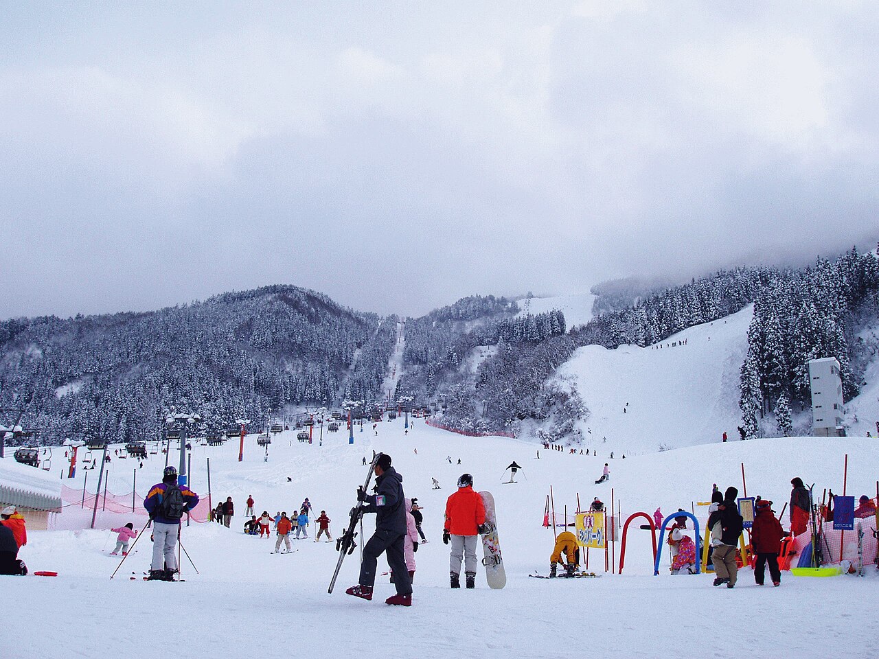
Tateyama Sanroku Ski Area is a downhill ski area in Toyama Prefecture, Japan. Mapped terrain includes easy, intermediate, advanced routes. Its mapped lift network extends from approximately 489 to 1177 metres above sea level.
Data: OpenSkiData / OpenSkiMap, OpenStreetMap contributors (ODbL), Skimap.org, Who's On First, Mapterhorn.
Tateyama Sanroku Ski Area - Base lift station
ECMWF · Model run: Next update expected:
Day Time (UTC) Temp. (°C) Humidity (%) Wind (km/h) Wind (knots) Wind (Bft) Direction Precip. (mm) Snow (cm) Pressure (hPa) Freezing (m) Conditions | Thursday, 05/11 06:00 18.2 56 5 3 1B W — — 1010 3050 Cloudy 78% cloud 09:00 15 71 9 5 2B S 0.33 0 1009 3044 Overcast 100% cloud 12:00 14.4 75 10 6 2B S 0.71 0 1007 3030 Cloudy 56% cloud 15:00 13.7 82 10 5 2B S 3.0 0 1007 3017 Overcast 88% cloud 18:00 13.5 83 8 4 2B SW 5.2 0 1007 3007 Overcast 100% cloud 21:00 12.2 86 8 4 2B W 8.9 0 1010 2690 Overcast 100% cloud Friday, 06/11 00:00 12.4 82 8 4 2B W 3.6 0 1013 2538 Cloudy 69% cloud 03:00 14.2 65 15 8 3B W 1.4 0 1012 2515 Cloudy 70% cloud 06:00 11.2 80 13 7 3B W 4.1 0 1015 2347 Cloudy 76% cloud 09:00 9.2 82 11 6 2B SW 2.5 0 1018 2115 Cloudy 80% cloud 12:00 7.7 85 9 5 2B W 1.9 0 1020 1833 Overcast 100% cloud 15:00 6.5 83 9 5 2B W 3.8 0 1021 1622 Overcast 100% cloud 18:00 5.3 84 7 4 2B W 3.2 0 1022 1409 Overcast 96% cloud 21:00 5.3 80 11 6 2B SW 1.5 0 1023 1389 Overcast 95% cloud Saturday, 07/11 00:00 5.2 82 10 5 2B W 3.8 0 1026 1372 Overcast 92% cloud 03:00 5.2 79 11 6 2B W 3.6 0 1027 1365 Overcast 89% cloud 06:00 4.8 79 8 4 2B W 2.3 0 1029 1317 Overcast 93% cloud 09:00 4.1 81 5 3 1B W 1.3 0 1031 1257 Overcast 82% cloud 12:00 3.6 80 1 1 1B NW 0.26 0 1032 1202 Overcast 82% cloud 15:00 3.3 79 2 1 1B NW 0.05 0 1034 1119 Overcast 83% cloud 18:00 3.1 77 3 2 1B NE 0.06 0 1034 < 1051 Overcast 86% cloud 21:00 3.2 74 4 2 1B E 0.16 0 1034 1156 Cloudy 76% cloud Sunday, 08/11 00:00 6.8 57 5 3 1B N 0 0 1034 2444 Overcast 85% cloud 03:00 8.8 51 7 4 2B N 0 0 1032 2616 Overcast 96% cloud 06:00 8.3 57 6 3 2B N 0 0 1031 2531 Overcast 84% cloud 09:00 5.5 69 1 1 1B NE 0 0 1031 1956 Overcast 89% cloud 12:00 5.9 65 3 2 1B SE 0.02 0 1030 1900 Overcast 95% cloud 15:00 6.7 62 3 2 1B SE 0 0 1028 1984 Overcast 100% cloud 18:00 7.1 60 4 2 1B SE 0 0 1027 1970 Overcast 99% cloud 21:00 7.7 58 5 3 1B S 0.09 0 1025 1964 Overcast 100% cloud Monday, 09/11 00:00 10.3 56 5 3 1B S 0.08 0 1025 2171 Overcast 98% cloud 03:00 13.1 51 7 4 2B W 0.06 0 1022 2364 Partly cloudy 33% cloud 06:00 11.7 61 5 2 1B W 0 0 1022 2255 Cloudy 69% cloud 09:00 8.9 83 5 2 1B NW 0.78 0 1023 2075 Overcast 100% cloud 12:00 7.3 84 11 6 2B N 6.2 0 1025 1845 Overcast 100% cloud 15:00 5.9 80 6 3 1B N 2.3 0 1025 1544 Overcast 98% cloud 18:00 4.6 79 6 3 2B N 0.38 0 1026 1376 Overcast 93% cloud 21:00 3.2 78 4 2 1B NE 0.17 0 1027 1088 Overcast 82% cloud Tuesday, 10/11 00:00 5.3 66 8 4 2B N 0.38 0 1028 1501 Partly cloudy 48% cloud 03:00 6.2 64 12 6 2B N 0.51 0 1027 1638 Cloudy 72% cloud 06:00 5.3 67 7 4 2B N 0.82 0 1026 1551 Cloudy 57% cloud 09:00 2.3 74 4 2 1B NE 0.06 0 1027 < 1051 Partly cloudy 47% cloud 12:00 1.6 58 1 1 1B E 0 0 1028 < 1051 Partly cloudy 38% cloud 15:00 2.1 52 1 1 1B S 0 0 1027 < 1051 Partly cloudy 37% cloud 18:00 1.6 54 2 1 1B S 0 0 1028 < 1051 Partly cloudy 25% cloud 21:00 1.5 54 3 1 1B S 0 0 1029 < 1051 Clear 19% cloud Wednesday, 11/11 00:00 6.7 48 3 2 1B W 0 0 1030 1783 Clear 6% cloud 03:00 9.5 44 5 3 1B NW 0 0 1029 2081 Clear 0% cloud 06:00 9 47 8 4 2B N 0 0 1029 2103 Clear 0% cloud |
|---|
Forecast notes
Forecast table times: UTC.
Coordinates: 36.5750922°N, 137.4169359°E · Requested elevation: 489 m. Model terrain: 1049 m. Terrain and 1000/925/850/700 hPa profiles are used for height estimates.
Outside the available profile, temperature uses an estimated 5.5°C/km height correction; wind retains the nearest available model-level value. Humidity is estimated with adjusted pressure and temperature.
These are altitude estimates, not a simulation of local mountain terrain. Precipitation, cloud and sea-level pressure use horizontal interpolation only.
Precipitation includes rain and snow water equivalent: preceding 3 hours through day 6, then 6 hours (see cell tooltip). Snow (cm) estimates fresh snowfall from precipitation and temperature using the GFS conversion; it is not snow depth on the ground. Freezing (m) uses additional 600/500 hPa temperatures when available and estimates the lowest resolved 0°C crossing above sea level. When all sampled levels are warm, the upper profile limit is shown (see tooltip). < marks an entirely cold sampled profile and its lower height limit. No extrapolation is used.
Source: ECMWF · CC BY 4.0 · Processed by Snow Report.
Tateyama Sanroku Ski Area - Top lift station
ECMWF · Model run: Next update expected:
Day Time (UTC) Temp. (°C) Humidity (%) Wind (km/h) Wind (knots) Wind (Bft) Direction Precip. (mm) Snow (cm) Pressure (hPa) Freezing (m) Conditions | Thursday, 05/11 06:00 14.5 62 7 4 2B SW — — 1010 3050 Cloudy 78% cloud 09:00 11.3 80 9 5 2B S 0.31 0 1009 3044 Overcast 100% cloud 12:00 10.7 85 11 6 2B S 0.78 0 1007 3030 Cloudy 57% cloud 15:00 10 94 10 6 2B S 3.2 0 1007 3017 Overcast 87% cloud 18:00 9.9 95 9 5 2B SW 5.0 0 1007 3007 Overcast 100% cloud 21:00 8.4 99 8 5 2B W 8.9 0 1010 2687 Overcast 100% cloud Friday, 06/11 00:00 8.4 94 8 4 2B W 3.8 0 1013 2530 Cloudy 72% cloud 03:00 10.2 77 15 8 3B W 1.4 0 1012 2512 Cloudy 70% cloud 06:00 7.1 94 13 7 3B W 4.2 0 1015 2322 Overcast 81% cloud 09:00 5.2 96 12 6 2B W 2.8 0 1018 2086 Overcast 84% cloud 12:00 3.8 98 10 5 2B W 1.9 0 1020 1825 Overcast 100% cloud 15:00 2.6 97 9 5 2B W 3.8 0 1021 1617 Overcast 100% cloud 18:00 1.4 97 7 4 2B W 3.3 0 1022 1400 Overcast 96% cloud 21:00 1.3 94 11 6 2B W 1.5 0 1023 1380 Overcast 96% cloud Saturday, 07/11 00:00 1.2 95 11 6 2B W 3.9 0 1026 1361 Overcast 94% cloud 03:00 1.2 92 12 6 2B W 3.6 0 1027 1357 Overcast 90% cloud 06:00 0.8 93 8 5 2B W 2.3 0.7 1029 1301 Overcast 95% cloud 09:00 0.1 94 6 3 2B W 1.2 0.4 1031 1208 Overcast 85% cloud 12:00 -0.4 93 2 1 1B NW 0.24 0 1032 < 1173 Overcast 83% cloud 15:00 -0.8 93 2 1 1B NW 0.04 0 1034 < 1173 Overcast 84% cloud 18:00 -1.1 89 4 2 1B NE 0.05 0 1034 < 1173 Overcast 87% cloud 21:00 -0.8 86 5 2 1B E 0.16 0 1034 < 1173 Cloudy 76% cloud Sunday, 08/11 00:00 3 64 5 3 1B N 0 0 1034 2397 Overcast 84% cloud 03:00 5 59 6 3 2B N 0 0 1032 2597 Overcast 96% cloud 06:00 4.6 67 5 3 1B N 0 0 1031 2509 Overcast 85% cloud 09:00 1.6 82 1 0 0B NE 0 0 1031 1845 Overcast 89% cloud 12:00 2.2 75 3 2 1B SE 0.02 0 1030 1851 Overcast 95% cloud 15:00 3.1 71 3 2 1B S 0 0 1028 1979 Overcast 100% cloud 18:00 3.4 69 4 2 1B SE 0 0 1027 1969 Overcast 99% cloud 21:00 4.1 66 5 3 1B S 0.10 0 1025 1979 Overcast 100% cloud Monday, 09/11 00:00 6.6 64 5 3 1B S 0.09 0 1025 2190 Overcast 99% cloud 03:00 9.3 59 8 4 2B W 0.07 0 1022 2375 Partly cloudy 33% cloud 06:00 7.7 72 4 2 1B W 0 0 1022 2255 Cloudy 69% cloud 09:00 5 97 4 2 1B NW 0.65 0 1023 2062 Overcast 100% cloud 12:00 3.4 97 10 5 2B N 5.8 0 1025 1836 Overcast 100% cloud 15:00 2 93 5 3 1B N 2.1 0 1025 1530 Overcast 98% cloud 18:00 0.6 93 6 3 2B N 0.34 0.1 1026 1309 Overcast 92% cloud 21:00 -0.9 91 4 2 1B NE 0.14 0 1027 < 1173 Overcast 80% cloud Tuesday, 10/11 00:00 1.3 76 8 4 2B N 0.34 0 1028 1460 Partly cloudy 46% cloud 03:00 2.4 73 11 6 2B N 0.42 0 1027 1629 Cloudy 69% cloud 06:00 1.5 76 7 4 2B N 0.70 0 1026 1524 Cloudy 52% cloud 09:00 -1.8 86 3 2 1B E 0.05 0 1027 < 1173 Partly cloudy 40% cloud 12:00 -2.5 65 1 1 1B E 0 0 1027 < 1173 Partly cloudy 31% cloud 15:00 -1.7 56 1 0 0B S 0 0 1027 < 1173 Partly cloudy 30% cloud 18:00 -2.3 60 1 1 1B S 0 0 1028 < 1173 Partly cloudy 21% cloud 21:00 -2.4 60 2 1 1B SE 0 0 1029 < 1173 Clear 17% cloud Wednesday, 11/11 00:00 3 53 3 2 1B W 0 0 1030 1785 Clear 5% cloud 03:00 5.7 49 5 3 1B NW 0 0 1029 2081 Clear 0% cloud 06:00 5.1 52 7 4 2B N 0 0 1029 2088 Clear 0% cloud |
|---|
Forecast notes
Forecast table times: UTC.
Coordinates: 36.5607408°N, 137.4344695°E · Requested elevation: 1177 m. Model terrain: 1170 m. Terrain and 1000/925/850/700 hPa profiles are used for height estimates.
These are altitude estimates, not a simulation of local mountain terrain. Precipitation, cloud and sea-level pressure use horizontal interpolation only.
Precipitation includes rain and snow water equivalent: preceding 3 hours through day 6, then 6 hours (see cell tooltip). Snow (cm) estimates fresh snowfall from precipitation and temperature using the GFS conversion; it is not snow depth on the ground. Freezing (m) uses additional 600/500 hPa temperatures when available and estimates the lowest resolved 0°C crossing above sea level. When all sampled levels are warm, the upper profile limit is shown (see tooltip). < marks an entirely cold sampled profile and its lower height limit. No extrapolation is used.