Camera 1
Press play to connect.

Each colour starts at the value shown. Wind colours match across all three units. Dry cells stay neutral. Colours describe the displayed values, not official weather warnings.
Preparing forecast graphs…
Times and values match the detailed forecast. Tap or point at a value for details. Scroll each chart sideways for later days. Rain / precipitation is the total water equivalent per forecast interval, including snow; snowfall is fresh snow per interval, not snow depth.
GFS and ECMWF model comparison. Each model retains its own forecast times and horizon. Precipitation and snowfall amounts cover their own forecast intervals; these can differ between models.
ECMWF · Model run: Next update expected:
Day Time (UTC) Temp. (°C) Humidity (%) Wind (km/h) Wind (knots) Wind (Bft) Direction Precip. (mm) Snow (cm) Pressure (hPa) Freezing (m) Conditions | Thursday, 05/11 06:00 2.4 94 11 6 2B NE — — 1028 2096 Overcast 100% cloud  09:00 2.8 93 8 4 2B NE 0.02 0 1028 2085 Overcast 100% cloud 12:00 3.5 91 6 3 1B E 0.06 0 1027 2211 Overcast 100% cloud 15:00 3.3 95 5 3 1B NE 0.53 0 1026 2223 Overcast 100% cloud 18:00 2.7 95 8 4 2B NE 0.17 0 1027 2261 Overcast 98% cloud 21:00 2.6 91 6 3 1B NE 0.10 0 1027 2242 Overcast 95% cloud Friday, 06/11 00:00 2.2 93 6 3 2B NE 0 0 1026 2242 Overcast 93% cloud 03:00 2 92 6 3 1B N 0 0 1025 2283 Overcast 88% cloud 06:00 2 89 5 2 1B NW 0 0 1025 2342 Overcast 89% cloud 09:00 3.3 86 5 3 1B NW 0 0 1023 2519 Cloudy 76% cloud  12:00 5.4 74 7 4 2B NW 0 0 1021 2663 Clear 14% cloud  15:00 5.8 72 8 4 2B NW 0 0 1020 2727 Clear 1% cloud 18:00 5.5 72 10 5 2B NW 0 0 1021 2834 Clear 0% cloud 21:00 4.8 74 12 6 2B N 0 0 1022 2783 Clear 0% cloud Saturday, 07/11 00:00 4.1 61 11 6 2B N 0 0 1023 2619 Clear 0% cloud 03:00 3.6 52 11 6 2B NE 0 0 1022 2583 Cloudy 65% cloud 06:00 3.1 49 10 6 2B NE 0 0 1024 2486 Overcast 92% cloud 09:00 2.9 52 6 3 2B NE 0 0 1024 2445 Partly cloudy 25% cloud  12:00 4.2 51 4 2 1B SE 0 0 1023 2503 Cloudy 54% cloud 15:00 3.8 62 7 4 2B SE 0 0 1024 2440 Clear 5% cloud 18:00 2.8 70 7 4 2B SE 0 0 1026 2282 Clear 9% cloud 21:00 2 75 8 4 2B SE 0 0 1028 2150 Clear 3% cloud Sunday, 08/11 00:00 1.2 88 10 5 2B SE 0 0 1029 1268 Partly cloudy 47% cloud 03:00 0.6 96 13 7 3B SE 0 0 1029 1776 Overcast 89% cloud 06:00 0.5 97 15 8 3B SE 0 0 1030 1674 Overcast 93% cloud 09:00 1.4 86 14 8 3B S 0.10 0 1030 1853 Cloudy 79% cloud 12:00 3.1 77 9 5 2B S 0 0 1028 2156 Clear 12% cloud 15:00 3.1 79 8 4 2B S 0 0 1029 2204 Clear 10% cloud 18:00 2.3 76 8 4 2B S 0 0 1030 2158 Partly cloudy 30% cloud 21:00 2.6 75 7 4 2B S 0 0 1031 2209 Overcast 93% cloud Monday, 09/11 00:00 3.2 72 7 4 2B S 0 0 1030 2294 Overcast 99% cloud 03:00 3.6 74 5 3 1B S 0.22 0 1029 2317 Overcast 100% cloud 06:00 3.8 77 11 6 2B S 0.60 0 1029 2373 Overcast 91% cloud 09:00 3.6 80 15 8 3B S 0.13 0 1030 2349 Overcast 100% cloud 12:00 3.5 90 9 5 2B S 0.22 0 1028 2313 Overcast 100% cloud 15:00 4 88 9 5 2B S 0.21 0 1027 2407 Overcast 100% cloud 18:00 4.5 88 9 5 2B SW 0.12 0 1027 2511 Overcast 95% cloud 21:00 4.7 96 9 5 2B SW 0 0 1026 2570 Overcast 91% cloud Tuesday, 10/11 00:00 4.8 96 11 6 2B W 0.01 0 1025 2586 Overcast 93% cloud 03:00 4.8 96 11 6 2B W 0 0 1024 2639 Overcast 96% cloud 06:00 5.1 90 10 6 2B W 0 0 1024 2982 Overcast 93% cloud 09:00 5.2 93 9 5 2B W 0 0 1024 3109 Cloudy 76% cloud 12:00 7 74 12 6 2B W 0 0 1021 3105 Overcast 95% cloud 15:00 7.5 73 13 7 3B SW 0 0 1020 3060 Overcast 93% cloud 18:00 6.9 81 12 6 2B W 0 0 1021 3064 Overcast 90% cloud 21:00 6.7 85 12 7 2B W 0 0 1021 3028 Overcast 96% cloud Wednesday, 11/11 00:00 7.1 83 14 8 3B W 0 0 1020 2952 Cloudy 77% cloud 03:00 7.4 84 14 8 3B W 0 0 1018 3023 Overcast 81% cloud 06:00 7.4 88 13 7 3B W 0 0 1018 3023 Overcast 97% cloud |
|---|
Forecast table times: UTC.
Coordinates: 40.77257°N, 21.26738°E · Requested elevation: 1540 m. Model terrain: 1255 m. Terrain and 1000/925/850/700 hPa profiles are used for height estimates.
These are altitude estimates, not a simulation of local mountain terrain. Precipitation, cloud and sea-level pressure use horizontal interpolation only.
Precipitation includes rain and snow water equivalent: preceding 3 hours through day 6, then 6 hours (see cell tooltip). Snow (cm) estimates fresh snowfall from precipitation and temperature using the GFS conversion; it is not snow depth on the ground. Freezing (m) uses additional 600/500 hPa temperatures when available and estimates the lowest resolved 0°C crossing above sea level. When all sampled levels are warm, the upper profile limit is shown (see tooltip). < marks an entirely cold sampled profile and its lower height limit. No extrapolation is used.
Swipe to see all 5 places to stay →
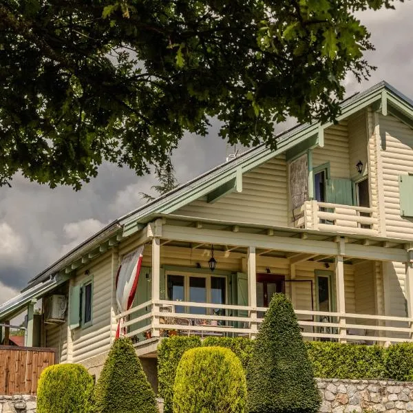 Maison de Montagne Florina
Florina
Drive to ski centre: ≈ 14.0 km · 13 min
View on Booking.com ↗
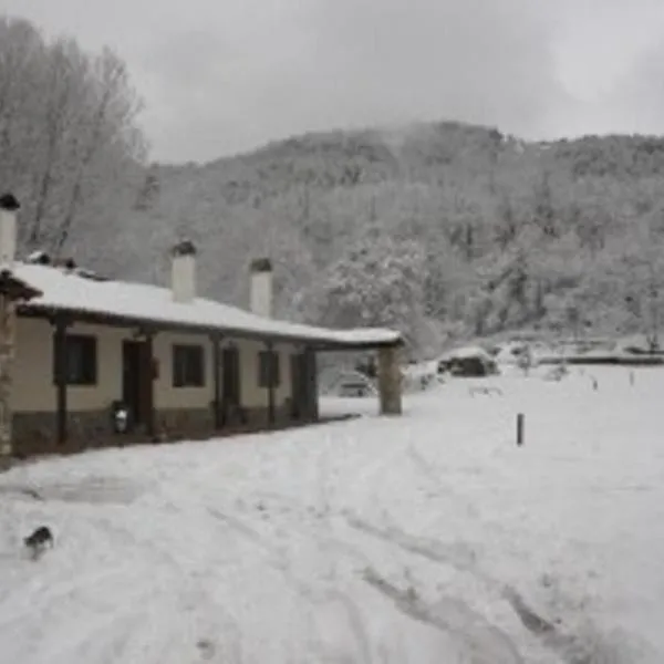 Villa Rosa
Antartiko
Drive to ski centre: ≈ 10.3 km · 11 min
View on Booking.com ↗
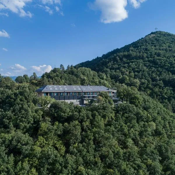 The Lynx Mountain Resort
Florina
Drive to ski centre: ≈ 20.6 km · 20 min
View on Booking.com ↗
 Emerald Suites
Florina
Drive to ski centre: ≈ 18.2 km · 16 min
View on Booking.com ↗
 Lithea Mountain Resort
Florina
Drive to ski centre: ≈ 19.8 km · 19 min
View on Booking.com ↗
Press play to connect.
Preparing forecast graphs…
Times and values match the detailed forecast. Tap or point at a value for details. Scroll each chart sideways for later days. Rain / precipitation is the total water equivalent per forecast interval, including snow; snowfall is fresh snow per interval, not snow depth.
GFS and ECMWF model comparison. Each model retains its own forecast times and horizon. Precipitation and snowfall amounts cover their own forecast intervals; these can differ between models.
ECMWF · Model run: Next update expected:
Day Time (UTC) Temp. (°C) Humidity (%) Wind (km/h) Wind (knots) Wind (Bft) Direction Precip. (mm) Snow (cm) Pressure (hPa) Freezing (m) Conditions | Thursday, 05/11 06:00 1.9 93 10 5 2B NE — — 1028 2099 Overcast 100% cloud 09:00 2.1 94 8 4 2B NE 0.02 0 1028 2087 Overcast 100% cloud 12:00 2.9 92 5 3 1B E 0.06 0 1027 2215 Overcast 100% cloud 15:00 2.7 94 5 3 1B NE 0.55 0 1026 2226 Overcast 100% cloud 18:00 2.3 93 9 5 2B NE 0.17 0 1027 2263 Overcast 99% cloud 21:00 2.2 88 7 4 2B NE 0.11 0 1027 2245 Overcast 97% cloud Friday, 06/11 00:00 1.9 89 7 4 2B N 0 0 1026 2245 Overcast 95% cloud 03:00 1.8 88 7 4 2B N 0 0 1025 2287 Overcast 90% cloud 06:00 1.7 85 6 3 2B N 0 0 1025 2345 Overcast 90% cloud 09:00 2.9 82 6 3 2B NW 0 0 1023 2523 Cloudy 78% cloud 12:00 4.9 71 8 4 2B NW 0 0 1021 2665 Clear 15% cloud 15:00 5.3 70 9 5 2B NW 0 0 1020 2727 Clear 1% cloud 18:00 5 70 10 6 2B N 0 0 1021 2835 Clear 0% cloud 21:00 4.4 72 12 6 2B N 0 0 1022 2784 Clear 0% cloud Saturday, 07/11 00:00 3.7 60 10 6 2B N 0 0 1023 2619 Clear 0% cloud 03:00 3.3 50 11 6 2B N 0 0 1022 2584 Cloudy 66% cloud 06:00 2.7 47 10 6 2B NE 0 0 1024 2489 Overcast 92% cloud 09:00 2.6 50 6 3 2B NE 0 0 1024 2449 Partly cloudy 26% cloud 12:00 3.8 50 3 2 1B E 0 0 1023 2506 Cloudy 55% cloud 15:00 3.3 59 6 3 2B SE 0 0 1024 2442 Clear 5% cloud 18:00 2.4 66 7 4 2B SE 0 0 1026 2282 Clear 9% cloud 21:00 1.8 72 8 4 2B SE 0 0 1028 2152 Clear 3% cloud Sunday, 08/11 00:00 1 85 9 5 2B SE 0 0 1029 1302 Partly cloudy 49% cloud 03:00 0.4 92 12 6 2B SE 0 0 1029 1280 Overcast 91% cloud 06:00 0.1 94 14 8 3B S 0 0 1030 1673 Overcast 94% cloud 09:00 0.7 87 13 7 3B S 0.11 0 1030 1853 Cloudy 80% cloud 12:00 2.3 78 8 4 2B S 0 0 1028 2157 Clear 10% cloud 15:00 2.6 77 8 4 2B S 0 0 1029 2206 Clear 10% cloud 18:00 2.1 72 7 4 2B S 0 0 1030 2158 Partly cloudy 30% cloud 21:00 2.5 73 7 4 2B S 0 0 1031 2207 Overcast 94% cloud Monday, 09/11 00:00 3 71 6 3 2B S 0 0 1030 2295 Overcast 99% cloud 03:00 3.4 73 6 3 1B SW 0.23 0 1029 2317 Overcast 100% cloud 06:00 3.5 76 11 6 2B S 0.60 0 1029 2373 Overcast 92% cloud 09:00 3.1 80 15 8 3B S 0.13 0 1030 2348 Overcast 100% cloud 12:00 3 91 9 5 2B S 0.21 0 1028 2313 Overcast 100% cloud 15:00 3.5 89 9 5 2B S 0.22 0 1027 2406 Overcast 100% cloud 18:00 4.1 87 10 5 2B SW 0.12 0 1027 2511 Overcast 96% cloud 21:00 4.4 94 11 6 2B W 0 0 1026 2570 Overcast 93% cloud Tuesday, 10/11 00:00 4.4 94 12 7 3B W 0.01 0 1025 2586 Overcast 95% cloud 03:00 4.3 94 12 7 2B W 0 0 1024 2641 Overcast 96% cloud 06:00 4.7 87 11 6 2B W 0 0 1024 2991 Overcast 95% cloud 09:00 4.8 90 10 5 2B W 0 0 1024 3115 Cloudy 76% cloud 12:00 6.6 72 13 7 3B W 0 0 1021 3105 Overcast 95% cloud 15:00 7 71 14 8 3B W 0 0 1020 3060 Overcast 94% cloud 18:00 6.4 80 13 7 3B W 0 0 1021 3066 Overcast 90% cloud 21:00 6.2 84 13 7 3B W 0 0 1021 3030 Overcast 96% cloud Wednesday, 11/11 00:00 6.5 84 15 8 3B W 0 0 1020 2951 Cloudy 76% cloud 03:00 6.9 84 16 9 3B W 0 0 1018 3021 Overcast 81% cloud 06:00 6.8 89 15 8 3B W 0 0 1018 3021 Overcast 97% cloud |
|---|
Forecast table times: UTC.
Coordinates: 40.771547°N, 21.25922°E · Requested elevation: 1650 m. Model terrain: 1272 m. Terrain and 1000/925/850/700 hPa profiles are used for height estimates.
These are altitude estimates, not a simulation of local mountain terrain. Precipitation, cloud and sea-level pressure use horizontal interpolation only.
Precipitation includes rain and snow water equivalent: preceding 3 hours through day 6, then 6 hours (see cell tooltip). Snow (cm) estimates fresh snowfall from precipitation and temperature using the GFS conversion; it is not snow depth on the ground. Freezing (m) uses additional 600/500 hPa temperatures when available and estimates the lowest resolved 0°C crossing above sea level. When all sampled levels are warm, the upper profile limit is shown (see tooltip). < marks an entirely cold sampled profile and its lower height limit. No extrapolation is used.
Preparing forecast graphs…
Times and values match the detailed forecast. Tap or point at a value for details. Scroll each chart sideways for later days. Rain / precipitation is the total water equivalent per forecast interval, including snow; snowfall is fresh snow per interval, not snow depth.
GFS and ECMWF model comparison. Each model retains its own forecast times and horizon. Precipitation and snowfall amounts cover their own forecast intervals; these can differ between models.
ECMWF · Model run: Next update expected:
Day Time (UTC) Temp. (°C) Humidity (%) Wind (km/h) Wind (knots) Wind (Bft) Direction Precip. (mm) Snow (cm) Pressure (hPa) Freezing (m) Conditions | Thursday, 05/11 06:00 0.9 90 8 5 2B NE — — 1028 2103 Overcast 100% cloud 09:00 0.9 93 6 3 1B NE 0.01 0 1028 2090 Overcast 100% cloud 12:00 1.6 91 3 2 1B NE 0.06 0 1027 2219 Overcast 100% cloud 15:00 1.5 92 6 3 2B N 0.57 0 1026 2230 Overcast 100% cloud 18:00 1.3 86 11 6 2B NE 0.18 0 1027 2266 Overcast 99% cloud 21:00 1.3 81 9 5 2B NE 0.11 0 1027 2247 Overcast 98% cloud Friday, 06/11 00:00 1.1 79 9 5 2B N 0 0 1026 2248 Overcast 97% cloud 03:00 1.1 77 10 6 2B N 0 0 1025 2291 Overcast 92% cloud 06:00 1.1 74 10 5 2B N 0 0 1025 2348 Overcast 92% cloud 09:00 2.1 73 9 5 2B N 0 0 1023 2526 Overcast 80% cloud 12:00 3.7 65 11 6 2B NW 0 0 1021 2666 Clear 15% cloud 15:00 4 64 12 6 2B N 0 0 1020 2728 Clear 1% cloud 18:00 4 64 12 6 2B N 0 0 1021 2835 Clear 0% cloud 21:00 3.4 65 13 7 3B N 0 0 1022 2785 Clear 0% cloud Saturday, 07/11 00:00 2.7 54 11 6 2B N 0 0 1022 2620 Clear 0% cloud 03:00 2.4 45 11 6 2B N 0 0 1022 2585 Cloudy 67% cloud 06:00 1.9 42 11 6 2B N 0 0 1024 2492 Overcast 93% cloud 09:00 1.8 45 6 3 2B NE 0 0 1024 2453 Partly cloudy 26% cloud 12:00 2.7 45 2 1 1B NE 0 0 1023 2509 Cloudy 56% cloud 15:00 2.3 53 4 2 1B E 0 0 1024 2443 Clear 4% cloud 18:00 1.5 58 5 3 1B E 0 0 1026 2282 Clear 9% cloud 21:00 0.9 63 6 3 2B SE 0 0 1028 2152 Clear 3% cloud Sunday, 08/11 00:00 0.1 75 7 4 2B SE 0 0 1029 1329 Cloudy 50% cloud 03:00 -0.4 80 8 4 2B S 0 0 1029 1316 Overcast 93% cloud 06:00 -0.7 85 10 6 2B S 0 0 1030 1671 Overcast 96% cloud 09:00 -0.2 81 10 6 2B S 0.11 0 1030 1851 Overcast 82% cloud 12:00 1.1 75 6 3 2B S 0 0 1028 2156 Clear 9% cloud 15:00 1.4 74 6 3 2B SW 0 0 1029 2207 Clear 11% cloud 18:00 1.1 70 6 3 1B SW 0 0 1030 2156 Partly cloudy 30% cloud 21:00 1.4 72 6 3 1B SW 0 0 1031 2205 Overcast 96% cloud Monday, 09/11 00:00 1.9 73 6 3 2B SW 0 0 1030 2295 Overcast 100% cloud 03:00 2.1 77 6 3 2B SW 0.23 0 1029 2318 Overcast 100% cloud 06:00 2.3 78 9 5 2B S 0.60 0 1029 2372 Overcast 93% cloud 09:00 2 81 15 8 3B S 0.13 0 1030 2346 Overcast 100% cloud 12:00 1.8 92 11 6 2B SW 0.19 0 1028 2312 Overcast 100% cloud 15:00 2.3 90 12 6 2B SW 0.23 0 1027 2406 Overcast 100% cloud 18:00 2.9 85 13 7 3B SW 0.12 0 1027 2511 Overcast 98% cloud 21:00 3.2 89 14 7 3B W 0 0 1026 2571 Overcast 95% cloud Tuesday, 10/11 00:00 3.2 88 16 8 3B W 0.01 0 1025 2587 Overcast 97% cloud 03:00 3.2 88 16 8 3B W 0 0 1024 2642 Overcast 97% cloud 06:00 3.8 80 13 7 3B W 0 0 1024 2997 Overcast 96% cloud 09:00 4 82 12 7 3B W 0 0 1024 3116 Cloudy 76% cloud 12:00 5.5 66 17 9 3B W 0 0 1021 3105 Overcast 95% cloud 15:00 5.7 68 19 10 3B W 0 0 1020 3060 Overcast 94% cloud 18:00 5.2 75 17 9 3B W 0 0 1021 3068 Overcast 90% cloud 21:00 5 82 16 9 3B W 0 0 1021 3032 Overcast 96% cloud Wednesday, 11/11 00:00 5.3 84 18 10 3B W 0 0 1020 2951 Cloudy 76% cloud 03:00 5.6 83 19 10 3B W 0 0 1018 3019 Overcast 81% cloud 06:00 5.6 89 19 10 3B W 0 0 1018 3018 Overcast 97% cloud |
|---|
Forecast table times: UTC.
Coordinates: 40.7675°N, 21.2534°E · Requested elevation: 1900 m. Model terrain: 1284 m. Terrain and 1000/925/850/700 hPa profiles are used for height estimates.
These are altitude estimates, not a simulation of local mountain terrain. Precipitation, cloud and sea-level pressure use horizontal interpolation only.
Precipitation includes rain and snow water equivalent: preceding 3 hours through day 6, then 6 hours (see cell tooltip). Snow (cm) estimates fresh snowfall from precipitation and temperature using the GFS conversion; it is not snow depth on the ground. Freezing (m) uses additional 600/500 hPa temperatures when available and estimates the lowest resolved 0°C crossing above sea level. When all sampled levels are warm, the upper profile limit is shown (see tooltip). < marks an entirely cold sampled profile and its lower height limit. No extrapolation is used.