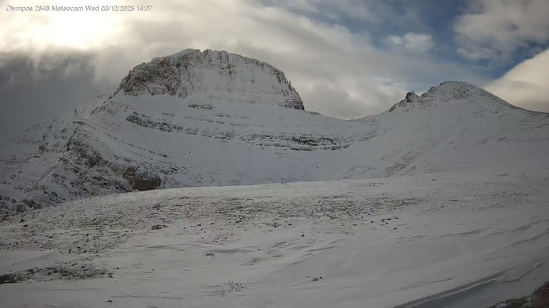
Kakkalos refuge · 2,648 m · SnowReport
Press play to connect.
Open camera page ↗
Each colour starts at the value shown. Wind colours match across all three units. Dry cells stay neutral. Colours describe the displayed values, not official weather warnings.
Preparing forecast graphs…
Times and values match the detailed forecast. Tap or point at a value for details. Scroll each chart sideways for later days. Rain / precipitation is the total water equivalent per forecast interval, including snow; snowfall is fresh snow per interval, not snow depth.
GFS and ECMWF model comparison. Each model retains its own forecast times and horizon. Precipitation and snowfall amounts cover their own forecast intervals; these can differ between models.
ECMWF · Model run: Next update expected:
Day Time (UTC) Temp. (°C) Humidity (%) Wind (km/h) Wind (knots) Wind (Bft) Direction Precip. (mm) Snow (cm) Pressure (hPa) Freezing (m) Conditions | Thursday, 05/11 06:00 1.5 100 9 5 2B E — — 1026 2145 Overcast 100% cloud  09:00 1.2 100 7 4 2B E 2.7 0 1028 2091 Overcast 100% cloud 12:00 1 98 2 1 1B NE 2.6 0.8 1027 2058 Overcast 98% cloud 15:00 1 97 5 3 1B NW 1.0 0.3 1027 2056 Overcast 98% cloud 18:00 1 96 8 5 2B N 0.31 0.1 1027 2077 Overcast 100% cloud 21:00 0.8 93 9 5 2B N 0.28 0.1 1027 2065 Overcast 99% cloud Friday, 06/11 00:00 0.8 88 11 6 2B N 0.17 0 1026 2092 Overcast 93% cloud 03:00 0.8 84 12 6 2B N 0.11 0 1025 2134 Overcast 91% cloud 06:00 0.8 81 11 6 2B N 0.11 0 1024 2175 Overcast 92% cloud 09:00 1.3 80 10 5 2B N 0.33 0 1024 2319 Overcast 92% cloud 12:00 2.3 77 11 6 2B NW 0.53 0 1022 2512 Overcast 82% cloud 15:00 2.8 73 14 8 3B NW 0.10 0 1021 2618 Partly cloudy 43% cloud  18:00 3.5 60 16 8 3B N 0.06 0 1021 2749 Partly cloudy 40% cloud 21:00 3.4 56 14 7 3B N 0 0 1022 2709 Partly cloudy 20% cloud Saturday, 07/11 00:00 3 49 10 5 2B N 0 0 1022 2630 Clear 16% cloud  03:00 2.4 55 9 5 2B N 0.04 0 1022 2516 Partly cloudy 27% cloud 06:00 1.5 69 8 4 2B N 0 0 1024 2412 Cloudy 79% cloud  09:00 1.3 67 6 3 1B N 0 0 1025 2328 Overcast 94% cloud 12:00 1.5 71 6 3 2B N 0.06 0 1024 2333 Overcast 82% cloud 15:00 1.3 71 6 3 2B NW 0.06 0 1025 2284 Cloudy 72% cloud 18:00 1 71 6 3 2B N 0 0 1026 2162 Overcast 86% cloud 21:00 0.6 77 6 3 1B NE 0.19 0 1028 2066 Overcast 90% cloud Sunday, 08/11 00:00 0.2 82 3 2 1B E 0.31 0.1 1029 1922 Overcast 97% cloud 03:00 -0 87 3 2 1B E 1.0 0.3 1029 1871 Overcast 100% cloud 06:00 -0.2 87 3 2 1B E 1.7 0.5 1030 1795 Overcast 100% cloud 09:00 -0.3 86 1 1 1B SE 1.2 0.4 1031 1772 Overcast 100% cloud 12:00 -0 85 2 1 1B NW 0.95 0.3 1030 1866 Overcast 95% cloud 15:00 0.3 83 6 3 2B W 0.33 0.1 1030 1956 Overcast 95% cloud 18:00 0.6 79 6 3 2B NW 0.10 0 1031 2035 Overcast 88% cloud 21:00 1 71 5 3 1B NW 0 0 1031 2127 Cloudy 64% cloud Monday, 09/11 00:00 1.3 65 5 3 1B NW 0 0 1030 2238 Cloudy 80% cloud 03:00 1.5 74 5 3 1B W 0 0 1030 2253 Overcast 98% cloud 06:00 1.8 74 5 3 1B W 0.04 0 1030 2287 Overcast 99% cloud 09:00 2.3 74 10 6 2B SW 0.10 0 1030 2379 Overcast 95% cloud 12:00 2.4 86 13 7 3B W 2.2 0 1029 2406 Overcast 100% cloud 15:00 2.7 90 16 9 3B W 2.2 0 1027 2466 Overcast 100% cloud 18:00 3.1 90 18 10 3B W 0.92 0 1027 2520 Overcast 97% cloud 21:00 3.6 88 20 11 4B W 0.81 0 1026 2547 Cloudy 57% cloud Tuesday, 10/11 00:00 3.8 87 21 11 4B W 0.05 0 1026 2556 Partly cloudy 39% cloud 03:00 3.8 83 19 10 3B W 0 0 1025 2611 Partly cloudy 38% cloud 06:00 3.9 78 16 9 3B W 0 0 1025 2681 Partly cloudy 37% cloud 09:00 4.3 78 15 8 3B W 0 0 1024 2836 Partly cloudy 40% cloud 12:00 5 74 17 9 3B W 0.07 0 1022 3028 Cloudy 67% cloud 15:00 5.4 72 20 11 3B W 0 0 1021 3077 Overcast 99% cloud 18:00 5.5 72 20 11 4B W 0 0 1021 3025 Cloudy 65% cloud 21:00 5.7 72 22 12 4B W 0 0 1021 2971 Overcast 90% cloud Wednesday, 11/11 00:00 6 73 24 13 4B W 0 0 1020 2982 Overcast 90% cloud 03:00 6.4 76 24 13 4B W 0 0 1018 2949 Overcast 93% cloud 06:00 6.5 75 22 12 4B W 0 0 1018 2988 Overcast 91% cloud |
|---|
Forecast table times: UTC.
Coordinates: 40.04192°N, 22.3415°E · Requested elevation: 1870 m. Model terrain: 900 m. Terrain and 1000/925/850/700 hPa profiles are used for height estimates.
These are altitude estimates, not a simulation of local mountain terrain. Precipitation, cloud and sea-level pressure use horizontal interpolation only.
Precipitation includes rain and snow water equivalent: preceding 3 hours through day 6, then 6 hours (see cell tooltip). Snow (cm) estimates fresh snowfall from precipitation and temperature using the GFS conversion; it is not snow depth on the ground. Freezing (m) uses additional 600/500 hPa temperatures when available and estimates the lowest resolved 0°C crossing above sea level. When all sampled levels are warm, the upper profile limit is shown (see tooltip). < marks an entirely cold sampled profile and its lower height limit. No extrapolation is used.
Swipe to see all 5 places to stay →
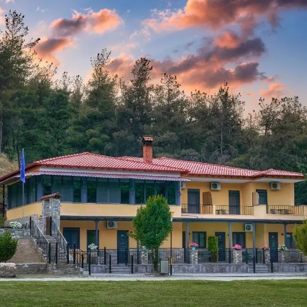 River Side Rooms
Elassona
Drive to ski centre: ≈ 39.0 km · 57 min
View on Booking.com ↗
 Villa Vasiliki
Elassona
Drive to ski centre: ≈ 38.9 km · 57 min
View on Booking.com ↗
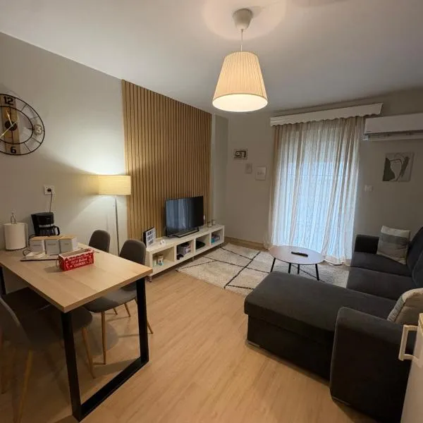 G&M Home
Elassona
Drive to ski centre: ≈ 40.5 km · 59 min
View on Booking.com ↗
 Houseloft Elassona center
Elassona
Drive to ski centre: ≈ 40.1 km · 58 min
View on Booking.com ↗
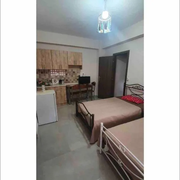 Margaret home
Kalývia
Drive to ski centre: ≈ 26.9 km · 44 min
View on Booking.com ↗
Press play to connect.
Open camera page ↗Press play to connect.
Open camera page ↗Preparing forecast graphs…
Times and values match the detailed forecast. Tap or point at a value for details. Scroll each chart sideways for later days. Rain / precipitation is the total water equivalent per forecast interval, including snow; snowfall is fresh snow per interval, not snow depth.
GFS and ECMWF model comparison. Each model retains its own forecast times and horizon. Precipitation and snowfall amounts cover their own forecast intervals; these can differ between models.
ECMWF · Model run: Next update expected:
Day Time (UTC) Temp. (°C) Humidity (%) Wind (km/h) Wind (knots) Wind (Bft) Direction Precip. (mm) Snow (cm) Pressure (hPa) Freezing (m) Conditions | Thursday, 05/11 06:00 -1.2 99 5 2 1B SE — — 1026 2138 Overcast 100% cloud 09:00 -1.5 100 2 1 1B SE 2.6 0.8 1028 2084 Overcast 100% cloud 12:00 -1.6 97 6 3 2B NW 2.4 0.7 1028 2053 Overcast 98% cloud 15:00 -1.6 95 11 6 2B NW 0.94 0.3 1027 2054 Overcast 98% cloud 18:00 -1.4 91 14 8 3B N 0.29 0.1 1027 2076 Overcast 100% cloud 21:00 -1.3 81 14 7 3B N 0.25 0.1 1027 2063 Overcast 99% cloud Friday, 06/11 00:00 -1 68 15 8 3B N 0.15 0 1026 2090 Overcast 91% cloud 03:00 -0.7 62 19 10 3B N 0.11 0 1025 2135 Overcast 89% cloud 06:00 -0.5 57 20 11 4B N 0.11 0 1024 2174 Overcast 91% cloud 09:00 -0.1 57 17 9 3B N 0.32 0.1 1024 2313 Overcast 90% cloud 12:00 0.5 55 16 9 3B N 0.52 0.2 1022 2508 Cloudy 80% cloud 15:00 1 54 19 10 3B N 0.09 0 1021 2617 Partly cloudy 39% cloud 18:00 1.5 46 18 10 3B N 0.06 0 1021 2750 Partly cloudy 38% cloud 21:00 1.4 44 17 9 3B N 0 0 1022 2707 Clear 19% cloud Saturday, 07/11 00:00 1.1 38 15 8 3B N 0 0 1022 2629 Clear 16% cloud 03:00 0.6 40 15 8 3B N 0.04 0 1022 2513 Partly cloudy 27% cloud 06:00 0.1 48 15 8 3B N 0 0 1024 2405 Cloudy 77% cloud 09:00 -0.1 47 12 6 2B N 0 0 1025 2323 Overcast 92% cloud 12:00 -0.1 49 11 6 2B N 0.06 0 1024 2328 Cloudy 80% cloud 15:00 -0.3 47 12 6 2B NW 0.06 0 1025 2282 Cloudy 67% cloud 18:00 -0.7 48 11 6 2B N 0 0 1026 2162 Overcast 85% cloud 21:00 -1 52 9 5 2B N 0.17 0 1028 2064 Overcast 88% cloud Sunday, 08/11 00:00 -1.4 57 6 3 1B N 0.29 0.1 1029 1922 Overcast 96% cloud 03:00 -1.6 63 6 3 1B N 1.1 0.3 1029 1866 Overcast 100% cloud 06:00 -1.8 63 6 3 1B N 1.8 0.5 1030 1787 Overcast 100% cloud 09:00 -1.7 61 4 2 1B N 1.2 0.4 1031 1766 Overcast 100% cloud 12:00 -1.5 60 6 3 2B NW 0.88 0.3 1030 1866 Overcast 93% cloud 15:00 -1.3 62 9 5 2B NW 0.31 0.1 1030 1959 Overcast 94% cloud 18:00 -1.2 64 11 6 2B NW 0.09 0 1031 2033 Overcast 87% cloud 21:00 -0.9 62 12 7 2B NW 0 0 1031 2125 Cloudy 66% cloud Monday, 09/11 00:00 -0.5 59 13 7 3B NW 0 0 1030 2233 Overcast 81% cloud 03:00 -0.4 73 11 6 2B NW 0 0 1030 2250 Overcast 98% cloud 06:00 -0.3 78 9 5 2B W 0.04 0 1030 2287 Overcast 99% cloud 09:00 0.1 78 12 6 2B W 0.09 0 1030 2376 Overcast 95% cloud 12:00 0.2 88 17 9 3B W 2.2 0.7 1029 2403 Overcast 100% cloud 15:00 0.5 94 28 15 4B W 2.4 0.7 1027 2467 Overcast 100% cloud 18:00 0.8 93 26 14 4B W 0.92 0.3 1027 2518 Overcast 96% cloud 21:00 1 89 26 14 4B W 0.81 0.2 1026 2546 Cloudy 57% cloud Tuesday, 10/11 00:00 1.1 84 26 14 4B W 0.05 0 1026 2555 Partly cloudy 40% cloud 03:00 1.3 74 23 12 4B W 0 0 1025 2609 Partly cloudy 37% cloud 06:00 1.5 68 20 11 4B NW 0 0 1025 2678 Partly cloudy 37% cloud 09:00 2.1 68 20 11 4B NW 0 0 1024 2835 Partly cloudy 42% cloud 12:00 2.9 61 21 11 4B W 0.07 0 1022 3026 Cloudy 68% cloud 15:00 3.2 60 23 13 4B W 0 0 1021 3073 Overcast 99% cloud 18:00 3.2 62 24 13 4B W 0 0 1021 3023 Cloudy 64% cloud 21:00 3.1 65 25 14 4B W 0 0 1021 2973 Overcast 90% cloud Wednesday, 11/11 00:00 3.4 69 27 15 4B W 0 0 1020 2982 Overcast 90% cloud 03:00 3.5 74 27 15 4B W 0 0 1018 2949 Overcast 93% cloud 06:00 3.7 76 23 12 4B W 0 0 1018 2988 Overcast 91% cloud |
|---|
Forecast table times: UTC.
Coordinates: 40.05729°N, 22.34962°E · Requested elevation: 2360 m. Model terrain: 864 m. Terrain and 1000/925/850/700 hPa profiles are used for height estimates.
These are altitude estimates, not a simulation of local mountain terrain. Precipitation, cloud and sea-level pressure use horizontal interpolation only.
Precipitation includes rain and snow water equivalent: preceding 3 hours through day 6, then 6 hours (see cell tooltip). Snow (cm) estimates fresh snowfall from precipitation and temperature using the GFS conversion; it is not snow depth on the ground. Freezing (m) uses additional 600/500 hPa temperatures when available and estimates the lowest resolved 0°C crossing above sea level. When all sampled levels are warm, the upper profile limit is shown (see tooltip). < marks an entirely cold sampled profile and its lower height limit. No extrapolation is used.
Preparing forecast graphs…
Times and values match the detailed forecast. Tap or point at a value for details. Scroll each chart sideways for later days. Rain / precipitation is the total water equivalent per forecast interval, including snow; snowfall is fresh snow per interval, not snow depth.
GFS and ECMWF model comparison. Each model retains its own forecast times and horizon. Precipitation and snowfall amounts cover their own forecast intervals; these can differ between models.
ECMWF · Model run: Next update expected:
Day Time (UTC) Temp. (°C) Humidity (%) Wind (km/h) Wind (knots) Wind (Bft) Direction Precip. (mm) Snow (cm) Pressure (hPa) Freezing (m) Conditions | Thursday, 05/11 06:00 -2.8 98 4 2 1B S — — 1026 2122 Overcast 100% cloud 09:00 -3.1 99 4 2 1B SW 2.3 2.3 1028 2069 Overcast 100% cloud 12:00 -3.2 96 10 5 2B NW 2.1 1.6 1028 2041 Overcast 98% cloud 15:00 -3.2 94 15 8 3B NW 0.75 0.8 1027 2051 Overcast 98% cloud 18:00 -2.9 87 18 10 3B N 0.24 0.2 1027 2073 Overcast 100% cloud 21:00 -2.6 73 16 9 3B N 0.19 0 1027 2059 Overcast 99% cloud Friday, 06/11 00:00 -2 54 18 10 3B N 0.12 0 1026 2086 Overcast 86% cloud 03:00 -1.6 47 24 13 4B N 0.11 0 1025 2138 Overcast 84% cloud 06:00 -1.3 41 25 14 4B N 0.11 0 1024 2171 Overcast 90% cloud 09:00 -1 42 21 12 4B N 0.28 0.1 1024 2298 Overcast 86% cloud 12:00 -0.6 41 20 11 4B N 0.49 0.1 1022 2499 Cloudy 74% cloud 15:00 -0.1 40 22 12 4B N 0.08 0 1021 2615 Partly cloudy 31% cloud 18:00 0.4 36 21 11 4B N 0.04 0 1021 2750 Partly cloudy 31% cloud 21:00 0.2 36 20 11 4B N 0 0 1022 2703 Clear 16% cloud Saturday, 07/11 00:00 -0.1 30 18 10 3B N 0 0 1022 2627 Clear 15% cloud 03:00 -0.5 30 18 10 3B N 0.04 0 1022 2508 Partly cloudy 26% cloud 06:00 -0.7 34 19 10 3B N 0 0 1024 2389 Cloudy 74% cloud 09:00 -1 34 15 8 3B N 0 0 1025 2311 Overcast 88% cloud 12:00 -1.1 34 15 8 3B NW 0.04 0 1024 2318 Cloudy 76% cloud 15:00 -1.2 32 15 8 3B NW 0.04 0 1025 2278 Cloudy 57% cloud 18:00 -1.7 33 13 7 3B N 0 0 1026 2162 Cloudy 80% cloud 21:00 -1.9 36 11 6 2B N 0.12 0 1028 2058 Overcast 81% cloud Sunday, 08/11 00:00 -2.4 40 9 5 2B N 0.25 0 1029 1920 Overcast 94% cloud 03:00 -2.6 47 10 5 2B NW 1.3 0.4 1029 1854 Overcast 100% cloud 06:00 -2.8 48 10 5 2B N 2.0 0.6 1030 1768 Overcast 100% cloud 09:00 -2.5 45 6 3 2B N 1.0 0.3 1031 1753 Overcast 100% cloud 12:00 -2.3 44 8 4 2B NW 0.72 0.2 1030 1865 Overcast 87% cloud 15:00 -2.2 47 11 6 2B NW 0.27 0.1 1030 1967 Overcast 90% cloud 18:00 -2.2 54 13 7 3B NW 0.08 0 1031 2025 Overcast 85% cloud 21:00 -2 55 16 9 3B NW 0 0 1031 2117 Cloudy 67% cloud Monday, 09/11 00:00 -1.6 54 18 10 3B NW 0 0 1030 2222 Overcast 83% cloud 03:00 -1.6 70 15 8 3B NW 0 0 1030 2242 Overcast 98% cloud 06:00 -1.6 80 12 6 2B NW 0.04 0 1030 2289 Overcast 99% cloud 09:00 -1.3 81 14 8 3B W 0.08 0 1030 2368 Overcast 94% cloud 12:00 -1.2 90 20 11 4B W 2.1 0.6 1029 2397 Overcast 99% cloud 15:00 -0.8 96 34 19 5B W 2.6 0.8 1027 2469 Overcast 100% cloud 18:00 -0.7 94 31 17 5B W 0.90 0.3 1027 2515 Overcast 93% cloud 21:00 -0.6 89 30 16 5B W 0.75 0.2 1026 2543 Cloudy 58% cloud Tuesday, 10/11 00:00 -0.6 82 29 15 4B W 0.06 0 1026 2551 Partly cloudy 39% cloud 03:00 -0.2 67 25 14 4B W 0 0 1025 2605 Partly cloudy 34% cloud 06:00 0.1 62 23 12 4B NW 0 0 1025 2670 Partly cloudy 37% cloud 09:00 0.8 61 23 12 4B NW 0 0 1024 2834 Partly cloudy 45% cloud 12:00 1.6 53 23 13 4B W 0.07 0 1022 3019 Cloudy 69% cloud 15:00 1.9 52 26 14 4B W 0 0 1021 3065 Overcast 99% cloud 18:00 1.7 55 27 15 4B W 0 0 1021 3019 Cloudy 62% cloud 21:00 1.7 60 28 15 4B W 0 0 1021 2975 Overcast 91% cloud Wednesday, 11/11 00:00 1.8 66 29 15 4B W 0 0 1020 2981 Overcast 89% cloud 03:00 1.8 72 28 15 4B W 0 0 1018 2949 Overcast 91% cloud 06:00 2 75 23 13 4B W 0 0 1018 2988 Overcast 91% cloud |
|---|
Forecast table times: UTC.
Coordinates: 40.09422°N, 22.3667°E · Requested elevation: 2650 m. Model terrain: 768 m. Terrain and 1000/925/850/700 hPa profiles are used for height estimates.
These are altitude estimates, not a simulation of local mountain terrain. Precipitation, cloud and sea-level pressure use horizontal interpolation only.
Precipitation includes rain and snow water equivalent: preceding 3 hours through day 6, then 6 hours (see cell tooltip). Snow (cm) estimates fresh snowfall from precipitation and temperature using the GFS conversion; it is not snow depth on the ground. Freezing (m) uses additional 600/500 hPa temperatures when available and estimates the lowest resolved 0°C crossing above sea level. When all sampled levels are warm, the upper profile limit is shown (see tooltip). < marks an entirely cold sampled profile and its lower height limit. No extrapolation is used.