Camera 1
Press play to connect.
Open camera page ↗
Each colour starts at the value shown. Wind colours match across all three units. Dry cells stay neutral. Colours describe the displayed values, not official weather warnings.
Preparing forecast graphs…
Times and values match the detailed forecast. Tap or point at a value for details. Scroll each chart sideways for later days. Rain / precipitation is the total water equivalent per forecast interval, including snow; snowfall is fresh snow per interval, not snow depth.
GFS and ECMWF model comparison. Each model retains its own forecast times and horizon. Precipitation and snowfall amounts cover their own forecast intervals; these can differ between models.
ECMWF · Model run: Next update expected:
Day Time (UTC) Temp. (°C) Humidity (%) Wind (km/h) Wind (knots) Wind (Bft) Direction Precip. (mm) Snow (cm) Pressure (hPa) Freezing (m) Conditions | Thursday, 05/11 06:00 5.8 80 18 10 3B E — — 1023 2756 Overcast 84% cloud  09:00 5.7 88 17 9 3B E 0.01 0 1024 2657 Partly cloudy 45% cloud  12:00 5.9 82 13 7 3B E 0.03 0 1023 2574 Cloudy 55% cloud  15:00 5.5 82 10 5 2B NE 0.12 0 1024 2550 Cloudy 66% cloud 18:00 5.1 85 10 5 2B NE 0.05 0 1025 2531 Cloudy 63% cloud 21:00 4.8 83 9 5 2B NE 0.03 0 1025 2478 Cloudy 69% cloud Friday, 06/11 00:00 4.2 83 8 4 2B NE 0.00 0 1024 2402 Cloudy 70% cloud 03:00 3.8 80 11 6 2B NE 0.00 0 1024 2410 Cloudy 68% cloud 06:00 3.6 77 12 6 2B N 0 0 1023 2517 Partly cloudy 38% cloud 09:00 3.8 83 7 4 2B N 0.00 0 1022 2652 Partly cloudy 37% cloud 12:00 5.5 76 8 5 2B NW 0.00 0 1020 2836 Cloudy 53% cloud 15:00 5.1 86 10 6 2B W 0.22 0 1020 2891 Partly cloudy 32% cloud 18:00 4.7 84 12 6 2B NW 0.05 0 1021 2825 Partly cloudy 26% cloud 21:00 5.3 67 15 8 3B N 0 0 1021 2915 Overcast 82% cloud Saturday, 07/11 00:00 5.1 63 11 6 2B N 0 0 1021 2830 Overcast 95% cloud 03:00 4.9 62 9 5 2B NE 0 0 1021 2771 Partly cloudy 30% cloud 06:00 4.4 65 9 5 2B NE 0 0 1023 2726 Cloudy 71% cloud 09:00 4.2 68 8 4 2B E 0 0 1023 2812 Partly cloudy 29% cloud 12:00 5 76 4 2 1B NE 0 0 1021 2837 Cloudy 52% cloud 15:00 4.3 88 1 0 0B E 0.05 0 1023 2821 Overcast 88% cloud 18:00 3.9 92 2 1 1B N 0.07 0 1024 2642 Cloudy 67% cloud 21:00 3.6 91 5 3 1B NE 0 0 1026 2503 Partly cloudy 34% cloud Sunday, 08/11 00:00 3.4 82 12 6 2B NE 0 0 1027 2396 Cloudy 51% cloud 03:00 2.8 77 20 11 3B NE 0.00 0 1027 2319 Cloudy 73% cloud 06:00 2.5 73 21 11 4B NE 0.00 0 1029 2242 Cloudy 69% cloud 09:00 2.8 63 21 11 4B NE 0 0 1029 2288 Partly cloudy 22% cloud 12:00 3.4 71 13 7 3B NE 0 0 1028 2414 Clear 10% cloud  15:00 3.7 76 9 5 2B NE 0 0 1029 2506 Clear 6% cloud 18:00 4.7 68 8 4 2B NE 0 0 1030 2583 Partly cloudy 23% cloud 21:00 5.5 59 8 4 2B NE 0 0 1030 2662 Cloudy 64% cloud Monday, 09/11 00:00 6 54 5 3 1B NE 0 0 1029 2699 Cloudy 61% cloud 03:00 6.1 52 1 0 0B NW 0 0 1028 2690 Cloudy 79% cloud 06:00 6.3 57 4 2 1B W 0 0 1029 2686 Overcast 82% cloud 09:00 6.4 72 8 4 2B W 0.01 0 1029 2666 Cloudy 70% cloud 12:00 6.7 75 10 6 2B W 0 0 1026 2718 Cloudy 68% cloud 15:00 6 85 11 6 2B W 0 0 1026 2703 Overcast 98% cloud 18:00 6.1 94 16 9 3B W 0.07 0 1027 2790 Overcast 87% cloud 21:00 6.3 91 17 9 3B W 0.07 0 1027 2755 Overcast 80% cloud Tuesday, 10/11 00:00 6.5 89 22 12 4B SW 0.12 0 1027 2755 Overcast 92% cloud 03:00 6.2 96 23 13 4B W 0.29 0 1026 2780 Overcast 94% cloud 06:00 6.6 98 23 13 4B W 0 0 1026 2853 Overcast 96% cloud 09:00 6.7 99 21 11 4B W 0.01 0 1025 2999 Overcast 97% cloud 12:00 7.5 89 22 12 4B W 0.75 0 1023 3000 Cloudy 66% cloud 15:00 7.3 90 22 12 4B W 0.24 0 1022 3123 Cloudy 59% cloud 18:00 7.3 97 23 12 4B W 0 0 1023 3127 Overcast 99% cloud 21:00 7.6 99 25 14 4B W 0 0 1023 3120 Overcast 100% cloud Wednesday, 11/11 00:00 7.7 88 28 15 4B W 0 0 1022 3121 Overcast 100% cloud 03:00 7.6 95 28 15 4B W 0 0 1020 3110 Overcast 100% cloud 06:00 7.6 81 26 14 4B W 0.09 0 1021 3014 Overcast 99% cloud |
|---|
Forecast table times: UTC.
Coordinates: 37.65311°N, 22.26628°E · Requested elevation: 1570 m. Model terrain: 900 m. Terrain and 1000/925/850/700 hPa profiles are used for height estimates.
These are altitude estimates, not a simulation of local mountain terrain. Precipitation, cloud and sea-level pressure use horizontal interpolation only.
Precipitation includes rain and snow water equivalent: preceding 3 hours through day 6, then 6 hours (see cell tooltip). Snow (cm) estimates fresh snowfall from precipitation and temperature using the GFS conversion; it is not snow depth on the ground. Freezing (m) uses additional 600/500 hPa temperatures when available and estimates the lowest resolved 0°C crossing above sea level. When all sampled levels are warm, the upper profile limit is shown (see tooltip). < marks an entirely cold sampled profile and its lower height limit. No extrapolation is used.
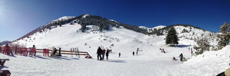
Swipe to see all 5 places to stay →
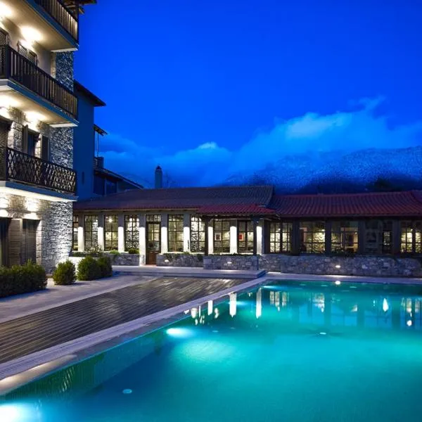 Art Mainalon Hotel
Vytina
Drive to ski centre: ≈ 15.4 km · 19 min
View on Booking.com ↗
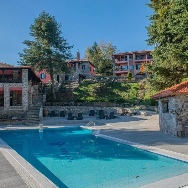 CHALET ELATI
Vytina
Drive to ski centre: ≈ 21.5 km · 27 min
View on Booking.com ↗
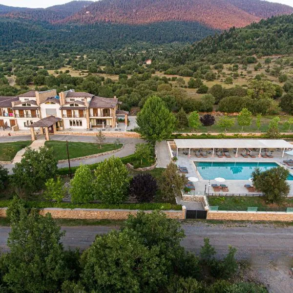 Nymfasia Resort
Vytina
Drive to ski centre: ≈ 16.6 km · 20 min
View on Booking.com ↗
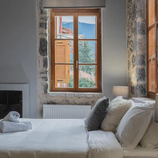 Anastasia's Suites Arcadia
Vytina
Drive to ski centre: ≈ 15.3 km · 19 min
View on Booking.com ↗
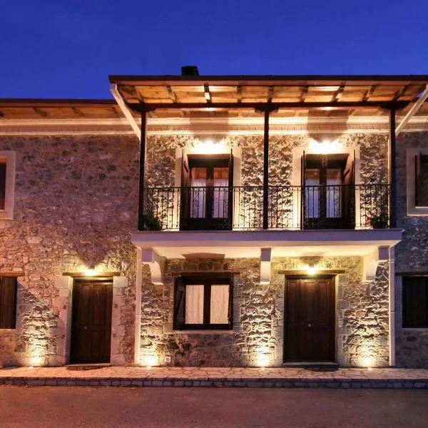 Archontiko Nikolopoulou
Vytina
Drive to ski centre: ≈ 15.3 km · 18 min
View on Booking.com ↗
Press play to connect.
Open camera page ↗Press play to connect.
Open camera page ↗Preparing forecast graphs…
Times and values match the detailed forecast. Tap or point at a value for details. Scroll each chart sideways for later days. Rain / precipitation is the total water equivalent per forecast interval, including snow; snowfall is fresh snow per interval, not snow depth.
GFS and ECMWF model comparison. Each model retains its own forecast times and horizon. Precipitation and snowfall amounts cover their own forecast intervals; these can differ between models.
ECMWF · Model run: Next update expected:
Day Time (UTC) Temp. (°C) Humidity (%) Wind (km/h) Wind (knots) Wind (Bft) Direction Precip. (mm) Snow (cm) Pressure (hPa) Freezing (m) Conditions | Thursday, 05/11 06:00 4.7 75 16 8 3B NE — — 1023 2760 Overcast 83% cloud 09:00 4.5 83 14 7 3B NE 0.01 0 1024 2659 Partly cloudy 44% cloud 12:00 4.6 81 10 6 2B NE 0.02 0 1023 2577 Cloudy 54% cloud 15:00 4.2 81 8 4 2B NE 0.12 0 1024 2553 Cloudy 66% cloud 18:00 3.9 82 8 5 2B NE 0.05 0 1025 2534 Cloudy 63% cloud 21:00 3.6 79 9 5 2B NE 0.03 0 1025 2482 Cloudy 67% cloud Friday, 06/11 00:00 3.1 80 9 5 2B N 0.00 0 1024 2406 Cloudy 69% cloud 03:00 2.8 77 13 7 3B N 0.00 0 1024 2415 Cloudy 67% cloud 06:00 2.7 70 14 8 3B N 0 0 1023 2522 Partly cloudy 36% cloud 09:00 3 75 10 5 2B N 0.00 0 1022 2654 Partly cloudy 36% cloud 12:00 4.5 69 12 6 2B NW 0.00 0 1020 2838 Cloudy 53% cloud 15:00 4.2 78 13 7 3B NW 0.24 0 1020 2894 Partly cloudy 32% cloud 18:00 3.9 76 15 8 3B NW 0.05 0 1021 2828 Partly cloudy 26% cloud 21:00 4.4 61 17 9 3B N 0 0 1021 2916 Overcast 84% cloud Saturday, 07/11 00:00 4.1 58 13 7 3B N 0 0 1021 2831 Overcast 96% cloud 03:00 3.9 57 10 5 2B N 0 0 1021 2773 Partly cloudy 28% cloud 06:00 3.5 59 8 5 2B NE 0 0 1023 2728 Cloudy 71% cloud 09:00 3.4 62 6 3 2B NE 0 0 1023 2813 Partly cloudy 28% cloud 12:00 4.1 69 6 3 2B N 0 0 1021 2841 Cloudy 53% cloud 15:00 3.5 80 4 2 1B NW 0.05 0 1023 2826 Overcast 88% cloud 18:00 3.1 85 6 3 1B NW 0.07 0 1024 2645 Cloudy 68% cloud 21:00 2.8 86 6 3 2B N 0 0 1026 2507 Partly cloudy 33% cloud Sunday, 08/11 00:00 2.5 81 11 6 2B N 0 0 1027 2400 Cloudy 50% cloud 03:00 2 77 16 9 3B NE 0.00 0 1027 2327 Cloudy 72% cloud 06:00 1.7 72 17 9 3B NE 0.00 0 1029 2254 Cloudy 69% cloud 09:00 1.9 63 16 9 3B NE 0 0 1029 2297 Partly cloudy 22% cloud 12:00 2.5 67 11 6 2B NE 0 0 1028 2421 Clear 9% cloud 15:00 2.9 73 9 5 2B N 0 0 1029 2512 Clear 6% cloud 18:00 3.7 69 10 5 2B N 0 0 1030 2586 Partly cloudy 23% cloud 21:00 4.4 61 10 5 2B N 0 0 1030 2665 Cloudy 64% cloud Monday, 09/11 00:00 4.8 56 6 3 1B N 0 0 1029 2702 Cloudy 61% cloud 03:00 4.9 56 3 2 1B NW 0 0 1028 2691 Cloudy 80% cloud 06:00 5 61 6 3 1B W 0 0 1029 2688 Overcast 81% cloud 09:00 5 75 10 5 2B W 0.00 0 1029 2666 Cloudy 69% cloud 12:00 5.3 78 13 7 3B W 0 0 1026 2718 Cloudy 69% cloud 15:00 4.8 87 14 8 3B W 0 0 1026 2703 Overcast 98% cloud 18:00 5 92 18 10 3B W 0.07 0 1027 2791 Overcast 87% cloud 21:00 5.1 92 19 10 3B W 0.07 0 1027 2755 Cloudy 79% cloud Tuesday, 10/11 00:00 5.2 90 23 13 4B W 0.12 0 1027 2755 Overcast 91% cloud 03:00 5 96 25 14 4B W 0.28 0 1026 2779 Overcast 94% cloud 06:00 5.4 96 25 14 4B W 0 0 1026 2854 Overcast 97% cloud 09:00 5.6 94 22 12 4B W 0.01 0 1025 2998 Overcast 98% cloud 12:00 6.3 85 23 13 4B W 0.75 0 1023 2998 Cloudy 66% cloud 15:00 6.3 85 24 13 4B W 0.24 0 1022 3123 Cloudy 59% cloud 18:00 6.2 94 24 13 4B W 0 0 1023 3127 Overcast 99% cloud 21:00 6.5 96 26 14 4B W 0 0 1023 3120 Overcast 100% cloud Wednesday, 11/11 00:00 6.7 84 28 15 4B W 0 0 1022 3121 Overcast 100% cloud 03:00 6.5 90 28 15 4B W 0 0 1020 3110 Overcast 100% cloud 06:00 6.4 80 28 15 4B W 0.10 0 1021 3015 Overcast 100% cloud |
|---|
Forecast table times: UTC.
Coordinates: 37.64713°N, 22.26055°E · Requested elevation: 1800 m. Model terrain: 902 m. Terrain and 1000/925/850/700 hPa profiles are used for height estimates.
These are altitude estimates, not a simulation of local mountain terrain. Precipitation, cloud and sea-level pressure use horizontal interpolation only.
Precipitation includes rain and snow water equivalent: preceding 3 hours through day 6, then 6 hours (see cell tooltip). Snow (cm) estimates fresh snowfall from precipitation and temperature using the GFS conversion; it is not snow depth on the ground. Freezing (m) uses additional 600/500 hPa temperatures when available and estimates the lowest resolved 0°C crossing above sea level. When all sampled levels are warm, the upper profile limit is shown (see tooltip). < marks an entirely cold sampled profile and its lower height limit. No extrapolation is used.