Worldwide Ski Resort Forecasts

More
Colour guide Temperature · Wind · Rain · Snow
Each colour starts at the value shown. Wind colours match across all three units. Dry cells stay neutral. Colours describe the displayed values, not official weather warnings.
Preparing forecast graphs…
Times and values match the detailed forecast. Tap or point at a value for details. Scroll each chart sideways for later days. Rain / precipitation is the total water equivalent per forecast interval, including snow; snowfall is fresh snow per interval, not snow depth.
GFS and ECMWF model comparison. Each model retains its own forecast times and horizon. Precipitation and snowfall amounts cover their own forecast intervals; these can differ between models.
Forecast values and model notes
Pilio Ski Area - Base Pilio3 1160
ECMWF · Model run: Next update expected:
Day Time (UTC) Temp. (°C) Humidity (%) Wind (km/h) Wind (knots) Wind (Bft) Direction Precip. (mm) Snow (cm) Pressure (hPa) Freezing (m) Conditions | Thursday, 05/11 06:00 5.4 93 28 15 4B E — — 1026 2162 Overcast 100% cloud  09:00 4.8 93 25 14 4B E 1.7 0 1027 2088 Overcast 100% cloud 12:00 4.5 92 16 9 3B NE 0.17 0 1027 2041 Overcast 95% cloud 15:00 4.3 90 13 7 3B NE 0.02 0 1026 2001 Cloudy 75% cloud  18:00 4.4 89 11 6 2B NE 0 0 1026 1940 Cloudy 66% cloud 21:00 4.3 93 11 6 2B NE 0.06 0 1026 1956 Overcast 99% cloud Friday, 06/11 00:00 4.1 97 11 6 2B N 0.63 0 1025 2031 Overcast 96% cloud 03:00 3.8 99 8 4 2B NE 1.3 0 1024 2067 Overcast 100% cloud 06:00 3.7 98 7 4 2B N 1.4 0 1024 2131 Overcast 94% cloud 09:00 4 96 9 5 2B N 1.1 0 1024 2281 Cloudy 79% cloud 12:00 4.4 94 10 5 2B N 1.1 0 1022 2369 Cloudy 72% cloud 15:00 5.2 84 14 8 3B NW 0.10 0 1021 2509 Partly cloudy 34% cloud  18:00 6.2 67 17 9 3B N 0 0 1021 2694 Clear 14% cloud  21:00 6.1 67 19 10 3B N 0.04 0 1021 2637 Cloudy 57% cloud Saturday, 07/11 00:00 5.6 69 19 10 3B N 0 0 1022 2538 Cloudy 77% cloud 03:00 4.9 81 18 10 3B N 0.02 0 1022 2357 Overcast 86% cloud 06:00 4.4 86 15 8 3B NE 0.19 0 1023 2328 Cloudy 69% cloud 09:00 4.2 95 11 6 2B E 0.62 0 1025 2316 Overcast 100% cloud 12:00 4.2 95 9 5 2B E 0.75 0 1024 2217 Overcast 99% cloud 15:00 4 97 6 3 2B E 0.38 0 1024 2190 Overcast 100% cloud 18:00 3.9 93 7 4 2B NE 0.08 0 1026 2014 Cloudy 80% cloud 21:00 3.8 90 12 6 2B E 0 0 1027 1947 Cloudy 52% cloud Sunday, 08/11 00:00 3.4 91 13 7 3B E 0.10 0 1028 1735 Cloudy 64% cloud 03:00 2.9 94 15 8 3B E 0.18 0 1028 1595 Overcast 96% cloud 06:00 2.4 91 13 7 3B E 0.16 0 1030 1547 Overcast 97% cloud 09:00 2.5 90 10 5 2B E 0 0 1031 1526 Overcast 95% cloud 12:00 2.7 90 6 3 2B NE 0.04 0 1030 1587 Overcast 100% cloud 15:00 3.2 86 3 2 1B NE 0 0 1030 1961 Cloudy 75% cloud 18:00 3.7 75 4 2 1B E 0 0 1031 2185 Partly cloudy 37% cloud 21:00 3.7 73 4 2 1B E 0 0 1031 2241 Partly cloudy 26% cloud Monday, 09/11 00:00 3.8 72 4 2 1B E 0 0 1030 2277 Cloudy 51% cloud 03:00 4.2 67 4 2 1B SE 0 0 1029 2400 Overcast 91% cloud 06:00 4.6 62 3 2 1B SE 0.05 0 1030 2409 Overcast 99% cloud 09:00 5.1 65 5 3 1B S 0.12 0 1030 2518 Overcast 93% cloud 12:00 5.3 75 4 2 1B SW 0.16 0 1029 2531 Overcast 99% cloud 15:00 5.5 80 7 4 2B SW 1.7 0 1028 2544 Overcast 99% cloud 18:00 5.9 86 12 6 2B SW 0.29 0 1027 2587 Overcast 86% cloud 21:00 6.5 86 15 8 3B SW 0.59 0 1027 2599 Cloudy 72% cloud Tuesday, 10/11 00:00 7.2 84 19 10 3B W 0.25 0 1026 2590 Cloudy 62% cloud 03:00 7.3 86 20 11 3B W 0 0 1025 2603 Partly cloudy 34% cloud 06:00 7.2 85 18 9 3B W 0 0 1025 2659 Partly cloudy 37% cloud 09:00 7.5 82 15 8 3B W 0 0 1025 2792 Partly cloudy 28% cloud 12:00 8.3 78 16 9 3B W 0 0 1022 3074 Cloudy 59% cloud 15:00 9 80 18 10 3B W 0 0 1021 3110 Overcast 96% cloud 18:00 9.3 78 19 10 3B W 0 0 1021 3111 Overcast 95% cloud 21:00 9.7 76 19 10 3B W 0 0 1021 3053 Overcast 96% cloud Wednesday, 11/11 00:00 10.1 77 25 13 4B W 0 0 1020 3017 Overcast 99% cloud 03:00 10.3 78 27 14 4B W 0 0 1018 2979 Overcast 98% cloud 06:00 10.8 76 23 13 4B W 0 0 1018 2913 Overcast 94% cloud |
|---|
Forecast notes
Forecast table times: UTC.
Coordinates: 39.391267°N, 23.082833°E · Requested elevation: 1160 m. Model terrain: 205 m. Terrain and 1000/925/850/700 hPa profiles are used for height estimates.
These are altitude estimates, not a simulation of local mountain terrain. Precipitation, cloud and sea-level pressure use horizontal interpolation only.
Precipitation includes rain and snow water equivalent: preceding 3 hours through day 6, then 6 hours (see cell tooltip). Snow (cm) estimates fresh snowfall from precipitation and temperature using the GFS conversion; it is not snow depth on the ground. Freezing (m) uses additional 600/500 hPa temperatures when available and estimates the lowest resolved 0°C crossing above sea level. When all sampled levels are warm, the upper profile limit is shown (see tooltip). < marks an entirely cold sampled profile and its lower height limit. No extrapolation is used.
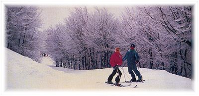
It is located 2 km from the settlement of Chania, km from Agios Lavrentios and 27 km from Volos. Its altitude of 1471 meters, is an extremely low for a ski resort, giving it peculiarities in snowfall, in combination with the morphology of the area and the climate.
Check current ski conditions at Snow Report Pilio
Places to stay — Chania, Pelion
Swipe to see all 5 places to stay →
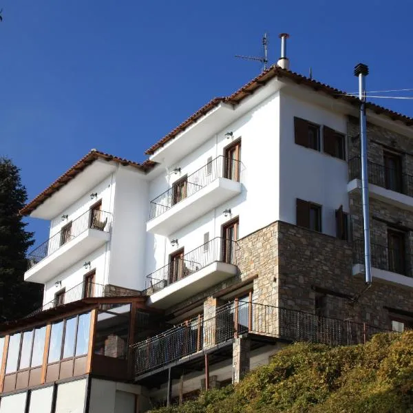 Tasia Mountain Hotel
Chania
Drive to ski centre: ≈ 2.2 km · 5 min
View on Booking.com ↗
 Hotel Hani Zisi
Chania
Drive to ski centre: ≈ 2.5 km · 6 min
View on Booking.com ↗
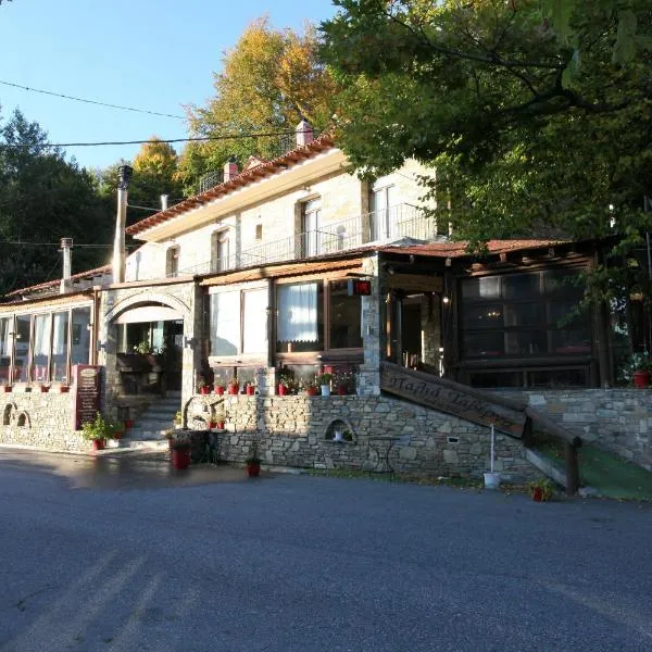 To Hani Tou Kokkini, Pelion
Chania
Drive to ski centre: ≈ 2.2 km · 5 min
View on Booking.com ↗
 Kenta Mountain Hotel
Portariá
Drive to ski centre: ≈ 14.5 km · 24 min
View on Booking.com ↗
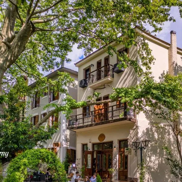 Gastronomy Hotel Kritsa
Portariá
Drive to ski centre: ≈ 14.7 km · 24 min
View on Booking.com ↗
Preparing forecast graphs…
Times and values match the detailed forecast. Tap or point at a value for details. Scroll each chart sideways for later days. Rain / precipitation is the total water equivalent per forecast interval, including snow; snowfall is fresh snow per interval, not snow depth.
GFS and ECMWF model comparison. Each model retains its own forecast times and horizon. Precipitation and snowfall amounts cover their own forecast intervals; these can differ between models.
Forecast values and model notes
Pilio Ski Area - Middle P2-P1 1320
ECMWF · Model run: Next update expected:
Day Time (UTC) Temp. (°C) Humidity (%) Wind (km/h) Wind (knots) Wind (Bft) Direction Precip. (mm) Snow (cm) Pressure (hPa) Freezing (m) Conditions | Thursday, 05/11 06:00 4.5 94 26 14 4B E — — 1026 2162 Overcast 100% cloud 09:00 3.9 93 23 12 4B E 1.6 0 1027 2089 Overcast 100% cloud 12:00 3.6 92 14 8 3B NE 0.17 0 1027 2042 Overcast 95% cloud 15:00 3.5 90 12 6 2B NE 0.02 0 1026 2002 Cloudy 76% cloud 18:00 3.4 91 11 6 2B NE 0 0 1026 1941 Cloudy 67% cloud 21:00 3.2 95 12 7 3B NE 0.06 0 1026 1957 Overcast 99% cloud Friday, 06/11 00:00 3.1 98 12 6 2B N 0.62 0 1025 2031 Overcast 96% cloud 03:00 2.8 99 9 5 2B N 1.3 0 1024 2067 Overcast 100% cloud 06:00 2.8 98 9 5 2B N 1.4 0 1024 2132 Overcast 94% cloud 09:00 3 96 10 5 2B N 1.1 0 1024 2282 Cloudy 79% cloud 12:00 3.4 95 12 7 2B NW 1.1 0 1022 2370 Cloudy 72% cloud 15:00 4.3 81 18 10 3B NW 0.10 0 1021 2508 Partly cloudy 35% cloud 18:00 5.4 58 21 11 4B N 0 0 1021 2693 Clear 14% cloud 21:00 5.2 61 23 12 4B N 0.04 0 1021 2638 Cloudy 57% cloud Saturday, 07/11 00:00 4.8 62 22 12 4B N 0 0 1022 2539 Cloudy 77% cloud 03:00 3.8 76 21 11 4B N 0.02 0 1022 2358 Overcast 86% cloud 06:00 3.3 85 15 8 3B NE 0.19 0 1023 2330 Cloudy 70% cloud 09:00 3.1 96 10 5 2B E 0.61 0 1025 2316 Overcast 100% cloud 12:00 3.1 97 7 4 2B E 0.74 0 1024 2216 Overcast 99% cloud 15:00 3 98 4 2 1B NE 0.37 0 1024 2189 Overcast 100% cloud 18:00 2.9 95 7 4 2B N 0.08 0 1026 2015 Cloudy 80% cloud 21:00 2.7 91 11 6 2B NE 0 0 1027 1948 Cloudy 52% cloud Sunday, 08/11 00:00 2.2 92 11 6 2B NE 0.10 0 1028 1735 Cloudy 64% cloud 03:00 1.8 96 12 7 3B E 0.17 0 1028 1594 Overcast 96% cloud 06:00 1.4 93 8 5 2B E 0.16 0 1030 1547 Overcast 97% cloud 09:00 1.4 92 8 4 2B E 0 0 1031 1526 Overcast 95% cloud 12:00 1.7 91 6 3 1B NE 0.04 0 1030 1588 Overcast 100% cloud 15:00 2.4 82 4 2 1B N 0 0 1030 1963 Cloudy 75% cloud 18:00 3.2 68 4 2 1B NE 0 0 1031 2185 Partly cloudy 37% cloud 21:00 3.3 65 3 2 1B E 0 0 1031 2241 Partly cloudy 25% cloud Monday, 09/11 00:00 3.3 64 2 1 1B E 0 0 1030 2278 Cloudy 51% cloud 03:00 3.9 57 2 1 1B SE 0 0 1029 2401 Overcast 91% cloud 06:00 4.3 54 2 1 1B S 0.04 0 1030 2409 Overcast 99% cloud 09:00 5 58 6 3 2B SW 0.11 0 1030 2519 Overcast 93% cloud 12:00 5.2 70 6 3 2B W 0.15 0 1029 2532 Overcast 99% cloud 15:00 5.3 78 9 5 2B SW 1.7 0 1028 2544 Overcast 99% cloud 18:00 5.6 86 15 8 3B SW 0.29 0 1027 2587 Overcast 86% cloud 21:00 6.1 88 19 10 3B W 0.58 0 1027 2600 Cloudy 71% cloud Tuesday, 10/11 00:00 6.6 88 25 13 4B W 0.25 0 1026 2591 Cloudy 62% cloud 03:00 6.7 89 24 13 4B W 0 0 1025 2603 Partly cloudy 34% cloud 06:00 6.6 87 21 11 4B W 0 0 1025 2659 Partly cloudy 37% cloud 09:00 6.9 80 19 10 3B W 0 0 1025 2792 Partly cloudy 28% cloud 12:00 7.5 75 19 10 3B W 0 0 1022 3074 Cloudy 59% cloud 15:00 8.2 78 24 13 4B W 0 0 1021 3110 Overcast 96% cloud 18:00 8.4 79 24 13 4B W 0 0 1021 3111 Overcast 95% cloud 21:00 8.8 75 23 12 4B W 0 0 1021 3053 Overcast 96% cloud Wednesday, 11/11 00:00 9.2 78 29 15 4B W 0 0 1020 3017 Overcast 99% cloud 03:00 9.5 79 31 17 5B W 0 0 1018 2979 Overcast 98% cloud 06:00 10 76 26 14 4B W 0 0 1018 2913 Overcast 94% cloud |
|---|
Forecast notes
Forecast table times: UTC.
Coordinates: 39.386889°N, 23.083155°E · Requested elevation: 1320 m. Model terrain: 201 m. Terrain and 1000/925/850/700 hPa profiles are used for height estimates.
These are altitude estimates, not a simulation of local mountain terrain. Precipitation, cloud and sea-level pressure use horizontal interpolation only.
Precipitation includes rain and snow water equivalent: preceding 3 hours through day 6, then 6 hours (see cell tooltip). Snow (cm) estimates fresh snowfall from precipitation and temperature using the GFS conversion; it is not snow depth on the ground. Freezing (m) uses additional 600/500 hPa temperatures when available and estimates the lowest resolved 0°C crossing above sea level. When all sampled levels are warm, the upper profile limit is shown (see tooltip). < marks an entirely cold sampled profile and its lower height limit. No extrapolation is used.
Preparing forecast graphs…
Times and values match the detailed forecast. Tap or point at a value for details. Scroll each chart sideways for later days. Rain / precipitation is the total water equivalent per forecast interval, including snow; snowfall is fresh snow per interval, not snow depth.
GFS and ECMWF model comparison. Each model retains its own forecast times and horizon. Precipitation and snowfall amounts cover their own forecast intervals; these can differ between models.
Forecast values and model notes
Pilio Ski Area - Top Pilio1 1450
ECMWF · Model run: Next update expected:
Day Time (UTC) Temp. (°C) Humidity (%) Wind (km/h) Wind (knots) Wind (Bft) Direction Precip. (mm) Snow (cm) Pressure (hPa) Freezing (m) Conditions | Thursday, 05/11 06:00 3.7 94 24 13 4B E — — 1026 2163 Overcast 100% cloud 09:00 3.2 94 21 11 4B E 1.6 0 1027 2089 Overcast 100% cloud 12:00 2.9 92 12 7 3B NE 0.16 0 1027 2042 Overcast 95% cloud 15:00 2.8 91 11 6 2B NE 0.02 0 1026 2002 Cloudy 76% cloud 18:00 2.5 93 11 6 2B NE 0 0 1026 1939 Cloudy 67% cloud 21:00 2.3 97 13 7 3B N 0.06 0 1026 1957 Overcast 99% cloud Friday, 06/11 00:00 2.4 98 13 7 3B N 0.61 0 1025 2032 Overcast 96% cloud 03:00 2.1 100 10 6 2B N 1.3 0 1024 2066 Overcast 100% cloud 06:00 2 99 11 6 2B N 1.4 0 1024 2133 Overcast 94% cloud 09:00 2.2 96 11 6 2B N 1.1 0 1024 2282 Cloudy 79% cloud 12:00 2.6 95 14 8 3B NW 1.1 0 1022 2368 Cloudy 72% cloud 15:00 3.6 79 22 12 4B NW 0.10 0 1021 2508 Partly cloudy 35% cloud 18:00 4.8 51 24 13 4B N 0 0 1021 2692 Clear 15% cloud 21:00 4.5 55 26 14 4B N 0.04 0 1021 2638 Cloudy 56% cloud Saturday, 07/11 00:00 4.1 55 25 14 4B N 0 0 1022 2539 Cloudy 77% cloud 03:00 2.9 72 23 12 4B N 0.02 0 1022 2356 Overcast 87% cloud 06:00 2.4 83 15 8 3B NE 0.20 0 1023 2331 Cloudy 70% cloud 09:00 2.2 98 9 5 2B NE 0.61 0 1025 2314 Overcast 100% cloud 12:00 2.2 98 6 3 1B NE 0.72 0 1024 2214 Overcast 99% cloud 15:00 2.2 99 4 2 1B N 0.35 0 1024 2186 Overcast 100% cloud 18:00 2 96 8 4 2B N 0.08 0 1026 2015 Cloudy 80% cloud 21:00 1.8 92 11 6 2B NE 0 0 1027 1947 Cloudy 52% cloud Sunday, 08/11 00:00 1.3 93 11 6 2B NE 0.10 0 1028 1735 Cloudy 64% cloud 03:00 0.9 98 10 6 2B E 0.17 0 1028 1591 Overcast 96% cloud 06:00 0.6 94 6 3 1B NE 0.15 0 1030 1547 Overcast 96% cloud 09:00 0.5 94 7 4 2B NE 0 0 1031 1526 Overcast 95% cloud 12:00 0.8 91 6 3 1B NE 0.04 0 1030 1591 Overcast 100% cloud 15:00 1.8 79 6 3 2B N 0 0 1030 1966 Cloudy 74% cloud 18:00 2.9 61 4 2 1B NE 0 0 1031 2185 Partly cloudy 35% cloud 21:00 2.9 58 3 2 1B NE 0 0 1031 2241 Partly cloudy 25% cloud Monday, 09/11 00:00 2.9 57 2 1 1B NE 0 0 1030 2279 Cloudy 51% cloud 03:00 3.7 50 2 1 1B S 0 0 1029 2402 Overcast 91% cloud 06:00 4.1 47 3 2 1B SW 0.04 0 1030 2410 Overcast 99% cloud 09:00 4.9 53 8 4 2B W 0.11 0 1030 2520 Overcast 93% cloud 12:00 5.1 66 9 5 2B W 0.15 0 1029 2532 Overcast 99% cloud 15:00 5.2 76 10 6 2B SW 1.6 0 1028 2544 Overcast 99% cloud 18:00 5.4 86 19 10 3B W 0.28 0 1027 2587 Overcast 86% cloud 21:00 5.8 90 23 13 4B W 0.55 0 1027 2600 Cloudy 71% cloud Tuesday, 10/11 00:00 6.2 91 29 16 5B W 0.25 0 1026 2591 Cloudy 61% cloud 03:00 6.3 92 28 15 4B W 0 0 1025 2603 Partly cloudy 34% cloud 06:00 6 88 24 13 4B W 0 0 1025 2660 Partly cloudy 37% cloud 09:00 6.4 79 21 12 4B W 0 0 1025 2792 Partly cloudy 27% cloud 12:00 6.9 73 22 12 4B W 0 0 1022 3074 Cloudy 58% cloud 15:00 7.6 77 28 15 4B W 0 0 1021 3110 Overcast 96% cloud 18:00 7.7 80 28 15 4B W 0 0 1021 3111 Overcast 95% cloud 21:00 8.1 74 25 14 4B W 0 0 1021 3054 Overcast 96% cloud Wednesday, 11/11 00:00 8.5 79 32 17 5B W 0 0 1020 3017 Overcast 99% cloud 03:00 8.8 80 34 18 5B W 0 0 1018 2979 Overcast 98% cloud 06:00 9.3 76 29 16 4B W 0 0 1018 2913 Overcast 94% cloud |
|---|
Forecast notes
Forecast table times: UTC.
Coordinates: 39.383439°N, 23.087039°E · Requested elevation: 1450 m. Model terrain: 195 m. Terrain and 1000/925/850/700 hPa profiles are used for height estimates.
These are altitude estimates, not a simulation of local mountain terrain. Precipitation, cloud and sea-level pressure use horizontal interpolation only.
Precipitation includes rain and snow water equivalent: preceding 3 hours through day 6, then 6 hours (see cell tooltip). Snow (cm) estimates fresh snowfall from precipitation and temperature using the GFS conversion; it is not snow depth on the ground. Freezing (m) uses additional 600/500 hPa temperatures when available and estimates the lowest resolved 0°C crossing above sea level. When all sampled levels are warm, the upper profile limit is shown (see tooltip). < marks an entirely cold sampled profile and its lower height limit. No extrapolation is used.