Προγνώσεις καιρού για χιονοδρομικά παγκοσμίως

Περισσότερα
Χρωματική κλίμακα Θερμοκρασία · Άνεμος · Βροχή · Χιόνι
Κάθε χρώμα ξεκινά από την τιμή που αναγράφεται. Τα χρώματα ανέμου αντιστοιχούν και στις τρεις μονάδες. Οι τιμές χωρίς υετό παραμένουν ουδέτερες. Τα χρώματα περιγράφουν τις τιμές και δεν αποτελούν επίσημες προειδοποιήσεις.
Προετοιμασία γραφημάτων…
Οι ώρες και οι τιμές αντιστοιχούν στην αναλυτική πρόγνωση. Πατήστε μια τιμή για λεπτομέρειες και μετακινήστε οριζόντια τα γραφήματα για επόμενες ημέρες. Ο υετός είναι το συνολικό ισοδύναμο νερού ανά διάστημα, μαζί με το χιόνι. Η χιονόπτωση αφορά νέο χιόνι ανά διάστημα, όχι το ύψος του χιονιού στο έδαφος.
Σύγκριση GFS και ECMWF. Κάθε μοντέλο διατηρεί τις δικές του ώρες και διάρκεια πρόγνωσης. Ο υετός και το νέο χιόνι αφορούν τα διαστήματα κάθε μοντέλου, τα οποία μπορεί να διαφέρουν.
Τιμές πρόγνωσης και σημειώσεις μοντέλων
Περτούλι - Βάση 1175
ECMWF · Εκτέλεση μοντέλου: Αναμενόμενη επόμενη ενημέρωση:
Ημέρα Ώρα (UTC) Θερμ. (°C) Υγρασία (%) Άνεμος (km/h) Άνεμος (κόμβοι) Άνεμος (Bft) Διεύθυνση Υετός (mm) Νέο χιόνι (cm) Πίεση (hPa) Σημείο παγοποίησης (m) Συνθήκες | Κυριακή, 22/11 06:00 3.8 78 12 6 2B W — — 1021 2808 Overcast 95% cloud  09:00 9.3 65 10 5 2B SW 0 0 1021 3060 Cloudy 60% cloud  12:00 10.8 59 15 8 3B SW 0 0 1017 3083 Cloudy 79% cloud 15:00 8.8 77 19 10 3B SW 0 0 1017 3076 Cloudy 74% cloud 18:00 8.1 90 21 11 4B SW 0.28 0 1016 3073 Overcast 92% cloud 21:00 8.4 87 28 15 4B SW 0.19 0 1014 3063 Overcast 96% cloud Δευτέρα, 23/11 00:00 9.7 89 36 19 5B SW 2.3 0 1010 3045 Overcast 97% cloud 03:00 9.9 87 35 19 5B SW 2.7 0 1008 3024 Overcast 95% cloud 06:00 9.8 82 34 19 5B W 1.8 0 1009 2930 Overcast 85% cloud 09:00 10.2 68 33 18 5B W 0.22 0 1010 2690 Cloudy 60% cloud 12:00 7.7 84 26 14 4B W 2.4 0 1010 2478 Overcast 85% cloud 15:00 7 77 34 18 5B W 1.4 0 1011 2447 Cloudy 65% cloud 18:00 6 83 19 10 3B W 0 0 1014 2459 Cloudy 71% cloud 21:00 5.7 82 19 10 3B W 0 0 1015 2281 Cloudy 65% cloud Τρίτη, 24/11 00:00 5.1 82 15 8 3B W 0 0 1017 2220 Cloudy 72% cloud 03:00 3.5 89 8 4 2B W 0.09 0 1019 2037 Cloudy 75% cloud 06:00 3 93 3 1 1B SW 0 0 1022 1867 Overcast 89% cloud 09:00 4.9 84 0 0 0B SE 0.38 0 1024 1914 Cloudy 67% cloud 12:00 6.4 76 1 1 0B SE 0.09 0 1022 2131 Cloudy 55% cloud 15:00 4.7 85 3 2 1B SW 0 0 1024 2140 Clear 18% cloud  18:00 2.7 83 5 3 1B W 0 0 1025 2098 Partly cloudy 38% cloud  21:00 2 75 4 2 1B W 0 0 1027 2098 Partly cloudy 28% cloud Τετάρτη, 25/11 00:00 1.7 70 3 2 1B SW 0 0 1027 2157 Partly cloudy 20% cloud 03:00 1.7 69 3 2 1B SW 0 0 1027 2206 Clear 4% cloud 06:00 1.9 67 4 2 1B SW 0 0 1027 2355 Clear 14% cloud 09:00 5.6 58 5 3 1B SW 0 0 1027 2657 Partly cloudy 36% cloud 12:00 7.4 50 8 5 2B SW 0 0 1023 3030 Cloudy 72% cloud 15:00 4.7 66 10 5 2B SW 0 0 1023 3094 Overcast 81% cloud 18:00 3.6 70 14 8 3B SW 0 0 1023 3093 Overcast 82% cloud 21:00 4.6 83 17 9 3B SW 0.09 0 1021 3089 Overcast 100% cloud Πέμπτη, 26/11 00:00 5.4 89 18 10 3B SW 0.09 0 1020 3081 Overcast 100% cloud 03:00 5.8 92 16 9 3B SW 0.28 0 1018 3067 Overcast 99% cloud 06:00 6.1 97 16 8 3B SW 0.66 0 1017 3059 Overcast 100% cloud 09:00 7 97 15 8 3B S 1.4 0 1017 2946 Overcast 99% cloud 12:00 8.4 96 22 12 4B SW 1.2 0 1014 2936 Overcast 99% cloud 15:00 8.2 98 20 11 4B SW 3.4 0 1013 2938 Overcast 99% cloud 18:00 7.9 96 17 9 3B SW 4.1 0 1012 2938 Overcast 99% cloud 21:00 8.8 96 23 12 4B SW 5.0 0 1012 2912 Overcast 100% cloud Παρασκευή, 27/11 00:00 8.4 96 17 9 3B SW 5.6 0 1012 2937 Overcast 99% cloud 03:00 8.1 96 11 6 2B SW 3.5 0 1011 2805 Overcast 97% cloud 06:00 8.1 97 9 5 2B SW 0.69 0 1012 2735 Overcast 97% cloud 09:00 9.2 95 11 6 2B SW 0.24 0 1013 2731 Overcast 100% cloud 12:00 9.3 93 14 7 3B SW 1.7 0 1011 2733 Overcast 100% cloud 15:00 8.5 93 18 10 3B SW 6.6 0 1010 2675 Overcast 100% cloud 18:00 8 92 15 8 3B SW 6.2 0 1010 2643 Overcast 99% cloud 21:00 7.6 95 10 6 2B SW 7.7 0 1009 2605 Overcast 100% cloud Σάββατο, 28/11 00:00 7.3 94 10 5 2B S 3.1 0 1009 2600 Overcast 100% cloud 03:00 7.1 96 12 6 2B S 3.6 0 1008 2514 Overcast 100% cloud 06:00 6.7 98 8 4 2B S 2.3 0 1008 2452 Overcast 100% cloud |
|---|
Forecast notes
Forecast table times: UTC.
Coordinates: 39.55326°N, 21.50522°E · Requested elevation: 1175 m. Model terrain: 959 m. Terrain and 1000/925/850/700 hPa profiles are used for height estimates.
These are altitude estimates, not a simulation of local mountain terrain. Precipitation, cloud and sea-level pressure use horizontal interpolation only.
Precipitation includes rain and snow water equivalent: preceding 3 hours through day 6, then 6 hours (see cell tooltip). Snow (cm) estimates fresh snowfall from precipitation and temperature using the GFS conversion; it is not snow depth on the ground. Freezing (m) uses additional 600/500 hPa temperatures when available and estimates the lowest resolved 0°C crossing above sea level. When all sampled levels are warm, the upper profile limit is shown (see tooltip). < marks an entirely cold sampled profile and its lower height limit. No extrapolation is used.
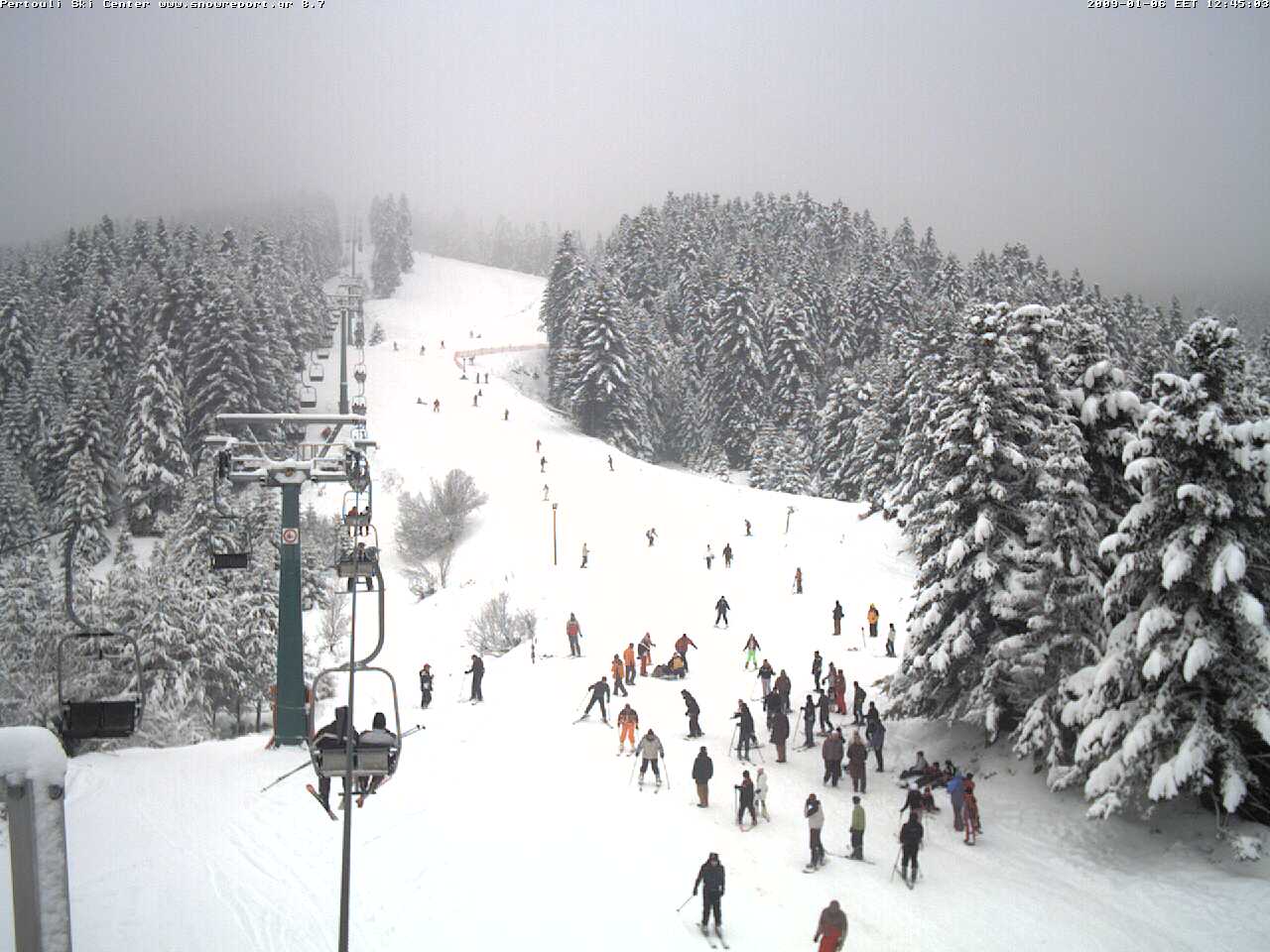
Είναι ένα από τα πιο εύκολα προσβάσιμα χιονοδρομικά της χώρας, ανάμεσα στην Ελάτη και το Περτούλι, στη Θεσσαλία. Απέχει περίπου 40 χλμ. ή 45 λεπτά από τα Τρίκαλα.
Δείτε τις τρέχουσες χιονοδρομικές συνθήκες στο Snow Report Pertouli
Διαμονή — Περτούλι
Σύρετε για να δείτε και τα 5 καταλύματα →
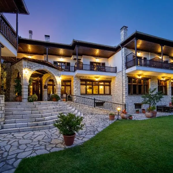 Hotel Giamandes
Ελάτη Τρικάλων
Προς το χιονοδρομικό: ≈ 8,6 km · 10 λεπτά
Δείτε στο Booking.com ↗
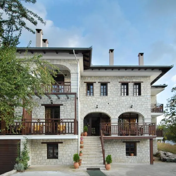 Mikri Arktos
Ελάτη Τρικάλων
Προς το χιονοδρομικό: ≈ 8,6 km · 10 λεπτά
Δείτε στο Booking.com ↗
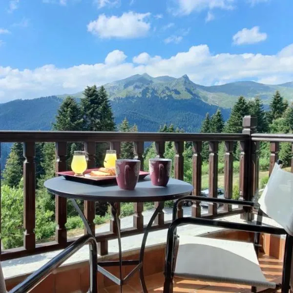 Ξενοδοχείο ΜΑΓΚΙΩΣΗ
Νεραϊδοχώρι
Προς το χιονοδρομικό: ≈ 8,6 km · 10 λεπτά
Δείτε στο Booking.com ↗
 Hotel Kroupi
Ελάτη Τρικάλων
Προς το χιονοδρομικό: ≈ 8,6 km · 10 λεπτά
Δείτε στο Booking.com ↗
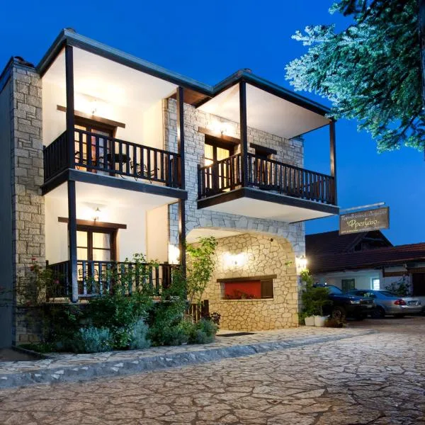 Fretzato
Ελάτη Τρικάλων
Προς το χιονοδρομικό: ≈ 8,2 km · 10 λεπτά
Δείτε στο Booking.com ↗
Προετοιμασία γραφημάτων…
Οι ώρες και οι τιμές αντιστοιχούν στην αναλυτική πρόγνωση. Πατήστε μια τιμή για λεπτομέρειες και μετακινήστε οριζόντια τα γραφήματα για επόμενες ημέρες. Ο υετός είναι το συνολικό ισοδύναμο νερού ανά διάστημα, μαζί με το χιόνι. Η χιονόπτωση αφορά νέο χιόνι ανά διάστημα, όχι το ύψος του χιονιού στο έδαφος.
Σύγκριση GFS και ECMWF. Κάθε μοντέλο διατηρεί τις δικές του ώρες και διάρκεια πρόγνωσης. Ο υετός και το νέο χιόνι αφορούν τα διαστήματα κάθε μοντέλου, τα οποία μπορεί να διαφέρουν.
Τιμές πρόγνωσης και σημειώσεις μοντέλων
Περτούλι - Κορυφή 1330
ECMWF · Εκτέλεση μοντέλου: Αναμενόμενη επόμενη ενημέρωση:
Ημέρα Ώρα (UTC) Θερμ. (°C) Υγρασία (%) Άνεμος (km/h) Άνεμος (κόμβοι) Άνεμος (Bft) Διεύθυνση Υετός (mm) Νέο χιόνι (cm) Πίεση (hPa) Σημείο παγοποίησης (m) Συνθήκες | Κυριακή, 22/11 06:00 4.3 73 14 8 3B W — — 1021 2815 Overcast 95% cloud 09:00 7.8 69 13 7 3B SW 0 0 1021 3067 Cloudy 60% cloud 12:00 9.1 63 19 10 3B SW 0 0 1017 3083 Cloudy 79% cloud 15:00 7.7 80 25 14 4B SW 0.00 0 1017 3076 Cloudy 73% cloud 18:00 7.2 92 28 15 4B SW 0.30 0 1016 3073 Overcast 94% cloud 21:00 7.7 88 38 21 5B SW 0.20 0 1014 3063 Overcast 97% cloud Δευτέρα, 23/11 00:00 9.6 87 50 27 7B SW 2.4 0 1010 3045 Overcast 98% cloud 03:00 9.7 85 50 27 7B SW 2.8 0 1008 3024 Overcast 96% cloud 06:00 9.1 77 45 24 6B W 1.9 0 1009 2922 Overcast 87% cloud 09:00 8.7 68 43 23 6B W 0.22 0 1010 2682 Cloudy 61% cloud 12:00 6.5 82 35 19 5B W 2.5 0 1010 2472 Overcast 86% cloud 15:00 6.3 73 45 24 6B W 1.5 0 1011 2444 Cloudy 66% cloud 18:00 5.3 80 28 15 4B W 0.00 0 1014 2460 Cloudy 73% cloud 21:00 5 79 27 14 4B W 0.00 0 1015 2280 Cloudy 68% cloud Τρίτη, 24/11 00:00 4.5 79 21 11 4B W 0.00 0 1017 2219 Cloudy 75% cloud 03:00 3 86 10 6 2B W 0.10 0 1019 2038 Cloudy 78% cloud 06:00 2.3 94 3 2 1B SW 0 0 1022 1872 Overcast 90% cloud 09:00 3.6 88 2 1 1B SW 0.40 0 1023 1921 Cloudy 69% cloud 12:00 5.1 80 3 1 1B SW 0.10 0 1022 2139 Cloudy 58% cloud 15:00 3.9 86 6 3 2B SW 0 0 1024 2144 Clear 19% cloud 18:00 2.5 82 7 4 2B W 0 0 1025 2099 Partly cloudy 38% cloud 21:00 2 72 6 3 1B W 0 0 1027 2101 Partly cloudy 29% cloud Τετάρτη, 25/11 00:00 2 66 5 3 1B SW 0 0 1027 2161 Partly cloudy 20% cloud 03:00 1.9 66 5 2 1B SW 0 0 1027 2210 Clear 4% cloud 06:00 2.1 60 6 3 1B SW 0 0 1027 2359 Clear 14% cloud 09:00 4.7 54 8 4 2B SW 0 0 1027 2663 Partly cloudy 35% cloud 12:00 6.2 50 13 7 3B SW 0 0 1023 3036 Cloudy 72% cloud 15:00 4.3 61 15 8 3B SW 0 0 1023 3094 Overcast 81% cloud 18:00 3.4 68 20 11 4B SW 0 0 1023 3093 Overcast 82% cloud 21:00 4.3 86 23 13 4B SW 0.10 0 1021 3089 Overcast 100% cloud Πέμπτη, 26/11 00:00 5.1 89 26 14 4B SW 0.10 0 1020 3081 Overcast 100% cloud 03:00 5.4 92 24 13 4B SW 0.30 0 1018 3067 Overcast 99% cloud 06:00 5.7 98 23 12 4B SW 0.70 0 1017 3059 Overcast 100% cloud 09:00 6.4 99 23 12 4B SW 1.5 0 1017 2942 Overcast 99% cloud 12:00 7.5 96 32 17 5B SW 1.3 0 1014 2932 Overcast 99% cloud 15:00 7.7 98 29 16 5B SW 3.5 0 1013 2936 Overcast 99% cloud 18:00 7.8 96 25 14 4B SW 4.2 0 1012 2937 Overcast 99% cloud 21:00 8.6 96 33 18 5B SW 5.1 0 1012 2909 Overcast 100% cloud Παρασκευή, 27/11 00:00 8.3 96 27 15 4B SW 5.8 0 1012 2938 Overcast 99% cloud 03:00 7.9 98 18 10 3B SW 3.6 0 1011 2805 Overcast 98% cloud 06:00 7.6 98 14 8 3B SW 0.72 0 1012 2734 Overcast 97% cloud 09:00 8.3 95 16 9 3B SW 0.25 0 1013 2731 Overcast 100% cloud 12:00 8.4 91 20 11 4B SW 1.8 0 1011 2732 Overcast 100% cloud 15:00 7.9 91 26 14 4B SW 6.6 0 1010 2674 Overcast 100% cloud 18:00 7.4 89 22 12 4B SW 6.0 0 1010 2642 Overcast 99% cloud 21:00 6.8 94 16 9 3B SW 7.8 0 1009 2605 Overcast 100% cloud Σάββατο, 28/11 00:00 6.7 92 14 8 3B S 3.1 0 1009 2599 Overcast 100% cloud 03:00 6.5 95 17 9 3B S 3.6 0 1008 2514 Overcast 100% cloud 06:00 5.9 97 12 6 2B S 2.3 0 1008 2453 Overcast 100% cloud |
|---|
Forecast notes
Forecast table times: UTC.
Coordinates: 39.54598°N, 21.49869°E · Requested elevation: 1330 m. Model terrain: 992 m. Terrain and 1000/925/850/700 hPa profiles are used for height estimates.
These are altitude estimates, not a simulation of local mountain terrain. Precipitation, cloud and sea-level pressure use horizontal interpolation only.
Precipitation includes rain and snow water equivalent: preceding 3 hours through day 6, then 6 hours (see cell tooltip). Snow (cm) estimates fresh snowfall from precipitation and temperature using the GFS conversion; it is not snow depth on the ground. Freezing (m) uses additional 600/500 hPa temperatures when available and estimates the lowest resolved 0°C crossing above sea level. When all sampled levels are warm, the upper profile limit is shown (see tooltip). < marks an entirely cold sampled profile and its lower height limit. No extrapolation is used.