Fterolaka · 1,850 m
Press play to connect.
Open camera page ↗
Each colour starts at the value shown. Wind colours match across all three units. Dry cells stay neutral. Colours describe the displayed values, not official weather warnings.
Preparing forecast graphs…
Times and values match the detailed forecast. Tap or point at a value for details. Scroll each chart sideways for later days. Rain / precipitation is the total water equivalent per forecast interval, including snow; snowfall is fresh snow per interval, not snow depth.
GFS and ECMWF model comparison. Each model retains its own forecast times and horizon. Precipitation and snowfall amounts cover their own forecast intervals; these can differ between models.
ECMWF · Model run: Next update expected:
Day Time (UTC) Temp. (°C) Humidity (%) Wind (km/h) Wind (knots) Wind (Bft) Direction Precip. (mm) Snow (cm) Pressure (hPa) Freezing (m) Conditions | Thursday, 05/11 06:00 4.5 94 15 8 3B NE — — 1024 2411 Overcast 83% cloud  09:00 3.6 95 18 10 3B NE 1.8 0 1026 2318 Overcast 92% cloud 12:00 3.3 93 13 7 3B NE 0.68 0 1026 2263 Overcast 100% cloud 15:00 3.2 86 12 6 2B NE 0.23 0 1026 2268 Overcast 87% cloud 18:00 2.9 85 13 7 3B NE 0.03 0 1026 2203 Cloudy 62% cloud  21:00 2.4 86 14 7 3B NE 0.01 0 1026 2141 Cloudy 76% cloud Friday, 06/11 00:00 2.2 91 16 9 3B NE 0.02 0 1025 2129 Cloudy 67% cloud 03:00 1.9 92 16 8 3B N 0.16 0 1024 2166 Cloudy 78% cloud 06:00 1.7 90 15 8 3B N 0.21 0 1024 2255 Overcast 84% cloud 09:00 1.8 91 13 7 3B N 0.14 0 1023 2408 Cloudy 54% cloud 12:00 2.9 81 15 8 3B N 0.03 0 1021 2548 Partly cloudy 38% cloud  15:00 3.5 77 17 9 3B NW 0 0 1021 2601 Clear 13% cloud  18:00 4.5 60 19 10 3B NW 0 0 1021 2794 Clear 5% cloud 21:00 4.6 56 18 9 3B N 0 0 1021 2855 Partly cloudy 32% cloud Saturday, 07/11 00:00 4.1 62 14 8 3B N 0 0 1022 2729 Partly cloudy 29% cloud 03:00 3.4 68 13 7 3B N 0 0 1022 2576 Clear 6% cloud 06:00 2.7 69 14 8 3B NE 0 0 1023 2519 Clear 7% cloud 09:00 2.3 84 13 7 3B NE 0.04 0 1024 2540 Overcast 90% cloud 12:00 2.8 84 11 6 2B N 0.17 0 1023 2575 Overcast 98% cloud 15:00 2.6 89 8 5 2B N 0.14 0 1024 2463 Cloudy 60% cloud 18:00 2.3 84 8 5 2B N 0.05 0 1025 2309 Cloudy 79% cloud 21:00 1.7 90 8 5 2B NE 0.05 0 1027 2150 Overcast 84% cloud Sunday, 08/11 00:00 1.1 94 11 6 2B NE 0.10 0 1028 2005 Cloudy 78% cloud 03:00 0.7 93 16 8 3B NE 0.07 0 1028 1850 Cloudy 80% cloud 06:00 0.3 95 15 8 3B NE 0.14 0 1030 1699 Overcast 92% cloud 09:00 0.5 89 12 6 2B NE 0 0 1031 1778 Overcast 93% cloud 12:00 0.9 90 9 5 2B NE 0 0 1029 1881 Cloudy 62% cloud 15:00 1.7 81 5 3 1B N 0 0 1029 2084 Partly cloudy 29% cloud 18:00 3.1 64 8 4 2B NE 0 0 1031 2348 Clear 17% cloud 21:00 3.3 60 7 4 2B NE 0 0 1031 2442 Cloudy 62% cloud Monday, 09/11 00:00 3.9 54 6 4 2B N 0 0 1030 2503 Overcast 90% cloud 03:00 4.4 52 4 2 1B N 0 0 1029 2498 Overcast 99% cloud 06:00 4.7 52 2 1 1B N 0 0 1030 2565 Overcast 99% cloud 09:00 5.3 50 4 2 1B SW 0 0 1030 2611 Cloudy 68% cloud 12:00 5.5 59 9 5 2B W 0.02 0 1028 2616 Overcast 91% cloud 15:00 5.3 79 13 7 3B W 0.08 0 1028 2593 Overcast 97% cloud 18:00 5.8 88 14 8 3B W 0.06 0 1028 2686 Overcast 80% cloud 21:00 6.1 89 16 9 3B W 0 0 1027 2743 Cloudy 74% cloud Tuesday, 10/11 00:00 6.6 86 19 10 3B W 0.06 0 1026 2719 Cloudy 71% cloud 03:00 6.2 91 19 10 3B W 0 0 1025 2761 Overcast 88% cloud 06:00 6 94 15 8 3B W 0 0 1025 2790 Cloudy 65% cloud 09:00 6.2 88 17 9 3B W 0.05 0 1025 2945 Cloudy 57% cloud 12:00 6.9 84 19 10 3B W 0 0 1022 3120 Cloudy 56% cloud 15:00 7.4 81 18 10 3B W 0 0 1022 3117 Cloudy 66% cloud 18:00 7.7 75 19 10 3B W 0 0 1022 3119 Overcast 91% cloud 21:00 8.1 81 19 10 3B W 0 0 1021 3112 Overcast 97% cloud Wednesday, 11/11 00:00 8 85 20 11 3B W 0.12 0 1020 3105 Overcast 96% cloud 03:00 8 86 19 10 3B W 0 0 1019 3092 Overcast 96% cloud 06:00 8.5 78 19 10 3B W 0 0 1019 2980 Overcast 93% cloud |
|---|
Forecast table times: UTC.
Coordinates: 38.572176°N, 22.577827°E · Requested elevation: 1590 m. Model terrain: 633 m. Terrain and 1000/925/850/700 hPa profiles are used for height estimates.
These are altitude estimates, not a simulation of local mountain terrain. Precipitation, cloud and sea-level pressure use horizontal interpolation only.
Precipitation includes rain and snow water equivalent: preceding 3 hours through day 6, then 6 hours (see cell tooltip). Snow (cm) estimates fresh snowfall from precipitation and temperature using the GFS conversion; it is not snow depth on the ground. Freezing (m) uses additional 600/500 hPa temperatures when available and estimates the lowest resolved 0°C crossing above sea level. When all sampled levels are warm, the upper profile limit is shown (see tooltip). < marks an entirely cold sampled profile and its lower height limit. No extrapolation is used.
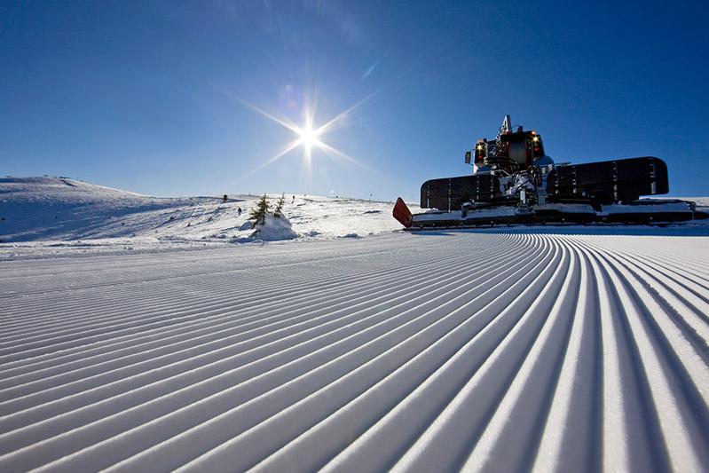
Parnassos has two main ski sectors, Kelaria and Fterolaka. This page separates their forecast points so you can compare the parking areas, chalets and upper lifts rather than treating the whole mountain as one location.
The six forecast elevations are Fterolaka Parking (1,590 m), Kelaria Parking (1,780 m), Fterolaka Chalet (1,785 m), Kelaria Chalet (1,950 m), Dias Top (2,165 m) and Iraklis Top (2,240 m). Start with the point nearest your planned activity. Around freezing, compare precipitation timing and temperature at the parking area with the upper mountain; forecast snow higher up does not mean snow at your arrival point.
Open a date in the compact forecast for the detailed time intervals. Compare models at the same elevation and valid time, and check the wind and gusts as well as snowfall. Use the dated SnowReport bulletin and webcams for operating information and visible conditions. Forecast snowfall is new snow expected during an interval, not measured piste depth, and it does not confirm that a lift or access road is open.
Forecast points and guidance reviewed 4 November 2026. Current bulletin and webcams: SnowReport.gr.
Swipe to see all 5 places to stay →
 Santa Marina Arachova Resort & Spa
Arachova
Drive to ski centre: ≈ 21.5 km · 33 min
View on Booking.com ↗
 Boutique Hotel Parnassia
Arachova
Drive to ski centre: ≈ 22.3 km · 35 min
View on Booking.com ↗
 Ellinon Thea Arachova
Arachova
Drive to ski centre: ≈ 22.3 km · 34 min
View on Booking.com ↗
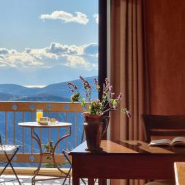 Likoria Hotel
Arachova
Drive to ski centre: ≈ 22.5 km · 34 min
View on Booking.com ↗
 Boutique Hotel Skamnos
Parnassos mountain
Drive to ski centre: ≈ 9.8 km · 16 min
View on Booking.com ↗
Press play to connect.
Open camera page ↗Press play to connect.
Open camera page ↗Press play to connect.
Open camera page ↗Preparing forecast graphs…
Times and values match the detailed forecast. Tap or point at a value for details. Scroll each chart sideways for later days. Rain / precipitation is the total water equivalent per forecast interval, including snow; snowfall is fresh snow per interval, not snow depth.
GFS and ECMWF model comparison. Each model retains its own forecast times and horizon. Precipitation and snowfall amounts cover their own forecast intervals; these can differ between models.
ECMWF · Model run: Next update expected:
Day Time (UTC) Temp. (°C) Humidity (%) Wind (km/h) Wind (knots) Wind (Bft) Direction Precip. (mm) Snow (cm) Pressure (hPa) Freezing (m) Conditions | Thursday, 05/11 06:00 3.5 92 14 8 3B NE — — 1024 2420 Overcast 81% cloud 09:00 2.7 93 16 9 3B NE 1.6 0 1026 2331 Overcast 92% cloud 12:00 2.4 91 12 6 2B NE 0.57 0 1026 2273 Overcast 100% cloud 15:00 2.4 84 11 6 2B N 0.21 0 1025 2278 Overcast 88% cloud 18:00 2.1 83 13 7 3B N 0.03 0 1026 2216 Cloudy 62% cloud 21:00 1.7 84 14 8 3B N 0.02 0 1026 2151 Cloudy 76% cloud Friday, 06/11 00:00 1.5 88 17 9 3B N 0.02 0 1025 2137 Cloudy 65% cloud 03:00 1.3 86 17 9 3B N 0.16 0 1024 2172 Cloudy 78% cloud 06:00 1.2 81 17 9 3B N 0.22 0 1024 2262 Overcast 84% cloud 09:00 1.4 82 15 8 3B N 0.15 0 1023 2414 Cloudy 54% cloud 12:00 2.4 75 17 9 3B N 0.03 0 1021 2554 Partly cloudy 37% cloud 15:00 2.8 72 18 10 3B NW 0 0 1021 2608 Clear 14% cloud 18:00 3.8 56 20 11 4B NW 0 0 1021 2800 Clear 5% cloud 21:00 3.9 52 18 10 3B N 0 0 1021 2859 Partly cloudy 36% cloud Saturday, 07/11 00:00 3.4 58 15 8 3B N 0 0 1022 2729 Partly cloudy 33% cloud 03:00 2.8 63 14 7 3B N 0 0 1022 2579 Clear 7% cloud 06:00 2.2 63 14 8 3B N 0 0 1023 2524 Clear 8% cloud 09:00 1.9 77 13 7 3B NE 0.04 0 1024 2550 Overcast 90% cloud 12:00 2.3 76 12 6 2B N 0.18 0 1023 2583 Overcast 98% cloud 15:00 2.1 81 10 6 2B N 0.14 0 1024 2469 Cloudy 58% cloud 18:00 1.7 78 10 5 2B N 0.05 0 1025 2316 Overcast 80% cloud 21:00 1.1 83 9 5 2B NE 0.06 0 1027 2158 Overcast 82% cloud Sunday, 08/11 00:00 0.6 86 10 6 2B NE 0.09 0 1028 2020 Cloudy 76% cloud 03:00 0.2 86 14 8 3B NE 0.07 0 1028 1867 Cloudy 78% cloud 06:00 -0.2 89 13 7 3B NE 0.13 0 1030 1717 Overcast 92% cloud 09:00 0 85 10 6 2B NE 0 0 1030 1792 Overcast 92% cloud 12:00 0.3 86 10 5 2B N 0 0 1029 1892 Cloudy 61% cloud 15:00 1 78 7 4 2B N 0 0 1029 2091 Partly cloudy 27% cloud 18:00 2.3 62 9 5 2B N 0 0 1031 2357 Clear 15% cloud 21:00 2.6 59 9 5 2B N 0 0 1031 2446 Cloudy 64% cloud Monday, 09/11 00:00 3.1 55 9 5 2B N 0 0 1030 2508 Overcast 91% cloud 03:00 3.5 54 6 3 1B N 0 0 1029 2503 Overcast 99% cloud 06:00 3.8 54 3 2 1B NW 0 0 1030 2570 Overcast 99% cloud 09:00 4.3 53 5 3 1B W 0 0 1030 2613 Cloudy 69% cloud 12:00 4.5 62 12 6 2B W 0.02 0 1028 2619 Overcast 90% cloud 15:00 4.3 81 16 9 3B W 0.08 0 1028 2595 Overcast 97% cloud 18:00 4.8 88 17 9 3B W 0.07 0 1028 2685 Overcast 81% cloud 21:00 5.1 89 19 10 3B W 0 0 1027 2747 Cloudy 77% cloud Tuesday, 10/11 00:00 5.5 88 22 12 4B W 0.07 0 1026 2719 Cloudy 71% cloud 03:00 5.2 91 22 12 4B W 0 0 1025 2761 Overcast 89% cloud 06:00 5 92 18 10 3B W 0 0 1025 2794 Cloudy 69% cloud 09:00 5.3 85 18 10 3B W 0.06 0 1025 2944 Cloudy 61% cloud 12:00 6.1 80 20 11 3B W 0 0 1022 3121 Cloudy 56% cloud 15:00 6.6 77 20 11 3B W 0 0 1022 3117 Cloudy 64% cloud 18:00 6.7 72 21 11 4B W 0 0 1022 3119 Overcast 92% cloud 21:00 7 80 21 11 4B W 0 0 1021 3117 Overcast 97% cloud Wednesday, 11/11 00:00 7 85 22 12 4B W 0.13 0 1021 3114 Overcast 97% cloud 03:00 7 84 21 11 4B W 0 0 1019 3099 Overcast 96% cloud 06:00 7.3 79 20 11 4B W 0 0 1019 2983 Overcast 94% cloud |
|---|
Forecast table times: UTC.
Coordinates: 38.551765°N, 22.579543°E · Requested elevation: 1780 m. Model terrain: 664 m. Terrain and 1000/925/850/700 hPa profiles are used for height estimates.
These are altitude estimates, not a simulation of local mountain terrain. Precipitation, cloud and sea-level pressure use horizontal interpolation only.
Precipitation includes rain and snow water equivalent: preceding 3 hours through day 6, then 6 hours (see cell tooltip). Snow (cm) estimates fresh snowfall from precipitation and temperature using the GFS conversion; it is not snow depth on the ground. Freezing (m) uses additional 600/500 hPa temperatures when available and estimates the lowest resolved 0°C crossing above sea level. When all sampled levels are warm, the upper profile limit is shown (see tooltip). < marks an entirely cold sampled profile and its lower height limit. No extrapolation is used.
Preparing forecast graphs…
Times and values match the detailed forecast. Tap or point at a value for details. Scroll each chart sideways for later days. Rain / precipitation is the total water equivalent per forecast interval, including snow; snowfall is fresh snow per interval, not snow depth.
GFS and ECMWF model comparison. Each model retains its own forecast times and horizon. Precipitation and snowfall amounts cover their own forecast intervals; these can differ between models.
ECMWF · Model run: Next update expected:
Day Time (UTC) Temp. (°C) Humidity (%) Wind (km/h) Wind (knots) Wind (Bft) Direction Precip. (mm) Snow (cm) Pressure (hPa) Freezing (m) Conditions | Thursday, 05/11 06:00 3.5 92 14 8 3B NE — — 1024 2411 Overcast 84% cloud 09:00 2.6 93 16 9 3B NE 1.8 0 1026 2319 Overcast 93% cloud 12:00 2.3 92 12 6 2B NE 0.65 0 1026 2263 Overcast 100% cloud 15:00 2.3 85 11 6 2B N 0.23 0 1025 2267 Overcast 87% cloud 18:00 2 83 13 7 3B N 0.03 0 1026 2203 Cloudy 61% cloud 21:00 1.6 84 14 8 3B N 0.02 0 1026 2141 Cloudy 76% cloud Friday, 06/11 00:00 1.4 88 17 9 3B N 0.02 0 1025 2130 Cloudy 68% cloud 03:00 1.2 86 17 9 3B N 0.18 0 1024 2166 Cloudy 79% cloud 06:00 1.2 81 17 9 3B N 0.23 0 1024 2256 Overcast 85% cloud 09:00 1.4 81 15 8 3B N 0.16 0 1023 2409 Cloudy 55% cloud 12:00 2.3 75 17 9 3B N 0.03 0 1021 2546 Partly cloudy 38% cloud 15:00 2.8 71 18 10 3B NW 0 0 1021 2599 Clear 14% cloud 18:00 3.8 56 20 11 4B NW 0 0 1021 2792 Clear 5% cloud 21:00 3.8 52 18 10 3B N 0 0 1021 2854 Partly cloudy 34% cloud Saturday, 07/11 00:00 3.4 58 15 8 3B N 0 0 1022 2729 Partly cloudy 32% cloud 03:00 2.7 63 14 7 3B N 0 0 1022 2574 Clear 7% cloud 06:00 2.1 63 14 8 3B N 0 0 1023 2519 Clear 8% cloud 09:00 1.8 76 13 7 3B NE 0.04 0 1024 2542 Overcast 90% cloud 12:00 2.2 76 12 6 2B N 0.19 0 1023 2573 Overcast 98% cloud 15:00 2 81 10 6 2B N 0.14 0 1024 2460 Cloudy 60% cloud 18:00 1.7 78 10 5 2B N 0.05 0 1025 2306 Overcast 81% cloud 21:00 1.1 83 9 5 2B NE 0.06 0 1027 2149 Overcast 84% cloud Sunday, 08/11 00:00 0.6 86 11 6 2B NE 0.09 0 1028 2004 Cloudy 78% cloud 03:00 0.2 86 14 8 3B NE 0.07 0 1028 1849 Cloudy 80% cloud 06:00 -0.2 89 13 7 3B NE 0.13 0 1030 1697 Overcast 92% cloud 09:00 -0 84 10 6 2B NE 0 0 1031 1776 Overcast 92% cloud 12:00 0.3 86 9 5 2B N 0 0 1029 1877 Cloudy 63% cloud 15:00 1 78 7 4 2B N 0 0 1029 2084 Partly cloudy 29% cloud 18:00 2.3 62 9 5 2B N 0 0 1031 2350 Clear 17% cloud 21:00 2.6 59 9 5 2B N 0 0 1031 2442 Cloudy 61% cloud Monday, 09/11 00:00 3.1 54 9 5 2B N 0 0 1030 2504 Overcast 89% cloud 03:00 3.5 53 6 3 2B N 0 0 1029 2499 Overcast 99% cloud 06:00 3.8 54 3 2 1B NW 0 0 1030 2567 Overcast 99% cloud 09:00 4.3 54 5 3 1B W 0 0 1030 2612 Cloudy 68% cloud 12:00 4.4 62 12 6 2B W 0.02 0 1028 2618 Overcast 91% cloud 15:00 4.3 81 16 8 3B W 0.08 0 1028 2593 Overcast 97% cloud 18:00 4.8 88 17 9 3B W 0.06 0 1028 2686 Cloudy 80% cloud 21:00 5.1 88 19 10 3B W 0 0 1027 2746 Cloudy 75% cloud Tuesday, 10/11 00:00 5.5 87 22 12 4B W 0.06 0 1026 2720 Cloudy 69% cloud 03:00 5.2 90 22 12 4B W 0 0 1025 2761 Overcast 88% cloud 06:00 5 91 18 9 3B W 0 0 1025 2791 Cloudy 65% cloud 09:00 5.3 84 18 10 3B W 0.06 0 1025 2943 Cloudy 56% cloud 12:00 6.1 80 19 10 3B W 0 0 1022 3120 Cloudy 55% cloud 15:00 6.6 77 19 11 3B W 0 0 1022 3117 Cloudy 65% cloud 18:00 6.7 72 21 11 4B W 0 0 1022 3119 Overcast 91% cloud 21:00 7 79 21 11 4B W 0 0 1021 3111 Overcast 97% cloud Wednesday, 11/11 00:00 7 85 22 12 4B W 0.12 0 1020 3105 Overcast 96% cloud 03:00 7 84 21 11 4B W 0 0 1019 3092 Overcast 96% cloud 06:00 7.3 78 20 11 4B W 0 0 1019 2980 Overcast 93% cloud |
|---|
Forecast table times: UTC.
Coordinates: 38.566421°N, 22.5870055°E · Requested elevation: 1785 m. Model terrain: 633 m. Terrain and 1000/925/850/700 hPa profiles are used for height estimates.
These are altitude estimates, not a simulation of local mountain terrain. Precipitation, cloud and sea-level pressure use horizontal interpolation only.
Precipitation includes rain and snow water equivalent: preceding 3 hours through day 6, then 6 hours (see cell tooltip). Snow (cm) estimates fresh snowfall from precipitation and temperature using the GFS conversion; it is not snow depth on the ground. Freezing (m) uses additional 600/500 hPa temperatures when available and estimates the lowest resolved 0°C crossing above sea level. When all sampled levels are warm, the upper profile limit is shown (see tooltip). < marks an entirely cold sampled profile and its lower height limit. No extrapolation is used.
Preparing forecast graphs…
Times and values match the detailed forecast. Tap or point at a value for details. Scroll each chart sideways for later days. Rain / precipitation is the total water equivalent per forecast interval, including snow; snowfall is fresh snow per interval, not snow depth.
GFS and ECMWF model comparison. Each model retains its own forecast times and horizon. Precipitation and snowfall amounts cover their own forecast intervals; these can differ between models.
ECMWF · Model run: Next update expected:
Day Time (UTC) Temp. (°C) Humidity (%) Wind (km/h) Wind (knots) Wind (Bft) Direction Precip. (mm) Snow (cm) Pressure (hPa) Freezing (m) Conditions | Thursday, 05/11 06:00 2.6 90 14 7 3B NE — — 1024 2418 Overcast 82% cloud 09:00 1.9 91 15 8 3B NE 1.6 0 1026 2331 Overcast 92% cloud 12:00 1.6 90 11 6 2B N 0.56 0 1026 2272 Overcast 100% cloud 15:00 1.6 83 12 6 2B N 0.22 0 1025 2277 Overcast 88% cloud 18:00 1.2 81 14 7 3B N 0.04 0 1026 2214 Cloudy 61% cloud 21:00 0.9 82 15 8 3B N 0.02 0 1026 2150 Cloudy 76% cloud Friday, 06/11 00:00 0.8 85 18 10 3B N 0.02 0 1025 2137 Cloudy 66% cloud 03:00 0.7 80 19 10 3B N 0.18 0 1024 2171 Cloudy 79% cloud 06:00 0.8 73 19 10 3B N 0.24 0 1024 2262 Overcast 85% cloud 09:00 1 74 17 9 3B N 0.17 0 1023 2415 Cloudy 56% cloud 12:00 1.8 69 19 10 3B N 0.04 0 1021 2550 Partly cloudy 37% cloud 15:00 2.2 66 20 11 4B N 0 0 1021 2605 Clear 14% cloud 18:00 3.1 52 21 11 4B N 0 0 1021 2797 Clear 6% cloud 21:00 3.3 48 19 10 3B N 0 0 1021 2858 Partly cloudy 38% cloud Saturday, 07/11 00:00 2.8 54 16 8 3B N 0 0 1022 2729 Partly cloudy 35% cloud 03:00 2.2 58 14 8 3B N 0 0 1022 2577 Clear 7% cloud 06:00 1.7 58 14 8 3B N 0 0 1023 2523 Clear 8% cloud 09:00 1.5 70 14 7 3B N 0.04 0 1024 2551 Overcast 91% cloud 12:00 1.8 70 13 7 3B N 0.19 0 1023 2580 Overcast 99% cloud 15:00 1.6 74 12 7 2B N 0.15 0 1024 2465 Cloudy 60% cloud 18:00 1.2 72 11 6 2B N 0.05 0 1025 2312 Overcast 81% cloud 21:00 0.6 76 9 5 2B N 0.07 0 1027 2155 Overcast 82% cloud Sunday, 08/11 00:00 0.2 78 11 6 2B N 0.09 0 1028 2017 Cloudy 77% cloud 03:00 -0.2 80 14 8 3B N 0.08 0 1028 1864 Cloudy 79% cloud 06:00 -0.6 84 13 7 3B NE 0.13 0 1030 1713 Overcast 91% cloud 09:00 -0.5 80 10 5 2B N 0 0 1030 1788 Overcast 91% cloud 12:00 -0.2 82 11 6 2B N 0 0 1029 1886 Cloudy 62% cloud 15:00 0.5 75 9 5 2B N 0 0 1029 2090 Partly cloudy 28% cloud 18:00 1.7 61 11 6 2B N 0 0 1031 2358 Clear 16% cloud 21:00 1.9 57 12 6 2B N 0 0 1031 2445 Cloudy 63% cloud Monday, 09/11 00:00 2.4 55 11 6 2B N 0 0 1030 2508 Overcast 90% cloud 03:00 2.7 55 7 4 2B N 0 0 1029 2504 Overcast 99% cloud 06:00 3 56 5 2 1B NW 0 0 1030 2571 Overcast 99% cloud 09:00 3.5 57 7 4 2B W 0 0 1030 2614 Cloudy 69% cloud 12:00 3.6 65 14 8 3B W 0.02 0 1028 2620 Overcast 91% cloud 15:00 3.4 82 18 10 3B W 0.08 0 1028 2595 Overcast 97% cloud 18:00 3.9 88 20 11 4B W 0.06 0 1028 2686 Overcast 81% cloud 21:00 4.2 88 21 12 4B W 0 0 1027 2749 Cloudy 77% cloud Tuesday, 10/11 00:00 4.5 88 25 13 4B W 0.06 0 1026 2721 Cloudy 70% cloud 03:00 4.3 90 25 14 4B W 0 0 1025 2761 Overcast 88% cloud 06:00 4.2 89 20 11 4B W 0 0 1025 2794 Cloudy 68% cloud 09:00 4.6 81 19 10 3B W 0.07 0 1025 2942 Cloudy 60% cloud 12:00 5.3 76 20 11 4B W 0 0 1022 3121 Cloudy 55% cloud 15:00 5.8 72 21 11 4B W 0 0 1022 3117 Cloudy 63% cloud 18:00 5.9 69 23 12 4B W 0 0 1022 3119 Overcast 92% cloud 21:00 6.2 78 23 12 4B W 0 0 1021 3115 Overcast 97% cloud Wednesday, 11/11 00:00 6.1 84 23 13 4B W 0.13 0 1020 3112 Overcast 96% cloud 03:00 6.1 82 22 12 4B W 0 0 1019 3099 Overcast 96% cloud 06:00 6.3 78 21 12 4B W 0 0 1019 2982 Overcast 94% cloud |
|---|
Forecast table times: UTC.
Coordinates: 38.548043°N, 22.589328°E · Requested elevation: 1950 m. Model terrain: 660 m. Terrain and 1000/925/850/700 hPa profiles are used for height estimates.
These are altitude estimates, not a simulation of local mountain terrain. Precipitation, cloud and sea-level pressure use horizontal interpolation only.
Precipitation includes rain and snow water equivalent: preceding 3 hours through day 6, then 6 hours (see cell tooltip). Snow (cm) estimates fresh snowfall from precipitation and temperature using the GFS conversion; it is not snow depth on the ground. Freezing (m) uses additional 600/500 hPa temperatures when available and estimates the lowest resolved 0°C crossing above sea level. When all sampled levels are warm, the upper profile limit is shown (see tooltip). < marks an entirely cold sampled profile and its lower height limit. No extrapolation is used.
Preparing forecast graphs…
Times and values match the detailed forecast. Tap or point at a value for details. Scroll each chart sideways for later days. Rain / precipitation is the total water equivalent per forecast interval, including snow; snowfall is fresh snow per interval, not snow depth.
GFS and ECMWF model comparison. Each model retains its own forecast times and horizon. Precipitation and snowfall amounts cover their own forecast intervals; these can differ between models.
ECMWF · Model run: Next update expected:
Day Time (UTC) Temp. (°C) Humidity (%) Wind (km/h) Wind (knots) Wind (Bft) Direction Precip. (mm) Snow (cm) Pressure (hPa) Freezing (m) Conditions | Thursday, 05/11 06:00 1.4 88 13 7 3B NE — — 1024 2413 Overcast 83% cloud 09:00 0.8 88 14 7 3B NE 1.7 0.5 1026 2324 Overcast 92% cloud 12:00 0.5 88 11 6 2B N 0.61 0.2 1026 2266 Overcast 100% cloud 15:00 0.5 81 12 7 3B N 0.23 0 1025 2270 Overcast 88% cloud 18:00 0.2 80 15 8 3B N 0.04 0 1026 2207 Cloudy 61% cloud 21:00 -0.1 80 17 9 3B N 0.02 0 1026 2144 Cloudy 76% cloud Friday, 06/11 00:00 -0.1 81 19 10 3B N 0.02 0 1025 2132 Cloudy 68% cloud 03:00 0 72 21 11 4B N 0.19 0 1024 2168 Cloudy 80% cloud 06:00 0.2 64 21 11 4B N 0.25 0.1 1024 2258 Overcast 86% cloud 09:00 0.5 63 20 11 3B N 0.17 0 1023 2412 Cloudy 57% cloud 12:00 1.2 60 21 11 4B N 0.04 0 1021 2546 Partly cloudy 38% cloud 15:00 1.5 59 22 12 4B N 0 0 1021 2599 Clear 14% cloud 18:00 2.3 46 22 12 4B N 0 0 1021 2793 Clear 6% cloud 21:00 2.5 43 19 10 3B N 0 0 1021 2854 Partly cloudy 36% cloud Saturday, 07/11 00:00 2 48 17 9 3B N 0 0 1022 2728 Partly cloudy 34% cloud 03:00 1.4 52 15 8 3B N 0 0 1022 2574 Clear 7% cloud 06:00 1 52 15 8 3B N 0 0 1023 2520 Clear 8% cloud 09:00 0.9 60 15 8 3B N 0.05 0 1024 2546 Overcast 90% cloud 12:00 1.1 61 14 8 3B N 0.20 0 1023 2575 Overcast 98% cloud 15:00 0.9 65 14 8 3B N 0.15 0 1024 2460 Cloudy 61% cloud 18:00 0.5 63 13 7 3B N 0.06 0 1025 2307 Overcast 82% cloud 21:00 -0.1 67 10 6 2B N 0.07 0 1027 2150 Overcast 83% cloud Sunday, 08/11 00:00 -0.4 69 11 6 2B N 0.09 0 1028 2008 Cloudy 78% cloud 03:00 -0.8 72 14 8 3B N 0.08 0 1028 1854 Cloudy 79% cloud 06:00 -1.2 77 13 7 3B N 0.13 0 1030 1702 Overcast 91% cloud 09:00 -1.1 74 10 6 2B N 0 0 1031 1779 Overcast 91% cloud 12:00 -0.9 76 13 7 3B N 0 0 1029 1878 Cloudy 63% cloud 15:00 -0.3 70 13 7 3B NW 0 0 1029 2087 Partly cloudy 29% cloud 18:00 0.8 59 15 8 3B NW 0 0 1031 2354 Clear 17% cloud 21:00 1.1 56 15 8 3B N 0 0 1031 2443 Cloudy 61% cloud Monday, 09/11 00:00 1.4 55 14 8 3B N 0 0 1030 2506 Overcast 90% cloud 03:00 1.6 58 10 5 2B N 0 0 1029 2501 Overcast 99% cloud 06:00 1.9 60 7 4 2B NW 0 0 1030 2569 Overcast 99% cloud 09:00 2.3 61 9 5 2B W 0 0 1030 2613 Cloudy 68% cloud 12:00 2.4 69 17 9 3B W 0.02 0 1028 2619 Overcast 91% cloud 15:00 2.3 84 22 12 4B W 0.08 0 1028 2594 Overcast 97% cloud 18:00 2.7 88 24 13 4B W 0.06 0 1028 2686 Cloudy 80% cloud 21:00 3.1 87 25 13 4B W 0 0 1027 2748 Cloudy 76% cloud Tuesday, 10/11 00:00 3.3 89 28 15 4B W 0.06 0 1026 2721 Cloudy 69% cloud 03:00 3.2 89 28 15 4B W 0 0 1025 2761 Overcast 88% cloud 06:00 3.1 84 22 12 4B W 0 0 1025 2792 Cloudy 65% cloud 09:00 3.6 76 21 11 4B W 0.07 0 1025 2942 Cloudy 58% cloud 12:00 4.4 70 21 12 4B W 0 0 1022 3120 Cloudy 55% cloud 15:00 4.9 67 21 12 4B W 0 0 1022 3117 Cloudy 64% cloud 18:00 4.9 65 25 14 4B W 0 0 1022 3119 Overcast 91% cloud 21:00 5 74 25 13 4B W 0 0 1021 3112 Overcast 97% cloud Wednesday, 11/11 00:00 5 83 26 14 4B W 0.12 0 1020 3107 Overcast 96% cloud 03:00 4.9 78 24 13 4B W 0 0 1019 3095 Overcast 96% cloud 06:00 5 76 23 12 4B W 0 0 1019 2981 Overcast 94% cloud |
|---|
Forecast table times: UTC.
Coordinates: 38.556266°N, 22.593437°E · Requested elevation: 2165 m. Model terrain: 642 m. Terrain and 1000/925/850/700 hPa profiles are used for height estimates.
These are altitude estimates, not a simulation of local mountain terrain. Precipitation, cloud and sea-level pressure use horizontal interpolation only.
Precipitation includes rain and snow water equivalent: preceding 3 hours through day 6, then 6 hours (see cell tooltip). Snow (cm) estimates fresh snowfall from precipitation and temperature using the GFS conversion; it is not snow depth on the ground. Freezing (m) uses additional 600/500 hPa temperatures when available and estimates the lowest resolved 0°C crossing above sea level. When all sampled levels are warm, the upper profile limit is shown (see tooltip). < marks an entirely cold sampled profile and its lower height limit. No extrapolation is used.
Preparing forecast graphs…
Times and values match the detailed forecast. Tap or point at a value for details. Scroll each chart sideways for later days. Rain / precipitation is the total water equivalent per forecast interval, including snow; snowfall is fresh snow per interval, not snow depth.
GFS and ECMWF model comparison. Each model retains its own forecast times and horizon. Precipitation and snowfall amounts cover their own forecast intervals; these can differ between models.
ECMWF · Model run: Next update expected:
Day Time (UTC) Temp. (°C) Humidity (%) Wind (km/h) Wind (knots) Wind (Bft) Direction Precip. (mm) Snow (cm) Pressure (hPa) Freezing (m) Conditions | Thursday, 05/11 06:00 1 87 13 7 3B N — — 1024 2415 Overcast 83% cloud 09:00 0.4 87 14 7 3B N 1.7 0.5 1026 2329 Overcast 92% cloud 12:00 0.1 87 12 6 2B N 0.57 0.2 1026 2269 Overcast 100% cloud 15:00 0.1 80 13 7 3B N 0.23 0 1025 2273 Overcast 88% cloud 18:00 -0.1 79 16 9 3B N 0.04 0 1026 2210 Cloudy 60% cloud 21:00 -0.4 78 17 9 3B N 0.02 0 1026 2147 Cloudy 76% cloud Friday, 06/11 00:00 -0.4 80 20 11 4B N 0.02 0 1025 2135 Cloudy 68% cloud 03:00 -0.2 69 21 12 4B N 0.21 0 1024 2170 Overcast 81% cloud 06:00 0 60 22 12 4B N 0.28 0.1 1024 2261 Overcast 87% cloud 09:00 0.4 60 21 11 4B N 0.19 0 1023 2415 Cloudy 58% cloud 12:00 0.9 57 22 12 4B N 0.04 0 1021 2545 Partly cloudy 38% cloud 15:00 1.2 56 23 12 4B N 0 0 1021 2599 Clear 15% cloud 18:00 2 44 23 12 4B N 0 0 1021 2792 Clear 6% cloud 21:00 2.2 41 19 11 3B N 0 0 1021 2855 Partly cloudy 39% cloud Saturday, 07/11 00:00 1.7 46 17 9 3B N 0 0 1022 2728 Partly cloudy 38% cloud 03:00 1.1 50 16 8 3B N 0 0 1022 2574 Clear 8% cloud 06:00 0.8 50 15 8 3B N 0 0 1023 2522 Clear 9% cloud 09:00 0.8 57 15 8 3B N 0.05 0 1024 2550 Overcast 91% cloud 12:00 0.9 57 15 8 3B N 0.21 0 1023 2575 Overcast 99% cloud 15:00 0.7 61 15 8 3B N 0.15 0 1024 2459 Cloudy 61% cloud 18:00 0.2 60 14 7 3B N 0.06 0 1025 2306 Overcast 83% cloud 21:00 -0.3 64 11 6 2B N 0.08 0 1027 2151 Overcast 82% cloud Sunday, 08/11 00:00 -0.6 66 12 6 2B N 0.08 0 1028 2011 Cloudy 77% cloud 03:00 -1 69 15 8 3B N 0.09 0 1028 1858 Cloudy 79% cloud 06:00 -1.3 75 13 7 3B N 0.13 0 1030 1706 Overcast 91% cloud 09:00 -1.3 72 11 6 2B N 0 0 1031 1782 Overcast 90% cloud 12:00 -1.1 74 14 7 3B N 0 0 1029 1877 Cloudy 63% cloud 15:00 -0.5 69 14 8 3B NW 0 0 1029 2089 Partly cloudy 29% cloud 18:00 0.5 58 16 9 3B NW 0 0 1031 2358 Clear 16% cloud 21:00 0.8 55 17 9 3B N 0 0 1031 2445 Cloudy 61% cloud Monday, 09/11 00:00 1.1 55 15 8 3B N 0 0 1030 2508 Overcast 90% cloud 03:00 1.3 59 11 6 2B NW 0 0 1029 2504 Overcast 99% cloud 06:00 1.6 61 7 4 2B NW 0 0 1030 2571 Overcast 99% cloud 09:00 1.9 63 9 5 2B W 0 0 1030 2614 Cloudy 69% cloud 12:00 2 71 18 10 3B W 0.01 0 1028 2621 Overcast 91% cloud 15:00 1.9 85 23 12 4B W 0.07 0 1028 2595 Overcast 98% cloud 18:00 2.3 88 25 14 4B W 0.06 0 1028 2686 Cloudy 80% cloud 21:00 2.7 87 26 14 4B W 0 0 1027 2752 Cloudy 77% cloud Tuesday, 10/11 00:00 2.8 90 29 16 5B W 0.06 0 1026 2722 Cloudy 67% cloud 03:00 2.8 89 30 16 5B W 0 0 1025 2761 Overcast 87% cloud 06:00 2.8 83 24 13 4B W 0 0 1025 2793 Cloudy 66% cloud 09:00 3.2 74 21 11 4B W 0.08 0 1025 2940 Cloudy 58% cloud 12:00 4.1 68 22 12 4B W 0 0 1022 3121 Cloudy 54% cloud 15:00 4.5 65 22 12 4B W 0 0 1022 3117 Cloudy 63% cloud 18:00 4.5 63 26 14 4B W 0 0 1022 3119 Overcast 91% cloud 21:00 4.6 73 26 14 4B W 0 0 1021 3112 Overcast 97% cloud Wednesday, 11/11 00:00 4.6 82 27 14 4B W 0.12 0 1020 3110 Overcast 96% cloud 03:00 4.6 76 25 14 4B W 0 0 1019 3097 Overcast 96% cloud 06:00 4.5 76 23 13 4B W 0 0 1019 2981 Overcast 94% cloud |
|---|
Forecast table times: UTC.
Coordinates: 38.545144°N, 22.602181°E · Requested elevation: 2240 m. Model terrain: 651 m. Terrain and 1000/925/850/700 hPa profiles are used for height estimates.
These are altitude estimates, not a simulation of local mountain terrain. Precipitation, cloud and sea-level pressure use horizontal interpolation only.
Precipitation includes rain and snow water equivalent: preceding 3 hours through day 6, then 6 hours (see cell tooltip). Snow (cm) estimates fresh snowfall from precipitation and temperature using the GFS conversion; it is not snow depth on the ground. Freezing (m) uses additional 600/500 hPa temperatures when available and estimates the lowest resolved 0°C crossing above sea level. When all sampled levels are warm, the upper profile limit is shown (see tooltip). < marks an entirely cold sampled profile and its lower height limit. No extrapolation is used.