Kaimaktsalan Top · 2,380 m · Meteolive.gr
Press play to connect.
Open camera page ↗
Each colour starts at the value shown. Wind colours match across all three units. Dry cells stay neutral. Colours describe the displayed values, not official weather warnings.
Preparing forecast graphs…
Times and values match the detailed forecast. Tap or point at a value for details. Scroll each chart sideways for later days. Rain / precipitation is the total water equivalent per forecast interval, including snow; snowfall is fresh snow per interval, not snow depth.
GFS and ECMWF model comparison. Each model retains its own forecast times and horizon. Precipitation and snowfall amounts cover their own forecast intervals; these can differ between models.
ECMWF · Model run: Next update expected:
Day Time (UTC) Temp. (°C) Humidity (%) Wind (km/h) Wind (knots) Wind (Bft) Direction Precip. (mm) Snow (cm) Pressure (hPa) Freezing (m) Conditions | Thursday, 05/11 06:00 0.1 94 4 2 1B N — — 1028 2037 Overcast 99% cloud  09:00 -0.1 98 1 0 0B E 0.22 0 1029 1995 Overcast 100% cloud 12:00 0.2 96 3 2 1B NW 0.26 0.1 1027 2068 Overcast 100% cloud 15:00 0.4 94 8 4 2B N 0.16 0 1027 2092 Overcast 94% cloud 18:00 0.5 87 10 6 2B N 0.03 0 1027 2139 Cloudy 75% cloud  21:00 0.4 80 10 6 2B N 0.01 0 1027 2133 Cloudy 73% cloud Friday, 06/11 00:00 0.4 74 13 7 3B N 0 0 1026 2153 Cloudy 70% cloud 03:00 0.5 71 15 8 3B N 0.03 0 1025 2182 Partly cloudy 36% cloud  06:00 0.6 66 14 8 3B N 0 0 1025 2253 Partly cloudy 24% cloud 09:00 0.9 66 13 7 3B N 0 0 1024 2339 Partly cloudy 28% cloud 12:00 2 61 14 7 3B N 0 0 1022 2539 Clear 12% cloud  15:00 2.8 50 16 9 3B N 0 0 1021 2660 Clear 1% cloud 18:00 3 44 19 10 3B N 0 0 1021 2760 Clear 0% cloud 21:00 2.8 39 21 11 4B N 0 0 1022 2729 Clear 0% cloud Saturday, 07/11 00:00 2.3 33 20 11 4B N 0 0 1023 2610 Clear 0% cloud 03:00 1.8 33 18 10 3B N 0 0 1023 2518 Clear 0% cloud 06:00 1.2 35 12 7 3B N 0 0 1024 2405 Cloudy 62% cloud 09:00 1 38 7 4 2B N 0 0 1025 2348 Cloudy 68% cloud 12:00 1.3 47 5 3 1B N 0 0 1024 2379 Overcast 81% cloud 15:00 1.1 53 4 2 1B N 0 0 1024 2321 Cloudy 68% cloud 18:00 0.9 52 4 2 1B N 0 0 1026 2253 Clear 6% cloud 21:00 0.4 49 2 1 1B NE 0 0 1028 2128 Clear 1% cloud Sunday, 08/11 00:00 -0.3 57 2 1 1B S 0 0 1029 1933 Clear 6% cloud 03:00 -0.7 61 3 1 1B S 0 0 1029 1824 Clear 11% cloud 06:00 -0.8 68 5 3 1B SE 0 0 1030 1769 Partly cloudy 35% cloud 09:00 -0.7 71 6 4 2B S 0 0 1031 1785 Cloudy 78% cloud 12:00 0.1 68 5 3 1B SW 0.04 0 1029 2043 Cloudy 64% cloud 15:00 0.4 69 8 4 2B SW 0.02 0 1030 2119 Partly cloudy 38% cloud 18:00 0.6 69 7 4 2B W 0 0 1030 2152 Cloudy 64% cloud 21:00 0.8 69 6 3 2B W 0 0 1030 2210 Partly cloudy 45% cloud Monday, 09/11 00:00 1 70 7 4 2B W 0 0 1030 2236 Overcast 86% cloud 03:00 1 75 8 4 2B W 0 0 1029 2246 Overcast 98% cloud 06:00 1.4 77 8 4 2B SW 0.25 0 1029 2327 Cloudy 60% cloud 09:00 1.4 84 14 7 3B SW 0.10 0 1030 2319 Overcast 96% cloud 12:00 1.2 91 17 9 3B SW 0.43 0 1028 2294 Overcast 99% cloud 15:00 1.5 92 16 9 3B SW 0.22 0 1027 2349 Overcast 97% cloud 18:00 1.9 86 17 9 3B SW 0.06 0 1027 2416 Cloudy 75% cloud 21:00 2.2 80 17 9 3B W 0 0 1026 2466 Cloudy 65% cloud Tuesday, 10/11 00:00 2.5 77 18 10 3B W 0.03 0 1025 2502 Cloudy 50% cloud 03:00 2.8 75 18 10 3B W 0 0 1024 2548 Partly cloudy 25% cloud 06:00 3.3 71 16 8 3B W 0 0 1024 2712 Partly cloudy 27% cloud 09:00 3.7 71 15 8 3B W 0 0 1024 2865 Partly cloudy 28% cloud 12:00 4 70 17 9 3B W 0 0 1021 2878 Overcast 81% cloud 15:00 4.6 69 19 10 3B W 0 0 1020 2918 Overcast 83% cloud 18:00 4.7 70 20 11 4B W 0 0 1020 2922 Overcast 82% cloud 21:00 4.7 75 20 11 3B W 0 0 1020 2918 Overcast 82% cloud Wednesday, 11/11 00:00 5 76 21 11 4B W 0 0 1019 2913 Overcast 80% cloud 03:00 5.3 74 22 12 4B W 0 0 1018 2949 Cloudy 72% cloud 06:00 5.5 74 20 11 4B W 0 0 1018 3057 Overcast 88% cloud |
|---|
Forecast table times: UTC.
Coordinates: 40.9091°N, 21.81389°E · Requested elevation: 2020 m. Model terrain: 1010 m. Terrain and 1000/925/850/700 hPa profiles are used for height estimates.
These are altitude estimates, not a simulation of local mountain terrain. Precipitation, cloud and sea-level pressure use horizontal interpolation only.
Precipitation includes rain and snow water equivalent: preceding 3 hours through day 6, then 6 hours (see cell tooltip). Snow (cm) estimates fresh snowfall from precipitation and temperature using the GFS conversion; it is not snow depth on the ground. Freezing (m) uses additional 600/500 hPa temperatures when available and estimates the lowest resolved 0°C crossing above sea level. When all sampled levels are warm, the upper profile limit is shown (see tooltip). < marks an entirely cold sampled profile and its lower height limit. No extrapolation is used.
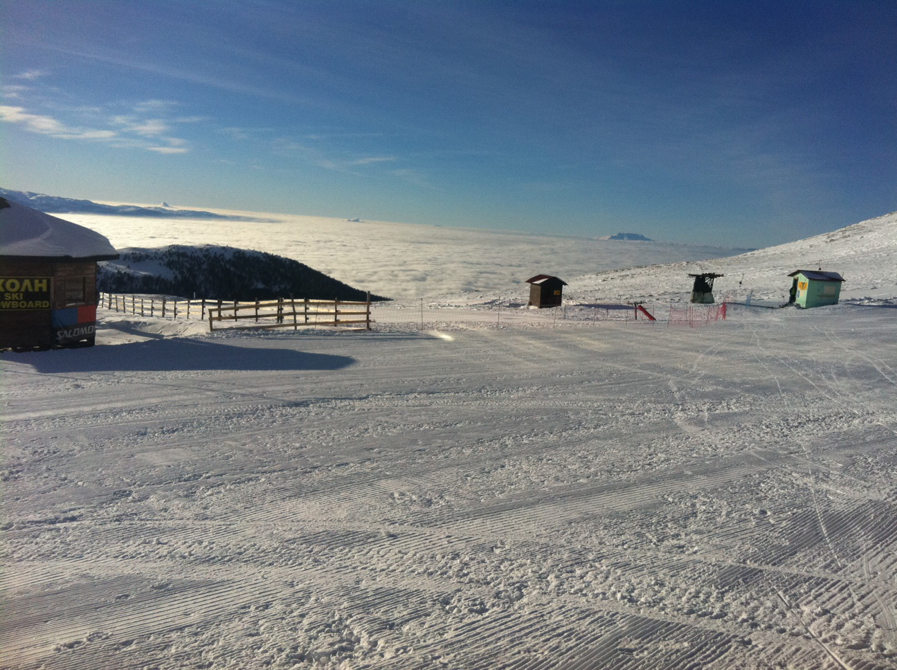
Kaimaktsalan is the ski area on Mount Voras, whose summit reaches 2,524 m on Greece’s northern border. The summit chapel of Profitis Ilias is a distinctive mountain landmark, but the summit height should not be confused with the elevation of the car park or an individual lift. Meterizi and Sarantovrisi are names to look for when matching a forecast point to the resort’s lift information.
This page provides separate forecasts for Parking Meterizi at 2,020 m, the top of Sarantovrisi II at 2,205 m and the top of Sarantovrisi I at 2,375 m, and the Prophet Elias chapel forecast point at 2,504 m. These are specific reference points, not a claim that conditions are uniform across the ski area. Compare them when deciding whether precipitation could fall as rain near the parking area and as snow higher up; the freezing level alone is not an exact rain–snow boundary.
Check the dated SnowReport.gr report and available camera views alongside the forecast before travelling. On this high mountain, visibility, wind and road conditions matter as well as fresh snow. Forecast snowfall describes an expected weather event, not the amount of usable snow on a piste or confirmation that the lifts will operate.
Sources: SnowReport.gr — Kaimaktsalan. Reviewed 4 November 2026.
Swipe to see all 5 places to stay →
 Country House Apartments and Suites Exohiko
Palaios Agios Athanasios
Drive to ski centre: ≈ 17.7 km · 28 min
View on Booking.com ↗
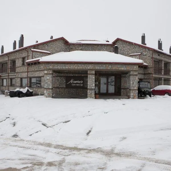 Miramonte Chalet Hotel Spa
Palaios Agios Athanasios
Drive to ski centre: ≈ 17.8 km · 28 min
View on Booking.com ↗
 Guesthouse Toitos
Palaios Agios Athanasios
Drive to ski centre: ≈ 17.5 km · 27 min
View on Booking.com ↗
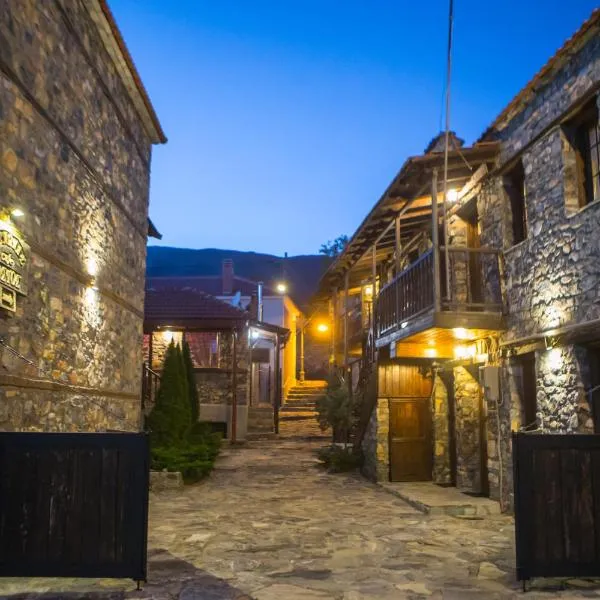 Nostos
Palaios Agios Athanasios
Drive to ski centre: ≈ 17.6 km · 27 min
View on Booking.com ↗
 ROUGA Mountain Chalets & Suites
Palaios Agios Athanasios
Drive to ski centre: ≈ 17.5 km · 28 min
View on Booking.com ↗
Press play to connect.
Open camera page ↗Preparing forecast graphs…
Times and values match the detailed forecast. Tap or point at a value for details. Scroll each chart sideways for later days. Rain / precipitation is the total water equivalent per forecast interval, including snow; snowfall is fresh snow per interval, not snow depth.
GFS and ECMWF model comparison. Each model retains its own forecast times and horizon. Precipitation and snowfall amounts cover their own forecast intervals; these can differ between models.
ECMWF · Model run: Next update expected:
Day Time (UTC) Temp. (°C) Humidity (%) Wind (km/h) Wind (knots) Wind (Bft) Direction Precip. (mm) Snow (cm) Pressure (hPa) Freezing (m) Conditions | Thursday, 05/11 06:00 -0.9 94 4 2 1B N — — 1028 2036 Overcast 99% cloud 09:00 -1.1 98 1 0 0B SW 0.22 0 1029 1995 Overcast 100% cloud 12:00 -0.7 96 4 2 1B NW 0.26 0.1 1027 2069 Overcast 100% cloud 15:00 -0.6 93 9 5 2B N 0.17 0 1027 2095 Overcast 95% cloud 18:00 -0.3 84 12 7 2B N 0.03 0 1027 2143 Cloudy 76% cloud 21:00 -0.3 74 12 7 2B N 0.00 0 1027 2136 Cloudy 73% cloud Friday, 06/11 00:00 -0.2 66 15 8 3B N 0 0 1026 2154 Cloudy 70% cloud 03:00 -0.1 63 18 10 3B N 0.03 0 1025 2183 Partly cloudy 35% cloud 06:00 0.1 58 17 9 3B N 0 0 1025 2254 Partly cloudy 23% cloud 09:00 0.4 59 15 8 3B N 0 0 1024 2339 Partly cloudy 27% cloud 12:00 1.3 55 15 8 3B N 0 0 1022 2537 Clear 12% cloud 15:00 2 46 18 9 3B N 0 0 1021 2660 Clear 1% cloud 18:00 2.2 42 21 11 4B N 0 0 1021 2759 Clear 0% cloud 21:00 2.1 36 22 12 4B N 0 0 1022 2728 Clear 0% cloud Saturday, 07/11 00:00 1.5 31 21 11 4B N 0 0 1023 2609 Clear 0% cloud 03:00 1.1 31 19 10 3B N 0 0 1023 2516 Clear 0% cloud 06:00 0.6 32 14 8 3B N 0 0 1024 2404 Cloudy 62% cloud 09:00 0.4 34 9 5 2B N 0 0 1025 2351 Cloudy 68% cloud 12:00 0.6 41 7 4 2B N 0 0 1024 2382 Overcast 81% cloud 15:00 0.4 46 6 3 2B N 0 0 1024 2323 Cloudy 69% cloud 18:00 0.2 45 6 3 2B N 0 0 1026 2257 Clear 5% cloud 21:00 -0.3 44 4 2 1B N 0 0 1028 2129 Clear 1% cloud Sunday, 08/11 00:00 -0.9 51 0 0 0B SW 0 0 1029 1937 Clear 6% cloud 03:00 -1.3 54 1 0 0B SW 0 0 1029 1829 Clear 10% cloud 06:00 -1.4 60 2 1 1B SE 0 0 1030 1775 Partly cloudy 32% cloud 09:00 -1.3 63 4 2 1B S 0 0 1031 1787 Cloudy 78% cloud 12:00 -0.6 59 5 3 1B SW 0.03 0 1029 2054 Cloudy 61% cloud 15:00 -0.3 63 8 4 2B W 0.02 0 1029 2125 Partly cloudy 34% cloud 18:00 -0.2 66 8 4 2B W 0 0 1030 2158 Cloudy 63% cloud 21:00 0 68 8 4 2B W 0 0 1030 2214 Partly cloudy 43% cloud Monday, 09/11 00:00 0.1 69 9 5 2B W 0 0 1030 2239 Overcast 85% cloud 03:00 0.2 76 9 5 2B W 0 0 1029 2248 Overcast 98% cloud 06:00 0.6 79 8 5 2B SW 0.25 0.1 1029 2331 Cloudy 57% cloud 09:00 0.5 85 14 7 3B SW 0.11 0 1030 2323 Overcast 96% cloud 12:00 0.4 93 20 11 4B SW 0.45 0.1 1028 2296 Overcast 99% cloud 15:00 0.7 92 19 10 3B W 0.22 0 1027 2350 Overcast 96% cloud 18:00 1 84 19 10 3B W 0.05 0 1027 2418 Cloudy 75% cloud 21:00 1.3 77 18 10 3B W 0 0 1026 2466 Cloudy 66% cloud Tuesday, 10/11 00:00 1.6 74 20 11 3B W 0.03 0 1025 2502 Cloudy 51% cloud 03:00 1.8 73 20 11 4B W 0 0 1024 2549 Partly cloudy 24% cloud 06:00 2.5 67 18 9 3B W 0 0 1024 2714 Partly cloudy 26% cloud 09:00 2.9 67 17 9 3B W 0 0 1024 2866 Partly cloudy 27% cloud 12:00 3.2 66 19 10 3B W 0 0 1021 2876 Overcast 81% cloud 15:00 3.7 65 22 12 4B W 0 0 1020 2917 Overcast 84% cloud 18:00 3.7 67 22 12 4B W 0 0 1020 2923 Overcast 82% cloud 21:00 3.7 74 21 11 4B W 0 0 1020 2917 Overcast 83% cloud Wednesday, 11/11 00:00 4 77 22 12 4B W 0 0 1019 2914 Cloudy 80% cloud 03:00 4.3 75 23 13 4B W 0 0 1017 2949 Cloudy 72% cloud 06:00 4.6 74 21 12 4B W 0 0 1018 3058 Overcast 88% cloud |
|---|
Forecast table times: UTC.
Coordinates: 40.91772°N, 21.80146°E · Requested elevation: 2205 m. Model terrain: 1055 m. Terrain and 1000/925/850/700 hPa profiles are used for height estimates.
These are altitude estimates, not a simulation of local mountain terrain. Precipitation, cloud and sea-level pressure use horizontal interpolation only.
Precipitation includes rain and snow water equivalent: preceding 3 hours through day 6, then 6 hours (see cell tooltip). Snow (cm) estimates fresh snowfall from precipitation and temperature using the GFS conversion; it is not snow depth on the ground. Freezing (m) uses additional 600/500 hPa temperatures when available and estimates the lowest resolved 0°C crossing above sea level. When all sampled levels are warm, the upper profile limit is shown (see tooltip). < marks an entirely cold sampled profile and its lower height limit. No extrapolation is used.
Preparing forecast graphs…
Times and values match the detailed forecast. Tap or point at a value for details. Scroll each chart sideways for later days. Rain / precipitation is the total water equivalent per forecast interval, including snow; snowfall is fresh snow per interval, not snow depth.
GFS and ECMWF model comparison. Each model retains its own forecast times and horizon. Precipitation and snowfall amounts cover their own forecast intervals; these can differ between models.
ECMWF · Model run: Next update expected:
Day Time (UTC) Temp. (°C) Humidity (%) Wind (km/h) Wind (knots) Wind (Bft) Direction Precip. (mm) Snow (cm) Pressure (hPa) Freezing (m) Conditions | Thursday, 05/11 06:00 -1.8 93 4 2 1B NW — — 1028 2035 Overcast 99% cloud 09:00 -2 97 2 1 1B W 0.22 0 1029 1993 Overcast 100% cloud 12:00 -1.6 95 5 3 1B NW 0.26 0.1 1027 2068 Overcast 100% cloud 15:00 -1.4 91 11 6 2B N 0.17 0 1027 2095 Overcast 95% cloud 18:00 -1 80 14 7 3B N 0.03 0 1027 2144 Cloudy 75% cloud 21:00 -0.9 68 14 7 3B N 0.00 0 1027 2137 Cloudy 73% cloud Friday, 06/11 00:00 -0.7 58 17 9 3B N 0 0 1026 2154 Cloudy 70% cloud 03:00 -0.5 55 21 11 4B N 0.03 0 1025 2183 Partly cloudy 34% cloud 06:00 -0.3 51 20 11 4B N 0 0 1025 2254 Partly cloudy 21% cloud 09:00 -0.1 52 16 9 3B N 0 0 1024 2338 Partly cloudy 26% cloud 12:00 0.6 50 17 9 3B N 0 0 1022 2536 Clear 11% cloud 15:00 1.2 42 19 10 3B N 0 0 1021 2660 Clear 0% cloud 18:00 1.5 39 22 12 4B N 0 0 1021 2759 Clear 0% cloud 21:00 1.4 33 22 12 4B N 0 0 1022 2728 Clear 0% cloud Saturday, 07/11 00:00 0.9 28 21 11 4B N 0 0 1023 2608 Clear 0% cloud 03:00 0.5 29 19 10 3B N 0 0 1023 2514 Clear 0% cloud 06:00 0.1 29 15 8 3B N 0 0 1024 2403 Cloudy 62% cloud 09:00 -0.1 29 11 6 2B N 0 0 1025 2352 Cloudy 69% cloud 12:00 0 35 8 5 2B N 0 0 1024 2382 Overcast 82% cloud 15:00 -0.2 40 8 4 2B N 0 0 1024 2323 Cloudy 70% cloud 18:00 -0.5 39 8 4 2B N 0 0 1026 2258 Clear 5% cloud 21:00 -1 39 5 3 1B N 0 0 1028 2130 Clear 1% cloud Sunday, 08/11 00:00 -1.5 45 2 1 1B NW 0 0 1029 1938 Clear 5% cloud 03:00 -1.8 47 2 1 1B NW 0 0 1029 1831 Clear 10% cloud 06:00 -1.9 52 1 1 1B NE 0 0 1030 1778 Partly cloudy 31% cloud 09:00 -1.8 54 2 1 1B S 0 0 1031 1787 Cloudy 79% cloud 12:00 -1.2 51 5 3 1B W 0.03 0 1029 2059 Cloudy 59% cloud 15:00 -1 57 9 5 2B W 0.02 0 1029 2127 Partly cloudy 33% cloud 18:00 -1 63 9 5 2B W 0 0 1030 2161 Cloudy 63% cloud 21:00 -0.7 66 10 5 2B W 0 0 1030 2215 Partly cloudy 42% cloud Monday, 09/11 00:00 -0.6 67 11 6 2B W 0 0 1030 2240 Overcast 84% cloud 03:00 -0.6 76 10 5 2B W 0 0 1029 2249 Overcast 98% cloud 06:00 -0.2 80 9 5 2B W 0.25 0.1 1029 2333 Cloudy 56% cloud 09:00 -0.2 87 14 7 3B SW 0.11 0 1029 2324 Overcast 95% cloud 12:00 -0.4 94 22 12 4B SW 0.46 0.1 1028 2297 Overcast 99% cloud 15:00 -0.1 91 22 12 4B W 0.22 0 1027 2350 Overcast 96% cloud 18:00 0.2 83 21 11 4B W 0.04 0 1027 2419 Cloudy 75% cloud 21:00 0.4 73 20 11 4B W 0 0 1026 2465 Cloudy 67% cloud Tuesday, 10/11 00:00 0.7 71 21 12 4B W 0.03 0 1025 2501 Cloudy 52% cloud 03:00 0.9 70 22 12 4B W 0 0 1024 2549 Partly cloudy 23% cloud 06:00 1.6 64 20 11 3B NW 0 0 1024 2714 Partly cloudy 26% cloud 09:00 2.2 62 19 10 3B W 0 0 1024 2866 Partly cloudy 27% cloud 12:00 2.4 62 21 11 4B W 0 0 1021 2875 Overcast 81% cloud 15:00 2.8 62 24 13 4B W 0 0 1020 2915 Overcast 84% cloud 18:00 2.8 64 24 13 4B W 0 0 1020 2924 Overcast 82% cloud 21:00 2.9 74 23 13 4B W 0 0 1020 2916 Overcast 83% cloud Wednesday, 11/11 00:00 3 78 24 13 4B W 0 0 1019 2914 Cloudy 80% cloud 03:00 3.3 76 25 13 4B W 0 0 1017 2948 Cloudy 72% cloud 06:00 3.6 74 23 12 4B W 0 0 1018 3058 Overcast 88% cloud |
|---|
Forecast table times: UTC.
Coordinates: 40.92486°N, 21.79807°E · Requested elevation: 2375 m. Model terrain: 1077 m. Terrain and 1000/925/850/700 hPa profiles are used for height estimates.
These are altitude estimates, not a simulation of local mountain terrain. Precipitation, cloud and sea-level pressure use horizontal interpolation only.
Precipitation includes rain and snow water equivalent: preceding 3 hours through day 6, then 6 hours (see cell tooltip). Snow (cm) estimates fresh snowfall from precipitation and temperature using the GFS conversion; it is not snow depth on the ground. Freezing (m) uses additional 600/500 hPa temperatures when available and estimates the lowest resolved 0°C crossing above sea level. When all sampled levels are warm, the upper profile limit is shown (see tooltip). < marks an entirely cold sampled profile and its lower height limit. No extrapolation is used.
Preparing forecast graphs…
Times and values match the detailed forecast. Tap or point at a value for details. Scroll each chart sideways for later days. Rain / precipitation is the total water equivalent per forecast interval, including snow; snowfall is fresh snow per interval, not snow depth.
GFS and ECMWF model comparison. Each model retains its own forecast times and horizon. Precipitation and snowfall amounts cover their own forecast intervals; these can differ between models.
ECMWF · Model run: Next update expected:
Day Time (UTC) Temp. (°C) Humidity (%) Wind (km/h) Wind (knots) Wind (Bft) Direction Precip. (mm) Snow (cm) Pressure (hPa) Freezing (m) Conditions | Thursday, 05/11 06:00 -2.4 93 4 2 1B NW — — 1028 2035 Overcast 99% cloud 09:00 -2.6 97 3 2 1B W 0.21 0 1029 1993 Overcast 100% cloud 12:00 -2.3 95 6 3 2B NW 0.27 0.1 1027 2069 Overcast 100% cloud 15:00 -2.1 90 11 6 2B N 0.18 0 1027 2098 Overcast 96% cloud 18:00 -1.6 77 15 8 3B N 0.02 0 1027 2148 Cloudy 76% cloud 21:00 -1.4 64 15 8 3B N 0.00 0 1027 2140 Cloudy 73% cloud Friday, 06/11 00:00 -1.2 52 18 10 3B N 0 0 1026 2155 Cloudy 69% cloud 03:00 -0.9 49 23 12 4B N 0.03 0 1025 2185 Partly cloudy 33% cloud 06:00 -0.7 45 22 12 4B N 0 0 1025 2255 Clear 20% cloud 09:00 -0.5 47 18 10 3B N 0 0 1024 2338 Partly cloudy 26% cloud 12:00 0.1 45 18 10 3B N 0 0 1022 2535 Clear 11% cloud 15:00 0.7 39 20 11 4B N 0 0 1021 2660 Clear 0% cloud 18:00 1 37 23 12 4B N 0 0 1021 2758 Clear 0% cloud 21:00 0.9 31 23 12 4B N 0 0 1022 2727 Clear 0% cloud Saturday, 07/11 00:00 0.4 27 21 11 4B N 0 0 1023 2608 Clear 0% cloud 03:00 0 27 19 11 3B N 0 0 1023 2512 Clear 0% cloud 06:00 -0.3 27 17 9 3B N 0 0 1024 2402 Cloudy 62% cloud 09:00 -0.5 26 13 7 3B N 0 0 1025 2355 Cloudy 69% cloud 12:00 -0.4 30 10 5 2B N 0 0 1023 2384 Overcast 83% cloud 15:00 -0.7 34 9 5 2B N 0 0 1024 2326 Cloudy 70% cloud 18:00 -0.9 34 9 5 2B N 0 0 1026 2262 Clear 4% cloud 21:00 -1.5 35 6 3 2B N 0 0 1028 2132 Clear 1% cloud Sunday, 08/11 00:00 -1.9 40 3 2 1B NW 0 0 1029 1942 Clear 5% cloud 03:00 -2.3 42 4 2 1B NW 0 0 1029 1835 Clear 9% cloud 06:00 -2.3 46 3 1 1B N 0 0 1030 1783 Partly cloudy 28% cloud 09:00 -2.2 48 1 1 1B SW 0 0 1031 1790 Cloudy 79% cloud 12:00 -1.6 45 5 3 1B W 0.02 0 1029 2069 Cloudy 57% cloud 15:00 -1.5 53 9 5 2B W 0.01 0 1029 2132 Partly cloudy 29% cloud 18:00 -1.5 62 11 6 2B W 0 0 1030 2166 Cloudy 62% cloud 21:00 -1.3 65 11 6 2B NW 0 0 1030 2219 Partly cloudy 40% cloud Monday, 09/11 00:00 -1.2 66 13 7 3B W 0 0 1030 2243 Overcast 83% cloud 03:00 -1.2 77 11 6 2B W 0 0 1029 2252 Overcast 98% cloud 06:00 -0.8 81 10 6 2B W 0.26 0.1 1029 2337 Cloudy 53% cloud 09:00 -0.8 87 14 7 3B SW 0.11 0 1029 2328 Overcast 95% cloud 12:00 -0.9 94 25 13 4B W 0.47 0.1 1028 2299 Overcast 99% cloud 15:00 -0.7 91 24 13 4B W 0.22 0 1027 2351 Overcast 96% cloud 18:00 -0.4 81 23 12 4B W 0.04 0 1027 2421 Cloudy 74% cloud 21:00 -0.2 70 22 12 4B W 0 0 1026 2466 Cloudy 68% cloud Tuesday, 10/11 00:00 -0 69 23 12 4B W 0.03 0 1025 2502 Cloudy 53% cloud 03:00 0.2 68 24 13 4B W 0 0 1024 2550 Partly cloudy 23% cloud 06:00 1 61 21 12 4B NW 0 0 1024 2716 Partly cloudy 25% cloud 09:00 1.6 59 20 11 4B W 0 0 1024 2867 Partly cloudy 27% cloud 12:00 1.8 58 22 12 4B W 0 0 1021 2874 Overcast 81% cloud 15:00 2.1 59 26 14 4B W 0 0 1020 2914 Overcast 85% cloud 18:00 2.2 62 26 14 4B W 0 0 1020 2926 Overcast 81% cloud 21:00 2.2 73 25 13 4B W 0 0 1020 2916 Overcast 83% cloud Wednesday, 11/11 00:00 2.3 78 25 13 4B W 0 0 1019 2916 Cloudy 79% cloud 03:00 2.5 76 26 14 4B W 0 0 1017 2948 Cloudy 71% cloud 06:00 3 73 23 13 4B W 0 0 1018 3059 Overcast 88% cloud |
|---|
Forecast table times: UTC.
Coordinates: 40.93063°N, 21.78621°E · Requested elevation: 2504 m. Model terrain: 1117 m. Terrain and 1000/925/850/700 hPa profiles are used for height estimates.
These are altitude estimates, not a simulation of local mountain terrain. Precipitation, cloud and sea-level pressure use horizontal interpolation only.
Precipitation includes rain and snow water equivalent: preceding 3 hours through day 6, then 6 hours (see cell tooltip). Snow (cm) estimates fresh snowfall from precipitation and temperature using the GFS conversion; it is not snow depth on the ground. Freezing (m) uses additional 600/500 hPa temperatures when available and estimates the lowest resolved 0°C crossing above sea level. When all sampled levels are warm, the upper profile limit is shown (see tooltip). < marks an entirely cold sampled profile and its lower height limit. No extrapolation is used.