Worldwide Ski Resort Forecasts

More
Colour guide Temperature · Wind · Rain · Snow
Each colour starts at the value shown. Wind colours match across all three units. Dry cells stay neutral. Colours describe the displayed values, not official weather warnings.
Preparing forecast graphs…
Times and values match the detailed forecast. Tap or point at a value for details. Scroll each chart sideways for later days. Rain / precipitation is the total water equivalent per forecast interval, including snow; snowfall is fresh snow per interval, not snow depth.
GFS and ECMWF model comparison. Each model retains its own forecast times and horizon. Precipitation and snowfall amounts cover their own forecast intervals; these can differ between models.
Forecast values and model notes
Wildhaus - Low lift station
ECMWF · Model run: Next update expected:
Day Time (UTC) Temp. (°C) Humidity (%) Wind (km/h) Wind (knots) Wind (Bft) Direction Precip. (mm) Snow (cm) Pressure (hPa) Freezing (m) Conditions | Thursday, 05/11 06:00 0.9 85 4 2 1B S — — 1022 < 1194 Partly cloudy 22% cloud  09:00 8 70 5 3 1B SE 0 0 1023 2956 Clear 6% cloud  12:00 12 55 4 2 1B SE 0 0 1022 3053 Clear 7% cloud 15:00 9.4 72 1 1 0B NE 0 0 1022 3038 Clear 8% cloud 18:00 4.4 83 1 1 1B S 0 0 1022 3067 Clear 20% cloud 21:00 3.5 86 2 1 1B S 0 0 1022 3055 Cloudy 57% cloud  Friday, 06/11 00:00 2.5 86 2 1 1B SW 0 0 1021 2840 Partly cloudy 44% cloud 03:00 2.5 86 1 1 1B SW 0 0 1022 2664 Overcast 97% cloud  06:00 2.1 88 2 1 1B SW 0 0 1021 2128 Overcast 95% cloud 09:00 6.2 76 2 1 1B W 0 0 1022 2639 Overcast 100% cloud 12:00 6.7 77 3 2 1B W 0.05 0 1022 2440 Overcast 100% cloud 15:00 5.5 90 0 0 0B W 0.61 0 1022 2182 Overcast 100% cloud 18:00 4.6 92 1 0 0B W 0.47 0 1023 2043 Overcast 100% cloud 21:00 4.4 92 1 1 0B W 0.10 0 1023 1968 Overcast 100% cloud Saturday, 07/11 00:00 4.3 92 2 1 1B SW 0.69 0 1024 1911 Overcast 100% cloud 03:00 3.9 93 2 1 1B SW 0.30 0 1024 1815 Overcast 100% cloud 06:00 4 91 2 1 1B SW 0.14 0 1024 1808 Overcast 99% cloud 09:00 5.8 86 2 1 1B S 0.09 0 1025 2022 Cloudy 70% cloud 12:00 8 68 1 1 0B N 0.08 0 1023 2233 Overcast 90% cloud 15:00 7 78 4 2 1B NE 0 0 1023 2180 Partly cloudy 48% cloud 18:00 4.4 92 2 1 1B E 0 0 1024 1914 Cloudy 73% cloud 21:00 2.9 93 3 2 1B S 0 0 1025 1697 Cloudy 78% cloud Sunday, 08/11 00:00 1.5 92 2 1 1B S 0 0 1024 1368 Cloudy 60% cloud 03:00 2 84 2 1 1B S 0 0 1024 1443 Partly cloudy 23% cloud 06:00 1.2 85 3 1 1B S 0 0 1024 1251 Partly cloudy 29% cloud 09:00 6.4 71 3 2 1B S 0 0 1024 2119 Clear 7% cloud 12:00 9 60 2 1 1B N 0 0 1023 2272 Partly cloudy 26% cloud 15:00 7.6 73 2 1 1B NE 0 0 1023 2187 Clear 10% cloud 18:00 2.9 85 2 1 1B S 0 0 1023 1647 Clear 9% cloud 21:00 1.6 88 2 1 1B S 0 0 1023 1358 Partly cloudy 35% cloud Monday, 09/11 00:00 2.2 79 2 1 1B S 0 0 1022 1500 Partly cloudy 36% cloud 03:00 2.5 71 3 2 1B S 0 0 1021 1592 Overcast 98% cloud 06:00 3.5 61 3 1 1B S 0 0 1020 1855 Overcast 97% cloud 09:00 7.2 57 7 4 2B S 0.04 0 1020 2343 Overcast 84% cloud 12:00 10.4 51 3 2 1B SE 0 0 1017 2582 Overcast 95% cloud 15:00 8.1 71 2 1 1B S 0.30 0 1016 2524 Overcast 100% cloud 18:00 6.5 81 6 3 1B S 1.5 0 1016 2495 Overcast 100% cloud 21:00 5.9 84 6 3 1B S 0.99 0 1016 2458 Overcast 100% cloud Tuesday, 10/11 00:00 5.9 86 6 3 1B S 1.4 0 1016 2480 Overcast 100% cloud 03:00 6.1 86 5 3 1B S 2.6 0 1015 2506 Overcast 100% cloud 06:00 6.2 87 6 3 1B S 4.5 0 1014 2525 Overcast 100% cloud 09:00 7.3 88 5 3 1B S 4.5 0 1014 2578 Overcast 100% cloud 12:00 8.3 90 5 3 1B S 4.2 0 1014 2654 Overcast 100% cloud 15:00 8.2 90 3 2 1B S 1.2 0 1013 2647 Overcast 100% cloud 18:00 7.9 87 4 2 1B S 0.44 0 1013 2619 Overcast 100% cloud 21:00 7.4 83 2 1 1B SE 0 0 1013 2668 Cloudy 69% cloud Wednesday, 11/11 00:00 6.1 82 3 2 1B S 0 0 1013 2648 Clear 19% cloud 03:00 4.5 84 3 2 1B S 0 0 1011 2688 Partly cloudy 22% cloud 06:00 3.9 85 3 1 1B S 0 0 1012 2840 Partly cloudy 26% cloud |
|---|
Forecast notes
Forecast table times: UTC.
Coordinates: 47.1989358°N, 9.3421841°E · Requested elevation: 1016 m. Model terrain: 1192 m. Terrain and 1000/925/850/700 hPa profiles are used for height estimates.
Outside the available profile, temperature uses an estimated 5.5°C/km height correction; wind retains the nearest available model-level value. Humidity is estimated with adjusted pressure and temperature.
These are altitude estimates, not a simulation of local mountain terrain. Precipitation, cloud and sea-level pressure use horizontal interpolation only.
Precipitation includes rain and snow water equivalent: preceding 3 hours through day 6, then 6 hours (see cell tooltip). Snow (cm) estimates fresh snowfall from precipitation and temperature using the GFS conversion; it is not snow depth on the ground. Freezing (m) uses additional 600/500 hPa temperatures when available and estimates the lowest resolved 0°C crossing above sea level. When all sampled levels are warm, the upper profile limit is shown (see tooltip). < marks an entirely cold sampled profile and its lower height limit. No extrapolation is used.
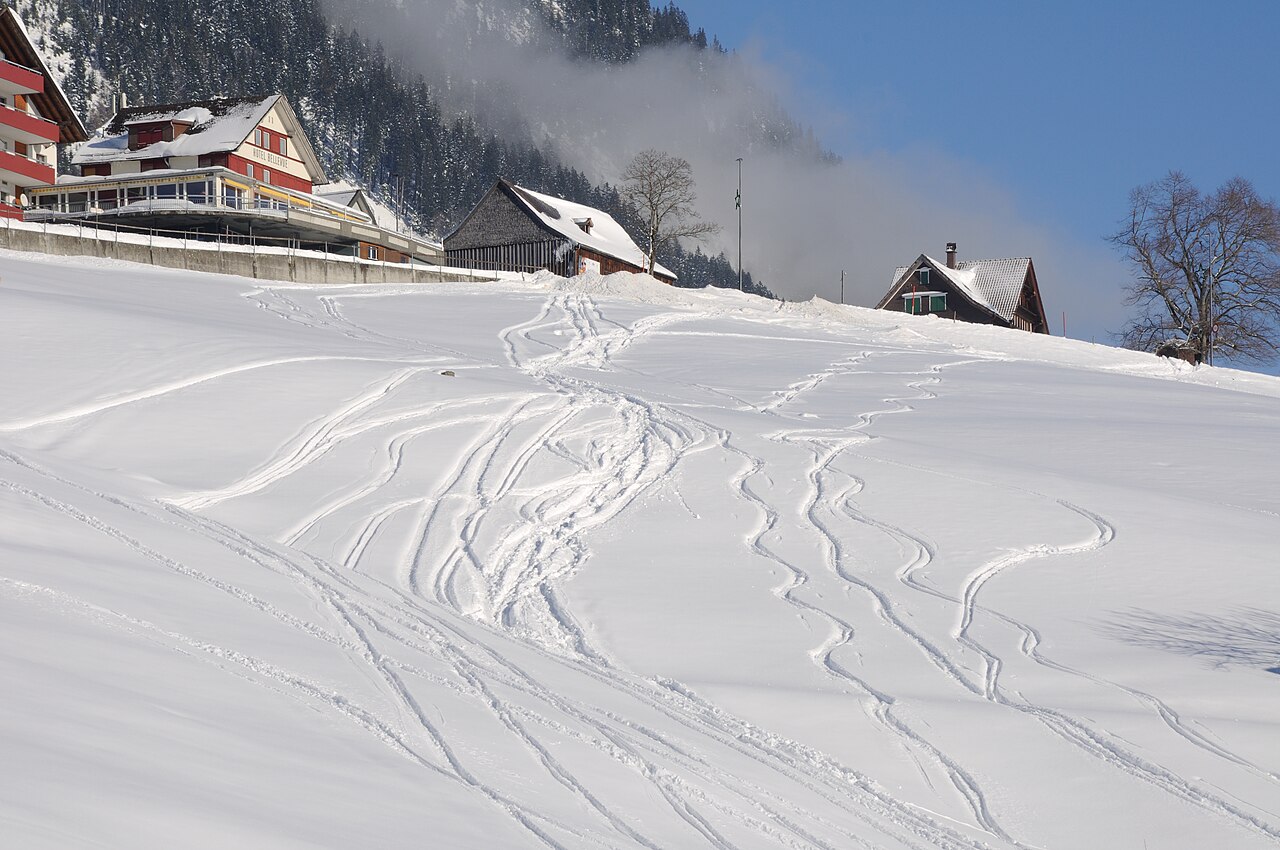
Wildhaus is a downhill ski area in Saint Gallen, Switzerland. Mapped terrain includes beginner, easy, intermediate, advanced, freeride routes. Its mapped lift network extends from approximately 1016 to 2070 metres above sea level. Cross-country skiing is also mapped within the area.
Data: OpenSkiData / OpenSkiMap, OpenStreetMap contributors (ODbL), Skimap.org, Who's On First, Mapterhorn.
Preparing forecast graphs…
Times and values match the detailed forecast. Tap or point at a value for details. Scroll each chart sideways for later days. Rain / precipitation is the total water equivalent per forecast interval, including snow; snowfall is fresh snow per interval, not snow depth.
GFS and ECMWF model comparison. Each model retains its own forecast times and horizon. Precipitation and snowfall amounts cover their own forecast intervals; these can differ between models.
Forecast values and model notes
Wildhaus - Base lift station
ECMWF · Model run: Next update expected:
Day Time (UTC) Temp. (°C) Humidity (%) Wind (km/h) Wind (knots) Wind (Bft) Direction Precip. (mm) Snow (cm) Pressure (hPa) Freezing (m) Conditions | Thursday, 05/11 06:00 -0.1 88 4 2 1B S — — 1022 < 1209 Partly cloudy 22% cloud 09:00 6.9 72 5 3 1B S 0 0 1023 2953 Clear 6% cloud 12:00 10.9 57 4 2 1B SE 0 0 1022 3052 Clear 8% cloud 15:00 8.4 74 1 0 0B E 0 0 1022 3037 Clear 8% cloud 18:00 3.4 86 2 1 1B S 0 0 1022 3068 Clear 20% cloud 21:00 2.4 90 2 1 1B S 0 0 1022 3042 Cloudy 57% cloud Friday, 06/11 00:00 1.4 89 2 1 1B SW 0 0 1021 2829 Partly cloudy 43% cloud 03:00 1.5 89 1 1 1B SW 0 0 1022 2658 Overcast 97% cloud 06:00 1.1 91 2 1 1B SW 0 0 1021 2127 Overcast 95% cloud 09:00 5.2 78 2 1 1B W 0 0 1022 2637 Overcast 100% cloud 12:00 5.6 80 2 1 1B W 0.06 0 1022 2438 Overcast 100% cloud 15:00 4.4 94 0 0 0B SW 0.64 0 1022 2182 Overcast 100% cloud 18:00 3.5 96 1 0 0B W 0.47 0 1023 2041 Overcast 100% cloud 21:00 3.3 96 1 1 0B W 0.11 0 1023 1965 Overcast 100% cloud Saturday, 07/11 00:00 3.1 96 2 1 1B W 0.72 0 1024 1908 Overcast 100% cloud 03:00 2.7 97 2 1 1B SW 0.31 0 1024 1815 Overcast 100% cloud 06:00 2.9 96 2 1 1B SW 0.16 0 1024 1807 Overcast 99% cloud 09:00 4.6 91 2 1 1B S 0.10 0 1025 2020 Cloudy 71% cloud 12:00 6.9 72 1 0 0B N 0.08 0 1023 2233 Overcast 90% cloud 15:00 5.9 81 4 2 1B NE 0 0 1023 2182 Partly cloudy 49% cloud 18:00 3.2 96 1 1 1B E 0 0 1024 1910 Cloudy 71% cloud 21:00 1.8 97 3 2 1B S 0 0 1025 1695 Cloudy 75% cloud Sunday, 08/11 00:00 0.4 96 2 1 1B S 0 0 1024 1360 Cloudy 58% cloud 03:00 0.8 88 3 1 1B S 0 0 1024 1430 Partly cloudy 22% cloud 06:00 0 89 3 2 1B S 0 0 1024 1237 Partly cloudy 30% cloud 09:00 5.2 74 3 2 1B S 0 0 1024 2119 Clear 6% cloud 12:00 7.8 62 2 1 1B NW 0 0 1023 2277 Partly cloudy 26% cloud 15:00 6.4 75 1 1 1B NE 0 0 1023 2192 Clear 10% cloud 18:00 1.8 88 2 1 1B S 0 0 1023 1651 Clear 9% cloud 21:00 0.4 92 2 1 1B S 0 0 1023 1332 Partly cloudy 34% cloud Monday, 09/11 00:00 1 83 3 1 1B S 0 0 1022 1478 Partly cloudy 36% cloud 03:00 1.3 74 3 2 1B S 0 0 1021 1572 Overcast 97% cloud 06:00 2.4 65 3 2 1B S 0 0 1020 1844 Overcast 97% cloud 09:00 6.1 60 7 4 2B S 0.03 0 1020 2346 Overcast 84% cloud 12:00 9.3 53 3 2 1B SE 0 0 1017 2585 Overcast 94% cloud 15:00 7 74 2 1 1B S 0.29 0 1016 2526 Overcast 100% cloud 18:00 5.4 86 6 3 2B S 1.5 0 1016 2490 Overcast 100% cloud 21:00 4.8 88 6 3 1B S 1.0 0 1017 2454 Overcast 100% cloud Tuesday, 10/11 00:00 4.7 90 6 3 1B S 1.4 0 1016 2476 Overcast 100% cloud 03:00 4.9 90 5 3 1B S 2.6 0 1015 2500 Overcast 100% cloud 06:00 5 92 6 3 1B S 4.5 0 1014 2522 Overcast 100% cloud 09:00 6.2 93 5 3 1B S 4.4 0 1014 2577 Overcast 100% cloud 12:00 7.1 95 5 3 1B S 4.2 0 1014 2655 Overcast 100% cloud 15:00 7.1 94 3 2 1B S 1.2 0 1013 2648 Overcast 100% cloud 18:00 6.8 91 4 2 1B S 0.42 0 1013 2620 Overcast 100% cloud 21:00 6.3 87 2 1 1B SE 0 0 1013 2667 Cloudy 69% cloud Wednesday, 11/11 00:00 5 86 3 2 1B S 0 0 1013 2648 Clear 19% cloud 03:00 3.3 89 3 2 1B S 0 0 1011 2676 Partly cloudy 24% cloud 06:00 2.8 89 3 1 1B S 0 0 1012 2832 Partly cloudy 28% cloud |
|---|
Forecast notes
Forecast table times: UTC.
Coordinates: 47.189917°N, 9.3433875°E · Requested elevation: 1224 m. Model terrain: 1207 m. Terrain and 1000/925/850/700 hPa profiles are used for height estimates.
These are altitude estimates, not a simulation of local mountain terrain. Precipitation, cloud and sea-level pressure use horizontal interpolation only.
Precipitation includes rain and snow water equivalent: preceding 3 hours through day 6, then 6 hours (see cell tooltip). Snow (cm) estimates fresh snowfall from precipitation and temperature using the GFS conversion; it is not snow depth on the ground. Freezing (m) uses additional 600/500 hPa temperatures when available and estimates the lowest resolved 0°C crossing above sea level. When all sampled levels are warm, the upper profile limit is shown (see tooltip). < marks an entirely cold sampled profile and its lower height limit. No extrapolation is used.
Preparing forecast graphs…
Times and values match the detailed forecast. Tap or point at a value for details. Scroll each chart sideways for later days. Rain / precipitation is the total water equivalent per forecast interval, including snow; snowfall is fresh snow per interval, not snow depth.
GFS and ECMWF model comparison. Each model retains its own forecast times and horizon. Precipitation and snowfall amounts cover their own forecast intervals; these can differ between models.
Forecast values and model notes
Wildhaus - Top lift station
ECMWF · Model run: Next update expected:
Day Time (UTC) Temp. (°C) Humidity (%) Wind (km/h) Wind (knots) Wind (Bft) Direction Precip. (mm) Snow (cm) Pressure (hPa) Freezing (m) Conditions | Thursday, 05/11 06:00 -0.6 63 13 7 3B S — — 1022 < 1275 Partly cloudy 22% cloud 09:00 3.5 57 12 6 2B S 0 0 1024 2947 Clear 8% cloud 12:00 5.9 52 11 6 2B S 0 0 1022 3047 Clear 10% cloud 15:00 4.6 63 10 5 2B S 0 0 1021 3035 Clear 8% cloud 18:00 1.9 68 10 5 2B S 0 0 1022 3069 Clear 19% cloud 21:00 1.2 73 11 6 2B S 0 0 1022 3002 Cloudy 55% cloud Friday, 06/11 00:00 0.6 70 10 6 2B S 0 0 1021 2796 Partly cloudy 39% cloud 03:00 0.6 69 8 4 2B SE 0 0 1021 2645 Overcast 97% cloud 06:00 0.1 71 9 5 2B SE 0 0 1021 2153 Overcast 96% cloud 09:00 2.1 66 10 5 2B SE 0 0 1022 2630 Overcast 100% cloud 12:00 1.7 75 11 6 2B SE 0.09 0 1022 2431 Overcast 100% cloud 15:00 0.5 93 11 6 2B S 0.73 0.2 1022 2183 Overcast 100% cloud 18:00 -0.2 98 6 3 2B S 0.48 0.1 1023 2035 Overcast 100% cloud 21:00 -0.5 98 4 2 1B SW 0.15 0 1023 1957 Overcast 100% cloud Saturday, 07/11 00:00 -0.8 98 5 3 1B SW 0.78 0.2 1024 1895 Overcast 100% cloud 03:00 -1.2 98 7 4 2B W 0.32 0.1 1024 1814 Overcast 100% cloud 06:00 -1.3 97 7 4 2B W 0.21 0 1024 1807 Overcast 99% cloud 09:00 -0.3 92 3 2 1B SW 0.12 0 1025 2014 Cloudy 76% cloud 12:00 1.1 79 4 2 1B S 0.08 0 1023 2237 Overcast 92% cloud 15:00 0.7 83 4 2 1B S 0 0 1023 2190 Cloudy 54% cloud 18:00 -0.8 88 6 3 2B S 0 0 1024 1898 Cloudy 61% cloud 21:00 -1.5 85 7 4 2B SW 0 0 1024 1693 Cloudy 63% cloud Sunday, 08/11 00:00 -2.3 81 5 3 1B SW 0 0 1024 1350 Partly cloudy 49% cloud 03:00 -2.6 81 4 2 1B SW 0 0 1024 1404 Clear 20% cloud 06:00 -2.9 79 5 3 1B SW 0 0 1024 < 1275 Partly cloudy 31% cloud 09:00 0.3 66 7 4 2B SW 0 0 1024 2131 Clear 6% cloud 12:00 1.7 58 7 4 2B W 0 0 1023 2293 Partly cloudy 23% cloud 15:00 1 65 8 5 2B W 0 0 1023 2215 Clear 9% cloud 18:00 -1.8 69 12 6 2B W 0 0 1023 1665 Clear 8% cloud 21:00 -2.8 83 15 8 3B W 0 0 1023 < 1275 Partly cloudy 31% cloud Monday, 09/11 00:00 -2.4 84 15 8 3B W 0 0 1022 1420 Partly cloudy 37% cloud 03:00 -2 80 14 8 3B W 0 0 1021 1523 Overcast 96% cloud 06:00 -1 75 16 9 3B W 0 0 1020 1817 Overcast 97% cloud 09:00 1.6 70 21 11 4B SW 0.03 0 1020 2362 Overcast 82% cloud 12:00 3.6 65 24 13 4B SW 0 0 1017 2597 Overcast 90% cloud 15:00 2.5 82 28 15 4B W 0.26 0 1016 2536 Overcast 100% cloud 18:00 1.6 92 30 16 5B W 1.5 0 1017 2472 Overcast 100% cloud 21:00 1.4 93 27 15 4B W 1.1 0 1017 2434 Overcast 100% cloud Tuesday, 10/11 00:00 1.4 94 26 14 4B W 1.4 0 1016 2461 Overcast 100% cloud 03:00 1.5 94 24 13 4B W 2.4 0 1015 2482 Overcast 100% cloud 06:00 1.7 95 21 11 4B W 4.4 0 1014 2511 Overcast 100% cloud 09:00 2.3 96 16 8 3B W 4.2 0 1015 2576 Overcast 100% cloud 12:00 2.9 97 17 9 3B W 4.0 0 1014 2657 Overcast 100% cloud 15:00 2.9 97 15 8 3B W 1.1 0 1013 2651 Overcast 100% cloud 18:00 2.7 95 11 6 2B W 0.36 0 1013 2624 Overcast 100% cloud 21:00 2.6 89 11 6 2B W 0 0 1013 2670 Cloudy 68% cloud Wednesday, 11/11 00:00 2 87 8 5 2B W 0 0 1013 2650 Clear 19% cloud 03:00 1.1 82 8 5 2B W 0 0 1011 2631 Partly cloudy 31% cloud 06:00 1.1 77 8 4 2B W 0 0 1012 2802 Partly cloudy 35% cloud |
|---|
Forecast notes
Forecast table times: UTC.
Coordinates: 47.1589556°N, 9.3378605°E · Requested elevation: 2070 m. Model terrain: 1272 m. Terrain and 1000/925/850/700 hPa profiles are used for height estimates.
These are altitude estimates, not a simulation of local mountain terrain. Precipitation, cloud and sea-level pressure use horizontal interpolation only.
Precipitation includes rain and snow water equivalent: preceding 3 hours through day 6, then 6 hours (see cell tooltip). Snow (cm) estimates fresh snowfall from precipitation and temperature using the GFS conversion; it is not snow depth on the ground. Freezing (m) uses additional 600/500 hPa temperatures when available and estimates the lowest resolved 0°C crossing above sea level. When all sampled levels are warm, the upper profile limit is shown (see tooltip). < marks an entirely cold sampled profile and its lower height limit. No extrapolation is used.