Worldwide Ski Resort Forecasts

More
Colour guide Temperature · Wind · Rain · Snow
Each colour starts at the value shown. Wind colours match across all three units. Dry cells stay neutral. Colours describe the displayed values, not official weather warnings.
Preparing forecast graphs…
Times and values match the detailed forecast. Tap or point at a value for details. Scroll each chart sideways for later days. Rain / precipitation is the total water equivalent per forecast interval, including snow; snowfall is fresh snow per interval, not snow depth.
GFS and ECMWF model comparison. Each model retains its own forecast times and horizon. Precipitation and snowfall amounts cover their own forecast intervals; these can differ between models.
Forecast values and model notes
Meiringen - Hasliberg - Low lift station
ECMWF · Model run: Next update expected:
Day Time (UTC) Temp. (°C) Humidity (%) Wind (km/h) Wind (knots) Wind (Bft) Direction Precip. (mm) Snow (cm) Pressure (hPa) Freezing (m) Conditions | Thursday, 05/11 06:00 6.6 62 6 3 2B SE — — 1023 2081 Overcast 82% cloud  09:00 10 53 8 4 2B SE 0.00 0 1024 2705 Cloudy 69% cloud  12:00 13 46 7 4 2B SE 0 0 1022 2929 Cloudy 50% cloud 15:00 11.7 52 6 3 2B SE 0 0 1022 2921 Partly cloudy 32% cloud  18:00 8 59 6 3 1B SE 0 0 1023 2684 Cloudy 73% cloud 21:00 7.2 61 6 3 1B SE 0.00 0 1022 2498 Overcast 99% cloud Friday, 06/11 00:00 7.7 62 5 3 1B SE 0.27 0 1022 2353 Overcast 88% cloud 03:00 7.2 63 4 2 1B SE 0.16 0 1022 2180 Overcast 95% cloud 06:00 7.1 62 2 1 1B SE 0.05 0 1022 2094 Overcast 100% cloud 09:00 8.6 68 1 0 0B E 0.45 0 1023 2295 Overcast 100% cloud 12:00 8.5 72 1 1 1B NW 0.91 0 1022 2222 Overcast 100% cloud 15:00 7.9 74 2 1 1B NW 1.3 0 1022 2105 Overcast 100% cloud 18:00 7.2 75 2 1 1B NW 1.0 0 1023 1977 Overcast 100% cloud 21:00 6.7 75 2 1 1B W 0.81 0 1024 1877 Overcast 100% cloud Saturday, 07/11 00:00 6.8 74 1 1 1B W 0.60 0 1024 1870 Overcast 100% cloud 03:00 6.9 73 1 1 1B NW 0.21 0 1023 1881 Overcast 100% cloud 06:00 7 72 1 0 0B NW 0.32 0 1024 1887 Overcast 98% cloud 09:00 8.5 66 2 1 1B NE 0.11 0 1024 2094 Cloudy 64% cloud 12:00 10.5 53 2 1 1B N 0.02 0 1022 2293 Overcast 88% cloud 15:00 9.1 62 2 1 1B N 0.01 0 1023 2195 Cloudy 56% cloud 18:00 7 68 2 1 1B SE 0 0 1024 1929 Partly cloudy 43% cloud 21:00 6.3 64 4 2 1B SE 0 0 1025 1803 Cloudy 72% cloud Sunday, 08/11 00:00 5 62 5 3 1B SE 0 0 1025 < 1674 Cloudy 75% cloud 03:00 3.7 61 5 3 1B SE 0 0 1024 < 1674 Cloudy 56% cloud 06:00 2.4 57 5 3 1B SE 0 0 1024 < 1674 Partly cloudy 40% cloud 09:00 8.9 41 3 1 1B SE 0 0 1024 2207 Clear 17% cloud  12:00 11.6 33 1 0 0B W 0 0 1022 2391 Clear 2% cloud 15:00 10.2 46 0 0 0B E 0 0 1022 2298 Clear 2% cloud 18:00 4.7 62 3 2 1B SE 0 0 1023 < 1674 Cloudy 60% cloud 21:00 3.2 59 5 3 1B SE 0 0 1022 < 1674 Overcast 86% cloud Monday, 09/11 00:00 4.4 55 5 3 1B SE 0 0 1021 < 1674 Overcast 100% cloud 03:00 5.6 54 6 3 1B SE 0 0 1020 < 1674 Overcast 98% cloud 06:00 6.3 54 6 3 2B SE 0.01 0 1020 1866 Overcast 95% cloud 09:00 10.2 46 7 4 2B SE 0.00 0 1019 2512 Overcast 93% cloud 12:00 12.4 42 7 4 2B SE 0.09 0 1018 2707 Overcast 100% cloud 15:00 10.1 58 6 3 2B SE 0.20 0 1017 2617 Overcast 99% cloud 18:00 9 58 8 4 2B SE 0.09 0 1016 2560 Overcast 96% cloud 21:00 8.4 57 7 4 2B SE 0.27 0 1016 2547 Overcast 97% cloud Tuesday, 10/11 00:00 8.9 62 6 3 2B SE 0.24 0 1015 2555 Overcast 100% cloud 03:00 9.2 67 5 3 1B SE 1.1 0 1014 2593 Overcast 100% cloud 06:00 9.5 68 3 2 1B SE 1.7 0 1013 2641 Overcast 100% cloud 09:00 10.5 69 3 2 1B SE 2.6 0 1014 2734 Overcast 100% cloud 12:00 12 71 3 2 1B SE 1.6 0 1013 2819 Overcast 98% cloud 15:00 12.2 72 1 1 1B SE 0.88 0 1013 2801 Cloudy 69% cloud 18:00 10 67 2 1 1B SE 0.44 0 1013 2763 Overcast 82% cloud 21:00 8.9 66 2 1 1B SE 0.17 0 1013 2855 Overcast 95% cloud Wednesday, 11/11 00:00 6 72 3 2 1B SE 0 0 1013 2406 Partly cloudy 44% cloud 03:00 5.3 70 3 2 1B SE 0 0 1012 < 1674 Cloudy 61% cloud 06:00 5.6 69 4 2 1B SE 0 0 1011 < 1674 Overcast 94% cloud |
|---|
Forecast notes
Forecast table times: UTC.
Coordinates: 46.7283483°N, 8.1921231°E · Requested elevation: 626 m. Model terrain: 1671 m. Terrain and 1000/925/850/700 hPa profiles are used for height estimates.
Outside the available profile, temperature uses an estimated 5.5°C/km height correction; wind retains the nearest available model-level value. Humidity is estimated with adjusted pressure and temperature.
These are altitude estimates, not a simulation of local mountain terrain. Precipitation, cloud and sea-level pressure use horizontal interpolation only.
Precipitation includes rain and snow water equivalent: preceding 3 hours through day 6, then 6 hours (see cell tooltip). Snow (cm) estimates fresh snowfall from precipitation and temperature using the GFS conversion; it is not snow depth on the ground. Freezing (m) uses additional 600/500 hPa temperatures when available and estimates the lowest resolved 0°C crossing above sea level. When all sampled levels are warm, the upper profile limit is shown (see tooltip). < marks an entirely cold sampled profile and its lower height limit. No extrapolation is used.
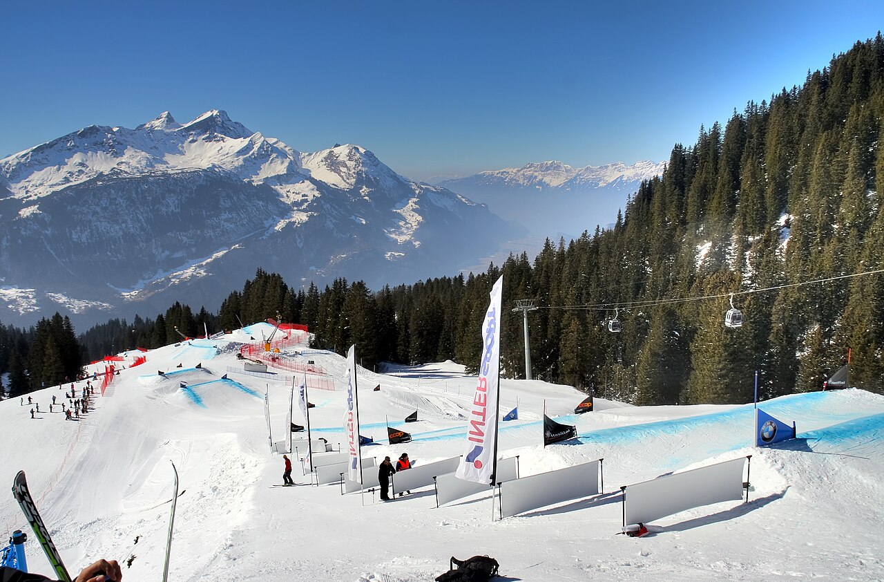
Meiringen - Hasliberg is a downhill ski area in Bern, Switzerland. Mapped terrain includes beginner, easy, intermediate, advanced routes. Its mapped lift network extends from approximately 626 to 2433 metres above sea level.
Data: OpenSkiData / OpenSkiMap, OpenStreetMap contributors (ODbL), Skimap.org, Who's On First, Mapterhorn.
Preparing forecast graphs…
Times and values match the detailed forecast. Tap or point at a value for details. Scroll each chart sideways for later days. Rain / precipitation is the total water equivalent per forecast interval, including snow; snowfall is fresh snow per interval, not snow depth.
GFS and ECMWF model comparison. Each model retains its own forecast times and horizon. Precipitation and snowfall amounts cover their own forecast intervals; these can differ between models.
Forecast values and model notes
Meiringen - Hasliberg - Base lift station
ECMWF · Model run: Next update expected:
Day Time (UTC) Temp. (°C) Humidity (%) Wind (km/h) Wind (knots) Wind (Bft) Direction Precip. (mm) Snow (cm) Pressure (hPa) Freezing (m) Conditions | Thursday, 05/11 06:00 6.6 62 6 3 2B SE — — 1023 2081 Overcast 82% cloud 09:00 10 53 8 4 2B SE 0.00 0 1024 2705 Cloudy 69% cloud 12:00 13 46 7 4 2B SE 0 0 1022 2929 Cloudy 50% cloud 15:00 11.7 52 6 3 2B SE 0 0 1022 2921 Partly cloudy 32% cloud 18:00 8 59 6 3 1B SE 0 0 1023 2684 Cloudy 73% cloud 21:00 7.2 61 6 3 1B SE 0.00 0 1022 2498 Overcast 99% cloud Friday, 06/11 00:00 7.7 62 5 3 1B SE 0.27 0 1022 2353 Overcast 88% cloud 03:00 7.2 63 4 2 1B SE 0.16 0 1022 2180 Overcast 95% cloud 06:00 7.1 62 2 1 1B SE 0.05 0 1022 2094 Overcast 100% cloud 09:00 8.6 68 1 0 0B E 0.45 0 1023 2295 Overcast 100% cloud 12:00 8.5 72 1 1 1B NW 0.91 0 1022 2222 Overcast 100% cloud 15:00 7.9 74 2 1 1B NW 1.3 0 1022 2105 Overcast 100% cloud 18:00 7.2 75 2 1 1B NW 1.0 0 1023 1977 Overcast 100% cloud 21:00 6.7 75 2 1 1B W 0.81 0 1024 1877 Overcast 100% cloud Saturday, 07/11 00:00 6.8 74 1 1 1B W 0.60 0 1024 1870 Overcast 100% cloud 03:00 6.9 73 1 1 1B NW 0.21 0 1023 1881 Overcast 100% cloud 06:00 7 72 1 0 0B NW 0.32 0 1024 1887 Overcast 98% cloud 09:00 8.5 66 2 1 1B NE 0.11 0 1024 2094 Cloudy 64% cloud 12:00 10.5 53 2 1 1B N 0.02 0 1022 2293 Overcast 88% cloud 15:00 9.1 62 2 1 1B N 0.01 0 1023 2195 Cloudy 56% cloud 18:00 7 68 2 1 1B SE 0 0 1024 1929 Partly cloudy 43% cloud 21:00 6.3 64 4 2 1B SE 0 0 1025 1803 Cloudy 72% cloud Sunday, 08/11 00:00 5 62 5 3 1B SE 0 0 1025 < 1674 Cloudy 75% cloud 03:00 3.7 61 5 3 1B SE 0 0 1024 < 1674 Cloudy 56% cloud 06:00 2.4 57 5 3 1B SE 0 0 1024 < 1674 Partly cloudy 40% cloud 09:00 8.9 41 3 1 1B SE 0 0 1024 2207 Clear 17% cloud 12:00 11.6 33 1 0 0B W 0 0 1022 2391 Clear 2% cloud 15:00 10.2 46 0 0 0B E 0 0 1022 2298 Clear 2% cloud 18:00 4.7 62 3 2 1B SE 0 0 1023 < 1674 Cloudy 60% cloud 21:00 3.2 59 5 3 1B SE 0 0 1022 < 1674 Overcast 86% cloud Monday, 09/11 00:00 4.4 55 5 3 1B SE 0 0 1021 < 1674 Overcast 100% cloud 03:00 5.6 54 6 3 1B SE 0 0 1020 < 1674 Overcast 98% cloud 06:00 6.3 54 6 3 2B SE 0.01 0 1020 1866 Overcast 95% cloud 09:00 10.2 46 7 4 2B SE 0.00 0 1019 2512 Overcast 93% cloud 12:00 12.4 42 7 4 2B SE 0.09 0 1018 2707 Overcast 100% cloud 15:00 10.1 58 6 3 2B SE 0.20 0 1017 2617 Overcast 99% cloud 18:00 9 58 8 4 2B SE 0.09 0 1016 2560 Overcast 96% cloud 21:00 8.4 57 7 4 2B SE 0.27 0 1016 2547 Overcast 97% cloud Tuesday, 10/11 00:00 8.9 62 6 3 2B SE 0.24 0 1015 2555 Overcast 100% cloud 03:00 9.2 67 5 3 1B SE 1.1 0 1014 2593 Overcast 100% cloud 06:00 9.5 68 3 2 1B SE 1.7 0 1013 2641 Overcast 100% cloud 09:00 10.5 69 3 2 1B SE 2.6 0 1014 2734 Overcast 100% cloud 12:00 12 71 3 2 1B SE 1.6 0 1013 2819 Overcast 98% cloud 15:00 12.2 72 1 1 1B SE 0.88 0 1013 2801 Cloudy 69% cloud 18:00 10 67 2 1 1B SE 0.44 0 1013 2763 Overcast 82% cloud 21:00 8.9 66 2 1 1B SE 0.17 0 1013 2855 Overcast 95% cloud Wednesday, 11/11 00:00 6 72 3 2 1B SE 0 0 1013 2406 Partly cloudy 44% cloud 03:00 5.3 70 3 2 1B SE 0 0 1012 < 1674 Cloudy 61% cloud 06:00 5.6 69 4 2 1B SE 0 0 1011 < 1674 Overcast 94% cloud |
|---|
Forecast notes
Forecast table times: UTC.
Coordinates: 46.7283483°N, 8.1921231°E · Requested elevation: 626 m. Model terrain: 1671 m. Terrain and 1000/925/850/700 hPa profiles are used for height estimates.
Outside the available profile, temperature uses an estimated 5.5°C/km height correction; wind retains the nearest available model-level value. Humidity is estimated with adjusted pressure and temperature.
These are altitude estimates, not a simulation of local mountain terrain. Precipitation, cloud and sea-level pressure use horizontal interpolation only.
Precipitation includes rain and snow water equivalent: preceding 3 hours through day 6, then 6 hours (see cell tooltip). Snow (cm) estimates fresh snowfall from precipitation and temperature using the GFS conversion; it is not snow depth on the ground. Freezing (m) uses additional 600/500 hPa temperatures when available and estimates the lowest resolved 0°C crossing above sea level. When all sampled levels are warm, the upper profile limit is shown (see tooltip). < marks an entirely cold sampled profile and its lower height limit. No extrapolation is used.
Preparing forecast graphs…
Times and values match the detailed forecast. Tap or point at a value for details. Scroll each chart sideways for later days. Rain / precipitation is the total water equivalent per forecast interval, including snow; snowfall is fresh snow per interval, not snow depth.
GFS and ECMWF model comparison. Each model retains its own forecast times and horizon. Precipitation and snowfall amounts cover their own forecast intervals; these can differ between models.
Forecast values and model notes
Meiringen - Hasliberg - Top lift station
ECMWF · Model run: Next update expected:
Day Time (UTC) Temp. (°C) Humidity (%) Wind (km/h) Wind (knots) Wind (Bft) Direction Precip. (mm) Snow (cm) Pressure (hPa) Freezing (m) Conditions | Thursday, 05/11 06:00 -0.7 58 8 4 2B S — — 1024 2060 Overcast 83% cloud 09:00 0.9 61 15 8 3B S 0.00 0 1024 2694 Cloudy 77% cloud 12:00 2.7 57 11 6 2B S 0 0 1022 2943 Partly cloudy 48% cloud 15:00 2.1 60 9 5 2B S 0 0 1022 2938 Partly cloudy 32% cloud 18:00 0.4 65 9 5 2B S 0 0 1024 2663 Cloudy 76% cloud 21:00 0.2 72 18 10 3B S 0 0 1022 2544 Overcast 100% cloud Friday, 06/11 00:00 -0.2 78 17 9 3B S 0.22 0 1022 2349 Overcast 85% cloud 03:00 -0.8 81 18 10 3B SE 0.12 0 1022 2132 Overcast 94% cloud 06:00 -1.1 84 15 8 3B SE 0.00 0 1021 2057 Overcast 100% cloud 09:00 -0.7 91 10 6 2B SE 0.50 0.2 1023 2285 Overcast 100% cloud 12:00 -1.2 98 5 3 1B SW 1.2 0.4 1022 2201 Overcast 100% cloud 15:00 -1.7 99 4 2 1B W 1.5 0.5 1022 2083 Overcast 100% cloud 18:00 -2.3 100 4 2 1B NW 1.1 0.3 1023 1954 Overcast 100% cloud 21:00 -2.7 99 5 3 1B W 0.51 0.2 1024 1874 Overcast 100% cloud Saturday, 07/11 00:00 -3 98 5 3 1B W 0.35 0.3 1024 1867 Overcast 100% cloud 03:00 -3.1 97 5 3 1B NW 0.12 0.1 1023 1870 Overcast 100% cloud 06:00 -3.1 96 3 2 1B W 0.22 0.2 1024 1876 Overcast 97% cloud 09:00 -2.3 87 4 2 1B S 0.11 0 1024 2092 Cloudy 57% cloud 12:00 -1.1 76 6 3 2B S 0 0 1022 2295 Overcast 86% cloud 15:00 -1.5 76 6 3 2B SW 0.00 0 1023 2198 Partly cloudy 48% cloud 18:00 -2.3 75 5 3 1B SW 0 0 1024 1955 Partly cloudy 41% cloud 21:00 -2.5 63 6 3 2B S 0 0 1025 1820 Cloudy 70% cloud Sunday, 08/11 00:00 -3.3 60 5 3 1B SW 0 0 1025 < 1631 Cloudy 72% cloud 03:00 -4.3 58 5 3 1B SW 0 0 1024 < 1631 Cloudy 62% cloud 06:00 -4.7 50 6 3 2B SW 0 0 1024 < 1631 Partly cloudy 47% cloud 09:00 -1.3 41 9 5 2B SW 0 0 1024 2216 Clear 18% cloud 12:00 -0.5 39 10 5 2B SW 0 0 1022 2379 Clear 2% cloud 15:00 -1 48 12 7 3B W 0 0 1022 2294 Clear 2% cloud 18:00 -3.7 69 15 8 3B SW 0 0 1023 < 1631 Cloudy 54% cloud 21:00 -4.3 78 13 7 3B SW 0 0 1022 < 1631 Overcast 85% cloud Monday, 09/11 00:00 -3.5 76 15 8 3B SW 0 0 1021 < 1631 Overcast 99% cloud 03:00 -2.7 76 16 8 3B SW 0 0 1020 < 1631 Overcast 98% cloud 06:00 -1.9 75 18 10 3B W 0 0 1020 1789 Overcast 95% cloud 09:00 0.3 67 20 11 4B SW 0 0 1019 2484 Overcast 94% cloud 12:00 1.5 69 26 14 4B SW 0.11 0 1018 2676 Overcast 100% cloud 15:00 0.5 85 29 15 4B W 0.29 0.1 1017 2559 Overcast 99% cloud 18:00 0.2 84 25 13 4B W 0.07 0 1016 2491 Overcast 97% cloud 21:00 0.1 81 22 12 4B W 0.12 0 1015 2469 Overcast 97% cloud Tuesday, 10/11 00:00 0.1 88 20 11 4B W 0.18 0 1015 2478 Overcast 100% cloud 03:00 0.3 94 22 12 4B W 1.0 0.3 1014 2519 Overcast 100% cloud 06:00 0.5 95 18 10 3B W 1.9 0.6 1013 2588 Overcast 100% cloud 09:00 1.1 96 17 9 3B W 2.8 0.8 1014 2695 Overcast 100% cloud 12:00 2 96 18 10 3B W 1.1 0 1013 2807 Overcast 97% cloud 15:00 2 95 13 7 3B W 0.55 0 1013 2785 Cloudy 70% cloud 18:00 1.2 91 11 6 2B W 0.25 0 1013 2746 Overcast 80% cloud 21:00 1.1 80 9 5 2B W 0.22 0 1013 2840 Overcast 95% cloud Wednesday, 11/11 00:00 -0 76 6 3 2B W 0 0 1013 2284 Partly cloudy 45% cloud 03:00 -0.2 72 5 3 1B SW 0 0 1012 < 1631 Partly cloudy 45% cloud 06:00 -0.1 74 5 3 1B S 0 0 1011 < 1631 Overcast 91% cloud |
|---|
Forecast notes
Forecast table times: UTC.
Coordinates: 46.7633962°N, 8.2589262°E · Requested elevation: 2433 m. Model terrain: 1628 m. Terrain and 1000/925/850/700 hPa profiles are used for height estimates.
These are altitude estimates, not a simulation of local mountain terrain. Precipitation, cloud and sea-level pressure use horizontal interpolation only.
Precipitation includes rain and snow water equivalent: preceding 3 hours through day 6, then 6 hours (see cell tooltip). Snow (cm) estimates fresh snowfall from precipitation and temperature using the GFS conversion; it is not snow depth on the ground. Freezing (m) uses additional 600/500 hPa temperatures when available and estimates the lowest resolved 0°C crossing above sea level. When all sampled levels are warm, the upper profile limit is shown (see tooltip). < marks an entirely cold sampled profile and its lower height limit. No extrapolation is used.