Worldwide Ski Resort Forecasts

More
Colour guide Temperature · Wind · Rain · Snow
Each colour starts at the value shown. Wind colours match across all three units. Dry cells stay neutral. Colours describe the displayed values, not official weather warnings.
Preparing forecast graphs…
Times and values match the detailed forecast. Tap or point at a value for details. Scroll each chart sideways for later days. Rain / precipitation is the total water equivalent per forecast interval, including snow; snowfall is fresh snow per interval, not snow depth.
GFS and ECMWF model comparison. Each model retains its own forecast times and horizon. Precipitation and snowfall amounts cover their own forecast intervals; these can differ between models.
Forecast values and model notes
L'Abbaye - Base lift station
ECMWF · Model run: Next update expected:
Day Time (UTC) Temp. (°C) Humidity (%) Wind (km/h) Wind (knots) Wind (Bft) Direction Precip. (mm) Snow (cm) Pressure (hPa) Freezing (m) Conditions | Thursday, 05/11 06:00 3.3 76 5 3 1B E — — 1022 2569 Cloudy 78% cloud  09:00 6.4 71 2 1 1B E 0.05 0 1024 2628 Clear 17% cloud  12:00 9.7 61 5 3 1B E 0.00 0 1022 2664 Partly cloudy 29% cloud  15:00 9.5 69 3 1 1B NW 0 0 1022 2650 Cloudy 54% cloud 18:00 6.5 80 3 2 1B N 0 0 1022 2666 Overcast 90% cloud  21:00 4.9 85 2 1 1B NW 0.02 0 1023 2514 Cloudy 68% cloud Friday, 06/11 00:00 5 83 1 1 1B NW 0.05 0 1023 2467 Overcast 99% cloud 03:00 5.5 78 1 1 1B N 0.12 0 1022 2387 Overcast 100% cloud 06:00 4.9 81 2 1 1B N 0.20 0 1022 2276 Cloudy 77% cloud 09:00 6.5 79 5 2 1B NE 0.12 0 1023 2180 Cloudy 69% cloud 12:00 7.8 74 4 2 1B NE 0.02 0 1022 2123 Overcast 86% cloud 15:00 6.7 85 6 3 2B N 0.19 0 1022 2003 Overcast 100% cloud 18:00 5.2 96 4 2 1B N 0.09 0 1023 1937 Overcast 94% cloud 21:00 4.9 95 1 1 0B N 0.07 0 1024 1943 Overcast 96% cloud Saturday, 07/11 00:00 3.6 94 1 1 0B NW 0 0 1024 1930 Cloudy 74% cloud 03:00 3.5 93 1 1 1B N 0 0 1023 1918 Partly cloudy 49% cloud 06:00 3.1 94 1 1 1B N 0.04 0 1024 1901 Cloudy 58% cloud 09:00 5.8 87 4 2 1B NE 0 0 1024 1887 Partly cloudy 43% cloud 12:00 7.6 77 4 2 1B E 0.07 0 1023 2053 Cloudy 68% cloud 15:00 7.2 78 3 1 1B E 0.09 0 1023 2084 Cloudy 65% cloud 18:00 4.4 89 2 1 1B SE 0 0 1024 2029 Partly cloudy 39% cloud 21:00 3.6 87 5 3 1B S 0 0 1024 2123 Partly cloudy 25% cloud Sunday, 08/11 00:00 2.8 87 7 4 2B SW 0 0 1024 2135 Partly cloudy 23% cloud 03:00 2.2 91 9 5 2B SW 0 0 1024 2067 Partly cloudy 32% cloud 06:00 2.8 89 6 3 2B S 0 0 1024 2197 Cloudy 59% cloud 09:00 6.2 80 9 5 2B SW 0 0 1025 2135 Cloudy 63% cloud 12:00 8.3 69 13 7 3B SW 0 0 1023 2197 Partly cloudy 36% cloud 15:00 8.1 71 8 5 2B SW 0 0 1022 2264 Overcast 92% cloud 18:00 6.5 82 12 6 2B SW 0.05 0 1022 2276 Overcast 82% cloud 21:00 6 86 10 5 2B SW 0.51 0 1022 2342 Overcast 98% cloud Monday, 09/11 00:00 6.4 87 12 7 2B SW 1.3 0 1021 2410 Overcast 100% cloud 03:00 6.9 85 14 7 3B SW 0 0 1020 2518 Overcast 100% cloud 06:00 7.3 83 14 8 3B SW 0.02 0 1019 2568 Overcast 100% cloud 09:00 9.3 75 17 9 3B SW 0.16 0 1018 2721 Overcast 98% cloud 12:00 9.5 82 19 10 3B SW 0.43 0 1016 2791 Overcast 99% cloud 15:00 10 85 19 10 3B SW 0.78 0 1015 2844 Overcast 91% cloud 18:00 9.2 86 20 11 4B SW 0.02 0 1015 2922 Overcast 91% cloud 21:00 9.7 83 21 11 4B SW 0.02 0 1015 2870 Overcast 99% cloud Tuesday, 10/11 00:00 9.2 90 19 10 3B SW 0.63 0 1014 2803 Overcast 100% cloud 03:00 9 93 14 8 3B SW 1.1 0 1013 2873 Overcast 100% cloud 06:00 8.9 91 7 4 2B SW 4.0 0 1013 2880 Overcast 100% cloud 09:00 9.4 94 11 6 2B SW 0.70 0 1013 2951 Overcast 100% cloud 12:00 11.3 86 10 5 2B SW 0.79 0 1012 2951 Overcast 86% cloud 15:00 11 87 5 3 1B SW 0.24 0 1012 2938 Cloudy 59% cloud 18:00 8.2 95 4 2 1B S 0.04 0 1012 2955 Overcast 97% cloud 21:00 7.6 93 4 2 1B S 0 0 1013 2982 Cloudy 60% cloud Wednesday, 11/11 00:00 7.3 93 3 2 1B S 0 0 1012 2988 Partly cloudy 28% cloud 03:00 7.2 94 4 2 1B S 0 0 1012 2939 Cloudy 69% cloud 06:00 7.2 94 6 3 2B S 0 0 1012 2939 Overcast 81% cloud |
|---|
Forecast notes
Forecast table times: UTC.
Coordinates: 46.6478912°N, 6.3172974°E · Requested elevation: 1011 m. Model terrain: 904 m. Terrain and 1000/925/850/700 hPa profiles are used for height estimates.
These are altitude estimates, not a simulation of local mountain terrain. Precipitation, cloud and sea-level pressure use horizontal interpolation only.
Precipitation includes rain and snow water equivalent: preceding 3 hours through day 6, then 6 hours (see cell tooltip). Snow (cm) estimates fresh snowfall from precipitation and temperature using the GFS conversion; it is not snow depth on the ground. Freezing (m) uses additional 600/500 hPa temperatures when available and estimates the lowest resolved 0°C crossing above sea level. When all sampled levels are warm, the upper profile limit is shown (see tooltip). < marks an entirely cold sampled profile and its lower height limit. No extrapolation is used.
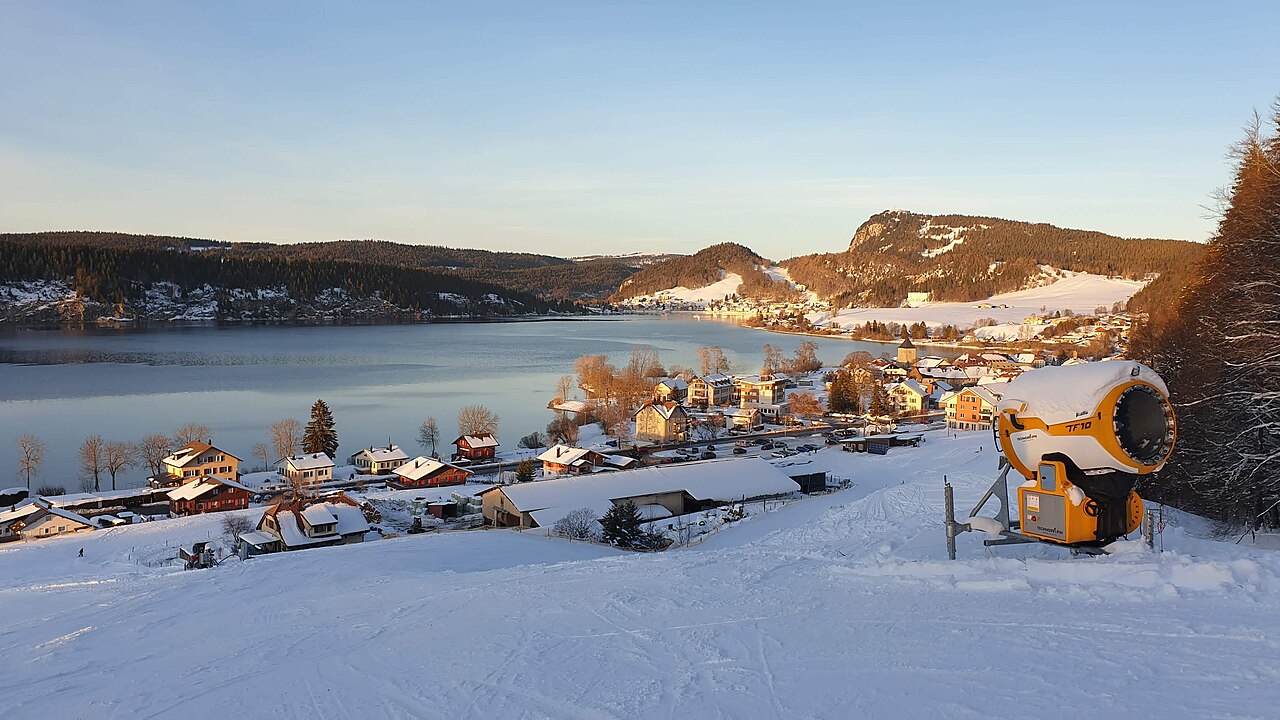
L'Abbaye is a mapped downhill ski area in CH. Forecasts cover three real lift-station locations from approximately 1011 to 1435 metres. Elevations are terrain-model estimates.
Data: OpenSkiData / OpenSkiMap, OpenStreetMap contributors (ODbL), Skimap.org, Who's On First, Mapterhorn.
Preparing forecast graphs…
Times and values match the detailed forecast. Tap or point at a value for details. Scroll each chart sideways for later days. Rain / precipitation is the total water equivalent per forecast interval, including snow; snowfall is fresh snow per interval, not snow depth.
GFS and ECMWF model comparison. Each model retains its own forecast times and horizon. Precipitation and snowfall amounts cover their own forecast intervals; these can differ between models.
Forecast values and model notes
L'Abbaye - Middle lift station
ECMWF · Model run: Next update expected:
Day Time (UTC) Temp. (°C) Humidity (%) Wind (km/h) Wind (knots) Wind (Bft) Direction Precip. (mm) Snow (cm) Pressure (hPa) Freezing (m) Conditions | Thursday, 05/11 06:00 4.8 60 8 4 2B E — — 1022 2568 Cloudy 78% cloud 09:00 6.2 62 4 2 1B SE 0.06 0 1024 2628 Clear 17% cloud 12:00 8.6 55 6 3 2B SE 0.00 0 1022 2666 Partly cloudy 30% cloud 15:00 8.3 66 4 2 1B W 0 0 1022 2653 Cloudy 52% cloud 18:00 6.8 67 5 3 1B N 0 0 1022 2666 Overcast 90% cloud 21:00 5.3 72 3 2 1B N 0.02 0 1023 2514 Cloudy 67% cloud Friday, 06/11 00:00 5.2 72 3 2 1B NW 0.05 0 1023 2466 Overcast 99% cloud 03:00 5.2 74 2 1 1B N 0.13 0 1022 2385 Overcast 100% cloud 06:00 4.5 79 4 2 1B N 0.21 0 1022 2277 Cloudy 76% cloud 09:00 5.1 79 6 3 2B NE 0.13 0 1023 2180 Cloudy 68% cloud 12:00 5.7 79 5 3 1B N 0.02 0 1022 2123 Overcast 86% cloud 15:00 4.8 89 9 5 2B N 0.20 0 1022 2004 Overcast 100% cloud 18:00 3.8 95 7 4 2B NE 0.09 0 1023 1938 Overcast 93% cloud 21:00 3.7 92 4 2 1B NE 0.08 0 1024 1942 Overcast 96% cloud Saturday, 07/11 00:00 3 92 2 1 1B N 0 0 1024 1931 Cloudy 74% cloud 03:00 3 90 2 1 1B N 0 0 1023 1920 Partly cloudy 49% cloud 06:00 2.7 90 3 2 1B NE 0.04 0 1024 1902 Cloudy 56% cloud 09:00 3.9 89 5 3 1B NE 0 0 1024 1888 Partly cloudy 42% cloud 12:00 5.2 82 5 3 1B E 0.07 0 1023 2053 Cloudy 65% cloud 15:00 5.2 81 3 2 1B E 0.09 0 1023 2088 Cloudy 62% cloud 18:00 3.6 86 6 3 1B SE 0 0 1024 2029 Partly cloudy 39% cloud 21:00 3.5 78 11 6 2B S 0 0 1024 2123 Partly cloudy 26% cloud Sunday, 08/11 00:00 3.1 77 17 9 3B SW 0 0 1024 2136 Partly cloudy 24% cloud 03:00 2.6 85 20 11 4B SW 0 0 1024 2066 Partly cloudy 35% cloud 06:00 3.1 77 16 9 3B SW 0 0 1024 2196 Cloudy 61% cloud 09:00 4.7 75 20 11 3B SW 0 0 1025 2134 Cloudy 63% cloud 12:00 6.1 72 22 12 4B SW 0 0 1023 2197 Partly cloudy 36% cloud 15:00 6.4 75 19 10 3B SW 0 0 1022 2265 Overcast 92% cloud 18:00 5.7 81 25 14 4B SW 0.05 0 1022 2277 Overcast 82% cloud 21:00 5.7 82 24 13 4B SW 0.46 0 1022 2341 Overcast 98% cloud Monday, 09/11 00:00 6 84 27 15 4B SW 1.2 0 1021 2411 Overcast 100% cloud 03:00 6.4 84 30 16 5B SW 0 0 1020 2519 Overcast 100% cloud 06:00 6.9 81 31 17 5B SW 0.02 0 1019 2568 Overcast 100% cloud 09:00 8.3 76 34 19 5B SW 0.15 0 1018 2721 Overcast 97% cloud 12:00 8.6 80 37 20 5B SW 0.40 0 1017 2791 Overcast 99% cloud 15:00 8.8 85 38 20 5B SW 0.77 0 1015 2842 Overcast 91% cloud 18:00 8.7 85 40 21 6B SW 0.02 0 1015 2919 Overcast 90% cloud 21:00 9 82 40 21 6B SW 0.02 0 1015 2868 Overcast 98% cloud Tuesday, 10/11 00:00 8.7 87 38 20 5B SW 0.62 0 1014 2802 Overcast 100% cloud 03:00 8.5 90 29 16 5B SW 1.1 0 1013 2871 Overcast 100% cloud 06:00 8.4 88 19 10 3B SW 4.0 0 1013 2881 Overcast 100% cloud 09:00 8.5 92 25 13 4B SW 0.68 0 1013 2950 Overcast 100% cloud 12:00 9.6 89 20 11 3B SW 0.83 0 1012 2952 Overcast 85% cloud 15:00 9.7 89 13 7 3B SW 0.24 0 1012 2939 Cloudy 59% cloud 18:00 8.5 91 11 6 2B SW 0.04 0 1013 2956 Overcast 97% cloud 21:00 8.6 87 10 6 2B SW 0 0 1013 2983 Cloudy 61% cloud Wednesday, 11/11 00:00 8.4 87 10 5 2B SW 0 0 1012 2989 Partly cloudy 28% cloud 03:00 8.1 89 11 6 2B SW 0 0 1012 2939 Cloudy 70% cloud 06:00 8.2 88 15 8 3B S 0 0 1012 2939 Overcast 81% cloud |
|---|
Forecast notes
Forecast table times: UTC.
Coordinates: 46.6379237°N, 6.3252616°E · Requested elevation: 1248 m. Model terrain: 881 m. Terrain and 1000/925/850/700 hPa profiles are used for height estimates.
These are altitude estimates, not a simulation of local mountain terrain. Precipitation, cloud and sea-level pressure use horizontal interpolation only.
Precipitation includes rain and snow water equivalent: preceding 3 hours through day 6, then 6 hours (see cell tooltip). Snow (cm) estimates fresh snowfall from precipitation and temperature using the GFS conversion; it is not snow depth on the ground. Freezing (m) uses additional 600/500 hPa temperatures when available and estimates the lowest resolved 0°C crossing above sea level. When all sampled levels are warm, the upper profile limit is shown (see tooltip). < marks an entirely cold sampled profile and its lower height limit. No extrapolation is used.
Preparing forecast graphs…
Times and values match the detailed forecast. Tap or point at a value for details. Scroll each chart sideways for later days. Rain / precipitation is the total water equivalent per forecast interval, including snow; snowfall is fresh snow per interval, not snow depth.
GFS and ECMWF model comparison. Each model retains its own forecast times and horizon. Precipitation and snowfall amounts cover their own forecast intervals; these can differ between models.
Forecast values and model notes
L'Abbaye - Top lift station
ECMWF · Model run: Next update expected:
Day Time (UTC) Temp. (°C) Humidity (%) Wind (km/h) Wind (knots) Wind (Bft) Direction Precip. (mm) Snow (cm) Pressure (hPa) Freezing (m) Conditions | Thursday, 05/11 06:00 5.9 49 10 6 2B E — — 1022 2567 Cloudy 79% cloud 09:00 5.9 56 7 4 2B SE 0.06 0 1024 2629 Clear 17% cloud 12:00 7.8 49 8 4 2B SE 0.00 0 1022 2667 Partly cloudy 31% cloud 15:00 7.4 63 5 3 1B W 0 0 1022 2655 Partly cloudy 50% cloud 18:00 6.9 58 7 4 2B N 0 0 1022 2665 Overcast 90% cloud 21:00 5.5 63 4 2 1B N 0.02 0 1023 2515 Cloudy 67% cloud Friday, 06/11 00:00 5.3 65 4 2 1B NW 0.06 0 1023 2466 Overcast 99% cloud 03:00 4.9 71 3 2 1B N 0.14 0 1022 2384 Overcast 100% cloud 06:00 4.2 77 5 3 1B N 0.22 0 1022 2277 Cloudy 76% cloud 09:00 4 78 7 4 2B NE 0.14 0 1023 2181 Cloudy 67% cloud 12:00 4.1 83 6 3 2B N 0.02 0 1022 2124 Overcast 85% cloud 15:00 3.4 91 11 6 2B N 0.20 0 1022 2004 Overcast 99% cloud 18:00 2.7 94 10 5 2B NE 0.08 0 1023 1939 Overcast 93% cloud 21:00 2.8 90 7 4 2B NE 0.08 0 1024 1941 Overcast 96% cloud Saturday, 07/11 00:00 2.5 91 4 2 1B NE 0 0 1024 1932 Cloudy 74% cloud 03:00 2.6 88 4 2 1B NE 0 0 1023 1921 Partly cloudy 49% cloud 06:00 2.3 88 5 3 1B NE 0.04 0 1024 1902 Cloudy 55% cloud 09:00 2.5 89 7 4 2B E 0 0 1024 1888 Partly cloudy 41% cloud 12:00 3.4 86 6 3 1B E 0.06 0 1023 2052 Cloudy 63% cloud 15:00 3.7 84 3 2 1B E 0.08 0 1023 2091 Cloudy 59% cloud 18:00 2.9 83 8 4 2B SE 0 0 1024 2030 Partly cloudy 39% cloud 21:00 3.4 71 17 9 3B S 0 0 1024 2123 Partly cloudy 27% cloud Sunday, 08/11 00:00 3.3 70 25 14 4B SW 0 0 1024 2137 Partly cloudy 26% cloud 03:00 2.8 81 29 16 5B SW 0 0 1024 2066 Partly cloudy 36% cloud 06:00 3.3 69 24 13 4B SW 0 0 1024 2196 Cloudy 63% cloud 09:00 3.6 70 28 15 4B SW 0 0 1025 2134 Cloudy 63% cloud 12:00 4.4 74 30 16 5B SW 0 0 1023 2197 Partly cloudy 36% cloud 15:00 5 77 27 14 4B SW 0 0 1022 2266 Overcast 92% cloud 18:00 5.1 80 35 19 5B SW 0.04 0 1022 2278 Overcast 82% cloud 21:00 5.4 79 34 18 5B SW 0.42 0 1022 2341 Overcast 98% cloud Monday, 09/11 00:00 5.6 81 39 21 6B SW 1.1 0 1021 2412 Overcast 100% cloud 03:00 5.9 82 43 23 6B SW 0 0 1020 2520 Overcast 100% cloud 06:00 6.7 80 43 23 6B SW 0.02 0 1019 2569 Overcast 100% cloud 09:00 7.5 77 47 26 6B SW 0.15 0 1018 2721 Overcast 97% cloud 12:00 7.9 77 50 27 6B SW 0.38 0 1017 2791 Overcast 98% cloud 15:00 8 85 52 28 7B SW 0.77 0 1015 2841 Overcast 91% cloud 18:00 8.2 85 54 29 7B SW 0.02 0 1015 2917 Overcast 90% cloud 21:00 8.4 81 54 29 7B SW 0.02 0 1015 2867 Overcast 98% cloud Tuesday, 10/11 00:00 8.2 84 52 28 7B SW 0.61 0 1015 2801 Overcast 100% cloud 03:00 8.1 87 41 22 6B SW 1.1 0 1013 2870 Overcast 100% cloud 06:00 8 86 28 15 4B SW 3.9 0 1013 2883 Overcast 100% cloud 09:00 7.8 91 35 19 5B SW 0.67 0 1013 2950 Overcast 100% cloud 12:00 8.3 91 27 15 4B SW 0.87 0 1013 2952 Overcast 83% cloud 15:00 8.7 90 19 10 3B SW 0.24 0 1012 2940 Cloudy 58% cloud 18:00 8.7 89 17 9 3B SW 0.04 0 1013 2956 Overcast 97% cloud 21:00 9.3 83 15 8 3B SW 0 0 1013 2984 Cloudy 62% cloud Wednesday, 11/11 00:00 9.1 84 15 8 3B SW 0 0 1013 2991 Partly cloudy 29% cloud 03:00 8.7 85 17 9 3B SW 0 0 1012 2939 Cloudy 70% cloud 06:00 8.8 84 22 12 4B SW 0 0 1012 2940 Overcast 82% cloud |
|---|
Forecast notes
Forecast table times: UTC.
Coordinates: 46.6296472°N, 6.3323265°E · Requested elevation: 1435 m. Model terrain: 861 m. Terrain and 1000/925/850/700 hPa profiles are used for height estimates.
These are altitude estimates, not a simulation of local mountain terrain. Precipitation, cloud and sea-level pressure use horizontal interpolation only.
Precipitation includes rain and snow water equivalent: preceding 3 hours through day 6, then 6 hours (see cell tooltip). Snow (cm) estimates fresh snowfall from precipitation and temperature using the GFS conversion; it is not snow depth on the ground. Freezing (m) uses additional 600/500 hPa temperatures when available and estimates the lowest resolved 0°C crossing above sea level. When all sampled levels are warm, the upper profile limit is shown (see tooltip). < marks an entirely cold sampled profile and its lower height limit. No extrapolation is used.