Worldwide Ski Resort Forecasts

More
Colour guide Temperature · Wind · Rain · Snow
Each colour starts at the value shown. Wind colours match across all three units. Dry cells stay neutral. Colours describe the displayed values, not official weather warnings.
Preparing forecast graphs…
Times and values match the detailed forecast. Tap or point at a value for details. Scroll each chart sideways for later days. Rain / precipitation is the total water equivalent per forecast interval, including snow; snowfall is fresh snow per interval, not snow depth.
GFS and ECMWF model comparison. Each model retains its own forecast times and horizon. Precipitation and snowfall amounts cover their own forecast intervals; these can differ between models.
Forecast values and model notes
Strallegg - Base lift station
ECMWF · Model run: Next update expected:
Day Time (UTC) Temp. (°C) Humidity (%) Wind (km/h) Wind (knots) Wind (Bft) Direction Precip. (mm) Snow (cm) Pressure (hPa) Freezing (m) Conditions | Thursday, 05/11 06:00 3.1 90 5 2 1B S — — 1032 1324 Overcast 100% cloud  09:00 4 85 8 4 2B S 0.04 0 1033 1449 Overcast 100% cloud 12:00 5.7 74 9 5 2B S 0.00 0 1031 2280 Overcast 96% cloud 15:00 5.4 75 6 3 2B S 0 0 1029 2781 Cloudy 54% cloud  18:00 2.7 87 3 2 1B S 0 0 1030 2909 Cloudy 77% cloud 21:00 3.3 89 4 2 1B SW 0.05 0 1030 2904 Overcast 96% cloud Friday, 06/11 00:00 2.3 91 2 1 1B SW 0 0 1029 3099 Overcast 82% cloud 03:00 1.3 91 1 1 1B W 0 0 1027 956 Overcast 80% cloud 06:00 0.4 91 1 1 1B NW 0 0 1026 1039 Overcast 87% cloud 09:00 6.2 72 4 2 1B S 0 0 1027 2907 Clear 11% cloud  12:00 9.4 56 7 4 2B S 0 0 1025 2835 Clear 2% cloud 15:00 6.3 69 3 2 1B SE 0 0 1025 2803 Clear 1% cloud 18:00 1.7 85 1 1 1B SE 0 0 1026 2673 Clear 0% cloud 21:00 0.7 84 1 0 0B SE 0 0 1027 1074 Clear 0% cloud Saturday, 07/11 00:00 -0.1 85 2 1 1B SE 0 0 1028 1261 Partly cloudy 41% cloud  03:00 -0.2 85 2 1 1B SE 0 0 1028 1375 Partly cloudy 41% cloud 06:00 -0.4 89 2 1 1B SW 0 0 1029 1383 Partly cloudy 46% cloud 09:00 4.6 65 4 2 1B SW 0 0 1030 1991 Clear 10% cloud 12:00 7.7 47 6 3 2B S 0 0 1028 1759 Clear 0% cloud 15:00 4.2 63 3 2 1B S 0 0 1028 2043 Clear 0% cloud 18:00 0.1 76 2 1 1B S 0 0 1029 1158 Clear 0% cloud 21:00 -0.5 78 1 1 1B SW 0 0 1030 1201 Clear 0% cloud Sunday, 08/11 00:00 -0.9 78 2 1 1B NW 0 0 1029 1186 Clear 1% cloud 03:00 -1.2 74 2 1 1B NW 0 0 1028 1190 Clear 4% cloud 06:00 -1.1 66 1 1 1B W 0 0 1028 1182 Clear 14% cloud 09:00 5.5 43 4 2 1B S 0 0 1029 2281 Clear 1% cloud 12:00 8 34 7 4 2B S 0 0 1026 2240 Partly cloudy 26% cloud 15:00 2.6 62 3 2 1B S 0 0 1027 2236 Clear 1% cloud 18:00 -0.2 77 1 1 1B W 0 0 1028 1141 Cloudy 57% cloud 21:00 0.5 78 1 1 1B W 0 0 1027 1099 Cloudy 62% cloud Monday, 09/11 00:00 -0.2 78 2 1 1B W 0 0 1026 1154 Clear 5% cloud 03:00 -0.8 80 2 1 1B NW 0 0 1025 1170 Clear 0% cloud 06:00 -0.7 78 2 1 1B NW 0 0 1024 1151 Clear 0% cloud 09:00 7.2 48 3 2 1B SW 0 0 1024 2132 Clear 0% cloud 12:00 10 44 6 3 2B S 0 0 1021 2226 Clear 0% cloud 15:00 4.3 75 4 2 1B S 0 0 1021 2270 Partly cloudy 33% cloud 18:00 1 84 1 1 1B S 0 0 1020 996 Cloudy 61% cloud 21:00 2.4 83 2 1 1B W 0 0 1018 2434 Overcast 91% cloud Tuesday, 10/11 00:00 2 84 5 3 1B NW 0 0 1017 2493 Overcast 100% cloud 03:00 2.1 87 4 2 1B NW 0.20 0 1016 2508 Overcast 98% cloud 06:00 2.1 87 3 2 1B NW 1.9 0 1016 2409 Overcast 92% cloud 09:00 4.9 89 4 2 1B NW 0.34 0 1015 2408 Overcast 99% cloud 12:00 5.6 87 5 3 1B NW 0.56 0 1014 2386 Overcast 100% cloud 15:00 5.9 88 4 2 1B NW 0.21 0 1014 2213 Overcast 99% cloud 18:00 5.3 90 4 2 1B N 0.03 0 1016 2029 Overcast 98% cloud 21:00 4.9 92 3 1 1B NW 0 0 1017 1926 Overcast 83% cloud Wednesday, 11/11 00:00 3.8 93 2 1 1B NW 0 0 1018 2015 Overcast 87% cloud 03:00 3.9 93 2 1 1B SW 0 0 1018 2202 Overcast 100% cloud 06:00 3.6 93 4 2 1B SW 0 0 1019 2305 Overcast 100% cloud |
|---|
Forecast notes
Forecast table times: UTC.
Coordinates: 47.4408945°N, 15.7040781°E · Requested elevation: 688 m. Model terrain: 943 m. Terrain and 1000/925/850/700 hPa profiles are used for height estimates.
Outside the available profile, temperature uses an estimated 5.5°C/km height correction; wind retains the nearest available model-level value. Humidity is estimated with adjusted pressure and temperature.
These are altitude estimates, not a simulation of local mountain terrain. Precipitation, cloud and sea-level pressure use horizontal interpolation only.
Precipitation includes rain and snow water equivalent: preceding 3 hours through day 6, then 6 hours (see cell tooltip). Snow (cm) estimates fresh snowfall from precipitation and temperature using the GFS conversion; it is not snow depth on the ground. Freezing (m) uses additional 600/500 hPa temperatures when available and estimates the lowest resolved 0°C crossing above sea level. When all sampled levels are warm, the upper profile limit is shown (see tooltip). < marks an entirely cold sampled profile and its lower height limit. No extrapolation is used.
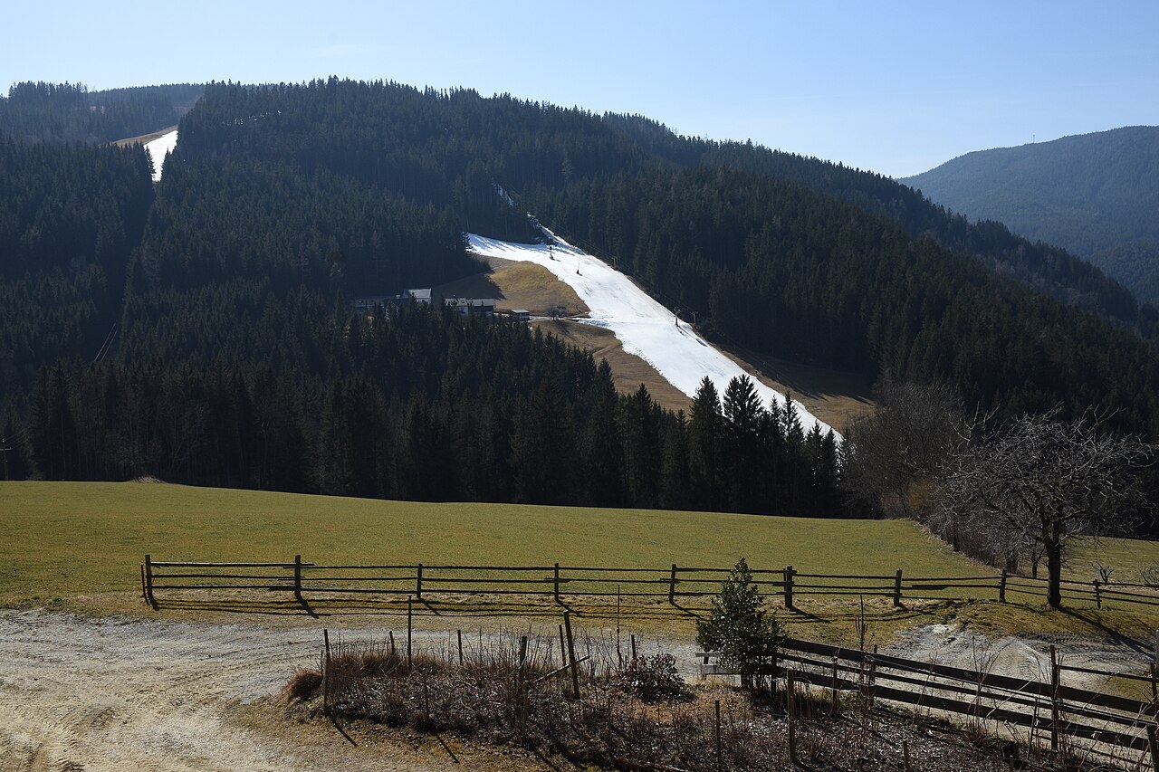
Strallegg is a mapped downhill ski area in AT. Forecasts cover three real lift-station locations from approximately 688 to 990 metres. Elevations are terrain-model estimates.
Data: OpenSkiData / OpenSkiMap, OpenStreetMap contributors (ODbL), Skimap.org, Who's On First, Mapterhorn.
Preparing forecast graphs…
Times and values match the detailed forecast. Tap or point at a value for details. Scroll each chart sideways for later days. Rain / precipitation is the total water equivalent per forecast interval, including snow; snowfall is fresh snow per interval, not snow depth.
GFS and ECMWF model comparison. Each model retains its own forecast times and horizon. Precipitation and snowfall amounts cover their own forecast intervals; these can differ between models.
Forecast values and model notes
Strallegg - Middle lift station
ECMWF · Model run: Next update expected:
Day Time (UTC) Temp. (°C) Humidity (%) Wind (km/h) Wind (knots) Wind (Bft) Direction Precip. (mm) Snow (cm) Pressure (hPa) Freezing (m) Conditions | Thursday, 05/11 06:00 1.9 96 5 2 1B S — — 1032 1322 Overcast 100% cloud 09:00 2.7 90 8 4 2B S 0.04 0 1033 1444 Overcast 100% cloud 12:00 4.4 79 9 5 2B S 0.00 0 1031 2273 Overcast 96% cloud 15:00 4.1 79 6 3 2B S 0 0 1029 2780 Cloudy 54% cloud 18:00 1.5 93 3 2 1B S 0 0 1030 2904 Cloudy 77% cloud 21:00 2.1 95 4 2 1B SW 0.05 0 1030 2903 Overcast 96% cloud Friday, 06/11 00:00 1 97 2 1 1B SW 0 0 1029 3100 Cloudy 80% cloud 03:00 0 97 1 1 1B W 0 0 1027 943 Cloudy 78% cloud 06:00 -0.9 97 1 1 1B NW 0 0 1026 1031 Overcast 86% cloud 09:00 4.9 76 4 2 1B S 0 0 1027 2906 Clear 11% cloud 12:00 8.1 60 7 4 2B S 0 0 1025 2836 Clear 3% cloud 15:00 5 73 3 2 1B SE 0 0 1025 2803 Clear 1% cloud 18:00 0.4 90 1 1 1B SE 0 0 1026 2671 Clear 0% cloud 21:00 -0.6 89 1 0 0B SE 0 0 1027 1056 Clear 0% cloud Saturday, 07/11 00:00 -1.4 90 2 1 1B SE 0 0 1028 1248 Partly cloudy 40% cloud 03:00 -1.4 91 2 1 1B SE 0 0 1028 1369 Partly cloudy 40% cloud 06:00 -1.6 95 1 1 1B SW 0 0 1029 1379 Partly cloudy 45% cloud 09:00 3.3 69 4 2 1B SW 0 0 1030 1986 Clear 10% cloud 12:00 6.4 50 6 3 2B S 0 0 1028 1757 Clear 0% cloud 15:00 2.9 67 3 2 1B S 0 0 1028 2042 Clear 0% cloud 18:00 -1.1 81 2 1 1B S 0 0 1029 1143 Clear 0% cloud 21:00 -1.7 83 1 1 1B SW 0 0 1030 1192 Clear 0% cloud Sunday, 08/11 00:00 -2.2 84 2 1 1B NW 0 0 1029 1177 Clear 1% cloud 03:00 -2.6 80 2 1 1B NW 0 0 1028 1183 Clear 5% cloud 06:00 -2.4 72 1 1 1B W 0 0 1028 1177 Clear 15% cloud 09:00 4.1 47 4 2 1B S 0 0 1029 2279 Clear 1% cloud 12:00 6.6 36 7 4 2B S 0 0 1026 2240 Partly cloudy 26% cloud 15:00 1.3 67 3 2 1B S 0 0 1027 2235 Clear 1% cloud 18:00 -1.4 82 1 1 1B W 0 0 1028 1129 Cloudy 58% cloud 21:00 -0.7 83 1 1 1B W 0 0 1027 1087 Cloudy 61% cloud Monday, 09/11 00:00 -1.5 84 2 1 1B W 0 0 1026 1145 Clear 6% cloud 03:00 -2.1 86 2 1 1B NW 0 0 1025 1163 Clear 0% cloud 06:00 -2 83 2 1 1B NW 0 0 1025 1144 Clear 0% cloud 09:00 5.8 51 3 1 1B SW 0 0 1024 2133 Clear 0% cloud 12:00 8.7 47 6 3 2B S 0 0 1021 2226 Clear 0% cloud 15:00 3.1 79 4 2 1B S 0 0 1021 2270 Partly cloudy 33% cloud 18:00 -0.3 90 1 1 1B S 0 0 1020 977 Cloudy 61% cloud 21:00 1.1 88 2 1 1B W 0 0 1018 2436 Overcast 91% cloud Tuesday, 10/11 00:00 0.7 90 5 3 1B NW 0 0 1017 2495 Overcast 100% cloud 03:00 0.8 92 4 2 1B NW 0.19 0 1016 2509 Overcast 98% cloud 06:00 0.8 92 3 2 1B NW 1.9 0.6 1016 2412 Overcast 92% cloud 09:00 3.7 95 4 2 1B NW 0.35 0 1015 2410 Overcast 99% cloud 12:00 4.4 92 5 3 1B NW 0.54 0 1014 2389 Overcast 100% cloud 15:00 4.6 93 4 2 1B NW 0.21 0 1014 2217 Overcast 99% cloud 18:00 4.1 96 4 2 1B N 0.03 0 1016 2034 Overcast 98% cloud 21:00 3.6 98 3 1 1B NW 0 0 1017 1929 Overcast 84% cloud Wednesday, 11/11 00:00 2.5 99 2 1 1B NW 0 0 1018 2020 Overcast 86% cloud 03:00 2.6 99 2 1 1B SW 0 0 1018 2205 Overcast 100% cloud 06:00 2.3 100 4 2 1B SW 0 0 1019 2306 Overcast 100% cloud |
|---|
Forecast notes
Forecast table times: UTC.
Coordinates: 47.4349519°N, 15.7024876°E · Requested elevation: 919 m. Model terrain: 933 m. Terrain and 1000/925/850/700 hPa profiles are used for height estimates.
Outside the available profile, temperature uses an estimated 5.5°C/km height correction; wind retains the nearest available model-level value. Humidity is estimated with adjusted pressure and temperature.
These are altitude estimates, not a simulation of local mountain terrain. Precipitation, cloud and sea-level pressure use horizontal interpolation only.
Precipitation includes rain and snow water equivalent: preceding 3 hours through day 6, then 6 hours (see cell tooltip). Snow (cm) estimates fresh snowfall from precipitation and temperature using the GFS conversion; it is not snow depth on the ground. Freezing (m) uses additional 600/500 hPa temperatures when available and estimates the lowest resolved 0°C crossing above sea level. When all sampled levels are warm, the upper profile limit is shown (see tooltip). < marks an entirely cold sampled profile and its lower height limit. No extrapolation is used.
Preparing forecast graphs…
Times and values match the detailed forecast. Tap or point at a value for details. Scroll each chart sideways for later days. Rain / precipitation is the total water equivalent per forecast interval, including snow; snowfall is fresh snow per interval, not snow depth.
GFS and ECMWF model comparison. Each model retains its own forecast times and horizon. Precipitation and snowfall amounts cover their own forecast intervals; these can differ between models.
Forecast values and model notes
Strallegg - Top lift station
ECMWF · Model run: Next update expected:
Day Time (UTC) Temp. (°C) Humidity (%) Wind (km/h) Wind (knots) Wind (Bft) Direction Precip. (mm) Snow (cm) Pressure (hPa) Freezing (m) Conditions | Thursday, 05/11 06:00 1.5 96 6 3 2B S — — 1032 1322 Overcast 100% cloud 09:00 2.3 90 9 5 2B S 0.04 0 1033 1441 Overcast 100% cloud 12:00 4 78 9 5 2B SW 0.00 0 1031 2270 Overcast 96% cloud 15:00 3.9 77 7 4 2B S 0 0 1029 2779 Cloudy 55% cloud 18:00 1.6 89 4 2 1B S 0 0 1030 2901 Cloudy 78% cloud 21:00 2.2 90 5 3 1B SW 0.05 0 1030 2903 Overcast 95% cloud Friday, 06/11 00:00 1.2 91 4 2 1B SW 0 0 1029 3099 Cloudy 79% cloud 03:00 0.5 89 3 1 1B SW 0 0 1027 937 Cloudy 77% cloud 06:00 -0.4 89 2 1 1B SW 0 0 1026 1027 Overcast 85% cloud 09:00 4.8 73 5 3 1B S 0 0 1027 2906 Clear 11% cloud 12:00 7.5 60 7 4 2B S 0 0 1025 2836 Clear 3% cloud 15:00 4.8 71 4 2 1B SE 0 0 1025 2804 Clear 1% cloud 18:00 0.6 86 3 2 1B SE 0 0 1026 2670 Clear 0% cloud 21:00 -0.3 84 3 2 1B SE 0 0 1027 1045 Clear 0% cloud Saturday, 07/11 00:00 -1.1 85 4 2 1B S 0 0 1028 1238 Partly cloudy 39% cloud 03:00 -1.2 84 4 2 1B S 0 0 1028 1363 Partly cloudy 39% cloud 06:00 -1.4 87 4 2 1B S 0 0 1029 1375 Partly cloudy 44% cloud 09:00 3.1 67 6 3 2B S 0 0 1030 1985 Clear 10% cloud 12:00 5.7 50 7 4 2B S 0 0 1028 1756 Clear 0% cloud 15:00 2.7 62 4 2 1B S 0 0 1028 2042 Clear 0% cloud 18:00 -0.8 71 4 2 1B S 0 0 1029 1133 Clear 0% cloud 21:00 -1.3 73 4 2 1B S 0 0 1030 1185 Clear 0% cloud Sunday, 08/11 00:00 -1.7 73 3 1 1B SW 0 0 1029 1171 Clear 1% cloud 03:00 -2 69 2 1 1B SW 0 0 1028 1179 Clear 5% cloud 06:00 -1.8 63 3 1 1B SW 0 0 1028 1173 Clear 15% cloud 09:00 4 43 6 3 2B S 0 0 1029 2279 Clear 1% cloud 12:00 6.2 35 8 5 2B S 0 0 1026 2240 Partly cloudy 25% cloud 15:00 1.5 63 5 2 1B S 0 0 1027 2234 Clear 1% cloud 18:00 -1 78 3 2 1B SW 0 0 1028 1122 Cloudy 59% cloud 21:00 -0.5 81 3 2 1B SW 0 0 1027 1079 Cloudy 61% cloud Monday, 09/11 00:00 -1.1 80 3 2 1B W 0 0 1026 1140 Clear 6% cloud 03:00 -1.6 81 3 1 1B NW 0 0 1025 1159 Clear 0% cloud 06:00 -1.5 78 2 1 1B NW 0 0 1025 1140 Clear 0% cloud 09:00 5.5 51 3 2 1B SW 0 0 1024 2133 Clear 0% cloud 12:00 8.1 47 7 4 2B S 0 0 1021 2227 Clear 0% cloud 15:00 3.2 76 5 3 1B S 0 0 1021 2271 Partly cloudy 33% cloud 18:00 0.2 85 4 2 1B SW 0 0 1020 966 Cloudy 60% cloud 21:00 1.4 85 5 3 1B W 0 0 1018 2438 Overcast 91% cloud Tuesday, 10/11 00:00 1.1 84 7 4 2B NW 0 0 1017 2496 Overcast 100% cloud 03:00 1.3 88 4 2 1B NW 0.19 0 1016 2510 Overcast 98% cloud 06:00 1.3 89 3 2 1B NW 1.9 0 1016 2413 Overcast 92% cloud 09:00 3.8 92 5 3 1B NW 0.35 0 1015 2412 Overcast 99% cloud 12:00 4.5 90 6 3 2B NW 0.53 0 1014 2391 Overcast 100% cloud 15:00 4.6 92 4 2 1B NW 0.21 0 1014 2220 Overcast 99% cloud 18:00 3.9 95 5 3 1B N 0.03 0 1016 2037 Overcast 98% cloud 21:00 3.4 98 4 2 1B NW 0 0 1017 1931 Overcast 84% cloud Wednesday, 11/11 00:00 2.3 99 3 2 1B NW 0 0 1018 2023 Overcast 85% cloud 03:00 2.5 98 4 2 1B W 0 0 1018 2207 Overcast 100% cloud 06:00 2.3 99 5 3 1B SW 0 0 1019 2308 Overcast 100% cloud |
|---|
Forecast notes
Forecast table times: UTC.
Coordinates: 47.4313721°N, 15.7031925°E · Requested elevation: 990 m. Model terrain: 927 m. Terrain and 1000/925/850/700 hPa profiles are used for height estimates.
These are altitude estimates, not a simulation of local mountain terrain. Precipitation, cloud and sea-level pressure use horizontal interpolation only.
Precipitation includes rain and snow water equivalent: preceding 3 hours through day 6, then 6 hours (see cell tooltip). Snow (cm) estimates fresh snowfall from precipitation and temperature using the GFS conversion; it is not snow depth on the ground. Freezing (m) uses additional 600/500 hPa temperatures when available and estimates the lowest resolved 0°C crossing above sea level. When all sampled levels are warm, the upper profile limit is shown (see tooltip). < marks an entirely cold sampled profile and its lower height limit. No extrapolation is used.