Lech am Arlberg - Flühen · Panorama/video

Provider panorama/video player. Capture time is shown by the camera.
Open camera page ↗
Each colour starts at the value shown. Wind colours match across all three units. Dry cells stay neutral. Colours describe the displayed values, not official weather warnings.
Preparing forecast graphs…
Times and values match the detailed forecast. Tap or point at a value for details. Scroll each chart sideways for later days. Rain / precipitation is the total water equivalent per forecast interval, including snow; snowfall is fresh snow per interval, not snow depth.
GFS and ECMWF model comparison. Each model retains its own forecast times and horizon. Precipitation and snowfall amounts cover their own forecast intervals; these can differ between models.
ECMWF · Model run: Next update expected:
Day Time (UTC) Temp. (°C) Humidity (%) Wind (km/h) Wind (knots) Wind (Bft) Direction Precip. (mm) Snow (cm) Pressure (hPa) Freezing (m) Conditions | Thursday, 05/11 06:00 -0.9 76 5 3 1B SE — — 1022 < 1807 Clear 10% cloud  09:00 8.3 47 4 2 1B SE 0 0 1023 3003 Clear 2% cloud 12:00 11.6 39 1 1 1B S 0 0 1021 3074 Clear 0% cloud 15:00 9.5 55 0 0 0B W 0 0 1021 3049 Clear 1% cloud 18:00 3.9 59 3 2 1B SE 0 0 1021 3064 Clear 1% cloud 21:00 2.4 61 3 2 1B SE 0 0 1021 3120 Clear 6% cloud Friday, 06/11 00:00 2.8 58 2 1 1B SE 0 0 1020 3113 Clear 2% cloud 03:00 3.5 53 1 0 0B SE 0 0 1019 3104 Partly cloudy 37% cloud  06:00 3.2 54 1 0 0B S 0 0 1019 2999 Overcast 91% cloud  09:00 7.8 46 2 1 1B NW 0 0 1020 3052 Overcast 95% cloud 12:00 6.7 59 5 3 1B NW 0 0 1020 2827 Overcast 99% cloud 15:00 4.1 80 3 1 1B NW 0.10 0 1021 2305 Overcast 97% cloud 18:00 2.6 88 1 1 1B W 0.46 0 1022 1994 Overcast 100% cloud 21:00 2.1 89 1 0 0B W 0.48 0 1023 1859 Overcast 100% cloud Saturday, 07/11 00:00 1.9 89 2 1 1B W 0.53 0 1024 < 1807 Overcast 100% cloud 03:00 1.7 88 0 0 0B SW 1.4 0 1023 < 1807 Overcast 100% cloud 06:00 1.6 89 0 0 0B NE 1.5 0 1024 < 1807 Overcast 100% cloud 09:00 2.7 84 0 0 0B SW 1.0 0 1025 1938 Overcast 100% cloud 12:00 4.8 70 0 0 0B E 0.05 0 1023 2219 Cloudy 79% cloud  15:00 4.1 75 3 2 1B N 0.06 0 1023 2155 Cloudy 68% cloud 18:00 1.3 86 2 1 1B SE 0 0 1024 < 1807 Partly cloudy 24% cloud 21:00 -1.2 81 2 1 1B SE 0 0 1024 < 1807 Clear 17% cloud Sunday, 08/11 00:00 -2.2 82 2 1 1B SE 0 0 1023 < 1807 Clear 20% cloud 03:00 -1.5 78 2 1 1B SE 0 0 1024 < 1807 Clear 19% cloud 06:00 -1.5 77 2 1 1B SE 0 0 1024 < 1807 Clear 16% cloud 09:00 4.8 59 2 1 1B SE 0 0 1024 2216 Clear 3% cloud 12:00 6.7 52 3 2 1B W 0 0 1022 2360 Clear 16% cloud 15:00 4.2 70 2 1 1B NW 0 0 1023 2144 Clear 4% cloud 18:00 -0.6 77 2 1 1B SE 0 0 1023 < 1807 Clear 0% cloud 21:00 -1.3 70 2 1 1B SE 0 0 1023 < 1807 Clear 0% cloud Monday, 09/11 00:00 -1.4 61 3 2 1B SE 0 0 1022 < 1807 Clear 18% cloud 03:00 -1.2 55 2 1 1B SE 0 0 1021 < 1807 Partly cloudy 43% cloud 06:00 0.5 56 3 2 1B SE 0 0 1020 < 1807 Overcast 91% cloud 09:00 4.1 54 5 3 1B SE 0.10 0 1020 2247 Overcast 89% cloud 12:00 7.9 39 4 2 1B SW 0 0 1017 2636 Overcast 93% cloud 15:00 5.6 55 3 1 1B SW 0.04 0 1015 2505 Overcast 99% cloud 18:00 3 80 5 3 1B S 0.99 0 1018 2167 Overcast 100% cloud 21:00 2.7 83 4 2 1B S 1.3 0 1018 2096 Overcast 100% cloud Tuesday, 10/11 00:00 2.7 83 6 3 1B S 2.0 0 1017 2119 Overcast 100% cloud 03:00 2.8 85 5 3 1B S 2.4 0 1016 2146 Overcast 100% cloud 06:00 3 87 7 4 2B S 3.7 0 1015 2207 Overcast 100% cloud 09:00 4.2 86 5 3 1B S 3.1 0 1015 2424 Overcast 100% cloud 12:00 4.9 87 3 2 1B SW 3.0 0 1015 2529 Overcast 100% cloud 15:00 4.3 88 3 2 1B SE 2.6 0 1015 2452 Overcast 100% cloud 18:00 4.2 84 2 1 1B SE 0.32 0 1014 2485 Overcast 99% cloud 21:00 5 79 2 1 1B S 0 0 1014 2495 Overcast 98% cloud Wednesday, 11/11 00:00 4 78 2 1 1B S 0 0 1013 2475 Partly cloudy 21% cloud 03:00 3.2 75 2 1 1B SE 0 0 1012 2490 Clear 12% cloud 06:00 3 74 2 1 1B SE 0 0 1012 2599 Clear 13% cloud |
|---|
Forecast table times: UTC.
Coordinates: 47.20773282°N, 10.14252663°E · Requested elevation: 1450 m. Model terrain: 1804 m. Terrain and 1000/925/850/700 hPa profiles are used for height estimates.
Outside the available profile, temperature uses an estimated 5.5°C/km height correction; wind retains the nearest available model-level value. Humidity is estimated with adjusted pressure and temperature.
These are altitude estimates, not a simulation of local mountain terrain. Precipitation, cloud and sea-level pressure use horizontal interpolation only.
Precipitation includes rain and snow water equivalent: preceding 3 hours through day 6, then 6 hours (see cell tooltip). Snow (cm) estimates fresh snowfall from precipitation and temperature using the GFS conversion; it is not snow depth on the ground. Freezing (m) uses additional 600/500 hPa temperatures when available and estimates the lowest resolved 0°C crossing above sea level. When all sampled levels are warm, the upper profile limit is shown (see tooltip). < marks an entirely cold sampled profile and its lower height limit. No extrapolation is used.
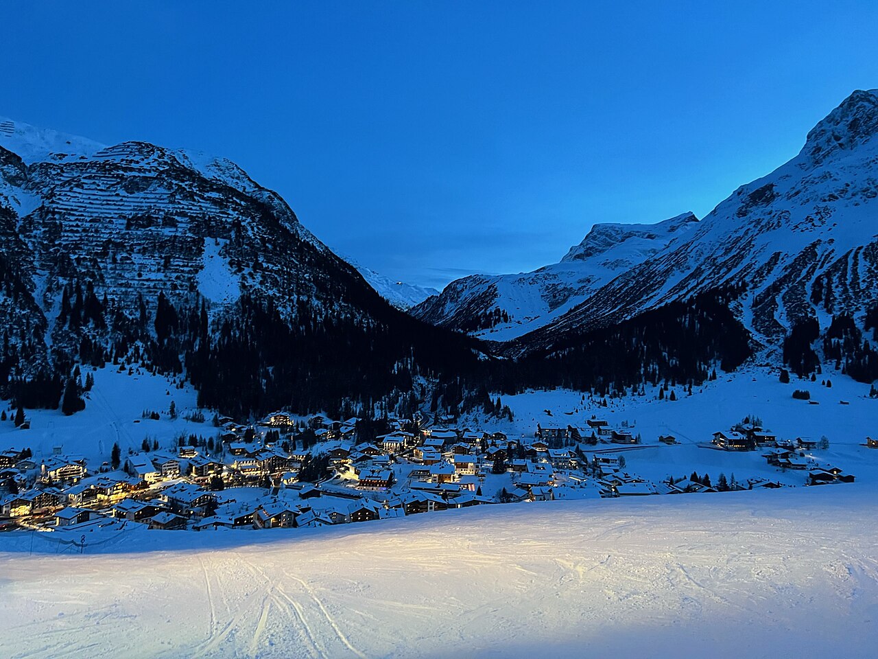
Provider panorama/video player. Capture time is shown by the camera.
Open camera page ↗
Provider panorama/video player. Capture time is shown by the camera.
Open camera page ↗
Provider panorama/video player. Capture time is shown by the camera.
Open camera page ↗Preparing forecast graphs…
Times and values match the detailed forecast. Tap or point at a value for details. Scroll each chart sideways for later days. Rain / precipitation is the total water equivalent per forecast interval, including snow; snowfall is fresh snow per interval, not snow depth.
GFS and ECMWF model comparison. Each model retains its own forecast times and horizon. Precipitation and snowfall amounts cover their own forecast intervals; these can differ between models.
ECMWF · Model run: Next update expected:
Day Time (UTC) Temp. (°C) Humidity (%) Wind (km/h) Wind (knots) Wind (Bft) Direction Precip. (mm) Snow (cm) Pressure (hPa) Freezing (m) Conditions | Thursday, 05/11 06:00 -2.7 78 6 3 2B S — — 1022 < 1825 Clear 10% cloud 09:00 5.6 51 5 3 1B S 0 0 1023 3003 Clear 2% cloud 12:00 8.5 42 3 2 1B S 0 0 1021 3075 Clear 0% cloud 15:00 6.7 59 1 1 1B S 0 0 1021 3049 Clear 1% cloud 18:00 1.7 62 4 2 1B S 0 0 1021 3062 Clear 1% cloud 21:00 0.3 64 3 2 1B S 0 0 1021 3120 Clear 5% cloud Friday, 06/11 00:00 0.7 61 3 1 1B S 0 0 1020 3113 Clear 2% cloud 03:00 1.4 57 2 1 1B SE 0 0 1019 3104 Partly cloudy 36% cloud 06:00 1.1 57 2 1 1B SE 0 0 1019 3005 Overcast 92% cloud 09:00 5.2 50 1 0 0B NE 0 0 1020 3054 Overcast 95% cloud 12:00 4.1 63 2 1 1B NW 0 0 1020 2832 Overcast 99% cloud 15:00 1.5 86 0 0 0B S 0.11 0 1021 2310 Overcast 97% cloud 18:00 0.2 95 2 1 1B S 0.44 0.1 1022 1996 Overcast 100% cloud 21:00 -0.3 97 2 1 1B S 0.46 0.1 1023 1859 Overcast 100% cloud Saturday, 07/11 00:00 -0.6 98 2 1 1B SW 0.54 0.2 1023 < 1825 Overcast 100% cloud 03:00 -0.8 97 1 1 0B SW 1.4 0.4 1023 < 1825 Overcast 100% cloud 06:00 -1 98 0 0 0B — 1.5 0.5 1024 < 1825 Overcast 100% cloud 09:00 -0 93 1 0 0B S 1.0 0.3 1025 1946 Overcast 100% cloud 12:00 1.9 79 1 1 1B SE 0.05 0 1023 2220 Overcast 80% cloud 15:00 1.3 83 1 1 0B NW 0.06 0 1023 2155 Cloudy 69% cloud 18:00 -1.2 92 2 1 1B S 0 0 1024 < 1825 Partly cloudy 24% cloud 21:00 -3.5 86 3 2 1B S 0 0 1024 < 1825 Clear 18% cloud Sunday, 08/11 00:00 -4.3 87 2 1 1B S 0 0 1023 < 1825 Partly cloudy 21% cloud 03:00 -3.8 84 2 1 1B S 0 0 1024 < 1825 Clear 19% cloud 06:00 -3.8 84 2 1 1B SE 0 0 1024 < 1825 Clear 16% cloud 09:00 1.8 66 2 1 1B SE 0 0 1024 2219 Clear 3% cloud 12:00 3.5 59 4 2 1B W 0 0 1022 2361 Clear 17% cloud 15:00 1.3 75 2 1 1B NW 0 0 1023 2142 Clear 4% cloud 18:00 -3 80 2 1 1B S 0 0 1023 < 1825 Clear 0% cloud 21:00 -3.7 74 2 1 1B SW 0 0 1023 < 1825 Clear 0% cloud Monday, 09/11 00:00 -3.8 68 3 2 1B SW 0 0 1022 < 1825 Clear 18% cloud 03:00 -3.6 62 3 2 1B SW 0 0 1021 < 1825 Partly cloudy 41% cloud 06:00 -1.9 63 4 2 1B S 0 0 1020 < 1825 Overcast 91% cloud 09:00 1.4 62 6 3 1B S 0.10 0 1020 2246 Overcast 89% cloud 12:00 4.9 45 8 5 2B SW 0 0 1017 2637 Overcast 93% cloud 15:00 2.9 63 7 4 2B SW 0.04 0 1015 2504 Overcast 99% cloud 18:00 0.6 89 9 5 2B SW 0.98 0.3 1018 2150 Overcast 100% cloud 21:00 0.3 92 7 4 2B SW 1.3 0.4 1018 2082 Overcast 100% cloud Tuesday, 10/11 00:00 0.4 92 8 4 2B SW 1.9 0.6 1017 2098 Overcast 100% cloud 03:00 0.5 94 7 4 2B SW 2.4 0.7 1016 2135 Overcast 100% cloud 06:00 0.7 96 7 4 2B SW 3.7 1.5 1015 2203 Overcast 100% cloud 09:00 1.7 95 6 3 1B SW 3.0 0 1015 2425 Overcast 100% cloud 12:00 2.3 96 6 3 2B SW 3.0 0 1015 2526 Overcast 100% cloud 15:00 1.8 97 3 1 1B SW 2.7 0 1015 2449 Overcast 100% cloud 18:00 1.8 93 3 1 1B SW 0.32 0 1014 2482 Overcast 99% cloud 21:00 2.4 88 2 1 1B SW 0 0 1014 2497 Overcast 99% cloud Wednesday, 11/11 00:00 1.5 86 1 1 1B SW 0 0 1013 2471 Partly cloudy 21% cloud 03:00 0.8 83 2 1 1B SW 0 0 1012 2454 Clear 13% cloud 06:00 0.7 80 2 1 1B SW 0 0 1012 2558 Clear 13% cloud |
|---|
Forecast table times: UTC.
Coordinates: 47.20464239°N, 10.15454292°E · Requested elevation: 1950 m. Model terrain: 1822 m. Terrain and 1000/925/850/700 hPa profiles are used for height estimates.
These are altitude estimates, not a simulation of local mountain terrain. Precipitation, cloud and sea-level pressure use horizontal interpolation only.
Precipitation includes rain and snow water equivalent: preceding 3 hours through day 6, then 6 hours (see cell tooltip). Snow (cm) estimates fresh snowfall from precipitation and temperature using the GFS conversion; it is not snow depth on the ground. Freezing (m) uses additional 600/500 hPa temperatures when available and estimates the lowest resolved 0°C crossing above sea level. When all sampled levels are warm, the upper profile limit is shown (see tooltip). < marks an entirely cold sampled profile and its lower height limit. No extrapolation is used.
Preparing forecast graphs…
Times and values match the detailed forecast. Tap or point at a value for details. Scroll each chart sideways for later days. Rain / precipitation is the total water equivalent per forecast interval, including snow; snowfall is fresh snow per interval, not snow depth.
GFS and ECMWF model comparison. Each model retains its own forecast times and horizon. Precipitation and snowfall amounts cover their own forecast intervals; these can differ between models.
ECMWF · Model run: Next update expected:
Day Time (UTC) Temp. (°C) Humidity (%) Wind (km/h) Wind (knots) Wind (Bft) Direction Precip. (mm) Snow (cm) Pressure (hPa) Freezing (m) Conditions | Thursday, 05/11 06:00 -2.2 55 12 6 2B S — — 1022 < 1874 Clear 12% cloud 09:00 2.9 45 11 6 2B S 0 0 1023 3001 Clear 1% cloud 12:00 4.7 41 9 5 2B S 0 0 1021 3074 Clear 0% cloud 15:00 3.6 51 6 3 2B S 0 0 1021 3050 Clear 1% cloud 18:00 0.8 52 7 4 2B S 0 0 1021 3052 Clear 0% cloud 21:00 0.1 55 5 3 1B S 0 0 1021 3120 Clear 5% cloud Friday, 06/11 00:00 0.4 52 5 3 1B S 0 0 1020 3113 Clear 2% cloud 03:00 0.7 50 5 3 1B SE 0 0 1019 3104 Partly cloudy 35% cloud 06:00 0.5 50 7 4 2B SE 0 0 1019 3009 Overcast 93% cloud 09:00 2.9 44 8 4 2B SE 0 0 1020 3056 Overcast 95% cloud 12:00 1.9 55 9 5 2B SE 0 0 1020 2840 Overcast 99% cloud 15:00 -0.6 79 12 6 2B SE 0.14 0 1021 2323 Overcast 96% cloud 18:00 -1.6 88 13 7 3B SE 0.42 0.1 1022 1998 Overcast 100% cloud 21:00 -2.2 95 8 4 2B S 0.43 0.1 1023 < 1874 Overcast 100% cloud Saturday, 07/11 00:00 -2.6 98 5 3 1B S 0.54 0.2 1023 < 1874 Overcast 100% cloud 03:00 -3 98 3 2 1B S 1.4 1.4 1023 < 1874 Overcast 100% cloud 06:00 -3.2 98 1 0 0B S 1.5 1.5 1024 < 1874 Overcast 100% cloud 09:00 -2.7 95 3 1 1B S 1.1 0.3 1025 1965 Overcast 100% cloud 12:00 -1.6 85 6 3 1B S 0.03 0 1023 2223 Overcast 83% cloud 15:00 -1.9 81 7 4 2B S 0.07 0 1023 2156 Cloudy 72% cloud 18:00 -3.2 82 7 4 2B S 0 0 1024 < 1874 Partly cloudy 22% cloud 21:00 -4.4 75 7 4 2B S 0 0 1024 < 1874 Partly cloudy 22% cloud Sunday, 08/11 00:00 -4.8 75 3 2 1B SW 0 0 1024 < 1874 Partly cloudy 24% cloud 03:00 -4.8 78 2 1 1B SW 0 0 1024 < 1874 Partly cloudy 21% cloud 06:00 -5.1 79 2 1 1B S 0 0 1024 < 1874 Clear 17% cloud 09:00 -1.6 67 5 3 1B S 0 0 1024 2222 Clear 3% cloud 12:00 -0.8 64 7 4 2B W 0 0 1022 2363 Clear 19% cloud 15:00 -2.1 70 6 3 1B W 0 0 1023 2135 Clear 5% cloud 18:00 -4.5 64 6 3 2B W 0 0 1023 < 1874 Clear 0% cloud 21:00 -5 62 11 6 2B W 0 0 1023 < 1874 Clear 0% cloud Monday, 09/11 00:00 -5 69 12 6 2B W 0 0 1022 < 1874 Clear 17% cloud 03:00 -4.7 69 14 7 3B W 0 0 1021 < 1874 Partly cloudy 39% cloud 06:00 -3.4 67 14 7 3B SW 0 0 1020 < 1874 Overcast 91% cloud 09:00 -1 70 20 11 4B SW 0.09 0 1020 2242 Overcast 89% cloud 12:00 1.3 54 23 12 4B SW 0 0 1017 2639 Overcast 92% cloud 15:00 0.3 71 25 14 4B W 0.03 0 1016 2501 Overcast 99% cloud 18:00 -1 92 30 16 5B W 0.94 0.3 1018 2103 Overcast 100% cloud 21:00 -1 95 29 16 5B W 1.3 0.4 1018 2042 Overcast 100% cloud Tuesday, 10/11 00:00 -1 95 28 15 4B W 1.8 0.5 1017 2033 Overcast 100% cloud 03:00 -0.9 96 27 15 4B W 2.2 0.7 1016 2099 Overcast 100% cloud 06:00 -0.7 97 23 12 4B W 3.5 1.4 1015 2187 Overcast 100% cloud 09:00 -0.1 96 18 10 3B W 2.9 0.9 1015 2427 Overcast 100% cloud 12:00 0.3 97 19 10 3B W 2.9 0.9 1015 2522 Overcast 100% cloud 15:00 -0 98 13 7 3B W 2.6 0.8 1015 2447 Overcast 100% cloud 18:00 0.1 95 15 8 3B W 0.32 0.1 1014 2475 Overcast 99% cloud 21:00 0.2 92 10 6 2B W 0 0 1014 2504 Overcast 99% cloud Wednesday, 11/11 00:00 0 89 8 4 2B W 0 0 1013 2458 Partly cloudy 21% cloud 03:00 -0.2 83 8 4 2B W 0 0 1012 2315 Clear 18% cloud 06:00 -0.1 74 8 4 2B W 0 0 1012 2365 Clear 17% cloud |
|---|
Forecast table times: UTC.
Coordinates: 47.19210387°N, 10.17934799°E · Requested elevation: 2449 m. Model terrain: 1872 m. Terrain and 1000/925/850/700 hPa profiles are used for height estimates.
These are altitude estimates, not a simulation of local mountain terrain. Precipitation, cloud and sea-level pressure use horizontal interpolation only.
Precipitation includes rain and snow water equivalent: preceding 3 hours through day 6, then 6 hours (see cell tooltip). Snow (cm) estimates fresh snowfall from precipitation and temperature using the GFS conversion; it is not snow depth on the ground. Freezing (m) uses additional 600/500 hPa temperatures when available and estimates the lowest resolved 0°C crossing above sea level. When all sampled levels are warm, the upper profile limit is shown (see tooltip). < marks an entirely cold sampled profile and its lower height limit. No extrapolation is used.