Worldwide Ski Resort Forecasts

More
Colour guide Temperature · Wind · Rain · Snow
Each colour starts at the value shown. Wind colours match across all three units. Dry cells stay neutral. Colours describe the displayed values, not official weather warnings.
Ramsau am Dachstein - Low lift station
ECMWF · Model run: Next update expected:
Day Time (UTC) Temp. (°C) Humidity (%) Wind (km/h) Wind (knots) Wind (Bft) Direction Precip. (mm) Snow (cm) Pressure (hPa) Freezing (m) Conditions | Thursday, 05/11 12:00 9.7 56 5 3 1B SE — — 1025 3048 Clear 2% cloud  15:00 6.9 67 3 2 1B SE 0 0 1024 3098 Clear 1% cloud 18:00 0.6 83 3 2 1B SE 0 0 1024 3096 Partly cloudy 20% cloud  21:00 -0.6 80 3 1 1B SE 0 0 1024 2811 Partly cloudy 26% cloud Friday, 06/11 00:00 -0.3 75 3 1 1B SE 0 0 1023 2885 Partly cloudy 23% cloud 03:00 -0.2 68 2 1 1B SE 0 0 1021 2806 Clear 17% cloud 06:00 -0.2 64 2 1 1B SE 0 0 1020 2956 Clear 10% cloud 09:00 8.7 42 2 1 1B SE 0 0 1021 3106 Clear 5% cloud 12:00 11.8 37 4 2 1B SE 0 0 1019 3097 Clear 0% cloud 15:00 7.4 57 3 2 1B SE 0 0 1019 2961 Clear 0% cloud 18:00 1.6 71 3 2 1B SE 0 0 1021 < 1467 Clear 8% cloud 21:00 -0.5 75 4 2 1B SE 0 0 1022 < 1467 Clear 8% cloud Saturday, 07/11 00:00 -1.2 78 4 2 1B SE 0 0 1024 < 1467 Cloudy 56% cloud  03:00 -1.3 77 3 2 1B SE 0 0 1024 < 1467 Cloudy 65% cloud 06:00 -1.6 74 3 1 1B SE 0 0 1025 < 1467 Clear 16% cloud 09:00 5.6 50 3 2 1B SE 0 0 1025 2265 Clear 16% cloud 12:00 8.5 40 5 3 1B SE 0 0 1023 2473 Clear 2% cloud 15:00 5 51 4 2 1B SE 0 0 1024 2232 Clear 3% cloud 18:00 -0.2 65 4 2 1B SE 0 0 1025 < 1467 Clear 0% cloud 21:00 -1.3 68 4 2 1B SE 0 0 1026 < 1467 Clear 0% cloud Sunday, 08/11 00:00 -1.5 63 3 2 1B SE 0 0 1026 < 1467 Clear 0% cloud 03:00 -1.7 56 2 1 1B SE 0 0 1025 < 1467 Clear 0% cloud 06:00 -1.7 48 2 1 1B SE 0 0 1025 < 1467 Clear 0% cloud 09:00 6.6 28 2 1 1B S 0 0 1025 2415 Clear 0% cloud 12:00 9.4 25 2 1 1B E 0 0 1023 2604 Clear 1% cloud 15:00 5.1 45 1 0 0B NE 0 0 1023 2145 Clear 9% cloud 18:00 1 57 1 1 1B SE 0 0 1024 < 1467 Clear 0% cloud 21:00 0.4 53 1 1 1B SE 0 0 1024 < 1467 Clear 0% cloud Monday, 09/11 00:00 0.1 52 1 1 1B SE 0 0 1024 < 1467 Clear 0% cloud 03:00 -0.1 53 1 1 0B S 0 0 1023 < 1467 Clear 1% cloud 06:00 -0.2 53 1 1 1B SE 0 0 1023 < 1467 Partly cloudy 43% cloud 09:00 7.3 35 3 2 1B SE 0 0 1022 2356 Cloudy 70% cloud 12:00 9.9 33 4 2 1B SE 0 0 1019 2543 Cloudy 65% cloud 15:00 5.9 51 2 1 1B SE 0 0 1018 2330 Cloudy 71% cloud 18:00 2 63 4 2 1B S 0 0 1018 1542 Overcast 92% cloud  21:00 2.2 68 3 2 1B S 0 0 1017 1631 Overcast 87% cloud Tuesday, 10/11 00:00 2.2 72 1 1 1B SW 0 0 1017 1617 Overcast 92% cloud 03:00 2.5 77 2 1 1B SW 0.31 0 1017 1697 Overcast 97% cloud 06:00 2.8 81 1 1 1B W 0.87 0 1018 1756 Overcast 100% cloud 09:00 4.2 85 2 1 1B W 0.84 0 1019 1993 Overcast 100% cloud 12:00 7.2 75 4 2 1B W 0.09 0 1017 2375 Overcast 95% cloud 15:00 5.4 80 2 1 1B N 0 0 1017 2265 Overcast 96% cloud 18:00 1.7 88 1 0 0B SE 0 0 1017 < 1467 Overcast 84% cloud 21:00 -0.2 89 2 1 1B SE 0 0 1017 < 1467 Overcast 83% cloud Wednesday, 11/11 00:00 -0.3 88 2 1 1B SE 0 0 1017 < 1467 Cloudy 72% cloud 03:00 0 88 2 1 1B SE 0 0 1016 < 1467 Partly cloudy 50% cloud 06:00 0.4 86 3 2 1B S 0 0 1016 < 1467 Cloudy 53% cloud 09:00 7.1 73 3 2 1B S 0 0 1016 2745 Partly cloudy 25% cloud 12:00 11.5 57 4 2 1B SE 0 0 1013 3001 Clear 13% cloud 18:00 2.3 85 4 2 1B S 0 0 1013 3051 Cloudy 76% cloud Thursday, 12/11 00:00 1.6 86 4 2 1B S 0 0 1012 1695 Overcast 97% cloud 06:00 1.8 84 3 2 1B S 0 0 1011 1609 Overcast 83% cloud 12:00 12 55 5 3 1B S 0 0 1009 3023 Partly cloudy 29% cloud 18:00 3.4 86 6 3 2B S 0 0 1008 3017 Overcast 96% cloud Friday, 13/11 00:00 4.7 87 7 4 2B SE 0 0 1007 3004 Overcast 92% cloud 06:00 5.7 89 5 2 1B S 1.1 0 1005 2989 Overcast 98% cloud 12:00 12.7 69 5 3 1B S 0.53 0 1006 3005 Cloudy 77% cloud 18:00 5.7 88 4 2 1B SE 0 0 1009 3020 Overcast 86% cloud Saturday, 14/11 00:00 4.4 90 3 1 1B S 0.04 0 1011 3033 Overcast 98% cloud 06:00 3.5 89 1 1 1B S 0 0 1013 2376 Overcast 100% cloud 12:00 10.6 70 3 2 1B SE 0 0 1013 2797 Overcast 100% cloud 18:00 6.2 89 3 2 1B SE 0.68 0 1015 2587 Cloudy 78% cloud Sunday, 15/11 00:00 3.7 88 3 2 1B SE 0 0 1015 2243 Overcast 89% cloud 06:00 3.4 88 2 1 1B S 0 0 1015 2040 Overcast 96% cloud 12:00 10 68 2 1 1B NW 0.12 0 1014 2567 Cloudy 56% cloud |
|---|
Forecast notes
Forecast table times: UTC.
Coordinates: 47.4084648°N, 13.6365597°E · Requested elevation: 1131 m. Model terrain: 1464 m. Terrain and 1000/925/850/700 hPa profiles are used for height estimates.
Outside the available profile, temperature uses an estimated 5.5°C/km height correction; wind retains the nearest available model-level value. Humidity is estimated with adjusted pressure and temperature.
These are altitude estimates, not a simulation of local mountain terrain. Precipitation, cloud and sea-level pressure use horizontal interpolation only.
Precipitation includes rain and snow water equivalent: preceding 3 hours through day 6, then 6 hours (see cell tooltip). Snow (cm) estimates fresh snowfall from precipitation and temperature using the GFS conversion; it is not snow depth on the ground. Freezing (m) uses additional 600/500 hPa temperatures when available and estimates the lowest resolved 0°C crossing above sea level. When all sampled levels are warm, the upper profile limit is shown (see tooltip). < marks an entirely cold sampled profile and its lower height limit. No extrapolation is used.
Source: ECMWF · CC BY 4.0 · Processed by Snow Report.
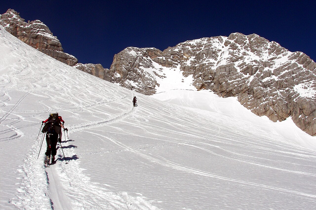
Ramsau am Dachstein is a downhill ski area in Styria, Austria. Mapped terrain includes easy, intermediate, advanced routes. Its mapped lift network extends from approximately 1131 to 1494 metres above sea level. Cross-country skiing is also mapped within the area.
Data: OpenSkiData / OpenSkiMap, OpenStreetMap contributors (ODbL), Skimap.org, Who's On First, Mapterhorn.
Plan your trip — Ramsau am Dachstein
Ramsau am Dachstein - Base lift station
ECMWF · Model run: Next update expected:
Day Time (UTC) Temp. (°C) Humidity (%) Wind (km/h) Wind (knots) Wind (Bft) Direction Precip. (mm) Snow (cm) Pressure (hPa) Freezing (m) Conditions | Thursday, 05/11 12:00 9.5 56 4 2 1B SE — — 1024 3051 Clear 2% cloud 15:00 6.7 67 3 2 1B SE 0 0 1023 3103 Clear 0% cloud 18:00 0.3 84 3 2 1B SE 0 0 1024 3092 Clear 16% cloud 21:00 -1 82 3 1 1B SE 0 0 1023 2809 Partly cloudy 23% cloud Friday, 06/11 00:00 -0.7 76 3 1 1B SE 0 0 1023 2876 Partly cloudy 22% cloud 03:00 -0.5 70 2 1 1B SE 0 0 1021 2794 Clear 16% cloud 06:00 -0.7 65 2 1 1B SE 0 0 1020 2950 Clear 10% cloud 09:00 8.4 43 2 1 1B SE 0 0 1021 3106 Clear 5% cloud 12:00 11.6 38 4 2 1B SE 0 0 1019 3097 Clear 0% cloud 15:00 7.2 58 3 1 1B SE 0 0 1019 2967 Clear 0% cloud 18:00 1.3 73 3 2 1B SE 0 0 1020 < 1442 Clear 8% cloud 21:00 -0.9 76 4 2 1B SE 0 0 1022 < 1442 Clear 7% cloud Saturday, 07/11 00:00 -1.6 79 4 2 1B SE 0 0 1023 < 1442 Cloudy 55% cloud 03:00 -1.7 78 3 2 1B SE 0 0 1024 < 1442 Cloudy 65% cloud 06:00 -2 76 2 1 1B SE 0 0 1025 < 1442 Clear 14% cloud 09:00 5.3 51 3 1 1B SE 0 0 1025 2275 Clear 16% cloud 12:00 8.4 40 4 2 1B SE 0 0 1023 2480 Clear 2% cloud 15:00 4.8 51 4 2 1B SE 0 0 1024 2255 Clear 3% cloud 18:00 -0.5 65 4 2 1B SE 0 0 1025 < 1442 Clear 0% cloud 21:00 -1.8 69 4 2 1B SE 0 0 1026 < 1442 Clear 0% cloud Sunday, 08/11 00:00 -1.9 64 3 1 1B SE 0 0 1026 < 1442 Clear 0% cloud 03:00 -2.1 57 2 1 1B SE 0 0 1025 < 1442 Clear 0% cloud 06:00 -2.1 49 2 1 1B SE 0 0 1025 < 1442 Clear 0% cloud 09:00 6.3 29 1 1 1B S 0 0 1025 2415 Clear 0% cloud 12:00 9.1 25 1 1 1B E 0 0 1023 2605 Clear 1% cloud 15:00 4.9 46 1 0 0B NE 0 0 1023 2148 Clear 10% cloud 18:00 0.7 59 1 1 0B SE 0 0 1024 < 1442 Clear 0% cloud 21:00 0 54 1 1 1B SE 0 0 1024 < 1442 Clear 0% cloud Monday, 09/11 00:00 -0.2 53 1 1 1B SE 0 0 1024 < 1442 Clear 0% cloud 03:00 -0.5 54 1 1 0B S 0 0 1023 < 1442 Clear 1% cloud 06:00 -0.6 54 1 1 1B SE 0 0 1023 < 1442 Partly cloudy 43% cloud 09:00 7.1 36 3 2 1B SE 0 0 1022 2353 Cloudy 70% cloud 12:00 9.7 34 4 2 1B SE 0 0 1019 2540 Cloudy 65% cloud 15:00 5.7 52 2 1 1B SE 0 0 1018 2338 Cloudy 70% cloud 18:00 1.7 64 4 2 1B S 0 0 1018 1571 Overcast 93% cloud 21:00 1.9 69 3 1 1B S 0 0 1017 1651 Overcast 88% cloud Tuesday, 10/11 00:00 1.9 72 1 1 1B SW 0 0 1017 1649 Overcast 94% cloud 03:00 2.1 79 2 1 1B SW 0.33 0 1017 1689 Overcast 98% cloud 06:00 2.4 84 1 1 0B W 0.92 0 1018 1744 Overcast 100% cloud 09:00 3.8 87 2 1 1B SW 0.87 0 1019 1975 Overcast 100% cloud 12:00 6.8 77 3 2 1B W 0.07 0 1017 2366 Overcast 95% cloud 15:00 5.2 81 1 1 1B N 0 0 1017 2267 Overcast 96% cloud 18:00 1.3 90 1 0 0B SE 0 0 1017 < 1442 Overcast 85% cloud 21:00 -0.7 90 2 1 1B SE 0 0 1017 < 1442 Overcast 84% cloud Wednesday, 11/11 00:00 -0.8 90 2 1 1B SE 0 0 1017 < 1442 Cloudy 72% cloud 03:00 -0.4 90 2 1 1B S 0 0 1016 < 1442 Partly cloudy 47% cloud 06:00 0 88 3 2 1B S 0 0 1016 < 1442 Partly cloudy 49% cloud 09:00 6.8 74 3 2 1B S 0 0 1016 2749 Partly cloudy 22% cloud 12:00 11.3 57 3 2 1B SE 0 0 1013 3001 Clear 14% cloud 18:00 2 86 4 2 1B S 0 0 1013 3050 Cloudy 75% cloud Thursday, 12/11 00:00 1.2 88 4 2 1B S 0 0 1012 1673 Overcast 97% cloud 06:00 1.4 85 3 2 1B S 0 0 1011 3032 Overcast 81% cloud 12:00 11.9 55 5 3 1B S 0 0 1009 3023 Partly cloudy 28% cloud 18:00 3 88 6 3 2B S 0 0 1008 3017 Overcast 96% cloud Friday, 13/11 00:00 4.4 89 7 4 2B S 0 0 1006 3004 Overcast 91% cloud 06:00 5.3 91 4 2 1B S 1.1 0 1005 2989 Overcast 97% cloud 12:00 12.6 69 5 3 1B S 0.46 0 1006 3005 Cloudy 75% cloud 18:00 5.3 90 4 2 1B SE 0 0 1009 3020 Overcast 85% cloud Saturday, 14/11 00:00 3.9 92 3 1 1B S 0.04 0 1011 3033 Overcast 98% cloud 06:00 3.1 91 1 1 1B S 0 0 1013 2363 Overcast 99% cloud 12:00 10.3 71 3 1 1B E 0 0 1013 2795 Overcast 100% cloud 18:00 5.8 91 3 2 1B SE 0.64 0 1015 2582 Cloudy 76% cloud Sunday, 15/11 00:00 3.2 89 3 1 1B SE 0 0 1015 2202 Overcast 87% cloud 06:00 2.9 90 2 1 1B S 0 0 1015 2006 Overcast 95% cloud 12:00 9.7 69 2 1 1B NW 0.12 0 1014 2563 Cloudy 55% cloud |
|---|
Forecast notes
Forecast table times: UTC.
Coordinates: 47.424032°N, 13.6243974°E · Requested elevation: 1181 m. Model terrain: 1440 m. Terrain and 1000/925/850/700 hPa profiles are used for height estimates.
Outside the available profile, temperature uses an estimated 5.5°C/km height correction; wind retains the nearest available model-level value. Humidity is estimated with adjusted pressure and temperature.
These are altitude estimates, not a simulation of local mountain terrain. Precipitation, cloud and sea-level pressure use horizontal interpolation only.
Precipitation includes rain and snow water equivalent: preceding 3 hours through day 6, then 6 hours (see cell tooltip). Snow (cm) estimates fresh snowfall from precipitation and temperature using the GFS conversion; it is not snow depth on the ground. Freezing (m) uses additional 600/500 hPa temperatures when available and estimates the lowest resolved 0°C crossing above sea level. When all sampled levels are warm, the upper profile limit is shown (see tooltip). < marks an entirely cold sampled profile and its lower height limit. No extrapolation is used.
Source: ECMWF · CC BY 4.0 · Processed by Snow Report.
Ramsau am Dachstein - Top lift station
ECMWF · Model run: Next update expected:
Day Time (UTC) Temp. (°C) Humidity (%) Wind (km/h) Wind (knots) Wind (Bft) Direction Precip. (mm) Snow (cm) Pressure (hPa) Freezing (m) Conditions | Thursday, 05/11 12:00 7.9 59 5 3 1B SE — — 1024 3053 Clear 2% cloud 15:00 5.2 70 3 2 1B SE 0 0 1023 3104 Clear 0% cloud 18:00 -1 88 3 2 1B SE 0 0 1024 3104 Clear 16% cloud 21:00 -2.3 84 3 2 1B SE 0 0 1023 2802 Partly cloudy 24% cloud Friday, 06/11 00:00 -1.9 79 3 1 1B SE 0 0 1023 2869 Partly cloudy 22% cloud 03:00 -1.8 72 2 1 1B SE 0 0 1021 2786 Clear 16% cloud 06:00 -2 68 2 1 1B SE 0 0 1020 2948 Clear 10% cloud 09:00 6.8 45 2 1 1B SE 0 0 1021 3106 Clear 4% cloud 12:00 9.9 40 4 2 1B SE 0 0 1018 3097 Clear 0% cloud 15:00 5.6 61 3 2 1B SE 0 0 1019 2966 Clear 0% cloud 18:00 -0.2 76 4 2 1B SE 0 0 1020 < 1449 Clear 9% cloud 21:00 -2.3 80 5 3 1B SE 0 0 1022 < 1449 Clear 8% cloud Saturday, 07/11 00:00 -3 83 5 3 1B SE 0 0 1023 < 1449 Cloudy 58% cloud 03:00 -3 82 4 2 1B SE 0 0 1024 < 1449 Cloudy 66% cloud 06:00 -3.4 80 3 2 1B SE 0 0 1025 < 1449 Clear 15% cloud 09:00 3.7 54 4 2 1B SE 0 0 1025 2276 Clear 17% cloud 12:00 6.6 43 5 3 1B SE 0 0 1023 2479 Clear 2% cloud 15:00 3.2 54 5 3 1B SE 0 0 1024 2258 Clear 3% cloud 18:00 -1.9 69 5 3 1B SE 0 0 1025 < 1449 Clear 0% cloud 21:00 -3.2 73 5 3 1B SE 0 0 1026 < 1449 Clear 0% cloud Sunday, 08/11 00:00 -3.3 67 4 2 1B SE 0 0 1026 < 1449 Clear 0% cloud 03:00 -3.5 60 3 2 1B S 0 0 1025 < 1449 Clear 0% cloud 06:00 -3.5 52 3 2 1B SE 0 0 1025 < 1449 Clear 0% cloud 09:00 4.6 31 2 1 1B S 0 0 1025 2414 Clear 0% cloud 12:00 7.4 27 2 1 1B SE 0 0 1023 2605 Clear 0% cloud 15:00 3.2 50 1 0 0B E 0 0 1023 2150 Clear 10% cloud 18:00 -0.8 63 1 1 1B SE 0 0 1024 < 1449 Clear 0% cloud 21:00 -1.5 58 1 1 1B S 0 0 1024 < 1449 Clear 0% cloud Monday, 09/11 00:00 -1.8 57 1 1 0B SE 0 0 1024 < 1449 Clear 0% cloud 03:00 -2.1 58 1 1 0B S 0 0 1023 < 1449 Clear 1% cloud 06:00 -2.1 57 1 1 1B S 0 0 1023 < 1449 Partly cloudy 44% cloud 09:00 5.3 39 3 1 1B S 0 0 1022 2355 Cloudy 71% cloud 12:00 7.9 37 3 2 1B S 0 0 1019 2542 Cloudy 65% cloud 15:00 4 56 2 1 1B S 0 0 1018 2339 Cloudy 70% cloud 18:00 0.1 69 4 2 1B S 0 0 1018 1548 Overcast 92% cloud 21:00 0.3 75 3 2 1B S 0 0 1017 1645 Overcast 88% cloud Tuesday, 10/11 00:00 0.3 78 2 1 1B SW 0 0 1017 1644 Overcast 94% cloud 03:00 0.5 85 3 1 1B SW 0.33 0.1 1017 1684 Overcast 98% cloud 06:00 0.8 90 3 1 1B W 0.91 0.3 1018 1740 Overcast 100% cloud 09:00 2.1 94 3 2 1B W 0.86 0 1019 1977 Overcast 100% cloud 12:00 5 82 5 3 1B W 0.08 0 1017 2368 Overcast 95% cloud 15:00 3.5 86 2 1 1B NW 0 0 1017 2273 Overcast 96% cloud 18:00 -0.2 94 0 0 0B NW 0 0 1017 < 1449 Overcast 84% cloud 21:00 -2.2 94 1 1 1B S 0 0 1017 < 1449 Overcast 84% cloud Wednesday, 11/11 00:00 -2.2 94 1 1 1B S 0 0 1017 < 1449 Cloudy 72% cloud 03:00 -1.8 95 2 1 1B S 0 0 1016 < 1449 Partly cloudy 46% cloud 06:00 -1.4 94 3 1 1B S 0 0 1016 < 1449 Partly cloudy 48% cloud 09:00 5.2 79 3 2 1B S 0 0 1016 2754 Partly cloudy 21% cloud 12:00 9.6 61 3 2 1B S 0 0 1013 3002 Clear 15% cloud 18:00 0.6 92 4 2 1B S 0 0 1013 3050 Cloudy 75% cloud Thursday, 12/11 00:00 -0.2 93 4 2 1B S 0 0 1012 1690 Overcast 96% cloud 06:00 0 90 3 2 1B S 0 0 1011 3032 Overcast 81% cloud 12:00 10.1 58 5 3 1B S 0 0 1009 3023 Partly cloudy 27% cloud 18:00 1.7 92 6 3 2B S 0 0 1008 3017 Overcast 96% cloud Friday, 13/11 00:00 3 93 8 4 2B S 0 0 1006 3004 Overcast 92% cloud 06:00 3.8 97 6 3 2B S 1.1 0 1005 2989 Overcast 97% cloud 12:00 10.9 73 6 3 1B S 0.47 0 1006 3005 Cloudy 75% cloud 18:00 3.8 95 4 2 1B S 0 0 1009 3020 Overcast 85% cloud Saturday, 14/11 00:00 2.5 97 3 2 1B S 0.04 0 1011 3033 Overcast 98% cloud 06:00 1.7 97 2 1 1B S 0 0 1013 2382 Overcast 99% cloud 12:00 8.6 77 2 1 1B SE 0 0 1013 2796 Overcast 100% cloud 18:00 4.2 97 3 2 1B SE 0.64 0 1015 2583 Cloudy 76% cloud Sunday, 15/11 00:00 1.6 95 3 2 1B S 0 0 1015 2204 Overcast 87% cloud 06:00 1.3 96 2 1 1B S 0 0 1015 2005 Overcast 95% cloud 12:00 7.9 75 2 1 1B NW 0.13 0 1014 2563 Cloudy 55% cloud |
|---|
Forecast notes
Forecast table times: UTC.
Coordinates: 47.4197744°N, 13.6136079°E · Requested elevation: 1494 m. Model terrain: 1446 m. Terrain and 1000/925/850/700 hPa profiles are used for height estimates.
These are altitude estimates, not a simulation of local mountain terrain. Precipitation, cloud and sea-level pressure use horizontal interpolation only.
Precipitation includes rain and snow water equivalent: preceding 3 hours through day 6, then 6 hours (see cell tooltip). Snow (cm) estimates fresh snowfall from precipitation and temperature using the GFS conversion; it is not snow depth on the ground. Freezing (m) uses additional 600/500 hPa temperatures when available and estimates the lowest resolved 0°C crossing above sea level. When all sampled levels are warm, the upper profile limit is shown (see tooltip). < marks an entirely cold sampled profile and its lower height limit. No extrapolation is used.