Worldwide Ski Resort Forecasts

More
Colour guide Temperature · Wind · Rain · Snow
Each colour starts at the value shown. Wind colours match across all three units. Dry cells stay neutral. Colours describe the displayed values, not official weather warnings.
Familienschiberg St. Jakob im Walde - Base lift station
ECMWF · Model run: Next update expected:
Day Local time Temp. (°C) Humidity (%) Wind (km/h) Wind (knots) Wind (Bft) Direction Precip. (mm) Snow (cm) Pressure (hPa) Freezing (m) Conditions | Thursday, 05/11 07:00 1.3 97 6 3 1B S — — 1032 1356 Overcast 100% cloud  10:00 2.2 92 9 5 2B S 0.05 0 1032 1609 Overcast 99% cloud 13:00 4 79 9 5 2B SW 0 0 1031 2378 Overcast 93% cloud 16:00 3.5 81 7 4 2B S 0 0 1029 2801 Cloudy 50% cloud  19:00 0.7 94 5 2 1B S 0 0 1030 2945 Cloudy 72% cloud 22:00 1.6 96 6 3 1B SW 0.05 0 1030 2916 Overcast 94% cloud Friday, 06/11 01:00 0.6 98 4 2 1B SW 0 0 1028 3070 Overcast 87% cloud 04:00 -0.3 97 3 2 1B W 0 0 1027 1041 Overcast 84% cloud 07:00 -1.2 97 2 1 1B W 0 0 1026 1103 Overcast 85% cloud 10:00 4.9 75 5 3 1B S 0 0 1027 2899 Clear 1% cloud  13:00 7.7 59 7 4 2B S 0 0 1025 2830 Clear 0% cloud 16:00 4.5 73 4 2 1B S 0 0 1025 2790 Clear 0% cloud 19:00 -0 91 2 1 1B SE 0 0 1026 1018 Clear 0% cloud 22:00 -0.8 89 2 1 1B S 0 0 1027 1131 Clear 0% cloud Saturday, 07/11 01:00 -1.6 91 3 2 1B S 0 0 1028 1276 Partly cloudy 34% cloud  04:00 -1.6 90 4 2 1B S 0 0 1028 1353 Partly cloudy 34% cloud 07:00 -2.1 96 3 2 1B SW 0 0 1029 1364 Partly cloudy 38% cloud 10:00 3.4 66 5 3 1B SW 0 0 1029 2059 Clear 1% cloud 13:00 6 47 7 4 2B S 0 0 1028 1844 Clear 0% cloud 16:00 2.3 67 4 2 1B S 0 0 1028 2092 Clear 0% cloud 19:00 -1.6 81 3 2 1B S 0 0 1029 1212 Clear 0% cloud 22:00 -2 82 3 2 1B SW 0 0 1030 1228 Clear 0% cloud Sunday, 08/11 01:00 -2.3 81 3 1 1B W 0 0 1029 1215 Clear 0% cloud 04:00 -2.5 74 2 1 1B W 0 0 1028 1213 Clear 1% cloud 07:00 -2 63 2 1 1B SW 0 0 1027 1191 Clear 1% cloud 10:00 4.4 41 5 3 1B S 0 0 1028 2318 Clear 0% cloud 13:00 6.4 33 8 4 2B S 0 0 1026 2263 Partly cloudy 29% cloud 16:00 0.7 65 4 2 1B S 0 0 1027 2265 Clear 0% cloud 19:00 -1.9 81 3 1 1B SW 0 0 1027 1194 Partly cloudy 42% cloud 22:00 -0.9 82 3 1 1B W 0 0 1027 1144 Cloudy 77% cloud Monday, 09/11 01:00 -1.5 83 3 2 1B W 0 0 1026 1185 Clear 8% cloud 04:00 -2 84 3 1 1B W 0 0 1024 1199 Clear 0% cloud 07:00 -1.8 81 3 1 1B NW 0 0 1024 1177 Clear 0% cloud 10:00 6.1 49 4 2 1B SW 0 0 1024 2132 Clear 0% cloud 13:00 8.5 46 7 4 2B S 0 0 1021 2228 Clear 0% cloud 16:00 2.6 80 4 2 1B S 0 0 1021 2277 Partly cloudy 34% cloud 19:00 -0.7 91 3 2 1B SW 0 0 1020 1072 Cloudy 62% cloud 22:00 1.1 88 4 2 1B W 0 0 1018 2454 Overcast 90% cloud Tuesday, 10/11 01:00 1 87 7 4 2B W 0 0 1017 2491 Overcast 100% cloud 04:00 0.7 92 4 2 1B NW 0.19 0 1015 2499 Overcast 100% cloud 07:00 0.9 91 3 1 1B NW 2.1 0.6 1015 2397 Overcast 92% cloud 10:00 3.7 95 5 2 1B NW 0.39 0 1015 2397 Overcast 100% cloud 13:00 3.9 96 6 3 2B NW 0.67 0 1014 2366 Overcast 100% cloud 16:00 4.4 96 4 2 1B NW 0.24 0 1014 2186 Overcast 99% cloud 19:00 3.8 98 5 3 1B N 0.03 0 1016 1991 Overcast 99% cloud 22:00 3.4 100 4 2 1B NW 0.00 0 1017 1900 Overcast 81% cloud Wednesday, 11/11 01:00 2.4 100 2 1 1B NW 0 0 1018 1975 Overcast 92% cloud 04:00 2.2 99 3 1 1B W 0 0 1018 2182 Overcast 100% cloud 07:00 2.1 100 4 2 1B SW 0 0 1018 2315 Overcast 100% cloud |
|---|
Forecast notes
Forecast table times: Europe/Vienna.
Coordinates: 47.4774454°N, 15.7884852°E · Requested elevation: 1008 m. Model terrain: 999 m. Terrain and 1000/925/850/700 hPa profiles are used for height estimates.
These are altitude estimates, not a simulation of local mountain terrain. Precipitation, cloud and sea-level pressure use horizontal interpolation only.
Precipitation includes rain and snow water equivalent: preceding 3 hours through day 6, then 6 hours (see cell tooltip). Snow (cm) estimates fresh snowfall from precipitation and temperature using the GFS conversion; it is not snow depth on the ground. Freezing (m) uses additional 600/500 hPa temperatures when available and estimates the lowest resolved 0°C crossing above sea level. When all sampled levels are warm, the upper profile limit is shown (see tooltip). < marks an entirely cold sampled profile and its lower height limit. No extrapolation is used.
Source: ECMWF · CC BY 4.0 · Processed by Snow Report.
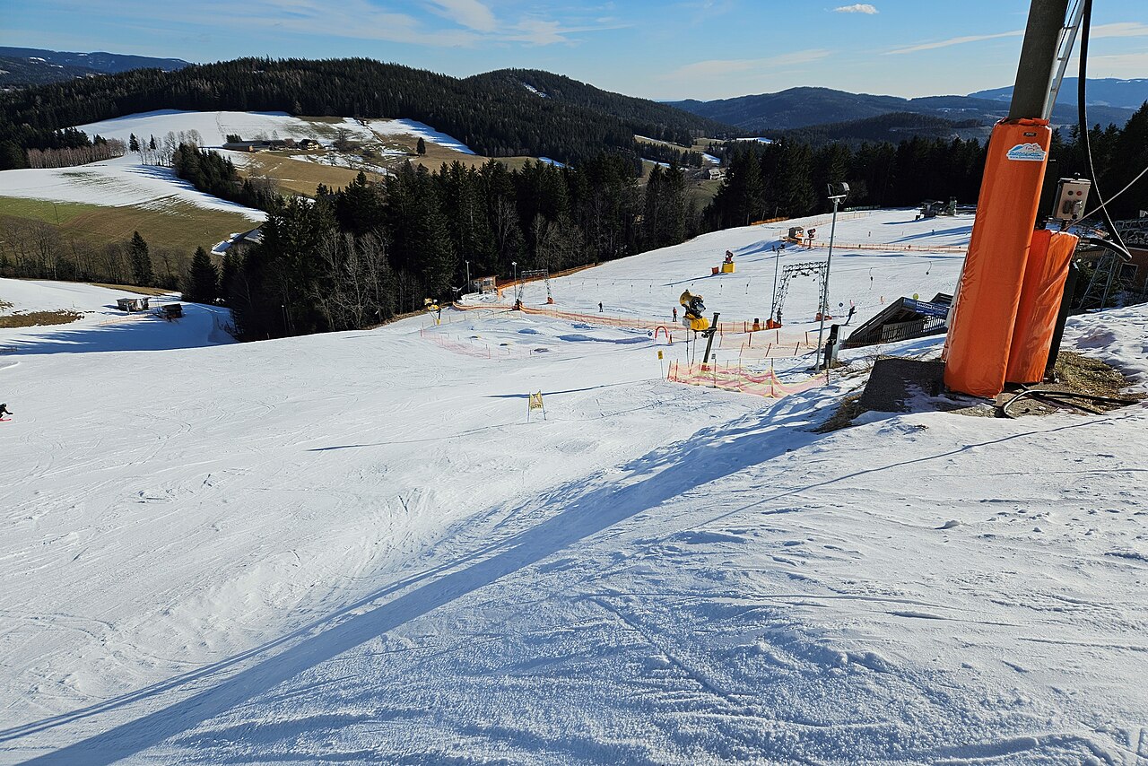
Familienschiberg St. Jakob im Walde is a mapped downhill ski area in AT. Forecasts cover three real lift-station locations from approximately 1008 to 1190 metres. Elevations are terrain-model estimates.
Data: OpenSkiData / OpenSkiMap, OpenStreetMap contributors (ODbL), Skimap.org, Who's On First, Mapterhorn.
Familienschiberg St. Jakob im Walde - Middle lift station
ECMWF · Model run: Next update expected:
Day Local time Temp. (°C) Humidity (%) Wind (km/h) Wind (knots) Wind (Bft) Direction Precip. (mm) Snow (cm) Pressure (hPa) Freezing (m) Conditions | Thursday, 05/11 07:00 1.1 95 7 4 2B S — — 1032 1354 Overcast 100% cloud 10:00 1.9 90 10 6 2B S 0.05 0 1032 1584 Overcast 99% cloud 13:00 3.7 78 10 6 2B SW 0 0 1031 2374 Overcast 94% cloud 16:00 3.5 78 8 4 2B S 0 0 1029 2800 Cloudy 50% cloud 19:00 1 88 6 3 1B S 0 0 1030 2945 Cloudy 72% cloud 22:00 1.9 89 7 4 2B SW 0.05 0 1030 2915 Overcast 95% cloud Friday, 06/11 01:00 1.1 89 5 3 1B SW 0 0 1028 3071 Overcast 88% cloud 04:00 0.3 87 4 2 1B SW 0 0 1027 1043 Overcast 85% cloud 07:00 -0.4 87 3 2 1B SW 0 0 1026 1104 Overcast 86% cloud 10:00 4.8 71 7 4 2B S 0 0 1027 2900 Clear 1% cloud 13:00 7.2 59 7 4 2B S 0 0 1025 2830 Clear 0% cloud 16:00 4.4 69 5 3 1B SE 0 0 1025 2790 Clear 0% cloud 19:00 0.3 85 4 2 1B SE 0 0 1026 1022 Clear 0% cloud 22:00 -0.4 83 4 2 1B S 0 0 1027 1133 Clear 0% cloud Saturday, 07/11 01:00 -1.2 84 6 3 2B S 0 0 1028 1279 Partly cloudy 34% cloud 04:00 -1.3 82 6 3 2B S 0 0 1028 1356 Partly cloudy 34% cloud 07:00 -1.8 86 6 3 2B S 0 0 1029 1367 Partly cloudy 38% cloud 10:00 3.1 64 7 4 2B S 0 0 1029 2057 Clear 1% cloud 13:00 5.4 47 8 4 2B S 0 0 1028 1840 Clear 0% cloud 16:00 2.2 61 5 3 1B S 0 0 1028 2089 Clear 0% cloud 19:00 -1.1 70 5 3 1B S 0 0 1029 1214 Clear 0% cloud 22:00 -1.4 70 5 3 1B S 0 0 1030 1230 Clear 0% cloud Sunday, 08/11 01:00 -1.6 69 4 2 1B SW 0 0 1029 1216 Clear 0% cloud 04:00 -1.7 63 4 2 1B SW 0 0 1028 1214 Clear 1% cloud 07:00 -1.4 54 4 2 1B SW 0 0 1027 1193 Clear 1% cloud 10:00 4.3 37 8 4 2B S 0 0 1028 2317 Clear 0% cloud 13:00 6 32 10 5 2B S 0 0 1026 2262 Partly cloudy 29% cloud 16:00 1.1 60 5 3 1B S 0 0 1027 2264 Clear 0% cloud 19:00 -1.3 77 5 3 1B SW 0 0 1027 1196 Partly cloudy 42% cloud 22:00 -0.5 80 5 3 1B SW 0 0 1027 1147 Cloudy 76% cloud Monday, 09/11 01:00 -1 80 5 3 1B W 0 0 1026 1187 Clear 8% cloud 04:00 -1.4 79 4 2 1B W 0 0 1024 1200 Clear 0% cloud 07:00 -1.2 75 3 2 1B NW 0 0 1024 1178 Clear 0% cloud 10:00 5.8 48 4 2 1B SW 0 0 1024 2132 Clear 0% cloud 13:00 8 46 7 4 2B S 0 0 1021 2228 Clear 0% cloud 16:00 2.9 75 6 3 2B S 0 0 1021 2276 Partly cloudy 34% cloud 19:00 -0 84 7 4 2B SW 0 0 1020 1075 Cloudy 62% cloud 22:00 1.6 83 8 4 2B SW 0 0 1018 2452 Overcast 90% cloud Tuesday, 10/11 01:00 1.5 81 8 5 2B NW 0 0 1017 2491 Overcast 100% cloud 04:00 1.2 87 4 2 1B NW 0.19 0 1015 2500 Overcast 100% cloud 07:00 1.4 88 3 2 1B W 2.1 0 1015 2397 Overcast 92% cloud 10:00 3.8 92 5 3 1B NW 0.38 0 1015 2398 Overcast 100% cloud 13:00 4 93 6 4 2B NW 0.67 0 1014 2366 Overcast 100% cloud 16:00 4.3 94 4 2 1B NW 0.24 0 1014 2187 Overcast 99% cloud 19:00 3.7 97 6 3 2B NW 0.03 0 1016 1992 Overcast 99% cloud 22:00 3.2 99 5 3 1B NW 0.00 0 1017 1900 Overcast 81% cloud Wednesday, 11/11 01:00 2.3 100 4 2 1B NW 0 0 1018 1975 Overcast 92% cloud 04:00 2.3 98 4 2 1B W 0 0 1018 2182 Overcast 100% cloud 07:00 2.2 98 5 3 1B SW 0 0 1018 2313 Overcast 100% cloud |
|---|
Forecast notes
Forecast table times: Europe/Vienna.
Coordinates: 47.4770566°N, 15.7848972°E · Requested elevation: 1069 m. Model terrain: 1000 m. Terrain and 1000/925/850/700 hPa profiles are used for height estimates.
These are altitude estimates, not a simulation of local mountain terrain. Precipitation, cloud and sea-level pressure use horizontal interpolation only.
Precipitation includes rain and snow water equivalent: preceding 3 hours through day 6, then 6 hours (see cell tooltip). Snow (cm) estimates fresh snowfall from precipitation and temperature using the GFS conversion; it is not snow depth on the ground. Freezing (m) uses additional 600/500 hPa temperatures when available and estimates the lowest resolved 0°C crossing above sea level. When all sampled levels are warm, the upper profile limit is shown (see tooltip). < marks an entirely cold sampled profile and its lower height limit. No extrapolation is used.
Source: ECMWF · CC BY 4.0 · Processed by Snow Report.
Familienschiberg St. Jakob im Walde - Top lift station
ECMWF · Model run: Next update expected:
Day Local time Temp. (°C) Humidity (%) Wind (km/h) Wind (knots) Wind (Bft) Direction Precip. (mm) Snow (cm) Pressure (hPa) Freezing (m) Conditions | Thursday, 05/11 07:00 0.6 93 10 6 2B SW — — 1032 1353 Overcast 100% cloud 10:00 1.4 88 12 7 3B SW 0.05 0 1032 1578 Overcast 99% cloud 13:00 3.1 76 12 6 2B SW 0 0 1031 2373 Overcast 94% cloud 16:00 3.3 71 10 5 2B S 0 0 1029 2800 Cloudy 50% cloud 19:00 1.4 77 8 4 2B SW 0 0 1030 2947 Cloudy 72% cloud 22:00 2.4 76 9 5 2B SW 0.05 0 1030 2915 Overcast 95% cloud Friday, 06/11 01:00 2 74 8 4 2B SW 0 0 1029 3073 Overcast 89% cloud 04:00 1.6 71 8 4 2B SW 0 0 1027 1052 Overcast 87% cloud 07:00 1.1 71 5 3 1B SW 0 0 1026 1111 Overcast 88% cloud 10:00 4.7 64 9 5 2B S 0 0 1027 2901 Clear 1% cloud 13:00 6.2 58 8 4 2B S 0 0 1025 2830 Clear 0% cloud 16:00 4.2 63 7 4 2B SE 0 0 1025 2790 Clear 0% cloud 19:00 1 75 8 4 2B SE 0 0 1026 1040 Clear 0% cloud 22:00 0.3 71 9 5 2B SE 0 0 1027 1146 Clear 0% cloud Saturday, 07/11 01:00 -0.6 72 11 6 2B S 0 0 1028 1289 Partly cloudy 35% cloud 04:00 -0.8 68 11 6 2B S 0 0 1028 1363 Partly cloudy 35% cloud 07:00 -1.1 68 11 6 2B S 0 0 1029 1373 Partly cloudy 39% cloud 10:00 2.7 59 12 6 2B S 0 0 1029 2056 Clear 1% cloud 13:00 4.3 46 10 6 2B S 0 0 1028 1837 Clear 0% cloud 16:00 2 49 9 5 2B S 0 0 1028 2087 Clear 0% cloud 19:00 -0.3 51 10 5 2B S 0 0 1029 1224 Clear 0% cloud 22:00 -0.4 50 10 6 2B S 0 0 1030 1238 Clear 0% cloud Sunday, 08/11 01:00 -0.4 49 10 5 2B S 0 0 1029 1223 Clear 0% cloud 04:00 -0.3 45 9 5 2B S 0 0 1028 1220 Clear 1% cloud 07:00 -0.1 39 10 5 2B S 0 0 1027 1198 Clear 1% cloud 10:00 4.1 30 13 7 3B S 0 0 1028 2316 Clear 0% cloud 13:00 5.3 28 13 7 3B S 0 0 1026 2261 Partly cloudy 30% cloud 16:00 1.7 51 9 5 2B S 0 0 1027 2264 Clear 0% cloud 19:00 -0.1 68 9 5 2B SW 0 0 1027 1204 Partly cloudy 41% cloud 22:00 0.2 75 10 5 2B SW 0 0 1027 1156 Cloudy 76% cloud Monday, 09/11 01:00 -0 73 9 5 2B SW 0 0 1026 1194 Clear 7% cloud 04:00 -0.2 69 6 3 1B W 0 0 1024 1206 Clear 0% cloud 07:00 0.1 64 4 2 1B W 0 0 1024 1185 Clear 0% cloud 10:00 5.3 45 5 3 1B SW 0 0 1024 2131 Clear 0% cloud 13:00 7.1 44 9 5 2B S 0 0 1021 2228 Clear 0% cloud 16:00 3.3 66 11 6 2B SW 0 0 1021 2275 Partly cloudy 34% cloud 19:00 1.2 74 13 7 3B SW 0 0 1020 1087 Cloudy 63% cloud 22:00 2.4 75 15 8 3B SW 0 0 1018 2449 Overcast 90% cloud Tuesday, 10/11 01:00 2.6 71 12 6 2B NW 0 0 1017 2489 Overcast 100% cloud 04:00 2.4 78 5 3 1B NW 0.20 0 1015 2499 Overcast 100% cloud 07:00 2.4 82 5 3 1B W 2.1 0 1015 2396 Overcast 92% cloud 10:00 4.2 86 6 3 2B W 0.37 0 1015 2396 Overcast 100% cloud 13:00 4.2 88 8 4 2B NW 0.67 0 1014 2365 Overcast 100% cloud 16:00 4.2 91 6 3 2B NW 0.24 0 1014 2185 Overcast 99% cloud 19:00 3.4 96 8 5 2B NW 0.03 0 1016 1989 Overcast 99% cloud 22:00 2.8 98 8 4 2B NW 0.00 0 1017 1899 Overcast 81% cloud Wednesday, 11/11 01:00 2.1 99 7 4 2B W 0 0 1018 1972 Overcast 93% cloud 04:00 2.3 96 8 4 2B W 0 0 1018 2180 Overcast 100% cloud 07:00 2.3 95 7 4 2B W 0 0 1018 2311 Overcast 100% cloud |
|---|
Forecast notes
Forecast table times: Europe/Vienna.
Coordinates: 47.4802897°N, 15.7815241°E · Requested elevation: 1190 m. Model terrain: 1009 m. Terrain and 1000/925/850/700 hPa profiles are used for height estimates.
These are altitude estimates, not a simulation of local mountain terrain. Precipitation, cloud and sea-level pressure use horizontal interpolation only.
Precipitation includes rain and snow water equivalent: preceding 3 hours through day 6, then 6 hours (see cell tooltip). Snow (cm) estimates fresh snowfall from precipitation and temperature using the GFS conversion; it is not snow depth on the ground. Freezing (m) uses additional 600/500 hPa temperatures when available and estimates the lowest resolved 0°C crossing above sea level. When all sampled levels are warm, the upper profile limit is shown (see tooltip). < marks an entirely cold sampled profile and its lower height limit. No extrapolation is used.