Worldwide Ski Resort Forecasts

More
Colour guide Temperature · Wind · Rain · Snow
Each colour starts at the value shown. Wind colours match across all three units. Dry cells stay neutral. Colours describe the displayed values, not official weather warnings.
Bormio Ski - Low lift station
ECMWF · Model run: Next update expected:
Day Time (UTC) Temp. (°C) Humidity (%) Wind (km/h) Wind (knots) Wind (Bft) Direction Precip. (mm) Snow (cm) Pressure (hPa) Freezing (m) Conditions | Thursday, 05/11 06:00 -0.9 64 0 0 0B S — — 1027 < 2322 Partly cloudy 48% cloud  09:00 6.3 52 3 2 1B S 0 0 1027 2371 Clear 6% cloud  12:00 8.8 47 3 2 1B S 0 0 1025 2772 Clear 4% cloud 15:00 7 52 2 1 1B S 0 0 1024 2599 Clear 5% cloud 18:00 2.4 62 0 0 0B SE 0 0 1024 < 2322 Clear 4% cloud 21:00 1.4 59 2 1 1B S 0 0 1025 < 2322 Clear 10% cloud Friday, 06/11 00:00 1.9 55 1 1 1B S 0 0 1023 < 2322 Partly cloudy 32% cloud 03:00 2.2 54 1 1 1B S 0 0 1021 < 2322 Cloudy 79% cloud  06:00 2 52 1 1 1B S 0 0 1020 < 2322 Cloudy 52% cloud 09:00 7.9 42 2 1 1B SE 0 0 1021 2727 Overcast 81% cloud  12:00 8.2 43 3 2 1B S 0.01 0 1020 2643 Overcast 100% cloud 15:00 5.3 64 1 1 1B SE 1.7 0 1022 < 2322 Overcast 100% cloud 18:00 4.5 69 2 1 1B E 1.7 0 1022 < 2322 Overcast 98% cloud 21:00 4.7 69 2 1 1B E 0.29 0 1022 < 2322 Overcast 100% cloud Saturday, 07/11 00:00 4.2 71 2 1 1B E 1.3 0 1022 < 2322 Overcast 100% cloud 03:00 3.7 71 2 1 1B E 1.9 0 1022 < 2322 Overcast 100% cloud 06:00 3.4 71 2 1 1B E 0.67 0 1023 < 2322 Overcast 99% cloud 09:00 4.9 65 2 1 1B E 0.32 0 1024 < 2322 Overcast 99% cloud 12:00 5.9 61 3 1 1B SE 0.14 0 1023 < 2322 Overcast 100% cloud 15:00 5.4 63 2 1 1B S 0.07 0 1023 < 2322 Overcast 93% cloud 18:00 2.7 70 1 1 0B SW 0.05 0 1025 < 2322 Cloudy 79% cloud 21:00 0 68 1 0 0B SW 0.02 0 1026 < 2322 Cloudy 73% cloud Sunday, 08/11 00:00 -0.3 67 1 0 0B S 0.01 0 1027 < 2322 Cloudy 69% cloud 03:00 -1 65 0 0 0B SW 0 0 1026 < 2322 Cloudy 69% cloud 06:00 -1.8 66 0 0 0B S 0 0 1027 < 2322 Cloudy 64% cloud 09:00 2.6 60 1 0 0B SE 0 0 1027 < 2322 Partly cloudy 36% cloud 12:00 5.7 51 4 2 1B S 0 0 1025 < 2322 Partly cloudy 34% cloud 15:00 3.9 57 2 1 1B SW 0 0 1025 < 2322 Partly cloudy 47% cloud 18:00 -2.7 69 1 0 0B S 0 0 1026 < 2322 Cloudy 75% cloud 21:00 -5.8 65 1 1 1B S 0 0 1026 < 2322 Overcast 88% cloud Monday, 09/11 00:00 -3.3 59 1 1 0B S 0 0 1025 < 2322 Cloudy 68% cloud 03:00 -1.9 57 1 1 0B S 0 0 1024 < 2322 Overcast 88% cloud 06:00 -0.8 56 2 1 1B S 0 0 1024 < 2322 Cloudy 76% cloud 09:00 4.8 49 4 2 1B S 0 0 1024 < 2322 Cloudy 70% cloud 12:00 6.3 51 6 3 2B S 0.05 0 1022 2340 Cloudy 76% cloud 15:00 5.3 58 5 3 1B S 0.05 0 1020 < 2322 Overcast 87% cloud 18:00 2.8 66 5 3 1B S 0 0 1021 < 2322 Overcast 93% cloud 21:00 3 71 6 3 1B S 0.06 0 1022 < 2322 Overcast 95% cloud Tuesday, 10/11 00:00 3.4 71 5 3 1B S 0.11 0 1021 < 2322 Overcast 99% cloud 03:00 4.1 71 5 2 1B S 0.16 0 1019 < 2322 Overcast 99% cloud 06:00 4.3 72 4 2 1B S 0.14 0 1018 < 2322 Overcast 100% cloud 09:00 6.1 69 5 2 1B S 0.24 0 1017 < 2322 Overcast 100% cloud 12:00 6.7 70 4 2 1B S 0.35 0 1016 2502 Overcast 100% cloud 15:00 6.7 69 1 1 1B SW 0.23 0 1015 2617 Overcast 98% cloud 18:00 4.8 72 0 0 0B NW 0 0 1014 < 2322 Cloudy 69% cloud 21:00 1.7 69 1 0 0B NW 0 0 1014 < 2322 Overcast 82% cloud Wednesday, 11/11 00:00 0.9 70 1 1 0B NW 0 0 1014 < 2322 Overcast 80% cloud 03:00 1.2 68 0 0 0B NW 0 0 1013 < 2322 Cloudy 59% cloud 06:00 0.7 68 1 0 0B S 0 0 1013 < 2322 Cloudy 58% cloud |
|---|
Forecast notes
Forecast table times: UTC.
Coordinates: 46.4621355°N, 10.3724437°E · Requested elevation: 1197 m. Model terrain: 2319 m. Terrain and 1000/925/850/700 hPa profiles are used for height estimates.
Outside the available profile, temperature uses an estimated 5.5°C/km height correction; wind retains the nearest available model-level value. Humidity is estimated with adjusted pressure and temperature.
These are altitude estimates, not a simulation of local mountain terrain. Precipitation, cloud and sea-level pressure use horizontal interpolation only.
Precipitation includes rain and snow water equivalent: preceding 3 hours through day 6, then 6 hours (see cell tooltip). Snow (cm) estimates fresh snowfall from precipitation and temperature using the GFS conversion; it is not snow depth on the ground. Freezing (m) uses additional 600/500 hPa temperatures when available and estimates the lowest resolved 0°C crossing above sea level. When all sampled levels are warm, the upper profile limit is shown (see tooltip). < marks an entirely cold sampled profile and its lower height limit. No extrapolation is used.
Source: ECMWF · CC BY 4.0 · Processed by Snow Report.
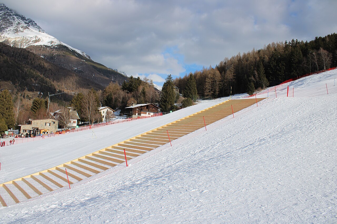
Bormio Ski is a downhill ski area in Sondrio, Italy. Mapped terrain includes beginner, easy, intermediate, advanced routes. Its mapped lift network extends from approximately 1197 to 3010 metres above sea level. Cross-country skiing is also mapped within the area.
Data: OpenSkiData / OpenSkiMap, OpenStreetMap contributors (ODbL), Skimap.org, Who's On First, Mapterhorn.
Bormio Ski - Base lift station
ECMWF · Model run: Next update expected:
Day Time (UTC) Temp. (°C) Humidity (%) Wind (km/h) Wind (knots) Wind (Bft) Direction Precip. (mm) Snow (cm) Pressure (hPa) Freezing (m) Conditions | Thursday, 05/11 06:00 -3.2 72 0 0 0B S — — 1027 < 2323 Partly cloudy 42% cloud 09:00 4 58 3 1 1B S 0 0 1027 2395 Clear 5% cloud 12:00 6.4 52 3 1 1B S 0 0 1025 2776 Clear 4% cloud 15:00 4.6 58 1 1 1B S 0 0 1024 2614 Clear 5% cloud 18:00 0 69 1 0 0B SE 0 0 1024 < 2323 Clear 4% cloud 21:00 -0.9 66 1 1 1B S 0 0 1024 < 2323 Clear 10% cloud Friday, 06/11 00:00 -0.5 61 1 1 1B S 0 0 1023 < 2323 Partly cloudy 32% cloud 03:00 -0.3 59 1 1 1B S 0 0 1021 < 2323 Cloudy 79% cloud 06:00 -0.4 58 1 1 1B S 0 0 1020 < 2323 Cloudy 54% cloud 09:00 5.5 46 2 1 1B SE 0 0 1021 2731 Overcast 82% cloud 12:00 5.8 48 3 1 1B S 0.01 0 1020 2645 Overcast 100% cloud 15:00 2.9 72 2 1 1B SE 1.7 0 1022 < 2323 Overcast 100% cloud 18:00 2.1 77 2 1 1B E 1.7 0 1022 < 2323 Overcast 98% cloud 21:00 2.2 77 2 1 1B E 0.30 0 1022 < 2323 Overcast 100% cloud Saturday, 07/11 00:00 1.8 79 2 1 1B E 1.2 0 1023 < 2323 Overcast 100% cloud 03:00 1.2 79 2 1 1B E 1.8 0 1022 < 2323 Overcast 100% cloud 06:00 1 79 2 1 1B E 0.62 0.2 1023 < 2323 Overcast 99% cloud 09:00 2.4 73 2 1 1B E 0.31 0 1024 < 2323 Overcast 99% cloud 12:00 3.4 68 3 1 1B SE 0.14 0 1023 < 2323 Overcast 100% cloud 15:00 3 71 2 1 1B S 0.06 0 1023 < 2323 Overcast 92% cloud 18:00 0.4 78 1 1 0B SW 0.05 0 1025 < 2323 Cloudy 77% cloud 21:00 -2 76 1 0 0B SW 0.02 0 1026 < 2323 Cloudy 70% cloud Sunday, 08/11 00:00 -2.4 75 1 0 0B S 0.01 0 1026 < 2323 Cloudy 66% cloud 03:00 -3.1 73 0 0 0B SW 0 0 1026 < 2323 Cloudy 67% cloud 06:00 -3.9 74 0 0 0B SE 0 0 1027 < 2323 Cloudy 61% cloud 09:00 0.4 67 1 0 0B SE 0 0 1027 < 2323 Partly cloudy 32% cloud 12:00 3.3 58 4 2 1B SW 0 0 1025 < 2323 Partly cloudy 37% cloud 15:00 1.6 63 2 1 1B SW 0 0 1025 < 2323 Partly cloudy 43% cloud 18:00 -4.9 78 1 0 0B S 0 0 1026 < 2323 Cloudy 71% cloud 21:00 -8 74 1 1 1B SE 0 0 1026 < 2323 Overcast 87% cloud Monday, 09/11 00:00 -5.6 66 1 1 1B SE 0 0 1025 < 2323 Cloudy 65% cloud 03:00 -4.3 63 1 1 1B S 0 0 1024 < 2323 Overcast 87% cloud 06:00 -3.2 62 2 1 1B S 0 0 1024 < 2323 Cloudy 74% cloud 09:00 2.4 54 4 2 1B S 0 0 1024 < 2323 Cloudy 70% cloud 12:00 3.9 57 6 3 2B S 0.04 0 1022 2345 Cloudy 76% cloud 15:00 2.9 65 5 3 1B S 0.05 0 1021 < 2323 Overcast 87% cloud 18:00 0.4 74 5 3 1B S 0 0 1021 < 2323 Overcast 93% cloud 21:00 0.6 80 5 3 1B S 0.05 0 1022 < 2323 Overcast 94% cloud Tuesday, 10/11 00:00 0.9 80 5 3 1B S 0.11 0 1021 < 2323 Overcast 99% cloud 03:00 1.6 80 4 2 1B S 0.16 0 1019 < 2323 Overcast 99% cloud 06:00 1.9 81 4 2 1B S 0.13 0 1018 < 2323 Overcast 100% cloud 09:00 3.7 78 4 2 1B S 0.24 0 1017 < 2323 Overcast 100% cloud 12:00 4.3 78 4 2 1B S 0.33 0 1016 2503 Overcast 100% cloud 15:00 4.3 78 1 1 1B SW 0.22 0 1015 2622 Overcast 98% cloud 18:00 2.4 80 0 0 0B — 0 0 1014 < 2323 Cloudy 68% cloud 21:00 -0.5 78 1 0 0B NW 0 0 1014 < 2323 Overcast 80% cloud Wednesday, 11/11 00:00 -1.3 79 1 0 0B NW 0 0 1014 < 2323 Cloudy 78% cloud 03:00 -1 77 0 0 0B — 0 0 1013 < 2323 Cloudy 54% cloud 06:00 -1.4 76 1 0 0B SE 0 0 1013 < 2323 Cloudy 53% cloud |
|---|
Forecast notes
Forecast table times: UTC.
Coordinates: 46.4536353°N, 10.3877178°E · Requested elevation: 1637 m. Model terrain: 2321 m. Terrain and 1000/925/850/700 hPa profiles are used for height estimates.
Outside the available profile, temperature uses an estimated 5.5°C/km height correction; wind retains the nearest available model-level value. Humidity is estimated with adjusted pressure and temperature.
These are altitude estimates, not a simulation of local mountain terrain. Precipitation, cloud and sea-level pressure use horizontal interpolation only.
Precipitation includes rain and snow water equivalent: preceding 3 hours through day 6, then 6 hours (see cell tooltip). Snow (cm) estimates fresh snowfall from precipitation and temperature using the GFS conversion; it is not snow depth on the ground. Freezing (m) uses additional 600/500 hPa temperatures when available and estimates the lowest resolved 0°C crossing above sea level. When all sampled levels are warm, the upper profile limit is shown (see tooltip). < marks an entirely cold sampled profile and its lower height limit. No extrapolation is used.
Source: ECMWF · CC BY 4.0 · Processed by Snow Report.
Bormio Ski - Top lift station
ECMWF · Model run: Next update expected:
Day Time (UTC) Temp. (°C) Humidity (%) Wind (km/h) Wind (knots) Wind (Bft) Direction Precip. (mm) Snow (cm) Pressure (hPa) Freezing (m) Conditions | Thursday, 05/11 06:00 -3.4 58 17 9 3B S — — 1027 < 2292 Partly cloudy 34% cloud 09:00 -1.9 52 17 9 3B S 0 0 1027 2450 Clear 4% cloud 12:00 -1.4 52 14 8 3B S 0 0 1025 2780 Clear 4% cloud 15:00 -1.2 52 13 7 3B S 0 0 1024 2659 Clear 5% cloud 18:00 -1 51 12 7 2B S 0 0 1024 < 2292 Clear 5% cloud 21:00 -1.3 50 12 6 2B S 0 0 1024 < 2292 Clear 12% cloud Friday, 06/11 00:00 -1.1 42 13 7 3B S 0 0 1023 < 2292 Partly cloudy 34% cloud 03:00 -1.1 39 13 7 3B SE 0 0 1022 < 2292 Cloudy 79% cloud 06:00 -1.3 38 14 8 3B SE 0 0 1020 < 2292 Cloudy 58% cloud 09:00 -1.2 41 17 9 3B SE 0 0 1021 2729 Overcast 84% cloud 12:00 -2.4 52 21 11 4B SE 0.01 0 1020 2633 Overcast 100% cloud 15:00 -3.7 87 19 11 3B SE 1.8 1.8 1022 < 2292 Overcast 100% cloud 18:00 -4.1 94 14 7 3B SE 1.7 1.7 1022 < 2292 Overcast 98% cloud 21:00 -4.8 97 11 6 2B SE 0.31 0.3 1022 < 2292 Overcast 100% cloud Saturday, 07/11 00:00 -5.6 96 11 6 2B SE 1.3 1.3 1023 < 2292 Overcast 100% cloud 03:00 -6.2 94 8 4 2B SE 1.7 1.7 1022 < 2292 Overcast 100% cloud 06:00 -6.3 95 5 3 1B E 0.52 0.5 1023 < 2292 Overcast 98% cloud 09:00 -6.4 94 5 3 1B E 0.29 0.3 1024 < 2292 Overcast 98% cloud 12:00 -6.2 96 6 3 2B E 0.14 0.1 1023 < 2292 Overcast 100% cloud 15:00 -6.2 92 5 3 1B SE 0.06 0.1 1023 < 2292 Overcast 89% cloud 18:00 -6.5 90 8 4 2B SE 0.05 0.1 1025 < 2292 Cloudy 72% cloud 21:00 -6.6 84 5 3 1B SE 0.04 0 1026 < 2292 Cloudy 68% cloud Sunday, 08/11 00:00 -6.4 75 3 2 1B SE 0.01 0 1026 < 2292 Cloudy 64% cloud 03:00 -6.6 70 3 1 1B S 0 0 1026 < 2292 Cloudy 67% cloud 06:00 -6.5 66 2 1 1B SW 0 0 1027 < 2292 Cloudy 58% cloud 09:00 -6.2 67 6 3 1B S 0 0 1027 < 2292 Partly cloudy 24% cloud 12:00 -6.6 80 9 5 2B SW 0 0 1025 < 2292 Partly cloudy 42% cloud 15:00 -6.7 80 5 3 1B W 0 0 1025 < 2292 Partly cloudy 39% cloud 18:00 -6.5 64 4 2 1B NW 0 0 1026 < 2292 Cloudy 61% cloud 21:00 -6.4 55 5 3 1B W 0 0 1026 < 2292 Overcast 87% cloud Monday, 09/11 00:00 -6 51 5 3 1B W 0 0 1025 < 2292 Cloudy 61% cloud 03:00 -5.5 57 7 4 2B SW 0 0 1024 < 2292 Overcast 85% cloud 06:00 -4.8 58 12 6 2B SW 0 0 1024 < 2292 Cloudy 72% cloud 09:00 -3.6 58 15 8 3B SW 0 0 1024 < 2292 Cloudy 70% cloud 12:00 -3.2 65 20 11 4B SW 0.03 0 1022 2352 Cloudy 75% cloud 15:00 -3.2 71 21 11 4B SW 0.05 0.1 1021 < 2292 Overcast 84% cloud 18:00 -3.1 77 25 13 4B SW 0 0 1021 < 2292 Overcast 93% cloud 21:00 -3.4 90 27 15 4B W 0.04 0 1022 < 2292 Overcast 95% cloud Tuesday, 10/11 00:00 -3.4 94 28 15 4B SW 0.10 0.1 1021 < 2292 Overcast 99% cloud 03:00 -2.7 90 24 13 4B W 0.19 0 1019 < 2292 Overcast 99% cloud 06:00 -2.1 90 20 11 3B W 0.14 0 1018 < 2292 Overcast 100% cloud 09:00 -1.5 89 18 10 3B W 0.24 0 1017 2326 Overcast 100% cloud 12:00 -1.5 91 19 10 3B W 0.30 0.1 1016 2508 Overcast 100% cloud 15:00 -0.8 88 16 9 3B W 0.22 0 1015 2651 Overcast 98% cloud 18:00 -0.8 87 16 8 3B NW 0 0 1014 < 2292 Cloudy 69% cloud 21:00 -0.9 78 14 7 3B NW 0 0 1014 < 2292 Cloudy 78% cloud Wednesday, 11/11 00:00 -0.9 76 10 5 2B NW 0 0 1014 < 2292 Cloudy 74% cloud 03:00 -0.6 72 6 3 2B W 0 0 1013 < 2292 Partly cloudy 43% cloud 06:00 -0.5 67 7 4 2B SW 0 0 1013 < 2292 Partly cloudy 42% cloud |
|---|
Forecast notes
Forecast table times: UTC.
Coordinates: 46.420502°N, 10.4110233°E · Requested elevation: 3010 m. Model terrain: 2290 m. Terrain and 1000/925/850/700 hPa profiles are used for height estimates.
These are altitude estimates, not a simulation of local mountain terrain. Precipitation, cloud and sea-level pressure use horizontal interpolation only.
Precipitation includes rain and snow water equivalent: preceding 3 hours through day 6, then 6 hours (see cell tooltip). Snow (cm) estimates fresh snowfall from precipitation and temperature using the GFS conversion; it is not snow depth on the ground. Freezing (m) uses additional 600/500 hPa temperatures when available and estimates the lowest resolved 0°C crossing above sea level. When all sampled levels are warm, the upper profile limit is shown (see tooltip). < marks an entirely cold sampled profile and its lower height limit. No extrapolation is used.