Worldwide Ski Resort Forecasts

More
Colour guide Temperature · Wind · Rain · Snow
Each colour starts at the value shown. Wind colours match across all three units. Dry cells stay neutral. Colours describe the displayed values, not official weather warnings.
Courmayeur - base
ECMWF · Model run: Next update expected:
Day Time (UTC) Temp. (°C) Humidity (%) Wind (km/h) Wind (knots) Wind (Bft) Direction Precip. (mm) Snow (cm) Pressure (hPa) Freezing (m) Conditions | Thursday, 05/11 06:00 2.7 71 4 2 1B E — — 1026 < 2161 Overcast 97% cloud  09:00 4.6 65 5 3 1B E 0.32 0 1028 < 2161 Overcast 94% cloud 12:00 6.3 60 5 3 1B E 0.10 0 1026 2376 Overcast 91% cloud 15:00 6 64 4 2 1B E 0.05 0 1025 2325 Overcast 86% cloud 18:00 4.3 70 3 1 1B E 0.41 0 1025 < 2161 Overcast 99% cloud 21:00 3.6 73 3 1 1B E 0.86 0 1025 < 2161 Overcast 99% cloud Friday, 06/11 00:00 4.1 74 3 1 1B NE 1.8 0 1025 < 2161 Overcast 100% cloud 03:00 3.8 75 3 2 1B NE 2.0 0 1024 < 2161 Overcast 100% cloud 06:00 2.9 73 2 1 1B N 1.2 0 1023 < 2161 Overcast 92% cloud 09:00 5.1 67 2 1 1B NE 0.20 0 1023 < 2161 Overcast 95% cloud 12:00 5.8 68 1 1 0B N 0.13 0 1022 2245 Overcast 100% cloud 15:00 5.7 70 1 1 1B N 0.45 0 1021 2229 Cloudy 61% cloud  18:00 4.4 75 1 1 1B NW 0.72 0 1022 < 2161 Overcast 100% cloud 21:00 4.6 75 2 1 1B W 0.56 0 1022 < 2161 Overcast 96% cloud Saturday, 07/11 00:00 4.2 75 1 1 1B W 0.27 0 1023 < 2161 Overcast 100% cloud 03:00 3.8 75 1 1 1B W 0.03 0 1022 < 2161 Overcast 94% cloud 06:00 3.7 75 0 0 0B N 0 0 1023 < 2161 Overcast 97% cloud 09:00 4.3 69 3 1 1B E 0 0 1025 < 2161 Cloudy 77% cloud 12:00 5.9 62 3 2 1B E 0 0 1023 2250 Cloudy 57% cloud 15:00 5.2 64 2 1 1B NE 0.09 0 1023 < 2161 Cloudy 60% cloud 18:00 2.4 72 1 0 0B NE 0.00 0 1025 < 2161 Cloudy 78% cloud 21:00 1.4 72 1 0 0B E 0 0 1027 < 2161 Overcast 96% cloud Sunday, 08/11 00:00 -1.2 70 1 1 1B NW 0 0 1026 < 2161 Overcast 84% cloud 03:00 -1.6 62 1 1 1B W 0 0 1026 < 2161 Partly cloudy 46% cloud  06:00 -1 54 2 1 1B NW 0 0 1025 < 2161 Partly cloudy 35% cloud 09:00 4.7 36 2 1 1B NW 0 0 1025 < 2161 Clear 12% cloud  12:00 7.6 30 2 1 1B NW 0 0 1023 2444 Partly cloudy 45% cloud 15:00 6.3 34 2 1 1B NW 0 0 1023 2308 Cloudy 79% cloud 18:00 1.6 45 2 1 1B W 0 0 1023 < 2161 Overcast 95% cloud 21:00 2.3 62 1 1 1B W 0 0 1023 < 2161 Overcast 95% cloud Monday, 09/11 00:00 2.3 66 1 0 0B W 0 0 1023 < 2161 Overcast 99% cloud 03:00 2 70 1 0 0B W 0.09 0 1022 < 2161 Overcast 98% cloud 06:00 0.9 71 1 0 0B W 0 0 1022 < 2161 Overcast 88% cloud 09:00 6.5 59 2 1 1B NE 0 0 1022 2425 Overcast 96% cloud 12:00 8.1 57 2 1 1B NE 0.01 0 1020 2682 Overcast 98% cloud 15:00 7.3 65 1 0 0B N 0.30 0 1018 2633 Overcast 100% cloud 18:00 6 72 0 0 0B NE 0.27 0 1019 2422 Overcast 99% cloud 21:00 5.9 75 1 1 0B NE 0.70 0 1019 2428 Overcast 100% cloud Tuesday, 10/11 00:00 6.1 75 1 0 0B NW 0.42 0 1018 2488 Overcast 100% cloud 03:00 6.3 74 1 1 1B NW 1.3 0 1016 2578 Overcast 99% cloud 06:00 6.6 74 1 0 0B NW 0.85 0 1015 2732 Overcast 100% cloud 09:00 7.5 75 1 0 0B NW 3.0 0 1015 2839 Overcast 100% cloud 12:00 9.7 69 1 0 0B W 1.0 0 1014 2938 Overcast 93% cloud 15:00 9.6 70 1 1 1B W 0.99 0 1013 2910 Cloudy 71% cloud 18:00 5.8 75 1 1 1B NW 0.00 0 1013 2680 Overcast 97% cloud 21:00 3 75 2 1 1B NW 0 0 1014 < 2161 Overcast 88% cloud Wednesday, 11/11 00:00 2.7 73 2 1 1B NW 0 0 1013 2972 Cloudy 65% cloud 03:00 3.5 67 1 1 1B W 0 0 1013 < 2161 Partly cloudy 24% cloud 06:00 3.4 66 1 1 1B NW 0 0 1013 < 2161 Partly cloudy 39% cloud |
|---|
Forecast notes
Forecast table times: UTC.
Coordinates: 45.78500315°N, 6.9708252°E · Requested elevation: 1205 m. Model terrain: 2159 m. Terrain and 1000/925/850/700 hPa profiles are used for height estimates.
Outside the available profile, temperature uses an estimated 5.5°C/km height correction; wind retains the nearest available model-level value. Humidity is estimated with adjusted pressure and temperature.
These are altitude estimates, not a simulation of local mountain terrain. Precipitation, cloud and sea-level pressure use horizontal interpolation only.
Precipitation includes rain and snow water equivalent: preceding 3 hours through day 6, then 6 hours (see cell tooltip). Snow (cm) estimates fresh snowfall from precipitation and temperature using the GFS conversion; it is not snow depth on the ground. Freezing (m) uses additional 600/500 hPa temperatures when available and estimates the lowest resolved 0°C crossing above sea level. When all sampled levels are warm, the upper profile limit is shown (see tooltip). < marks an entirely cold sampled profile and its lower height limit. No extrapolation is used.
Source: ECMWF · CC BY 4.0 · Processed by Snow Report.
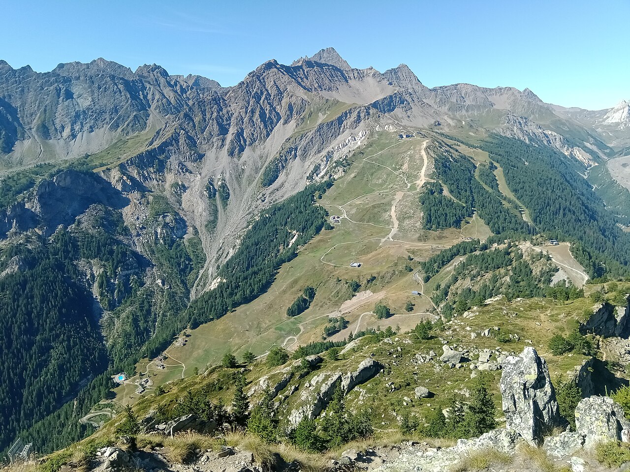
Courmayeur’s ski area has two principal sides, Chécrouit and Val Vény, facing the Mont Blanc landscape. Its appeal is not limited to difficult skiing: the resort provides ski schools and equipment hire alongside mountain restaurants. Use the piste map to choose terrain for your ability rather than treating the resort’s reputation as a description of every run.
Take care with headline distances. The official destination website combines groomed slopes and off-piste terrain in one advertised total; that is not the same measure as kilometres of prepared pistes alone. The map and current piste report are more informative when deciding what you can actually ski.
Our default point is at 1,205 m. It describes a lower location, while much of a ski day takes place above it. Check the chosen elevation before comparing a webcam with the forecast, and separate fresh snowfall from existing snow cover. For a mixed group planning both skiing and sightseeing, consult the particular facility’s operating information: a cable-car journey and a marked ski route are different activities with different access requirements.
Official sources: Courmayeur ski area · Courmayeur lifts and slopes. Reviewed 18 October 2026.
Courmayeur - Middle - Maison Vieille
ECMWF · Model run: Next update expected:
Day Time (UTC) Temp. (°C) Humidity (%) Wind (km/h) Wind (knots) Wind (Bft) Direction Precip. (mm) Snow (cm) Pressure (hPa) Freezing (m) Conditions | Thursday, 05/11 06:00 -1.3 85 4 2 1B E — — 1026 < 2136 Overcast 96% cloud 09:00 0.9 76 6 3 1B E 0.43 0.1 1027 < 2136 Overcast 91% cloud 12:00 2.7 71 6 3 2B E 0.08 0 1026 2465 Overcast 87% cloud 15:00 2.2 77 4 2 1B E 0.04 0 1025 2403 Overcast 83% cloud 18:00 0.3 86 3 2 1B E 0.46 0.1 1025 < 2136 Overcast 97% cloud 21:00 -0.4 89 3 2 1B E 1.1 0.3 1025 < 2136 Overcast 98% cloud Friday, 06/11 00:00 -0 90 3 2 1B NE 1.9 0.6 1025 < 2136 Overcast 100% cloud 03:00 -0.2 91 3 2 1B NE 2.1 0.6 1024 < 2136 Overcast 100% cloud 06:00 -1.1 89 1 1 1B N 1.1 0.3 1023 < 2136 Overcast 87% cloud 09:00 1.1 82 2 1 1B NE 0.18 0 1023 2170 Overcast 89% cloud 12:00 1.8 83 1 1 0B N 0.13 0 1022 2271 Overcast 100% cloud 15:00 1.5 87 1 1 1B N 0.53 0 1021 2220 Cloudy 68% cloud 18:00 0.2 92 2 1 1B NW 0.97 0.3 1022 < 2136 Overcast 100% cloud 21:00 0.3 92 2 1 1B W 0.57 0.2 1023 < 2136 Overcast 97% cloud Saturday, 07/11 00:00 0 92 1 1 1B W 0.31 0.1 1023 < 2136 Overcast 100% cloud 03:00 -0.3 93 1 1 1B W 0.04 0 1023 < 2136 Overcast 95% cloud 06:00 -0.5 92 0 0 0B NE 0 0 1023 < 2136 Overcast 95% cloud 09:00 0.3 85 3 2 1B E 0 0 1025 < 2136 Cloudy 73% cloud 12:00 2 74 3 2 1B E 0 0 1023 2275 Cloudy 50% cloud 15:00 1.2 77 2 1 1B NE 0.07 0 1023 2176 Cloudy 54% cloud 18:00 -1.8 89 1 1 0B NE 0.01 0 1024 < 2136 Cloudy 68% cloud 21:00 -3 88 1 1 0B E 0 0 1026 < 2136 Overcast 92% cloud Sunday, 08/11 00:00 -5.5 87 1 0 0B NW 0 0 1026 < 2136 Overcast 81% cloud 03:00 -5.6 75 1 0 0B W 0 0 1025 < 2136 Partly cloudy 47% cloud 06:00 -5.1 65 1 0 0B NW 0 0 1025 < 2136 Partly cloudy 33% cloud 09:00 0.8 43 1 1 1B NW 0 0 1025 < 2136 Clear 12% cloud 12:00 3.5 37 2 1 1B NW 0 0 1023 2440 Partly cloudy 49% cloud 15:00 2.2 43 2 1 1B NW 0 0 1023 2301 Cloudy 80% cloud 18:00 -2.4 56 1 1 1B W 0 0 1023 < 2136 Overcast 94% cloud 21:00 -1.6 76 1 0 0B W 0 0 1023 < 2136 Overcast 96% cloud Monday, 09/11 00:00 -1.6 81 0 0 0B SW 0 0 1023 < 2136 Overcast 99% cloud 03:00 -2 85 0 0 0B — 0.07 0 1022 < 2136 Overcast 98% cloud 06:00 -3 86 0 0 0B W 0 0 1022 < 2136 Overcast 89% cloud 09:00 2.7 71 2 1 1B NE 0 0 1022 2479 Overcast 96% cloud 12:00 4.3 69 2 1 1B E 0.03 0 1020 2707 Overcast 98% cloud 15:00 3.3 79 1 0 0B E 0.31 0 1018 2658 Overcast 100% cloud 18:00 2 88 1 0 0B E 0.29 0 1018 2468 Overcast 99% cloud 21:00 1.9 90 1 1 1B E 0.63 0 1018 2480 Overcast 100% cloud Tuesday, 10/11 00:00 2.1 91 1 0 0B N 0.35 0 1017 2528 Overcast 100% cloud 03:00 2.3 91 0 0 0B NW 1.3 0 1016 2614 Overcast 99% cloud 06:00 2.6 90 0 0 0B NW 0.88 0 1015 2768 Overcast 100% cloud 09:00 3.5 91 0 0 0B W 2.8 0 1015 2855 Overcast 100% cloud 12:00 5.8 84 1 1 0B W 0.95 0 1014 2940 Overcast 90% cloud 15:00 5.5 86 1 1 0B SW 1.00 0 1013 2907 Cloudy 70% cloud 18:00 1.8 92 1 1 0B NW 0.01 0 1013 2713 Overcast 96% cloud 21:00 -1 93 2 1 1B NW 0 0 1014 < 2136 Overcast 83% cloud Wednesday, 11/11 00:00 -1.1 90 1 1 1B NW 0 0 1013 2967 Cloudy 55% cloud 03:00 -0.1 81 1 1 0B NW 0 0 1013 < 2136 Partly cloudy 22% cloud 06:00 -0.3 80 1 0 0B NW 0 0 1013 < 2136 Partly cloudy 41% cloud |
|---|
Forecast notes
Forecast table times: UTC.
Coordinates: 45.7909197°N, 6.9333137°E · Requested elevation: 1958 m. Model terrain: 2134 m. Terrain and 1000/925/850/700 hPa profiles are used for height estimates.
Outside the available profile, temperature uses an estimated 5.5°C/km height correction; wind retains the nearest available model-level value. Humidity is estimated with adjusted pressure and temperature.
These are altitude estimates, not a simulation of local mountain terrain. Precipitation, cloud and sea-level pressure use horizontal interpolation only.
Precipitation includes rain and snow water equivalent: preceding 3 hours through day 6, then 6 hours (see cell tooltip). Snow (cm) estimates fresh snowfall from precipitation and temperature using the GFS conversion; it is not snow depth on the ground. Freezing (m) uses additional 600/500 hPa temperatures when available and estimates the lowest resolved 0°C crossing above sea level. When all sampled levels are warm, the upper profile limit is shown (see tooltip). < marks an entirely cold sampled profile and its lower height limit. No extrapolation is used.
Source: ECMWF · CC BY 4.0 · Processed by Snow Report.
Courmayeur - Top - Arp
ECMWF · Model run: Next update expected:
Day Time (UTC) Temp. (°C) Humidity (%) Wind (km/h) Wind (knots) Wind (Bft) Direction Precip. (mm) Snow (cm) Pressure (hPa) Freezing (m) Conditions | Thursday, 05/11 06:00 -3.8 82 20 11 4B SE — — 1026 < 2140 Overcast 96% cloud 09:00 -2.7 81 22 12 4B SE 0.53 0.2 1027 < 2140 Overcast 92% cloud 12:00 -1.5 76 18 10 3B SE 0.08 0 1026 2461 Overcast 86% cloud 15:00 -1.6 82 15 8 3B SE 0.04 0 1025 2398 Overcast 86% cloud 18:00 -2.5 89 15 8 3B SE 0.53 0.2 1025 < 2140 Overcast 96% cloud 21:00 -2.6 91 16 8 3B SE 1.2 0.4 1025 < 2140 Overcast 98% cloud Friday, 06/11 00:00 -2.8 95 10 6 2B SE 2.0 0.6 1025 < 2140 Overcast 100% cloud 03:00 -2.9 93 8 4 2B SE 2.0 2 1024 < 2140 Overcast 100% cloud 06:00 -3.5 95 5 3 1B SE 1.1 1.1 1023 < 2140 Overcast 86% cloud 09:00 -2.9 92 3 2 1B S 0.16 0.2 1023 2175 Overcast 86% cloud 12:00 -3.1 93 2 1 1B S 0.10 0.1 1022 2278 Overcast 100% cloud 15:00 -3.4 93 2 1 1B N 0.51 0.5 1021 2224 Cloudy 69% cloud 18:00 -4.1 98 7 4 2B N 0.88 0.9 1022 < 2140 Overcast 100% cloud 21:00 -4.3 99 7 4 2B N 0.53 0.5 1023 < 2140 Overcast 97% cloud Saturday, 07/11 00:00 -4.6 96 5 3 1B N 0.33 0.3 1023 < 2140 Overcast 100% cloud 03:00 -4.6 93 4 2 1B NE 0.04 0 1023 < 2140 Overcast 95% cloud 06:00 -4.7 88 2 1 1B NE 0 0 1023 < 2140 Overcast 97% cloud 09:00 -4.1 76 6 3 2B SE 0 0 1025 < 2140 Cloudy 75% cloud 12:00 -3.5 67 7 4 2B S 0 0 1023 2278 Partly cloudy 50% cloud 15:00 -3.9 77 5 3 1B SW 0.07 0.1 1023 2180 Cloudy 54% cloud 18:00 -4.8 71 5 3 1B SW 0.00 0 1024 < 2140 Cloudy 66% cloud 21:00 -5 55 6 3 2B SW 0 0 1026 < 2140 Overcast 92% cloud Sunday, 08/11 00:00 -5.5 47 7 4 2B W 0 0 1026 < 2140 Overcast 81% cloud 03:00 -5.8 44 9 5 2B W 0 0 1025 < 2140 Partly cloudy 50% cloud 06:00 -5.2 37 8 4 2B W 0 0 1025 < 2140 Partly cloudy 31% cloud 09:00 -3.4 35 11 6 2B W 0 0 1025 < 2140 Clear 12% cloud 12:00 -2.7 35 13 7 3B SW 0 0 1023 2437 Cloudy 52% cloud 15:00 -3.3 55 12 7 3B W 0 0 1023 2299 Overcast 81% cloud 18:00 -4.8 80 12 7 2B W 0 0 1023 < 2140 Overcast 95% cloud 21:00 -4.1 87 13 7 3B W 0 0 1023 < 2140 Overcast 96% cloud Monday, 09/11 00:00 -3.7 88 13 7 3B W 0 0 1023 < 2140 Overcast 99% cloud 03:00 -3.1 82 14 8 3B W 0.07 0.1 1022 < 2140 Overcast 98% cloud 06:00 -3.4 85 17 9 3B SW 0 0 1022 < 2140 Overcast 89% cloud 09:00 -1.4 86 20 11 3B SW 0 0 1022 2471 Overcast 96% cloud 12:00 -0.3 86 21 12 4B SW 0.04 0 1020 2704 Overcast 98% cloud 15:00 -0.4 91 20 11 4B SW 0.28 0.1 1018 2661 Overcast 100% cloud 18:00 -0.9 96 18 10 3B SW 0.19 0 1018 2456 Overcast 99% cloud 21:00 -0.8 96 15 8 3B SW 0.64 0.2 1018 2458 Overcast 100% cloud Tuesday, 10/11 00:00 -0.7 97 17 9 3B SW 0.32 0.1 1017 2512 Overcast 100% cloud 03:00 -0.4 97 17 9 3B W 1.3 0.4 1016 2605 Overcast 99% cloud 06:00 0 97 15 8 3B W 0.81 0.2 1015 2771 Overcast 100% cloud 09:00 0.3 98 14 8 3B W 2.8 0.8 1015 2854 Overcast 100% cloud 12:00 1.1 93 12 7 3B W 0.94 0.3 1014 2938 Overcast 91% cloud 15:00 0.9 94 10 5 2B W 1.0 0.3 1013 2906 Cloudy 71% cloud 18:00 -0.1 83 7 4 2B W 0.01 0 1013 2710 Overcast 97% cloud 21:00 -0.6 73 4 2 1B W 0 0 1014 < 2140 Overcast 85% cloud Wednesday, 11/11 00:00 -0.5 71 6 3 1B SW 0 0 1013 2972 Cloudy 55% cloud 03:00 -0.4 73 7 4 2B SW 0 0 1013 < 2140 Partly cloudy 21% cloud 06:00 -0.5 73 7 4 2B SW 0 0 1013 < 2140 Partly cloudy 41% cloud |
|---|
Forecast notes
Forecast table times: UTC.
Coordinates: 45.7706665°N, 6.9156433°E · Requested elevation: 2755 m. Model terrain: 2137 m. Terrain and 1000/925/850/700 hPa profiles are used for height estimates.
These are altitude estimates, not a simulation of local mountain terrain. Precipitation, cloud and sea-level pressure use horizontal interpolation only.
Precipitation includes rain and snow water equivalent: preceding 3 hours through day 6, then 6 hours (see cell tooltip). Snow (cm) estimates fresh snowfall from precipitation and temperature using the GFS conversion; it is not snow depth on the ground. Freezing (m) uses additional 600/500 hPa temperatures when available and estimates the lowest resolved 0°C crossing above sea level. When all sampled levels are warm, the upper profile limit is shown (see tooltip). < marks an entirely cold sampled profile and its lower height limit. No extrapolation is used.