Worldwide Ski Resort Forecasts

More
Colour guide Temperature · Wind · Rain · Snow
Each colour starts at the value shown. Wind colours match across all three units. Dry cells stay neutral. Colours describe the displayed values, not official weather warnings.
Llandudno Ski and Snowboard Centre - Base lift station
ECMWF · Model run: Next update expected:
Day Time (UTC) Temp. (°C) Humidity (%) Wind (km/h) Wind (knots) Wind (Bft) Direction Precip. (mm) Snow (cm) Pressure (hPa) Freezing (m) Conditions | Thursday, 05/11 06:00 9.4 86 24 13 4B E — — 1029 1448 Cloudy 76% cloud  09:00 9.6 86 24 13 4B E 0.12 0 1029 1632 Overcast 87% cloud  12:00 10.1 72 25 13 4B E 0.02 0 1028 1965 Cloudy 69% cloud 15:00 10 72 19 10 3B E 0.01 0 1027 1821 Overcast 84% cloud 18:00 9.1 77 16 9 3B E 0 0 1026 1712 Overcast 82% cloud 21:00 9.4 73 18 9 3B E 0.05 0 1027 1940 Overcast 100% cloud Friday, 06/11 00:00 8.6 79 13 7 3B E 0 0 1027 2057 Overcast 95% cloud 03:00 8.4 80 13 7 3B E 0.01 0 1026 2128 Overcast 97% cloud 06:00 8.3 82 11 6 2B E 0 0 1025 2120 Overcast 98% cloud 09:00 8.6 81 12 6 2B E 0.06 0 1026 2003 Overcast 98% cloud 12:00 9.1 80 13 7 3B SE 0.44 0 1025 1868 Overcast 90% cloud 15:00 9.6 77 10 6 2B E 0 0 1024 1833 Overcast 96% cloud 18:00 9 84 5 3 1B SE 0.04 0 1024 1751 Overcast 100% cloud 21:00 8.8 85 3 2 1B SE 0.05 0 1024 1634 Overcast 100% cloud Saturday, 07/11 00:00 8.8 85 3 2 1B E 0.12 0 1024 1543 Overcast 100% cloud 03:00 8.5 84 3 2 1B S 0.10 0 1023 1495 Overcast 99% cloud 06:00 8.4 81 4 2 1B S 0 0 1023 1418 Overcast 86% cloud 09:00 8.9 79 6 3 1B SW 0 0 1023 1383 Cloudy 75% cloud 12:00 10.2 75 5 3 1B W 0 0 1023 1436 Overcast 81% cloud 15:00 9.9 80 7 4 2B W 0.09 0 1022 1445 Overcast 99% cloud 18:00 9.3 87 7 4 2B SW 0.51 0 1022 1484 Overcast 100% cloud 21:00 8.9 90 10 5 2B SW 0.35 0 1022 1477 Overcast 98% cloud Sunday, 08/11 00:00 7.8 89 9 5 2B SW 0.17 0 1021 1449 Partly cloudy 49% cloud  03:00 7.6 90 10 5 2B SW 0.19 0 1020 1459 Cloudy 56% cloud 06:00 7.8 90 9 5 2B SW 0.26 0 1020 1421 Cloudy 77% cloud 09:00 8.3 89 8 4 2B SW 0.01 0 1020 1464 Overcast 88% cloud 12:00 10.3 78 10 5 2B W 0.20 0 1020 1406 Cloudy 55% cloud 15:00 10 81 10 5 2B W 0.27 0 1019 1412 Partly cloudy 39% cloud 18:00 7.7 85 7 4 2B SW 0.13 0 1019 1401 Partly cloudy 40% cloud 21:00 7 87 5 3 1B SW 0.10 0 1019 1407 Partly cloudy 43% cloud Monday, 09/11 00:00 5.5 89 4 2 1B SW 0.08 0 1019 1436 Cloudy 59% cloud 03:00 4.3 97 6 3 2B S 0.03 0 1018 1447 Cloudy 67% cloud 06:00 3.8 97 7 4 2B SE 0 0 1018 1480 Overcast 99% cloud 09:00 5.4 93 13 7 3B SE 0 0 1018 1722 Cloudy 66% cloud 12:00 8.1 88 16 9 3B E 0 0 1018 2069 Cloudy 57% cloud 15:00 7.7 86 20 11 3B E 0 0 1016 2376 Cloudy 76% cloud 18:00 8.1 81 19 10 3B E 0 0 1016 2541 Cloudy 69% cloud 21:00 6.2 87 20 11 3B SE 0 0 1016 2657 Clear 5% cloud  Tuesday, 10/11 00:00 5.8 89 21 11 4B SE 0.03 0 1015 2764 Cloudy 50% cloud 03:00 5.7 90 23 12 4B SE 0 0 1013 2780 Cloudy 73% cloud 06:00 5.7 90 24 13 4B SE 0 0 1012 2895 Overcast 80% cloud 09:00 6.3 88 25 14 4B SE 0 0 1012 2956 Cloudy 61% cloud 12:00 8.1 82 27 15 4B SE 0 0 1011 2872 Partly cloudy 36% cloud 15:00 8.7 79 24 13 4B SE 0 0 1009 2767 Overcast 83% cloud 18:00 8.6 84 22 12 4B SE 0.74 0 1008 2624 Overcast 100% cloud 21:00 9 85 21 12 4B SE 0.59 0 1007 2608 Overcast 99% cloud Wednesday, 11/11 00:00 8.8 86 20 11 4B SE 0.02 0 1006 2652 Overcast 100% cloud 03:00 9 90 17 9 3B SE 1.1 0 1004 2616 Overcast 100% cloud 06:00 9 91 15 8 3B SE 0.64 0 1002 2554 Overcast 100% cloud |
|---|
Forecast notes
Forecast table times: UTC.
Coordinates: 53.3294311°N, -3.8294551°E · Requested elevation: 39 m. Model terrain: 100 m. Terrain and 1000/925/850/700 hPa profiles are used for height estimates.
Outside the available profile, temperature uses an estimated 5.5°C/km height correction; wind retains the nearest available model-level value. Humidity is estimated with adjusted pressure and temperature.
These are altitude estimates, not a simulation of local mountain terrain. Precipitation, cloud and sea-level pressure use horizontal interpolation only.
Precipitation includes rain and snow water equivalent: preceding 3 hours through day 6, then 6 hours (see cell tooltip). Snow (cm) estimates fresh snowfall from precipitation and temperature using the GFS conversion; it is not snow depth on the ground. Freezing (m) uses additional 600/500 hPa temperatures when available and estimates the lowest resolved 0°C crossing above sea level. When all sampled levels are warm, the upper profile limit is shown (see tooltip). < marks an entirely cold sampled profile and its lower height limit. No extrapolation is used.
Source: ECMWF · CC BY 4.0 · Processed by Snow Report.
Outdoor dry ski slope · Synthetic surface; weather forecast for the outdoor location.
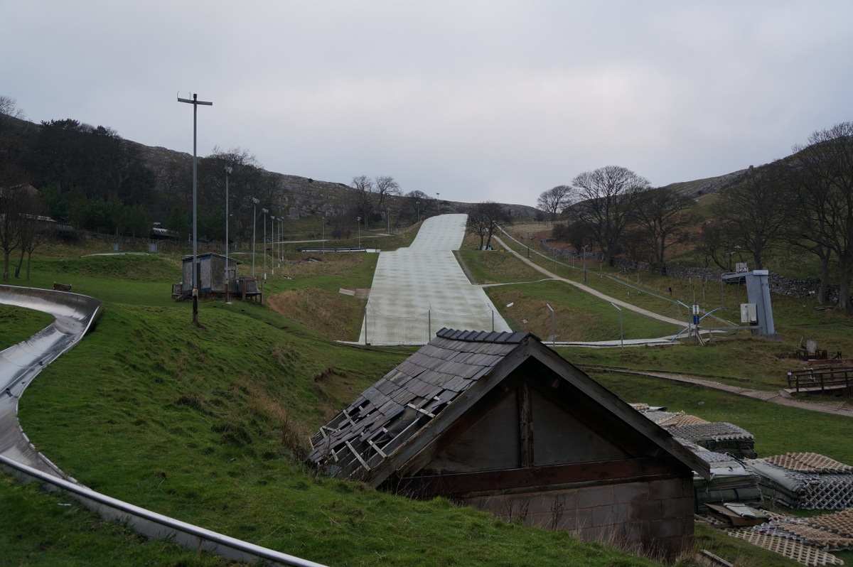
Llandudno Ski and Snowboard Centre is a mapped downhill ski area in GB. Forecasts cover three real lift-station locations from approximately 39 to 197 metres. Elevations are terrain-model estimates.
Data: OpenSkiData / OpenSkiMap, OpenStreetMap contributors (ODbL), Skimap.org, Who's On First, Mapterhorn.
Llandudno Ski and Snowboard Centre - Middle lift station
ECMWF · Model run: Next update expected:
Day Time (UTC) Temp. (°C) Humidity (%) Wind (km/h) Wind (knots) Wind (Bft) Direction Precip. (mm) Snow (cm) Pressure (hPa) Freezing (m) Conditions | Thursday, 05/11 06:00 8.9 87 27 14 4B E — — 1029 1450 Cloudy 75% cloud 09:00 9 87 26 14 4B E 0.12 0 1029 1634 Overcast 87% cloud 12:00 9.4 74 26 14 4B E 0.02 0 1028 1965 Cloudy 68% cloud 15:00 9.4 74 20 11 4B E 0.01 0 1027 1820 Overcast 84% cloud 18:00 8.7 77 18 10 3B E 0 0 1026 1710 Overcast 82% cloud 21:00 8.9 74 19 10 3B E 0.05 0 1027 1935 Overcast 100% cloud Friday, 06/11 00:00 8.1 80 15 8 3B E 0 0 1027 2055 Overcast 94% cloud 03:00 7.9 81 15 8 3B E 0.01 0 1026 2127 Overcast 96% cloud 06:00 7.8 83 12 7 3B E 0 0 1025 2119 Overcast 98% cloud 09:00 8 83 13 7 3B E 0.05 0 1026 2003 Overcast 98% cloud 12:00 8.4 82 14 7 3B SE 0.43 0 1025 1868 Overcast 90% cloud 15:00 8.9 78 11 6 2B E 0 0 1024 1834 Overcast 96% cloud 18:00 8.6 84 6 3 2B SE 0.04 0 1024 1752 Overcast 100% cloud 21:00 8.4 85 4 2 1B E 0.05 0 1024 1634 Overcast 100% cloud Saturday, 07/11 00:00 8.3 85 4 2 1B E 0.12 0 1024 1542 Overcast 100% cloud 03:00 8.2 84 4 2 1B S 0.11 0 1023 1494 Overcast 99% cloud 06:00 8.1 82 4 2 1B S 0 0 1023 1417 Overcast 86% cloud 09:00 8.4 80 5 3 1B SW 0 0 1023 1384 Cloudy 75% cloud 12:00 9.4 78 6 3 1B W 0 0 1023 1436 Overcast 82% cloud 15:00 9.3 82 7 4 2B W 0.10 0 1022 1446 Overcast 99% cloud 18:00 8.8 88 8 4 2B SW 0.53 0 1022 1485 Overcast 100% cloud 21:00 8.5 90 11 6 2B SW 0.35 0 1022 1478 Overcast 98% cloud Sunday, 08/11 00:00 7.8 88 11 6 2B SW 0.18 0 1021 1448 Partly cloudy 49% cloud 03:00 7.5 89 12 6 2B SW 0.20 0 1020 1459 Cloudy 57% cloud 06:00 7.6 89 11 6 2B W 0.27 0 1020 1420 Cloudy 77% cloud 09:00 8 89 9 5 2B SW 0.01 0 1020 1464 Overcast 88% cloud 12:00 9.3 81 11 6 2B W 0.20 0 1020 1406 Cloudy 56% cloud 15:00 9.5 82 10 6 2B W 0.27 0 1019 1412 Partly cloudy 39% cloud 18:00 7.3 87 7 4 2B SW 0.13 0 1019 1400 Partly cloudy 41% cloud 21:00 6.6 88 5 3 1B SW 0.11 0 1019 1407 Partly cloudy 43% cloud Monday, 09/11 00:00 5.2 91 4 2 1B SW 0.08 0 1019 1437 Cloudy 59% cloud 03:00 4 98 6 3 1B S 0.03 0 1018 1447 Cloudy 68% cloud 06:00 3.6 98 7 4 2B SE 0 0 1018 1481 Overcast 99% cloud 09:00 5 94 13 7 3B SE 0 0 1018 1723 Cloudy 67% cloud 12:00 7.6 89 17 9 3B E 0 0 1018 2068 Cloudy 57% cloud 15:00 7.2 87 20 11 4B E 0 0 1016 2376 Cloudy 75% cloud 18:00 7.5 82 20 11 4B E 0 0 1016 2542 Cloudy 68% cloud 21:00 5.9 87 21 11 4B SE 0 0 1016 2657 Clear 5% cloud Tuesday, 10/11 00:00 5.5 89 22 12 4B SE 0.03 0 1015 2764 Partly cloudy 49% cloud 03:00 5.4 90 24 13 4B SE 0 0 1013 2781 Cloudy 72% cloud 06:00 5.4 90 25 14 4B SE 0 0 1012 2893 Cloudy 79% cloud 09:00 6 87 27 14 4B SE 0 0 1012 2953 Cloudy 59% cloud 12:00 7.7 81 29 15 4B SE 0 0 1011 2871 Partly cloudy 36% cloud 15:00 8.4 79 25 13 4B SE 0 0 1009 2766 Overcast 82% cloud 18:00 8.3 86 23 12 4B SE 0.74 0 1008 2623 Overcast 100% cloud 21:00 8.6 86 22 12 4B SE 0.59 0 1007 2608 Overcast 99% cloud Wednesday, 11/11 00:00 8.5 87 20 11 4B SE 0.03 0 1006 2652 Overcast 99% cloud 03:00 8.8 91 17 9 3B SE 1.1 0 1004 2615 Overcast 100% cloud 06:00 8.8 93 15 8 3B SE 0.66 0 1002 2553 Overcast 100% cloud |
|---|
Forecast notes
Forecast table times: UTC.
Coordinates: 53.3327822°N, -3.8354474°E · Requested elevation: 125 m. Model terrain: 98 m. Terrain and 1000/925/850/700 hPa profiles are used for height estimates.
These are altitude estimates, not a simulation of local mountain terrain. Precipitation, cloud and sea-level pressure use horizontal interpolation only.
Precipitation includes rain and snow water equivalent: preceding 3 hours through day 6, then 6 hours (see cell tooltip). Snow (cm) estimates fresh snowfall from precipitation and temperature using the GFS conversion; it is not snow depth on the ground. Freezing (m) uses additional 600/500 hPa temperatures when available and estimates the lowest resolved 0°C crossing above sea level. When all sampled levels are warm, the upper profile limit is shown (see tooltip). < marks an entirely cold sampled profile and its lower height limit. No extrapolation is used.
Source: ECMWF · CC BY 4.0 · Processed by Snow Report.
Llandudno Ski and Snowboard Centre - Top lift station
ECMWF · Model run: Next update expected:
Day Time (UTC) Temp. (°C) Humidity (%) Wind (km/h) Wind (knots) Wind (Bft) Direction Precip. (mm) Snow (cm) Pressure (hPa) Freezing (m) Conditions | Thursday, 05/11 06:00 8.4 88 31 17 5B E — — 1029 1453 Cloudy 74% cloud 09:00 8.3 88 31 17 5B E 0.12 0 1029 1652 Overcast 87% cloud 12:00 8.4 75 29 15 4B E 0.02 0 1028 1973 Cloudy 67% cloud 15:00 8.5 75 23 13 4B E 0.01 0 1027 1822 Overcast 84% cloud 18:00 8.4 75 23 13 4B E 0 0 1026 1698 Overcast 80% cloud 21:00 8.3 74 24 13 4B E 0.05 0 1027 1927 Overcast 100% cloud Friday, 06/11 00:00 7.5 80 19 10 3B E 0 0 1027 2050 Overcast 93% cloud 03:00 7.3 81 19 10 3B E 0.02 0 1026 2124 Overcast 96% cloud 06:00 7.3 82 16 9 3B E 0 0 1025 2118 Overcast 98% cloud 09:00 7.3 84 16 9 3B E 0.05 0 1026 2000 Overcast 98% cloud 12:00 7.4 83 15 8 3B SE 0.41 0 1025 1865 Overcast 88% cloud 15:00 8.1 79 13 7 3B E 0 0 1024 1834 Overcast 95% cloud 18:00 8.1 82 8 4 2B SE 0.04 0 1024 1754 Overcast 100% cloud 21:00 8 82 5 3 1B E 0.05 0 1024 1634 Overcast 100% cloud Saturday, 07/11 00:00 8 83 5 3 1B E 0.12 0 1024 1542 Overcast 100% cloud 03:00 8 81 4 2 1B SE 0.10 0 1023 1493 Overcast 99% cloud 06:00 7.8 81 4 2 1B S 0 0 1023 1415 Overcast 87% cloud 09:00 7.9 80 5 3 1B SW 0 0 1023 1385 Cloudy 73% cloud 12:00 8.3 81 6 3 2B W 0 0 1023 1436 Overcast 83% cloud 15:00 8.4 84 8 4 2B W 0.11 0 1022 1446 Overcast 99% cloud 18:00 8.1 88 10 5 2B SW 0.54 0 1022 1485 Overcast 100% cloud 21:00 8 89 13 7 3B SW 0.35 0 1022 1479 Overcast 97% cloud Sunday, 08/11 00:00 8 86 13 7 3B W 0.17 0 1021 1447 Cloudy 50% cloud 03:00 7.6 87 14 7 3B SW 0.20 0 1020 1458 Cloudy 58% cloud 06:00 7.6 87 12 7 3B W 0.27 0 1020 1419 Cloudy 76% cloud 09:00 7.8 87 9 5 2B W 0.02 0 1020 1463 Overcast 88% cloud 12:00 8.2 84 12 6 2B W 0.20 0 1020 1406 Cloudy 56% cloud 15:00 8.9 83 11 6 2B W 0.26 0 1019 1412 Partly cloudy 39% cloud 18:00 7 87 8 4 2B SW 0.13 0 1019 1399 Partly cloudy 41% cloud 21:00 6.4 88 5 3 1B SW 0.10 0 1019 1408 Partly cloudy 43% cloud Monday, 09/11 00:00 5.1 90 4 2 1B SW 0.08 0 1019 1438 Cloudy 60% cloud 03:00 4 97 5 3 1B S 0.02 0 1018 1447 Cloudy 68% cloud 06:00 3.6 97 7 4 2B SE 0 0 1018 1483 Overcast 99% cloud 09:00 4.9 93 14 8 3B SE 0 0 1018 1727 Cloudy 67% cloud 12:00 7.3 87 18 10 3B E 0 0 1018 2070 Cloudy 55% cloud 15:00 6.9 85 22 12 4B E 0 0 1016 2379 Cloudy 72% cloud 18:00 7 83 22 12 4B E 0 0 1016 2545 Cloudy 67% cloud 21:00 5.7 85 23 13 4B SE 0 0 1016 2661 Clear 5% cloud Tuesday, 10/11 00:00 5.4 86 25 13 4B SE 0.03 0 1015 2767 Partly cloudy 47% cloud 03:00 5.3 85 27 15 4B SE 0 0 1013 2785 Cloudy 69% cloud 06:00 5.4 85 28 15 4B SE 0 0 1012 2894 Cloudy 78% cloud 09:00 6.1 82 30 16 5B SE 0 0 1012 2947 Cloudy 56% cloud 12:00 7.7 76 31 17 5B SE 0 0 1010 2870 Partly cloudy 34% cloud 15:00 8.4 76 27 15 4B SE 0 0 1009 2761 Overcast 81% cloud 18:00 8.1 86 25 14 4B SE 0.79 0 1008 2622 Overcast 100% cloud 21:00 8.5 87 24 13 4B SE 0.58 0 1007 2608 Overcast 99% cloud Wednesday, 11/11 00:00 8.7 88 20 11 4B SE 0.03 0 1006 2652 Overcast 99% cloud 03:00 8.9 92 16 9 3B SE 1.0 0 1004 2612 Overcast 100% cloud 06:00 9 93 13 7 3B SE 0.71 0 1002 2551 Overcast 100% cloud |
|---|
Forecast notes
Forecast table times: UTC.
Coordinates: 53.3327795°N, -3.8527482°E · Requested elevation: 197 m. Model terrain: 98 m. Terrain and 1000/925/850/700 hPa profiles are used for height estimates.
These are altitude estimates, not a simulation of local mountain terrain. Precipitation, cloud and sea-level pressure use horizontal interpolation only.
Precipitation includes rain and snow water equivalent: preceding 3 hours through day 6, then 6 hours (see cell tooltip). Snow (cm) estimates fresh snowfall from precipitation and temperature using the GFS conversion; it is not snow depth on the ground. Freezing (m) uses additional 600/500 hPa temperatures when available and estimates the lowest resolved 0°C crossing above sea level. When all sampled levels are warm, the upper profile limit is shown (see tooltip). < marks an entirely cold sampled profile and its lower height limit. No extrapolation is used.