Worldwide Ski Resort Forecasts

More
Colour guide Temperature · Wind · Rain · Snow
Each colour starts at the value shown. Wind colours match across all three units. Dry cells stay neutral. Colours describe the displayed values, not official weather warnings.
Preparing forecast graphs…
Times and values match the detailed forecast. Tap or point at a value for details. Scroll each chart sideways for later days. Rain / precipitation is the total water equivalent per forecast interval, including snow; snowfall is fresh snow per interval, not snow depth.
GFS and ECMWF model comparison. Each model retains its own forecast times and horizon. Precipitation and snowfall amounts cover their own forecast intervals; these can differ between models.
Forecast values and model notes
Hakuba Happo One - Low lift station
ECMWF · Model run: Next update expected:
Day Time (UTC) Temp. (°C) Humidity (%) Wind (km/h) Wind (knots) Wind (Bft) Direction Precip. (mm) Snow (cm) Pressure (hPa) Freezing (m) Conditions | Thursday, 05/11 06:00 16.5 61 0 0 0B W — — 1010 3049 Partly cloudy 46% cloud  09:00 12.7 77 2 1 1B S 0.14 0 1010 3044 Overcast 97% cloud  12:00 12 78 2 1 1B SW 1.1 0 1008 3027 Cloudy 54% cloud  15:00 12.1 77 2 1 1B W 0.86 0 1007 3014 Overcast 90% cloud 18:00 11.6 80 3 2 1B W 2.5 0 1006 3000 Overcast 90% cloud 21:00 11 82 6 3 1B NW 3.4 0 1008 2894 Overcast 96% cloud Friday, 06/11 00:00 11.6 82 6 3 1B NW 1.9 0 1010 2804 Cloudy 79% cloud 03:00 13.7 53 9 5 2B W 0.64 0 1010 2810 Cloudy 68% cloud 06:00 11.4 69 7 4 2B NW 2.2 0 1011 2617 Overcast 87% cloud 09:00 8.6 75 7 4 2B NW 1.7 0 1015 2417 Overcast 89% cloud 12:00 6.8 77 5 2 1B NW 1.0 0 1017 2007 Overcast 89% cloud 15:00 5.2 79 6 3 1B NW 2.5 0 1019 1674 Overcast 99% cloud 18:00 3.6 80 5 3 1B NW 3.0 0 1019 1413 Overcast 99% cloud 21:00 3 76 5 2 1B NW 1.2 0 1021 < 1409 Overcast 96% cloud Saturday, 07/11 00:00 3.3 75 7 4 2B NW 3.3 0 1024 < 1409 Overcast 99% cloud 03:00 4.3 66 8 4 2B NW 2.5 0 1024 1501 Overcast 89% cloud 06:00 3.3 65 9 5 2B NW 1.7 0 1026 < 1409 Overcast 88% cloud 09:00 1.2 72 5 3 1B NW 1.2 0 1030 < 1409 Overcast 80% cloud 12:00 0.1 70 5 2 1B NW 0.14 0 1031 < 1409 Overcast 82% cloud 15:00 -1 69 5 3 1B NW 0.06 0 1033 < 1409 Cloudy 80% cloud 18:00 -0.3 71 5 3 1B NW 0.19 0 1033 < 1409 Overcast 93% cloud 21:00 -0 73 3 2 1B NW 0.11 0 1034 < 1409 Overcast 94% cloud Sunday, 08/11 00:00 3.7 57 2 1 1B NW 0.03 0 1035 1474 Cloudy 66% cloud 03:00 7.1 46 4 2 1B N 0 0 1032 2479 Cloudy 53% cloud 06:00 6.1 58 3 2 1B NE 0 0 1031 2351 Cloudy 69% cloud 09:00 2.4 74 1 0 0B N 0 0 1032 < 1409 Overcast 92% cloud 12:00 2.2 72 2 1 1B S 0 0 1031 < 1409 Overcast 85% cloud 15:00 2.8 68 2 1 1B S 0 0 1029 < 1409 Overcast 96% cloud 18:00 3.2 65 1 1 1B S 0.08 0 1027 < 1409 Overcast 99% cloud 21:00 4.6 62 2 1 1B S 0.16 0 1025 1672 Overcast 98% cloud Monday, 09/11 00:00 8.8 58 3 2 1B SW 0.29 0 1024 2253 Overcast 91% cloud 03:00 11.5 48 3 1 1B W 0.04 0 1021 2438 Partly cloudy 23% cloud 06:00 10.5 54 2 1 1B NW 0 0 1020 2351 Cloudy 66% cloud 09:00 6.6 74 3 2 1B NW 0.26 0 1021 2025 Overcast 87% cloud 12:00 4.7 81 5 3 1B NW 4.2 0 1024 1653 Overcast 96% cloud 15:00 3.2 81 5 3 1B NW 2.4 0 1025 < 1409 Overcast 97% cloud 18:00 2.1 77 5 3 1B NW 0.44 0 1025 < 1409 Overcast 87% cloud 21:00 0.8 76 5 2 1B NW 0.08 0 1026 < 1409 Overcast 87% cloud Tuesday, 10/11 00:00 2.8 66 5 3 1B NW 0.11 0 1027 < 1409 Cloudy 74% cloud 03:00 5.1 55 7 4 2B N 0.14 0 1025 1662 Cloudy 63% cloud 06:00 3.6 62 5 3 1B N 0.26 0 1026 1411 Cloudy 56% cloud 09:00 -0.2 75 2 1 1B N 0 0 1028 < 1409 Overcast 81% cloud 12:00 -2.5 72 2 1 1B NW 0.07 0 1028 < 1409 Cloudy 58% cloud 15:00 -3.4 68 1 1 1B NW 0 0 1028 < 1409 Partly cloudy 37% cloud 18:00 -3.3 65 1 1 1B NW 0 0 1028 < 1409 Partly cloudy 30% cloud 21:00 -3 62 1 1 1B NW 0 0 1029 < 1409 Clear 19% cloud  Wednesday, 11/11 00:00 4.3 48 2 1 1B N 0 0 1030 1573 Clear 6% cloud 03:00 7.5 43 4 2 1B N 0 0 1028 2027 Clear 4% cloud 06:00 7.1 46 4 2 1B N 0 0 1029 2027 Clear 0% cloud |
|---|
Forecast notes
Forecast table times: UTC.
Coordinates: 36.6982934°N, 137.8387784°E · Requested elevation: 749 m. Model terrain: 1407 m. Terrain and 1000/925/850/700 hPa profiles are used for height estimates.
Outside the available profile, temperature uses an estimated 5.5°C/km height correction; wind retains the nearest available model-level value. Humidity is estimated with adjusted pressure and temperature.
These are altitude estimates, not a simulation of local mountain terrain. Precipitation, cloud and sea-level pressure use horizontal interpolation only.
Precipitation includes rain and snow water equivalent: preceding 3 hours through day 6, then 6 hours (see cell tooltip). Snow (cm) estimates fresh snowfall from precipitation and temperature using the GFS conversion; it is not snow depth on the ground. Freezing (m) uses additional 600/500 hPa temperatures when available and estimates the lowest resolved 0°C crossing above sea level. When all sampled levels are warm, the upper profile limit is shown (see tooltip). < marks an entirely cold sampled profile and its lower height limit. No extrapolation is used.
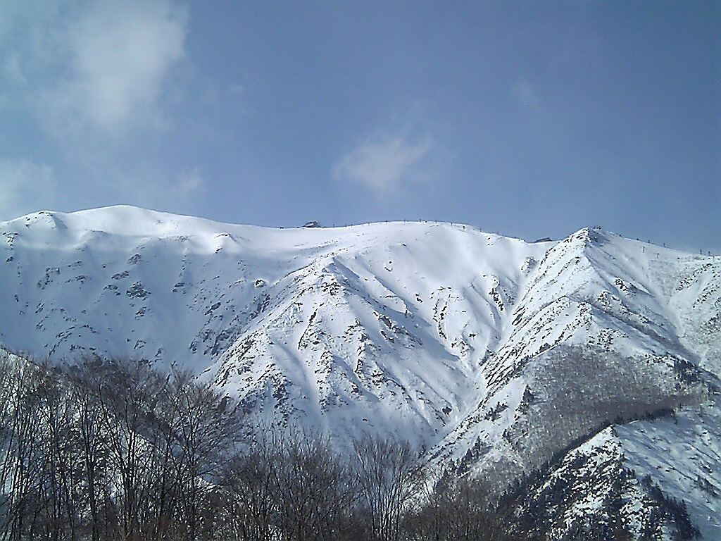
Hakuba Happo-one is a ski area in Nagano, with courses that hosted alpine events during the 1998 Winter Olympics. The official trail guide distinguishes the Olympic courses from learning areas and other runs. Its upper lifts reach approximately 1,830 m, giving a very different mountain setting from the lower access points.
The Olympic name is part of the area’s history, not a difficulty rating for every piste. Choose a route from the current trail guide, including any easier alternative indicated there. For a group with different abilities, agree on a suitable meeting area before heading up rather than assuming everyone will return by the same descent.
The SnowReportMeteo forecast starts at a lower reference of 749 m. For skiing near the upper lifts, select an appropriate elevation and inspect wind and cloud together with the snow forecast. The lower-point temperature alone cannot describe the upper mountain. Compare the forecast with the resort’s current operating information and webcams; an open lower area does not establish that all upper terrain is available.
Official sources: Hakuba Happo-one mountain information · Happo-one trail guide · 白馬八方尾根 — ゲレンデ情報. Reviewed 18 October 2026.
Preparing forecast graphs…
Times and values match the detailed forecast. Tap or point at a value for details. Scroll each chart sideways for later days. Rain / precipitation is the total water equivalent per forecast interval, including snow; snowfall is fresh snow per interval, not snow depth.
GFS and ECMWF model comparison. Each model retains its own forecast times and horizon. Precipitation and snowfall amounts cover their own forecast intervals; these can differ between models.
Forecast values and model notes
Hakuba Happo One - Base lift station
ECMWF · Model run: Next update expected:
Day Time (UTC) Temp. (°C) Humidity (%) Wind (km/h) Wind (knots) Wind (Bft) Direction Precip. (mm) Snow (cm) Pressure (hPa) Freezing (m) Conditions | Thursday, 05/11 06:00 16.4 61 0 0 0B W — — 1010 3049 Partly cloudy 47% cloud 09:00 12.6 77 2 1 1B S 0.15 0 1010 3044 Overcast 98% cloud 12:00 11.9 79 2 1 1B SW 1.1 0 1008 3027 Cloudy 53% cloud 15:00 12 78 2 1 1B W 0.87 0 1007 3014 Overcast 91% cloud 18:00 11.6 80 3 2 1B W 2.6 0 1006 3000 Overcast 90% cloud 21:00 10.9 82 6 3 1B NW 3.5 0 1008 2891 Overcast 96% cloud Friday, 06/11 00:00 11.5 82 6 3 1B NW 1.9 0 1010 2800 Cloudy 79% cloud 03:00 13.5 54 9 5 2B W 0.65 0 1010 2805 Cloudy 68% cloud 06:00 11.2 70 7 4 2B NW 2.3 0 1011 2612 Overcast 87% cloud 09:00 8.4 76 7 4 2B NW 1.7 0 1015 2408 Overcast 89% cloud 12:00 6.6 77 5 2 1B NW 1.0 0 1017 2001 Overcast 90% cloud 15:00 5.1 79 6 3 1B NW 2.5 0 1019 1670 Overcast 99% cloud 18:00 3.5 80 5 3 1B NW 3.1 0 1020 < 1416 Overcast 99% cloud 21:00 2.8 76 5 3 1B NW 1.2 0 1021 < 1416 Overcast 96% cloud Saturday, 07/11 00:00 3.1 76 7 4 2B NW 3.3 0 1024 < 1416 Overcast 99% cloud 03:00 4.1 67 8 4 2B NW 2.6 0 1024 1493 Overcast 90% cloud 06:00 3.1 65 9 5 2B NW 1.8 0 1026 < 1416 Overcast 88% cloud 09:00 1.1 72 5 3 1B NW 1.2 0.4 1030 < 1416 Overcast 81% cloud 12:00 -0 70 5 3 1B NW 0.14 0 1031 < 1416 Overcast 82% cloud 15:00 -1.2 69 5 3 1B NW 0.06 0 1033 < 1416 Cloudy 80% cloud 18:00 -0.5 71 5 3 1B NW 0.19 0 1033 < 1416 Overcast 93% cloud 21:00 -0.1 73 3 2 1B W 0.11 0 1034 < 1416 Overcast 94% cloud Sunday, 08/11 00:00 3.5 58 2 1 1B NW 0.03 0 1035 < 1416 Cloudy 65% cloud 03:00 7 46 4 2 1B N 0 0 1032 2469 Cloudy 52% cloud 06:00 5.9 59 3 2 1B NE 0 0 1031 2339 Cloudy 69% cloud 09:00 2.3 74 1 0 0B N 0 0 1032 < 1416 Overcast 92% cloud 12:00 2.1 72 2 1 1B S 0 0 1031 < 1416 Overcast 85% cloud 15:00 2.7 68 2 1 1B S 0 0 1029 < 1416 Overcast 96% cloud 18:00 3.1 65 1 1 1B S 0.08 0 1027 < 1416 Overcast 99% cloud 21:00 4.5 63 2 1 1B S 0.16 0 1025 1672 Overcast 98% cloud Monday, 09/11 00:00 8.7 58 3 2 1B SW 0.29 0 1024 2254 Overcast 91% cloud 03:00 11.4 48 3 1 1B W 0.04 0 1021 2436 Partly cloudy 23% cloud 06:00 10.3 55 3 1 1B NW 0 0 1020 2347 Cloudy 66% cloud 09:00 6.5 75 3 2 1B NW 0.27 0 1021 2021 Overcast 87% cloud 12:00 4.6 82 5 3 1B NW 4.2 0 1024 1645 Overcast 96% cloud 15:00 3 81 5 3 1B NW 2.4 0 1025 < 1416 Overcast 97% cloud 18:00 1.9 78 5 3 1B NW 0.45 0 1025 < 1416 Overcast 88% cloud 21:00 0.7 76 5 3 1B NW 0.08 0 1026 < 1416 Overcast 87% cloud Tuesday, 10/11 00:00 2.6 67 5 3 1B NW 0.11 0 1028 < 1416 Cloudy 75% cloud 03:00 5 55 7 4 2B NW 0.14 0 1025 1653 Cloudy 63% cloud 06:00 3.5 63 5 3 1B N 0.27 0 1026 < 1416 Cloudy 56% cloud 09:00 -0.4 76 2 1 1B N 0 0 1028 < 1416 Overcast 82% cloud 12:00 -2.7 72 2 1 1B NW 0.07 0 1028 < 1416 Cloudy 58% cloud 15:00 -3.6 69 1 1 1B W 0 0 1028 < 1416 Partly cloudy 37% cloud 18:00 -3.5 65 1 1 1B NW 0 0 1028 < 1416 Partly cloudy 30% cloud 21:00 -3.1 62 1 1 1B NW 0 0 1029 < 1416 Clear 19% cloud Wednesday, 11/11 00:00 4.2 49 2 1 1B N 0 0 1030 1570 Clear 6% cloud 03:00 7.4 44 4 2 1B N 0 0 1028 2024 Clear 4% cloud 06:00 7 46 4 2 1B N 0 0 1029 2022 Clear 0% cloud |
|---|
Forecast notes
Forecast table times: UTC.
Coordinates: 36.7017907°N, 137.8368278°E · Requested elevation: 768 m. Model terrain: 1413 m. Terrain and 1000/925/850/700 hPa profiles are used for height estimates.
Outside the available profile, temperature uses an estimated 5.5°C/km height correction; wind retains the nearest available model-level value. Humidity is estimated with adjusted pressure and temperature.
These are altitude estimates, not a simulation of local mountain terrain. Precipitation, cloud and sea-level pressure use horizontal interpolation only.
Precipitation includes rain and snow water equivalent: preceding 3 hours through day 6, then 6 hours (see cell tooltip). Snow (cm) estimates fresh snowfall from precipitation and temperature using the GFS conversion; it is not snow depth on the ground. Freezing (m) uses additional 600/500 hPa temperatures when available and estimates the lowest resolved 0°C crossing above sea level. When all sampled levels are warm, the upper profile limit is shown (see tooltip). < marks an entirely cold sampled profile and its lower height limit. No extrapolation is used.
Preparing forecast graphs…
Times and values match the detailed forecast. Tap or point at a value for details. Scroll each chart sideways for later days. Rain / precipitation is the total water equivalent per forecast interval, including snow; snowfall is fresh snow per interval, not snow depth.
GFS and ECMWF model comparison. Each model retains its own forecast times and horizon. Precipitation and snowfall amounts cover their own forecast intervals; these can differ between models.
Forecast values and model notes
Hakuba Happo One - Top lift station
ECMWF · Model run: Next update expected:
Day Time (UTC) Temp. (°C) Humidity (%) Wind (km/h) Wind (knots) Wind (Bft) Direction Precip. (mm) Snow (cm) Pressure (hPa) Freezing (m) Conditions | Thursday, 05/11 06:00 10.2 73 12 7 3B SW — — 1010 3049 Cloudy 51% cloud 09:00 7.2 90 13 7 3B SW 0.16 0 1010 3044 Overcast 98% cloud 12:00 6.7 92 15 8 3B SW 1.0 0 1008 3027 Partly cloudy 46% cloud 15:00 6.6 93 17 9 3B SW 0.97 0 1007 3014 Overcast 94% cloud 18:00 6 95 19 10 3B W 2.7 0 1006 3001 Overcast 94% cloud 21:00 5.3 97 18 9 3B W 4.0 0 1008 2881 Overcast 98% cloud Friday, 06/11 00:00 5.3 90 21 11 4B W 2.2 0 1011 2770 Overcast 87% cloud 03:00 6.6 68 25 13 4B W 0.76 0 1010 2766 Cloudy 72% cloud 06:00 4.5 87 20 11 4B W 2.7 0 1012 2548 Overcast 92% cloud 09:00 2.3 84 21 12 4B W 2.1 0 1015 2306 Overcast 93% cloud 12:00 0.5 89 18 9 3B W 1.2 0.4 1017 1934 Overcast 94% cloud 15:00 -1.2 95 16 9 3B W 3.0 1.2 1019 1624 Overcast 99% cloud 18:00 -2.7 94 21 11 4B W 3.5 1.4 1020 < 1491 Overcast 99% cloud 21:00 -3.4 91 23 12 4B W 1.5 1.5 1021 < 1491 Overcast 97% cloud Saturday, 07/11 00:00 -3.5 92 23 12 4B W 3.9 3.9 1024 < 1491 Overcast 99% cloud 03:00 -2.9 83 25 13 4B W 3.0 3 1025 < 1491 Overcast 93% cloud 06:00 -3.6 79 25 14 4B W 2.1 2.1 1027 < 1491 Overcast 93% cloud 09:00 -4.8 77 22 12 4B NW 1.5 1.5 1030 < 1491 Overcast 88% cloud 12:00 -5 70 22 12 4B W 0.18 0.2 1032 < 1491 Overcast 90% cloud 15:00 -5.6 66 22 12 4B W 0.08 0.1 1034 < 1491 Overcast 87% cloud 18:00 -4.7 68 22 12 4B NW 0.23 0.2 1034 < 1491 Overcast 94% cloud 21:00 -4.2 70 19 10 3B NW 0.10 0.1 1035 < 1491 Overcast 95% cloud Sunday, 08/11 00:00 -0.9 57 14 8 3B NW 0.02 0 1035 < 1491 Cloudy 65% cloud 03:00 1.8 50 12 7 3B W 0 0 1032 2410 Cloudy 52% cloud 06:00 1.1 63 12 6 2B W 0 0 1031 2275 Cloudy 68% cloud 09:00 -2 82 12 7 2B W 0 0 1031 < 1491 Overcast 94% cloud 12:00 -2.5 86 13 7 3B W 0 0 1031 < 1491 Overcast 87% cloud 15:00 -2 81 14 8 3B W 0 0 1028 < 1491 Overcast 96% cloud 18:00 -1.7 76 15 8 3B SW 0.10 0 1027 < 1491 Overcast 99% cloud 21:00 -0.7 76 17 9 3B SW 0.17 0 1025 1626 Overcast 98% cloud Monday, 09/11 00:00 2.7 70 16 9 3B SW 0.31 0 1024 2257 Overcast 92% cloud 03:00 4.5 62 16 8 3B W 0.05 0 1021 2421 Partly cloudy 23% cloud 06:00 3.3 71 15 8 3B W 0 0 1021 2309 Cloudy 71% cloud 09:00 0.6 90 14 7 3B W 0.31 0.1 1022 1961 Overcast 92% cloud 12:00 -1 96 10 6 2B W 4.6 1.9 1024 1604 Overcast 97% cloud 15:00 -2.7 96 13 7 3B W 2.6 0.8 1025 < 1491 Overcast 98% cloud 18:00 -3.4 80 18 10 3B NW 0.47 0.5 1026 < 1491 Overcast 90% cloud 21:00 -4.4 78 19 10 3B NW 0.04 0 1027 < 1491 Overcast 89% cloud Tuesday, 10/11 00:00 -3 69 17 9 3B NW 0.12 0.1 1028 < 1491 Cloudy 73% cloud 03:00 -1.2 61 16 9 3B NW 0.08 0 1025 1629 Cloudy 62% cloud 06:00 -1.9 64 14 8 3B NW 0.23 0 1026 < 1491 Partly cloudy 49% cloud 09:00 -4.8 73 12 7 2B NW 0 0 1028 < 1491 Cloudy 79% cloud 12:00 -6.9 70 11 6 2B W 0.04 0 1028 < 1491 Partly cloudy 49% cloud 15:00 -7.8 68 11 6 2B W 0 0 1028 < 1491 Partly cloudy 26% cloud 18:00 -7.8 64 13 7 3B W 0 0 1028 < 1491 Clear 18% cloud 21:00 -7.4 60 13 7 3B W 0 0 1029 < 1491 Clear 11% cloud Wednesday, 11/11 00:00 -1.1 52 12 6 2B W 0 0 1030 1574 Clear 3% cloud 03:00 1.3 49 13 7 3B NW 0 0 1028 2029 Clear 2% cloud 06:00 1 50 10 6 2B NW 0 0 1029 2004 Clear 0% cloud |
|---|
Forecast notes
Forecast table times: UTC.
Coordinates: 36.6969699°N, 137.7992746°E · Requested elevation: 1827 m. Model terrain: 1489 m. Terrain and 1000/925/850/700 hPa profiles are used for height estimates.
These are altitude estimates, not a simulation of local mountain terrain. Precipitation, cloud and sea-level pressure use horizontal interpolation only.
Precipitation includes rain and snow water equivalent: preceding 3 hours through day 6, then 6 hours (see cell tooltip). Snow (cm) estimates fresh snowfall from precipitation and temperature using the GFS conversion; it is not snow depth on the ground. Freezing (m) uses additional 600/500 hPa temperatures when available and estimates the lowest resolved 0°C crossing above sea level. When all sampled levels are warm, the upper profile limit is shown (see tooltip). < marks an entirely cold sampled profile and its lower height limit. No extrapolation is used.