Worldwide Ski Resort Forecasts

More
Colour guide Temperature · Wind · Rain · Snow
Each colour starts at the value shown. Wind colours match across all three units. Dry cells stay neutral. Colours describe the displayed values, not official weather warnings.
Grindelwald-Wengen and the Jungfrau - base
ECMWF · Model run: Next update expected:
Day Time (UTC) Temp. (°C) Humidity (%) Wind (km/h) Wind (knots) Wind (Bft) Direction Precip. (mm) Snow (cm) Pressure (hPa) Freezing (m) Conditions | Thursday, 05/11 06:00 3.5 65 4 2 1B SE — — 1024 < 2074 Overcast 86% cloud  09:00 7.5 54 4 2 1B SE 0.03 0 1024 2567 Partly cloudy 50% cloud  12:00 9.8 51 3 2 1B SE 0 0 1023 2835 Cloudy 56% cloud  15:00 8.9 57 3 1 1B SE 0 0 1023 2820 Partly cloudy 32% cloud 18:00 5.3 62 1 1 1B SE 0 0 1022 < 2074 Cloudy 78% cloud 21:00 4.2 67 2 1 1B SE 0.03 0 1022 < 2074 Overcast 98% cloud Friday, 06/11 00:00 5 70 1 1 1B SE 0.64 0 1022 < 2074 Overcast 97% cloud 03:00 4.7 68 1 1 1B SE 0.32 0 1022 < 2074 Overcast 98% cloud 06:00 4.6 67 1 0 0B E 0.16 0 1021 < 2074 Overcast 99% cloud 09:00 6.3 69 1 0 0B NW 0.30 0 1023 2230 Overcast 100% cloud 12:00 6.4 71 1 1 0B W 0.37 0 1022 2243 Overcast 100% cloud 15:00 6 73 2 1 1B W 0.76 0 1021 2158 Overcast 100% cloud 18:00 5.3 74 2 1 1B NW 1.1 0 1022 < 2074 Overcast 100% cloud 21:00 4.6 74 2 1 1B W 1.2 0 1023 < 2074 Overcast 100% cloud Saturday, 07/11 00:00 4.4 74 2 1 1B NW 0.82 0 1024 < 2074 Overcast 100% cloud 03:00 4.3 74 2 1 1B NW 0.39 0 1023 < 2074 Overcast 100% cloud 06:00 4.3 74 1 1 1B NW 0.49 0 1024 < 2074 Overcast 99% cloud 09:00 5.5 69 2 1 1B NE 0.11 0 1024 < 2074 Overcast 88% cloud 12:00 6.9 60 1 0 0B E 0.07 0 1023 2255 Overcast 88% cloud 15:00 6.1 65 1 0 0B E 0.01 0 1023 2158 Overcast 80% cloud 18:00 3.8 72 1 0 0B SE 0 0 1025 < 2074 Cloudy 62% cloud 21:00 2.4 70 1 1 0B SE 0 0 1025 < 2074 Cloudy 76% cloud Sunday, 08/11 00:00 0.8 66 1 0 0B SE 0 0 1025 < 2074 Cloudy 51% cloud 03:00 0.4 57 0 0 0B E 0 0 1024 < 2074 Partly cloudy 24% cloud 06:00 -1 57 1 0 0B E 0 0 1024 < 2074 Clear 15% cloud  09:00 4.7 40 1 0 0B W 0 0 1024 < 2074 Clear 14% cloud 12:00 7.6 34 1 1 1B W 0 0 1024 2344 Clear 1% cloud 15:00 5.7 44 2 1 1B NW 0 0 1023 2092 Clear 2% cloud 18:00 0.5 58 0 0 0B — 0 0 1024 < 2074 Cloudy 71% cloud 21:00 0.2 62 1 0 0B S 0 0 1023 < 2074 Overcast 84% cloud Monday, 09/11 00:00 1.6 61 1 0 0B SE 0 0 1022 < 2074 Overcast 100% cloud 03:00 2.7 60 0 0 0B SE 0 0 1020 < 2074 Overcast 99% cloud 06:00 3.5 60 1 0 0B S 0.01 0 1020 < 2074 Overcast 94% cloud 09:00 7.5 51 2 1 1B S 0.05 0 1020 2477 Overcast 92% cloud 12:00 9.8 46 3 1 1B S 0.02 0 1018 2719 Overcast 99% cloud 15:00 8.4 60 2 1 1B S 0.15 0 1017 2654 Overcast 99% cloud 18:00 7.7 63 2 1 1B S 0.35 0 1016 2612 Overcast 97% cloud 21:00 7.7 65 2 1 1B S 0.53 0 1016 2641 Overcast 98% cloud Tuesday, 10/11 00:00 8.1 69 1 0 0B SW 0.57 0 1015 2684 Overcast 100% cloud 03:00 8.4 69 1 0 0B SW 1.6 0 1014 2705 Overcast 100% cloud 06:00 8.6 71 1 1 0B W 2.4 0 1014 2735 Overcast 100% cloud 09:00 9.3 71 1 0 0B SW 2.4 0 1014 2812 Overcast 100% cloud 12:00 9.7 73 1 0 0B W 2.5 0 1014 2841 Overcast 100% cloud 15:00 9.7 73 1 1 1B NW 1.5 0 1013 2829 Overcast 81% cloud 18:00 8.1 71 0 0 0B — 0.79 0 1013 2772 Overcast 87% cloud 21:00 6.7 73 0 0 0B N 0.02 0 1013 2779 Overcast 96% cloud Wednesday, 11/11 00:00 4.5 75 1 0 0B NE 0 0 1013 < 2074 Cloudy 55% cloud 03:00 3.7 74 1 0 0B N 0 0 1012 < 2074 Overcast 88% cloud 06:00 3.5 74 0 0 0B N 0 0 1012 < 2074 Overcast 98% cloud |
|---|
Forecast notes
Forecast table times: UTC.
Coordinates: 46.62492015°N, 8.04182053°E · Requested elevation: 1062 m. Model terrain: 2072 m. Terrain and 1000/925/850/700 hPa profiles are used for height estimates.
Outside the available profile, temperature uses an estimated 5.5°C/km height correction; wind retains the nearest available model-level value. Humidity is estimated with adjusted pressure and temperature.
These are altitude estimates, not a simulation of local mountain terrain. Precipitation, cloud and sea-level pressure use horizontal interpolation only.
Precipitation includes rain and snow water equivalent: preceding 3 hours through day 6, then 6 hours (see cell tooltip). Snow (cm) estimates fresh snowfall from precipitation and temperature using the GFS conversion; it is not snow depth on the ground. Freezing (m) uses additional 600/500 hPa temperatures when available and estimates the lowest resolved 0°C crossing above sea level. When all sampled levels are warm, the upper profile limit is shown (see tooltip). < marks an entirely cold sampled profile and its lower height limit. No extrapolation is used.
Source: ECMWF · CC BY 4.0 · Processed by Snow Report.
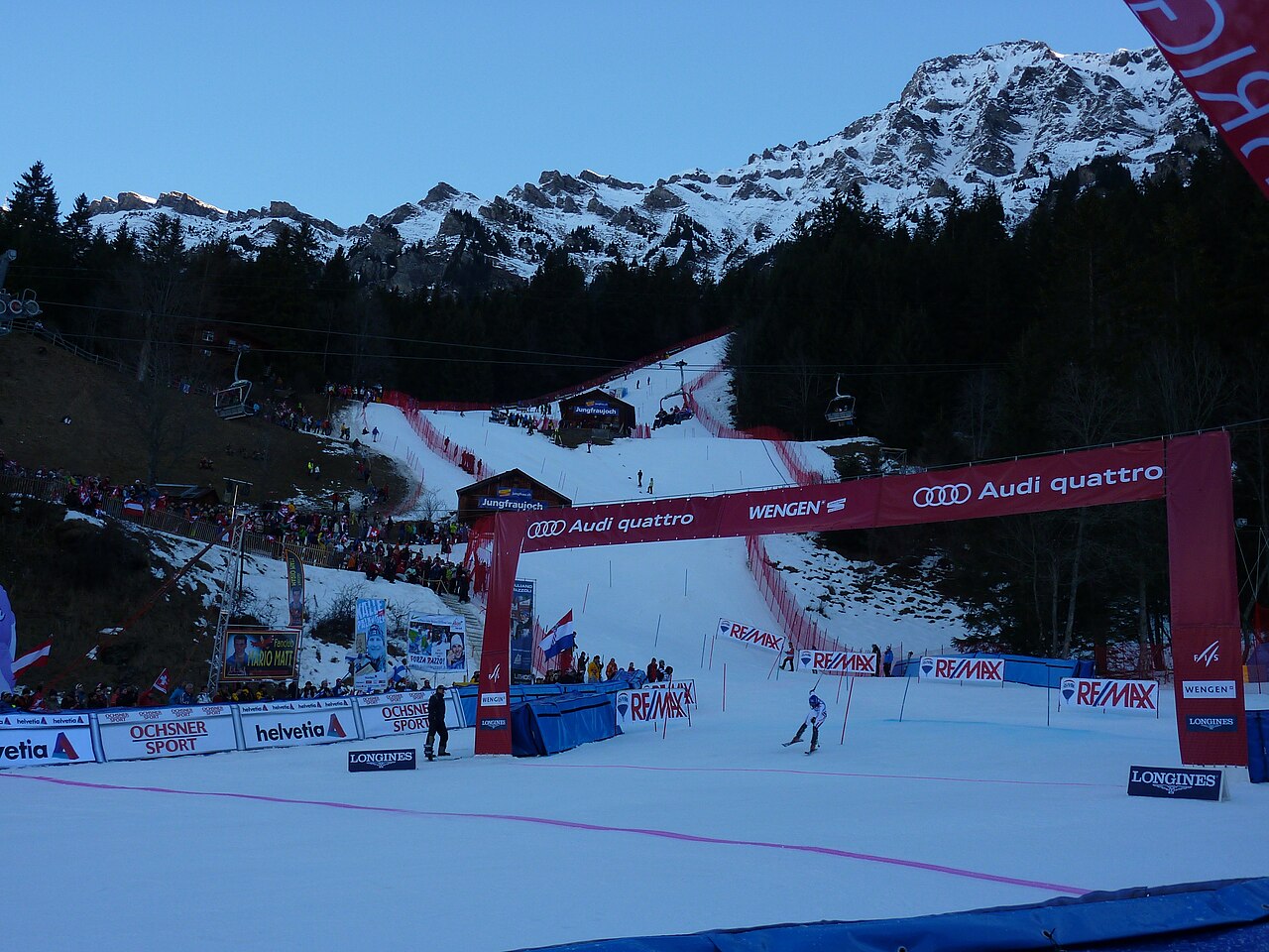
Grindelwald-Wengen covers the Kleine Scheidegg and Männlichen sectors, with the Lauberhorn slopes forming part of its identity. The wider Jungfrau Ski Region also includes Grindelwald-First and Mürren-Schilthorn. These names describe distinct ski areas: a regional pass or a regional piste total should not be read as one uninterrupted ski route.
For orientation, begin with the part of the official map that matches your departure point. A day around Kleine Scheidegg is a different plan from one at First or Mürren. Railways and mountain lifts are part of the area’s transport network, so the return journey deserves the same attention as the first ascent.
The forecast on this page starts at 1,062 m. It is a lower reference for this broad mountain destination, not a prediction for the surrounding summits. Compare weather at your chosen skiing height and at the lower return point. A temperature rise can change the precipitation type between those levels. The public forecast cannot determine the condition or opening of an individual piste; use the regional live report for that detail.
Official sources: Jungfrau Ski Region · Grindelwald-Wengen. Reviewed 18 October 2026.