North ski area
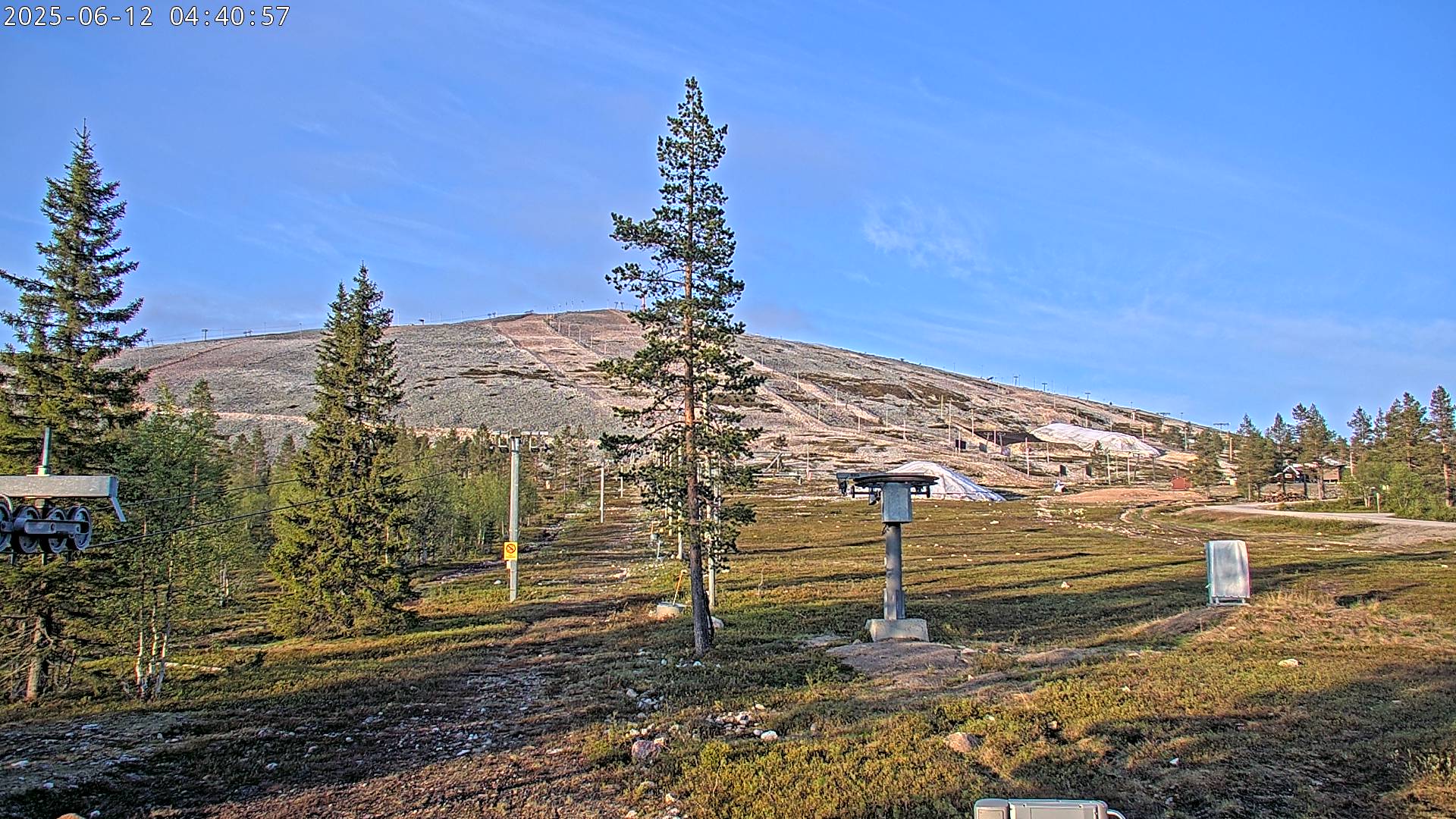
Camera image unavailable
Camera image · refreshes every 60 seconds while visible.
Open camera page ↗
Each colour starts at the value shown. Wind colours match across all three units. Dry cells stay neutral. Colours describe the displayed values, not official weather warnings.
Preparing forecast graphs…
Times and values match the detailed forecast. Tap or point at a value for details. Scroll each chart sideways for later days. Rain / precipitation is the total water equivalent per forecast interval, including snow; snowfall is fresh snow per interval, not snow depth.
GFS and ECMWF model comparison. Each model retains its own forecast times and horizon. Precipitation and snowfall amounts cover their own forecast intervals; these can differ between models.
ECMWF · Model run: Next update expected:
Day Time (UTC) Temp. (°C) Humidity (%) Wind (km/h) Wind (knots) Wind (Bft) Direction Precip. (mm) Snow (cm) Pressure (hPa) Freezing (m) Conditions | Thursday, 05/11 06:00 0.6 71 20 11 3B NW — — 1009 505 Clear 11% cloud  09:00 1.1 66 19 10 3B NW 0 0 1011 466 Partly cloudy 36% cloud  12:00 0.8 68 18 10 3B NW 0 0 1014 423 Clear 16% cloud 15:00 -0.7 76 17 9 3B NW 0 0 1017 < 252 Clear 7% cloud 18:00 -1.2 76 16 9 3B NW 0 0 1019 < 252 Clear 7% cloud 21:00 -0.8 73 17 9 3B NW 0 0 1021 < 252 Partly cloudy 23% cloud Friday, 06/11 00:00 -1 70 17 9 3B NW 0 0 1021 < 252 Partly cloudy 31% cloud 03:00 -1.3 76 12 7 3B NW 0 0 1022 < 252 Cloudy 77% cloud  06:00 -1.9 85 15 8 3B W 0 0 1022 < 252 Cloudy 79% cloud 09:00 -1.4 81 12 7 3B W 0 0 1022 < 252 Partly cloudy 41% cloud 12:00 -0.3 76 12 6 2B W 0 0 1020 539 Overcast 96% cloud  15:00 0.7 87 13 7 3B W 0.12 0 1018 1114 Overcast 100% cloud 18:00 0.4 94 15 8 3B W 0.10 0 1016 1201 Overcast 85% cloud 21:00 0.9 89 17 9 3B W 0.02 0 1014 1201 Cloudy 79% cloud Saturday, 07/11 00:00 1.3 85 16 9 3B W 0.00 0 1012 1177 Overcast 95% cloud 03:00 1.4 87 17 9 3B W 0 0 1010 1236 Overcast 98% cloud 06:00 0.5 93 16 9 3B W 0.02 0 1008 1313 Cloudy 71% cloud 09:00 2.1 87 16 9 3B W 0 0 1008 1040 Overcast 88% cloud 12:00 1.6 89 13 7 3B W 0 0 1008 949 Overcast 94% cloud 15:00 1.5 83 19 10 3B W 0 0 1007 958 Overcast 97% cloud 18:00 2.5 76 21 11 4B W 0 0 1006 879 Overcast 98% cloud 21:00 1.6 77 20 11 4B W 0 0 1007 892 Overcast 97% cloud Sunday, 08/11 00:00 2.2 78 19 10 3B W 0.20 0 1007 867 Overcast 93% cloud 03:00 2.7 79 18 10 3B W 0 0 1006 969 Overcast 100% cloud 06:00 1.9 98 15 8 3B W 0.37 0 1005 1061 Overcast 100% cloud 09:00 2.3 98 15 8 3B W 0.12 0 1006 1121 Overcast 94% cloud 12:00 2.9 93 16 8 3B W 0.00 0 1004 1462 Overcast 81% cloud 15:00 3.9 80 20 11 3B W 0 0 1003 1443 Overcast 94% cloud 18:00 3.8 76 19 10 3B W 0 0 1003 1478 Cloudy 73% cloud 21:00 3.4 77 18 10 3B SW 0 0 1002 1504 Overcast 95% cloud Monday, 09/11 00:00 4.1 70 22 12 4B SW 0 0 1000 1522 Overcast 97% cloud 03:00 4.4 73 23 12 4B SW 0 0 998 1454 Overcast 99% cloud 06:00 4.7 72 25 13 4B SW 0 0 995 1257 Overcast 98% cloud 09:00 4.6 73 26 14 4B SW 0.00 0 995 1015 Cloudy 74% cloud 12:00 3.6 59 27 15 4B W 0 0 995 817 Partly cloudy 32% cloud 15:00 1.4 65 24 13 4B W 0 0 998 657 Cloudy 58% cloud 18:00 -0.4 71 20 11 4B W 0 0 1001 < 252 Clear 1% cloud 21:00 -1.8 74 18 10 3B W 0 0 1004 < 252 Partly cloudy 41% cloud Tuesday, 10/11 00:00 -2.8 74 15 8 3B W 0.02 0 1005 < 252 Clear 0% cloud 03:00 -3.7 76 14 7 3B W 0 0 1005 < 252 Clear 0% cloud 06:00 -4.2 76 12 7 2B W 0 0 1006 < 252 Clear 0% cloud 09:00 -3.5 73 12 6 2B W 0 0 1006 < 252 Clear 0% cloud 12:00 -3.4 70 10 6 2B W 0 0 1006 < 252 Clear 0% cloud 15:00 -5.2 81 10 5 2B W 0 0 1007 < 252 Clear 0% cloud 18:00 -5.3 82 10 5 2B W 0 0 1007 < 252 Clear 0% cloud 21:00 -5.6 81 8 4 2B W 0 0 1007 < 252 Partly cloudy 36% cloud Wednesday, 11/11 00:00 -6 84 7 4 2B W 0 0 1006 < 252 Clear 0% cloud 03:00 -6.7 85 6 3 1B NW 0 0 1006 < 252 Clear 0% cloud 06:00 -7 87 5 3 1B NW 0 0 1006 < 252 Clear 0% cloud |
|---|
Forecast table times: UTC.
Coordinates: 67.546461°N, 24.2535825°E · Requested elevation: 273 m. Model terrain: 250 m. Terrain and 1000/925/850/700 hPa profiles are used for height estimates.
These are altitude estimates, not a simulation of local mountain terrain. Precipitation, cloud and sea-level pressure use horizontal interpolation only.
Precipitation includes rain and snow water equivalent: preceding 3 hours through day 6, then 6 hours (see cell tooltip). Snow (cm) estimates fresh snowfall from precipitation and temperature using the GFS conversion; it is not snow depth on the ground. Freezing (m) uses additional 600/500 hPa temperatures when available and estimates the lowest resolved 0°C crossing above sea level. When all sampled levels are warm, the upper profile limit is shown (see tooltip). < marks an entirely cold sampled profile and its lower height limit. No extrapolation is used.
Ylläs is a downhill ski area in Lapland, Finland. Mapped terrain includes beginner, easy, intermediate routes. Its mapped lift network extends from approximately 273 to 717 metres above sea level. Cross-country skiing is also mapped within the area.
Data: OpenSkiData / OpenSkiMap, OpenStreetMap contributors (ODbL), Skimap.org, Who's On First, Mapterhorn.
Camera image · refreshes every 60 seconds while visible.
Open camera page ↗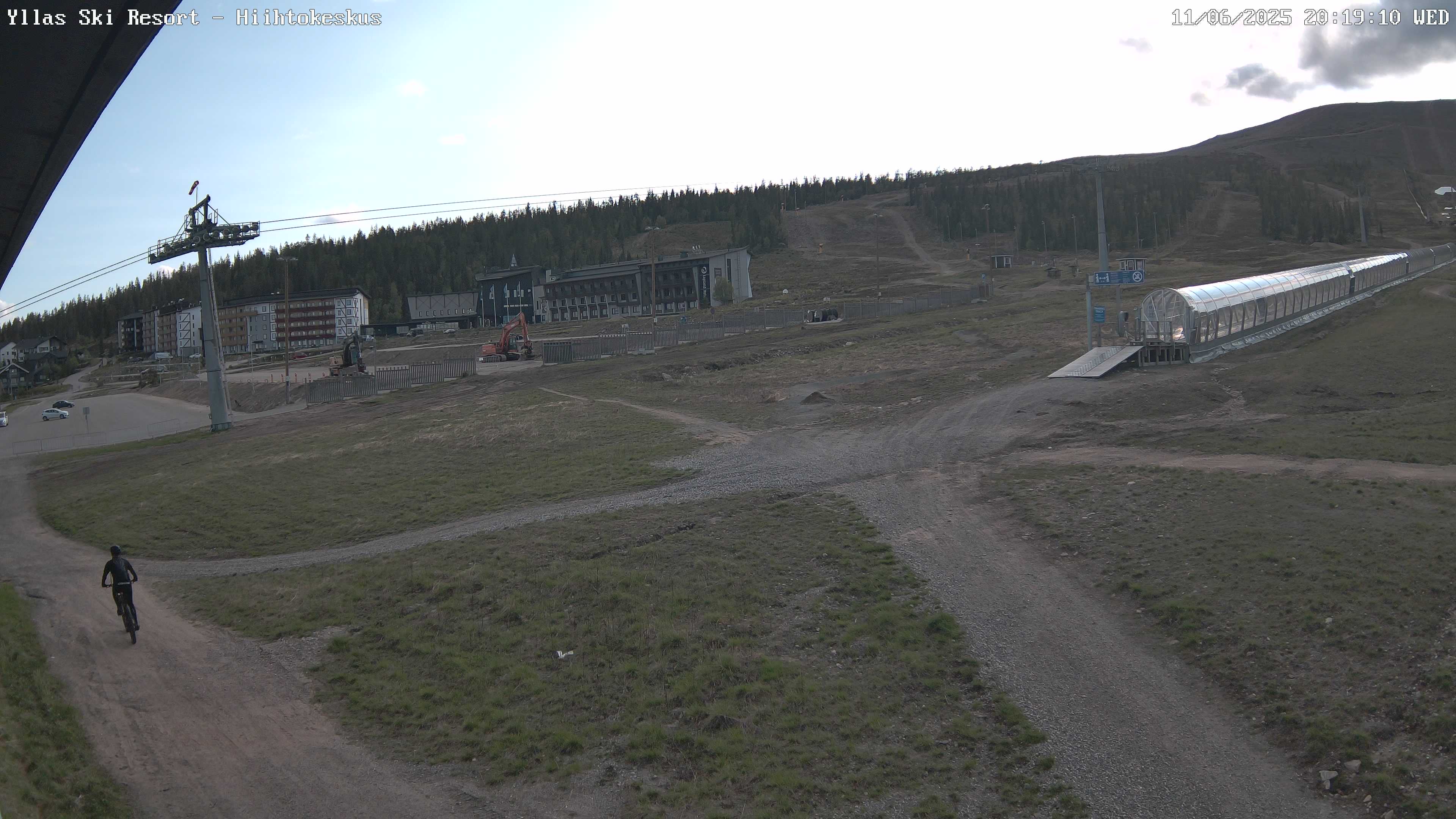
Camera image · refreshes every 60 seconds while visible.
Open camera page ↗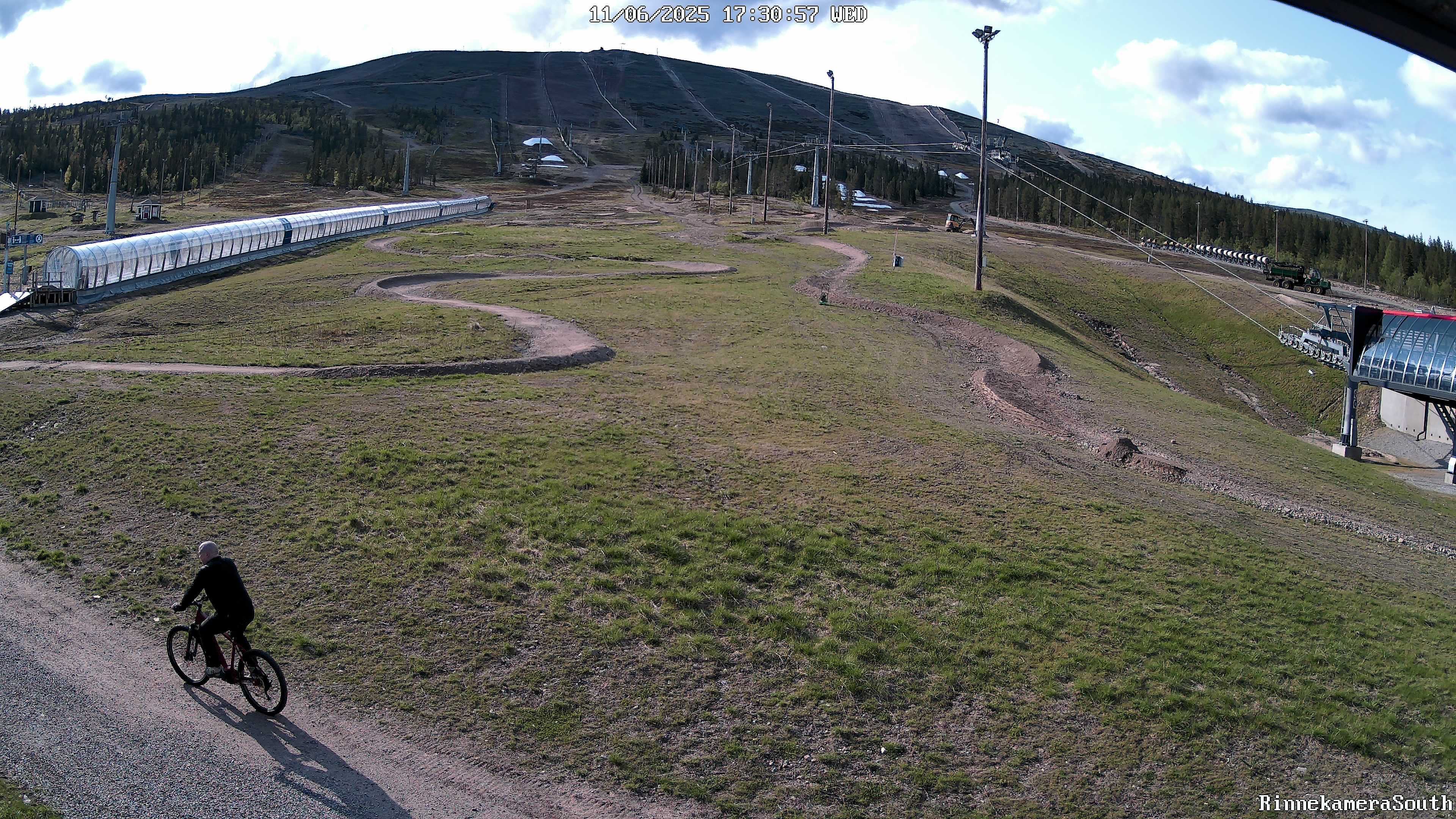
Camera image · refreshes every 60 seconds while visible.
Open camera page ↗Preparing forecast graphs…
Times and values match the detailed forecast. Tap or point at a value for details. Scroll each chart sideways for later days. Rain / precipitation is the total water equivalent per forecast interval, including snow; snowfall is fresh snow per interval, not snow depth.
GFS and ECMWF model comparison. Each model retains its own forecast times and horizon. Precipitation and snowfall amounts cover their own forecast intervals; these can differ between models.
ECMWF · Model run: Next update expected:
Day Time (UTC) Temp. (°C) Humidity (%) Wind (km/h) Wind (knots) Wind (Bft) Direction Precip. (mm) Snow (cm) Pressure (hPa) Freezing (m) Conditions | Thursday, 05/11 06:00 0.3 70 31 17 5B NW — — 1009 500 Clear 11% cloud 09:00 0.5 67 29 16 5B NW 0 0 1011 464 Partly cloudy 37% cloud 12:00 0.3 68 27 15 4B NW 0 0 1014 421 Clear 17% cloud 15:00 -1.1 75 25 13 4B NW 0 0 1017 < 255 Clear 7% cloud 18:00 -1.6 76 24 13 4B NW 0 0 1019 < 255 Clear 7% cloud 21:00 -1.3 74 25 13 4B NW 0 0 1021 < 255 Partly cloudy 24% cloud Friday, 06/11 00:00 -1.5 71 25 14 4B NW 0 0 1021 < 255 Partly cloudy 31% cloud 03:00 -1.6 77 18 10 3B NW 0 0 1022 < 255 Cloudy 76% cloud 06:00 -2 86 20 11 4B NW 0 0 1022 < 255 Cloudy 79% cloud 09:00 -1.5 81 18 10 3B NW 0 0 1022 < 255 Partly cloudy 43% cloud 12:00 -0.2 77 18 10 3B W 0 0 1020 529 Overcast 96% cloud 15:00 0.9 85 18 10 3B W 0.12 0 1018 1114 Overcast 100% cloud 18:00 0.8 88 20 11 4B W 0.09 0 1016 1200 Overcast 85% cloud 21:00 1.4 84 23 12 4B W 0.03 0 1014 1201 Cloudy 80% cloud Saturday, 07/11 00:00 1.7 81 24 13 4B W 0 0 1012 1177 Overcast 95% cloud 03:00 1.8 83 24 13 4B W 0 0 1010 1237 Overcast 97% cloud 06:00 1.2 87 25 13 4B W 0.03 0 1008 1311 Cloudy 71% cloud 09:00 2.3 83 23 13 4B W 0 0 1008 1038 Overcast 88% cloud 12:00 1.8 85 20 11 4B W 0 0 1008 946 Overcast 94% cloud 15:00 1.7 78 28 15 4B W 0 0 1007 956 Overcast 97% cloud 18:00 2.3 75 30 16 5B W 0 0 1006 878 Overcast 98% cloud 21:00 1.6 76 29 16 5B W 0 0 1007 888 Overcast 97% cloud Sunday, 08/11 00:00 2 77 29 15 4B W 0.19 0 1007 864 Overcast 92% cloud 03:00 2.6 77 28 15 4B W 0 0 1006 966 Overcast 100% cloud 06:00 2.1 95 24 13 4B W 0.37 0 1005 1057 Overcast 100% cloud 09:00 2.5 94 24 13 4B W 0.12 0 1006 1118 Overcast 94% cloud 12:00 3.2 87 26 14 4B W 0.00 0 1004 1459 Overcast 81% cloud 15:00 3.9 77 29 16 5B W 0 0 1003 1441 Overcast 94% cloud 18:00 3.8 74 28 15 4B W 0 0 1003 1476 Cloudy 73% cloud 21:00 3.5 74 27 15 4B W 0 0 1002 1505 Overcast 95% cloud Monday, 09/11 00:00 3.9 70 33 18 5B W 0 0 1000 1519 Overcast 97% cloud 03:00 4.2 72 34 18 5B SW 0 0 998 1455 Overcast 99% cloud 06:00 4.3 72 36 20 5B SW 0 0 995 1256 Overcast 98% cloud 09:00 4.1 74 37 20 5B W 0 0 995 1014 Cloudy 72% cloud 12:00 3.1 59 39 21 6B W 0 0 995 815 Partly cloudy 33% cloud 15:00 1 65 36 19 5B W 0 0 998 655 Cloudy 57% cloud 18:00 -0.6 70 31 17 5B W 0 0 1001 < 255 Clear 1% cloud 21:00 -2.1 72 27 14 4B W 0 0 1004 < 255 Partly cloudy 39% cloud Tuesday, 10/11 00:00 -2.9 72 23 13 4B W 0.03 0 1005 < 255 Clear 0% cloud 03:00 -3.7 72 21 12 4B NW 0 0 1005 < 255 Clear 0% cloud 06:00 -4.1 71 20 11 3B NW 0 0 1006 < 255 Clear 0% cloud 09:00 -3.6 69 18 10 3B W 0 0 1006 < 255 Clear 0% cloud 12:00 -3.5 66 16 9 3B W 0 0 1006 < 255 Clear 0% cloud 15:00 -4.9 73 15 8 3B W 0 0 1007 < 255 Clear 0% cloud 18:00 -5 75 13 7 3B W 0 0 1007 < 255 Clear 0% cloud 21:00 -5.2 77 11 6 2B W 0 0 1007 < 255 Partly cloudy 34% cloud Wednesday, 11/11 00:00 -5.5 79 9 5 2B NW 0 0 1006 < 255 Clear 0% cloud 03:00 -6.1 80 8 4 2B NW 0 0 1006 < 255 Clear 0% cloud 06:00 -6.5 83 7 4 2B NW 0 0 1006 < 255 Clear 0% cloud |
|---|
Forecast table times: UTC.
Coordinates: 67.5571635°N, 24.2499888°E · Requested elevation: 369 m. Model terrain: 252 m. Terrain and 1000/925/850/700 hPa profiles are used for height estimates.
These are altitude estimates, not a simulation of local mountain terrain. Precipitation, cloud and sea-level pressure use horizontal interpolation only.
Precipitation includes rain and snow water equivalent: preceding 3 hours through day 6, then 6 hours (see cell tooltip). Snow (cm) estimates fresh snowfall from precipitation and temperature using the GFS conversion; it is not snow depth on the ground. Freezing (m) uses additional 600/500 hPa temperatures when available and estimates the lowest resolved 0°C crossing above sea level. When all sampled levels are warm, the upper profile limit is shown (see tooltip). < marks an entirely cold sampled profile and its lower height limit. No extrapolation is used.
Preparing forecast graphs…
Times and values match the detailed forecast. Tap or point at a value for details. Scroll each chart sideways for later days. Rain / precipitation is the total water equivalent per forecast interval, including snow; snowfall is fresh snow per interval, not snow depth.
GFS and ECMWF model comparison. Each model retains its own forecast times and horizon. Precipitation and snowfall amounts cover their own forecast intervals; these can differ between models.
ECMWF · Model run: Next update expected:
Day Time (UTC) Temp. (°C) Humidity (%) Wind (km/h) Wind (knots) Wind (Bft) Direction Precip. (mm) Snow (cm) Pressure (hPa) Freezing (m) Conditions | Thursday, 05/11 06:00 -0.6 65 69 38 8B NW — — 1009 496 Clear 11% cloud 09:00 -1.5 71 65 35 8B NW 0 0 1012 464 Partly cloudy 36% cloud 12:00 -1.7 71 61 33 7B NW 0 0 1014 422 Clear 18% cloud 15:00 -2.3 74 55 30 7B NW 0 0 1017 < 256 Clear 8% cloud 18:00 -3.1 75 54 29 7B NW 0 0 1019 < 256 Clear 7% cloud 21:00 -3 78 56 30 7B NW 0 0 1021 < 256 Partly cloudy 25% cloud Friday, 06/11 00:00 -3.1 74 58 31 7B NW 0 0 1021 < 256 Partly cloudy 33% cloud 03:00 -2.9 79 45 24 6B NW 0 0 1022 < 256 Cloudy 76% cloud 06:00 -2.8 86 45 24 6B NW 0 0 1022 < 256 Cloudy 79% cloud 09:00 -1.9 78 43 23 6B NW 0 0 1022 < 256 Partly cloudy 45% cloud 12:00 0.2 81 43 23 6B NW 0 0 1020 496 Overcast 96% cloud 15:00 1.7 76 43 23 6B W 0.12 0 1018 1114 Overcast 100% cloud 18:00 2.5 72 43 23 6B W 0.08 0 1016 1199 Overcast 86% cloud 21:00 3 68 46 25 6B W 0.04 0 1014 1200 Overcast 80% cloud Saturday, 07/11 00:00 3.4 68 52 28 7B W 0 0 1012 1176 Overcast 94% cloud 03:00 3.1 72 52 28 7B W 0 0 1010 1235 Overcast 97% cloud 06:00 3.5 70 58 31 7B W 0.03 0 1008 1309 Cloudy 72% cloud 09:00 2.9 72 49 26 6B NW 0 0 1008 1036 Overcast 88% cloud 12:00 2 73 44 24 6B W 0 0 1008 945 Overcast 94% cloud 15:00 2 65 56 30 7B W 0 0 1007 953 Overcast 97% cloud 18:00 1.3 73 60 32 7B W 0 0 1006 877 Overcast 98% cloud 21:00 1.3 73 59 32 7B W 0 0 1007 886 Overcast 97% cloud Sunday, 08/11 00:00 1.1 75 59 32 7B W 0.16 0 1007 865 Overcast 92% cloud 03:00 2.1 73 56 30 7B W 0 0 1006 966 Overcast 100% cloud 06:00 2.3 87 50 27 7B W 0.38 0 1005 1056 Overcast 100% cloud 09:00 3 81 53 29 7B W 0.12 0 1006 1117 Overcast 94% cloud 12:00 4.1 70 59 32 7B W 0.00 0 1004 1461 Overcast 82% cloud 15:00 3.7 70 59 32 7B W 0 0 1003 1440 Overcast 94% cloud 18:00 3.6 70 59 32 7B W 0 0 1003 1474 Cloudy 74% cloud 21:00 3.4 68 56 30 7B W 0 0 1002 1509 Overcast 95% cloud Monday, 09/11 00:00 3.4 68 61 33 7B W 0 0 1000 1515 Overcast 97% cloud 03:00 3.3 71 61 33 7B W 0 0 998 1454 Overcast 99% cloud 06:00 2.7 74 64 34 8B SW 0 0 995 1255 Overcast 98% cloud 09:00 2.1 77 65 35 8B W 0 0 995 1010 Cloudy 70% cloud 12:00 0.8 62 70 38 8B W 0 0 995 814 Partly cloudy 34% cloud 15:00 -0.4 63 71 38 8B NW 0 0 998 654 Cloudy 57% cloud 18:00 -1.7 65 63 34 8B NW 0 0 1001 < 256 Clear 1% cloud 21:00 -3.2 66 52 28 7B NW 0 0 1004 < 256 Partly cloudy 38% cloud Tuesday, 10/11 00:00 -3.8 63 46 25 6B NW 0.03 0 1005 < 256 Clear 0% cloud 03:00 -4.1 60 43 23 6B NW 0 0 1005 < 256 Clear 0% cloud 06:00 -4.3 55 41 22 6B NW 0 0 1006 < 256 Clear 0% cloud 09:00 -4.3 54 38 20 5B NW 0 0 1006 < 256 Clear 0% cloud 12:00 -4.2 51 36 20 5B NW 0 0 1006 < 256 Clear 0% cloud 15:00 -4.4 52 32 17 5B W 0 0 1007 < 256 Clear 0% cloud 18:00 -4.4 59 26 14 4B NW 0 0 1007 < 256 Clear 0% cloud 21:00 -4.4 64 23 12 4B NW 0 0 1007 < 256 Partly cloudy 32% cloud Wednesday, 11/11 00:00 -4.6 65 19 10 3B NW 0 0 1006 < 256 Clear 0% cloud 03:00 -4.8 66 18 9 3B NW 0 0 1006 < 256 Clear 0% cloud 06:00 -5.2 70 11 6 2B NW 0 0 1006 < 256 Clear 0% cloud |
|---|
Forecast table times: UTC.
Coordinates: 67.5654091°N, 24.2215831°E · Requested elevation: 717 m. Model terrain: 253 m. Terrain and 1000/925/850/700 hPa profiles are used for height estimates.
These are altitude estimates, not a simulation of local mountain terrain. Precipitation, cloud and sea-level pressure use horizontal interpolation only.
Precipitation includes rain and snow water equivalent: preceding 3 hours through day 6, then 6 hours (see cell tooltip). Snow (cm) estimates fresh snowfall from precipitation and temperature using the GFS conversion; it is not snow depth on the ground. Freezing (m) uses additional 600/500 hPa temperatures when available and estimates the lowest resolved 0°C crossing above sea level. When all sampled levels are warm, the upper profile limit is shown (see tooltip). < marks an entirely cold sampled profile and its lower height limit. No extrapolation is used.