Malo jezero - resort webcam image
Camera image unavailable
Camera image · refreshes every 60 seconds while visible.
Open camera page ↗
Each colour starts at the value shown. Wind colours match across all three units. Dry cells stay neutral. Colours describe the displayed values, not official weather warnings.
Preparing forecast graphs…
Times and values match the detailed forecast. Tap or point at a value for details. Scroll each chart sideways for later days. Rain / precipitation is the total water equivalent per forecast interval, including snow; snowfall is fresh snow per interval, not snow depth.
GFS and ECMWF model comparison. Each model retains its own forecast times and horizon. Precipitation and snowfall amounts cover their own forecast intervals; these can differ between models.
ECMWF · Model run: Next update expected:
Day Time (UTC) Temp. (°C) Humidity (%) Wind (km/h) Wind (knots) Wind (Bft) Direction Precip. (mm) Snow (cm) Pressure (hPa) Freezing (m) Conditions | Thursday, 05/11 06:00 2.5 96 5 3 1B NE — — 1031 1621 Overcast 100% cloud  09:00 3.5 92 5 3 1B NE 0.05 0 1031 1653 Overcast 100% cloud 12:00 4.8 86 3 2 1B NE 0.05 0 1030 1821 Overcast 100% cloud 15:00 4.2 90 3 1 1B N 0.06 0 1029 1898 Overcast 99% cloud 18:00 3.3 95 2 1 1B NE 0.01 0 1029 1886 Overcast 99% cloud 21:00 2.9 94 1 1 1B NE 0.03 0 1029 1939 Overcast 94% cloud Friday, 06/11 00:00 2.5 92 1 1 1B NW 0 0 1028 1970 Overcast 95% cloud 03:00 1.9 90 2 1 1B N 0 0 1028 1984 Overcast 94% cloud 06:00 1.5 88 2 1 1B N 0 0 1027 2103 Overcast 92% cloud 09:00 5.1 69 4 2 1B N 0 0 1026 2177 Partly cloudy 41% cloud  12:00 7.1 67 6 3 2B N 0 0 1024 2383 Clear 16% cloud  15:00 5 76 5 3 1B NW 0 0 1023 2546 Clear 3% cloud 18:00 2 75 8 4 2B N 0 0 1025 2535 Clear 3% cloud 21:00 1.1 69 8 4 2B N 0 0 1025 2456 Partly cloudy 43% cloud Saturday, 07/11 00:00 0.5 67 6 3 2B N 0 0 1026 924 Partly cloudy 40% cloud 03:00 0.2 62 5 3 1B N 0 0 1026 997 Cloudy 78% cloud  06:00 0.1 62 3 2 1B N 0 0 1027 1022 Partly cloudy 43% cloud 09:00 4.1 49 4 2 1B NE 0 0 1027 1967 Clear 0% cloud 12:00 6 50 3 2 1B NE 0 0 1025 2021 Clear 0% cloud 15:00 3.2 67 1 1 1B NE 0 0 1026 2045 Clear 9% cloud 18:00 0.7 69 3 1 1B E 0 0 1028 2055 Clear 6% cloud 21:00 0.1 64 4 2 1B SE 0 0 1029 1061 Clear 2% cloud Sunday, 08/11 00:00 -0.1 61 5 2 1B SE 0 0 1029 1097 Clear 0% cloud 03:00 -0 64 6 3 1B S 0 0 1029 1087 Clear 0% cloud 06:00 0.8 65 7 4 2B S 0 0 1029 2175 Clear 0% cloud 09:00 5.9 50 7 4 2B S 0 0 1029 2297 Clear 0% cloud 12:00 8.3 46 4 2 1B S 0 0 1027 2362 Clear 0% cloud 15:00 5.3 63 4 2 1B S 0 0 1027 2396 Clear 0% cloud 18:00 3.1 65 4 2 1B S 0 0 1028 2411 Clear 0% cloud 21:00 2.5 70 5 3 1B SW 0 0 1028 2402 Clear 6% cloud Monday, 09/11 00:00 2.7 74 5 3 1B SW 0 0 1027 2395 Cloudy 70% cloud 03:00 2.5 78 5 3 1B SW 0 0 1026 2391 Clear 2% cloud 06:00 2.8 80 4 2 1B SW 0 0 1027 2369 Partly cloudy 39% cloud 09:00 8.1 63 6 3 1B SW 0 0 1027 2350 Partly cloudy 33% cloud 12:00 9.7 62 5 3 1B S 0.12 0 1024 2367 Clear 16% cloud 15:00 6.6 81 5 3 1B SW 0.11 0 1024 2336 Partly cloudy 33% cloud 18:00 4 90 6 3 2B SW 0.02 0 1024 2373 Clear 19% cloud 21:00 3.6 90 7 4 2B SW 0 0 1024 2380 Partly cloudy 36% cloud Tuesday, 10/11 00:00 3.2 91 9 5 2B SW 0.05 0 1023 2423 Clear 8% cloud 03:00 2.9 91 8 4 2B SW 0 0 1023 2479 Cloudy 57% cloud 06:00 3.6 90 8 4 2B SW 0 0 1023 2594 Overcast 88% cloud 09:00 7.6 79 10 5 2B SW 0 0 1022 2687 Overcast 80% cloud 12:00 9.7 69 10 6 2B SW 0 0 1019 2641 Overcast 92% cloud 15:00 8 79 11 6 2B SW 0 0 1018 2620 Cloudy 76% cloud 18:00 6.8 85 13 7 3B SW 0 0 1018 2644 Cloudy 65% cloud 21:00 6.6 85 13 7 3B SW 0 0 1018 2719 Overcast 88% cloud Wednesday, 11/11 00:00 7.3 87 13 7 3B SW 0 0 1017 2719 Overcast 93% cloud 03:00 6.8 93 5 3 1B W 1.7 0 1016 2730 Overcast 100% cloud 06:00 7.1 93 2 1 1B S 3.8 0 1017 2758 Overcast 100% cloud |
|---|
Forecast table times: UTC.
Coordinates: 43.2928282°N, 20.8759848°E · Requested elevation: 1078 m. Model terrain: 899 m. Terrain and 1000/925/850/700 hPa profiles are used for height estimates.
These are altitude estimates, not a simulation of local mountain terrain. Precipitation, cloud and sea-level pressure use horizontal interpolation only.
Precipitation includes rain and snow water equivalent: preceding 3 hours through day 6, then 6 hours (see cell tooltip). Snow (cm) estimates fresh snowfall from precipitation and temperature using the GFS conversion; it is not snow depth on the ground. Freezing (m) uses additional 600/500 hPa temperatures when available and estimates the lowest resolved 0°C crossing above sea level. When all sampled levels are warm, the upper profile limit is shown (see tooltip). < marks an entirely cold sampled profile and its lower height limit. No extrapolation is used.
Summer dry ski slope · This snow resort also has an outdoor synthetic slope for seasonal use. Check the operator for opening dates.
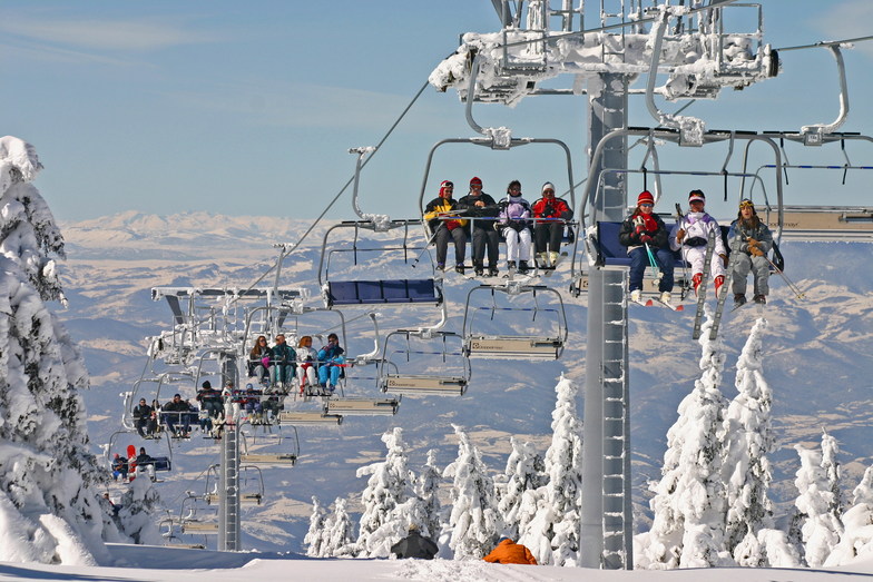
Kopaonik is a downhill ski area in Mitrovica, Serbia. Mapped terrain includes beginner, easy, intermediate, advanced routes. Its mapped lift network extends from approximately 1078 to 1975 metres above sea level. Cross-country skiing is also mapped within the area.
Data: OpenSkiData / OpenSkiMap, OpenStreetMap contributors (ODbL), Skimap.org, Who's On First, Mapterhorn.
Camera image · refreshes every 60 seconds while visible.
Open camera page ↗Camera image · refreshes every 60 seconds while visible.
Open camera page ↗Preparing forecast graphs…
Times and values match the detailed forecast. Tap or point at a value for details. Scroll each chart sideways for later days. Rain / precipitation is the total water equivalent per forecast interval, including snow; snowfall is fresh snow per interval, not snow depth.
GFS and ECMWF model comparison. Each model retains its own forecast times and horizon. Precipitation and snowfall amounts cover their own forecast intervals; these can differ between models.
ECMWF · Model run: Next update expected:
Day Time (UTC) Temp. (°C) Humidity (%) Wind (km/h) Wind (knots) Wind (Bft) Direction Precip. (mm) Snow (cm) Pressure (hPa) Freezing (m) Conditions | Thursday, 05/11 06:00 0.5 99 12 7 2B NE — — 1030 1619 Overcast 100% cloud 09:00 0.8 98 11 6 2B NE 0.04 0 1031 1661 Overcast 100% cloud 12:00 1.3 97 4 2 1B NE 0.05 0 1030 1810 Overcast 100% cloud 15:00 1.4 97 2 1 1B N 0.06 0 1029 1899 Overcast 100% cloud 18:00 1.1 96 2 1 1B NE 0.01 0 1029 1897 Overcast 99% cloud 21:00 1.2 90 2 1 1B NE 0.02 0 1029 1950 Overcast 97% cloud Friday, 06/11 00:00 1.2 84 2 1 1B N 0 0 1028 1975 Overcast 97% cloud 03:00 1.1 75 5 3 1B N 0 0 1028 1999 Overcast 94% cloud 06:00 1.3 69 6 3 2B N 0 0 1027 2105 Overcast 93% cloud 09:00 1.7 64 7 4 2B N 0 0 1026 2174 Partly cloudy 47% cloud 12:00 2.9 78 9 5 2B N 0 0 1023 2390 Clear 13% cloud 15:00 3.2 64 11 6 2B NW 0 0 1023 2544 Clear 2% cloud 18:00 2.7 43 19 10 3B N 0 0 1025 2551 Clear 2% cloud 21:00 3 28 23 12 4B N 0 0 1025 2456 Partly cloudy 40% cloud Saturday, 07/11 00:00 1.8 40 18 10 3B N 0 0 1026 952 Partly cloudy 36% cloud 03:00 1.2 39 16 8 3B N 0 0 1026 1040 Overcast 81% cloud 06:00 1 32 10 6 2B N 0 0 1027 1075 Cloudy 53% cloud 09:00 1.3 28 7 4 2B NE 0 0 1027 1967 Clear 0% cloud 12:00 2.1 52 3 2 1B NE 0 0 1025 2034 Clear 0% cloud 15:00 2.1 54 2 1 1B E 0 0 1026 2052 Clear 7% cloud 18:00 1.9 55 5 3 1B SE 0 0 1028 909 Clear 6% cloud 21:00 1.8 46 10 5 2B SE 0 0 1029 1112 Clear 2% cloud Sunday, 08/11 00:00 1.9 41 13 7 3B SE 0 0 1029 1143 Clear 0% cloud 03:00 2.1 41 15 8 3B S 0 0 1029 1122 Clear 0% cloud 06:00 2.5 41 18 10 3B S 0 0 1030 929 Clear 0% cloud 09:00 4 33 13 7 3B S 0 0 1029 2296 Clear 0% cloud 12:00 4.7 43 7 4 2B S 0 0 1027 2365 Clear 0% cloud 15:00 4.7 48 7 4 2B SW 0 0 1027 2397 Clear 0% cloud 18:00 5 52 8 4 2B SW 0 0 1028 2404 Clear 0% cloud 21:00 5.3 56 9 5 2B SW 0 0 1028 2399 Clear 8% cloud Monday, 09/11 00:00 5.3 64 11 6 2B SW 0 0 1027 2393 Cloudy 70% cloud 03:00 5.2 68 11 6 2B SW 0 0 1027 2386 Clear 1% cloud 06:00 5.1 70 8 4 2B W 0 0 1027 2365 Partly cloudy 44% cloud 09:00 5.6 69 9 5 2B SW 0 0 1027 2345 Partly cloudy 34% cloud 12:00 5.9 71 10 5 2B SW 0.13 0 1024 2367 Clear 16% cloud 15:00 5.2 79 11 6 2B SW 0.12 0 1024 2333 Partly cloudy 36% cloud 18:00 5.3 82 13 7 3B SW 0.02 0 1024 2373 Partly cloudy 22% cloud 21:00 5.1 82 16 9 3B SW 0 0 1024 2375 Partly cloudy 37% cloud Tuesday, 10/11 00:00 5 81 21 12 4B SW 0.07 0 1024 2420 Clear 9% cloud 03:00 4.7 79 21 11 4B W 0 0 1023 2475 Cloudy 68% cloud 06:00 4.8 75 19 10 3B SW 0 0 1023 2586 Overcast 92% cloud 09:00 5.2 72 23 12 4B SW 0 0 1022 2675 Overcast 83% cloud 12:00 5.9 77 21 11 4B SW 0 0 1019 2636 Overcast 91% cloud 15:00 6.9 71 26 14 4B SW 0 0 1018 2619 Cloudy 78% cloud 18:00 6.9 72 32 17 5B SW 0 0 1018 2641 Cloudy 64% cloud 21:00 7.3 70 31 17 5B SW 0 0 1018 2710 Overcast 89% cloud Wednesday, 11/11 00:00 7.9 75 32 17 5B SW 0 0 1017 2710 Overcast 95% cloud 03:00 7 84 15 8 3B W 1.4 0 1016 2733 Overcast 100% cloud 06:00 6.7 88 2 1 1B SW 3.7 0 1017 2760 Overcast 100% cloud |
|---|
Forecast table times: UTC.
Coordinates: 43.2826331°N, 20.8406593°E · Requested elevation: 1502 m. Model terrain: 905 m. Terrain and 1000/925/850/700 hPa profiles are used for height estimates.
These are altitude estimates, not a simulation of local mountain terrain. Precipitation, cloud and sea-level pressure use horizontal interpolation only.
Precipitation includes rain and snow water equivalent: preceding 3 hours through day 6, then 6 hours (see cell tooltip). Snow (cm) estimates fresh snowfall from precipitation and temperature using the GFS conversion; it is not snow depth on the ground. Freezing (m) uses additional 600/500 hPa temperatures when available and estimates the lowest resolved 0°C crossing above sea level. When all sampled levels are warm, the upper profile limit is shown (see tooltip). < marks an entirely cold sampled profile and its lower height limit. No extrapolation is used.
Preparing forecast graphs…
Times and values match the detailed forecast. Tap or point at a value for details. Scroll each chart sideways for later days. Rain / precipitation is the total water equivalent per forecast interval, including snow; snowfall is fresh snow per interval, not snow depth.
GFS and ECMWF model comparison. Each model retains its own forecast times and horizon. Precipitation and snowfall amounts cover their own forecast intervals; these can differ between models.
ECMWF · Model run: Next update expected:
Day Time (UTC) Temp. (°C) Humidity (%) Wind (km/h) Wind (knots) Wind (Bft) Direction Precip. (mm) Snow (cm) Pressure (hPa) Freezing (m) Conditions | Thursday, 05/11 06:00 -1.1 94 13 7 3B NE — — 1030 1617 Overcast 100% cloud 09:00 -1 93 11 6 2B NE 0.03 0 1031 1665 Overcast 100% cloud 12:00 -0.6 87 6 3 2B NE 0.05 0 1030 1802 Overcast 100% cloud 15:00 -0.2 80 6 3 2B N 0.06 0 1029 1899 Overcast 100% cloud 18:00 -0.2 77 7 4 2B N 0.00 0 1029 1901 Overcast 100% cloud 21:00 -0.1 71 6 3 2B N 0.02 0 1029 1954 Overcast 98% cloud Friday, 06/11 00:00 0 67 6 3 2B N 0 0 1028 1977 Overcast 98% cloud 03:00 0.1 61 10 5 2B N 0 0 1028 2007 Overcast 96% cloud 06:00 0.3 57 11 6 2B N 0 0 1027 2104 Overcast 95% cloud 09:00 0.4 54 11 6 2B N 0 0 1026 2170 Cloudy 50% cloud 12:00 1.3 67 12 7 2B N 0 0 1023 2394 Clear 12% cloud 15:00 1.8 53 15 8 3B N 0 0 1023 2541 Clear 2% cloud 18:00 1.6 34 21 12 4B N 0 0 1025 2561 Clear 2% cloud 21:00 1.7 25 24 13 4B N 0 0 1025 2458 Partly cloudy 38% cloud Saturday, 07/11 00:00 0.8 30 20 11 3B N 0 0 1026 964 Partly cloudy 33% cloud 03:00 0.5 28 17 9 3B N 0 0 1026 1060 Overcast 83% cloud 06:00 0.2 24 14 8 3B N 0 0 1027 1100 Cloudy 59% cloud 09:00 -0 23 11 6 2B NE 0 0 1027 1963 Clear 0% cloud 12:00 0.2 45 7 4 2B NE 0 0 1025 2043 Clear 0% cloud 15:00 0.3 47 4 2 1B NE 0 0 1026 2056 Clear 5% cloud 18:00 0.3 48 5 3 1B E 0 0 1027 944 Clear 6% cloud 21:00 0.3 38 8 5 2B SE 0 0 1029 1135 Clear 2% cloud Sunday, 08/11 00:00 0.4 34 11 6 2B SE 0 0 1029 1162 Clear 0% cloud 03:00 0.5 35 12 7 2B S 0 0 1029 1136 Clear 0% cloud 06:00 0.9 33 15 8 3B S 0 0 1030 951 Clear 0% cloud 09:00 1.6 28 12 7 2B S 0 0 1029 2293 Clear 0% cloud 12:00 2 36 9 5 2B SW 0 0 1027 2365 Clear 0% cloud 15:00 2.3 40 8 5 2B SW 0 0 1027 2397 Clear 0% cloud 18:00 2.7 48 10 5 2B SW 0 0 1028 2400 Clear 0% cloud 21:00 2.9 56 11 6 2B SW 0 0 1028 2397 Clear 9% cloud Monday, 09/11 00:00 2.8 65 13 7 3B W 0 0 1027 2391 Cloudy 70% cloud 03:00 2.7 69 14 7 3B W 0 0 1027 2383 Clear 1% cloud 06:00 2.6 71 11 6 2B W 0 0 1027 2364 Partly cloudy 47% cloud 09:00 2.5 75 13 7 3B SW 0 0 1027 2343 Partly cloudy 34% cloud 12:00 2.6 75 14 8 3B SW 0.12 0 1024 2368 Clear 15% cloud 15:00 2.3 80 16 9 3B W 0.11 0 1024 2331 Partly cloudy 37% cloud 18:00 2.6 80 17 9 3B W 0.01 0 1025 2373 Partly cloudy 23% cloud 21:00 2.5 79 20 11 4B W 0 0 1024 2372 Partly cloudy 38% cloud Tuesday, 10/11 00:00 2.5 74 24 13 4B W 0.08 0 1024 2417 Clear 10% cloud 03:00 2.5 71 24 13 4B W 0 0 1023 2472 Cloudy 74% cloud 06:00 2.8 70 24 13 4B W 0 0 1023 2580 Overcast 94% cloud 09:00 3.1 66 27 14 4B W 0 0 1022 2666 Overcast 84% cloud 12:00 3.4 75 24 13 4B W 0 0 1019 2634 Overcast 90% cloud 15:00 4 75 28 15 4B W 0 0 1019 2620 Cloudy 78% cloud 18:00 4 78 31 17 5B W 0 0 1018 2639 Cloudy 63% cloud 21:00 4.4 77 32 17 5B W 0 0 1018 2705 Overcast 90% cloud Wednesday, 11/11 00:00 4.8 81 33 18 5B W 0 0 1017 2708 Overcast 95% cloud 03:00 4.4 89 22 12 4B W 1.2 0 1017 2736 Overcast 100% cloud 06:00 4.2 91 15 8 3B W 3.7 0 1017 2761 Overcast 100% cloud |
|---|
Forecast table times: UTC.
Coordinates: 43.2695951°N, 20.8258449°E · Requested elevation: 1975 m. Model terrain: 910 m. Terrain and 1000/925/850/700 hPa profiles are used for height estimates.
These are altitude estimates, not a simulation of local mountain terrain. Precipitation, cloud and sea-level pressure use horizontal interpolation only.
Precipitation includes rain and snow water equivalent: preceding 3 hours through day 6, then 6 hours (see cell tooltip). Snow (cm) estimates fresh snowfall from precipitation and temperature using the GFS conversion; it is not snow depth on the ground. Freezing (m) uses additional 600/500 hPa temperatures when available and estimates the lowest resolved 0°C crossing above sea level. When all sampled levels are warm, the upper profile limit is shown (see tooltip). < marks an entirely cold sampled profile and its lower height limit. No extrapolation is used.