Cervinia · Matterhorn · Panorama

Provider panorama/video player. Capture time is shown by the camera.
Open camera page ↗
Each colour starts at the value shown. Wind colours match across all three units. Dry cells stay neutral. Colours describe the displayed values, not official weather warnings.
Preparing forecast graphs…
Times and values match the detailed forecast. Tap or point at a value for details. Scroll each chart sideways for later days. Rain / precipitation is the total water equivalent per forecast interval, including snow; snowfall is fresh snow per interval, not snow depth.
GFS and ECMWF model comparison. Each model retains its own forecast times and horizon. Precipitation and snowfall amounts cover their own forecast intervals; these can differ between models.
GFS · Model run: · Updated on this site: · 4 model runs daily.Next update expected:
Day Local time Temp. (°C) Humidity (%) Wind (km/h) Wind (knots) Wind (Bft) Direction Rain (mm) Snow (cm) Pressure (hPa) Freezing (m) Conditions | Thursday, 05/11 06 0.8 93 13 7 3B SE 0 0 1027 1871 Clear  09 3.4 89 12 6 2B SE 0 0 1025 2236 Clear 12 5.2 84 11 6 2B SE 0.01 0 1023 2475 Clear 15 4.1 95 12 6 2B SE 0.23 0 1024 2361 Chance of rain  18 3.1 97 11 6 2B SE 0.61 0 1025 2232 Light rain  21 3.6 96 8 5 2B SE 2.2 0 1023 2340 Light rain Friday, 06/11 00 3.4 98 8 5 2B SE 3.2 0 1023 2270 Rain 03 3 98 6 3 2B SE 2.0 0 1022 2215 Light rain 06 2.6 98 5 3 1B SE 1.3 0 1022 2146 Light rain 09 3.1 96 5 3 1B S 0.20 0 1022 2217 Chance of rain 12 3.4 95 2 1 1B W 0.24 0 1021 2260 Chance of rain 15 3.6 98 2 1 1B NW 0.62 0 1019 2328 Light rain 18 2.5 99 1 0 0B NW 1.5 0 1021 2138 Light rain 21 2 98 3 1 1B NW 2.8 0 1021 2036 Snowfall  Saturday, 07/11 00 1.3 98 5 3 1B NW 4.2 0 1022 1934 Heavy snowfall 03 0.5 97 6 3 2B NW 2.0 0.6 1023 1836 Snowfall 06 0.1 96 6 3 2B NW 0.79 0.2 1024 1783 Snowfall 09 1.1 85 2 1 1B S 0.04 0 1024 1891 Clear 12 2.4 84 3 2 1B SW 0.07 0 1022 2089 Chance of rain 15 1.8 90 2 1 1B SW 0.11 0 1022 2024 Light snowfall 18 -2 96 4 2 1B S 0.04 0 1026 1480 Clear 21 -3.7 95 7 4 2B S 0.03 0 1029 1192 Clear Sunday, 08/11 00 -4.7 90 5 3 1B S 0.01 0 1030 1043 Clear 03 -5.6 84 2 1 1B SE 0.03 0 1030 894 Clear 06 -5.3 70 1 1 0B SE 0 0 1028 940 Clear 09 0.5 67 4 2 1B S 0 0 1025 1827 Clear 12 1.9 72 4 2 1B SW 0 0 1023 1985 Clear 15 0.4 89 3 2 1B SW 0.03 0 1024 1801 Clear 18 -4.2 94 1 1 1B SW 0.02 0 1028 1109 Clear 21 -4.6 91 2 1 1B SW 0 0 1029 1054 Clear Monday, 09/11 00 -4.9 82 2 1 1B SW 0 0 1028 1007 Clear 03 -4.8 74 2 1 1B NW 0 0 1027 1019 Clear 06 -4.6 72 1 1 1B N 0 0 1027 1056 Clear 09 1.8 64 5 2 1B SW 0 0 1022 2010 Clear 12 3.9 66 4 2 1B SW 0 0 1019 2292 Clear 15 1.6 85 3 2 1B SW 0 0 1020 1984 Clear 18 -1.3 71 4 2 1B S 0 0 1023 1564 Clear 21 -0.2 70 4 2 1B S 0.01 0 1022 1734 Clear Tuesday, 10/11 00 0.5 83 3 2 1B S 0.03 0 1021 1842 Clear 03 1.6 93 5 3 1B S 1.2 0 1018 2004 Snowfall 06 2.4 97 5 3 1B S 3.0 0 1016 2127 Rain 09 4.2 96 8 4 2B SW 0.84 0 1015 2367 Light rain 12 5.8 96 6 3 1B W 0.15 0 1012 2610 Chance of rain 15 5.7 97 4 2 1B W 0.02 0 1011 2750 Clear 18 4.2 99 3 2 1B W 0.69 0 1011 2621 Light rain 21 4.6 99 6 3 1B NW 2.1 0 1011 2655 Light rain Wednesday, 11/11 00 4.7 98 6 3 2B NW 0.79 0 1010 2671 Light rain 03 4.8 98 7 4 2B NW 0.14 0 1009 2671 Chance of rain 06 4.9 98 6 3 2B NW 0.77 0 1009 2682 Light rain 09 5.8 97 5 3 1B NW 0.14 0 1010 2725 Chance of rain 12 6.2 95 6 3 2B NW 0 0 1009 2748 Clear 15 6.1 98 6 3 2B NW 0.07 0 1009 2764 Chance of rain 18 4.5 96 0 0 0B E 0 0 1010 2598 Clear 21 4.4 90 3 2 1B SW 0 0 1010 2613 Clear Thursday, 12/11 00 4 94 2 1 1B W 0 0 1010 2545 Clear 03 4 95 2 1 1B W 0 0 1009 2548 Clear 06 3.4 95 1 1 0B W 0.02 0 1009 2425 Clear 09 5.2 95 3 2 1B SW 0.01 0 1009 2636 Clear 12 6.1 96 2 1 1B SW 0.65 0 1008 2660 Light rain 15 5.6 97 1 1 1B NW 1.9 0 1008 2644 Light rain 18 4.7 95 3 1 1B SE 1.5 0 1010 2498 Light rain 21 4.4 96 8 4 2B SE 0.29 0 1011 2464 Chance of rain Friday, 13/11 00 3.7 96 8 4 2B SE 0.24 0 1012 2359 Chance of rain 03 3.4 97 10 6 2B SE 0.43 0 1013 2295 Light rain 06 2.9 97 10 5 2B SE 0.54 0 1014 2197 Light rain 09 3.8 97 10 5 2B SE 0.46 0 1015 2328 Light rain 12 3.8 97 9 5 2B SE 0.23 0 1015 2328 Chance of rain 15 3.5 92 7 4 2B SE 0.29 0 1015 2288 Chance of rain 18 1.7 97 9 5 2B S 0.05 0 1018 2012 Clear 21 1.8 96 9 5 2B S 0.08 0 1018 2038 Light snowfall Saturday, 14/11 00 0.9 95 7 4 2B SE 0 0 1019 1931 Clear 03 -0.2 92 3 2 1B SE 0 0 1019 1773 Clear 06 -1 80 2 1 1B NE 0 0 1019 1657 Clear 09 4.3 75 1 1 0B N 0 0 1016 2398 Clear 12 5.5 82 5 3 1B NW 0 0 1015 2507 Clear 15 3 92 6 3 2B NW 0 0 1017 2223 Clear 18 0.2 92 7 4 2B N 0 0 1021 1895 Clear 21 1.3 92 10 5 2B N 0.02 0 1020 2097 Clear Sunday, 15/11 00 1.7 93 11 6 2B N 0 0 1020 2173 Clear 03 1.5 93 13 7 3B NW 0.02 0 1020 2134 Clear 06 0.9 93 15 8 3B NW 0.02 0 1021 2080 Clear 09 3.1 85 9 5 2B NW 0 0 1020 2277 Clear 12 4.8 78 11 6 2B NW 0 0 1018 2467 Clear 15 2.2 81 13 7 3B NW 0.02 0 1021 2210 Clear 18 -0.7 61 12 7 3B NW 0 0 1025 1928 Clear 21 -0.5 54 13 7 3B NW 0 0 1025 1825 Clear Monday, 16/11 00 0.5 80 13 7 3B NW 0 0 1024 2122 Clear 03 1 90 15 8 3B NW 0 0 1024 2187 Clear 06 1.5 93 15 8 3B NW 0 0 1024 2247 Clear 09 4.8 91 14 7 3B NW 0 0 1022 2593 Clear 12 6.4 89 14 8 3B NW 0 0 1021 2696 Clear 15 5.4 92 13 7 3B NW 0 0 1021 2706 Clear 18 3.5 87 11 6 2B NW 0 0 1023 2499 Clear 21 3.1 80 10 5 2B NW 0 0 1024 2441 Clear Tuesday, 17/11 00 2.1 71 9 5 2B NW 0 0 1025 2297 Clear 03 2.1 74 9 5 2B NW 0 0 1024 2313 Clear 06 2.7 71 6 3 2B NW 0 0 1024 2439 Clear 09 6.6 71 9 5 2B NW 0 0 1023 3039 Clear 12 8.2 82 8 5 2B NW 0 0 1022 3506 Clear 15 6.7 79 13 7 3B NW 0 0 1023 2940 Clear 18 5.8 84 12 6 2B NW 0 0 1024 2976 Clear 21 5 85 12 6 2B NW 0 0 1025 2848 Clear Wednesday, 18/11 00 5.9 85 14 7 3B NW 0.04 0 1024 2898 Clear 03 7 93 13 7 3B NW 0.27 0 1023 3390 Chance of rain 06 6.9 81 12 7 3B NW 0 0 1022 3623 Clear 09 8.8 74 10 6 2B NW 0 0 1023 3803 Clear 12 9.9 82 11 6 2B NW 0 0 1022 3858 Clear 15 8.2 67 11 6 2B NW 0 0 1023 3902 Clear 18 5.9 52 11 6 2B NW 0 0 1024 3083 Clear 21 5.6 38 11 6 2B NW 0 0 1024 3093 Clear Thursday, 19/11 00 4.6 39 15 8 3B NW 0 0 1025 2817 Clear 03 3.7 46 16 9 3B NW 0 0 1026 2661 Clear 06 2.6 57 16 9 3B NW 0 0 1027 2522 Clear 09 6.7 55 13 7 3B NW 0 0 1026 3062 Clear 12 9.4 55 12 6 2B NW 0 0 1024 3585 Clear 15 5.9 49 11 6 2B N 0 0 1025 2859 Clear 18 3.4 31 8 4 2B N 0 0 1027 2665 Clear 21 3.2 24 6 3 2B N 0 0 1028 2670 Clear Friday, 20/11 00 3.1 24 5 3 1B N 0 0 1027 2666 Clear 03 3.3 24 7 4 2B N 0 0 1026 2697 Clear 06 3.1 27 5 3 1B NW 0 0 1026 2672 Clear 09 7.4 44 5 3 1B NW 0 0 1024 3341 Clear 12 8.9 57 6 3 2B NW 0 0 1023 3516 Clear 15 5.4 50 7 4 2B NW 0 0 1023 2774 Clear 18 2.7 41 9 5 2B NW 0 0 1024 2445 Clear 21 2.6 46 12 6 2B NW 0 0 1024 2415 Clear Saturday, 21/11 00 2.3 53 14 8 3B NW 0 0 1023 2344 Clear 03 1.8 64 16 9 3B NW 0 0 1023 2209 Clear 06 1.4 85 17 9 3B NW 0 0 1021 2142 Clear |
|---|
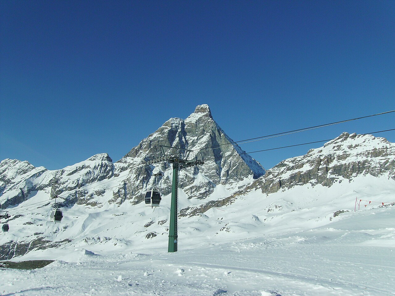
Breuil-Cervinia is the Italian starting point for skiing beneath the Matterhorn, known here as the Cervino. Its linked area includes Valtournenche and the Swiss resort of Zermatt. This is a cross-border ski area with several bases, not a descent from the summit of the Matterhorn: the mountain’s height should not be mistaken for the height of a ski lift or piste.
The forecast point on this page is at 2,023 m. That represents the lower resort rather than Plateau Rosà or the upper connections. A webcam showing snow high on the glacier can therefore be consistent with a warmer forecast here. To assess the day you intend to ski, choose the relevant mountain elevation and follow wind and temperature as well as snowfall.
The Italian operator publishes separate lift and piste information for Breuil-Cervinia, Valtournenche and Zermatt. Check the actual international connection before making it part of your itinerary, including the return. A lift marked as scheduled to open is not the same as an operating lift. For arrival and departure days, also look at the lower-elevation forecast along your route instead of relying only on the mountain outlook.
Official sources: Cervino Ski Paradise — skiing · Cervino Ski Paradise — lifts and pistes. Reviewed 18 October 2026.
Provider panorama/video player. Capture time is shown by the camera.
Open camera page ↗